Hey There! Before You Go. 😧
Get the best vintage content straight into your inbox!

Don't worry, we don't spam

What St. Ives looked like in the Late 19th Century

In the late 19th century, St. Ives was a working Cornish town with salt in the air and fish on every street. Narrow lanes wound between granite cottages, the harbor was rarely quiet, and the rhythms of daily life were set almost entirely by the sea. The town was not yet a tourist destination in any real sense — it was a place where people worked hard, lived close together, and depended on what the Atlantic provided.
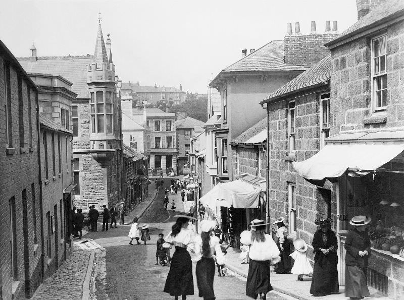
Looking down Tregenna Hill toward Tregenna Place, St. Ives, Cornwall

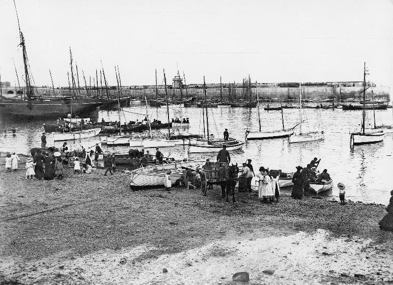
The fishing industry was the backbone of St. Ives. Each morning, fishermen set out in flat-bottomed sailing boats called luggers, heading into open Atlantic waters to haul in pilchards, mackerel, and herring. The harbor was the center of town life, with seine boats returning loaded and crews working quickly to offload their catch before it spoiled. Horse-drawn carts waited at the slipway to carry the fish to cellars for processing.
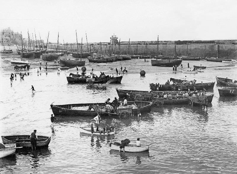
A busy scene in the harbour showing the seine boats offloading their catch of pilchards, which were then taken by horse and cart to the fish cellars for processing, St. Ives, Cornwall

The streets closest to the water — an area known locally as ‘Downalong’ — were home to most of the fishing families. Fishermen moved through narrow passages like Virgin Street between tides, mending nets, tending to their boats, and preparing for the next run.
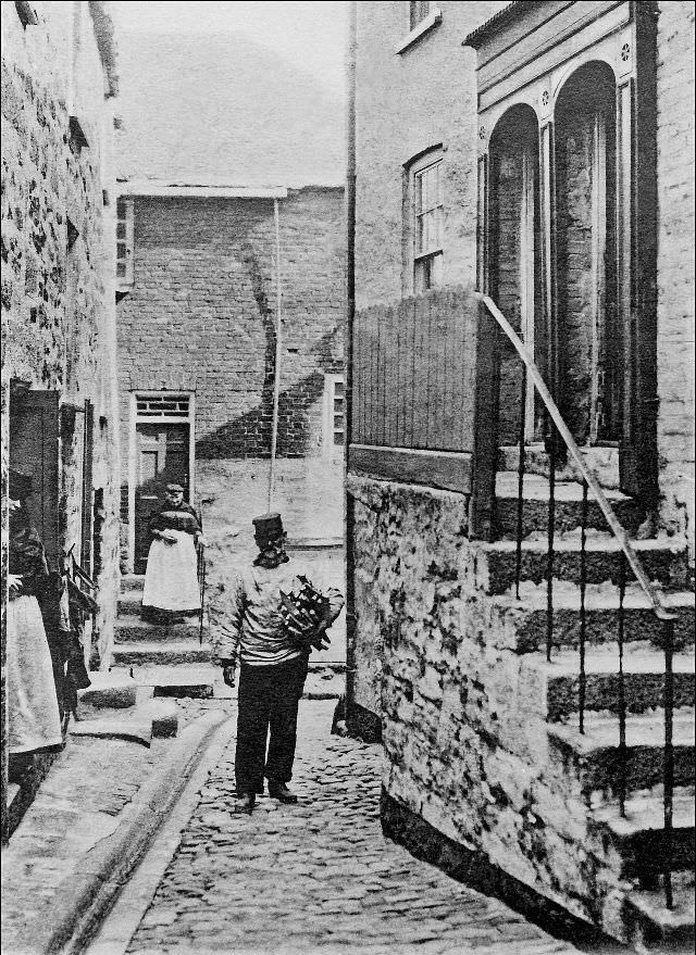
A fisherman makes his way along Virgin Street, St. Ives, Cornwall

Women, known as fishwives, did much of the processing work. They gutted, salted, and smoked the catch in stone-built fish cellars, sometimes called ‘fish palaces,’ tucked into the back streets of the town. The work was relentless and physical, carried out by groups of women in all weather.
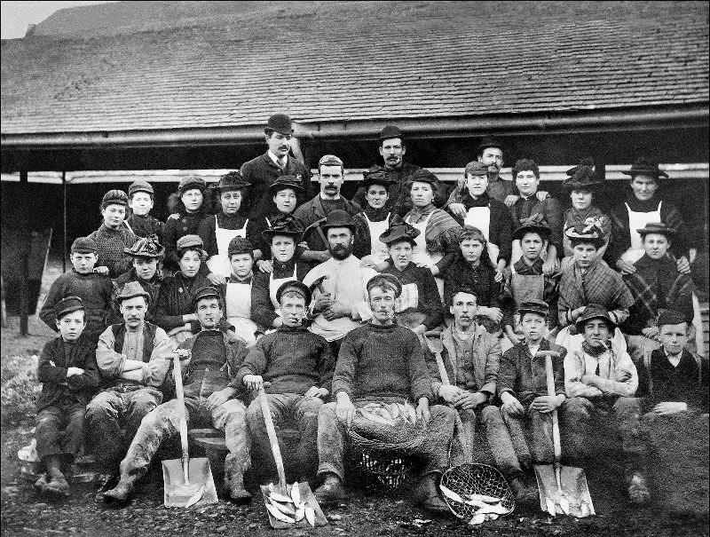
A group of pilchard processing workers outside a fish cellar or "fish palace" somewhere in the back streets of St. Ives, Cornwall
A group of pilchard processing workers outside a fish cellar or “fish palace” somewhere in the back streets of St. Ives, Cornwall

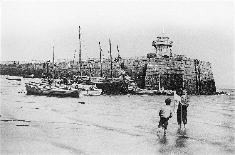
The harbor itself was the town’s most recognizable feature. Smeaton’s Pier, built to protect the anchorage, stretched out into the bay and was topped with a small lighthouse. At high water, boats crowded the harbor walls. At low tide, the sands were exposed and local boys waded freely around the pier’s base.
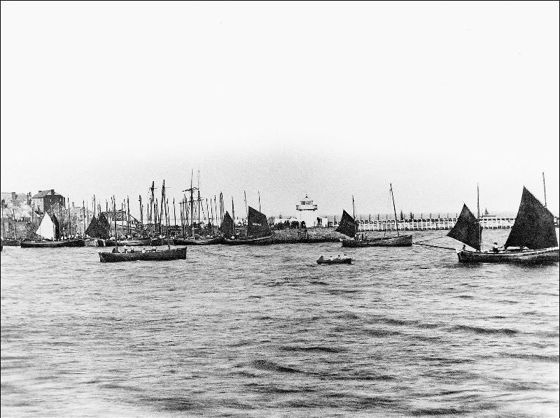
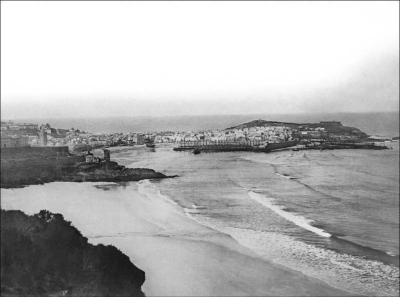
A view across the harbour showing Smeaton's Pier and lighthouse, St. Ives, Cornwall
A view across the harbour showing Smeaton’s Pier and lighthouse, St. Ives, Cornwall
A view from the east showing Porthminster beach, Pedn-Olva mine engine house and the harbour, St. Ives, Cornwall

Beyond the harbor, the town climbed steeply up the hillside. Streets like Barnoon Hill and Tregenna Hill gave views down over the rooftops and out to sea. The buildings were mostly granite — grey, solid, and built to last. There was little ornamentation. These were working-class homes, built for function.
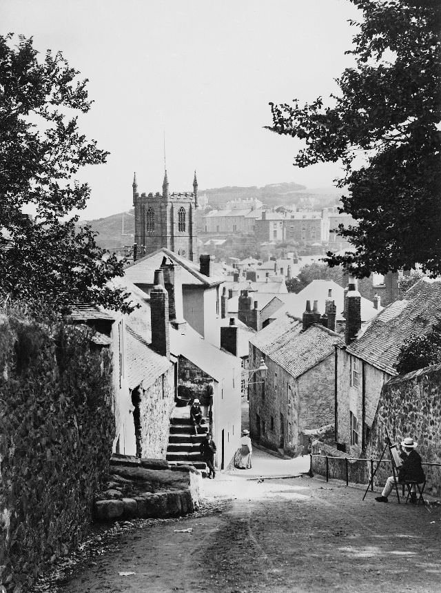
A view looking down Barnoon Hill toward the town. The entrance to Ayr Lane can be seen on the right, St. Ives, Cornwall

Along Fore Street and the surrounding lanes, everyday life played out in full view. Rays — a type of flat fish — were pegged to walls and left to dry in the sun. Once salted, this dried fish was known locally as ‘toe-rag.’ Nothing was wasted. Even the walls of buildings served a practical purpose during the drying season.
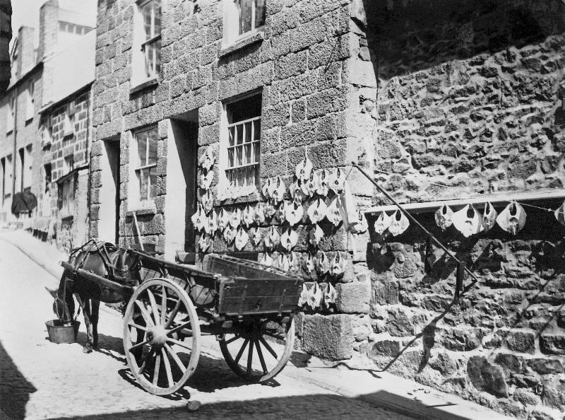
A view looks up Bunkers Hill from Fore Street. On the wall can be seen rays that have been pegged out to dry in the sun. When salted this was known locally as "toe-rag", St. Ives, Cornwall
A view looks up Bunkers Hill from Fore Street. On the wall can be seen rays that have been pegged out to dry in the sun. When salted this was known locally as “toe-rag”, St. Ives, Cornwall
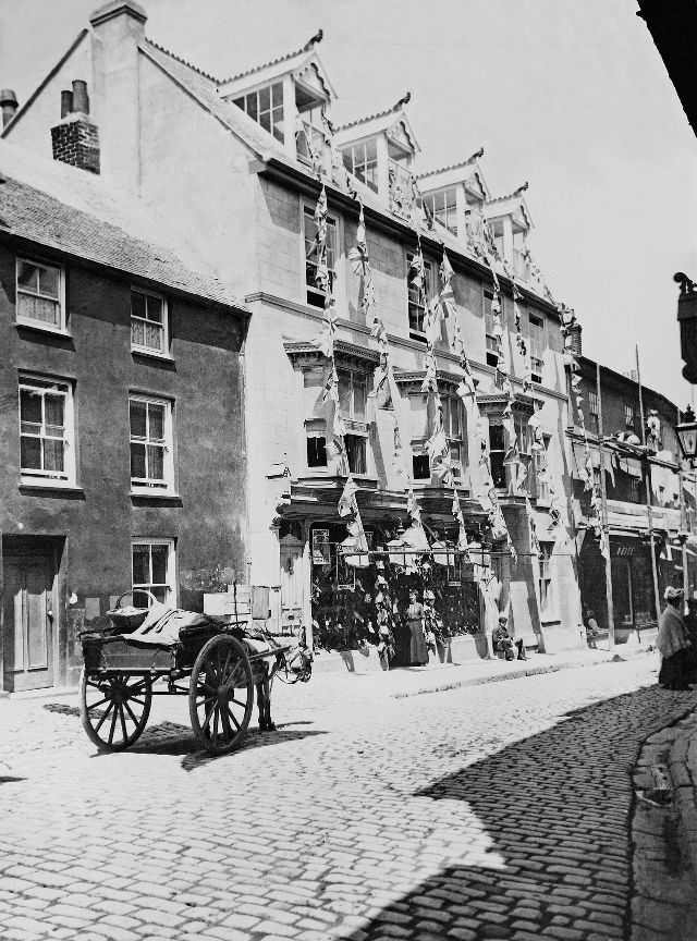
A view mid-way along Fore Street, just opposite the former premises of Woolworths, St. Ives, Cornwall

Back at the harbor, the transfer of fish from boat to cart was a constant operation during the season. Seine boats — large net-fishing vessels worked by a crew — would pull alongside and offload directly into waiting horse-drawn carts, which then moved the catch inland to the processing cellars.
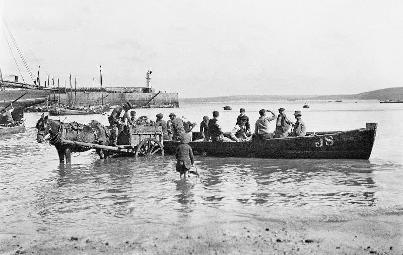
A view of a seine boat off-loading fish into a horse-drawn cart, St. Ives, Cornwall

St. Ives was not only fishing cottages and harbor walls. The town also had its grander buildings. Ayr Manor house stood apart from the cramped streets of Downalong, representing the more prosperous side of local life. Tregenna Place similarly held some of the town’s more substantial properties, including the old manor house of the Stephens family, which also served at one point as the shipping office of the Hain Steamship Company.
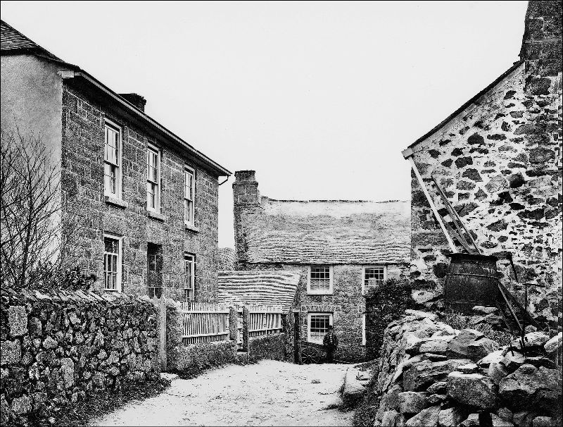
A view of Ayr manor house, St. Ives, Cornwall

Just outside the town, Carbis Bay — known in Cornish as Carrack Gladden — was only beginning to develop by the late 19th century. A handful of hotels had appeared, and beach huts dotted the sand, but the area was still largely undisturbed. The arrival of tourism was just beginning to reshape the coastline.
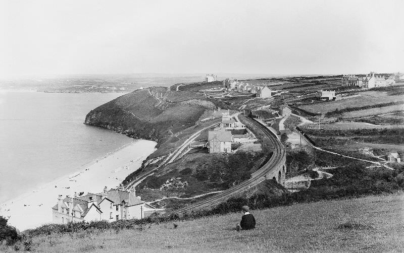
A view of Carbis Bay (Carrack Gladden) before very much development is in evidence. The first hotels have appeared though and beach hunt/tents can be seen on the beach itself, St. Ives, Cornwall

Smeaton’s Pier was a landmark from every angle. At high water, the harbor behind it filled to capacity. The Pedn Olva mine engine house stood clearly visible on the headland, and the Malakoff — a disused engine house — had already found a second life as an artist’s studio, an early sign of St. Ives becoming a draw for painters.
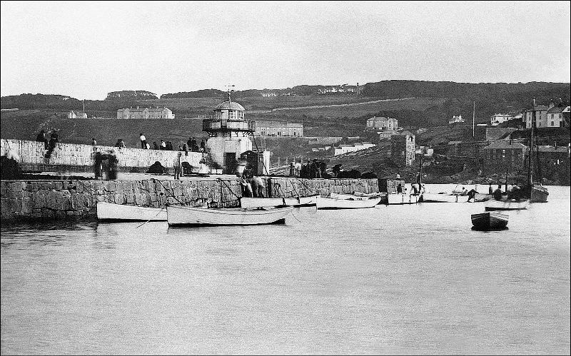
A view of Smeaton's Pier at high water. The Pedn Olva mine engine house can be clearly seen as well as the Malakoff (the disused engine house was used an artists studio for a period), St. Ives, Cornwall
A view of Smeaton’s Pier at high water. The Pedn Olva mine engine house can be clearly seen as well as the Malakoff (the disused engine house was used an artists studio for a period), St. Ives, Cornwall
A view of Smeaton's Pier at low tide with a couple of local lads, St. Ives, Cornwall
A view of Smeaton’s Pier at low tide with a couple of local lads, St. Ives, Cornwall

The town beach beside Smeaton’s Pier served as an informal boatyard. Fishermen pulled their vessels onto the sand for repairs and routine maintenance, working in the open air with basic tools. It was a scene repeated throughout the year, weather permitting.
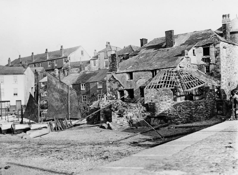
A view of the "town beach" adjacent to Smeaton's Pier. Boat repairs/maintenance were often carried out here, St. Ives, Cornwall
A view of the “town beach” adjacent to Smeaton’s Pier. Boat repairs/maintenance were often carried out here, St. Ives, Cornwall

At the slipway, barrels were stacked and waiting throughout the pilchard season. Once packed with salted fish, they were loaded onto carts and transported away — many destined for export to Catholic countries in southern Europe, where salted pilchards were in steady demand.
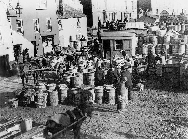
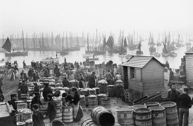
A view of the activity around the slipway, with the barrels awaiting their turn to be packed with fish and then transported away on waiting carts, St. Ives, Cornwall
A view of the boat-filled harbour and foresand showing the bustling activity connected with the fishing industry, St. Ives, Cornwall

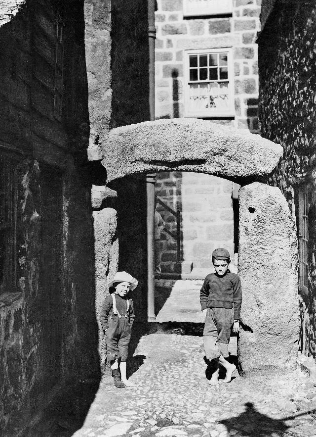
The Digey was one of the characteristic passages of Downalong — a narrow lane barely wide enough for a loaded donkey cart. Hicks Court, just off the Digey, was entered through a distinctive granite arch that had stood for generations and was well known to locals as a landmark within the maze of back streets.
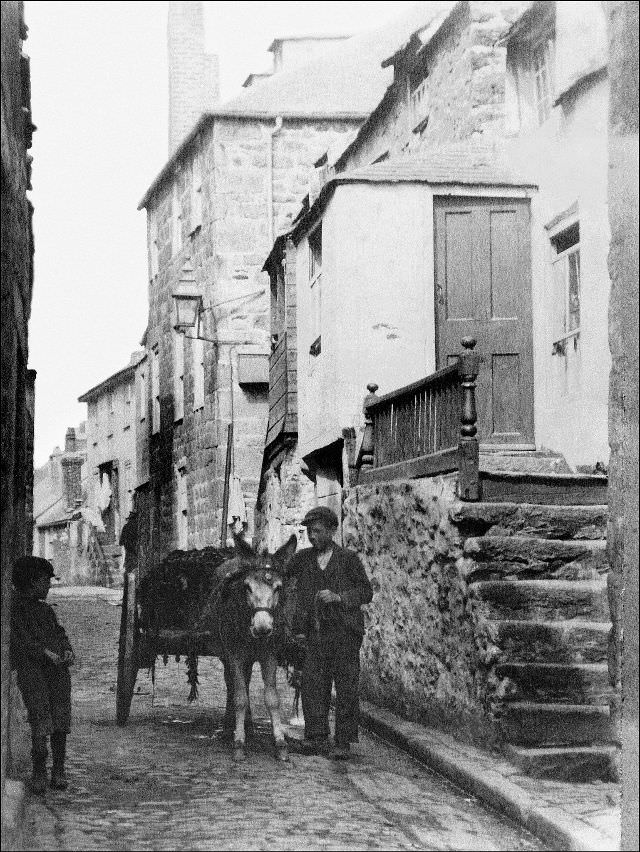
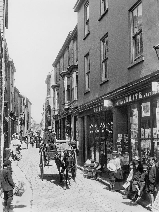
A view of the Digey with donkey cart. Hicks Court, with its famous granite arch is just off to the left, St. Ives, Cornwall
A view of the entrance to Fore Street, St. Ives, Cornwall

The market place was one of the few open spaces in an otherwise tightly packed town. Vendors sold fish and produce here, and it served as a gathering point for the community. Around it, the commercial street life of St. Ives concentrated — shops, traders, and the steady foot traffic of a working town.
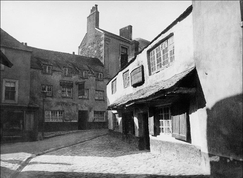
A view of the market place, St. Ives, Cornwall

The Parish Church of St. Ia, with its solid granite tower, dominated the townscape from several vantage points. Next to it stood the Star Inn, a building that has since been demolished. The church was a constant reference point in a town where streets twisted and turned without any obvious grid.
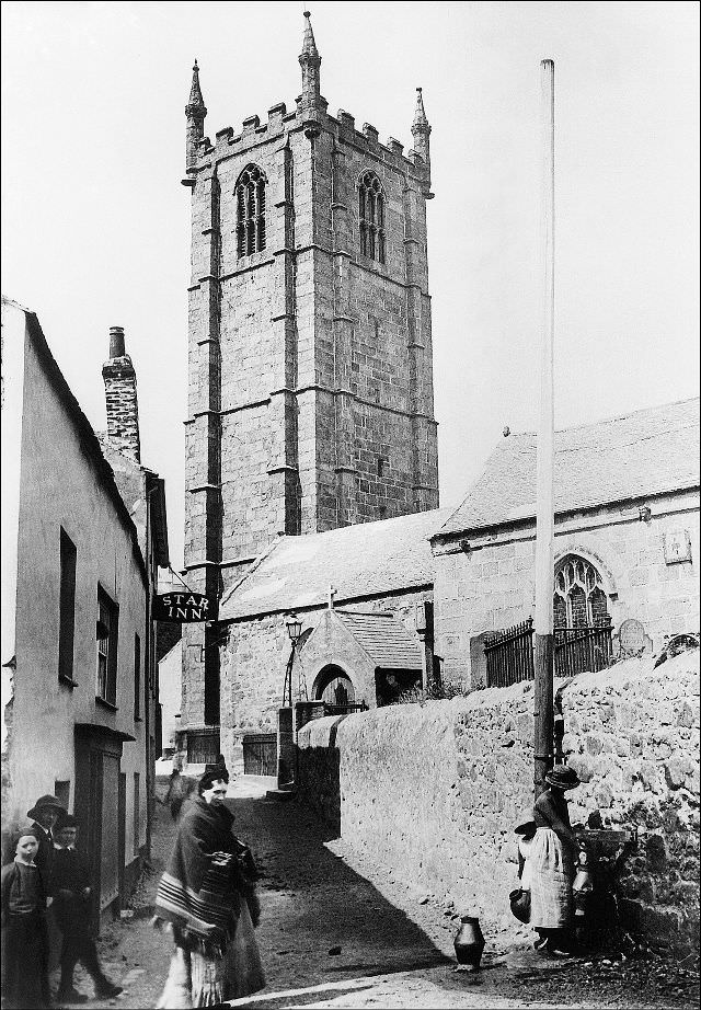
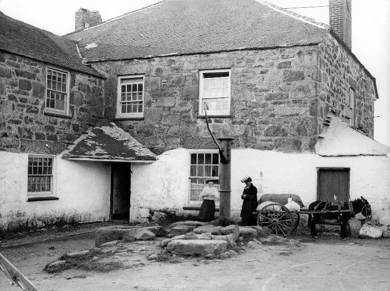
A view of the Parish Church of St. Ia and its sturdy granite tower. To the left is the Star Inn (long since demolished), St. Ives, Cornwall
A view of the rear of the Halsetown Inn, St. Ives, Cornwall

The arrival of the Great Western Railway in 1877 was a turning point. The St. Erth branch line — the very last broad gauge line to be built — connected St. Ives to the national rail network for the first time. Tourists began arriving in numbers, and the town’s relationship with the outside world changed permanently. The track visible at the station in photographs from this period still shows the wide broad gauge rails before conversion.
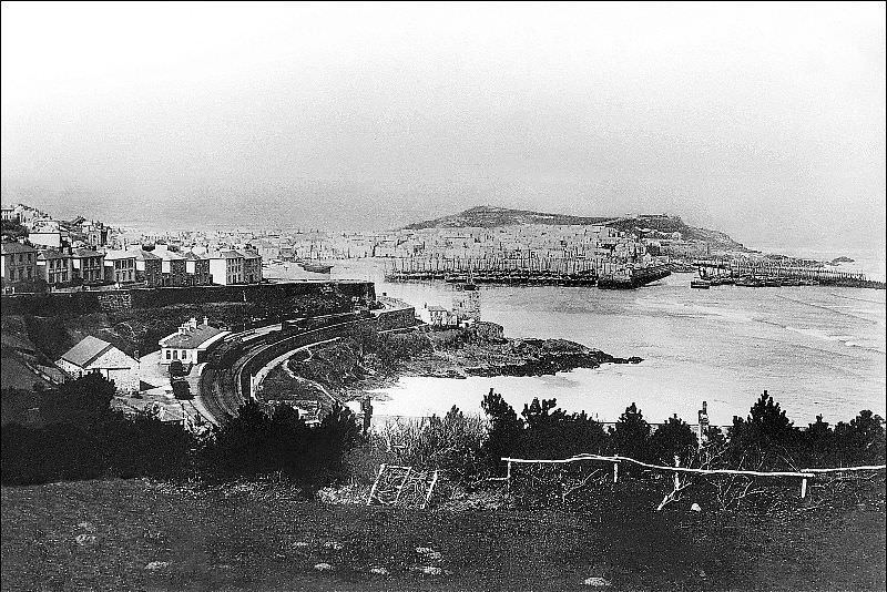
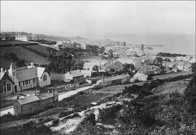
A view of the town and harbour. The track at the station appears to be broad gauge, the St. Erth branch line was the very last broad gauge line to be built, St. Ives, Cornwall
A view of the town from Park Avenue, St. Ives, Cornwall

From several elevated viewpoints around the town, the full extent of St. Ives became clear — the cluster of rooftops running down to the harbor, the boats in the bay, and the open Atlantic beyond. These views attracted artists as much as any other feature of the place. The quality of the light in St. Ives, shaped by water on three sides, was unlike anywhere else in England.
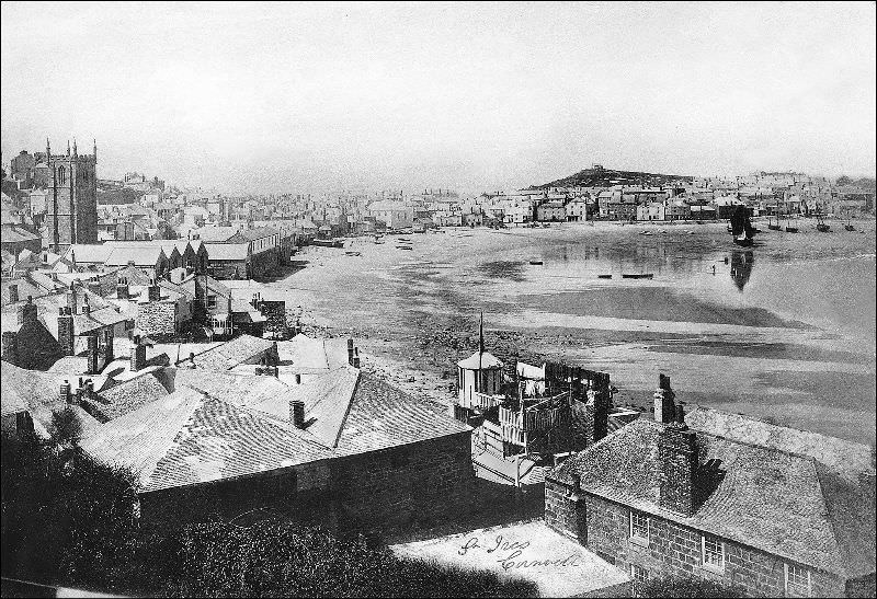
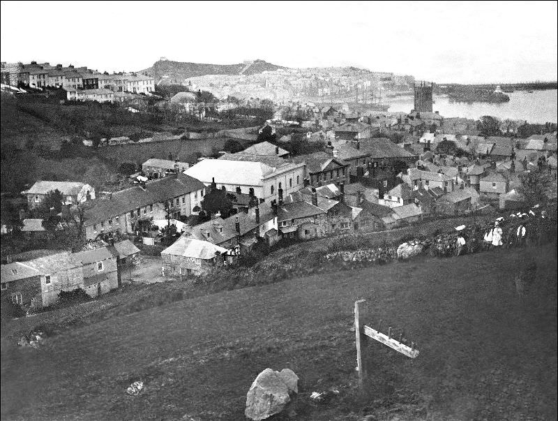
A view of the town from where the bus station is now located, St. Ives, Cornwall
A view of the town taken from where the large car park is now situated, St. Ives, Cornwall

By the late 19th century, an art colony had taken root in St. Ives. Painters including Julius Olsson and Louis Grier set up studios in the town, drawn by the coastal landscapes and the light. The Warren, Downalong, and even disused industrial buildings became spaces for artistic work. Marine artist Alfred Joseph Pazolt — A.J. Pazolt — had premises somewhere within the winding streets of Downalong, his name visible on the building front.
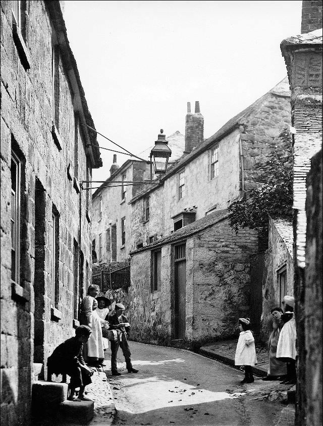
A view of the Warren, St. Ives, Cornwall
A view of the well known granite arch that leads into Hicks Court from the Digey, St. Ives, Cornwall

Down at the wharf, fishermen worked at rough wooden benches, repairing gear, sorting catch, or preparing equipment for the next outing. The wharf and slipway area were rarely empty during working hours, with boats coming and going and the constant movement of carts and barrels.
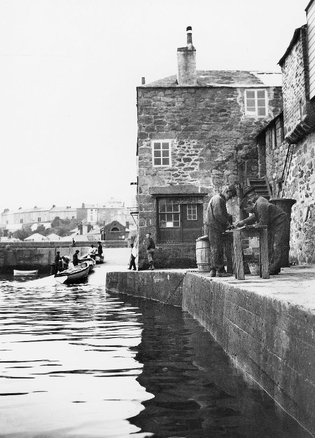
A view of the wharf with some fisherman occupied with a task at a crude bench/table, St. Ives, Cornwall
Much activity in the harbour with the arrival and unloading of a seine boat, St. Ives, Cornwall

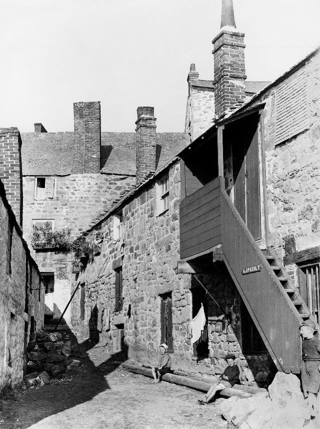
The maze of streets in Downalong was tightly packed with cottages, small businesses, and the occasional artist’s premises. A.J. Pazolt’s building stood among these lanes, its signage marking it out as belonging to a man whose trade was capturing the sea on canvas — fitting for a street where the water was never far from view.
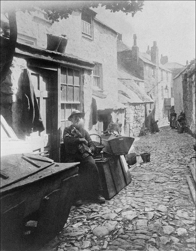
Somewhere in the maze of streets 'Downalong'. The occupier of the building on the right is A.J. Pazolt (Alfred Joseph Pazolt). He was a marine artist, St. Ives, Cornwall
Somewhere in the maze of streets ‘Downalong’. The occupier of the building on the right is A.J. Pazolt (Alfred Joseph Pazolt). He was a marine artist, St. Ives, Cornwall
The "Pudding Bag Lane" (Capel Court), St. Ives, Cornwall
The “Pudding Bag Lane” (Capel Court), St. Ives, Cornwall

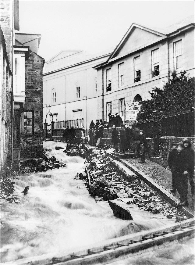
In November 1894, a severe flood struck St. Ives and caused significant damage across the town. Photographs taken at the time show floodwaters running down Tregenna Hill, up the Stennack from Royal Square, and along the Terrace. The event was serious enough to be remembered simply as ‘the great flood,’ and the images taken in its aftermath are among the most dramatic records of the town from this era.
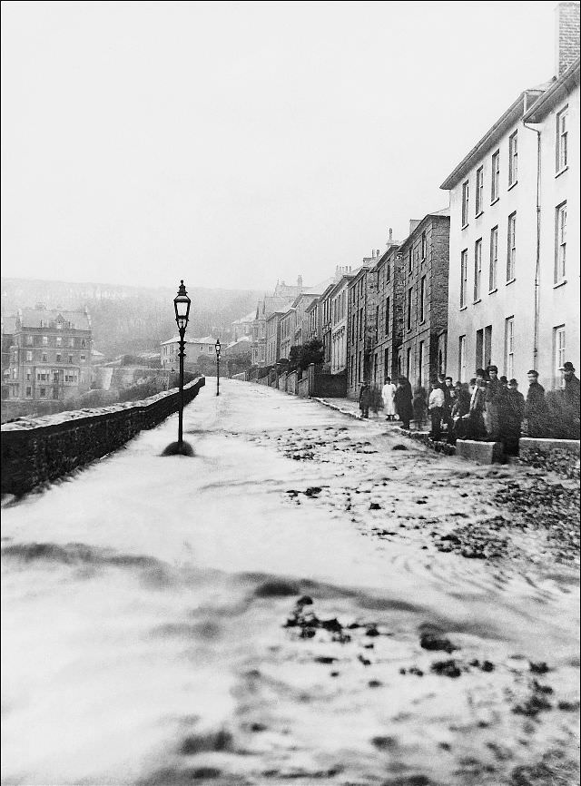
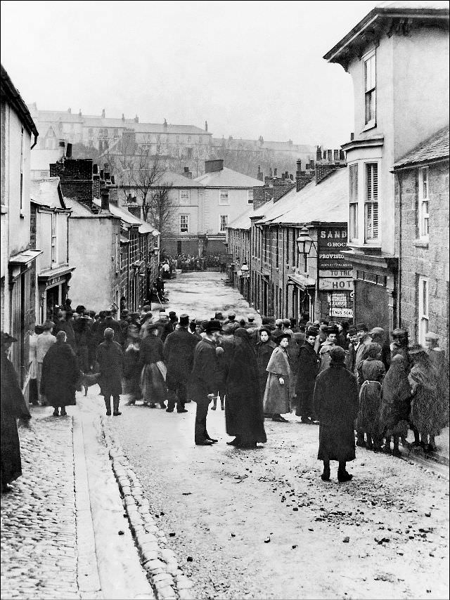
The great flood of 1894. A view looking south east up 'The Terrace', St. Ives, Cornwall
The great flood of 1894. A view looking south east up ‘The Terrace’, St. Ives, Cornwall
The great flood of November 1894. Looking down Tregenna Hill toward Tregenna Place, St. Ives, Cornwall
The great flood of November 1894. Taken from the Royal Square looking west up the Stennack, St. Ives, Cornwall

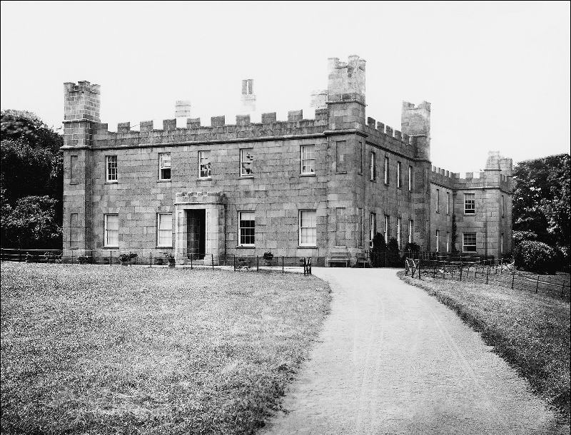
Tregenna Place held some of the town’s most recognizable historic buildings. The old manor house of the Stephens family was a substantial stone structure that had, at one point, also served as the shipping office of the Hain Steamship Company — one of the most significant local shipping enterprises of the era. Above the town, Tregenna Castle looked out over everything from its elevated position.
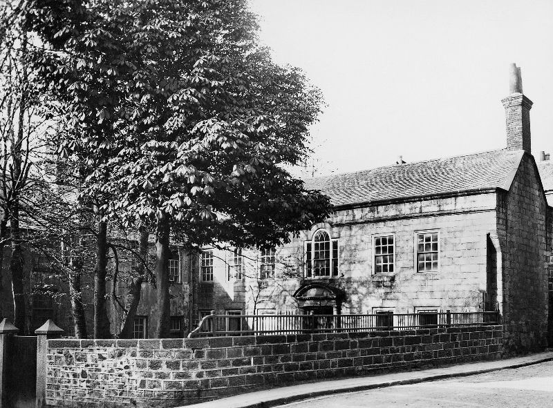
The old manor house of the Stephens family located in Tregenna Place. It was also the shipping office of the Hain Steamship company at one time, St. Ives, Cornwall

Near the slipway, the Sloop Inn was already a well-established fixture of the waterfront. The premises that would later become Hart’s Ice Cream Parlour also stood nearby — at this point still in an earlier use, though the building was clearly visible. The wharf around it stayed busy from first light until the last boat was secured.
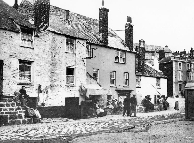
The wharf near the slipway. The Sloop Inn is clearly visible off to the right and also the premises that would later become Hart's Ice Cream Parlour, St. Ives, Cornwall
The wharf near the slipway. The Sloop Inn is clearly visible off to the right and also the premises that would later become Hart’s Ice Cream Parlour, St. Ives, Cornwall
Tregenna Castle, St. Ives, Cornwall

The unloading of seine boats was one of the defining sights of the harbor. Crews worked fast, passing fish hand to hand and into waiting containers. Every stage of the process — from hauling the net to salting the final barrel — involved many hands and little machinery. St. Ives ran on physical labor, and the harbor was where that labor was most visible.
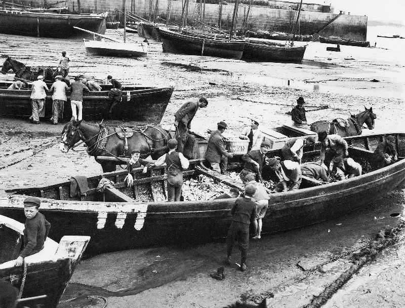
Unloading one of the seine boats in the harbour, St. Ives, Cornwall

Residents of streets like Virgin Street posed outside their front doors for the camera — one of the few times these lanes were still long enough to be photographed. The faces looking back are those of a fishing community at the end of a century defined by the sea. Their houses were small, their street was narrow, and the harbor was just a short walk away.
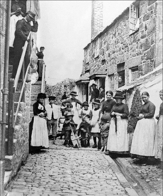

Virgin Street, with the locals posed outside of their dwellings, St. Ives, Cornwall
Enjoyed this post? Get new ones in your inbox.

2 thoughts on “What St. Ives looked like in the Late 19th Century”

Leave a Comment

Your email address will not be published. Required fields are marked *

Share this Post 🥺

Please take a moment to share this content. Your support is greatly appreciated! 🙌🙏

Share this Post 🥺

Please take a moment to share this content. Your support is greatly appreciated! 🙌🙏
Scroll to Top
 
Hey Friend, Before You Go.. Please like & follow for more interesting content