
Before European settlers arrived, the land that would become San Francisco was home to Native Americans who had lived there for thousands of years. The United States formally took control of the city in July 1846, when the USS Portsmouth sailed into San Francisco Bay and sailors and marines went ashore to raise the American flag. At that point, fewer than 800 people called the settlement home. That number was about to explode.
On January 24, 1848, gold was discovered at Sutter’s Fort in the California foothills. Word spread fast. Within a single year, the population of San Francisco shot up to 25,000. The city that emerged from this rush was rough and dangerous — high crime rates, gambling halls, and prostitution were fixtures of daily life. Between 1849 and 1851, six major fires tore through the city, burning large sections to the ground each time. San Francisco rebuilt after every one of them.
The gold boom faded by 1853, but the city didn’t slow down. Silver was discovered in Nevada in 1859, and San Francisco became the financial hub for the new mining rush. Unlike gold panning, silver extraction required heavy, expensive equipment. That meant only wealthy investors — soon called ‘silver barons’ — could profit on a large scale. Their fortunes poured into the city, funding grand mansions, businesses, and civic institutions that shaped San Francisco’s look for decades.
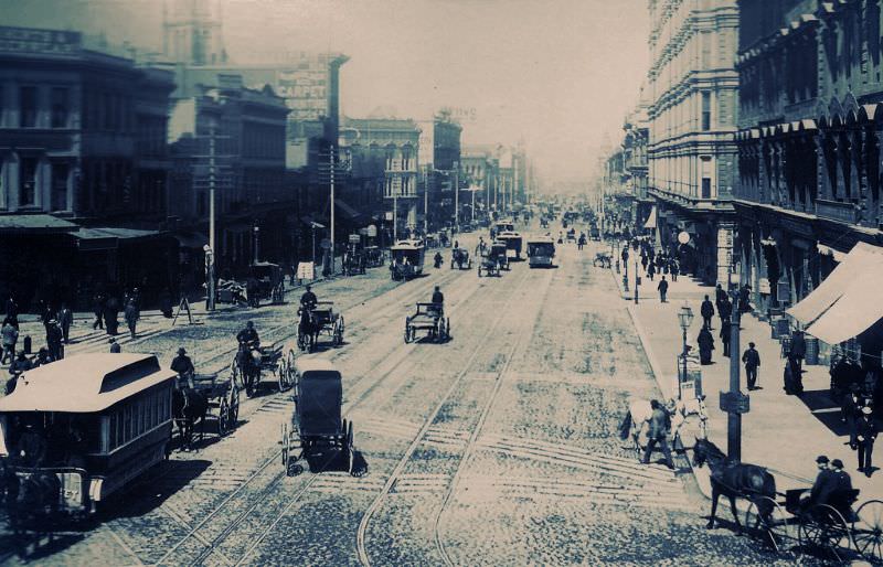
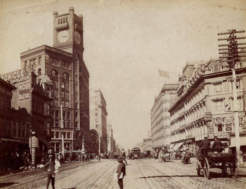
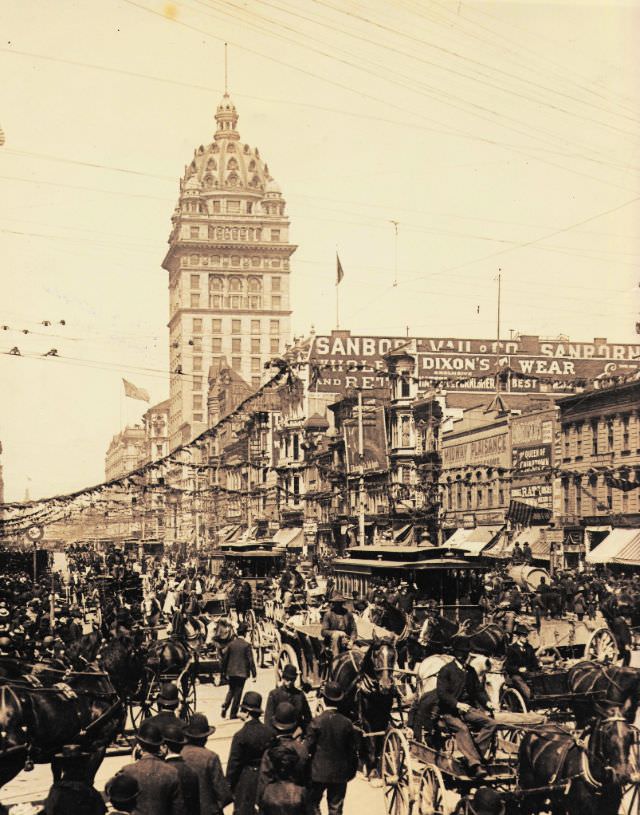
Market Street became the spine of the city. By the 1890s, it was lined with some of the most recognizable buildings in San Francisco. The Palace Hotel, which opened in 1875, stood as one of the grandest hotels in the entire country. The Chronicle Building and the Crocker Building anchored other stretches of the street. Trolley cars and horse-drawn carriages moved steadily along its wide lanes, carrying merchants, workers, and visitors through the city’s commercial core.
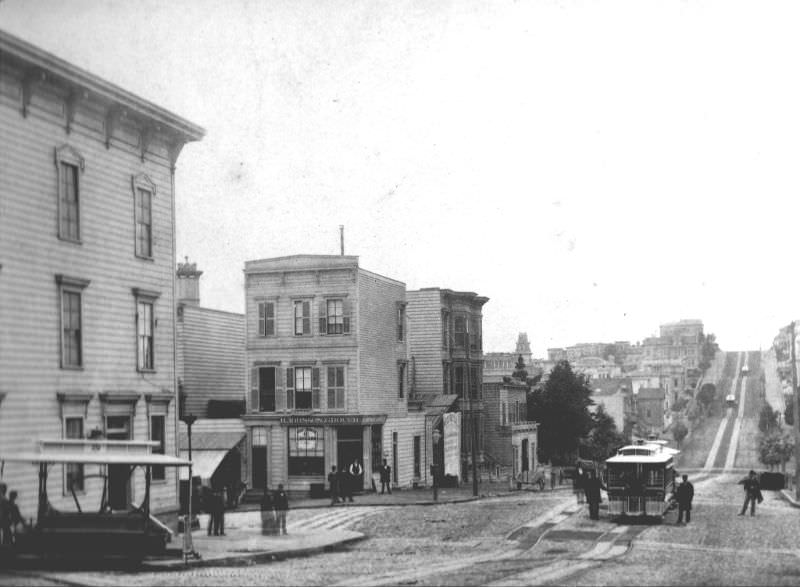
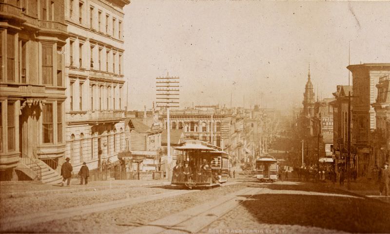
One of the most important developments in San Francisco’s growth was the introduction of cable cars. The first cable car line began running on Clay Street in 1873. The California Street Railroad followed, extending the network across the city’s steep hills. Before cable cars, those hills were a serious barrier to development. Once the lines were running, neighborhoods that had been hard to reach became accessible, and the city expanded rapidly in all directions.
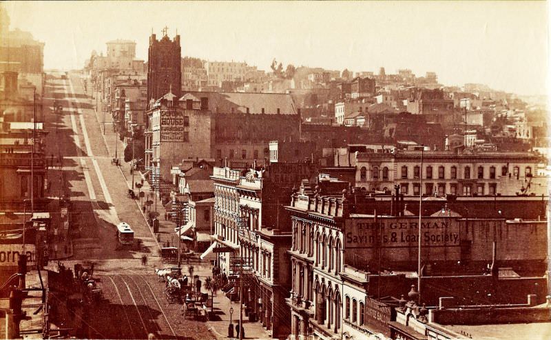
California Street connected the financial district to the wealthy residential neighborhoods of Nob Hill. The street climbed sharply westward from Montgomery Street, passing banks, commercial buildings, and eventually the grand homes of the city’s elite. In the 1880s, this corridor was one of the most active and well-developed stretches in San Francisco, reflecting the city’s rapid accumulation of wealth.
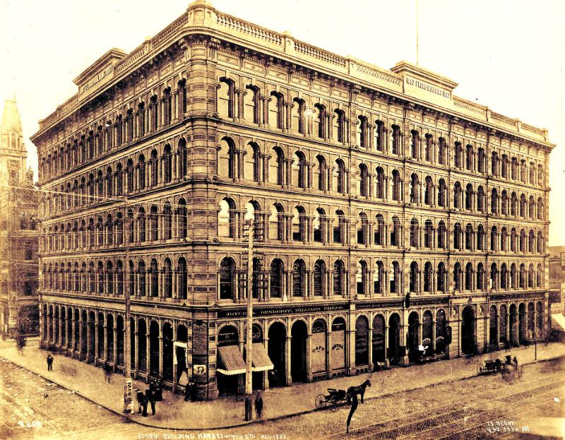
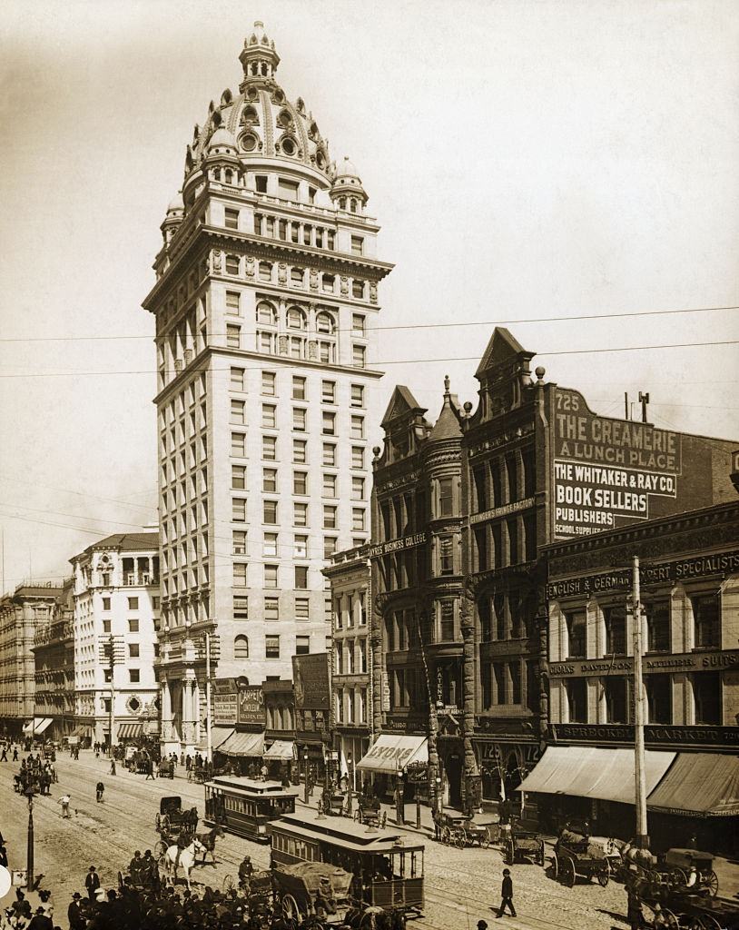
The Flood Building at Market and Fourth Street was a product of silver money. James Flood was one of the most powerful silver barons in California, and the building that bore his name was a statement of that wealth. Completed in the 1890s, it was a prominent commercial landmark on one of the city’s busiest corners. Buildings like this one reflected how thoroughly the silver boom had reshaped San Francisco’s physical landscape.
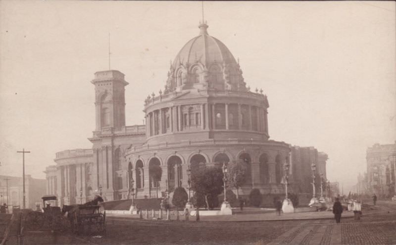
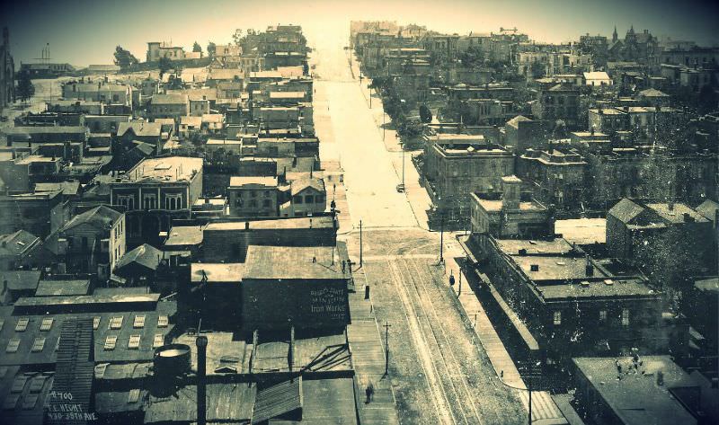
San Francisco’s civic infrastructure grew alongside its commercial development. The old City Hall and its Hall of Records served as the administrative center of a rapidly expanding city government. Rincon Hill, visible looking up First Street, had once been a fashionable residential neighborhood in the 1860s, but by the 1890s it was transitioning into a more industrial and working-class district as wealthier residents moved to Nob Hill and other areas further west.
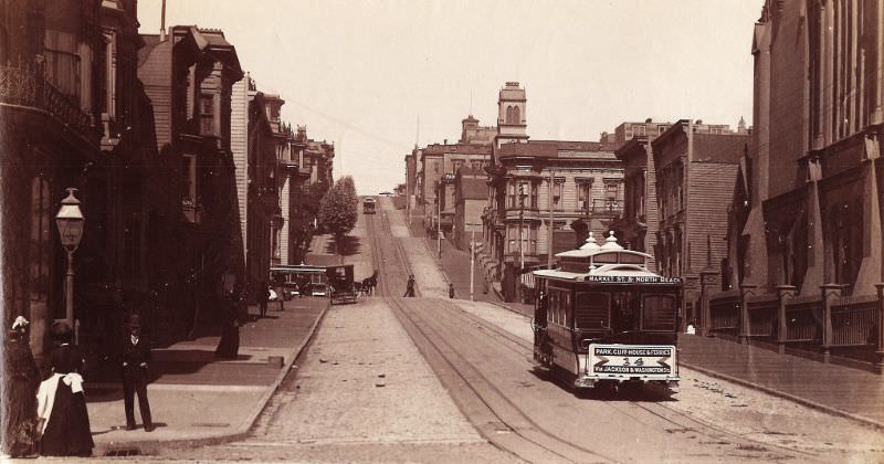
Union Square and the streets surrounding it formed one of the city’s key social and commercial zones. Powell Street ran north from the square through a mix of hotels, shops, and residential buildings. The view looking up Powell Street in the 1890s captured a city in full stride — cable car tracks embedded in the road, buildings several stories tall, and steady foot traffic along the sidewalks. Market Street, running diagonally through the city, brought all of these districts together.
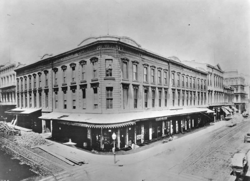
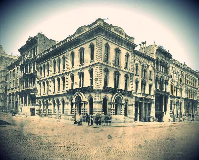
Montgomery Street was the financial heart of San Francisco. Banks, exchanges, and brokerages lined both sides of the street from Washington down through the commercial district. The San Francisco Stock and Bond Exchange, founded in 1882, was central to this activity. The Exchange processed investments tied to silver mining, railroads, real estate, and trade — connecting San Francisco’s economy to national and international markets.
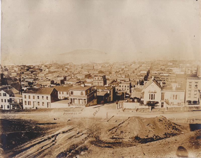
Nob Hill sat above much of the city both literally and socially. From its heights, you could look down Powell and Sacramento Streets and see the full spread of San Francisco below. The hill became home to the city’s wealthiest residents — railroad and silver magnates who built enormous mansions on its slopes. The view from Nob Hill in the 1890s showed a dense, built-up city stretching toward the bay, with church spires, commercial blocks, and residential streets filling nearly every lot.
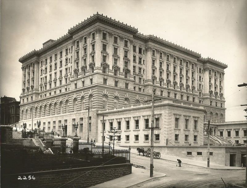
The Fairmont Hotel on Nob Hill was built in the 1890s by Tessie Fair Oelrichs, daughter of silver baron James Fair. The building was still under construction at the time of some of the earliest photographs taken of it, yet it was already clear that it would dominate the hill’s skyline. Its location at the top of California Street made it visible from a wide swath of the city. Along with the grand residences nearby, it reinforced Nob Hill’s identity as the address of San Francisco’s upper class.
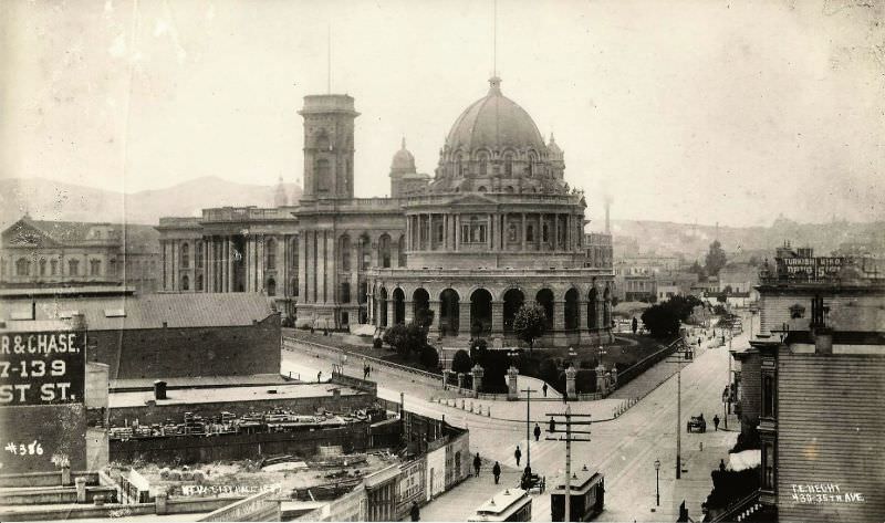
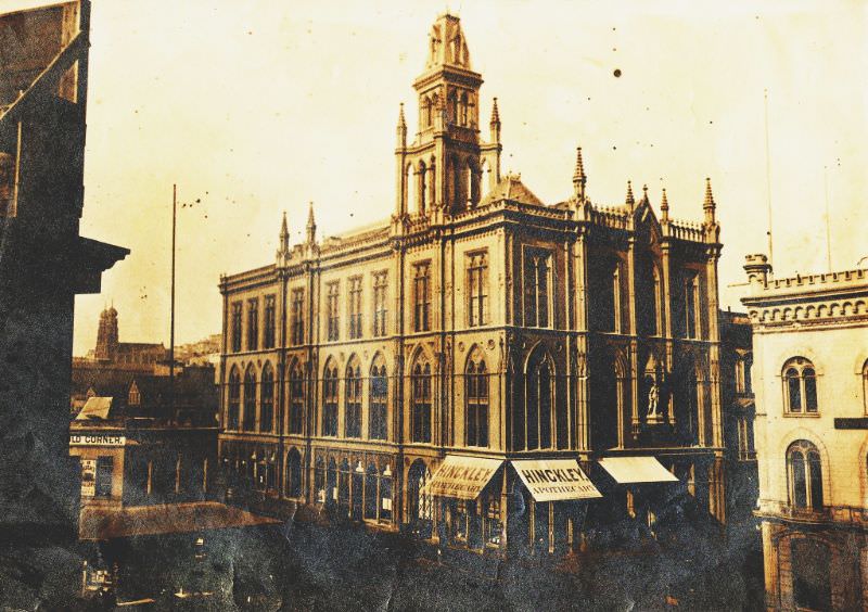
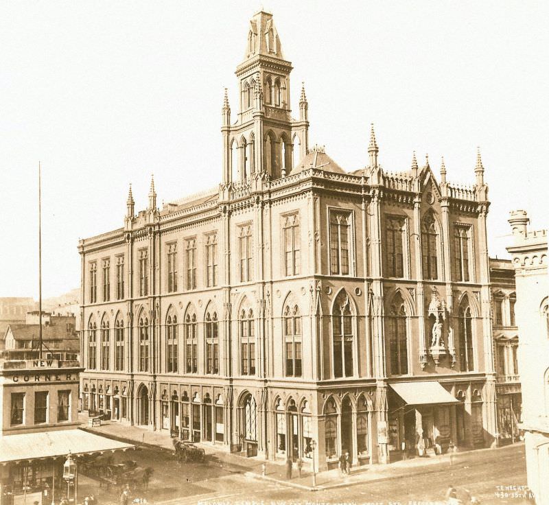
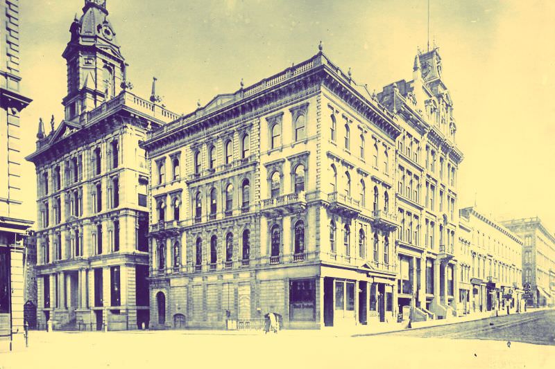
Fraternal organizations played a significant role in San Francisco’s civic life during this era. The Masonic Temple at Post and Montgomery was one of the most visible expressions of that influence. Built in a prominent location at the intersection of two major streets, it served as a meeting place for some of the city’s most powerful businessmen and community leaders. The building appeared in photographs from both the 1880s and 1890s, reflecting its lasting presence on the San Francisco streetscape.
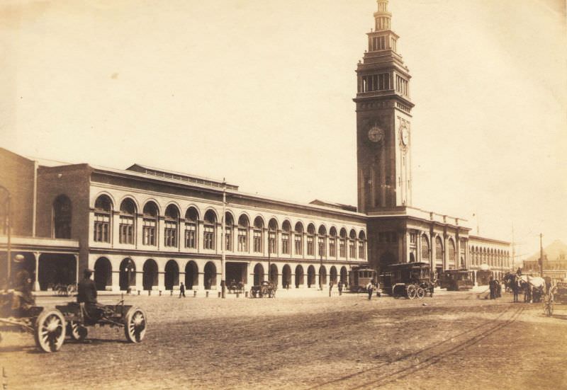
The Ferry Building was completed in 1898 at the foot of Market Street, right on the waterfront. Before the Bay Bridge existed, ferries were the only way to cross San Francisco Bay. The building processed tens of thousands of commuters and travelers each day. Its tall clock tower made it one of the most recognizable structures in the city and served as a landmark visible from ships approaching the bay. For many people arriving in San Francisco by water, the Ferry Building was their first sight of the city.
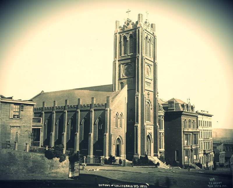
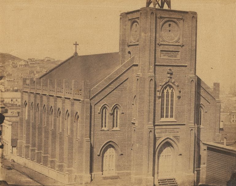
Old St. Mary’s Church stood at the corner of Dupont Street — later renamed Grant Avenue — and California Street. Completed in 1854, it was the first Catholic cathedral in California. By the 1890s, it sat at the edge of Chinatown, which had grown up around it over the preceding decades. The church remained a steady presence in the neighborhood even as the character of the surrounding streets changed dramatically with the arrival of Chinese immigrants.
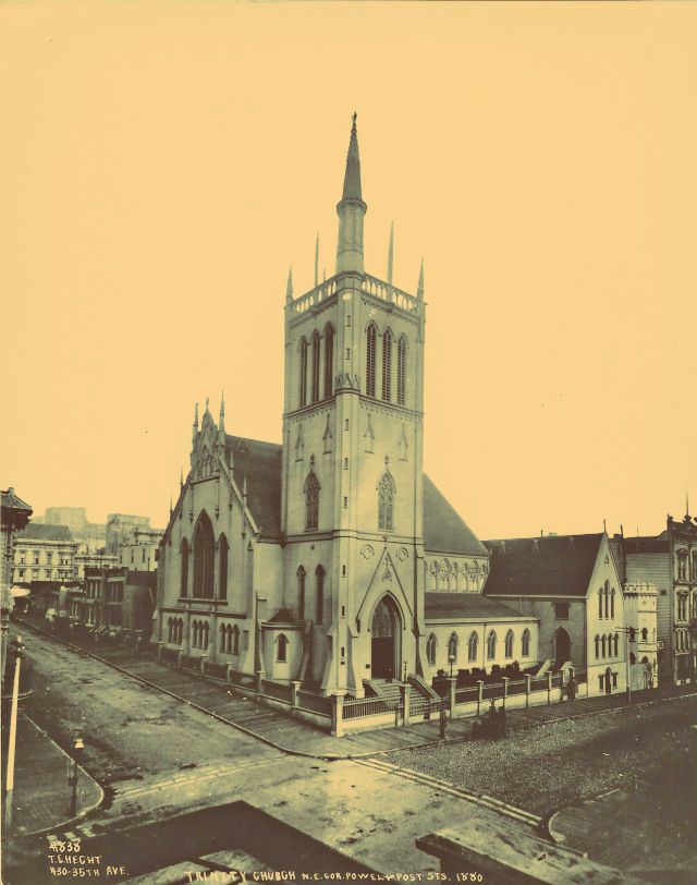
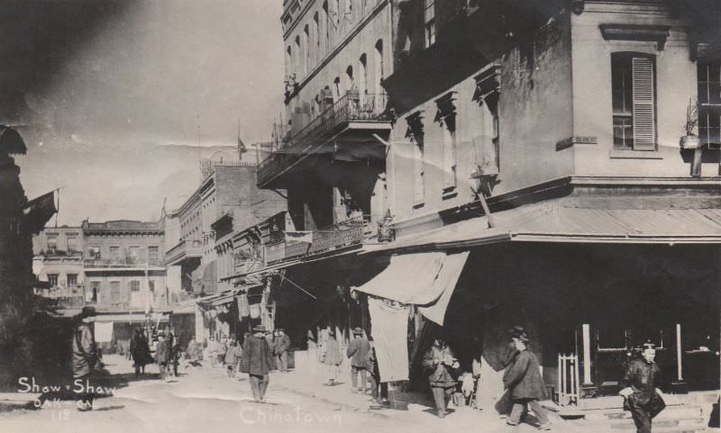
The construction of the Central Pacific Railroad brought large numbers of Chinese laborers to California in the 1860s. Many settled in San Francisco after the railroad’s completion, and the community they built on and around Dupont Street became the largest Chinese settlement outside of Asia. By the 1890s, Chinatown was a densely populated neighborhood with its own businesses, temples, newspapers, and social organizations, occupying several city blocks in the heart of San Francisco.
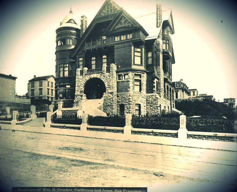
The Crocker family was one of San Francisco’s most prominent dynasties. William Crocker’s residence on California and Jones Streets was a massive Victorian mansion that exemplified the architectural ambitions of the city’s wealthy class. His father, Charles Crocker, had been one of the original investors in the Central Pacific Railroad, and the family’s fortune was one of the largest in California. Homes like this one stood as physical markers of the vast economic inequality that defined San Francisco during this period.
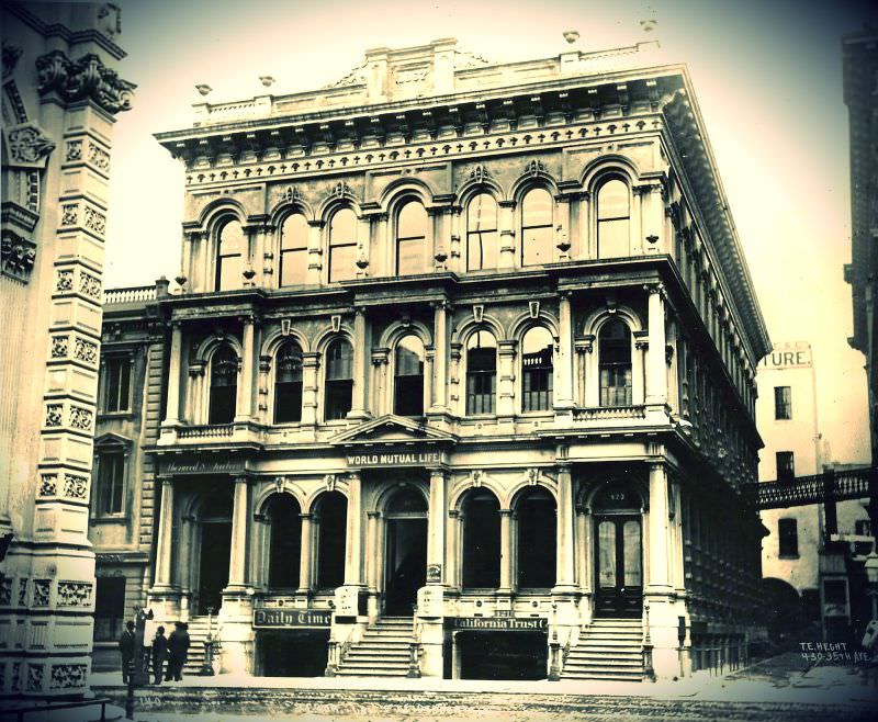
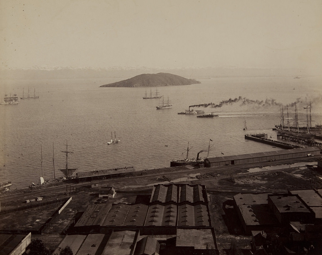
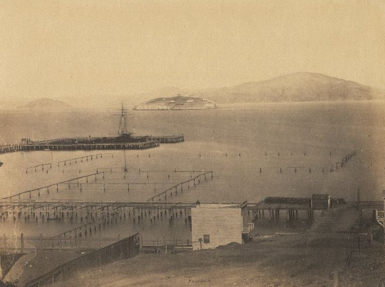
Alcatraz Island sat in the middle of San Francisco Bay, clearly visible from the city’s waterfront. In 1880, it functioned as a military fortification and prison. The U.S. Army had begun using the island as a military prison in the 1860s, and by 1880 it held military inmates in a facility that would later evolve into one of the most well-known penitentiaries in American history. From the shores of San Francisco, the island was a constant, visible reminder of federal authority over the bay.
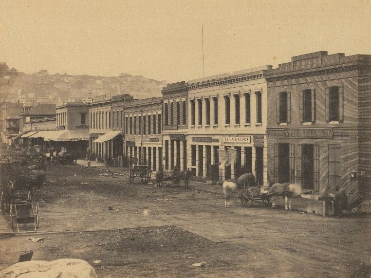
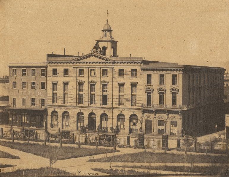
San Francisco’s old City Hall was a sprawling, ornate building that took decades to complete — construction stretched from 1872 to 1899. During much of the late 19th century, the building was partially finished but still in use, serving as the seat of city government while workers continued to add floors and facades. It was one of the largest buildings in California at the time and was meant to signal the city’s ambitions as a major American metropolis.
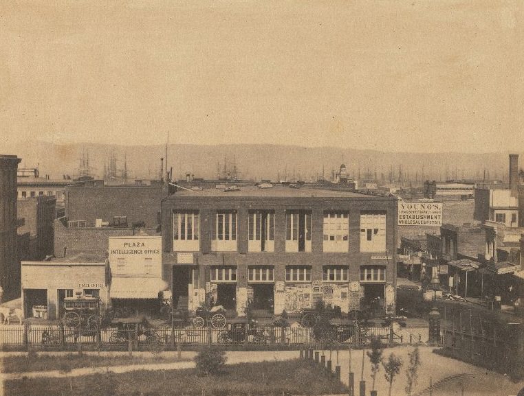
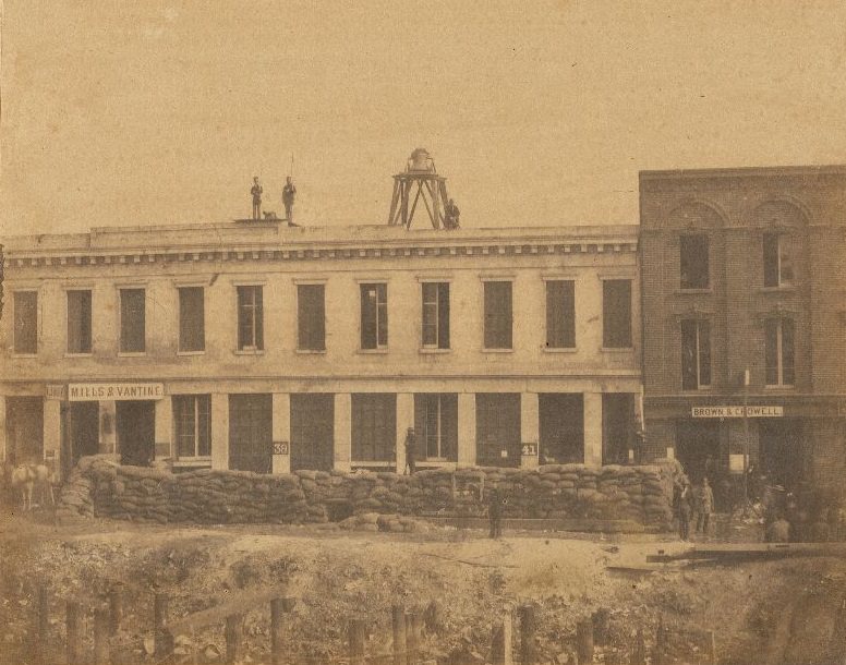
Political life in San Francisco was never quiet. The ‘Law and Order’ Party emerged in response to the vigilante movements that had periodically taken control of city justice in the 1850s. Rallies at public buildings like the former Post Office drew crowds of citizens who wanted to debate how order should be maintained in a city that had grown too fast for its institutions to keep pace. These gatherings reflected the ongoing tension between formal government authority and the informal power structures that had taken root during the Gold Rush years.
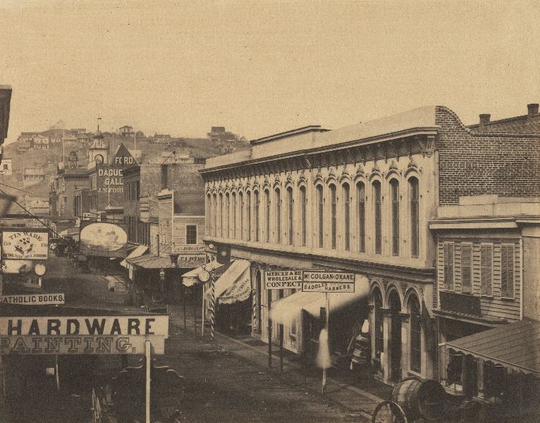
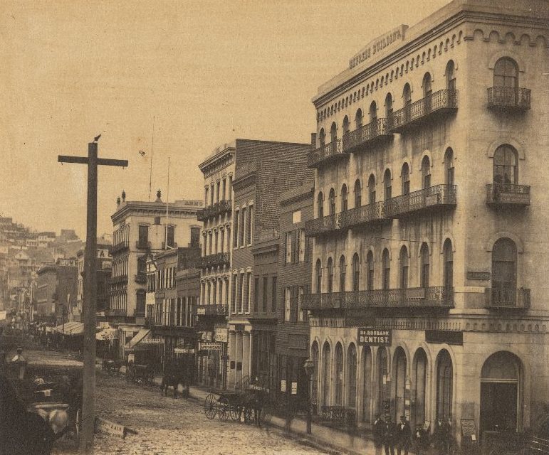
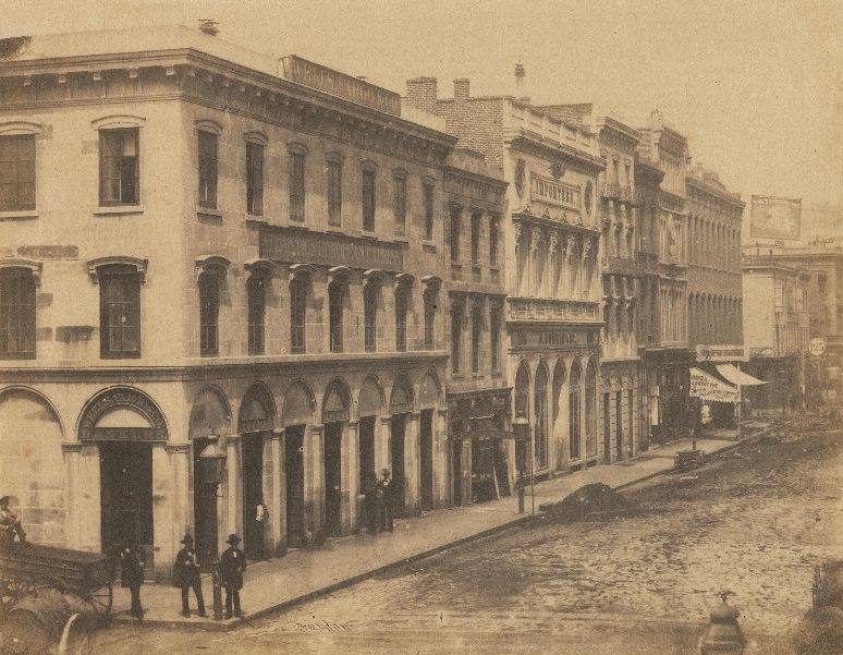
Kearny Street ran through the center of downtown San Francisco, connecting the waterfront district to the neighborhoods further inland. By the 1890s, it was a busy commercial corridor lined with storefronts, offices, and saloons. The street had been one of the original thoroughfares laid out in the city’s early grid, and it had grown steadily denser as San Francisco’s population expanded through the second half of the 19th century.
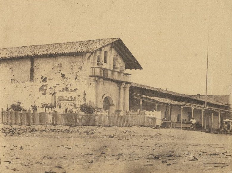
The Mission Dolores, formally known as Mission San Francisco de Asís, was the oldest surviving structure in San Francisco. Founded in 1776 by Spanish Franciscan missionaries, it predated the American city by decades. By the late 19th century, the original adobe mission chapel still stood, surrounded by a city that had grown up entirely around it. It served as a direct physical link to the Spanish colonial period and the era before the Gold Rush transformed the region.
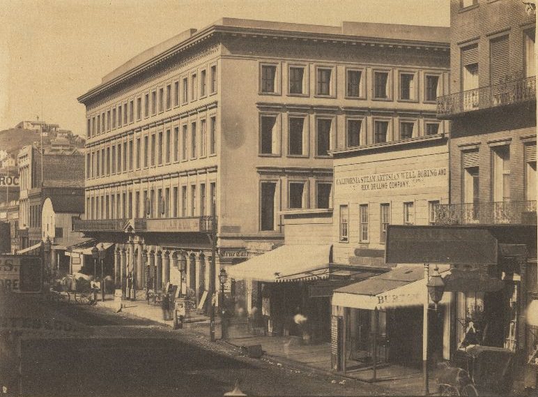
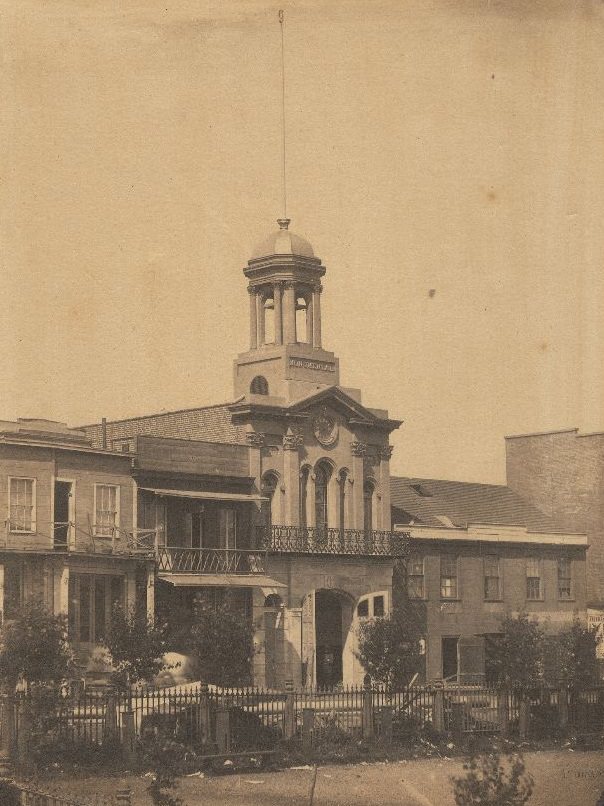
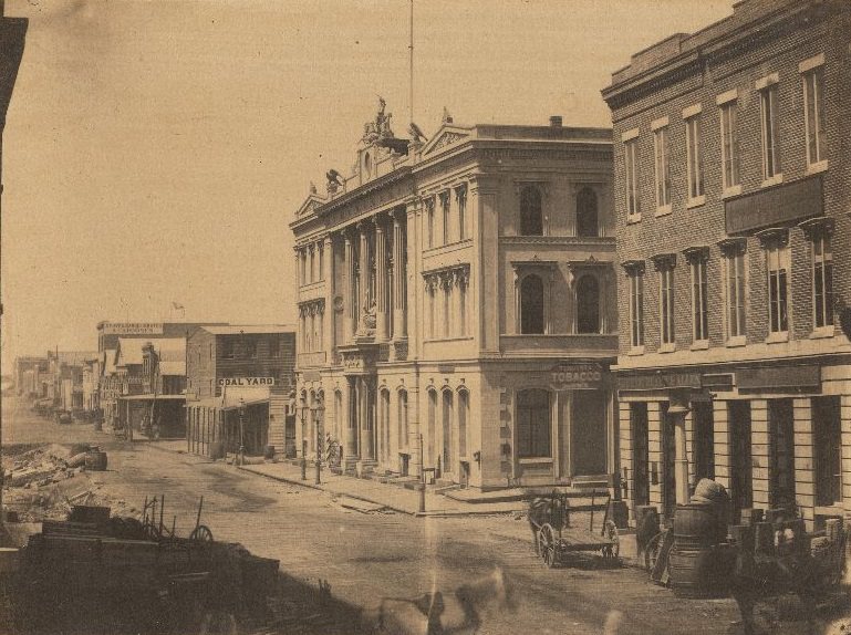
The Montgomery Block was the largest building in San Francisco when it was completed in 1853. It occupied an entire city block on Montgomery Street and housed law offices, newspapers, and businesses on its lower floors, while its upper floors were home to artists, writers, and other residents. The building was a fixture of the financial district throughout the second half of the 19th century. Fire stations like the Monumental Engine House on the Plaza were also essential infrastructure, given the city’s history of devastating fires in its early years.
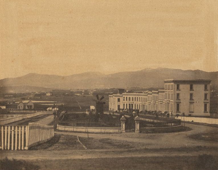
South Park was one of San Francisco’s earliest planned residential developments. Laid out in the 1850s by an English developer, it was modeled after London’s private garden squares and was intended for the city’s upper class. By the late 19th century, the neighborhood had shifted in character as wealthier residents moved to Nob Hill and other areas, but the oval park at its center remained a distinct feature of the South of Market district.
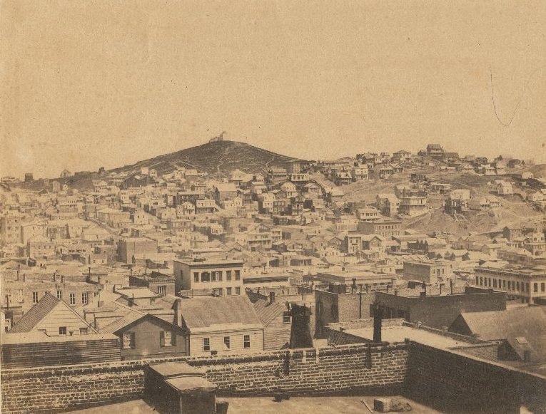
Telegraph Hill rose steeply on the northeastern edge of the city, offering wide views of the bay and the surrounding neighborhoods. In the early days of San Francisco, a semaphore station at its peak was used to signal the arrival of ships in the bay — giving the hill its name. By the 1890s, the hill’s slopes were covered with the homes of working-class residents, many of them Irish and Italian immigrants who had settled in the North Beach neighborhood at its base.
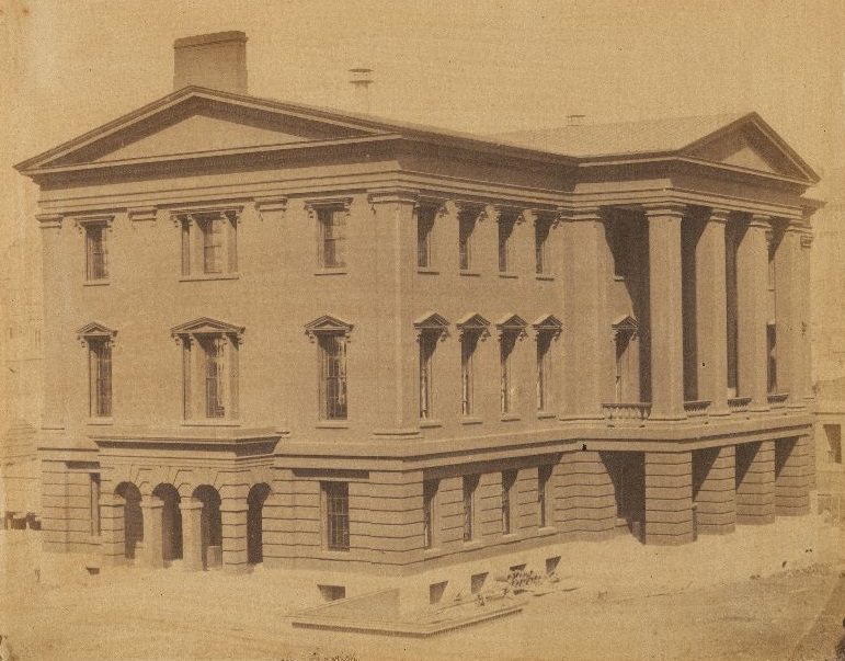
The Custom House was among the first federal buildings established in San Francisco after the United States took control. It processed the enormous volume of goods flowing through the port, collecting duties on imported merchandise. As San Francisco grew into one of the busiest ports on the Pacific coast, the Custom House became a critical piece of the city’s commercial infrastructure. The volume of trade it handled reflected the city’s role as the main gateway between the American interior and the Pacific world.
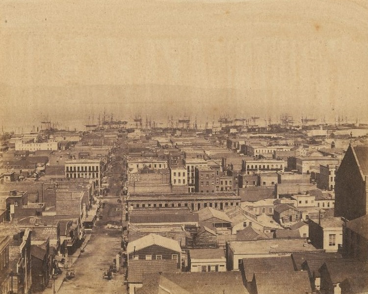
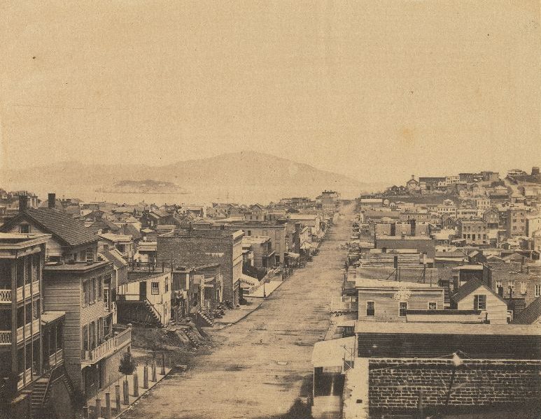
Sacramento Street and Stockton Street were two of the major east-west arteries cutting through the city’s core. Sacramento Street ran from the waterfront through the financial district and up toward Nob Hill. Stockton Street passed through the retail and residential areas north of Union Square. Both streets were well-established by the 1890s, lined with brick and stone buildings several stories tall, and served by cable car lines that made the city’s hills navigable.
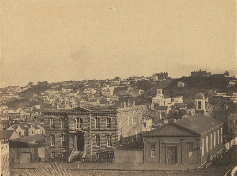
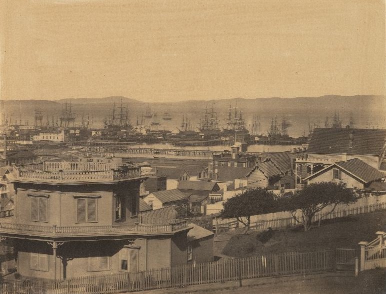
Rincon Point jutted into the bay at the southern end of the waterfront, offering a clear view of the city’s shoreline and the industrial activity along the docks. By the 1890s, the waterfront was a working environment — warehouses, rail depots, and shipping facilities dominated the land along the bay. The view from Rincon Point captured this industrial character, showing a city whose wealth was built as much on trade and labor as on the silver and gold that had originally drawn people west.
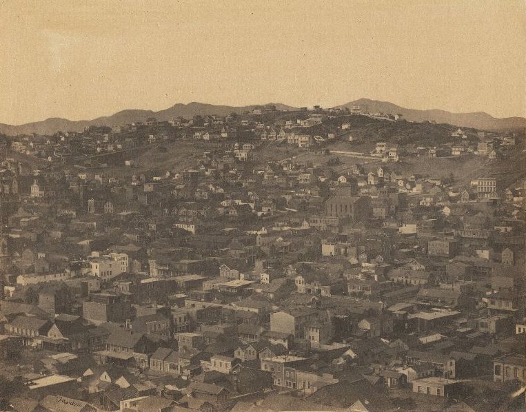
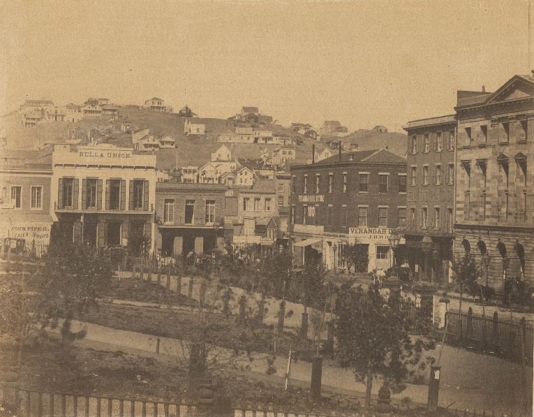
Russian Hill and Telegraph Hill together framed the northern part of the city. Views from these heights showed how densely San Francisco had been built up over just a few decades. The Plaza — also known as Portsmouth Square — had been the original center of the city during the Mexican and early American periods. By the 1890s, it was surrounded by buildings and remained an active public space at the edge of Chinatown, used for gatherings, commerce, and everyday street life.
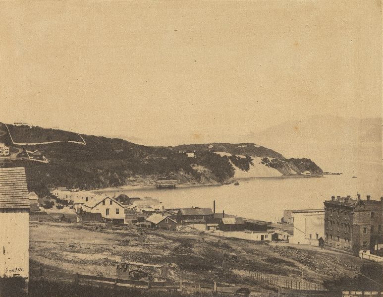
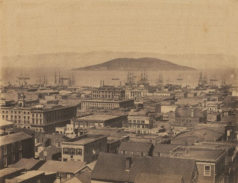
North Beach sat at the base of Telegraph Hill and along the northern waterfront. In the late 19th century, it was a working-class neighborhood with a strong immigrant presence. Italian fishermen and their families were among the most prominent residents, and the neighborhood’s proximity to the bay made it a natural home for those whose livelihoods depended on the water. The area’s streets, visible from the heights of Telegraph Hill, showed the dense, human-scale development typical of San Francisco’s neighborhoods outside the downtown core.

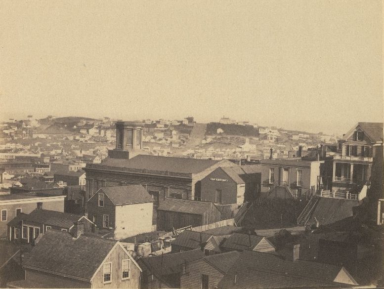
Happy Valley was a neighborhood in the South of Market district that had been a tent city during the Gold Rush and later developed into a residential and commercial area. By the late 19th century, the name referred more to a general district than a single defined neighborhood. The South of Market area more broadly was home to a large working-class population, and views over the district showed a mix of wooden houses, commercial buildings, and the infrastructure of an industrial city.
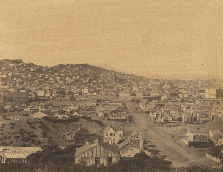
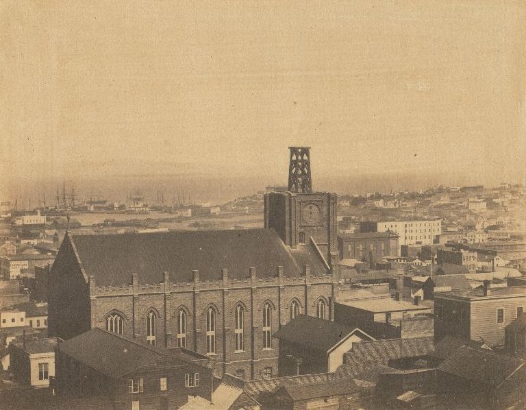
The stretch of the city between California and Bush Streets contained some of San Francisco’s most important commercial and civic institutions. Looking over this section of the city, you could see the rooftops of banks, office buildings, hotels, and churches packed tightly together across the grid of streets. Harrison Street, further south, offered a different perspective — a view across the broader South of Market district toward the bay, showing just how far the city had spread since the first settlers arrived a few decades earlier.
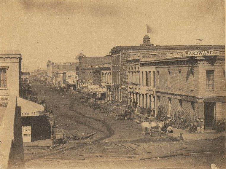





The last one says it’s Powell, looking north from Union Square. The peak on Powell is at California, and we can count the intersections: Post (where the camera is), Sutter, Bush, Pine, and then the last we can see is California.
And the relative grades on Powell between each intersection look much as today’s.
It can’t possibly be the same tree, but the trees today on the west side of Powell between Sutter and Bush have the same tilt toward the street as the tree in the 1890s photo.
In one of the photos, I could make out my great great grandparents house, the pic along California street from Larkin westward.
Love old photos of the bay. So much has changed yet so much endures.
Great photos and easy to scroll through