Hey There! Before You Go. 😧
Get the best vintage content straight into your inbox!

Don't worry, we don't spam

What Norfolk looked like in the 1960s

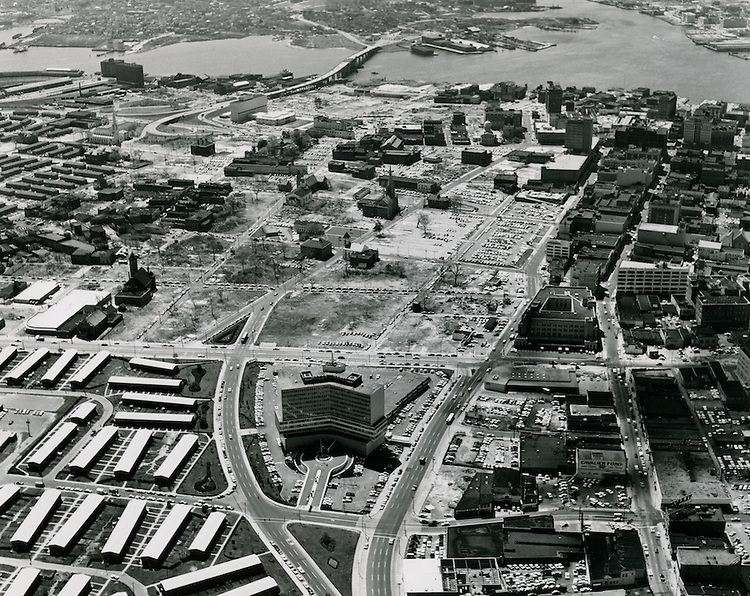
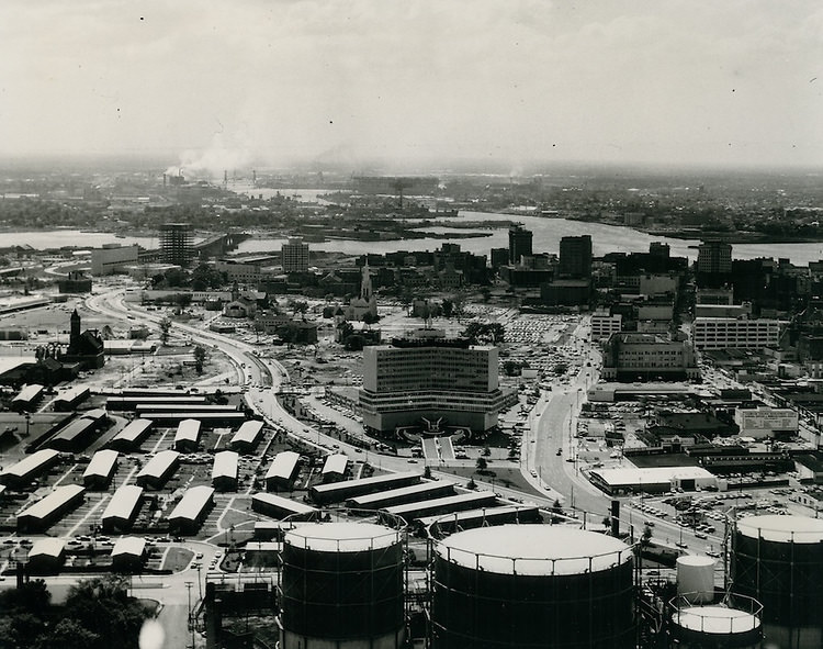
Norfolk, Virginia entered the 1960s as a city in motion. Its port hummed with commercial traffic, its downtown streets were lined with businesses, and new construction was reshaping entire blocks. But beneath that busy surface, the city was also dealing with serious tensions — over race, housing, urban renewal, and the economy. The photographs taken during this decade tell a story that no written record fully captures. They show a city that was, in equal parts, thriving and struggling, building up and tearing down.
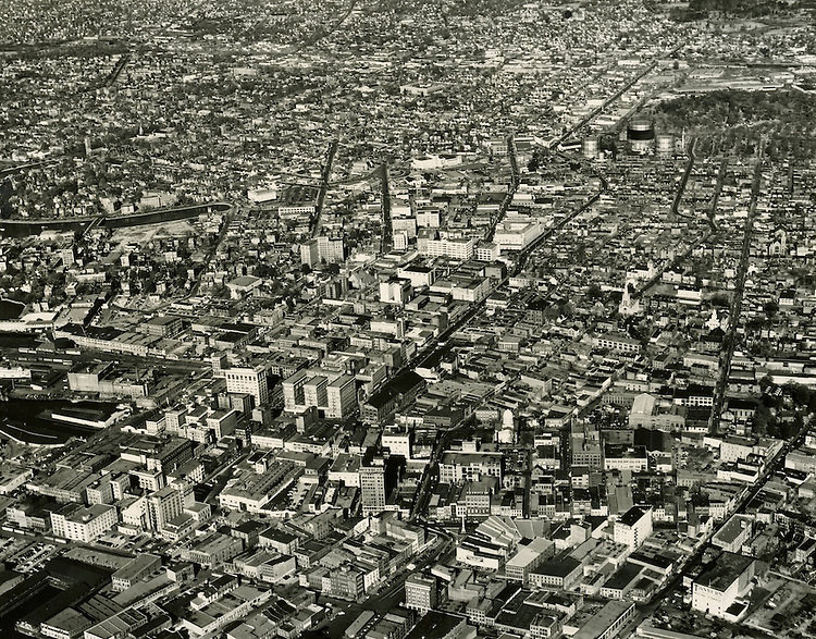
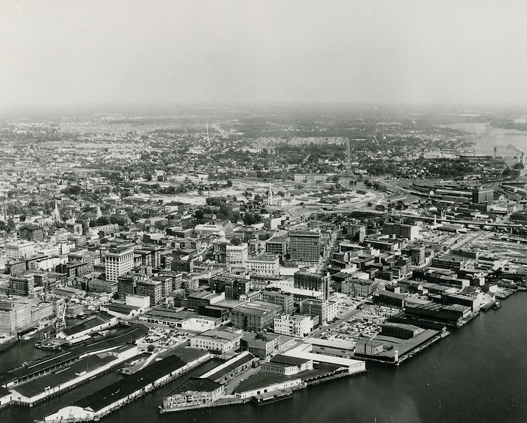
Aerial View Looking North at Downtown - November 30, 1949
Aerial View Looking North at Downtown – November 30, 1949

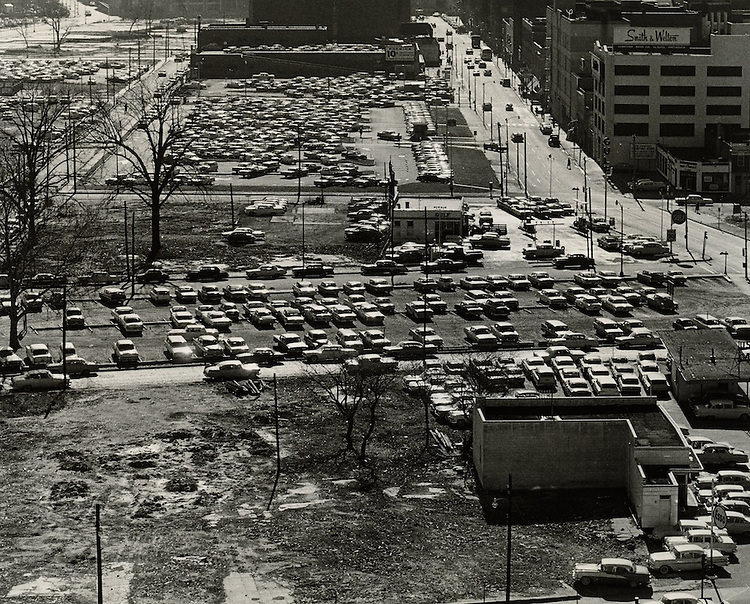
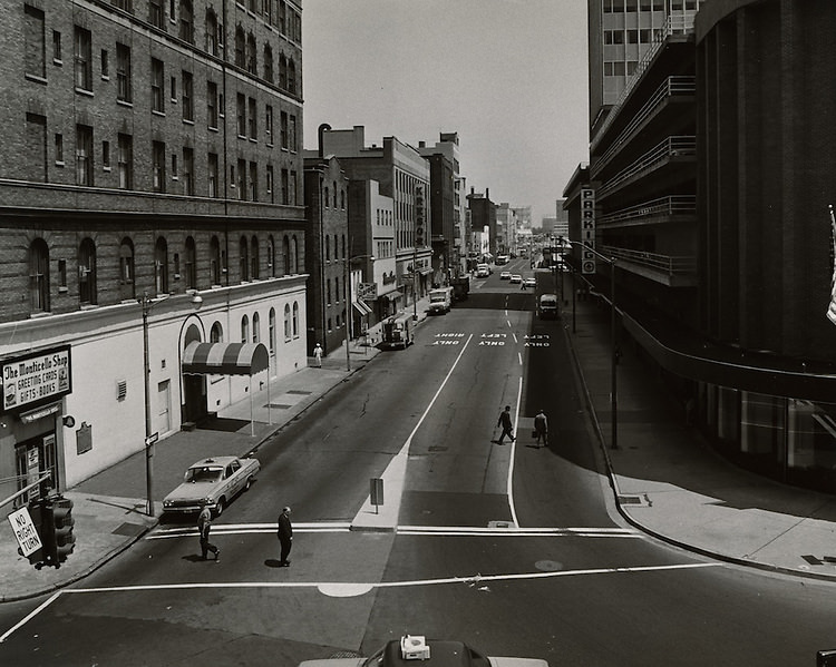
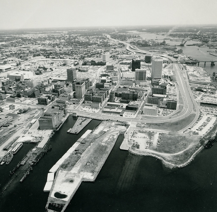
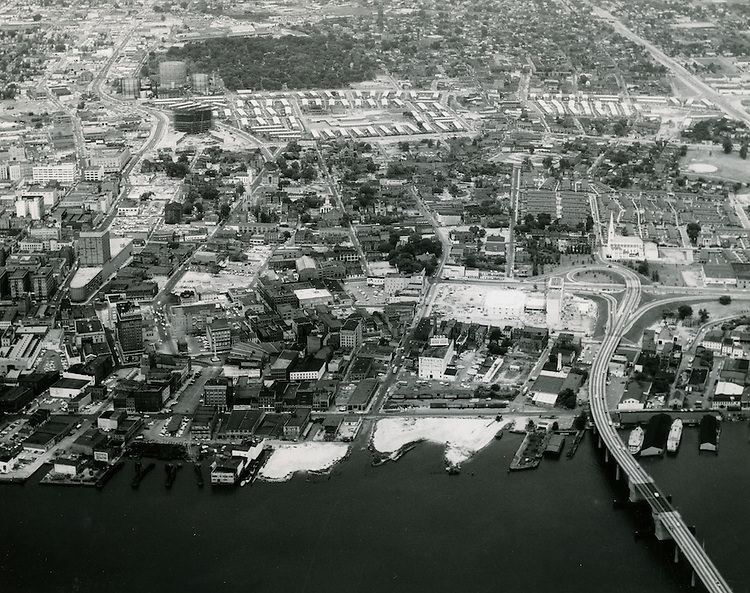
By the early 1960s, downtown Norfolk had already established itself as the commercial and civic heart of the region. Granby Street was the main artery — a busy commercial corridor that stayed active well into the evening hours. Shoppers, workers, and residents moved through a dense grid of streets lined with storefronts, banks, churches, and hotels. The city’s skyline was modest by today’s standards, but it was growing.
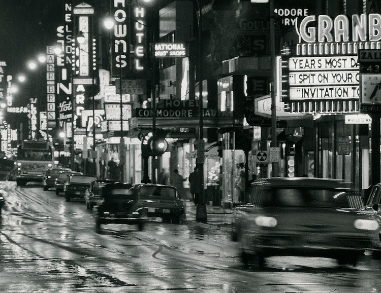
Granby Street looking South at night, 1963

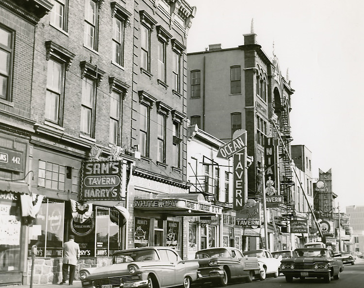
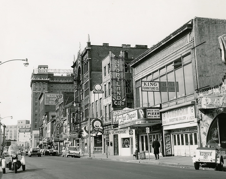
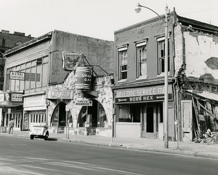
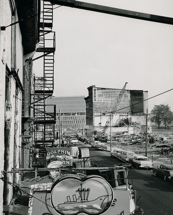
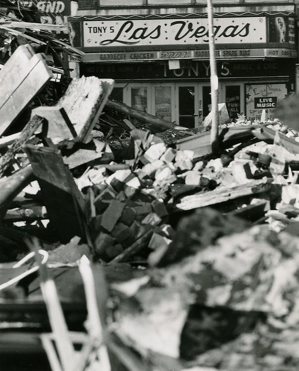
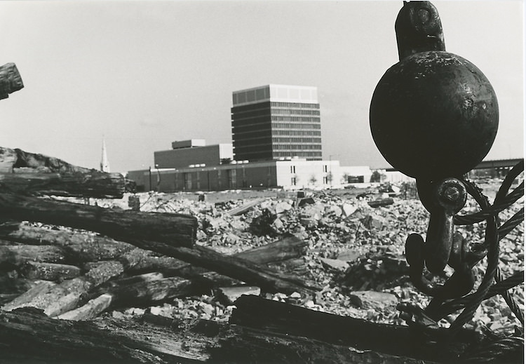
East Main Street was one of the most recognizable corridors in the city, but it was on its way out. In the early part of the decade, the city moved forward with demolition plans that cleared out much of the old commercial strip. Taverns, shops, and older buildings gave way to rubble, and the character of that part of downtown changed overnight. On January 2, 1962, East Main Street officially closed — ending an era for a stretch of the city that many residents had known their entire lives.
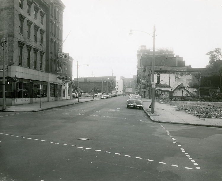
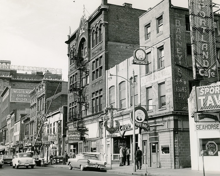
Main Street looking West. July 28, 1961
Main Street looking West. December 07, 1961
Main Street looking East. December 07, 1961
East Main Street looking West. December 07, 1961
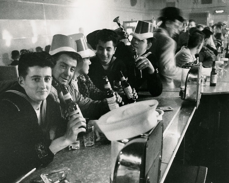
East Main Street.Taverns. December 07, 1961
Main Street looking East. January 02, 1962
The Street - Rubble Creeps In. January 02, 1962
The Street – Rubble Creeps In. January 02, 1962
The Night East Main Street Closed. January 02, 1962
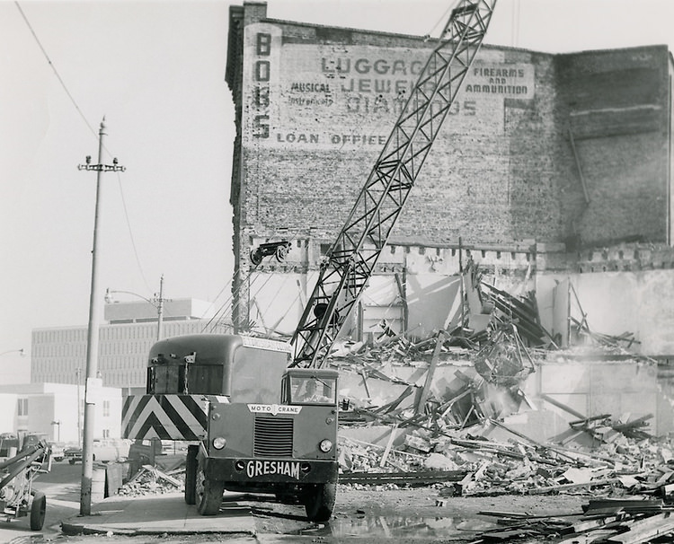
East Main Street Demolition. February 02, 1962

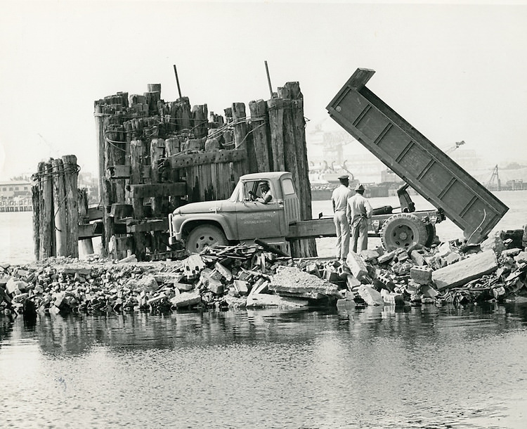
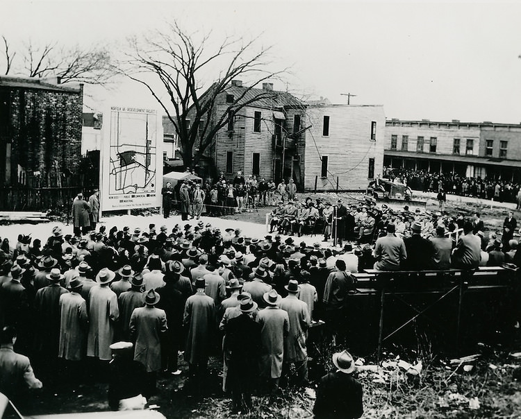
The demolition of East Main Street was part of a wider urban renewal push that reshaped large sections of Norfolk during the 1960s. The Downtown North area, designated as the R-8 redevelopment zone, saw extensive clearance throughout the early part of the decade. Historic structures were torn down, neighborhoods were reorganized, and new civic projects began to take shape on the cleared land. The city’s jail and future Municipal Complex site came into view as older buildings around Commercial Place came down.
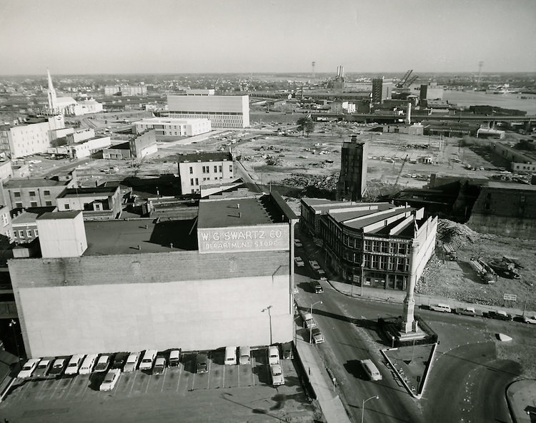
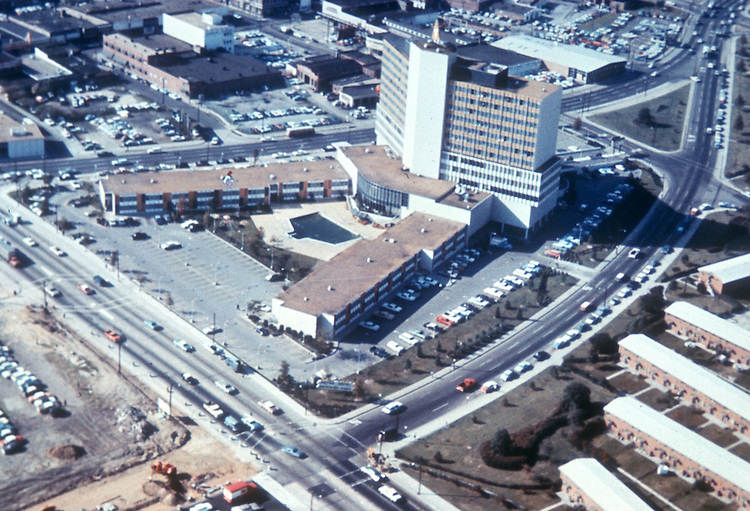
Looking East at Commercial Place & City Jail and future Municipal Complex site. January 16, 1962
Downtown North (R-8) - September 1961
Downtown North (R-8) – September 1961
Downtown North (R-8) - October 05, 1961
Downtown North (R-8) – October 05, 1961
Downtown North (R-8) - October 05, 1961
Downtown North (R-8) – October 05, 1961
Downtown North (R-8) - October 05, 1961
Downtown North (R-8) – October 05, 1961
Downtown North (R-8) - October 05, 1961
Downtown North (R-8) – October 05, 1961
Downtown North (R-8) - March 02, 1962
Downtown North (R-8) – March 02, 1962
Downtown North (R-8) - March 08, 1962
Downtown North (R-8) – March 08, 1962
Downtown North (R-8) - April 09, 1962
Downtown North (R-8) – April 09, 1962
Downtown North (R-8) - January 28, 1963
Downtown North (R-8) – January 28, 1963
Downtown North (R-8) - October 13, 1963
Downtown North (R-8) – October 13, 1963

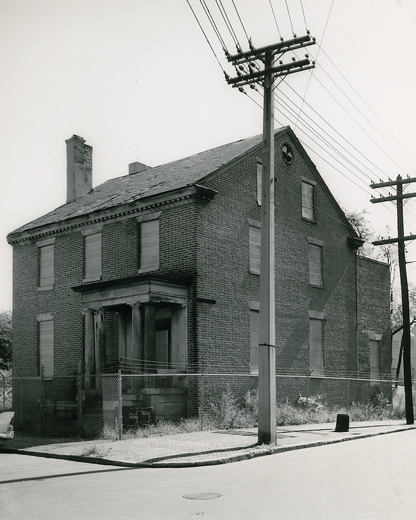
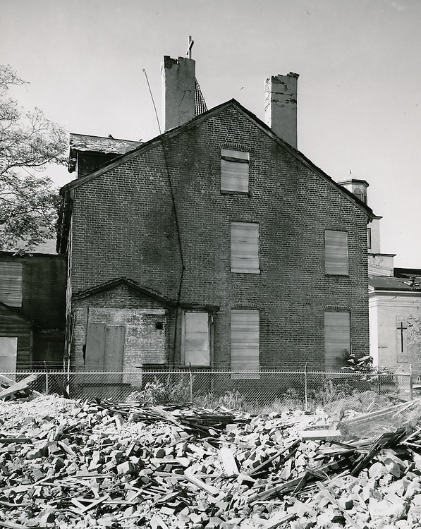
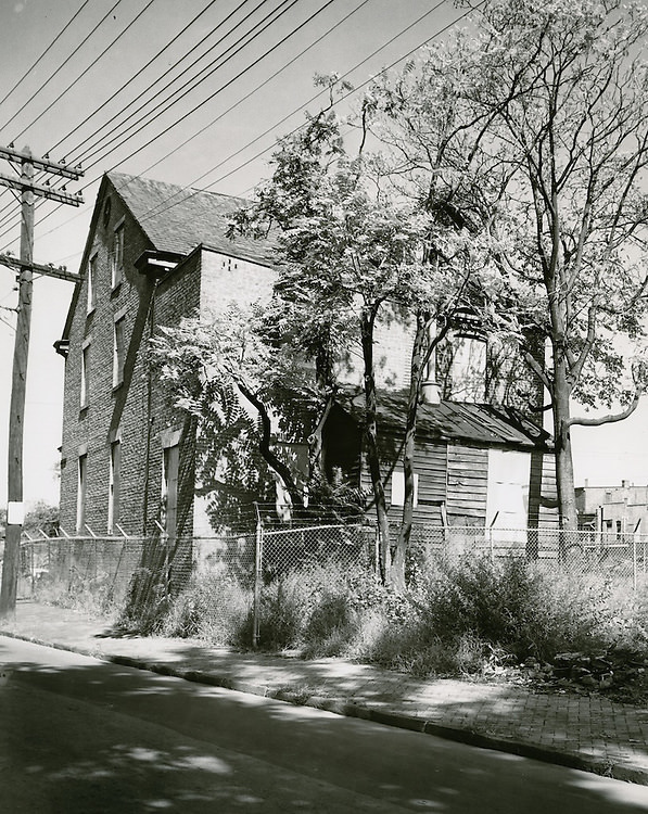
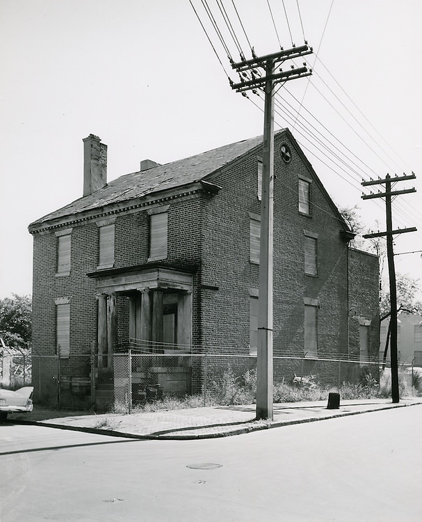
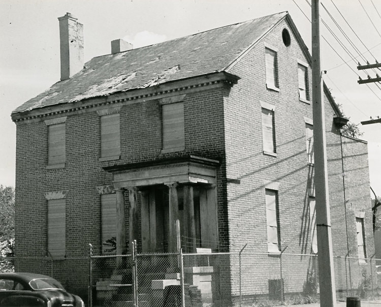
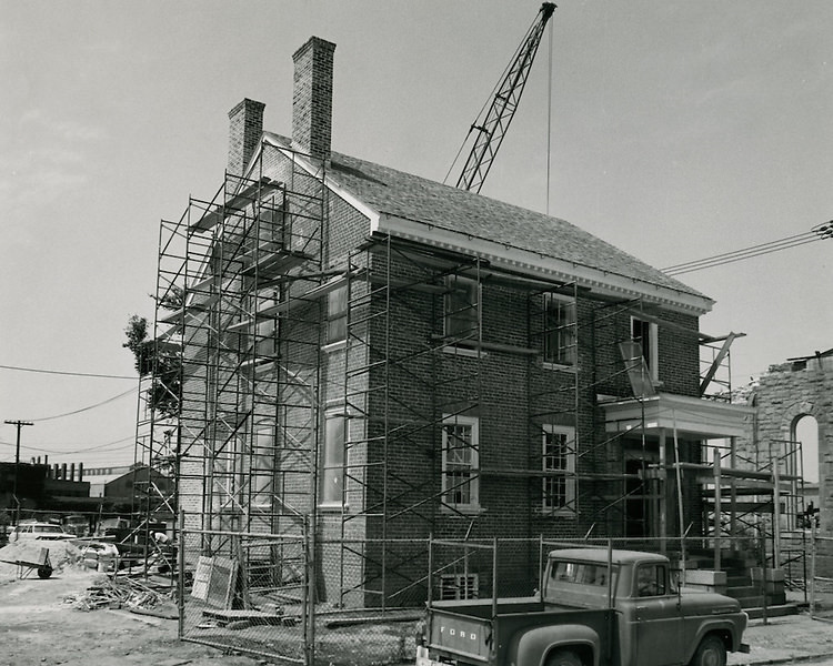
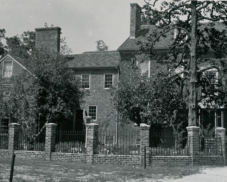
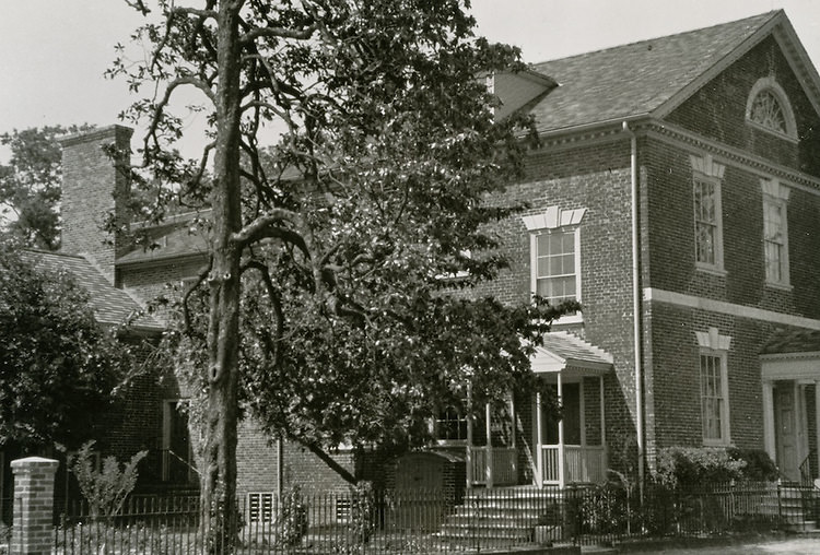
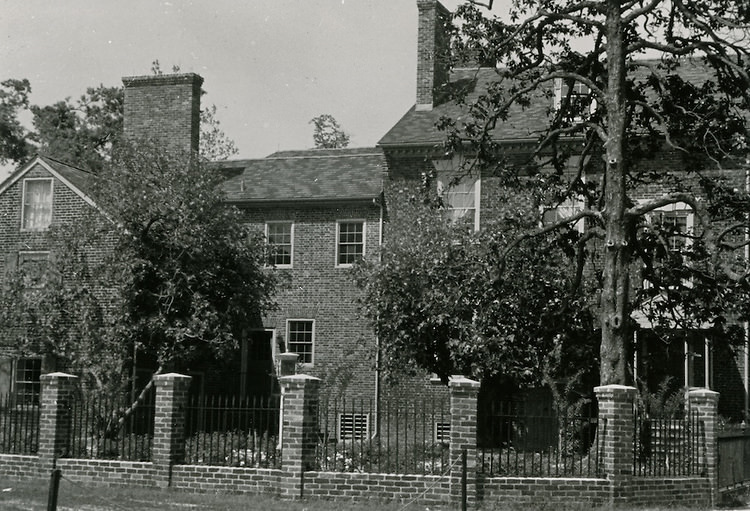
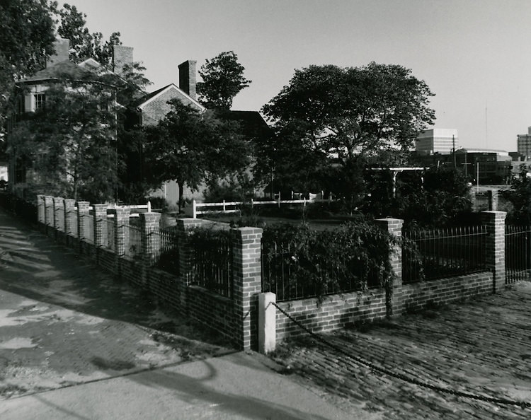
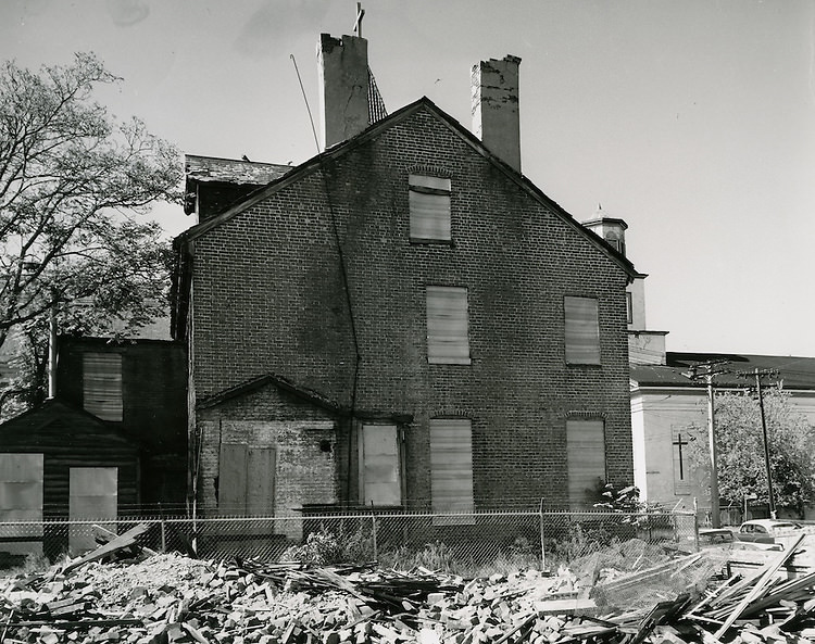
Not everything being cleared was neglected. The Hannon House on Cumberland Street, a structure dating back to around 1794, stood at the corner of Cumberland and Freemason Streets — boarded up and fenced in by October 1961 to prevent vandalism as the area around it was transformed. The house represented a thread of Norfolk’s pre-Civil War past that was at risk of being severed entirely by the pace of redevelopment.
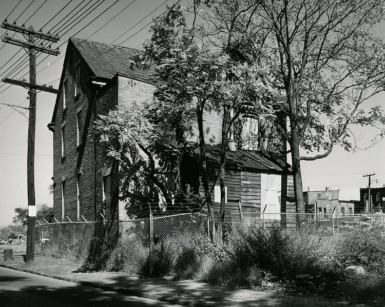
Hannon House - Cumberland St - October 05, 1961
Hannon House – Cumberland St – October 05, 1961
Hannon House - Cumberland St - Side View of House at SE Corner of Cumberland and Freemason Streets Boarded Up and Fenced in to Avoid Vandalism - October 05, 1961
Hannon House – Cumberland St – Side View of House at SE Corner of Cumberland and Freemason Streets Boarded Up and Fenced in to Avoid Vandalism – October 05, 1961
Hannon House (c. 1794) - Cumberland St - October 05, 1961
Hannon House (c. 1794) – Cumberland St – October 05, 1961
Hannon House, Cumberland St - July 30, 1963
Hannon House, Cumberland St – July 30, 1963
Hannon House, Cumberland St - May 27, 1965
Hannon House, Cumberland St – May 27, 1965

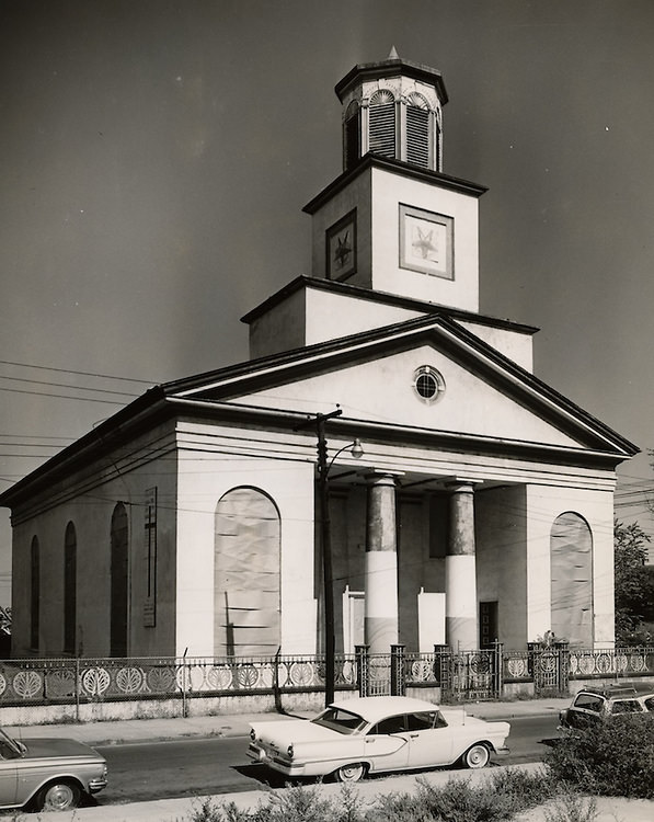
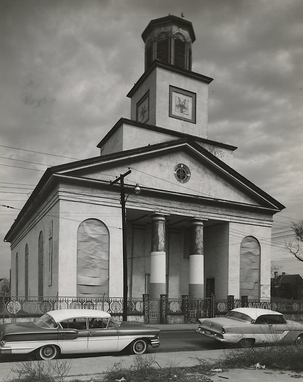
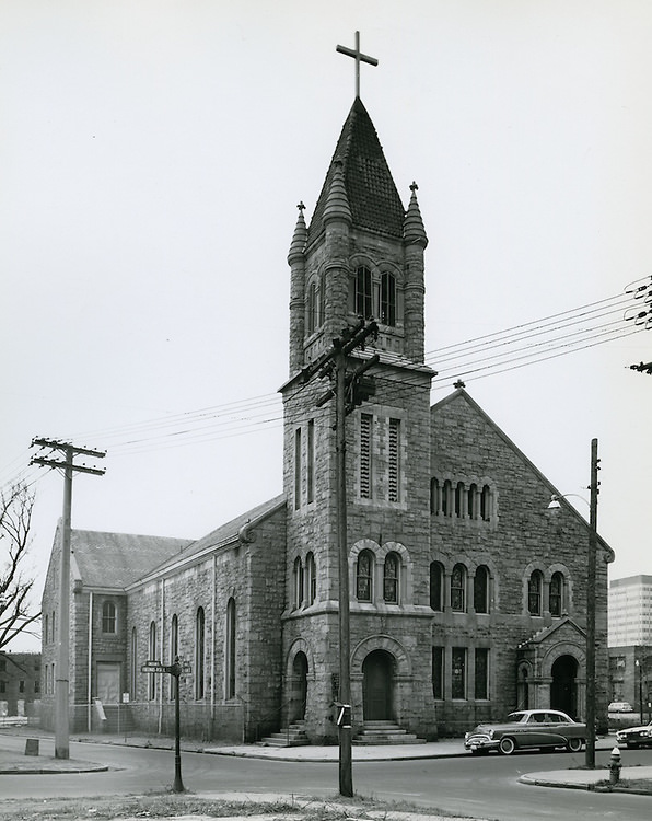
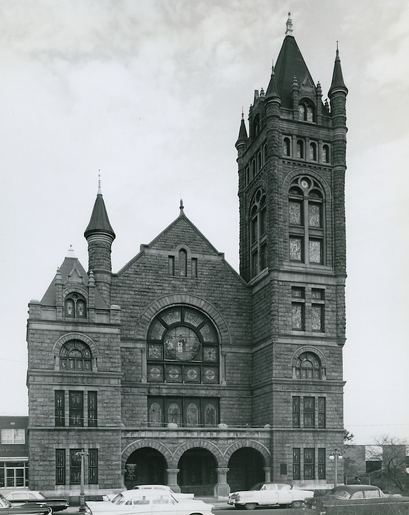
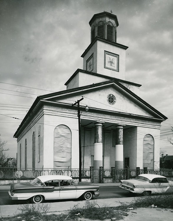
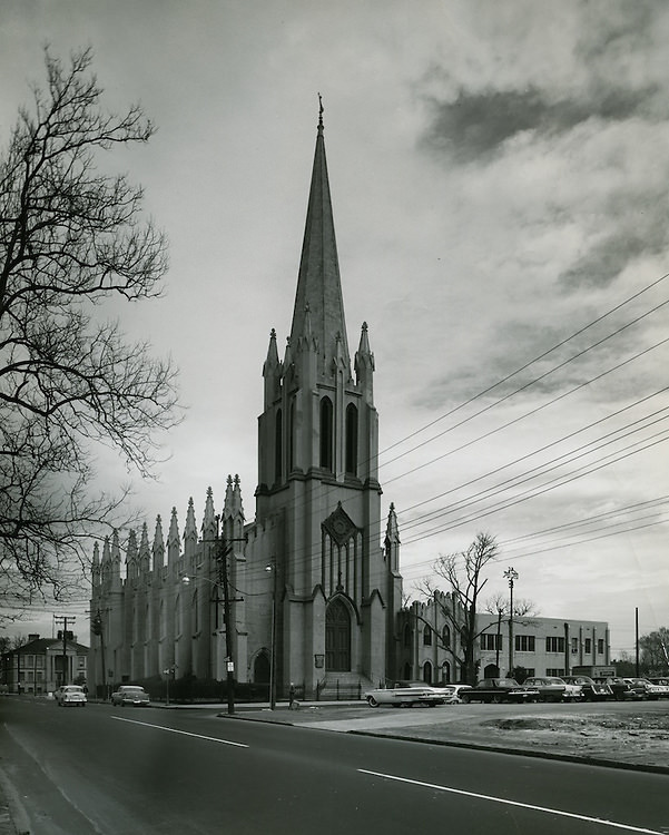
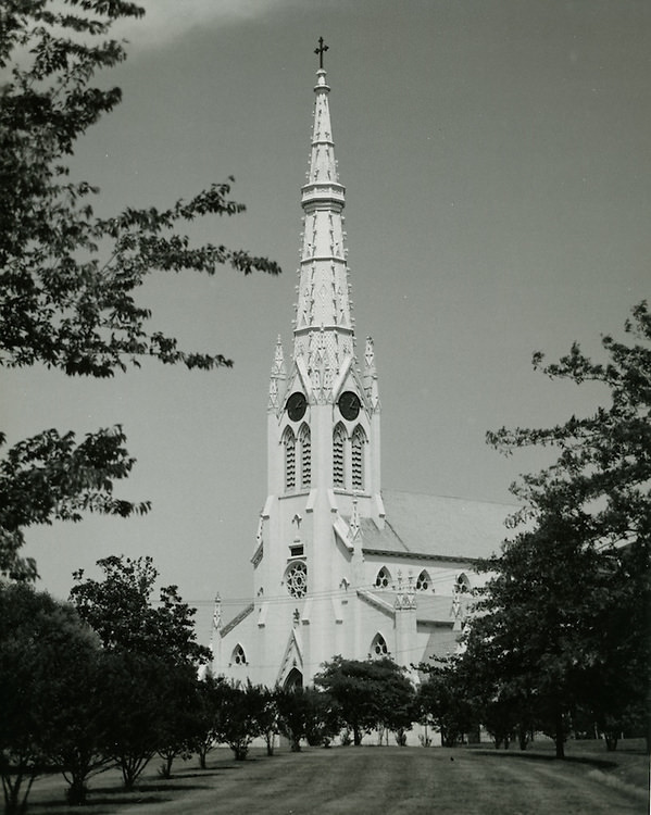
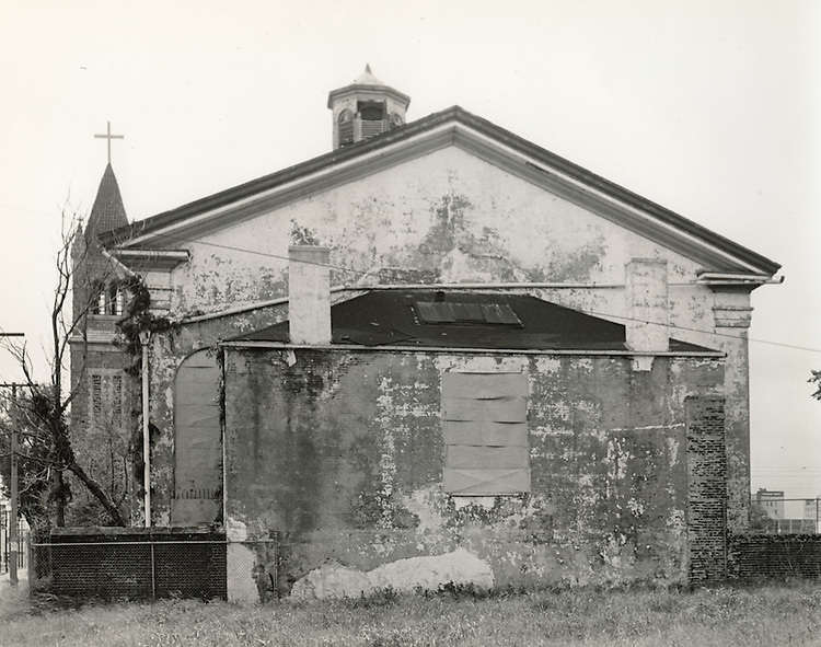
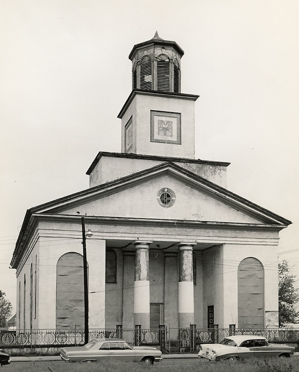
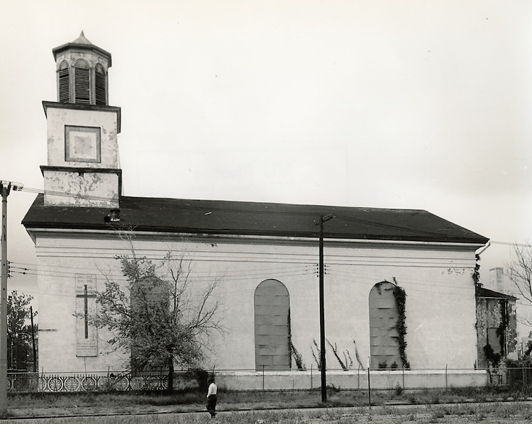
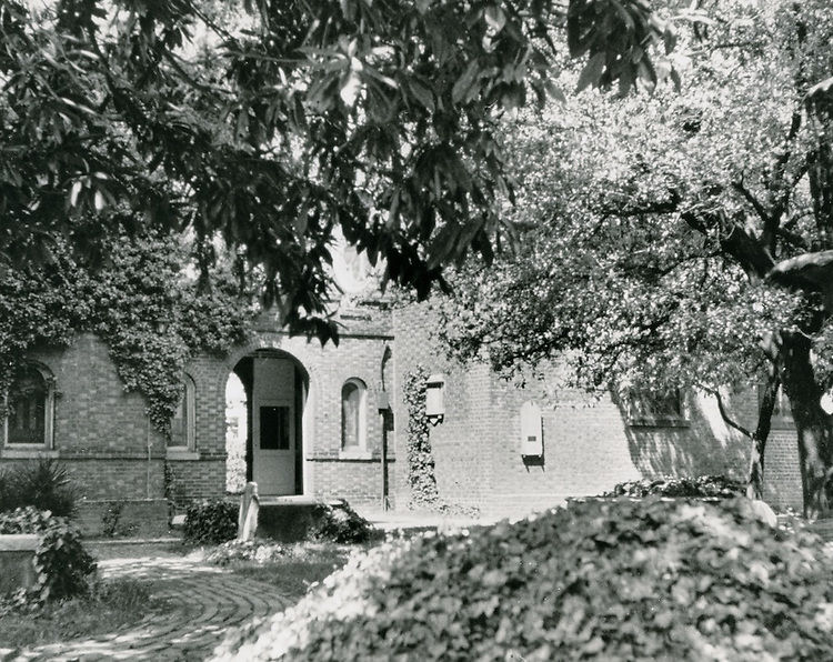
Norfolk’s religious landmarks were also photographed extensively during this period. St. Mary’s Catholic Church, the Freemason Street Baptist Church, and Old Christ Church were all documented in the early 1960s as the city took stock of its architectural heritage. The vessel “St. Joseph” appeared in images from March 1962, a reminder that water — both as a working resource and as a threat — was central to Norfolk’s identity.
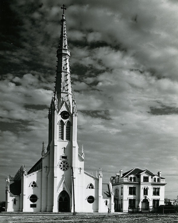
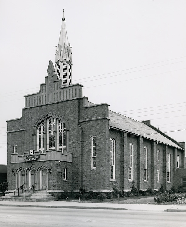
St Mary's Catholic Church - March 02, 1962
St Mary’s Catholic Church – March 02, 1962
Caption - March 02, 1961
Caption – March 02, 1961
"St. Joseph" - March 02, 1962
“St. Joseph” – March 02, 1962
Caption - March 02, 1962
Caption – March 02, 1962
Old Christ Church - March 03, 1962
Old Christ Church – March 03, 1962
Freemason Street Baptist Church - March 03, 1962
Freemason Street Baptist Church – March 03, 1962
St Mary's Catholic Church - June 11, 1964
St Mary’s Catholic Church – June 11, 1964

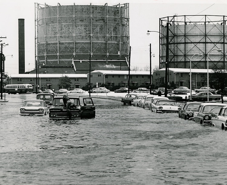
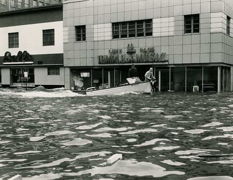
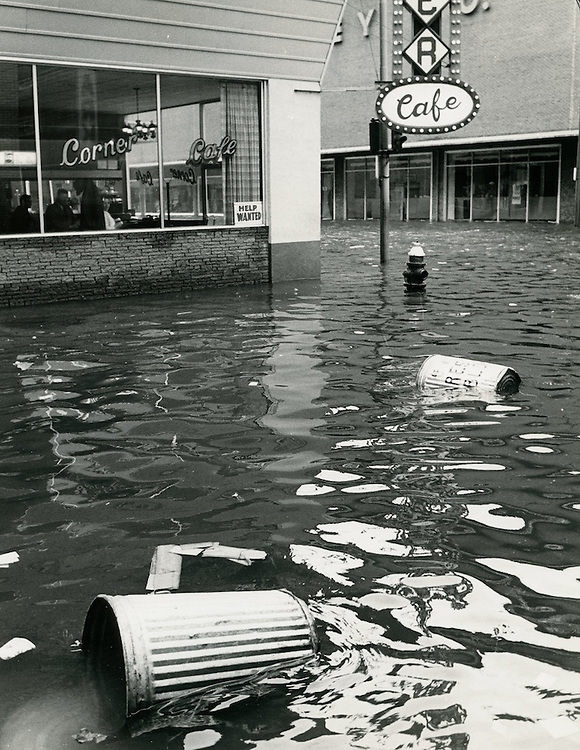
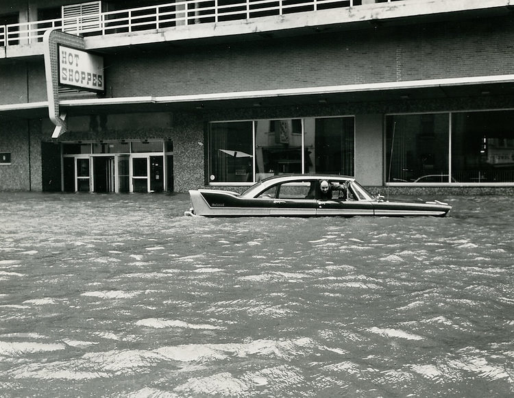
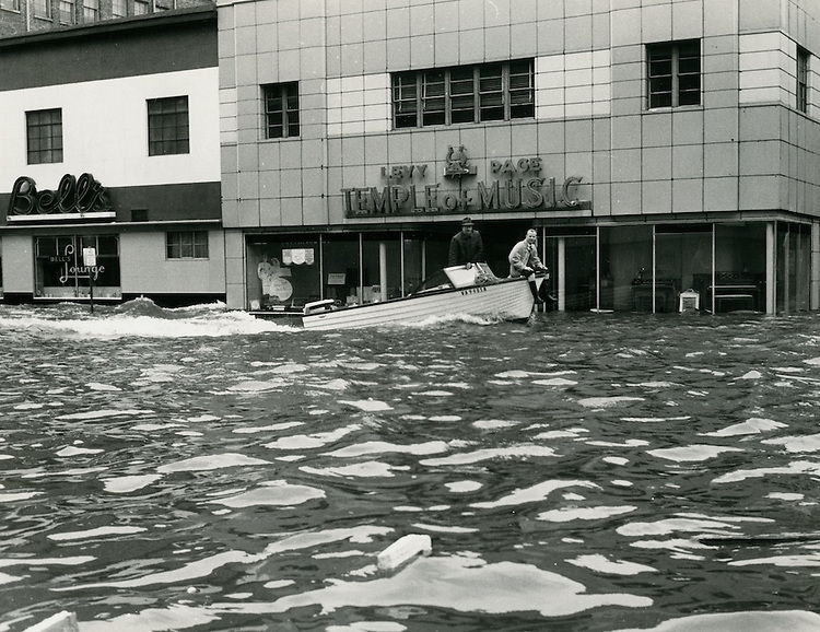
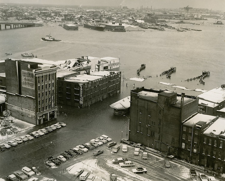
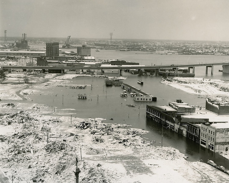
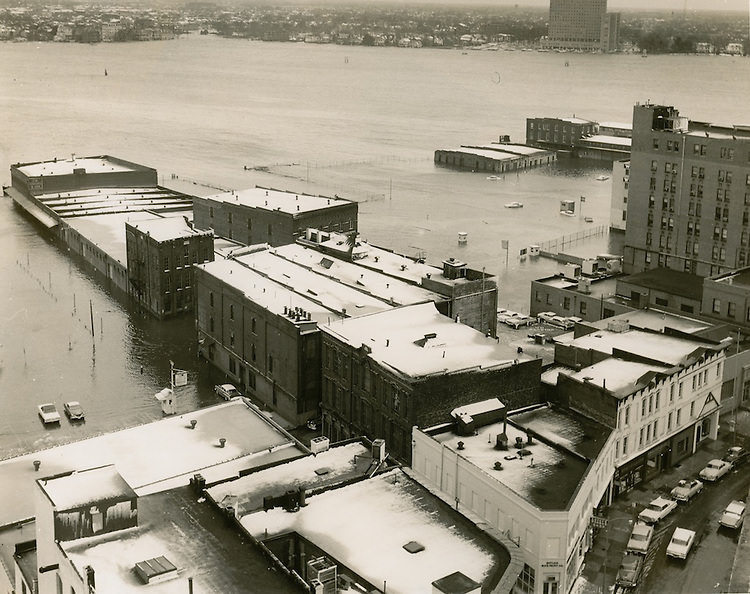
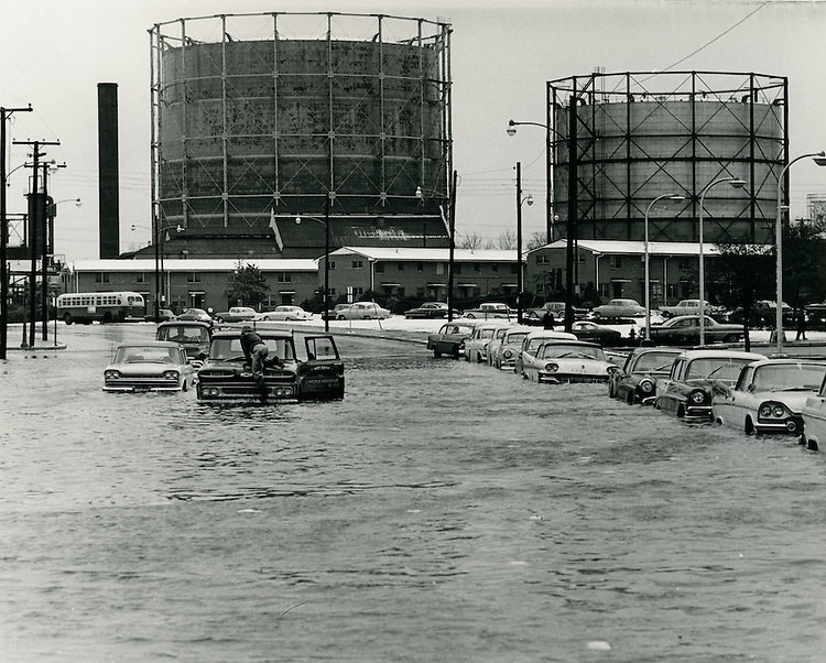
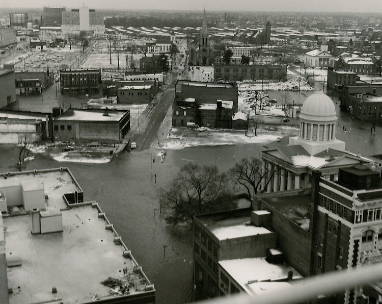
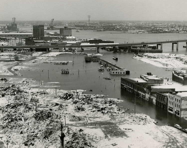
In March 1962, a powerful nor’easter struck the Eastern Seaboard — one of the most destructive storms of the twentieth century. Norfolk was hit hard. Streets flooded, the Ferry Terminal was inundated, and neighborhoods across the city were submerged. Photos taken on March 7 and 8, 1962 show just how severe the damage was. The Levy Page Temple of Music took on water. City Hall Avenue and Bank Street flooded. Looking east on Union Street and Water Street, the scene resembled a river more than a city road.
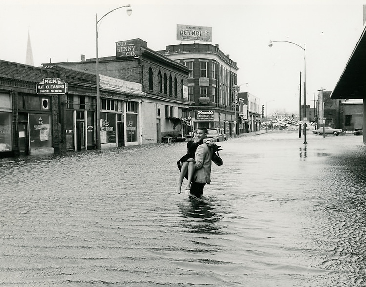
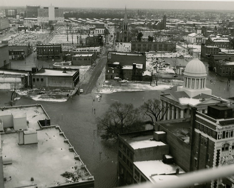
1962 Norfolk Flooding - March 08, 1962
1962 Norfolk Flooding – March 08, 1962
1962 Norfolk Flooding - March 07, 1962
1962 Norfolk Flooding – March 07, 1962
Levy Page Temple of Music - Flooding - March 08, 1962
Levy Page Temple of Music – Flooding – March 08, 1962
1962 Norfolk Flooding - March 08, 1962
1962 Norfolk Flooding – March 08, 1962
1962 Norfolk Flooding - March 08, 1962
1962 Norfolk Flooding – March 08, 1962
1962 Norfolk Flooding - March 08, 1962
1962 Norfolk Flooding – March 08, 1962
Ferry Terminal - March 07, 1962
Ferry Terminal – March 07, 1962
1962 Norfolk Flooding - March 07, 1962
1962 Norfolk Flooding – March 07, 1962
1962 Norfolk Flooding - March 07, 1962
1962 Norfolk Flooding – March 07, 1962
1962 Norfolk Flooding - March 08, 1962
1962 Norfolk Flooding – March 08, 1962
City Hall Avenue and Bank Street.Flooding. March 07, 1962
Looking East on Union Street and Water Street.Flooding. March 07, 1962

Even as the city rebuilt from the storm, construction continued on major infrastructure projects. Brambleton Avenue was widened during this period — a project photographed in both February 1962, while work was underway, and again in February 1964, after the new road was finished. The changes to Brambleton Avenue reflected Norfolk’s broader effort to modernize its road network and accommodate a growing number of cars.
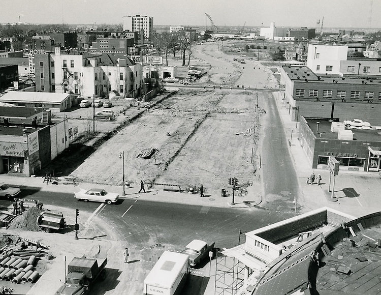
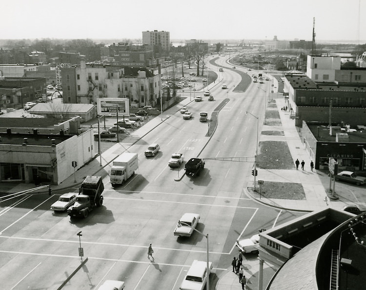
Brambleton Avenue widening under construction, looking west from Boush Street and Brambleton Avenue - February 02, 1962
Brambleton Avenue widening under construction, looking west from Boush Street and Brambleton Avenue – February 02, 1962
Brambleton Avenue after widening, looking west from Boush Street and Brambleton Avenue - February 28, 1964
Brambleton Avenue after widening, looking west from Boush Street and Brambleton Avenue – February 28, 1964

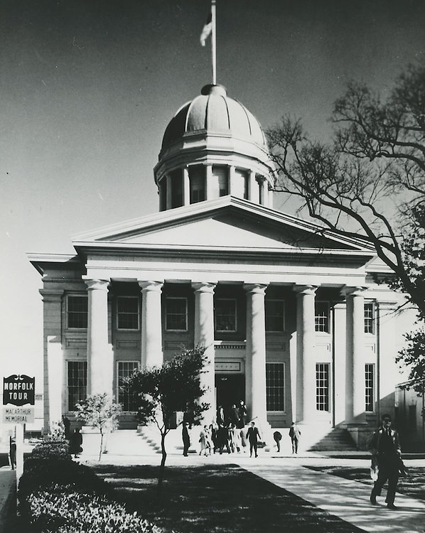
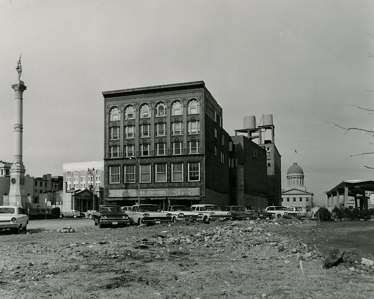
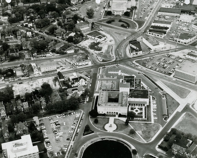
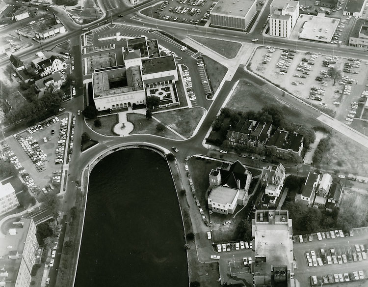
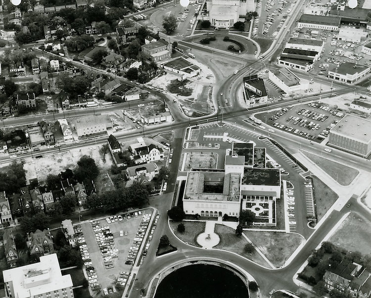
The MacArthur Memorial, built in the old city hall rotunda, became one of the defining civic landmarks of 1960s Norfolk. It opened in 1964 and quickly became a point of community pride. Photos from January and July 1963, as well as January and March 1964, document the area around Commercial Place as the memorial took shape and began drawing visitors. Nearby, the Moses Myers House — one of the oldest surviving homes in Norfolk — stood as another reminder of the city’s deep historical roots.
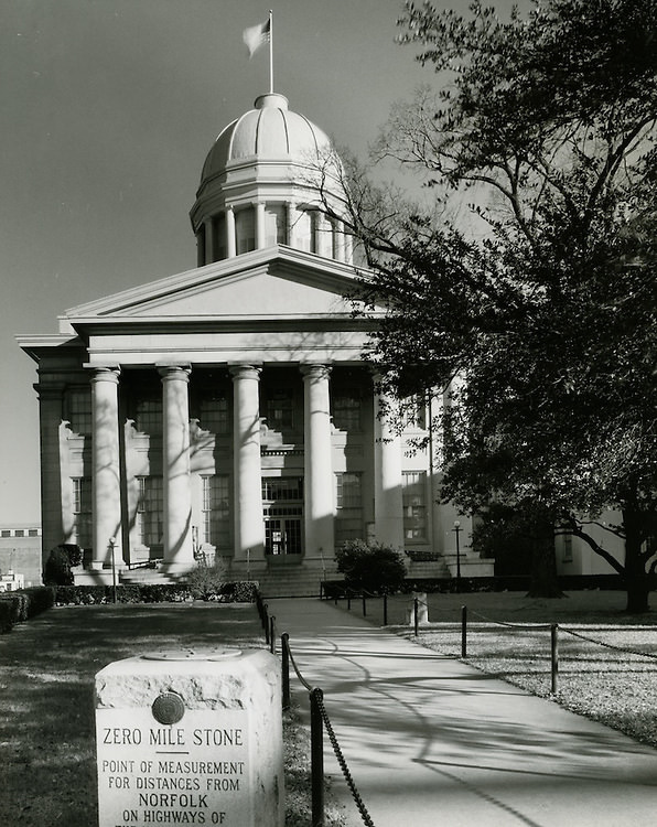
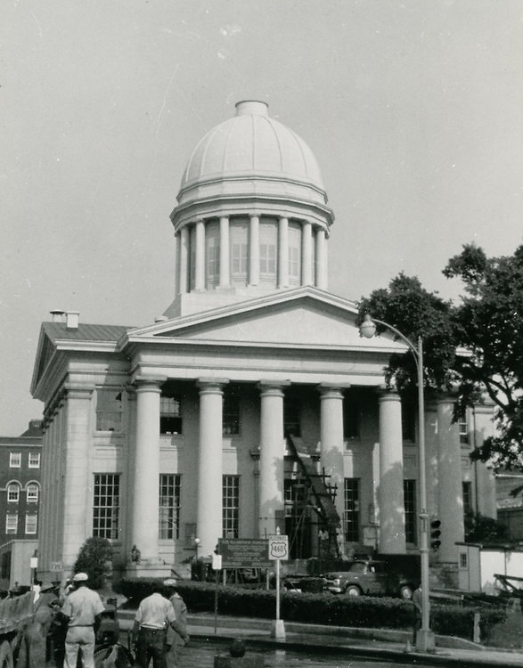
MacArthur Memorial - March 02, 1963
MacArthur Memorial – March 02, 1963
MacArthur Memorial - July 30, 1963
MacArthur Memorial – July 30, 1963
MacArthur Memorial - January 26, 1964
MacArthur Memorial – January 26, 1964
Commercial Place, MacArthur Memorial - January 27, 1964
Commercial Place, MacArthur Memorial – January 27, 1964
Moses Myers House - July 30, 1963
Moses Myers House – July 30, 1963

The downtown financial district anchored the city’s economic activity. Bank Street Baptist Church at 501 Bank Street was photographed in September 1964, both as a standalone structure and in context with the surrounding neighborhood. The Golden Triangle Motor Hotel, completed by the mid-1960s, brought a modern commercial presence to the area near Young Park. Monticello Avenue, photographed looking north from City Hall Avenue in May 1965, showed the Maritime Office Building on the right and a streetscape that was clearly in the middle of transformation.
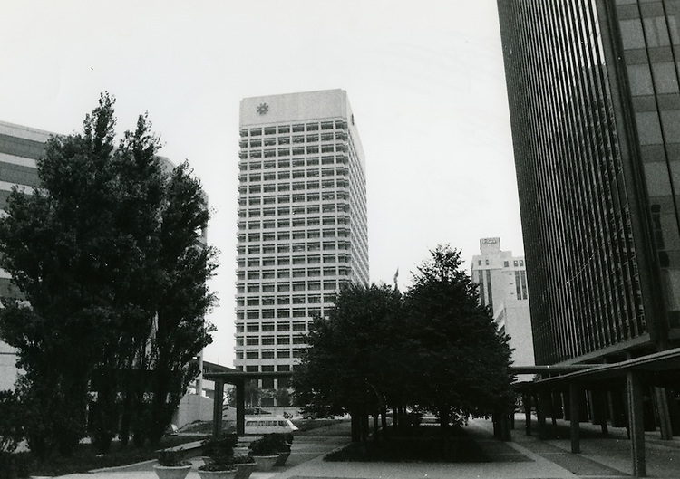
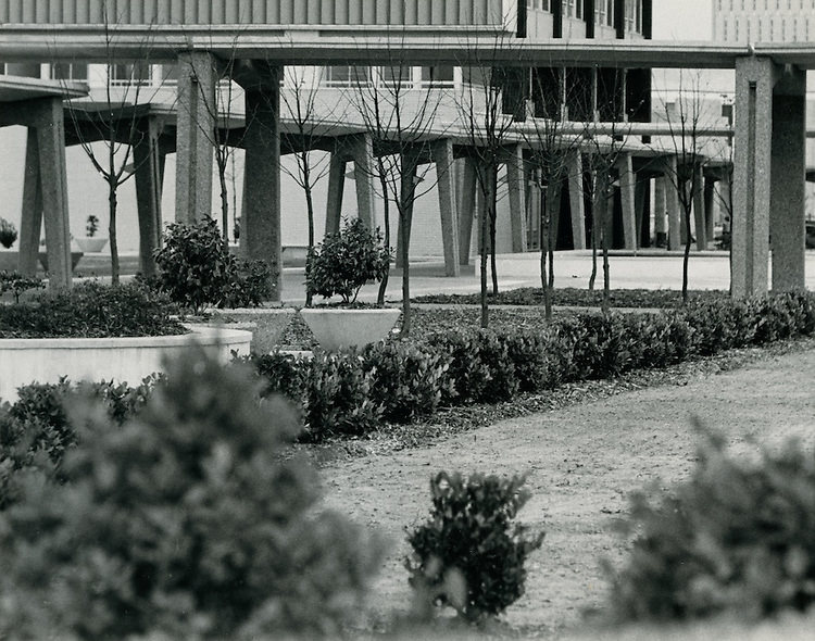
Downtown financial district - 1960s
Downtown financial district – 1960s
Historical.Downtown North.Downtown Financial District. November 12, 1963
Redevelopment.Downtown North.Golden Triangle Hotel.Young Park on right. April 04, 1964
Bank Street Baptist Church. 501 Bank Street. September 01, 1964
Conservation.Downtown North.Bank Street Baptist Church.501 Bank Street. September 01, 1964
View looking North up Monticello Avenue from City Hall Avenue.Maritime Office Building on right. May 26, 1965
Golden Triangle Motor Hotel.Looking South. December 27, 1965

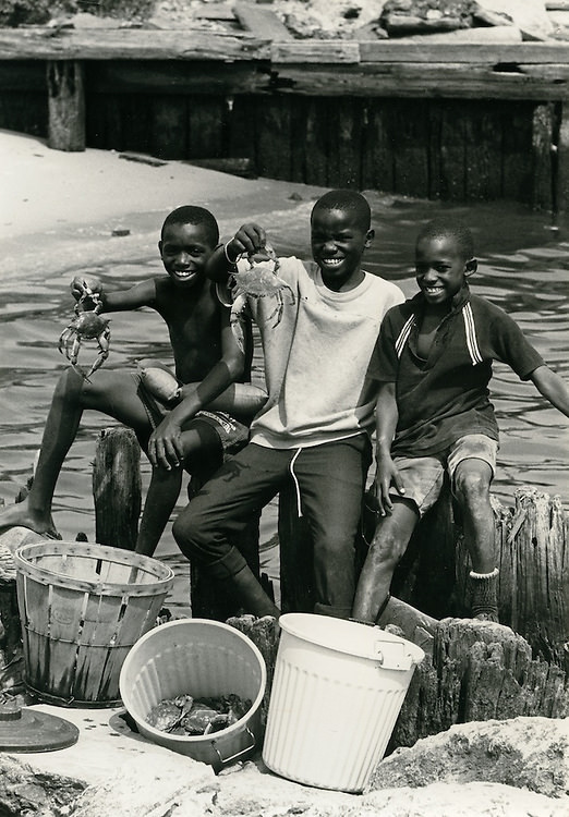
Norfolk’s industrial base was on full display at the Ford Assembly Plant, which operated in the city as of 1964. The plant was one of several manufacturing operations that kept blue-collar workers employed throughout the decade. The city’s port and shipping industries ran parallel to these land-based operations, and the waterfront remained one of the busiest stretches of coastline on the East Coast. Crabbers working the local waters in 1966 represented yet another dimension of Norfolk’s economy — one tied directly to the Chesapeake Bay.
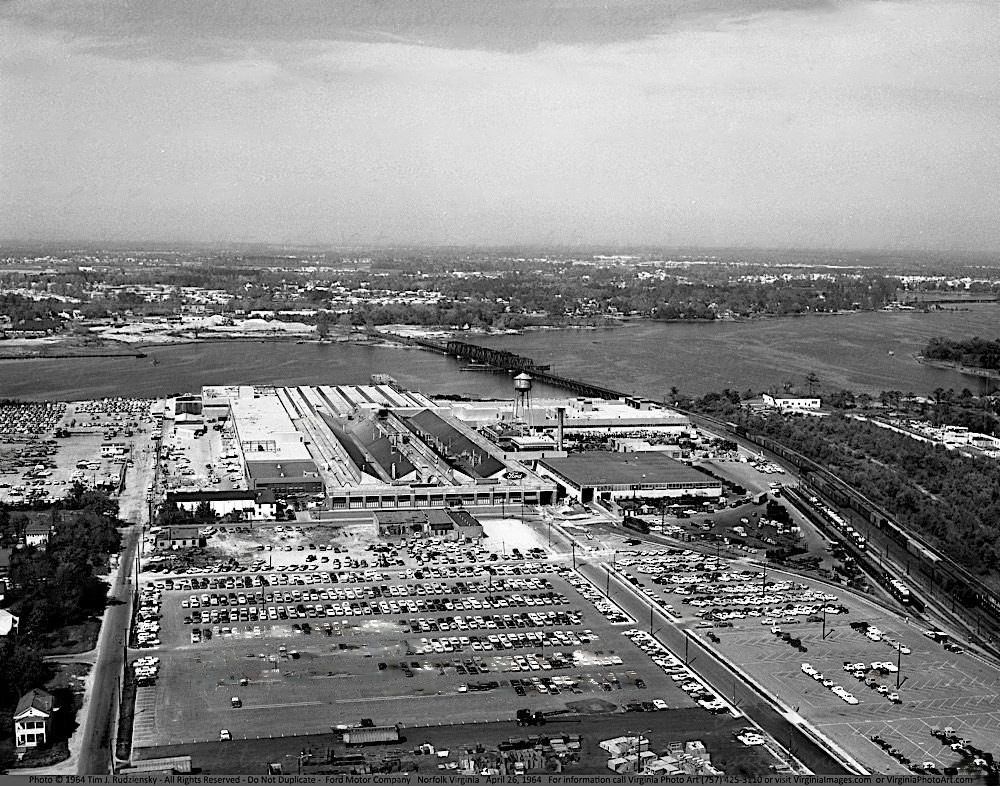
Ford Assembly Plant Norfolk, 1964
Crabbers - 1966
Crabbers – 1966

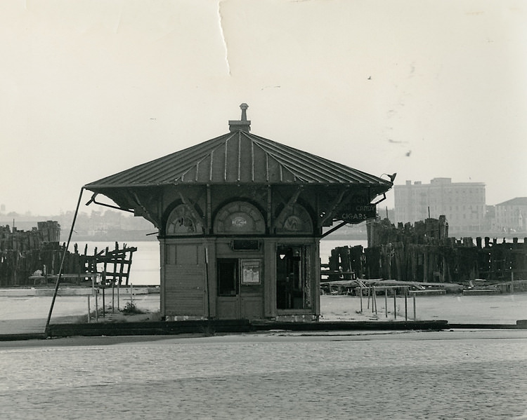
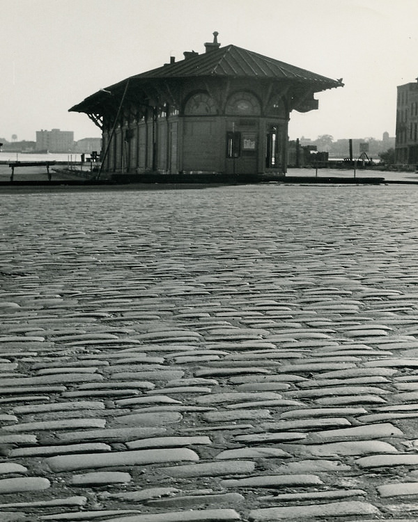
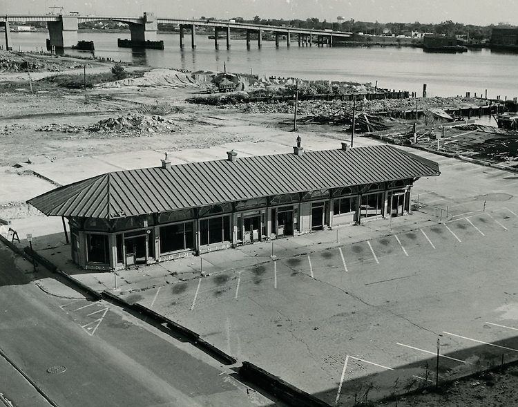
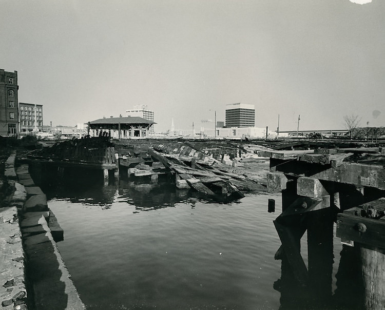
The Ferry Terminal at the foot of downtown connected Norfolk to Portsmouth across the Elizabeth River. Photos from March 1962, May 1964, and November 1964 document the terminal at different moments — during the flood, in ordinary operation, and as the city debated the future of ferry service. The Hotel York stood nearby, visible in one image alongside the terminal, a fixture of the city’s commercial waterfront.
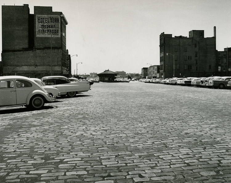
Ferry Terminal, Hotel York - May 05, 1964
Ferry Terminal, Hotel York – May 05, 1964
Ferry Terminal - November 15, 1964
Ferry Terminal – November 15, 1964
Ferry Terminal - November 15, 1964
Ferry Terminal – November 15, 1964
Ferry Terminal - November 15, 1964
Ferry Terminal – November 15, 1964
Ferry Terminal - November 15, 1964
Ferry Terminal – November 15, 1964

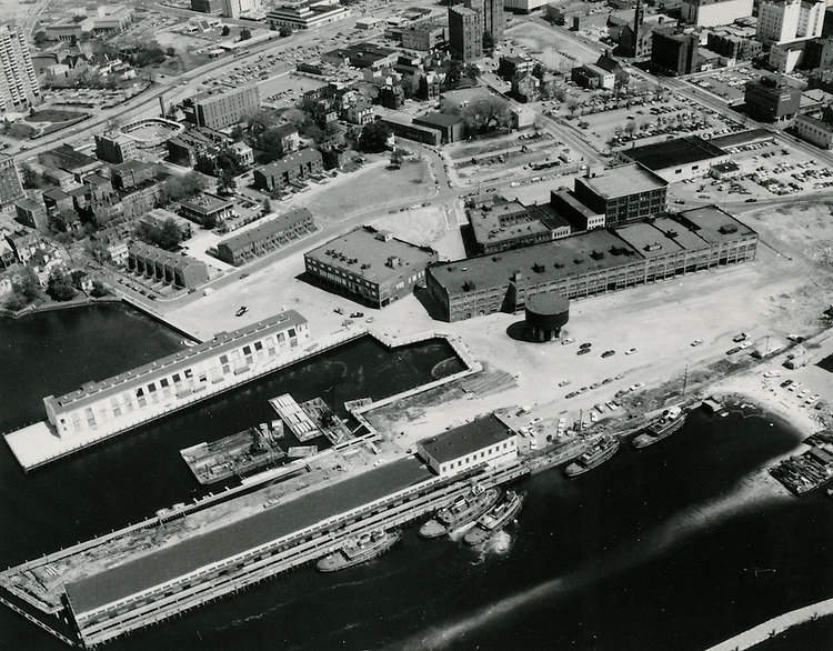
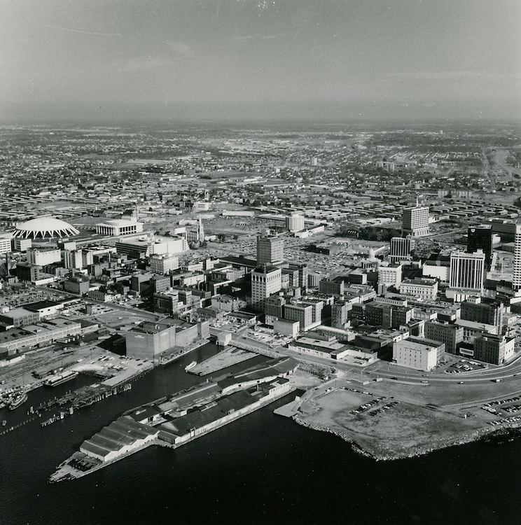
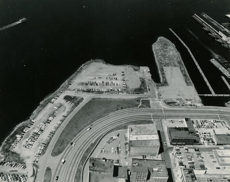
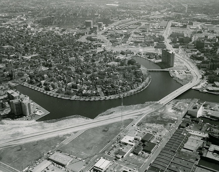
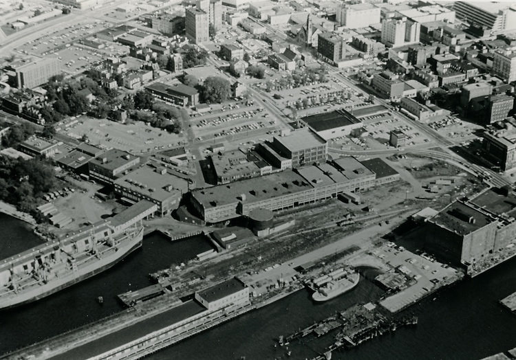
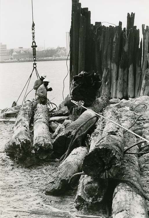
Looking across the Elizabeth River toward downtown Norfolk, the city’s skyline was compact but defined. The view looking north from the river in 1960 showed a tight cluster of mid-rise buildings just back from the waterfront, with church steeples rising above the rooftops. Freemason Harbor sat along the western edge of downtown, flanked by warehouses and cold storage facilities like the Boush Cold Storage Building. These waterfront structures formed a working edge to a city that depended on maritime commerce.
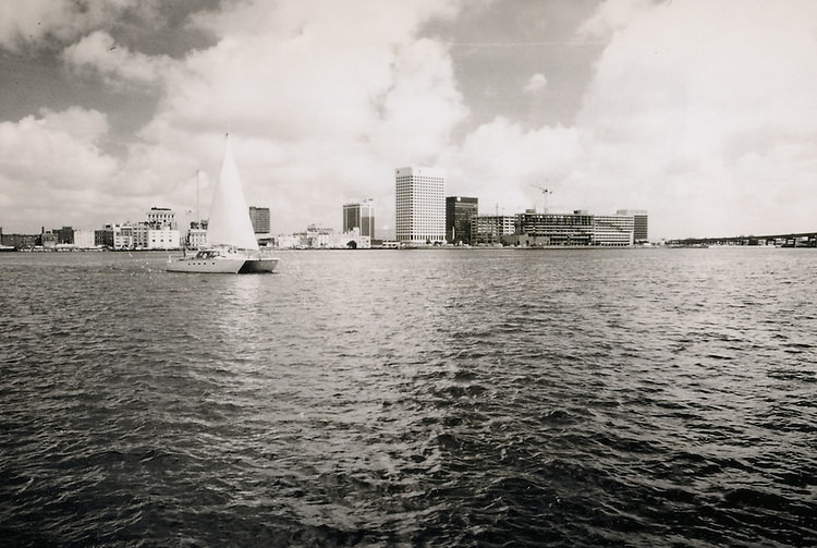
Looking North from River - 1960
Looking North from River – 1960
Norfolk skyline from Elizabeth River - 1960s
Norfolk skyline from Elizabeth River – 1960s
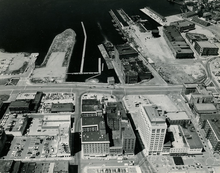
Downtown West.Freemason Harbor, 1960s
Freemason Harbor.Downtown Norfolk, 1960s
View looking Northeast.Freemason Harbor. Downtown Norfolk, 1960s
View of Freemason Harbor & Downtown. 1960s
Looking West at future Nauticus site & Freemason Harbor. 1960s
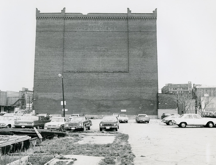
Boush Cold Storage Building. 1960s

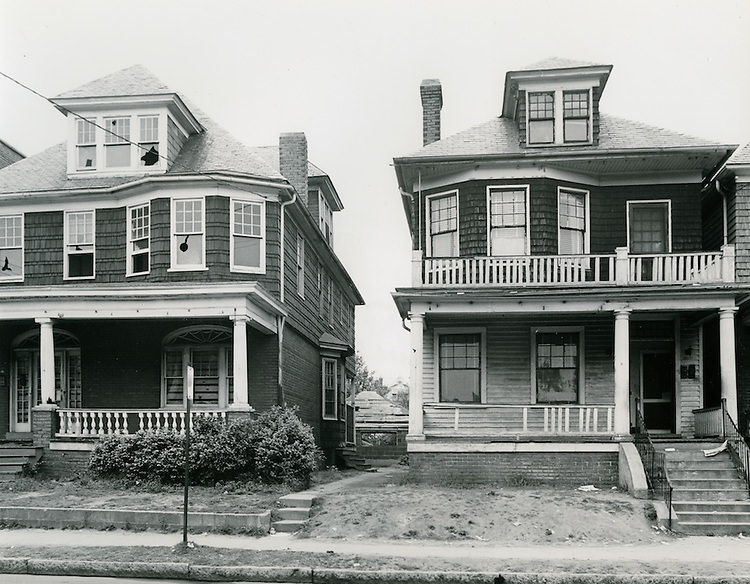
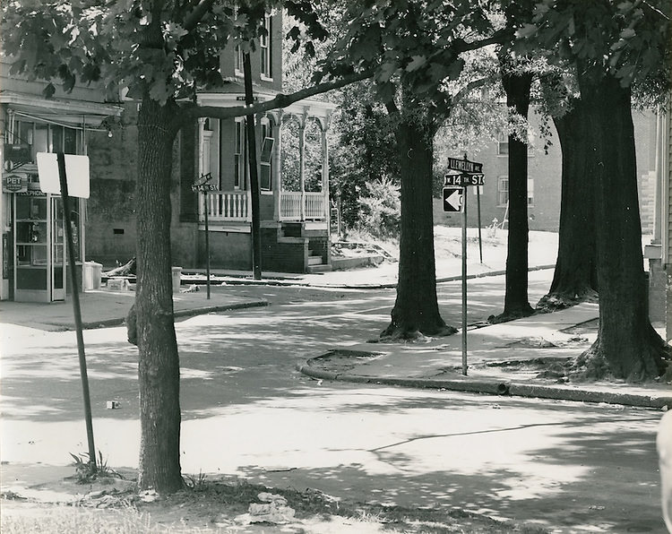
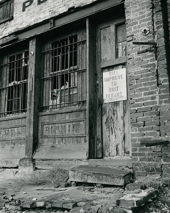
The Ghent neighborhood and its surrounding areas showed a different side of Norfolk. The Hague, Mowbray Arch, and the nearby residential streets were photographed extensively, and conditions varied sharply from block to block. East Ghent South was documented in March 1963 under the label “slum conditions,” a term that redevelopment agencies used to justify clearance. East Ghent North, designated as the R-55 zone, was also under study. Princess Anne Road, 13th Street, and the intersection of 14th and Llewellyn were all captured as the city evaluated which blocks would be redeveloped.
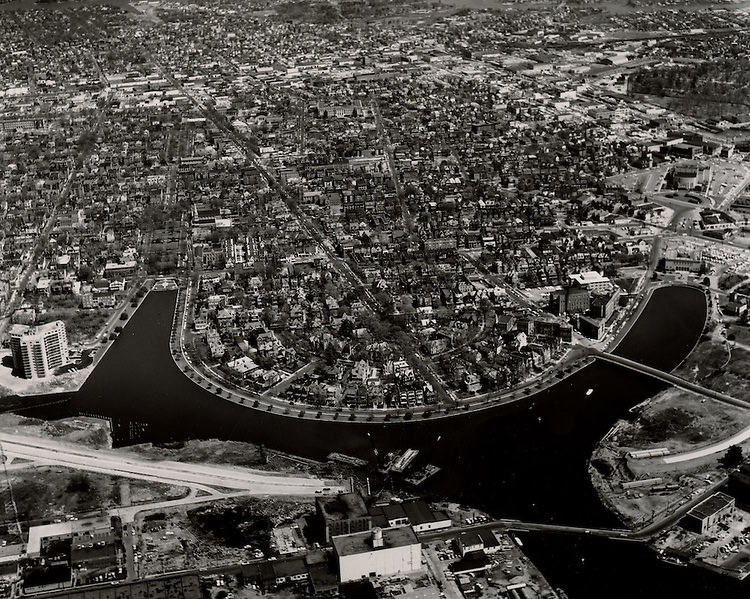
View looking Northeast at Ghent, The Hague, Mowbray Arch. April 09, 1962
E Ghent South.Slum Conditions. March 23, 1963
View looking East.Ghent.Young Terrace in distance. February 19, 1965
Ghent.7070 Raleigh Avenue. June 23, 1964
East Ghent North R-55.N side of Princess Anne Road between Movan, 1960s
E Ghent North R-55.Homes on south side of 13th Street between Omohundro and Llewellyn, 1968
East Ghent North R-55. Looking South at intersection of 14th & Llewellyn, 1960s

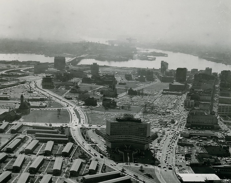
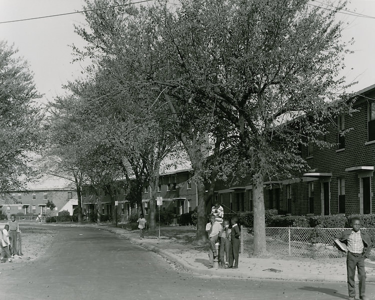
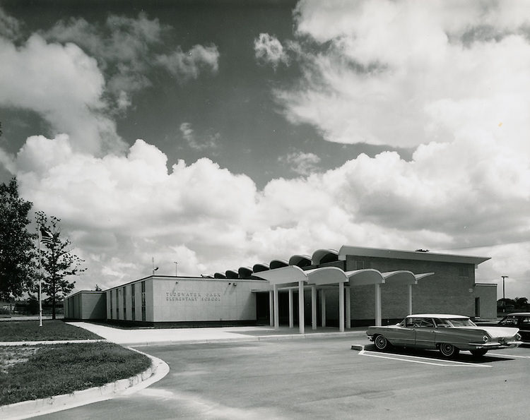
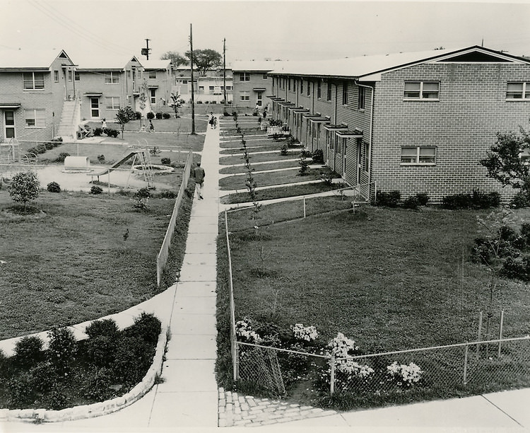
Public housing was a major part of the city’s landscape throughout the 1960s. Tidewater Gardens, Young Park, Calvert Square, and Roberts Village were all operating during this period, housing thousands of Norfolk residents. Young Park’s 752 low-rent units were eventually cleared to make way for a new Second Precinct Police Station. Roberts Village and Tidewater Gardens appear in aerial photographs from 1963, showing the scale of the housing projects relative to the surrounding neighborhoods. Tidewater Park Elementary School, photographed in 1964, served the children who lived in these developments.
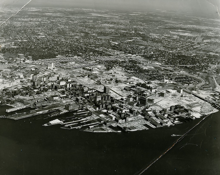
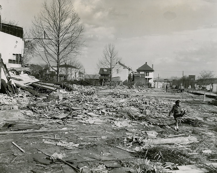
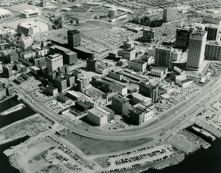
View looking north at downtown Norfolk, Young Park, Tidewater Gardens, Calvert Square in background - July 12, 1963
View looking north at downtown Norfolk, Young Park, Tidewater Gardens, Calvert Square in background – July 12, 1963
Young Park Demolition.Scene showing area being cleared for new Second Precinct Police Station, 1960s
Site of Young Park - 752 low-rent unit, 1960s
Site of Young Park – 752 low-rent unit, 1960s
Roberts Village, 1963
Tidewater Gardens, 1961
Tidewater Park Elementary School, 1964
Assisted Housing - Caption - 1961 ?
Assisted Housing – Caption – 1961 ?

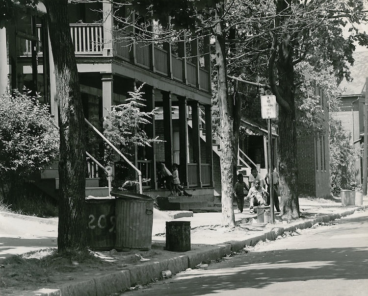
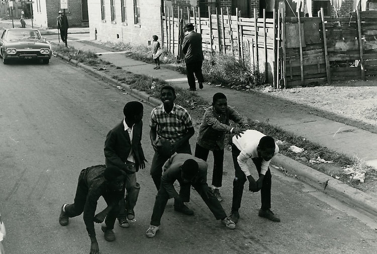
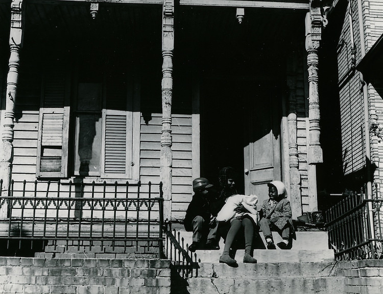
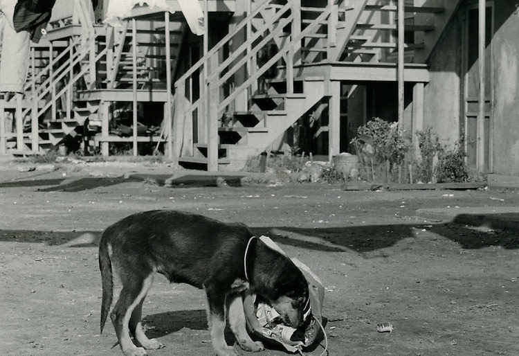
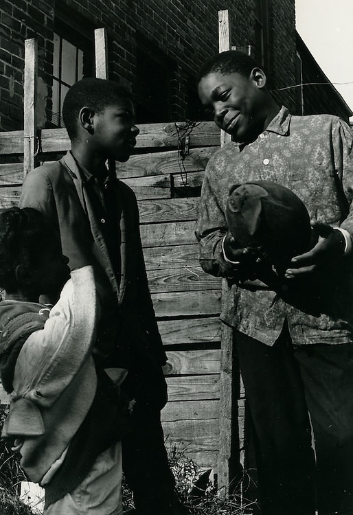
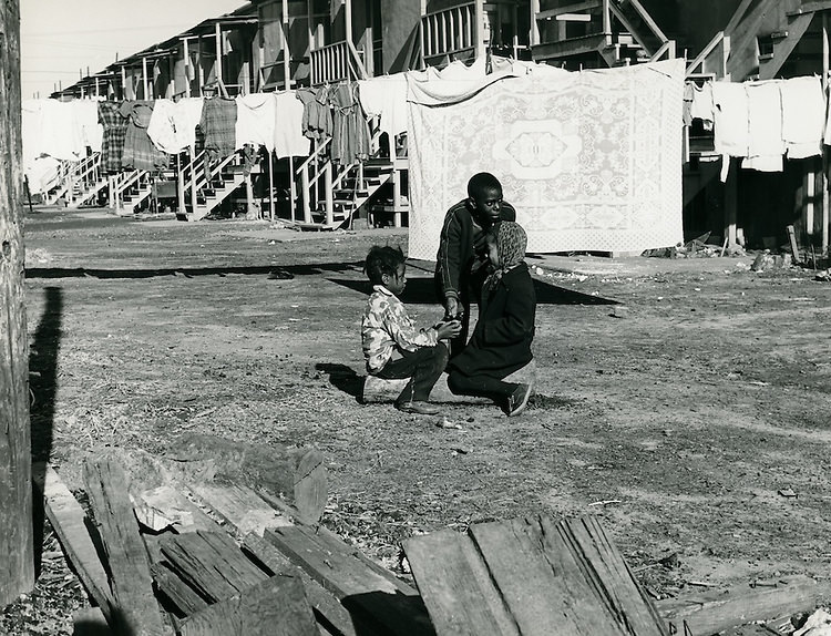
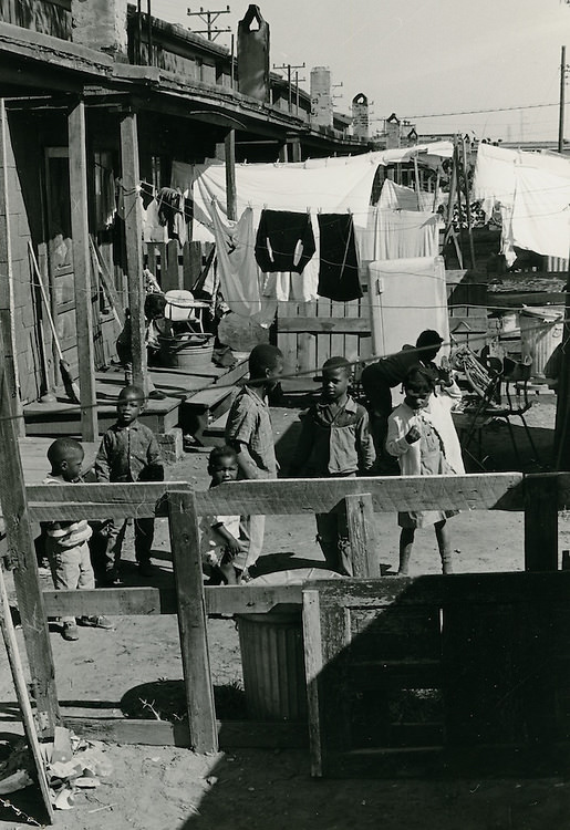
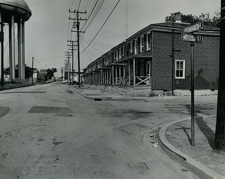
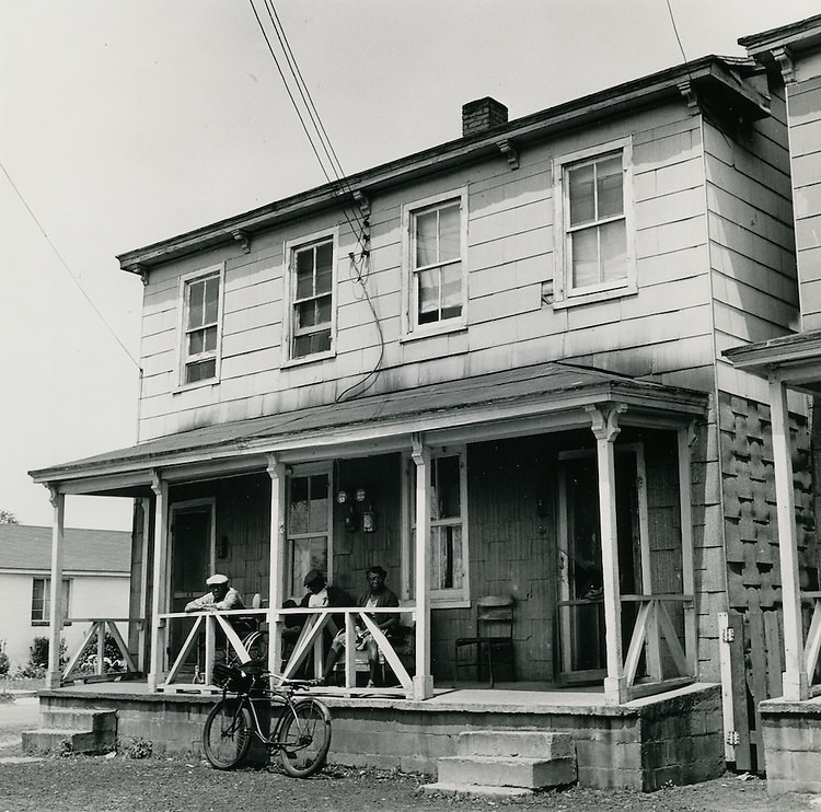
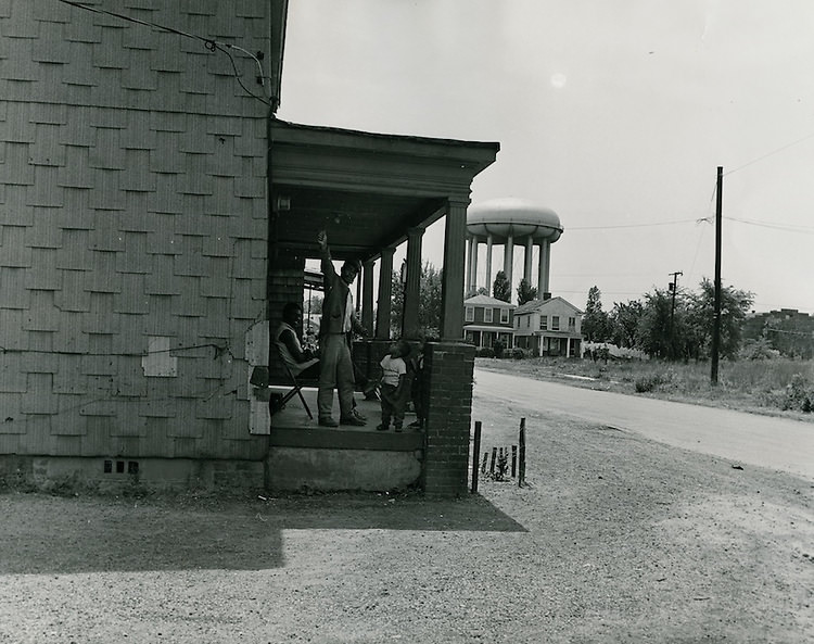
The Berkley neighborhood and nearby streets like Lavale Street, Alleghany Street, and Halifax Street showed a city where poverty was concentrated in specific blocks. October 1966 photographs taken around Lavale Street show boys playing football in the street, a dog rooting through a garbage bag, and residents going about their daily lives against a backdrop of aging housing stock. These images were not casual snapshots — they were part of systematic documentation efforts tied to urban renewal planning and the Model Cities program that the federal government was rolling out in the mid-1960s.
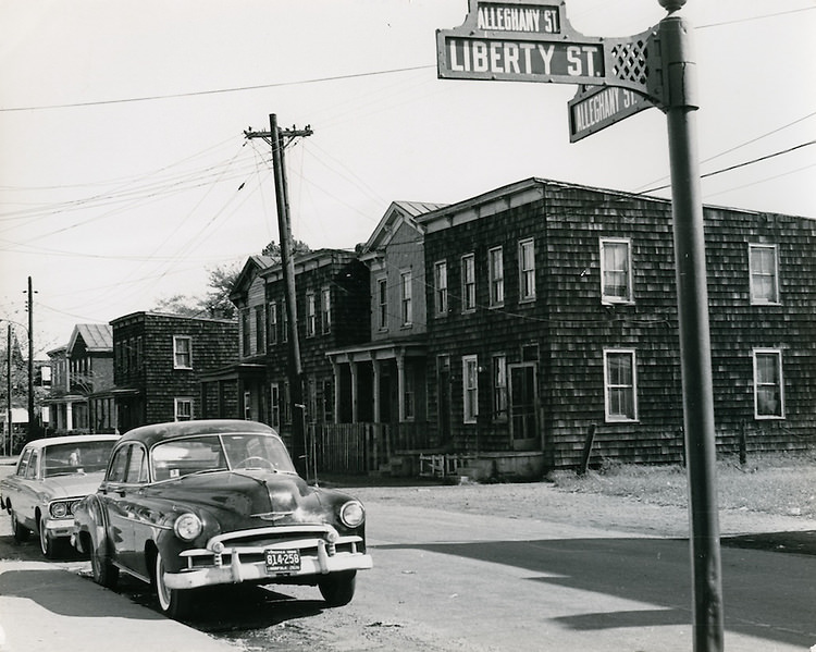
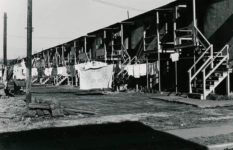
Looking down Alleghany Street from corner of Liberty Street and Alleghany Street - October 21, 1966
Looking down Alleghany Street from corner of Liberty Street and Alleghany Street – October 21, 1966
Berkley - Model Cities - October 21, 1966
Berkley – Model Cities – October 21, 1966
Norfolk - October 27, 1966
Norfolk – October 27, 1966
Norfolk - October 27, 1966
Norfolk – October 27, 1966
Picture of boys playing football on Lavale Street - October 27, 1966
Picture of boys playing football on Lavale Street – October 27, 1966
Norfolk - October 27, 1966
Norfolk – October 27, 1966
Dog rooting in garbage bag on Lavale Street - October 27, 1966
Dog rooting in garbage bag on Lavale Street – October 27, 1966
Shot of the block's football hero, taken on Lavale Street - October 27, 1966
Shot of the block’s football hero, taken on Lavale Street – October 27, 1966
Norfolk - October 27, 1966
Norfolk – October 27, 1966
Norfolk - October 27, 1966
Norfolk – October 27, 1966
Norfolk October 21, 1966.
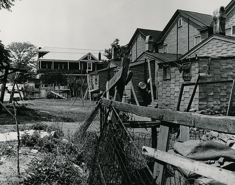
Shot of backyard between Halifax & Chesterfield, 1966
Looking down Halifax Street from corner of Halifax Street and Mason Street, 1969

Cedar Street was home to vegetable carts in October 1966 — a vivid detail that shows how street commerce still existed in parts of the city well into the decade. Vendors sold produce directly from carts near Wilson Road, a practice that reflected both the poverty and the self-sufficiency of certain neighborhoods. These carts were a common sight in older parts of Norfolk, where grocery stores were not always within easy reach.
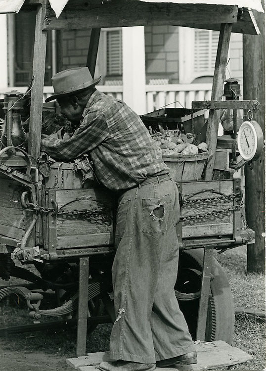
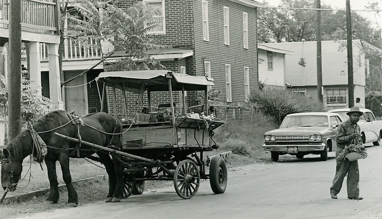
Vegetable Cart on Cedar Street - October 17, 1966
Vegetable Cart on Cedar Street – October 17, 1966
Vegetable cart on Cedar Street off Wilson Road - October 17, 1966
Vegetable cart on Cedar Street off Wilson Road – October 17, 1966

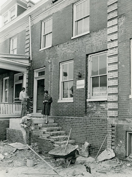
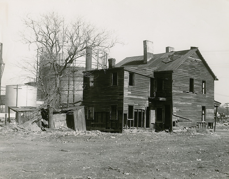
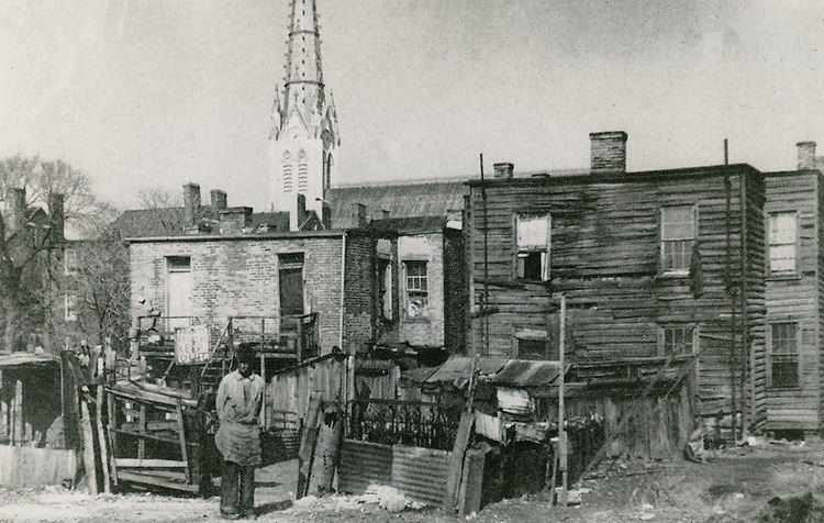
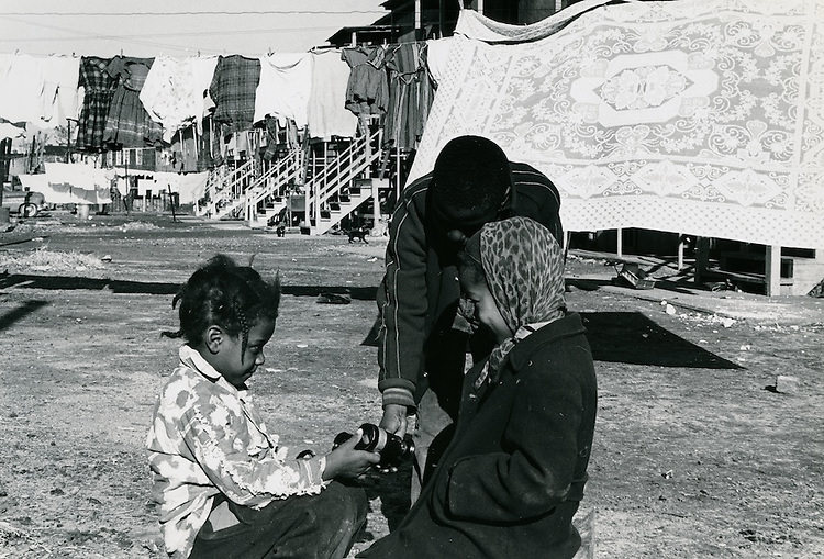
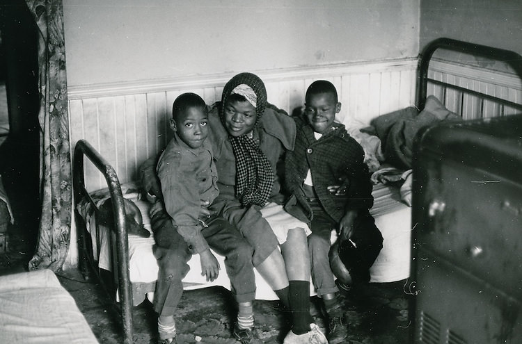
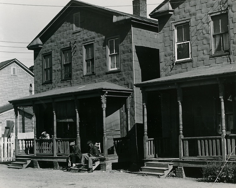
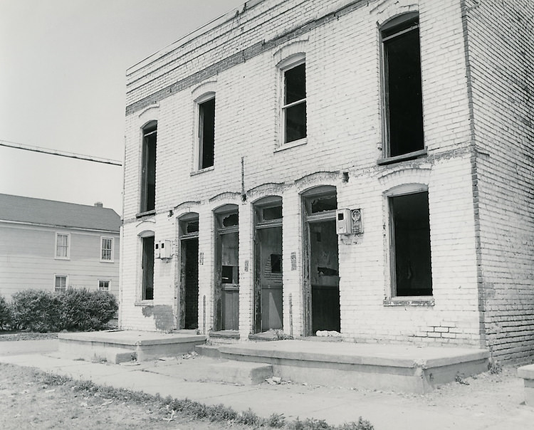
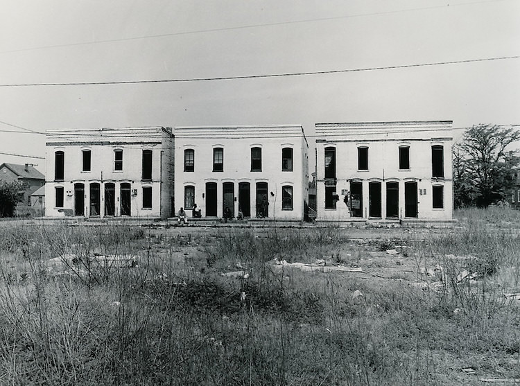
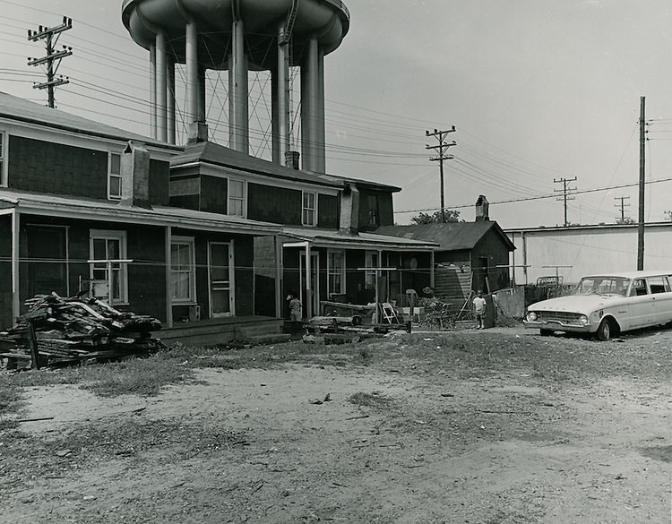
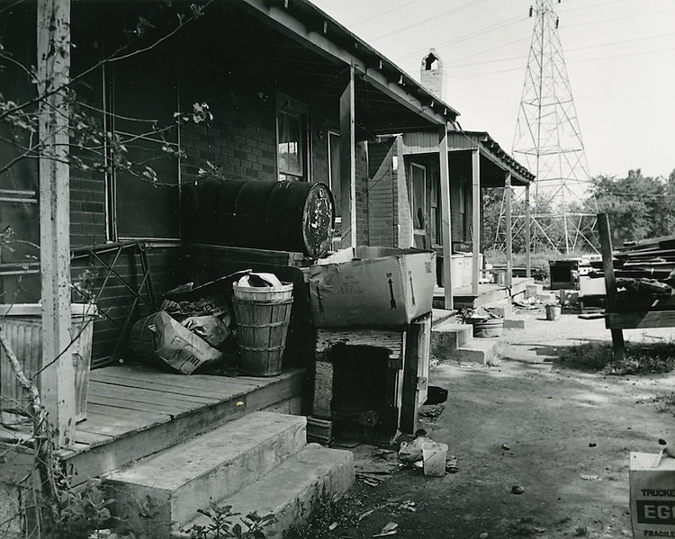
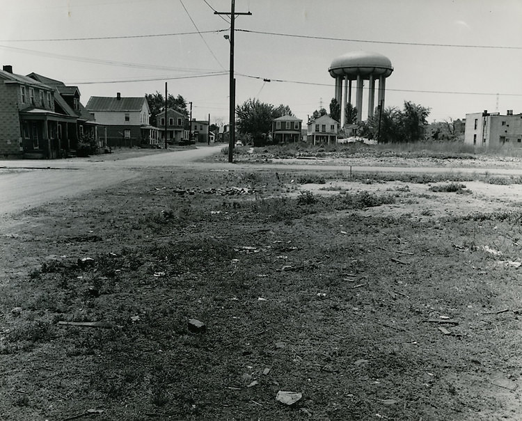
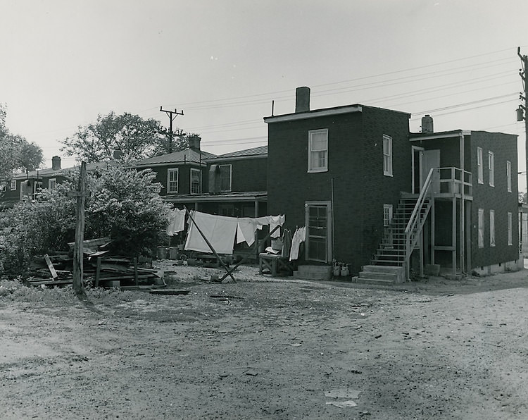
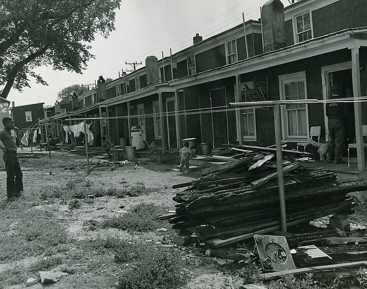
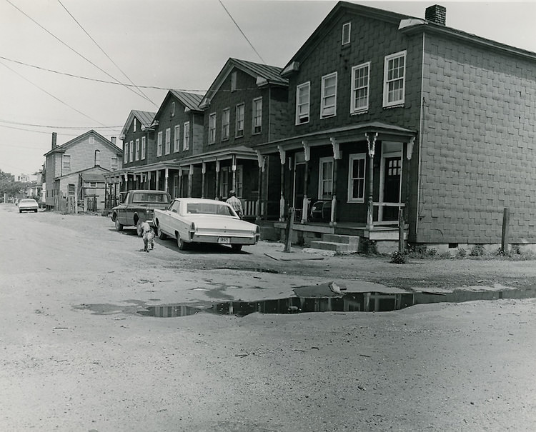
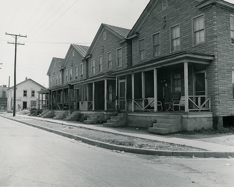
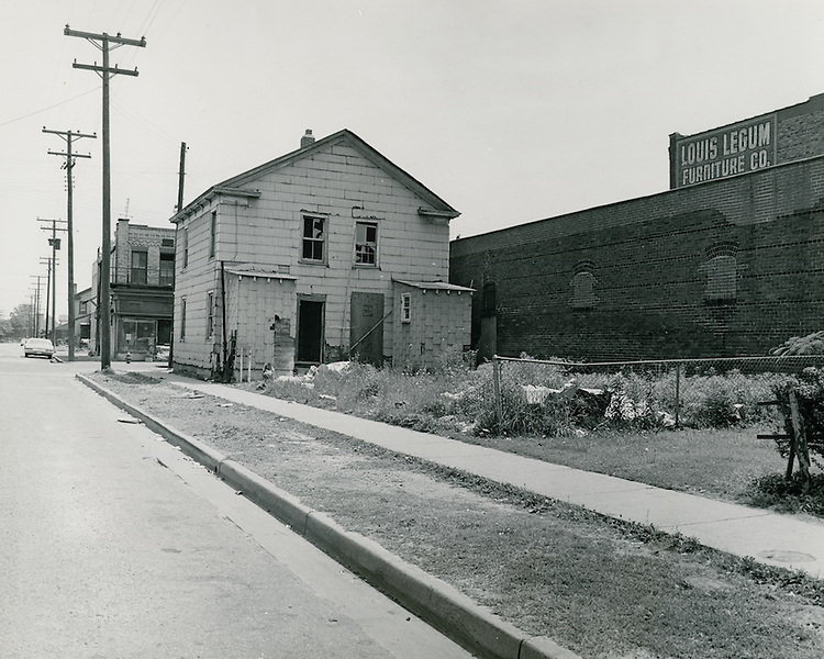
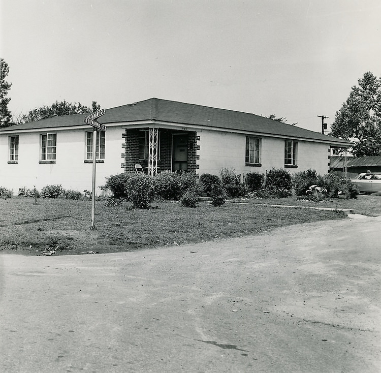
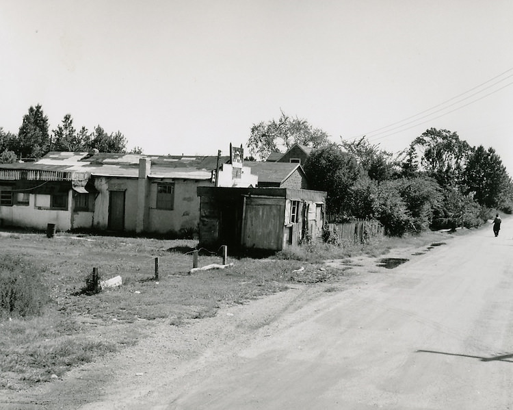
Slum conditions were documented across multiple neighborhoods throughout the decade. By May 1969, photographers were working the Bell-Diamond redevelopment area, capturing the corner of Middlesex and Fluvanna Streets, houses along Middlesex Street, and surrounding blocks. The scale of the documentation effort in 1969 shows that despite years of urban renewal, significant portions of Norfolk’s residential housing stock remained in poor condition.
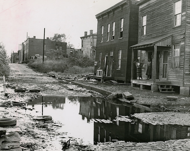
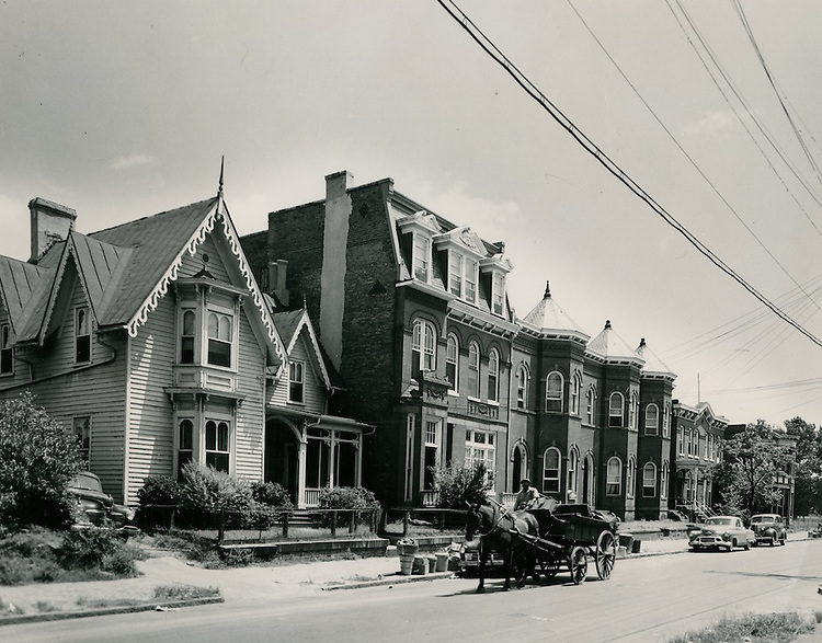
Slum Conditions, 1960s
Barry Robinson Apartments. East Holt Street.1114-1130 Holt Street, 1960s
Norfolk, 1969
Norfolk, 1969
Norfolk May 20, 1969
Slum Conditions, May 20, 1969
Middlesex Street houses, May 20, 1969
Norfolk, May 20, 1969
Norfolk, 1960s
Norfolk, 1960s
May 20..Redevelopment...Bell-Diamond (A-1-3)..Corner of Middleses Street and Fluvanna Street, 1960s
May 20..Redevelopment…Bell-Diamond (A-1-3)..Corner of Middleses Street and Fluvanna Street, 1960s
Norfolk, 1969
Norfolk, 1969
Norfolk, 1969
Norfolk, 1969
Norfolk, 1969
Norfolk, 1969
Norfolk, 1969
Norfolk, 1969
Norfolk, 1969
Norfolk, 1969
Norfolk, 1969
Norfolk, 1969
Norfolk, 1969
Norfolk, 1969

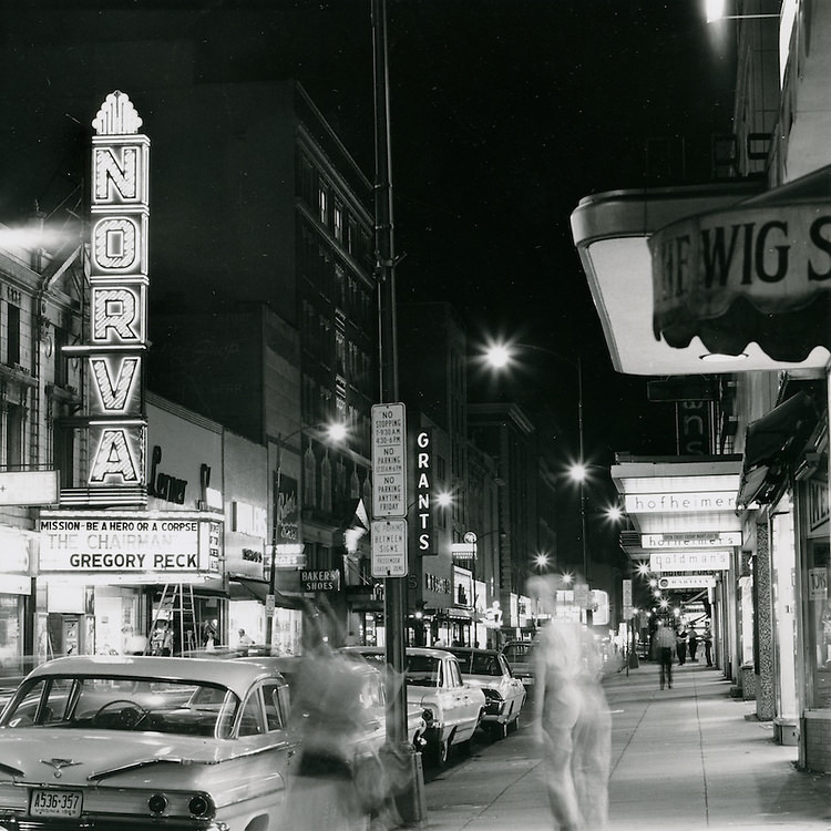
Toward the end of the decade, the city’s cultural institutions were growing in prominence. The Chrysler Museum was photographed in October 1969, marking its arrival as a major arts destination. Granby Street at night, photographed again in July 1969, still showed the same lit-up commercial corridor that had defined downtown for decades, though the street’s character had shifted with new businesses replacing old ones. The Norfolk Public Health Center was also documented in January 1969, reflecting the city’s expanding network of public services.
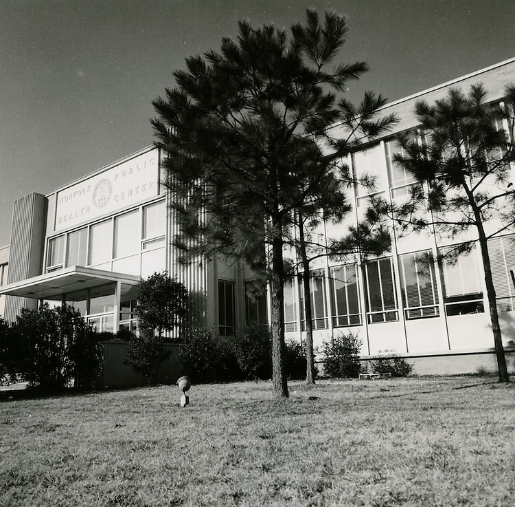
Norfolk Public Health Center - January 20, 1969
Norfolk Public Health Center – January 20, 1969
Granby Street at night looking south - July 11, 1969
Granby Street at night looking south – July 11, 1969
Chrysler Museum - October 13, 1969
Chrysler Museum – October 13, 1969
Chrysler Museum - October 13, 1969
Chrysler Museum – October 13, 1969
Chrysler Museum - October 13, 1969
Chrysler Museum – October 13, 1969

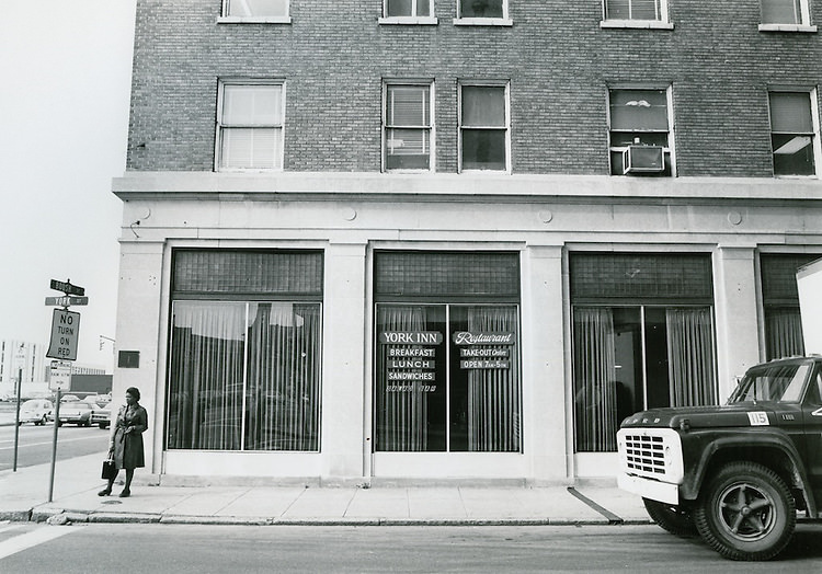
The Freemason Street neighborhood, Botetourt Street, and Boush Street were all photographed during the 1960s as the city tracked changes to its older residential and commercial fabric. The York Inn Restaurant at the corner of Boush and York Streets was a neighborhood fixture. Botetourt Street Bridge, looking south from Mowbray Arch toward Brambleton, connected the older parts of the city to its newer developments. These blocks held a mix of period architecture, small businesses, and longtime residents navigating a city that was changing faster than most of them anticipated.
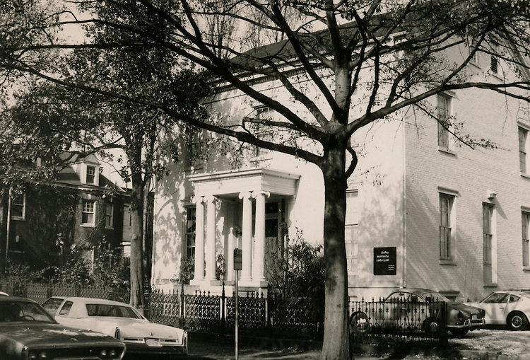
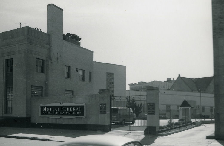
Freemason Street. 1960s
Boush Street, 1960s
Boush Street, 1960s
Downtown West, 1960s
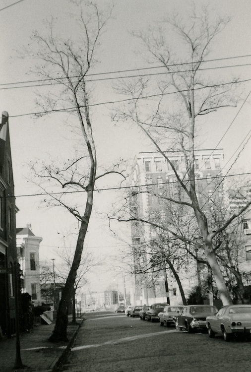
Botetourt Street looking North from Freemason Street, 1960s
116 Tazewell Street, 1960s
View looking Northeast at Downtown Norfolk, 1960s
Botetourt Street Bridge.View looking South from Mowbray Arch toward Brambleton. 1960s
York Inn Restaurant, corner of Boush & York Streets - 1960s
York Inn Restaurant, corner of Boush & York Streets – 1960s

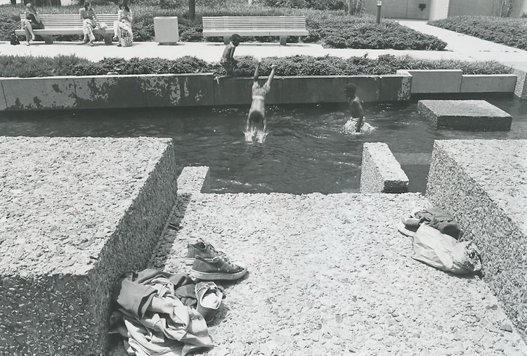
Children in East Ghent played in the streets in 1968, their daily lives captured in photographs that were part of the ongoing R-55 redevelopment study. A series of images from November 1967 documented streets across the city, showing a Norfolk that was still very much a place of dense residential blocks, neighborhood commerce, and everyday life carried out in public spaces. Kids swam in a downtown fountain in undated 1960s photographs, a small detail that suggests summers in the city were not unlike summers anywhere else in mid-century America.
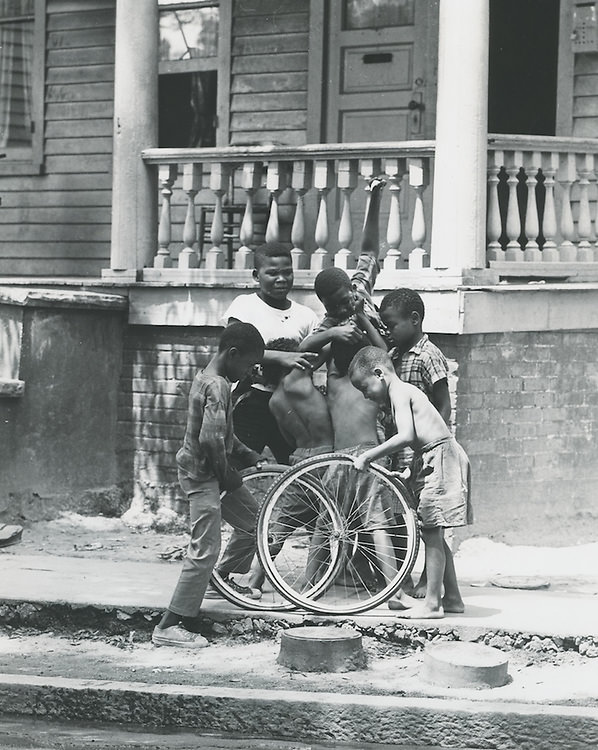
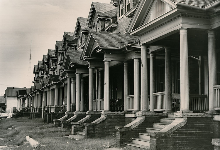
Kids playing in street in East Ghent, 1968
Norfolk, October 23, 1968
Kids swimming in fountain. 1960s
Norfolk - November 21, 1967
Norfolk – November 21, 1967
Norfolk - November 21, 1967
Norfolk – November 21, 1967
Norfolk - November 21, 1967
Norfolk – November 21, 1967
Norfolk - November 21, 1967
Norfolk – November 21, 1967
Norfolk - November 21, 1967
Norfolk – November 21, 1967
Norfolk - November 21, 1967
Norfolk – November 21, 1967

The Willoughby area, on the northern edge of the city near the Chesapeake Bay, was home to the Baylor House, photographed in January 1969. Out in that part of Norfolk, the landscape was looser — more open land, fewer dense city blocks. It was a different world from the crowded streets of East Ghent or the clearance zones of Downtown North, but it was still part of the same city working through the same decade of change.
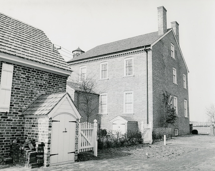
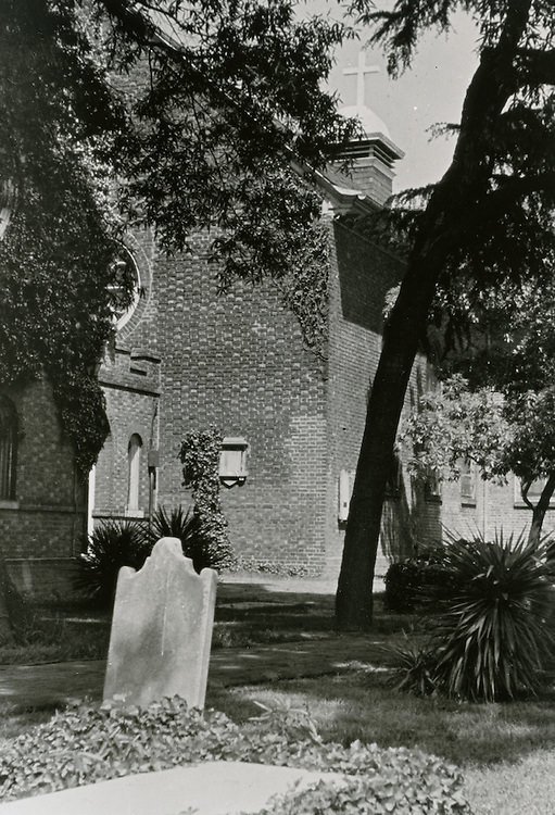
Willoughby - Baylor House - January 31, 1969
Willoughby – Baylor House – January 31, 1969
Norfolk - July 30, 1963
Norfolk – July 30, 1963
Norfolk - July 30, 1963
Norfolk – July 30, 1963
Norfolk - July 30, 1963
Norfolk – July 30, 1963
Norfolk - July 30, 1963
Norfolk – July 30, 1963
Caption - August 14, 1963
Caption – August 14, 1963
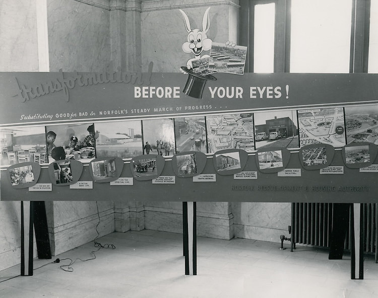
City Hall exhibit - 1964
City Hall exhibit – 1964
Norfolk - June 14, 1964
Norfolk – June 14, 1964
Norfolk - June 14, 1964
Norfolk – June 14, 1964
Norfolk - September 14, 1964
Norfolk – September 14, 1964
Caption - October 27, 1966
Caption – October 27, 1966
Caption - Undated
Caption – Undated
Norfolk, January 09, 1964.
Norfolk, April 02, 1968.
Norfolk December, 1951.
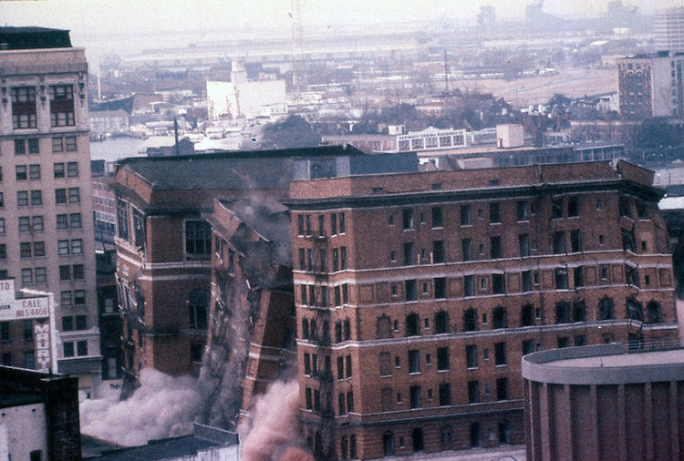
Monticelo Hotel Demolition, July 04, 1976
Enjoyed this post? Get new ones in your inbox.

4 thoughts on “What Norfolk looked like in the 1960s”

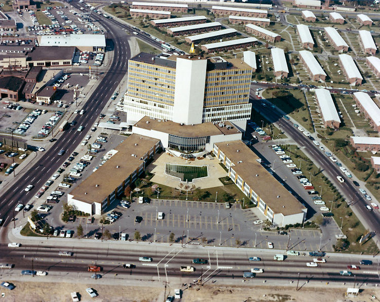
  1. There are entirely too many cars, the EVMS (I think BLDG 9, 400 Gresham Ave) building I think, was new in the ’60’s, and I don’t think The Hague BLDG (triple sided) is very old. Cool photos though – I could look through them all day.

Leave a Comment

Your email address will not be published. Required fields are marked *

Share this Post 🥺

Please take a moment to share this content. Your support is greatly appreciated! 🙌🙏

Share this Post 🥺

Please take a moment to share this content. Your support is greatly appreciated! 🙌🙏
Scroll to Top
 
Hey Friend, Before You Go.. Please like & follow for more interesting content