The disaster that struck the Los Angeles area on New Year’s Eve 1933 did not happen without warning. Weeks earlier, wildfires had burned through the mountains above La Cañada, La Crescenta, Montrose, and Tujunga in November 1933, stripping the hillsides of the vegetation that held the soil in place. Then, in December, winter storms dropped 12 inches of rain onto those same scorched slopes. The ground was already saturated and unstable when the final blow came.
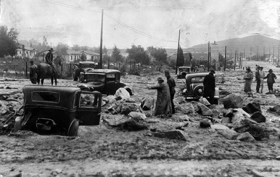
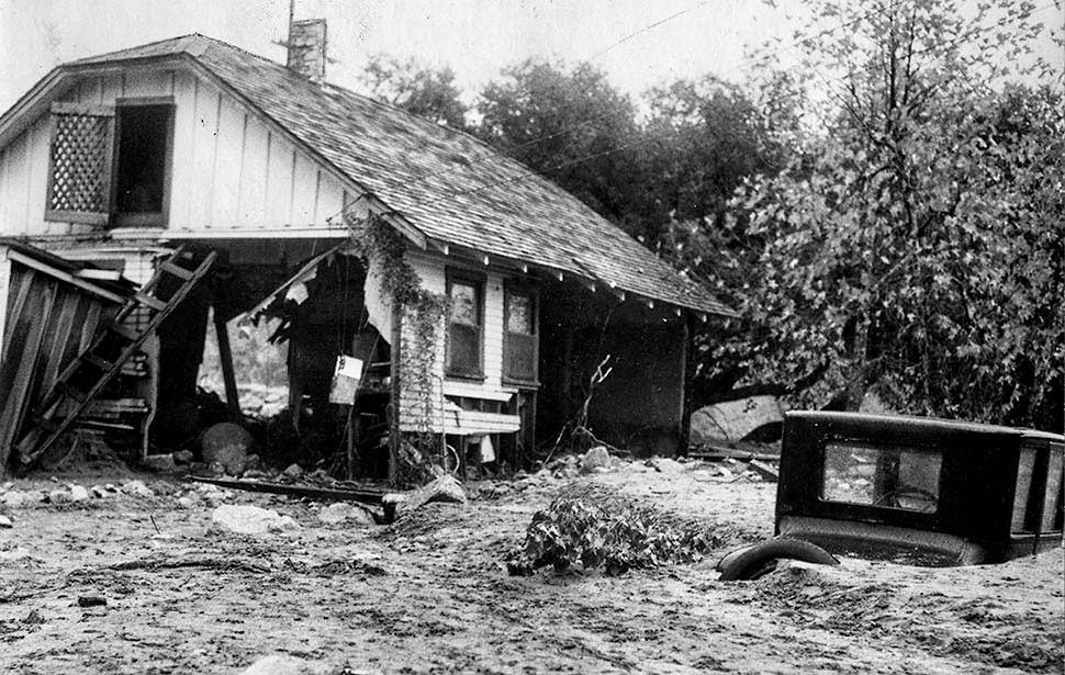
Around midnight on New Year’s Eve, several mountain ridges gave way. Millions of tons of mud, boulders, and debris came roaring down into the Crescenta Valley neighborhoods below. More than 400 homes were destroyed across La Cañada, La Crescenta, Montrose, and Tujunga. Hundreds of people were left without shelter. Foothill Boulevard disappeared under 12 feet of mud and rock. On Montrose Avenue, the mud ran deep enough to completely bury cars. Many miles of Honolulu Boulevard were swallowed by sand and silt.
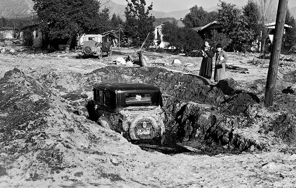
The speed and force of the debris flows gave residents almost no time to react. Mud and wreckage swept through streets, swallowing vehicles whole and pushing homes off their foundations. Montrose Avenue became one of the most photographed scenes of the disaster, showing the sheer scale of what the floodwaters left behind.
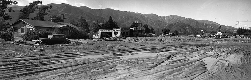
Honolulu Avenue in Montrose was buried under a thick blanket of mud that stretched for miles. The destruction along this stretch was so extensive that it took a panoramic photograph stitched together from three separate negatives to capture the full scope of what had happened.
The flooding was not confined to the mountain foothills. Floodwaters pushed into East Los Angeles and other low-lying communities across the region. Roads flooded, vehicles stalled, and the water caught many people completely off guard.
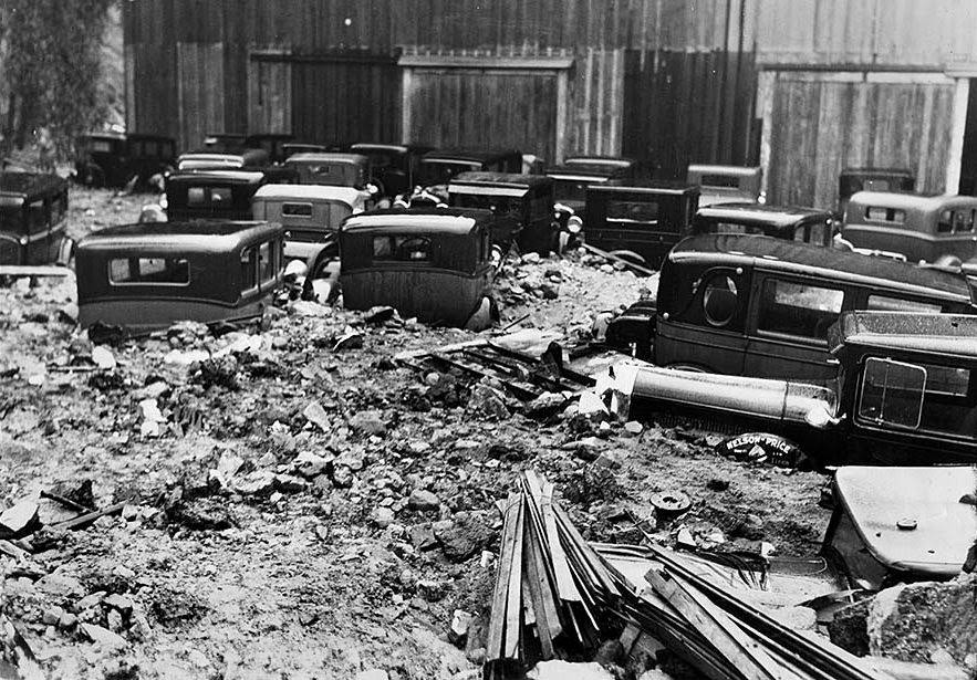
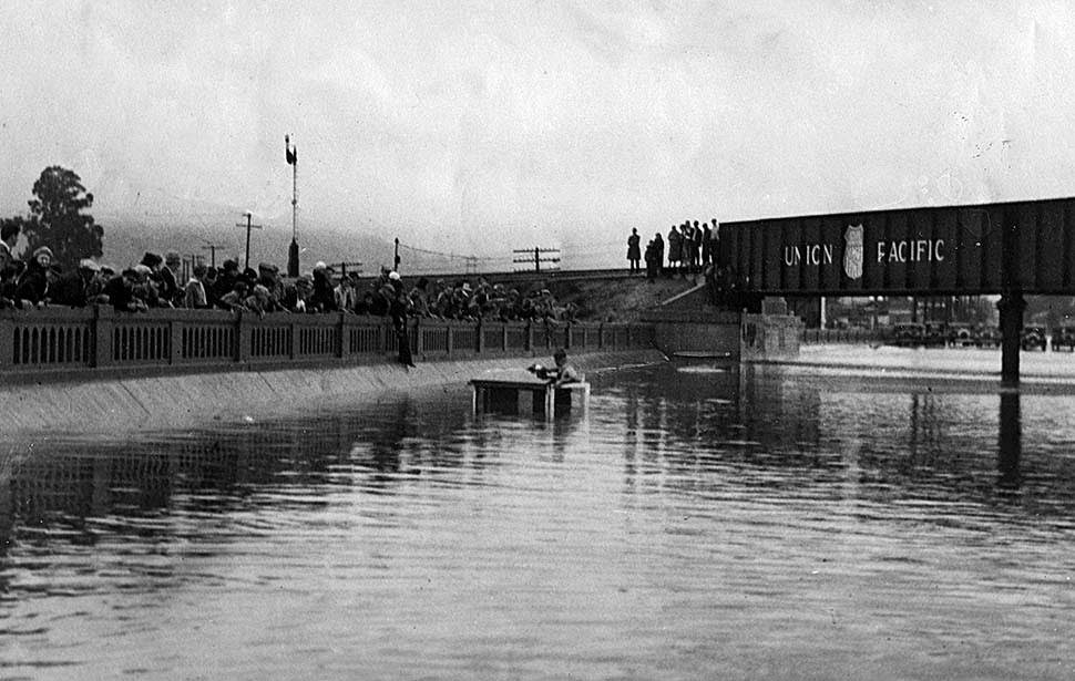
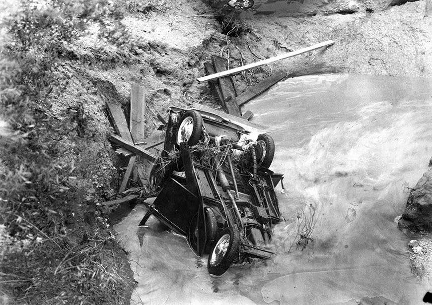
The flooding claimed lives in multiple locations across the greater Los Angeles area. At the Mesa Street bridge over the Rubio Wash, west of San Gabriel Boulevard in the Monterey Park area, four people drowned when their car plunged into the swollen wash. Crowds gathered at the washed-out bridge after the fact, looking at where the road had simply ceased to exist.
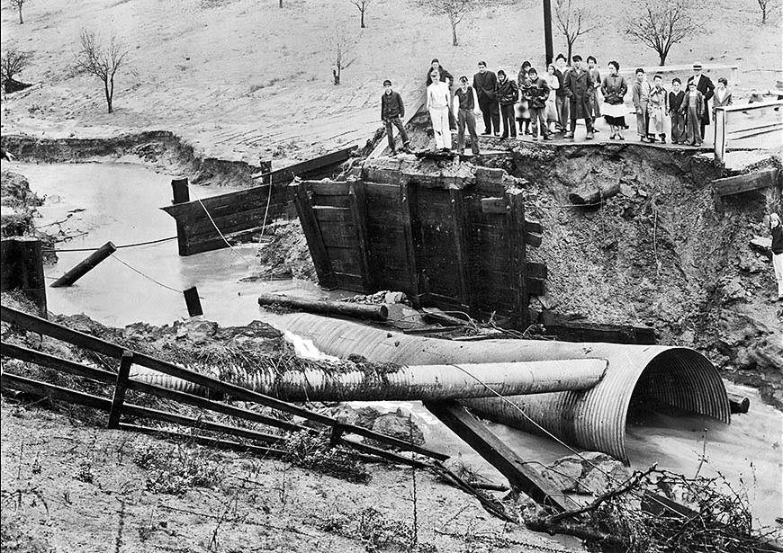
Near the area now known as Whittier Narrows Recreation Area, a car and the entire Rush Avenue bridge were swept into the Alhambra Wash, killing five people. These losses, scattered across different neighborhoods, showed just how wide the disaster’s reach truly was.
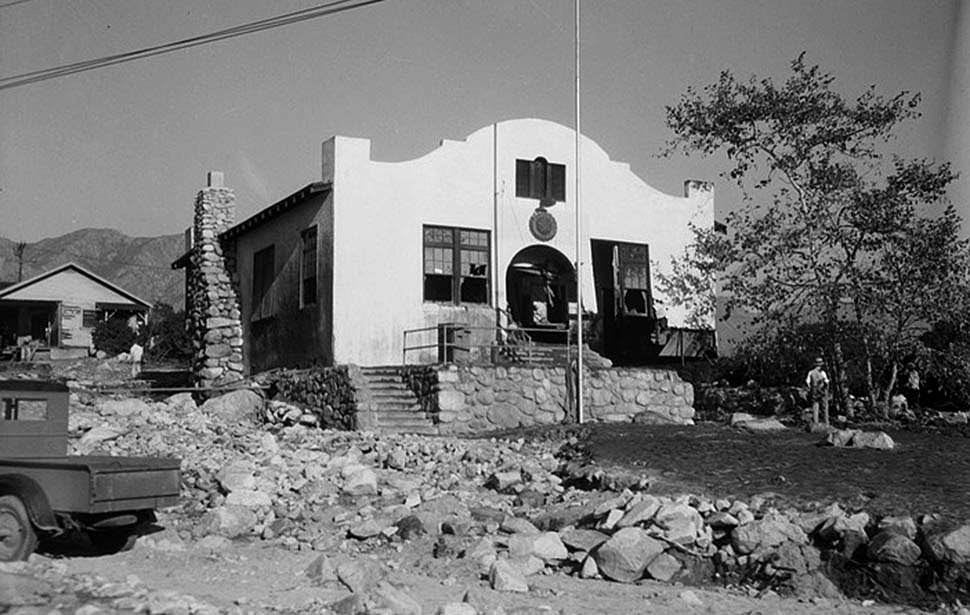
Some of the deadliest moments of that night came when people sought safety in public buildings that turned out to be directly in the path of the debris flows. At a local American Legion Hall, sixteen people gathered believing they had found a safe place to wait out the storm. The hall stood in the direct path of the debris flow coming out of nearby Pickens Canyon. The torrent ripped the building open and filled it with mud, killing everyone inside. At American Legion Post 288, also in Montrose, twelve more people died when the building was destroyed.
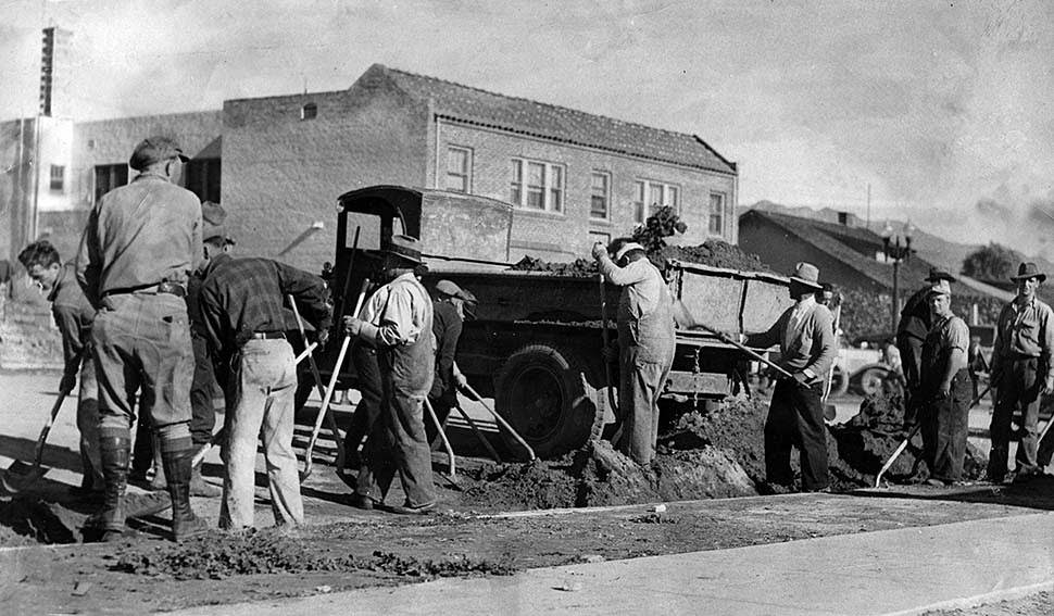
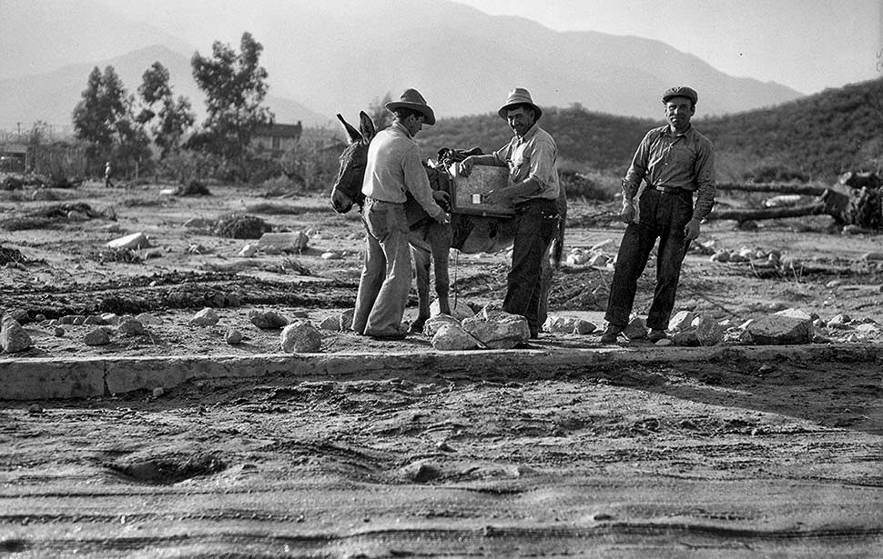
Once the mud stopped moving, the work of clearing it began. Civil Works Administration crews from Pasadena arrived to help dig out Honolulu Avenue and other buried streets. The scale of the cleanup was enormous. In some places, workers used equipment; in others, they relied on shovels and manpower — and in the rougher terrain, even pack animals.
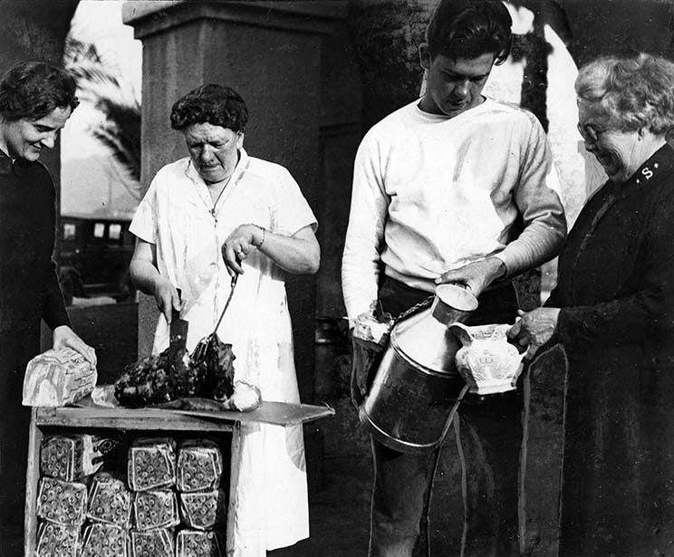
As recovery efforts got underway, community kitchens were set up to feed survivors who had lost their homes and had nowhere to go. Basic needs — food, water, and supplies — had to be organized quickly for hundreds of displaced residents.
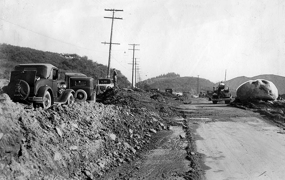
The depth of debris dumped onto Foothill Boulevard in Montrose was staggering. Cars parked on higher ground nearby gave passersby a way to gauge exactly how deep the mud and rock had piled up on the road surface. One boulder left behind measured 50 feet in circumference.
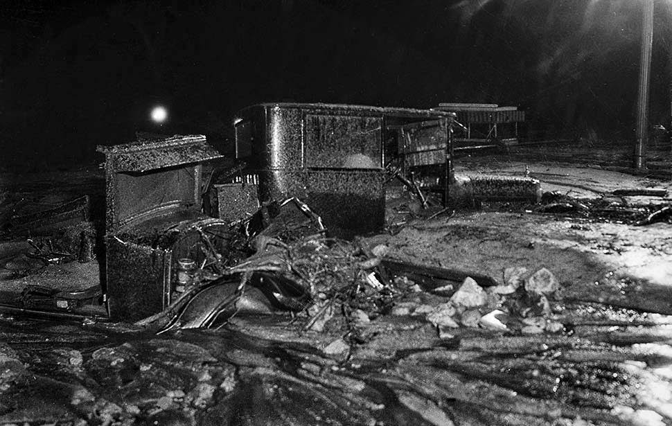
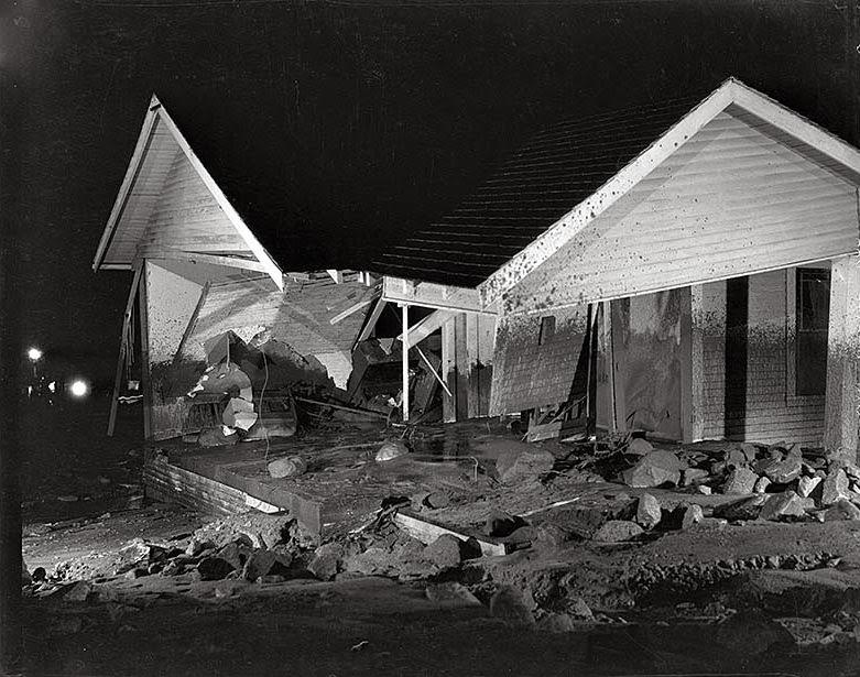
Residential streets across Montrose told the same story block after block — homes damaged or destroyed, yards buried, and personal belongings lost under feet of debris. Among the many tragedies tied to the flood were the deaths of Winston and Weston Doty, identical twin actors from the silent film era, who were just 19 years old when the floodwaters took their lives.
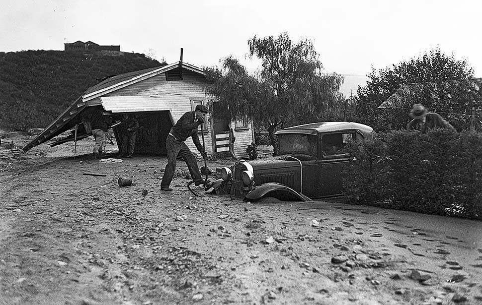
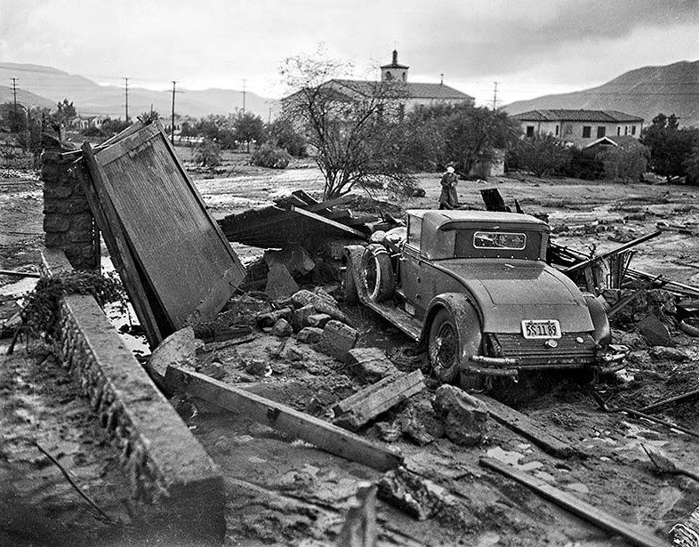
The debris flows were fed in part by the area’s wash system, which channeled water off the mountains and through neighborhoods. When those channels overflowed or were overwhelmed, the results were immediate and destructive. Streets like Glenada Avenue became extensions of the wash itself.
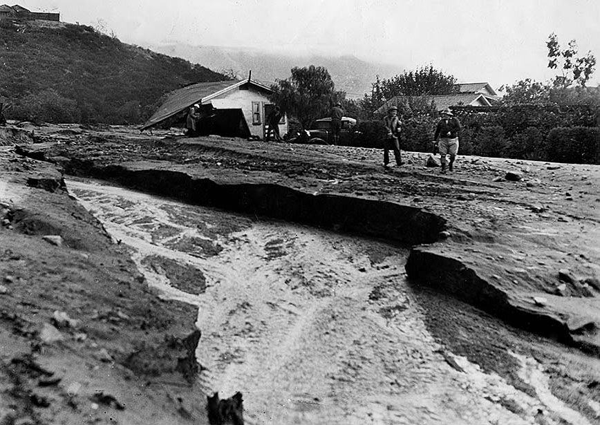
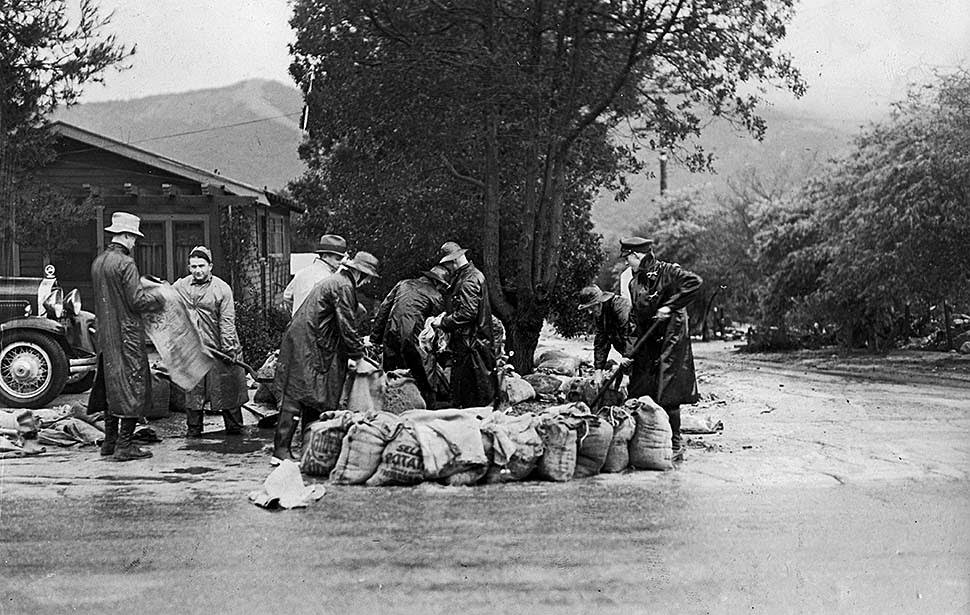
Montrose was hit not once but twice in 1934 — first on New Year’s Eve, and again in October. Workers returned to the same flood-prone intersections to fill sandbags and attempt to hold back the water at points that had already proven vulnerable. The photographs taken at Honolulu and Agner streets show crews doing exactly that work, preparing for the next wave before it arrived.