
Kent sits in the far southeastern corner of England, where it has served as one of the country’s most important gateways for centuries. Its ports supplied warships to the Royal Navy across generations of conflict, and its coastline made it the first point of contact for wave after wave of invaders and settlers. Among the earliest were Germanic tribes, who arrived in Kent before spreading further into Britain. The county’s other great identity is agricultural. Locals and visitors alike call it ‘The Garden of England,’ a nickname earned by its vast orchards and sprawling hop gardens that fed both kitchens and breweries across the country. The photos in this collection, taken between the 1900s and the 1920s, capture Kent’s towns, villages, coastlines, and working life at a moment of significant change.
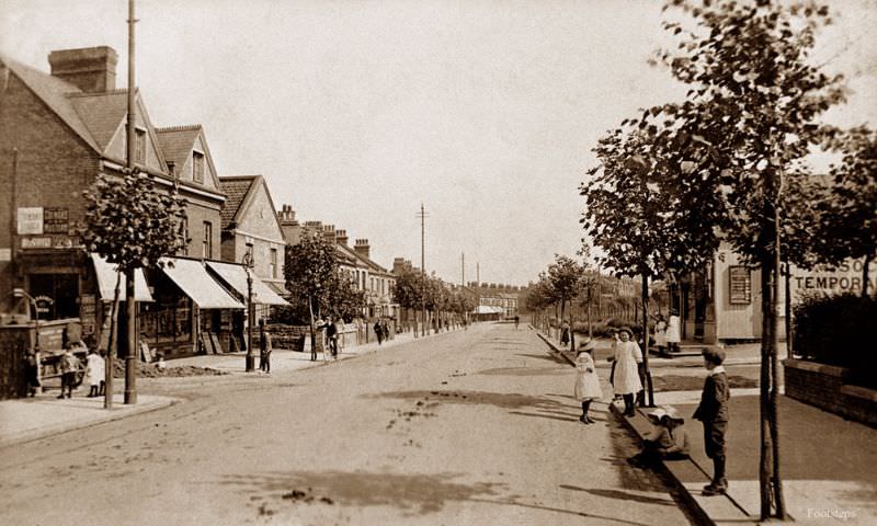
The roads of Kent in this era were still largely free of motor traffic. Horse-drawn carts, pedestrians, and the occasional bicycle dominated the streets. Quiet residential roads like Abbey Wood Road show the neat, orderly character of suburban Kent at the turn of the century, with modest homes lining streets that had changed little in decades. That calm would not last — the motor car was already beginning to reshape road life across England.
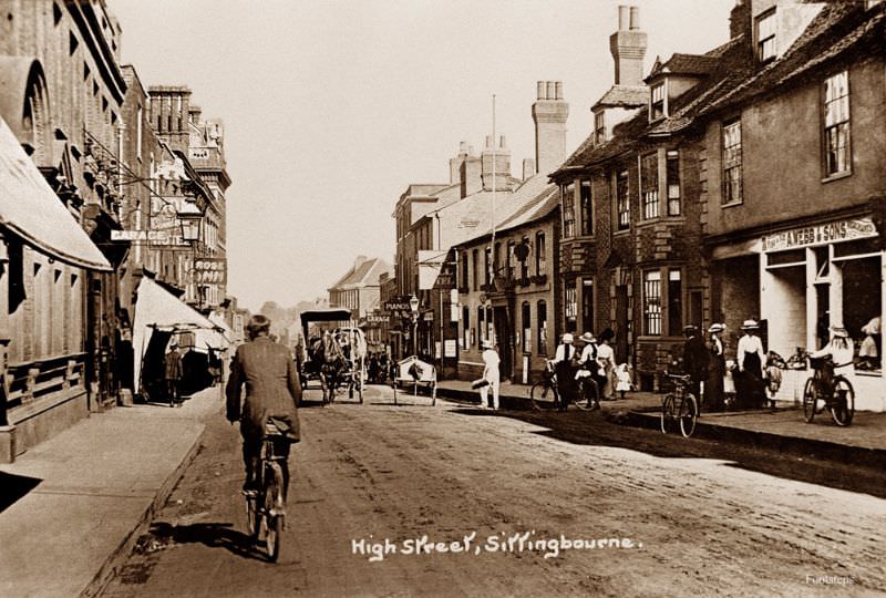
Sittingbourne sits along the old Roman road of Watling Street, and its High Street was a working commercial spine for the town. Shops, traders, and foot traffic filled these streets on ordinary days. Sittingbourne was also closely tied to the paper-making and brick-making industries, and its high street reflected a town with a strong working-class economy.
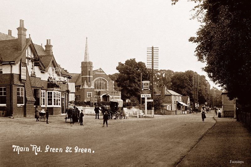
Green Street Green, a small village in the northwest of Kent, retained its rural character well into the early twentieth century. The main road through the village carried local traffic between larger towns, and the pace of life here was noticeably slower than in the county’s market centers. Villages like this one depended on nearby farms and local tradespeople for their daily needs.
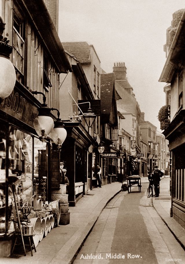
Ashford was a significant market town and railway junction in Kent. Middle Row, a narrow strip of buildings running through the center of the town, was typical of medieval English market towns where traders gradually built permanent stalls that became permanent structures. By the early 1900s, these buildings were centuries old and still very much in use.
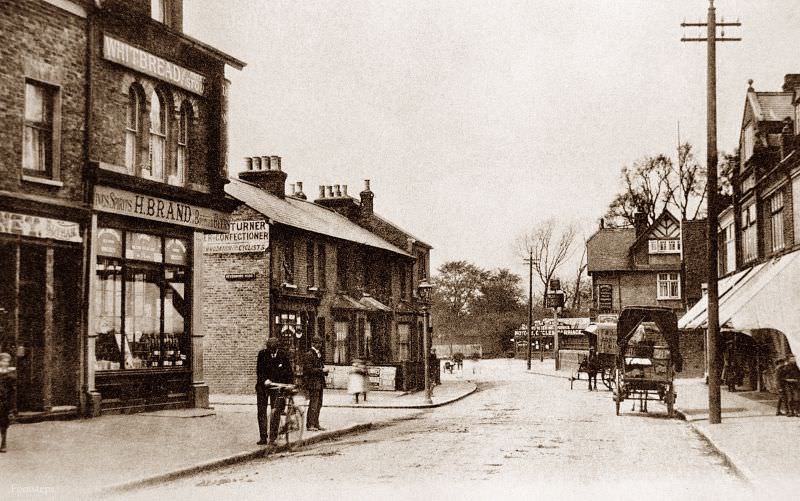
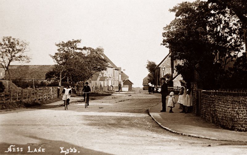
Lydd is one of Kent’s older settlements, located on the flat expanse of Romney Marsh in the south of the county. Ness Lane reflects the plain, functional style of building that suited the exposed marshland landscape. The town itself is one of the largest parishes in England by area, though its population remained small. Romney Marsh was sheep country, and towns like Lydd served the farming communities spread across it.
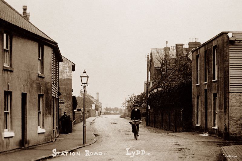
The railway came to Lydd in 1881 with the opening of the Lydd Railway, giving the remote marshland town a direct connection to the wider network. Station Road was the artery that connected the town center to the station, and photos from this period show a quiet but functional street built around that link. The arrival of the railway changed the pace of life in even the most isolated Kentish communities.
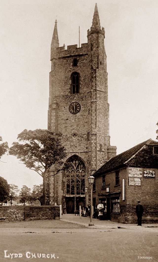
All Saints’ Church in Lydd is sometimes called ‘the Cathedral of the Marsh.’ Its tower stands over 130 feet tall and has been a landmark on the flat Romney Marsh for centuries. The church dates back to the thirteenth century and survived extensive damage during World War Two, when the town was used as a military training area. In the early 1900s, it stood as the dominant structure in a landscape with almost no natural high ground.
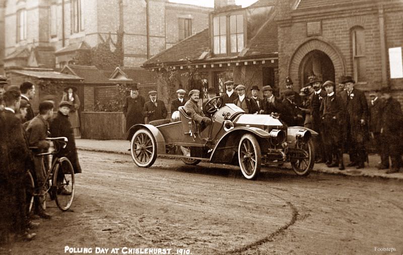
Polling day photographs from the Edwardian and early Georgian periods are rare and valuable records. At this time, voting in Britain was still restricted — women did not receive the right to vote on equal terms with men until 1928. Election days drew crowds regardless, and Chislehurst, a prosperous village in northwest Kent, was no exception. These scenes of civic participation capture a democratic process that was still evolving rapidly.
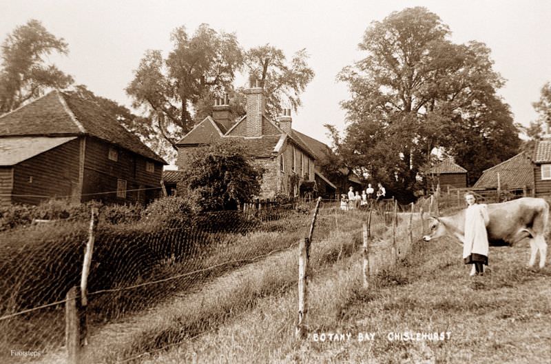
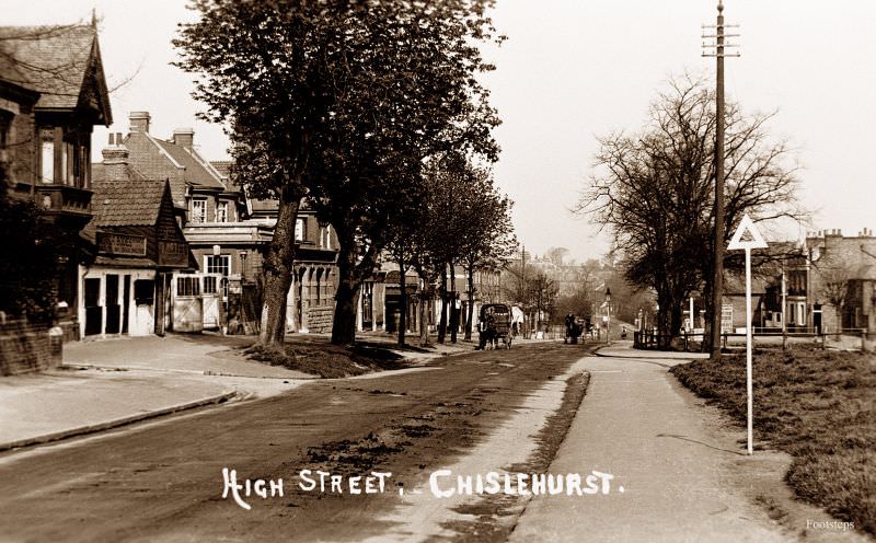
Chislehurst’s high street in the early twentieth century shows a well-maintained village center with a mix of shops and residential buildings. The village had grown in popularity as a retreat for wealthier Londoners, thanks to its rail connection to the capital. Its green spaces, including the famous Chislehurst Caves, made it a recognizable name beyond Kent’s borders.
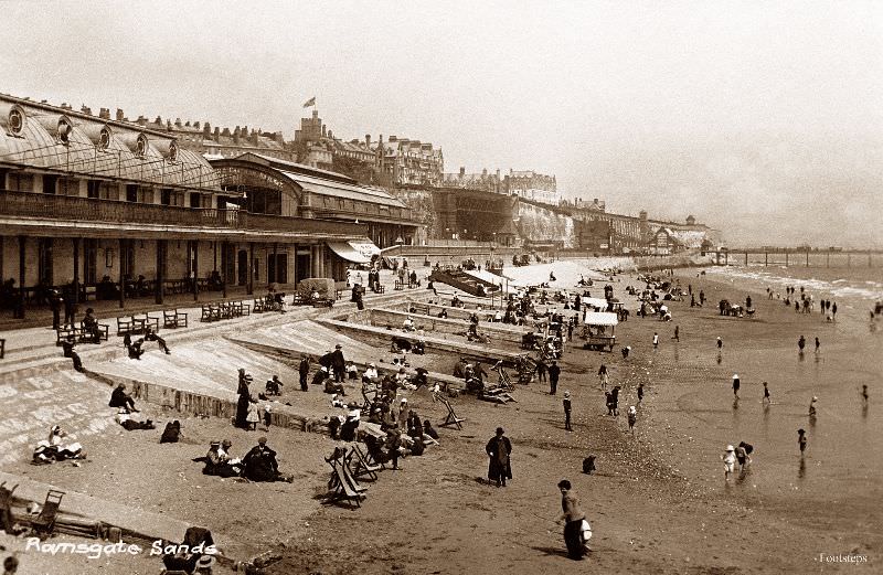
Ramsgate was one of Kent’s most popular seaside resorts during the Edwardian era. Its sandy beach drew visitors from London by train, and the seafront was lined with hotels, bathing machines, and promenading families. The sands at Ramsgate were wide and accessible, and the town worked hard to attract and accommodate the growing tourist trade that the railway made possible.
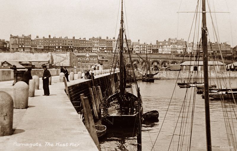
Ramsgate Harbour is one of the most significant on the Kent coast. The West Pier formed part of the outer harbor wall and gave the town’s busy port its distinctive silhouette. Ramsgate held Royal Harbour status — the only one in Britain — granted by King George IV in 1821. By the early 1900s, the harbor handled a mix of commercial fishing vessels, passenger ferries, and pleasure craft.
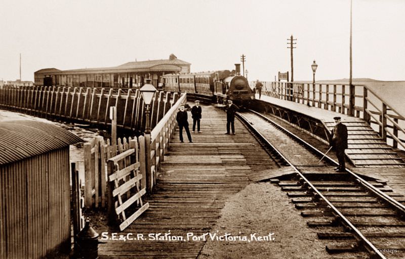
Port Victoria was a small and somewhat unusual railway terminus built on the Isle of Grain in north Kent. The South Eastern and Chatham Railway — known as the S.E. & C.R. — operated the line and intended Port Victoria to serve as a departure point for continental ferry services. The project never fully succeeded, and the station remained a minor and remote outpost. The photo records a piece of Kent’s railway history that most people today have forgotten entirely.
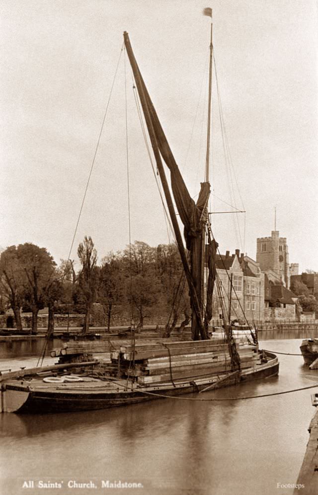
The River Medway was Kent’s main inland waterway, and Thames sailing barges worked its waters for centuries. Maidstone, the county town of Kent, sat directly on the Medway and relied on the river to move goods — stone, grain, timber, and paper — to and from the Thames estuary. These flat-bottomed, brown-sailed barges were perfectly suited to the shallow tidal rivers of southeast England, and they remained a common sight on the Medway well into the twentieth century.
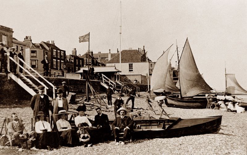
Deal sits on a stretch of the Kent coast facing the Goodwin Sands, one of England’s most dangerous offshore sandbanks. The beach at Deal is shingle rather than sand, and it served a working community of fishermen and boatmen as much as it did holidaymakers. Deal had a long history as a naval town and was once home to a major naval yard at nearby Walmer. The beach in these early photographs shows both the working and leisure faces of a small coastal town.
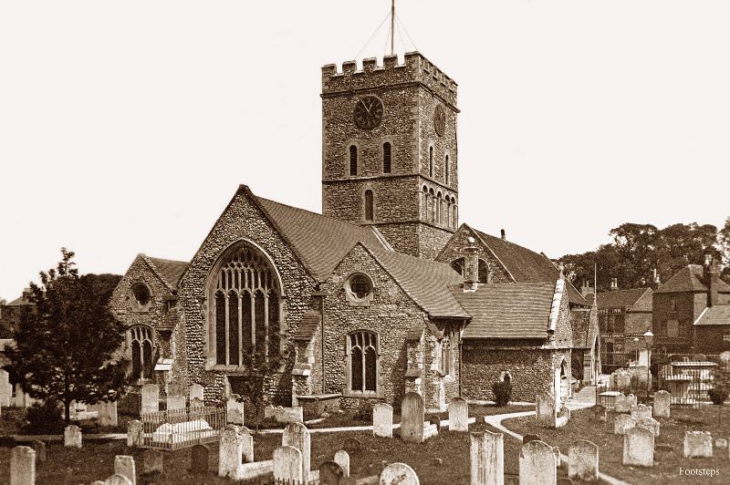
The Isle of Thanet, technically no longer a true island since the silting of the Wantsum Channel, forms the northeastern tip of Kent. St Lawrence was one of the villages in this area, and its church is typical of the solid, flint-built Norman architecture found throughout the region. Thanet’s churches are among the oldest in England — Augustine landed nearby in 597 AD, making this one of the first areas of England to adopt Christianity.
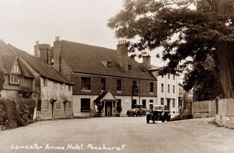
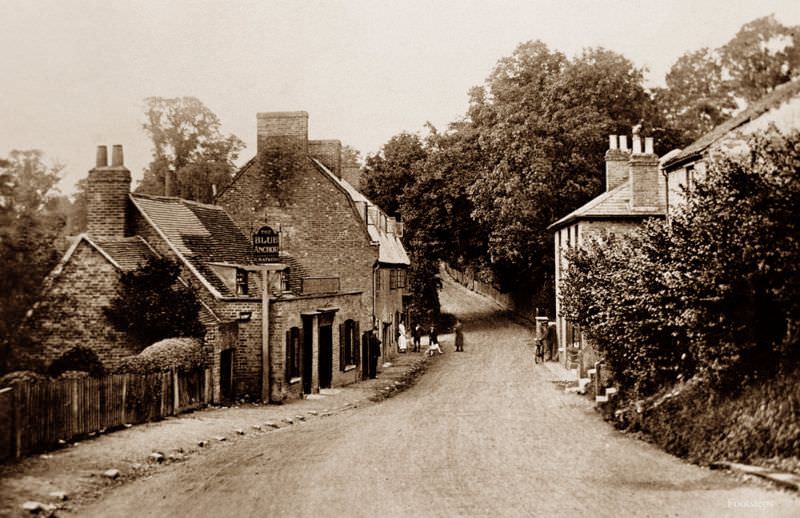
Penshurst is a small village in the Weald of Kent, best known for Penshurst Place, the medieval manor house associated with the Sidney family. The Leicester Arms Hotel stood at the heart of the village and served travelers and local residents alike. Named after Robert Dudley, Earl of Leicester, the hotel’s name reflects the deep connection between the village and its most famous estate.
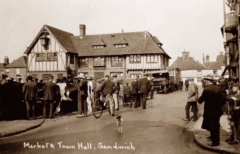
Sandwich is one of the original Cinque Ports — the group of Channel coastal towns that provided ships and men to the English Crown in exchange for special privileges. By the early twentieth century, Sandwich had long since lost its direct access to the sea due to silting, but its medieval street layout and buildings remained largely intact. The market and town hall photograph captures a town that wore its history visibly, with structures dating back hundreds of years still defining its civic center.
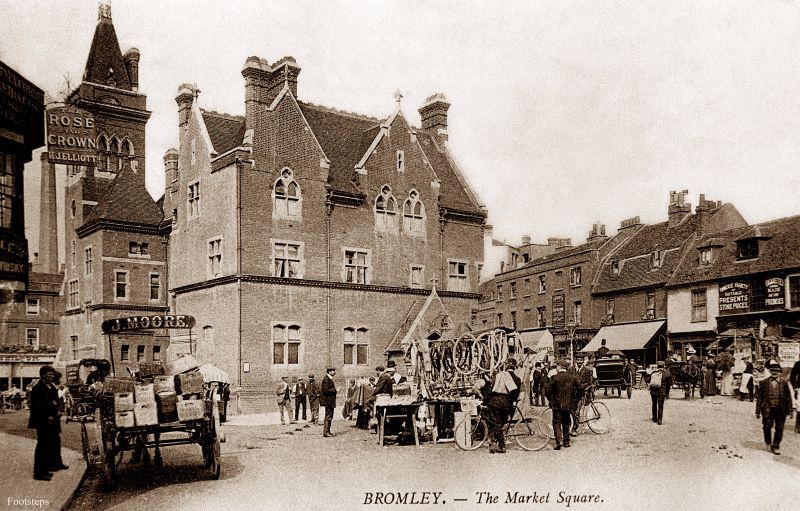
Bromley was one of the larger towns in northwest Kent and was growing rapidly in the early twentieth century as London expanded outward. Its market square was the commercial center of the town, busy with traders and shoppers on market days. Bromley’s proximity to London made it a natural destination for businesses serving the expanding suburban population.
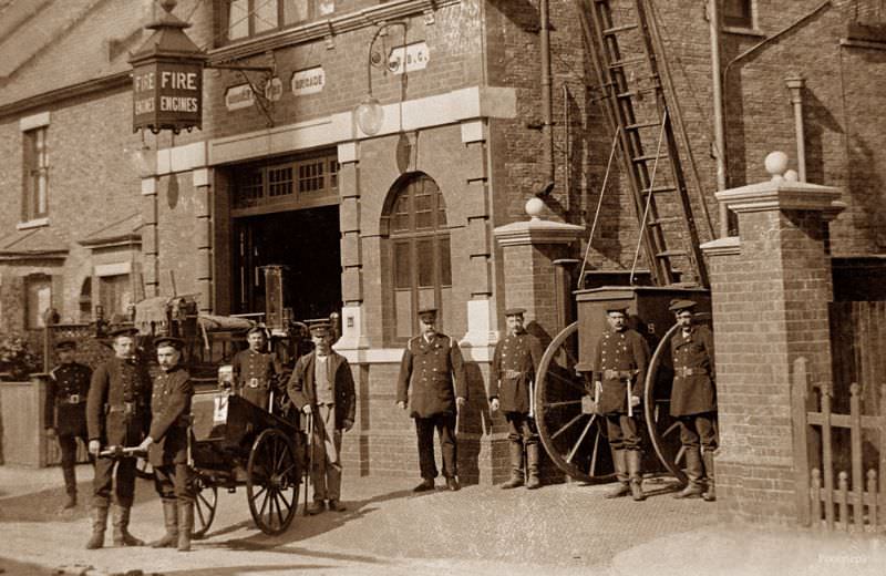
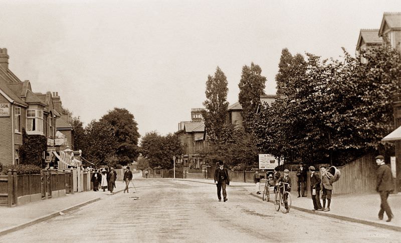
College Road in Bromley ran through one of the town’s more established residential areas. By the early 1900s, Bromley had a well-developed infrastructure including schools, churches, and civic services. The town’s fire brigade, photographed during this same period, represents the growing professionalization of local public services that characterized English towns of this era.
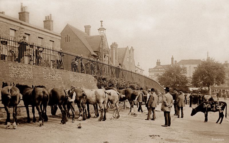
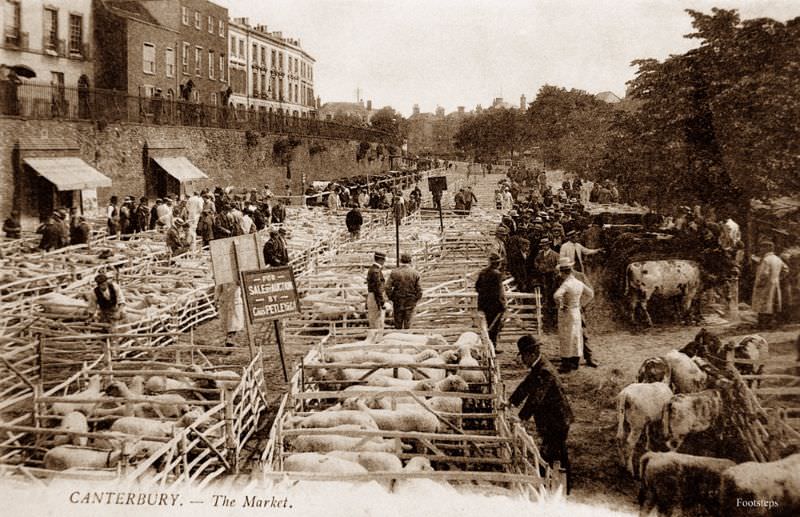
Canterbury was, and remains, Kent’s most historically significant city. Its cathedral drew Christian pilgrims for centuries, as immortalized in Chaucer’s Canterbury Tales. The city’s market was a center of commerce that served the surrounding agricultural region, bringing in produce, livestock, and goods from across the county. Early twentieth-century market photographs from Canterbury show a city that balanced its ancient religious identity with a practical, working economic life.
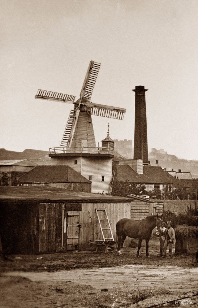
Windmills were once a defining feature of the Kent landscape, used for grinding grain and, in some cases, powering industrial operations. The windmill at Kingsfords Buckland Brewery in Dover combined two of Kent’s great industries — milling and brewing — in a single site. Dover itself was one of England’s most strategically vital towns, guarding the narrowest point of the English Channel. Its famous white cliffs and castle dominated the landscape above the town.
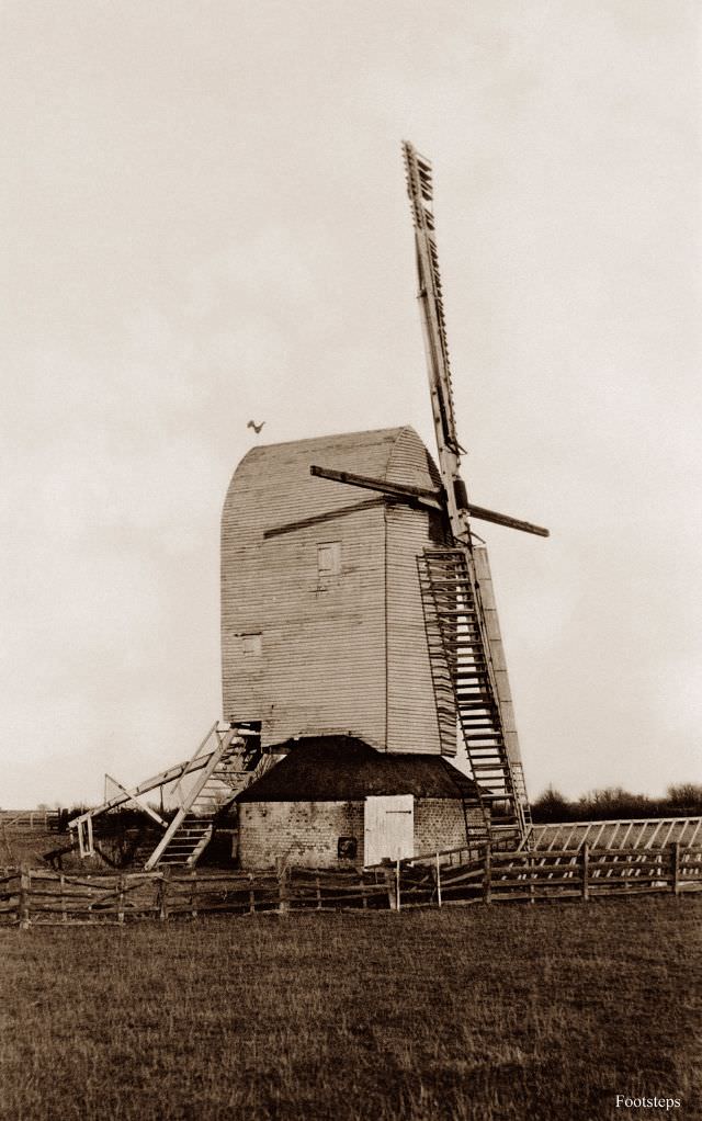
Brenzett, another small settlement on Romney Marsh, was home to its own windmill — a common sight on the flat, wind-exposed marshland. These mills ground the grain produced by the farms of the marsh, and their sails turning against a wide open sky were characteristic of the region’s landscape. By the early twentieth century, many of Kent’s windmills were already falling out of use as steam-powered mills took over.
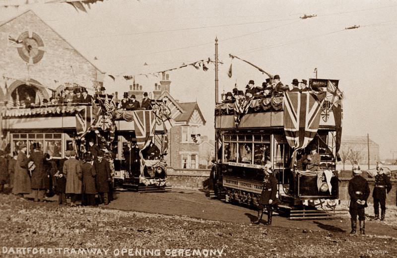
Dartford, one of the westernmost towns in Kent, opened its tramway in the early twentieth century as part of a broader expansion of electric public transport across Britain. The opening ceremony was a civic event, marking the arrival of a modern, reliable form of transport for the working population. Dartford’s tramway connected the town center to its surrounding streets and was part of the network operated by the Dartford Light Railways.
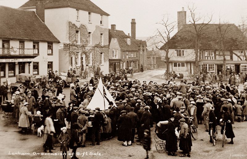
Lenham is a village in the heart of the North Downs in mid-Kent. Its market square is one of the most complete medieval squares surviving in the county. A gift sale held in the village was a local fundraising event typical of Edwardian community life, often organized to support churches, schools, or charitable causes. These events brought together the whole village and were a central part of rural social life.
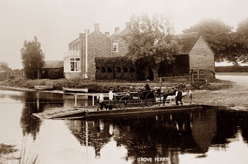
Grove Ferry was a crossing point on the River Stour in east Kent, between Canterbury and the coast. Before bridges were built, ferry crossings like this one were essential links in the local road network. The ferry at Grove carried passengers and goods across the river and was a popular spot for river excursions by the early twentieth century. The River Stour flows through some of the most distinctive flat, reed-lined landscape in the county.
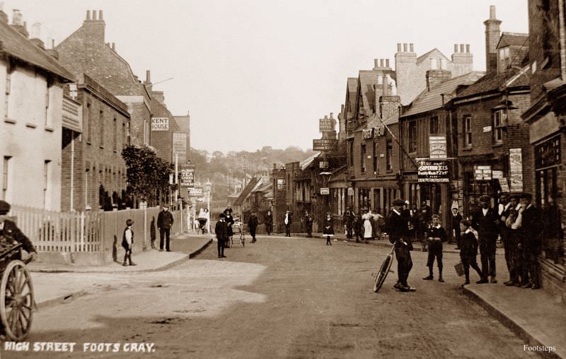
Foots Cray was a village in northwest Kent, close to Sidcup, that sat along the River Cray. Its high street in the early 1900s retained the look of a small English village, with local shops and modest buildings lining the road. The Cray Valley as a whole was home to several small communities that maintained distinct identities despite their proximity to London.
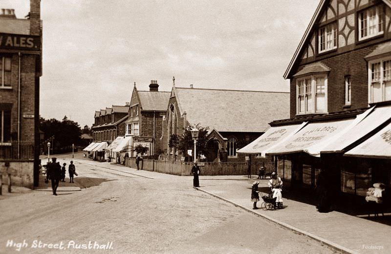
Rusthall is a village on the western edge of Royal Tunbridge Wells, one of Kent’s most fashionable towns. Its high street served the local residential community and connected the village to the wider town. Rusthall is also known for Toad Rock, a distinctive sandstone outcrop on the common nearby. The high street photographs from this era show a community that was quiet but connected to the prosperity of Tunbridge Wells.





My home is in Bromley, so Green St Green, Foots Cray, and other nearby locations are very close to me. I must go back and see if I can replace the old photos with the more modern ones.
I’ve been to probably most of those sites many years ago, not much is recognisable now
Wow, I live near Bromley, so there, Green St Green, Foots Cray etc are all very local to me, I shall have to re visit these locations to see if I can fit the photos to the modern sites.
These are great, thanks for posting. Particularly like the Ramsgate Sands photo, the Royal Pavillion looks the same now, apart from the Wetherspoon’s signage!
amazing . these were great
I think there are only 3 places i haven’t been to, I grew up in Orpington, born 1965, so just about when the switch to the LBB started, but these pictures are brilliant.
I know living back then wasn’t easy, but photos like these bring me such a sense of peace.