
In December 1935, Houston was hit by one of the most destructive floods in its history. Heavy rains had already soaked the Hill Country and much of North Texas throughout the year, saturating the ground and swelling waterways. When a major storm dropped five inches of rain on downtown Houston on December 7, the city’s bayous had nowhere left to drain. North of the city, rainfall totals were even higher, sending a massive surge of water downstream toward the urban core. What followed was four days of flooding that left the city nearly unrecognizable.
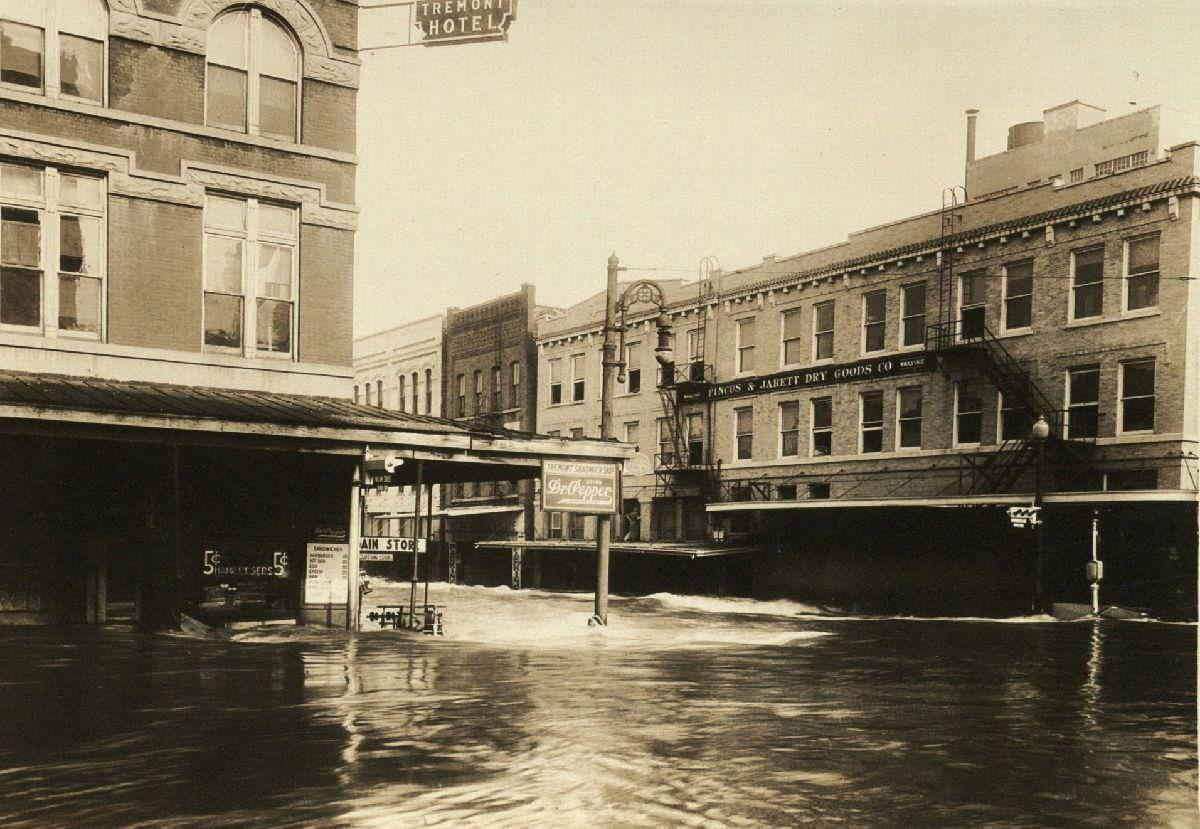
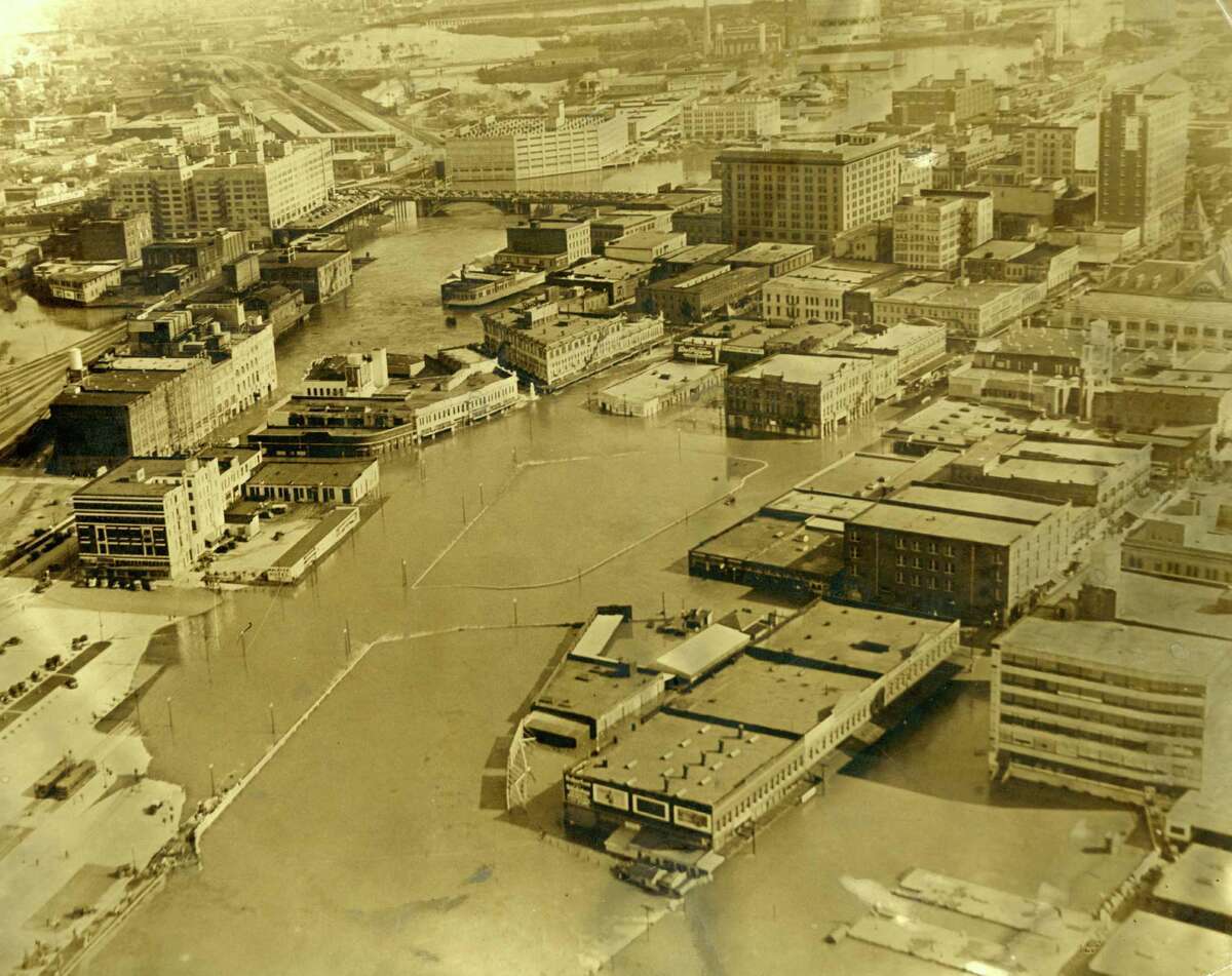
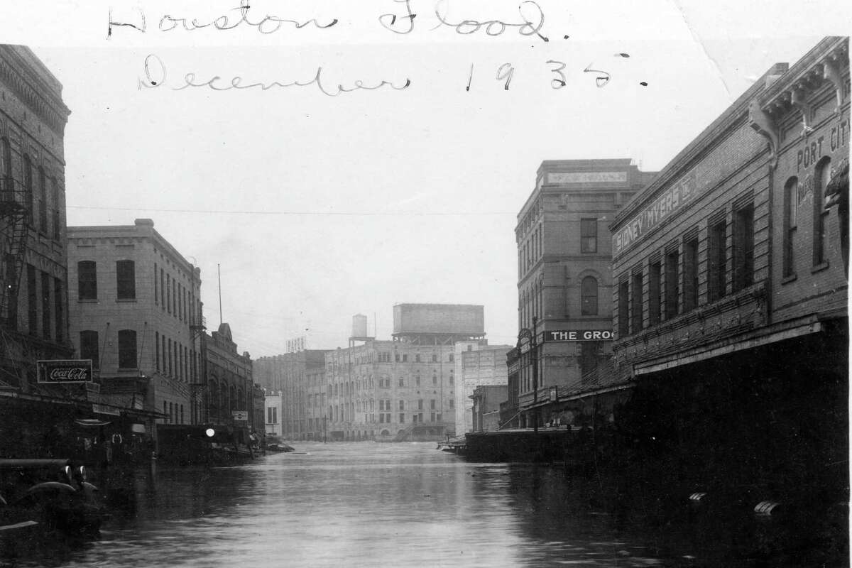
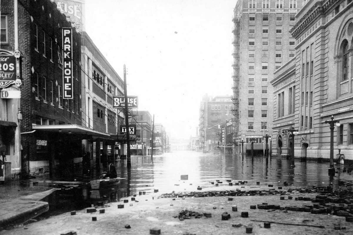
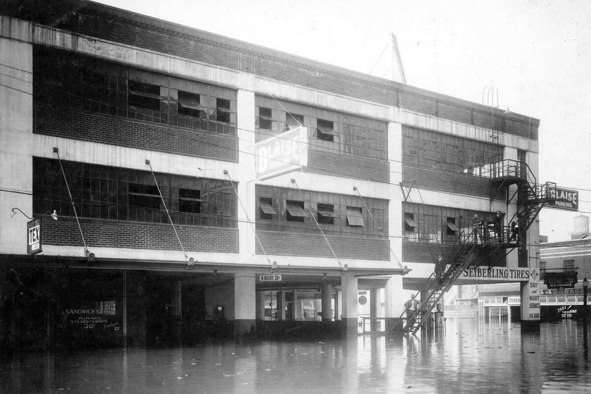
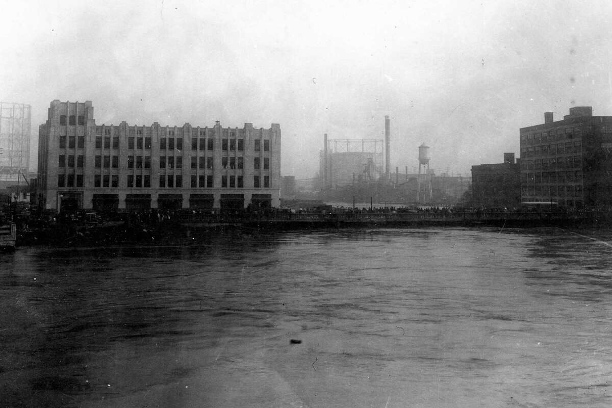
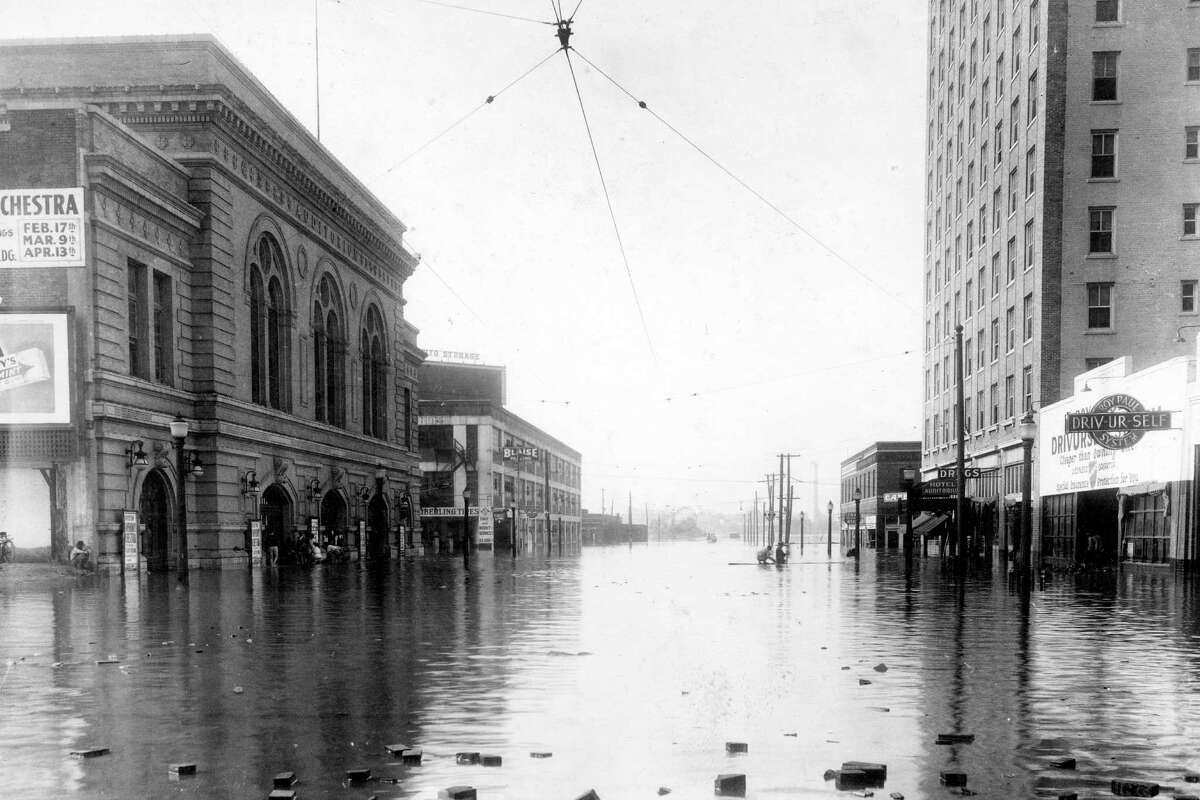
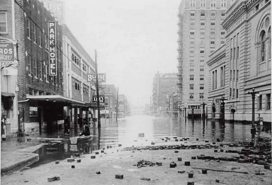
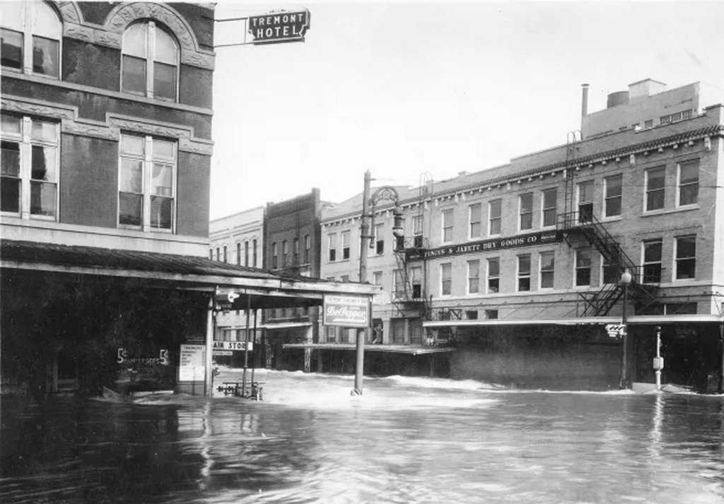
Buffalo Bayou bore the brunt of the disaster. As runoff poured in from the north, the water backed up behind the Magnolia Bridge — a narrow structure originally built by the Magnolia Brewery in 1912. The bridge’s design constricted the flow of water, acting like a dam and forcing floodwaters to spill over into the surrounding streets. On Milam Street, water reached eight feet deep. The Capitol Avenue Bridge, normally sitting forty feet above the waterline, was completely submerged. Downtown Houston, a dense grid of commercial buildings and infrastructure, was turned into a series of flooded channels.
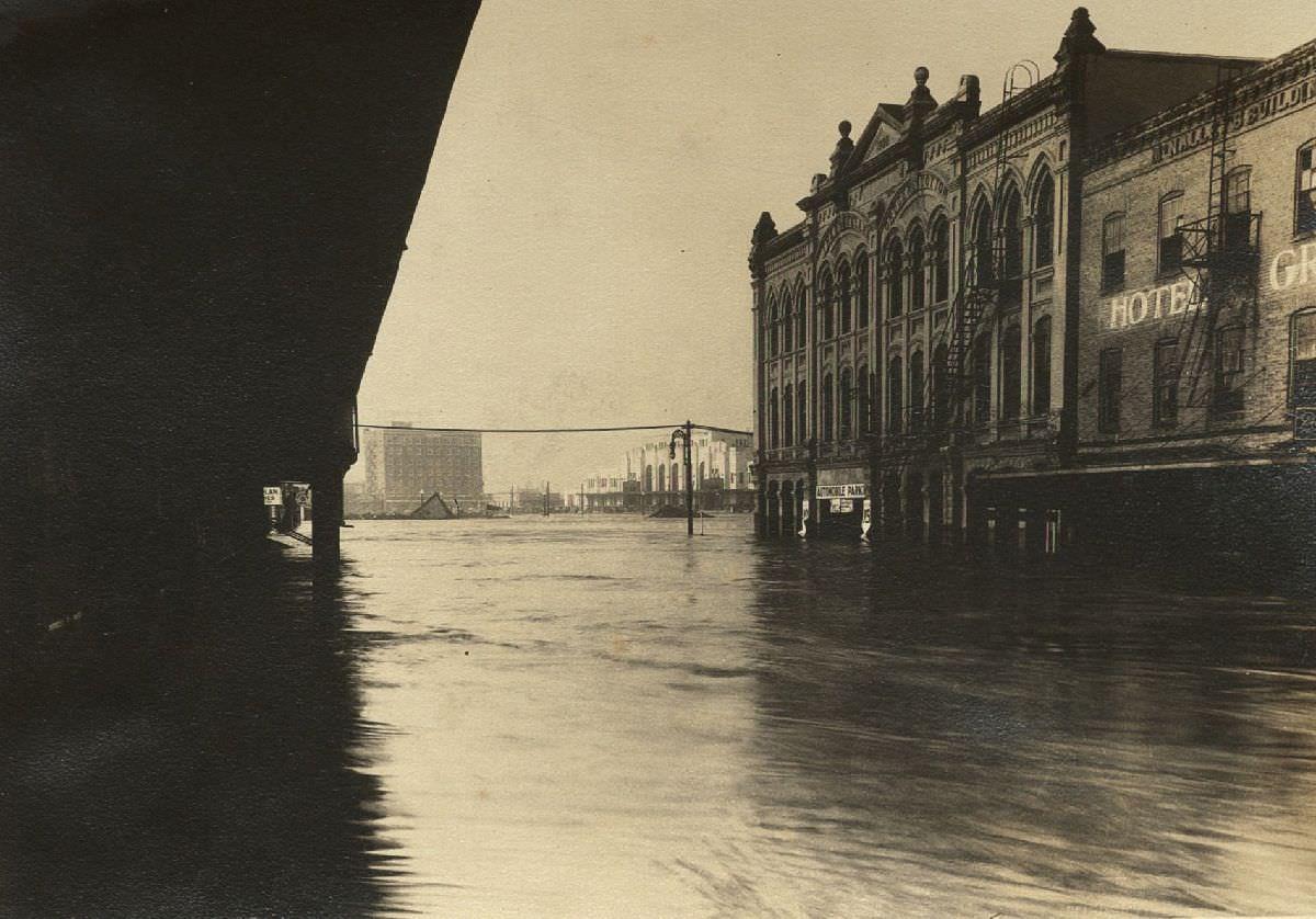
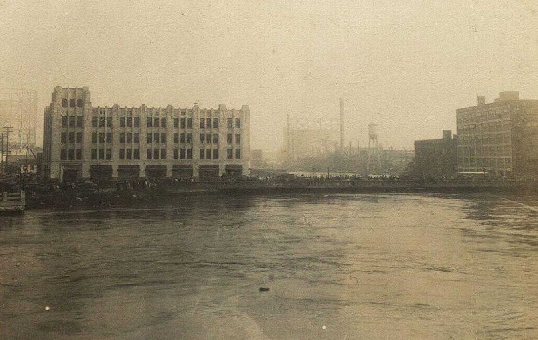
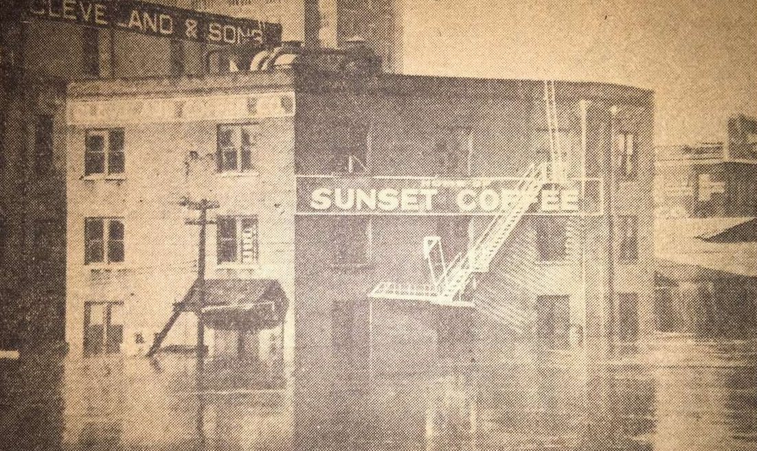
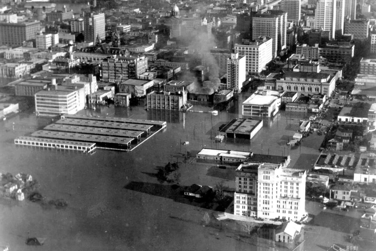
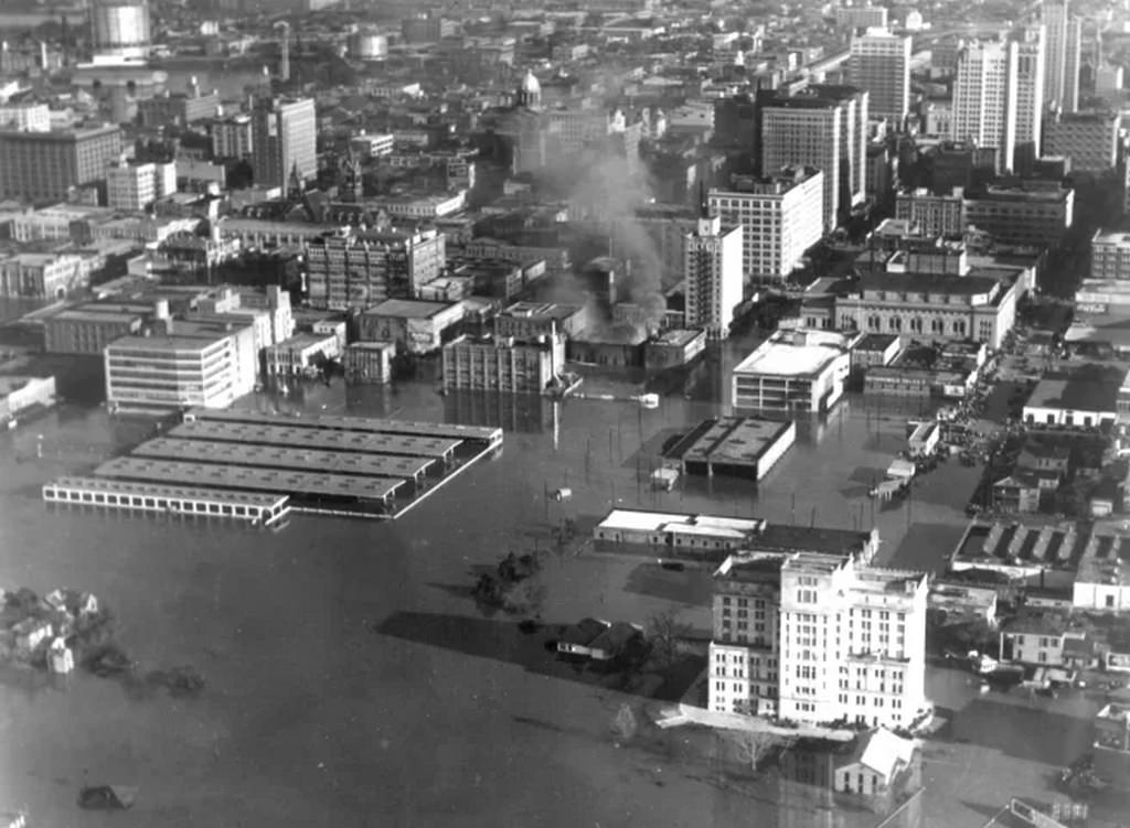
Twenty-five blocks of Houston’s business district and 100 blocks of residential areas went under water. Between twenty and forty percent of downtown buildings sustained severe structural damage. Some structures were completely washed away. The city post office, the farmers’ market, the Magnolia Brewery, the MK&T railroad facilities, and the city’s own archives were all destroyed. The Sears-Roebuck store on Buffalo Drive and Lincoln Street saw floodwaters rise to its second story. Buildings that had stood for decades were either condemned or left structurally compromised.
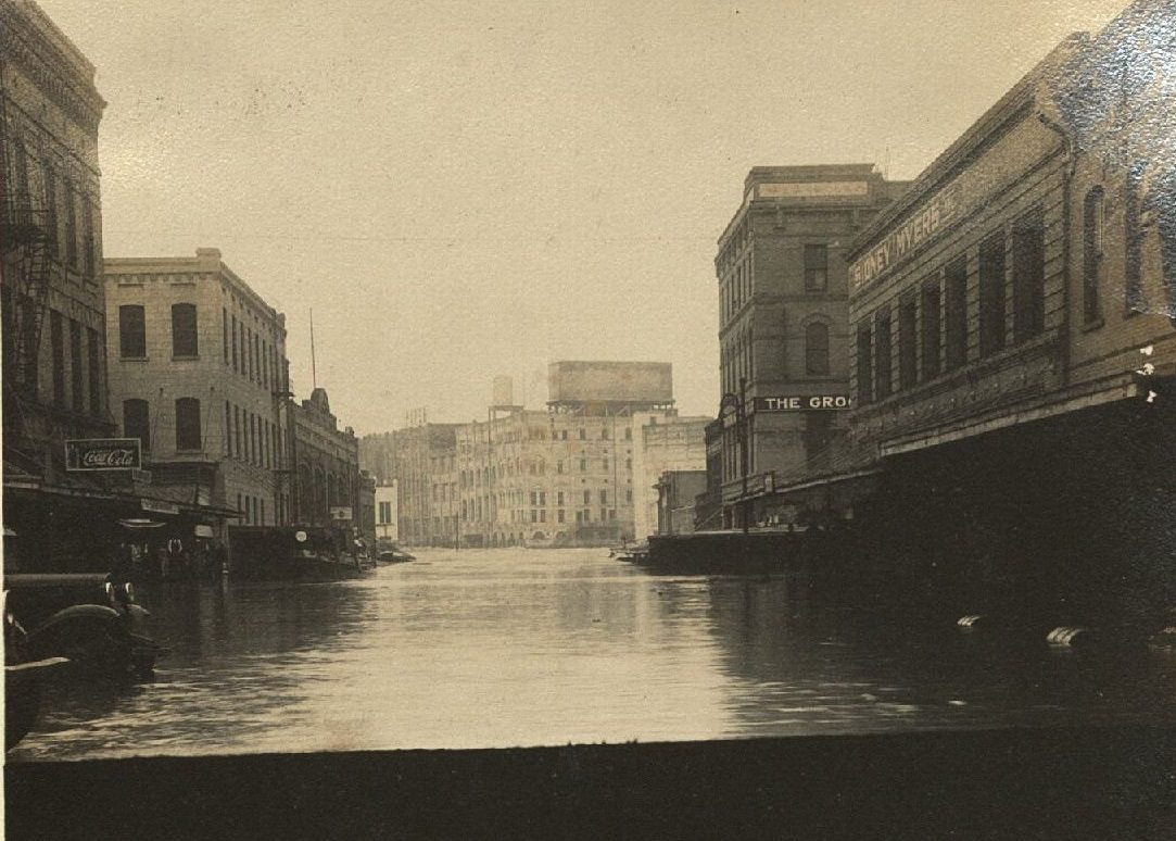
The flooding knocked out every fire-water pumping station in the area. With the central water plant inundated and its wells submerged, the city had almost no functional water supply for days. The risk of contamination made even the remaining water unsafe. This created a dangerous situation when fires broke out across the flooded city — firefighters had no reliable water source to draw from.
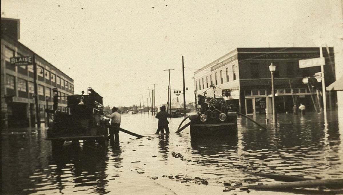
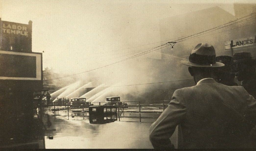
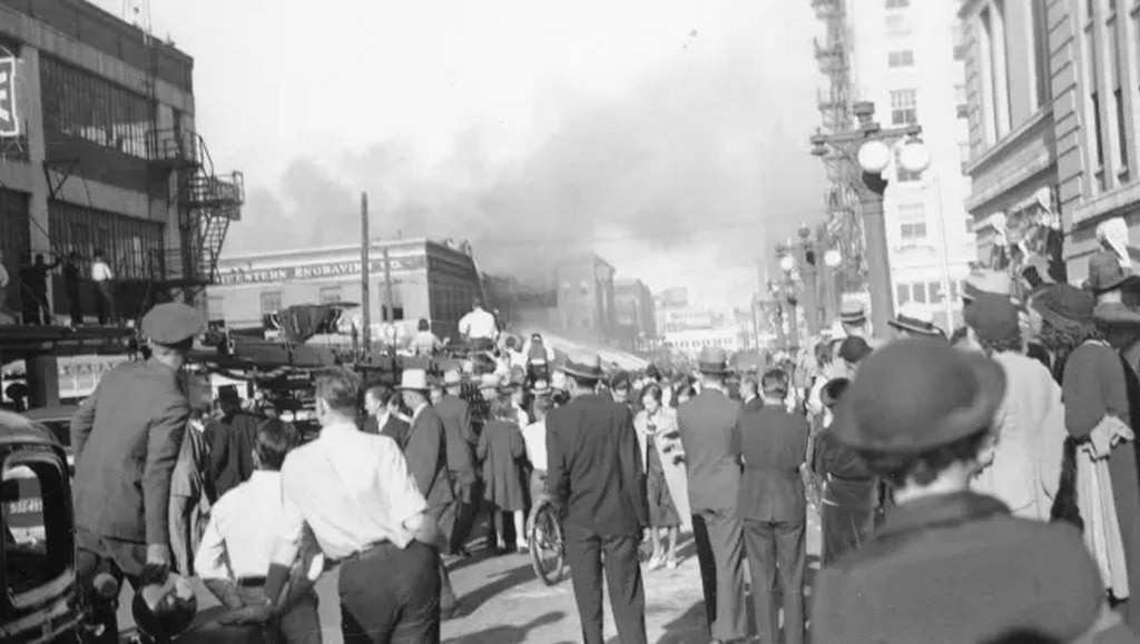
The fire at the Yellow Cab Company on Louisiana Street became one of the flood’s most dramatic episodes. With the water mains useless, the Houston Fire Department drove pumper trucks directly into the floodwaters and used them to suck up muddy street water to fight the blaze. The department lost eight trucks in the process. An estimated 20,000 Houstonians gathered to watch firefighters battle the fire under these extreme conditions, with four trucks flooding out as crews worked to draught water directly from the streets.
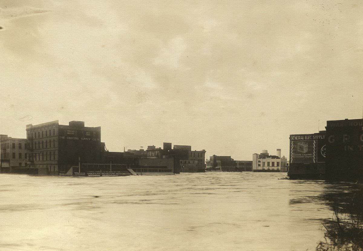
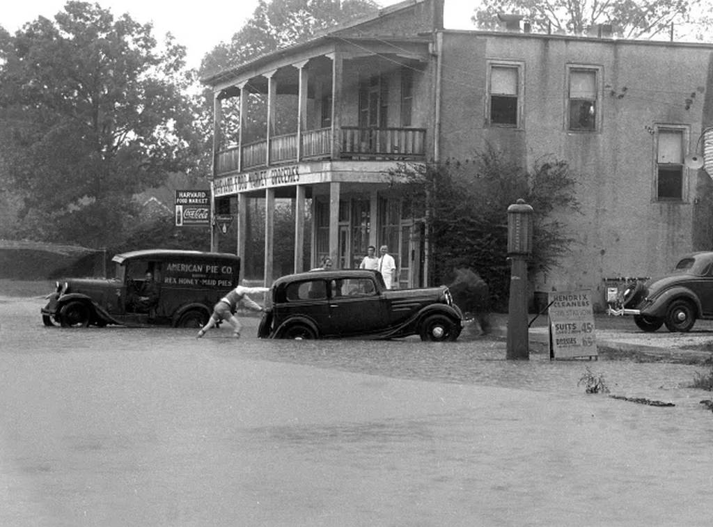
Houston’s bayous rose 52 feet above their normal levels during the storm, which lasted from December 6 through December 9. Before the waters began to recede, the flooding had pushed well beyond downtown and reached the Heights neighborhood. Harvard Street was swamped, and the Harvard Food Market at the corner of 9th Street became a temporary island surrounded by water. Two-thirds of rural Harris County was left underwater as well, making this a regional disaster far beyond the downtown corridor.
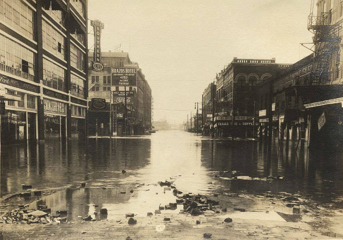
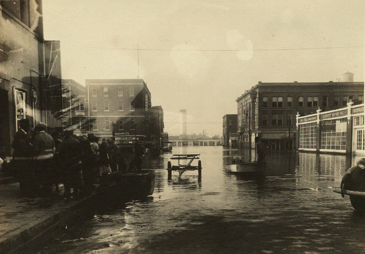
The flood did not just damage buildings — it disrupted nearly every system the city depended on. Submerged docks, thick layers of sediment, and scattered wreckage clogged the Houston Ship Channel. Uprooted railroad tracks crippled the Port of Houston for months. Railcars sat submerged in flooded rail yards. Crates of food and clothing that had been stored in warehouses washed out and ended up in the bayou, where residents pulled them out of the water. At the Rice Hotel, people fished from the mezzanine level as the waters filled the lower floors.
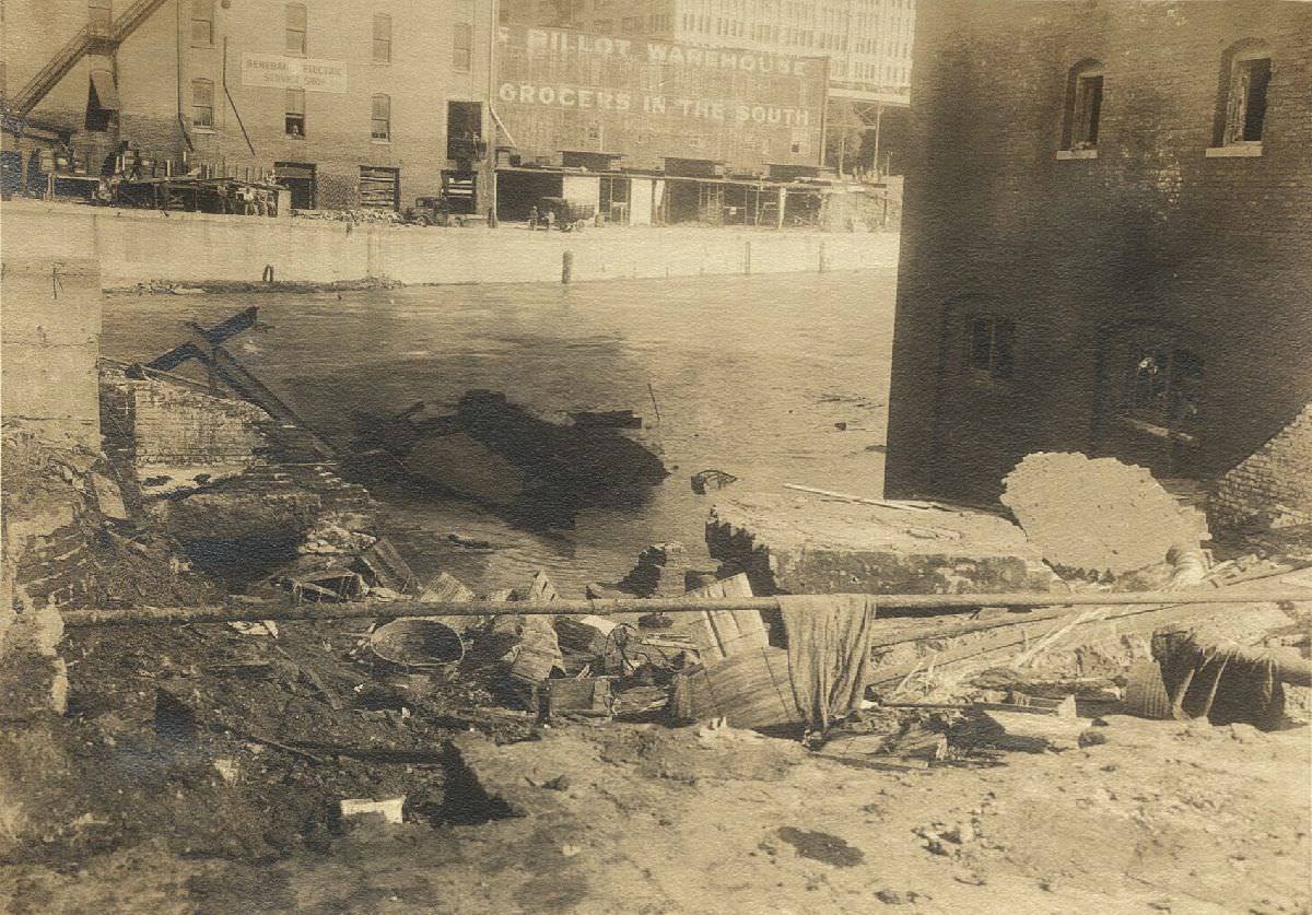
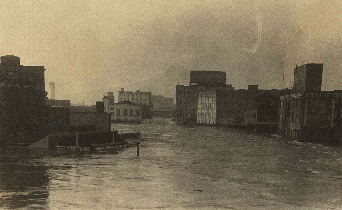
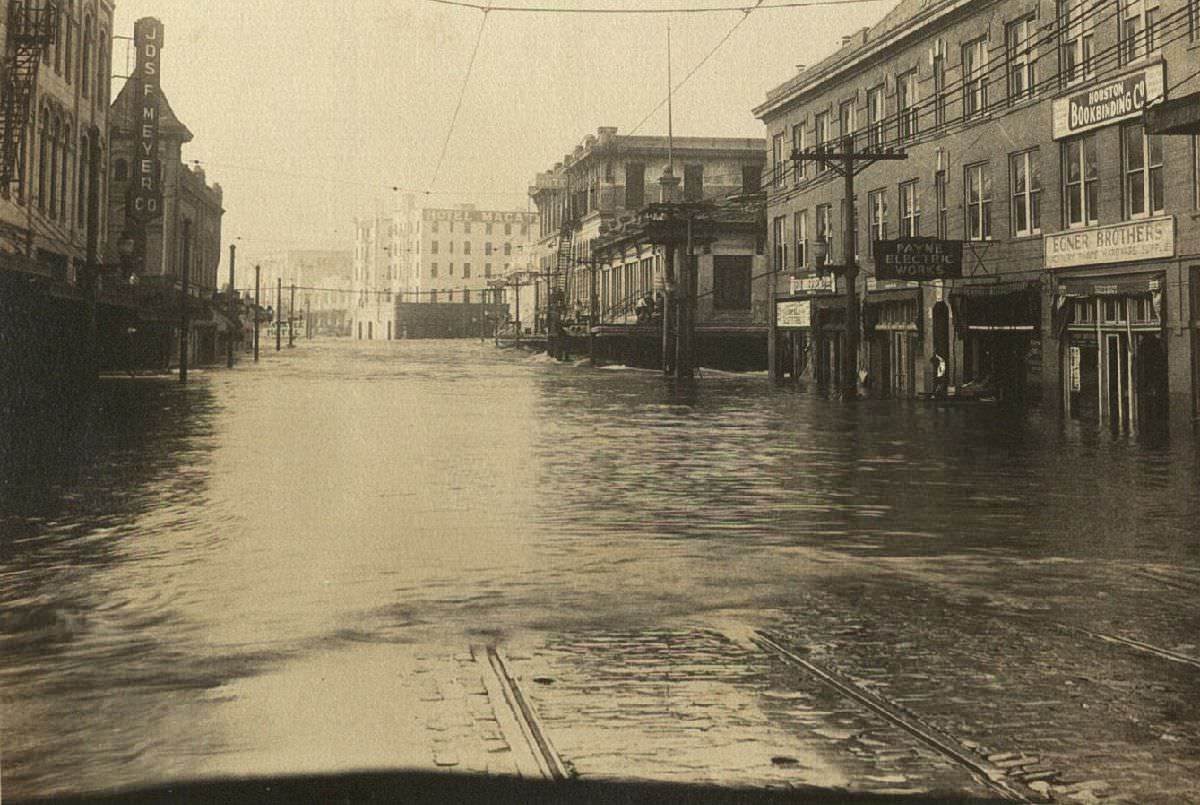
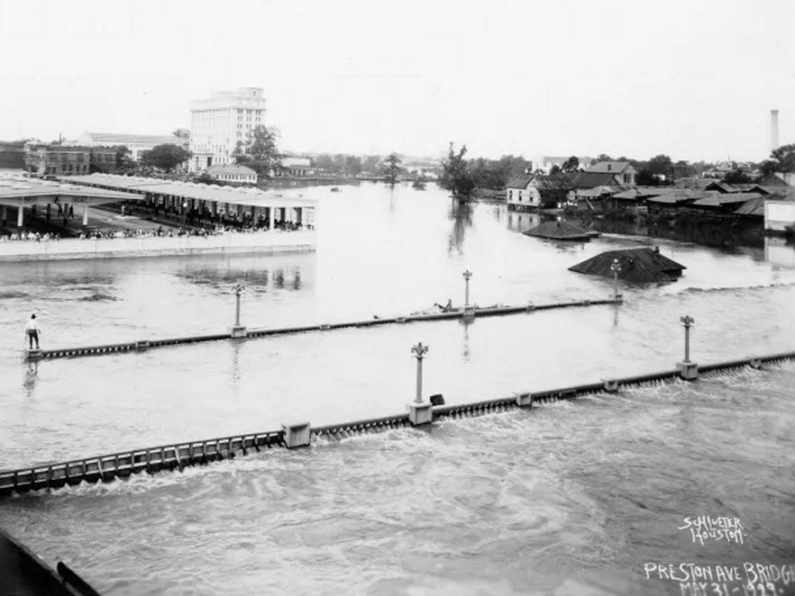
The financial damage was staggering. Houston had only recently been recovering from a serious flood in 1929 that caused nearly $1.4 million in property damage. The 1935 flood more than doubled that, resulting in over $2.5 million in losses. Seven people died. The flooding subsided by December 10, but the damage to the city’s infrastructure, commerce, and public systems took far longer to repair.
In the aftermath, investigators turned their attention to the Magnolia Bridge. A state-ordered investigation concluded that the bridge’s narrow base was the sole cause of the downtown flooding disaster. The bridge had been built by the Magnolia Brewery in 1912 and had never been designed to handle the volume of water that flowed through Buffalo Bayou during heavy rainfall. The commission condemned it in the harshest terms. It was not just an engineering failure — it had turned a severe flood into a catastrophic one.
The Texas Legislature responded with urgency. On April 23, 1937, lawmakers passed a bill unanimously establishing the Harris County Flood Control District. The district was given the authority and resources to build infrastructure designed to hold excess runoff during heavy rainfall events. Among the most significant projects that followed were the construction of the Addicks and Barker Dams, which were built to capture water before it could surge downstream into Buffalo Bayou and flood the city again.
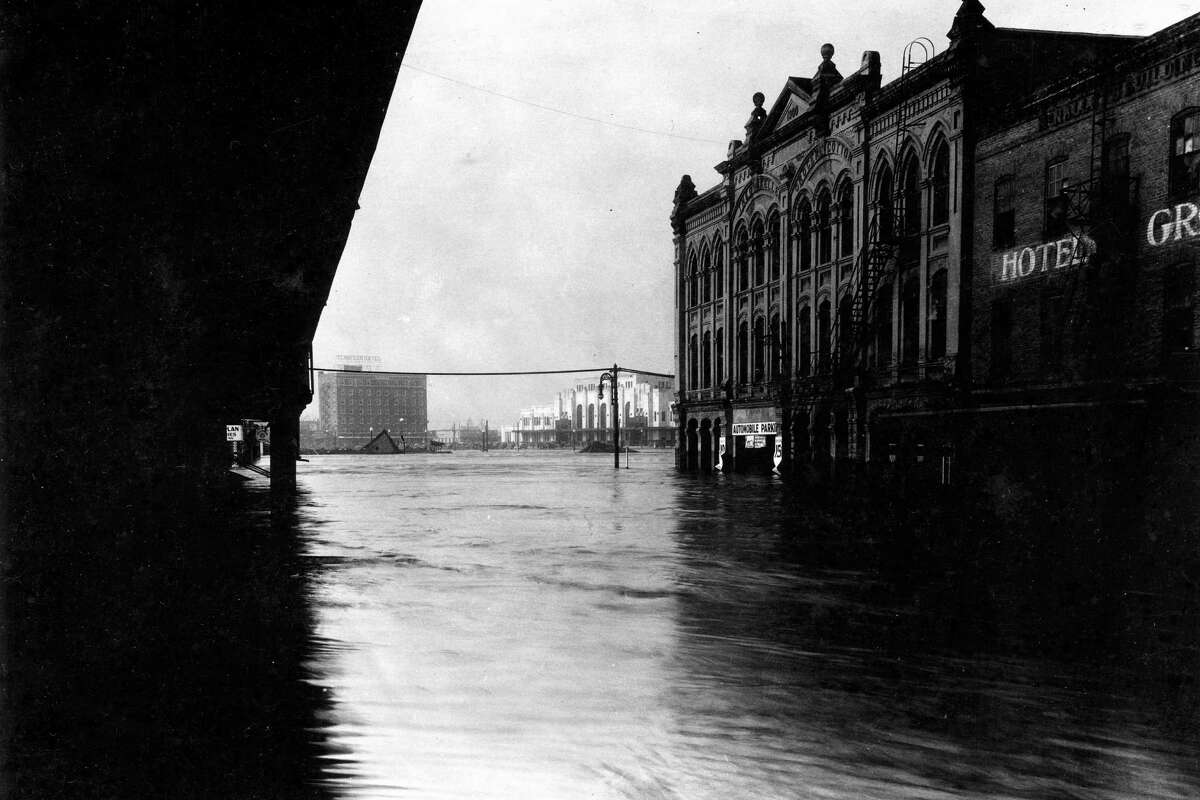
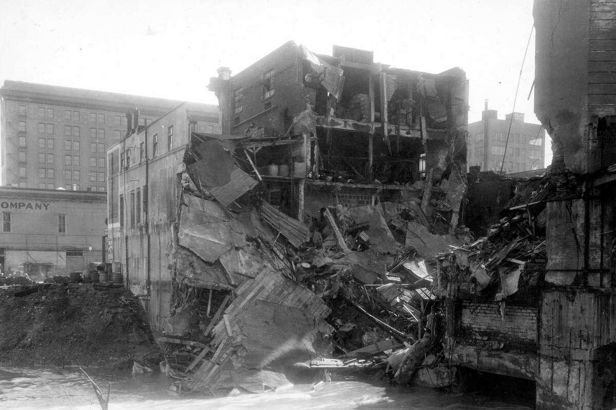
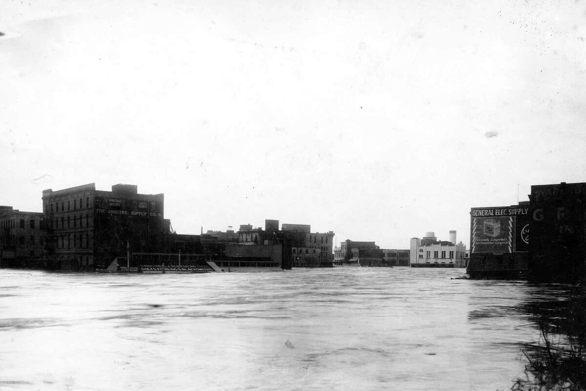
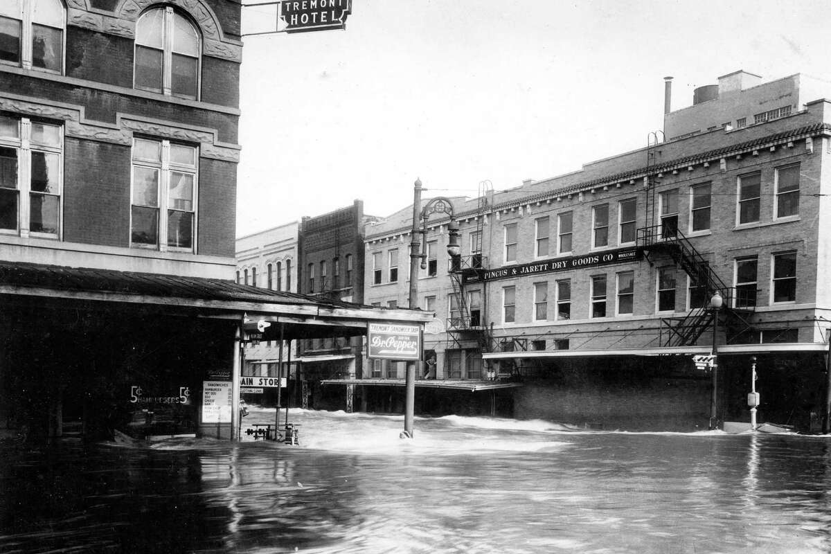
The rare photographs taken during and immediately after the flood show the sheer scale of what Houston endured. Streets that carried daily traffic became fast-moving waterways. Familiar intersections disappeared beneath murky brown water. The intersection of Milam and Congress, a central point in downtown, became a white-water rapid. Aerial views show block after block of submerged rooftops and the wreckage of a city brought to a standstill.





I had not seen these photos before, thanks for sharing.