

There are plenty of historic buildings and landmarks in Charleston, from mansions to cobblestone streets, that offer a glimpse into the town’s history. It was founded in 1670 as Charles Town on the west bank of the Ashley River and moved to its current location in 1680. With eight different architectural styles, it is the oldest city in South Carolina. It is an excellent example of South Carolina’s progression through time: Colonial, Georgian, Federal, Classical Revival, Gothic Revival, Italianate, Victorian, and Art Deco.
From the 1600s to the mid-1700s, the colonial-style was a popular form of architecture in Charleston. It features a low foundation with two to three levels, multi-pane windows, symmetrical facades, pillars, and columns. Colonial architecture gave Georgian architecture: square and symmetrical facades with five windows across the front, chimneys, and a centered front door with crown molding. Federal architecture began appearing in Charleston from the late 1700s to the 1830s following the Revolutionary War. This style was inspired by Britain and the temples of ancient Rome, with many chimneys, staircases, balconies, shutters, narrow windows framing the front door, Palladian-style arched windows, and fanlights above the door.
When the United States was establishing itself as a nation, Classical Revival, also known as Neo-Classical, gained popularity. Charleston prospered and expanded before the Civil War, with several plantation owners building elaborate homes to display their wealth – Classic Revival, with its giant columns, high arches, and triangular roofs, represents ‘social prominence.’ Although The Fireproof Building, now the South Carolina Historical Society, is modestly ornamented, it remains one of Charleston’s most impressive Classical Revival structures. Neo-Gothic architectural styles such as the Gothic Revival, or Neo-Gothic, became popular after the century. Their decorative designs, ornamentation, pointed windows, and pinnacles, with a tower-like appearance, were patterned after medieval Gothic architecture.
Below are some stunning iconic historic buildings, homes, and architectures of Charleston that have been demolished.
#1 6 George Street, 1983
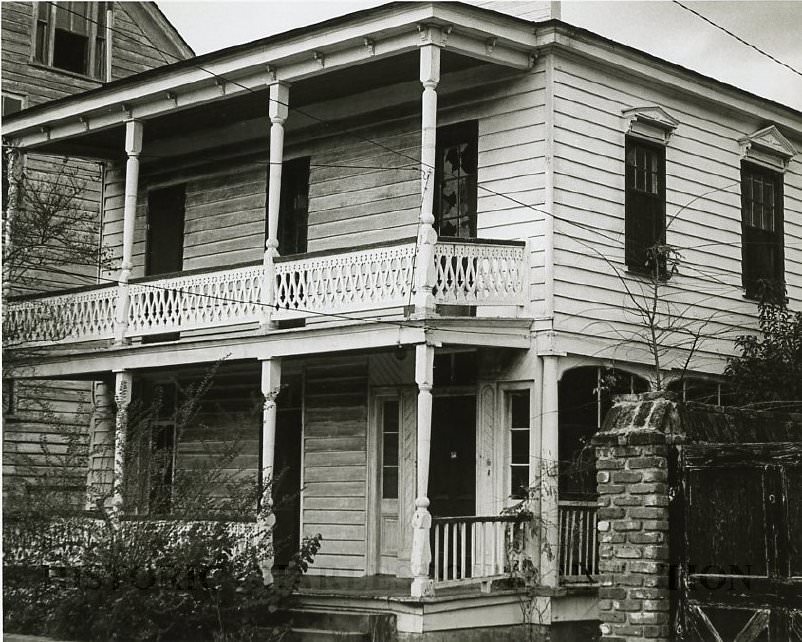
#2 102 Beaufain Street, 1964
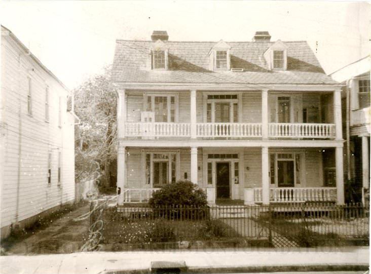
#3 110-116 Meeting Street, 1900
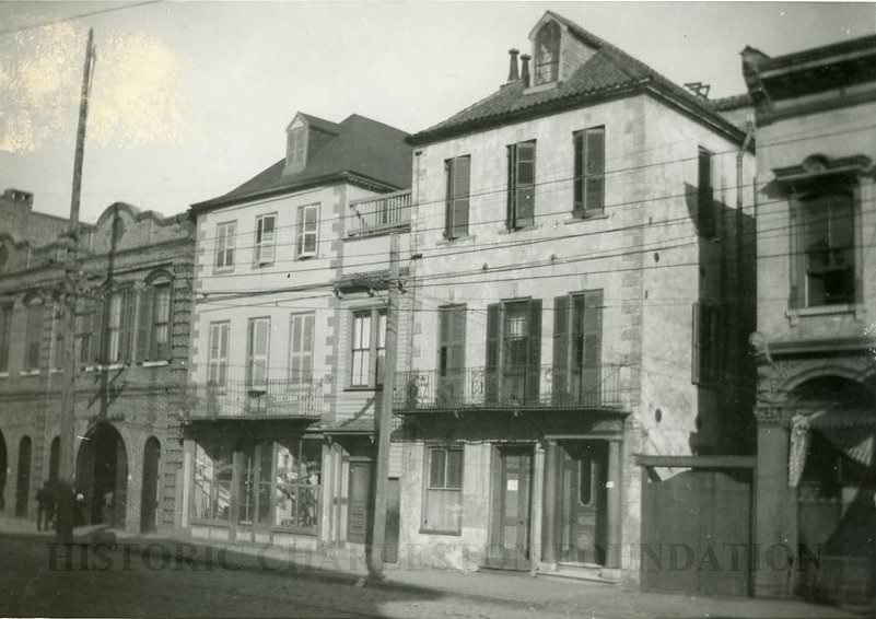
#4 129 Rutledge Avenue, 1970s
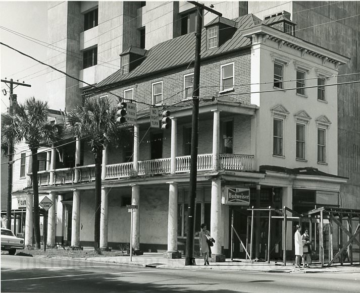
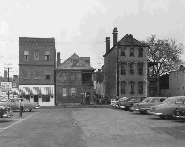
#5 36-40 Archdale Street, 1950s
#6 100 Broad Street, 1950
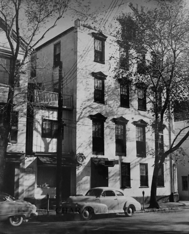
100 Broad Street, street (front) elevation. The building was demolished 1953 for the construction of the American Mutual Life Insurance building, which itself was later demolished for the construction of the Judicial Center. Courtesy of the Fairfield County Historical Museum.
#7 104 President Street, 1980s
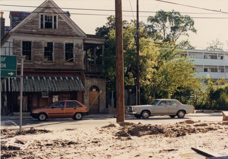
A house identified as being on the southeast corner of President and Cannon Streets. Address is likely 104 President. Street (front) elevation. Apartment building in the background. "Behold God's Army" spray-painted on front. House is for sale by Fitzhenry Realty. Note on back indicates that the house collapsed and is gone now.
There's no history on this building in HCF's Archives. What is known is that it was located on the southeast corner of President and Cannon Streets, served as rented rooms or apartments, and operated as a corner store for many years, including Cash Carry, Mike's Semi-Self Service, and Tom's Victory Fruit Store. A note written on the back of the photograph indicates that the building collapsed (no date indicated). However, in 1980, the owner requested a variance from the Board of Adjustment to renovate the house, and in 1991 the owner requested a variance to allow for the construction of 6 new dwellings on the site. Therefore, it's assumed that the fall of the building must have been sometime in the 1980s. (News & Courier and Evening Post advertisements and public notices accessed via the database "America's News-Historical and Current.")
#8 116 Rutledge Avenue, 1967
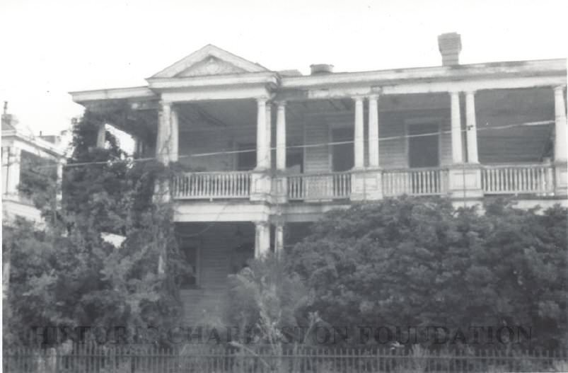
a: West (front) elevation, showing the piazzas. View of the house is partially obstructed by trees.
b: Corner view looking up at the piazzas on the upper story of the house (northwest corner). View of the lower story is obstructed by trees. Portion of an iron gate in foreground. The address appears in a list of "new buildings" in 1895 ("two-story wood dwelling") but not on the 1902 Sanborn Map. James R. Johnson, a coal merchant, lived there by 1908. The house was demolished in 1970.
#9 119-121 Meeting Street [now 177 Meeting, 1886
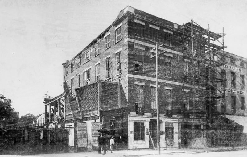
A four-story building identified as "East Storage" at what was 119 Meeting Street, taken sometime after the 1886 Earthquake. "A. Kennedy" painted over the entry what would have been 121 Meeting. Current address is 177-179 Meeting Street. A portion of the drug store to the north at what would have been 181 Meeting also in view at right; now lost.
#10 Twelve George Street, 1960s
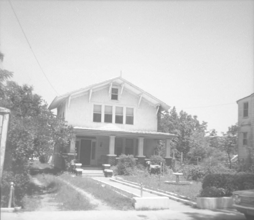
#11 131 Market Street (Boswick’s Auto Service), 1970s
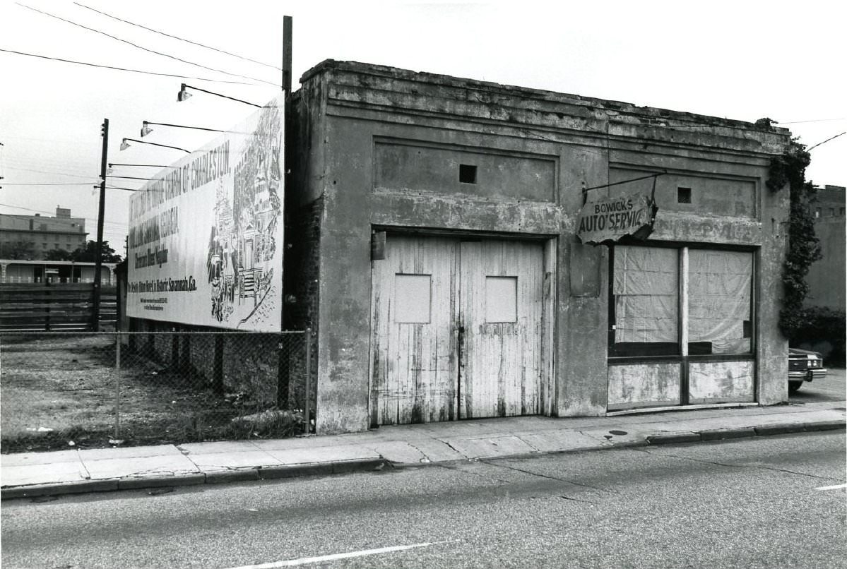
#12 135 Market Street (Jones Dry Cleaners), 1970s
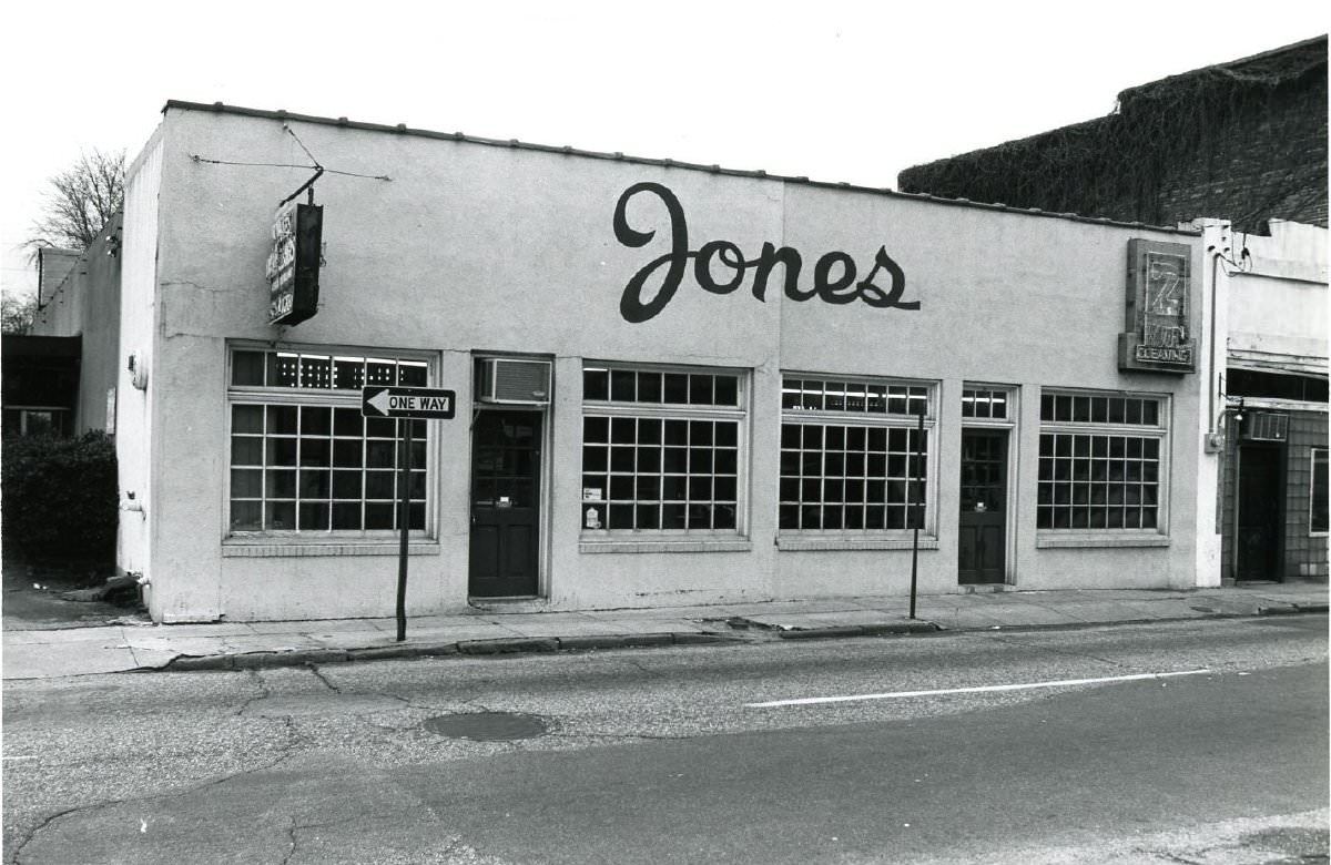
#13 143 East Bay Street and 145 East Bay Street, 1937
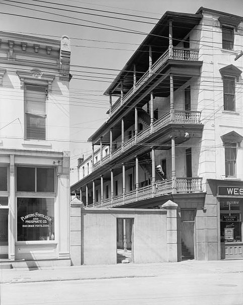
#14 150-156 Ashley Avenue, Before 1948
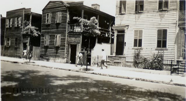
#15 164-166 East Bay Street, 1961
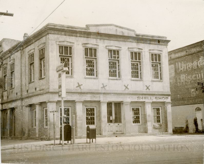
B&W photograph of 164-166 East Bay Street, front (west) elevation showing the northwest corner of the building and the corner of East Bay Street and Vendue Range, where the Vendue Range currently stands. "The Shell Shop" is painted on the builting at 164 East Bay. Street sign for the East Bay/Queen Street corner across the street is at the far right.
#16 157 Rutledge Avenue.ca. 1915
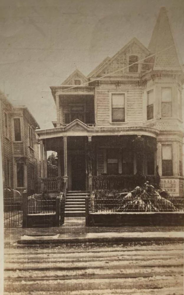
#17 176 Tradd Street, 1915
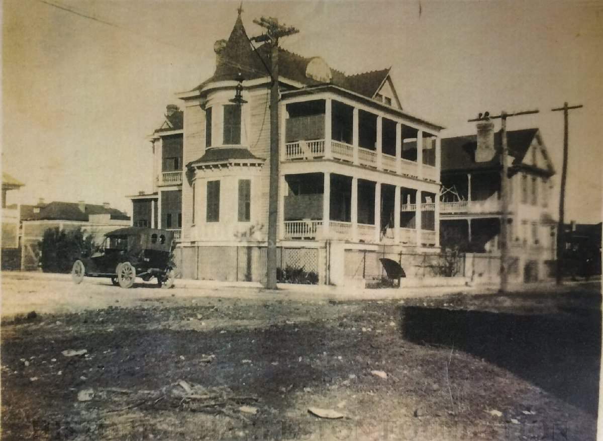
Photograph (scan) of 176 Tradd Street in 1915. Oblique of the original house on the property, showing the south (front) and west elevations. Also shows 174 Tradd, the street corner (Tradd and Colonial Streets), and a car parked on Colonial Street. The house was demolished in the early 1970s and replaced by a townhouse.
#18 199 Meeting Street and View West Across Parking Lot Bounded by Meeting, Market, and King Street,1970s
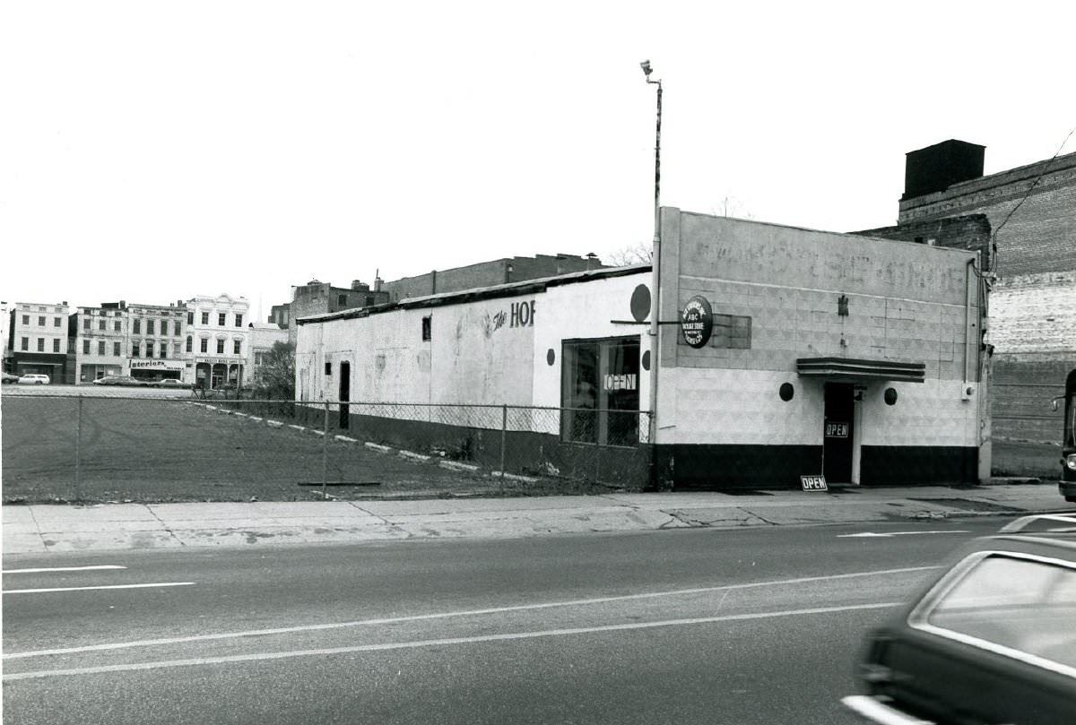
B&W photograph of 199 Meeting Street (Ace Liquors Inc, f/k/a The Horse Shoe bar) and the view west across what was a parking lot for Belk Department Store (232 King Street), now the site of Charleston Place (f/k/a Charleston Center). Shows buildings on the west side of King Street: 231 King, 233 King, 235 King, and 237 King. Two copies of photo in sleeve.
#19 20 George Street.1962
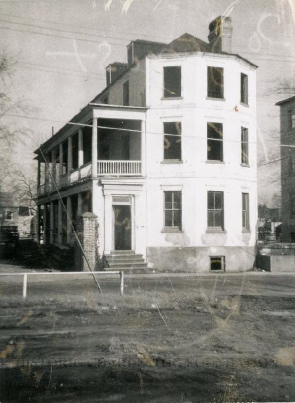
Two B&W photographs of 20 George Street before it was demolished in 1962:
a: South (front) elevation also showing the piazzas on the west elevation, taken from the lot across the street. Dated 1/26/1962. "Demolished Feb. 1962" written on back.
b: View of the west (piazzas) elevation also showing front of the house on the south elevation. Station wagon parked on street in front of house. "Gone" written on back.
#20 205 Meeting Street Before Demolition,1970s
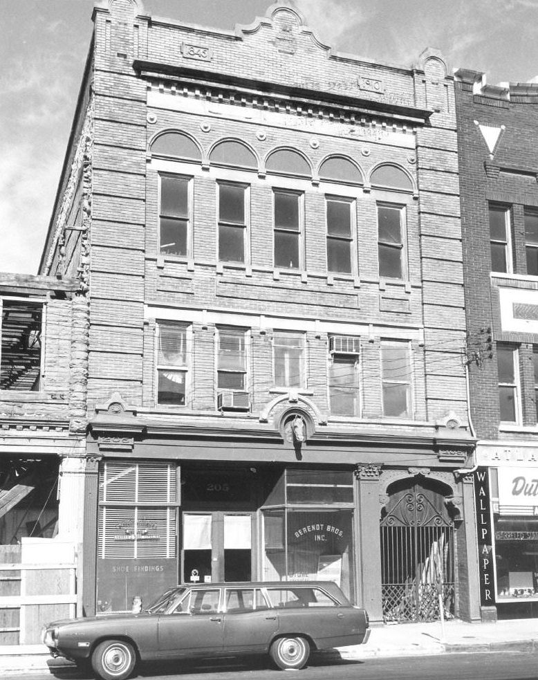
#21 207 Meeting Street,1970s
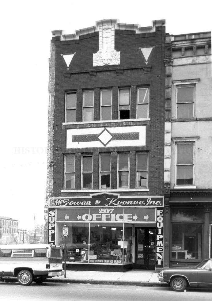
#22 207-211 Meeting Street, 1970s
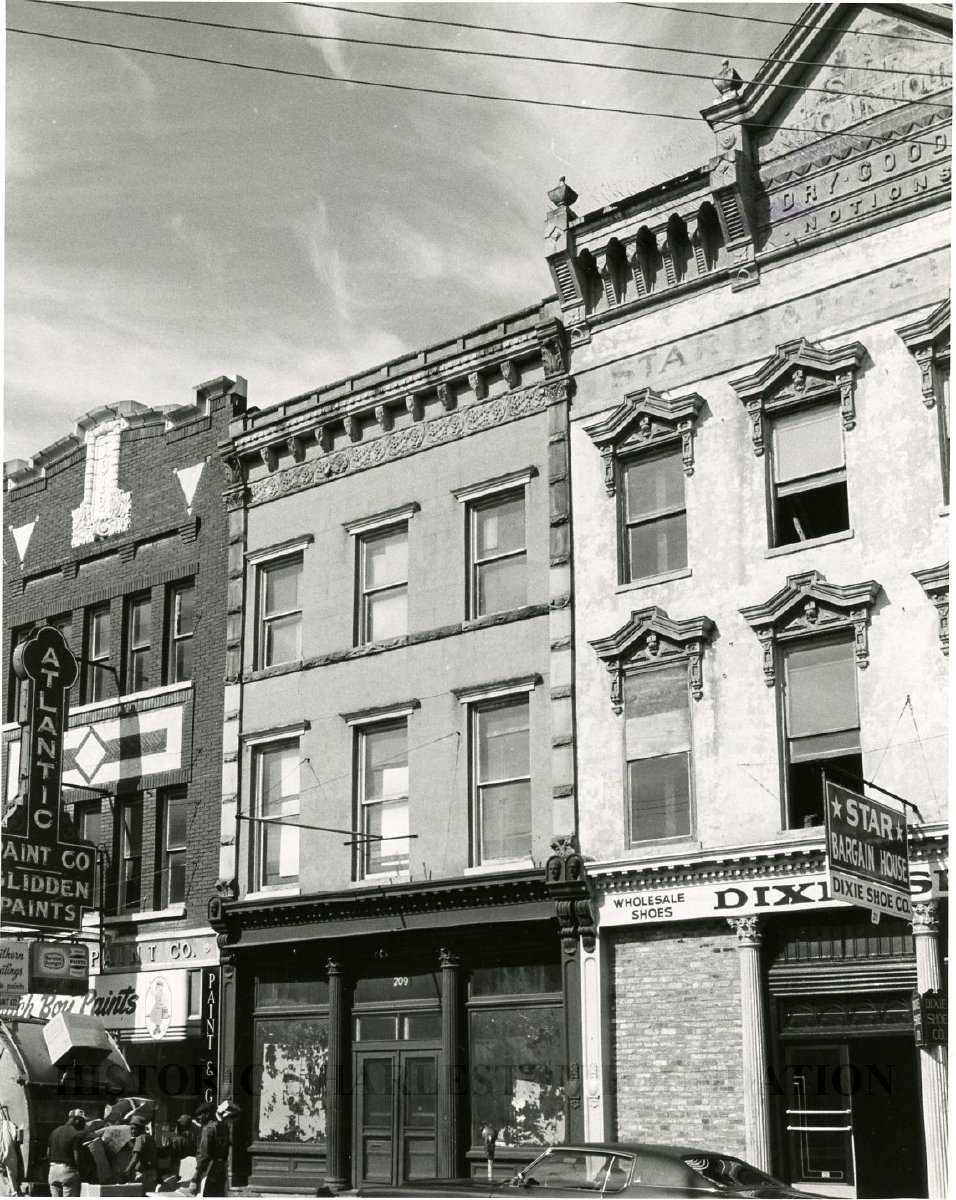
#23 240 Block of Meeting Street, 1970s
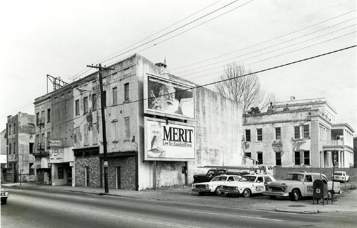
The east side of the 240 block of Meeting Street, from a parking lot at the corner of Meeting and Hasell Streets and showing 246 Meeting Street (Anderson Electric Co.). 248 Meeting, 250 Meeting, and 252 Meeting. Southwest elevations of 66 Hasell Street and 64 Hasell Street visible at right. 246-250 Meeting is currently a parking lot.
#24 244-248 Meeting Street Before and During Demolition, 1980
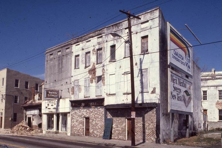
#25 246 King Street, 1961
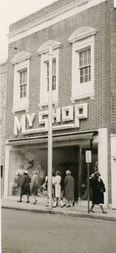
#26 First National Bank Building [139 East Bay Street], early 1950s
![First National Bank Building [139 East Bay Street], early 1950s](https://www.bygonely.com/wp-content/uploads/2021/11/Charleston_demolished_landmarks_25.jpg)
139 East Bay Street (First National Bank Building), front (east) elevation. For Rent signs posted on two of its columns. Several rows of wires are stretched across and in front of the building, perhaps in preparation for the demolition of the building. Car parked on street in front.
#27 1 Reid Street (John F. Riley House), 1958
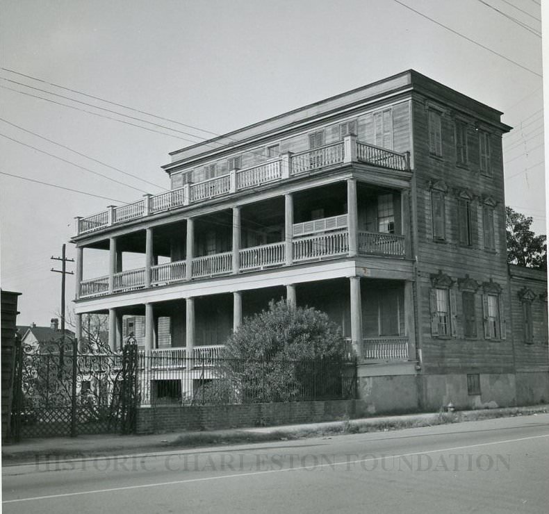
1 Reid Street (John F. Riley House), showing the south (piazzas) and east (East Bay Street) elevations. Captioned on back of photograph "Bay Street at Reid Street." Also known as 601 East Bay Street.
When the City Engineer's office discovered that the demolition permit was issued without full knowledge about the building's age or its location, demolition was halted in April, 1961. It is presumed that the demolition was completed sometime soon thereafter. The house was believed to be 147 years old at the time.
#28 1-11 Ashley Boulevard, 2016
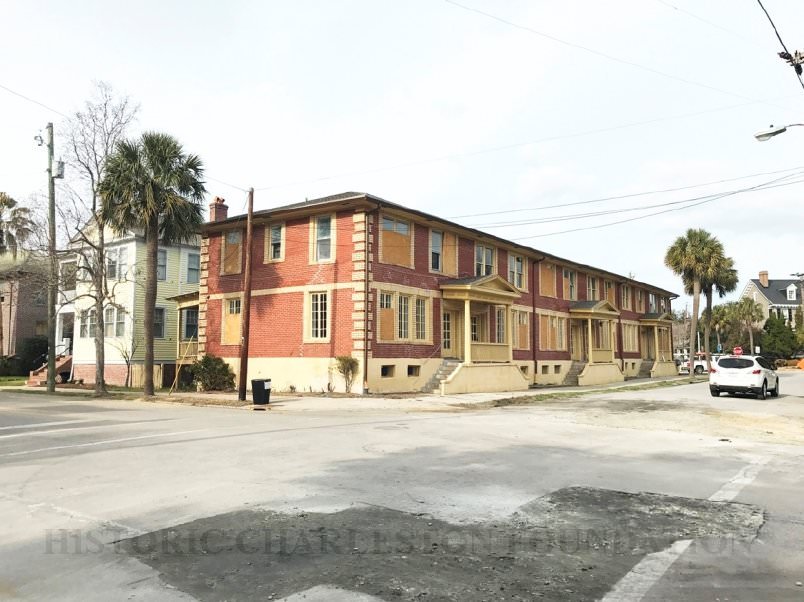
#29 1-11 Vendue Range / North Atlantic Wharf Building / Union Pier, 1924-1925
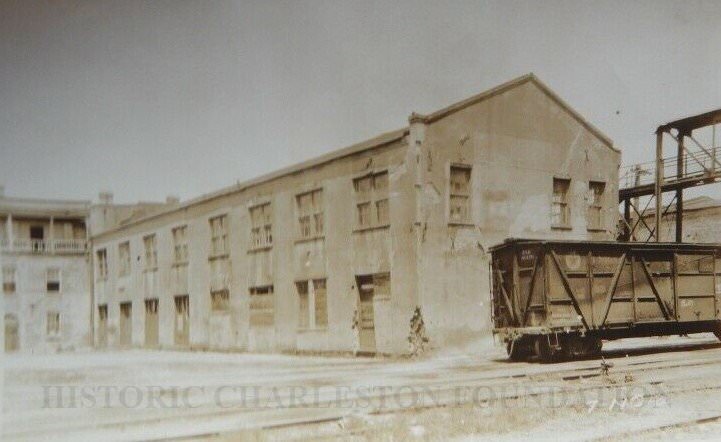
#30 647 East Bay Street: Destroyed December 1957
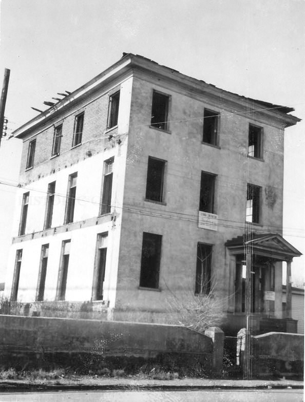
#31 51 Wentworth Street / 53 Wentworth Street, 1950s
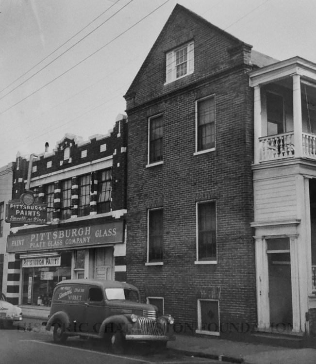
#32 55 Wentworth Street / 57 Wentworth Street, 1953
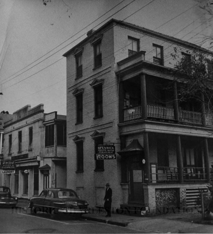
5 Wentworth Street (United Dry Cleaners) and 57 Wentworth Street (Fenwick Rooms), street (front) elevation. These buildings were demolished in 1953 for the construction of a restaurant.
Both buildings were built on lots that were originally part of Rhettsbury, that were sold by a descendant of Col. William Rhett in 1844. Soon after, "the two substantial and typical single houses were built in the classic revival style by Samuel Meeker and Leonard Weissinger.
#33 56 Beaufain Street, 1937
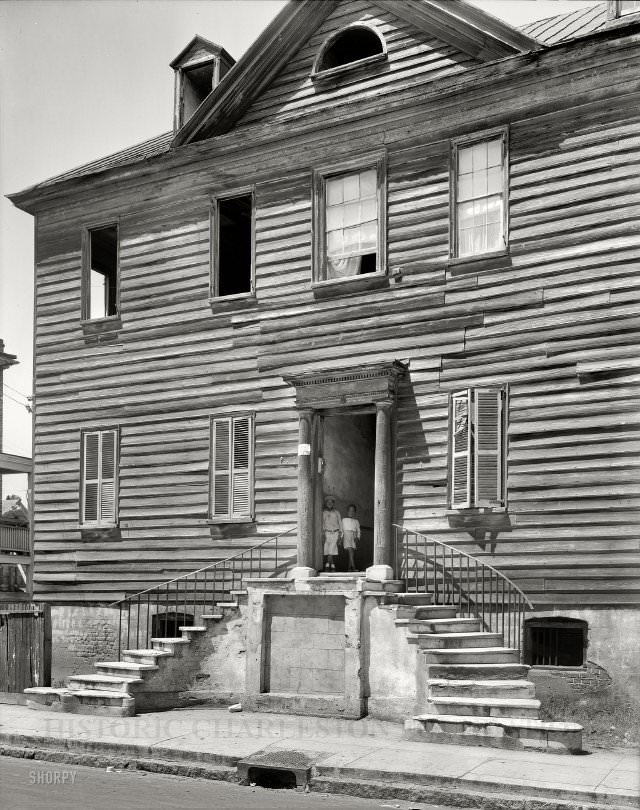
#34 414 King Street / 416 King Street, 1990s
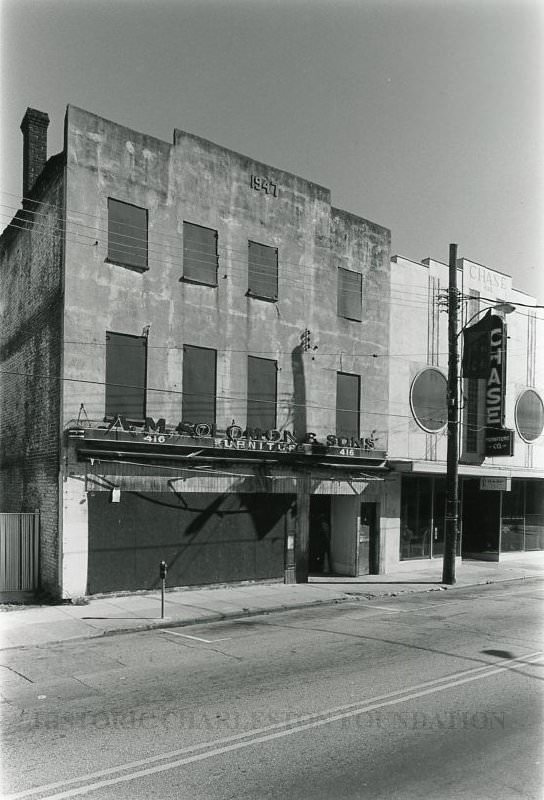
#35 418-422 Meeting Street, 1950s
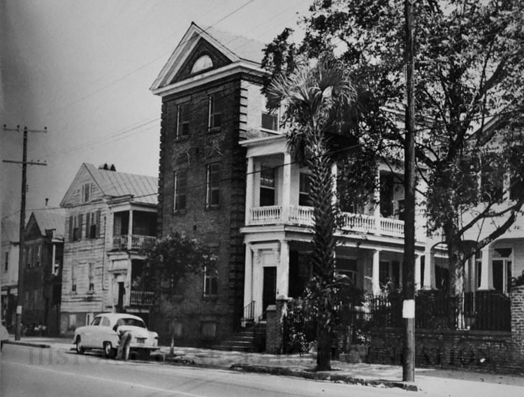
#36 424 King Street (B. Slotchiver & Son Furniture Co. and Gene’s Electric Service), 1950s
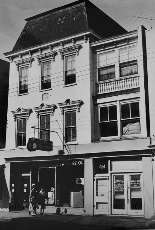
#37 39 and 41 Calhoun Street, Two of “The Three Sisters”, 1962
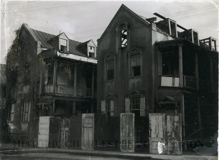
#38 4 George Street (James W. Brown House) / 91 Anson Street, 1960s
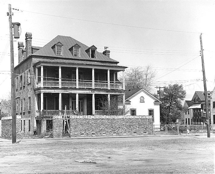
#39 339-341 East Bay Street, 1957
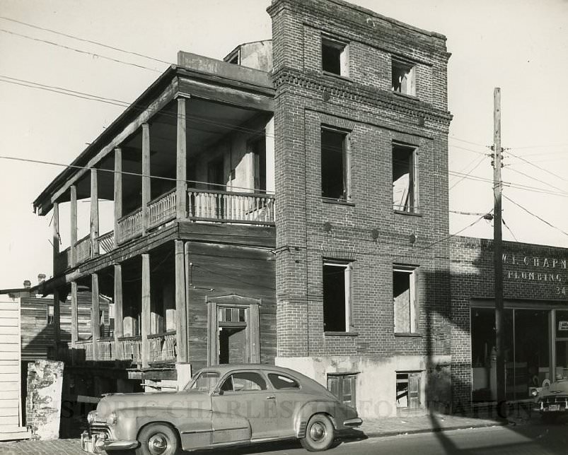
#40 324-326 East Bay Street, 1960s
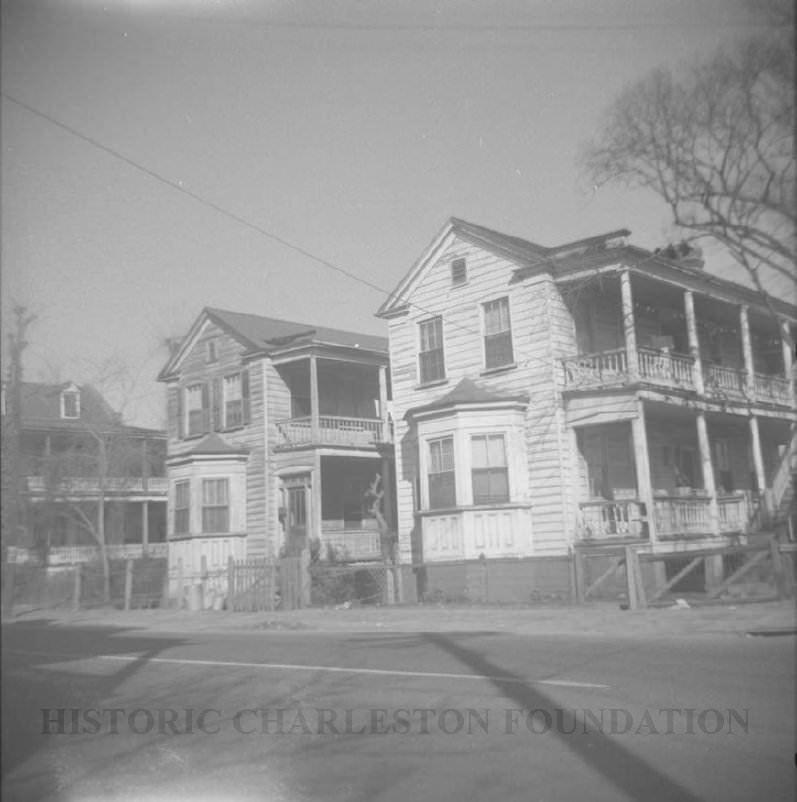
#41 325 East Bay Street, 1960s
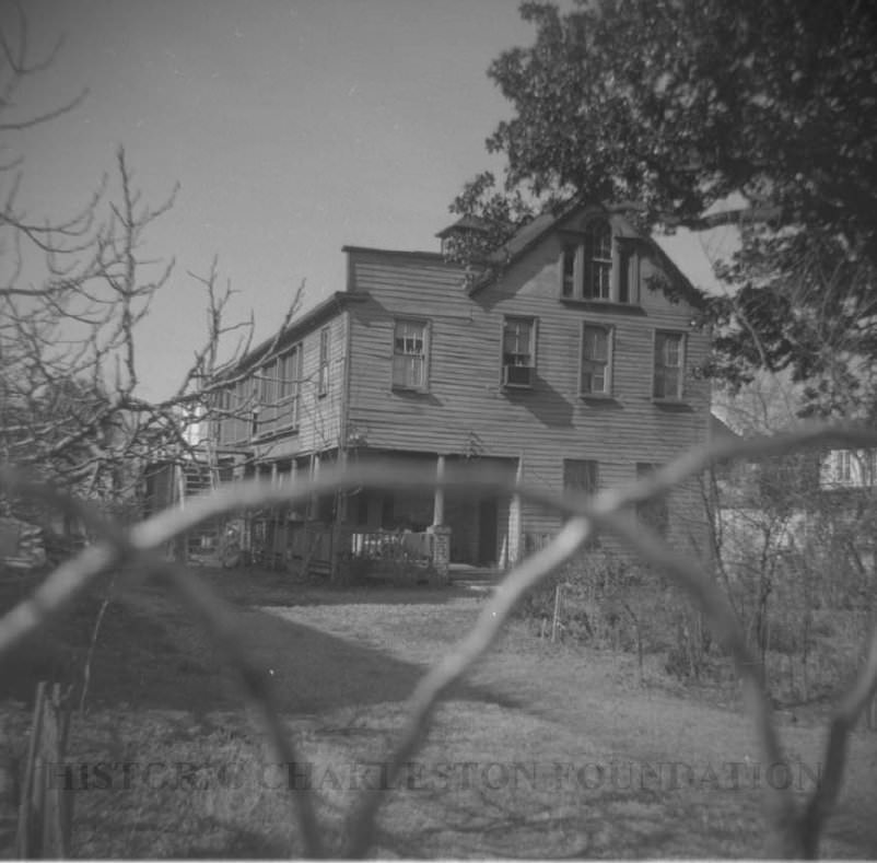
#42 28 Wall Street During Demolition, 1960s
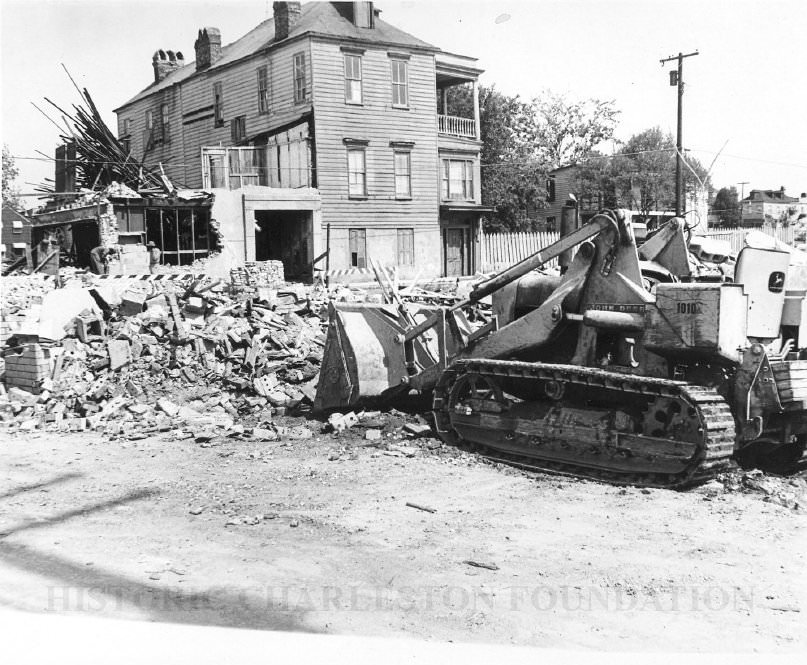
#43 281-285 Meeting Street, 1895
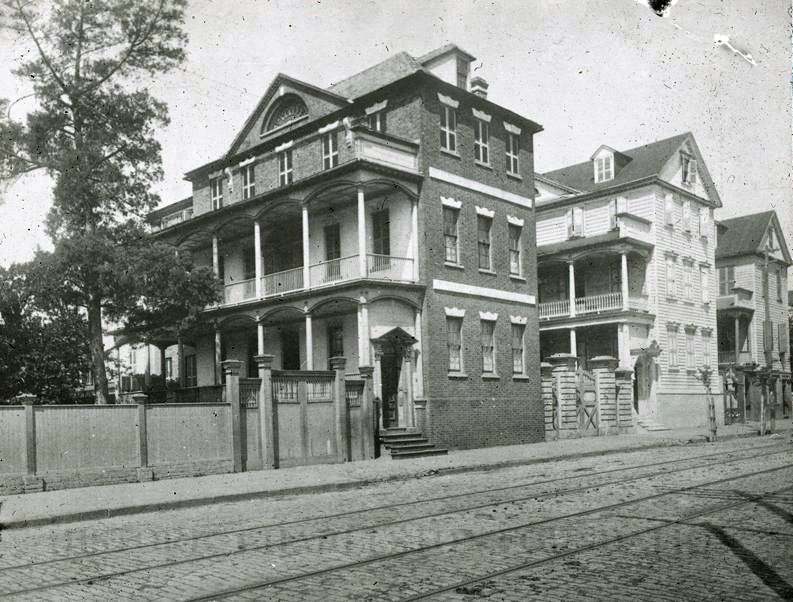
#44 292 Meeting Street, 1962
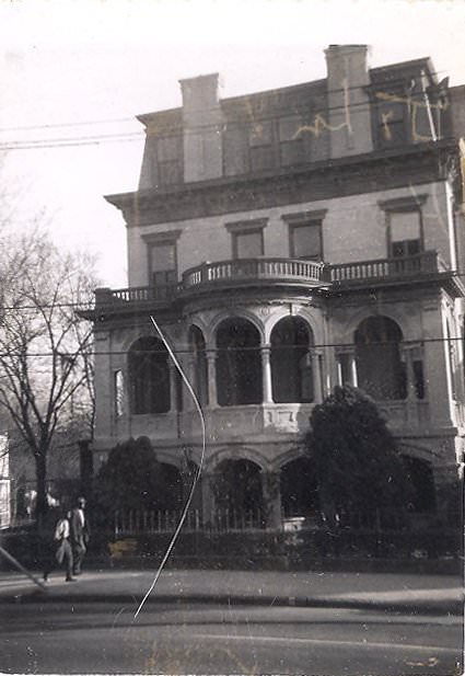
#45 68 Anson Street, 1960
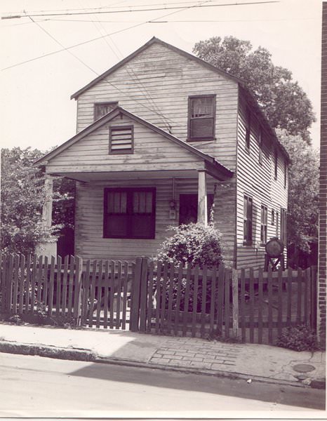
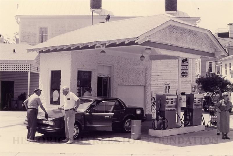
#46 71 King Street (Fort Sumter Filling Station), 1994
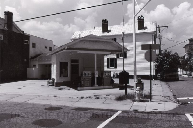
#47 71 King Street (Fort Sumter Filling Station), 1999
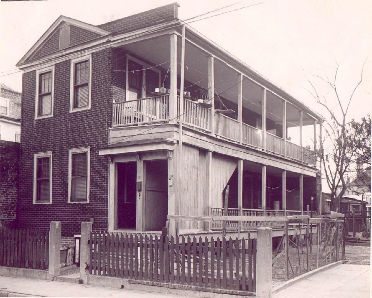
#48 82 Anson Street (Mary Smith House) Before Demolition, 1960
#49 85 Hasell Street, 1970s
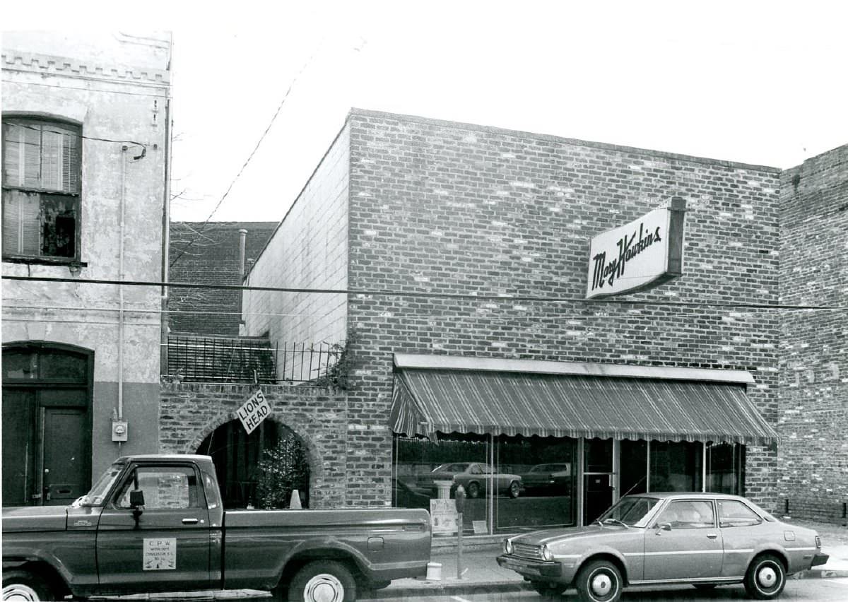
#50 87 Hasell Street Side (East) Elevation / 85 Hasell Street, Side (West) Elevation,1970s
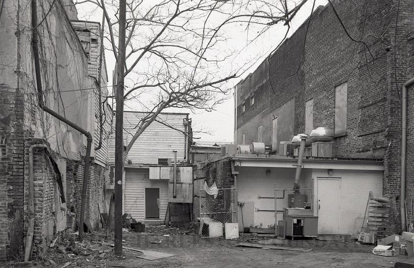
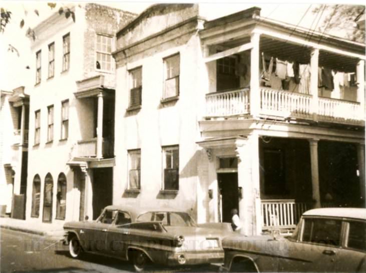
#51 96 and 98 Anson Street Before Demolition, 1960
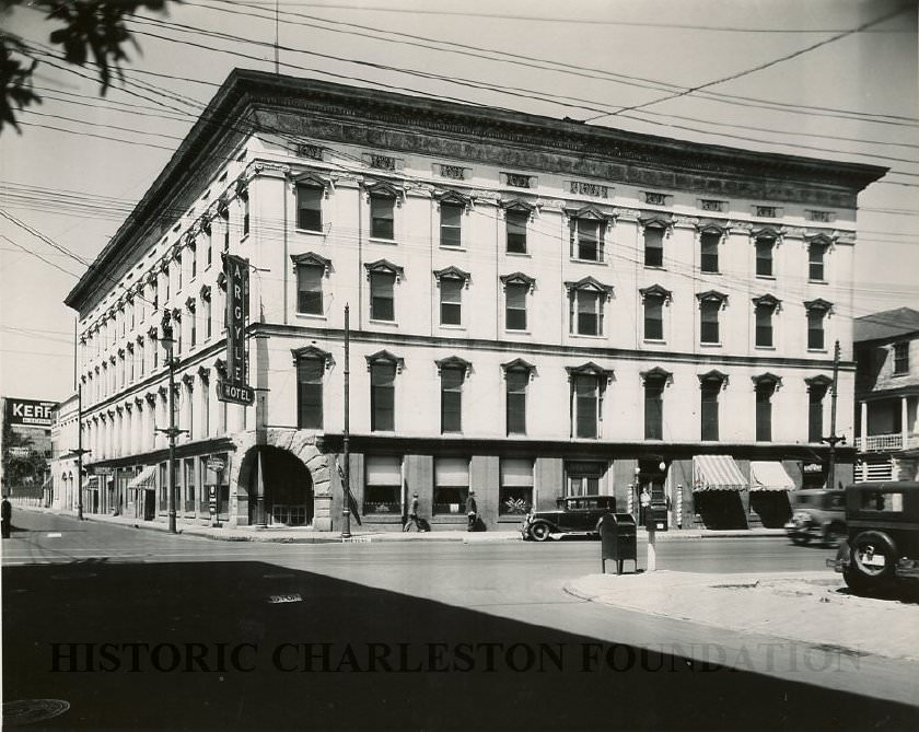
#52 Argyle Hotel, 1930s
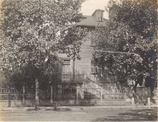
#53 Bacot House (61 Coming Street) 1920
#54 Bennett Rice Mill, 1960
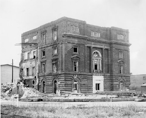
#55 Bennett Rice Mill 19 Concord Street] 1950s
![Bennett Rice Mill 19 Concord Street] 1950s](https://www.bygonely.com/wp-content/uploads/2021/11/Charleston_demolished_landmarks_56.jpg)
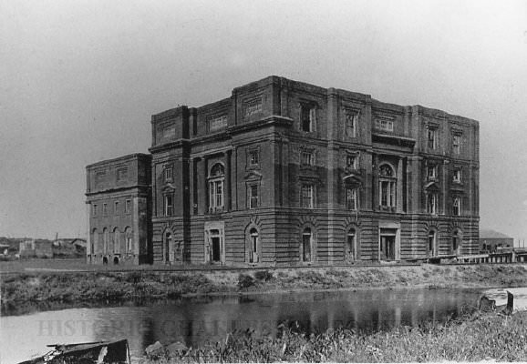
#56 Bennett Rice Mill, early 20th century
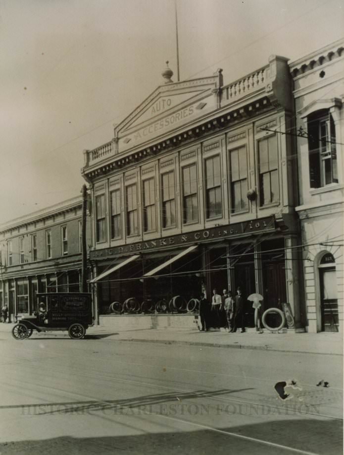
#57 C.D. Franke & Co. Building, Auto Accessories (159-161 Meeting Street) early 1900s
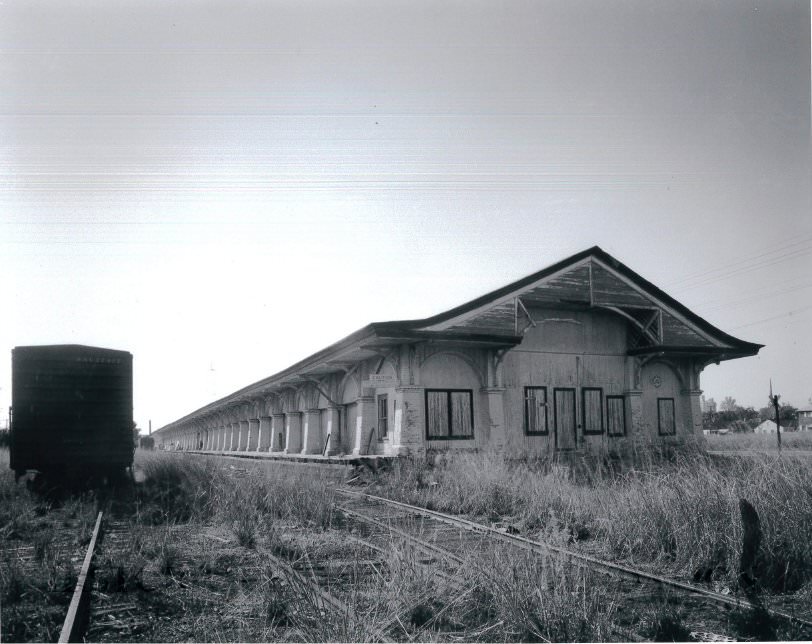
#58 Charleston Freight Station.
#59 Charleston Hotel, 1898-1912
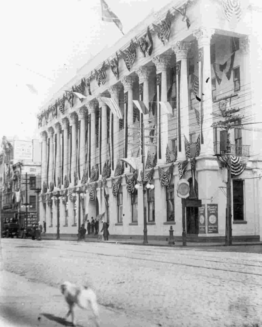
#60 Charlotte Street Houses, 1960
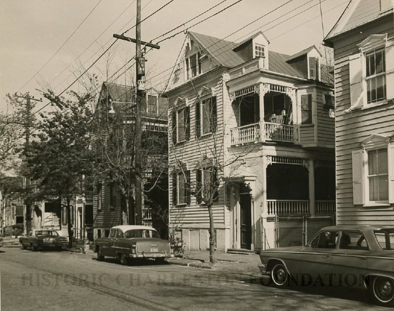
#61 Condon’s Department Store (431 King Street), 1940s
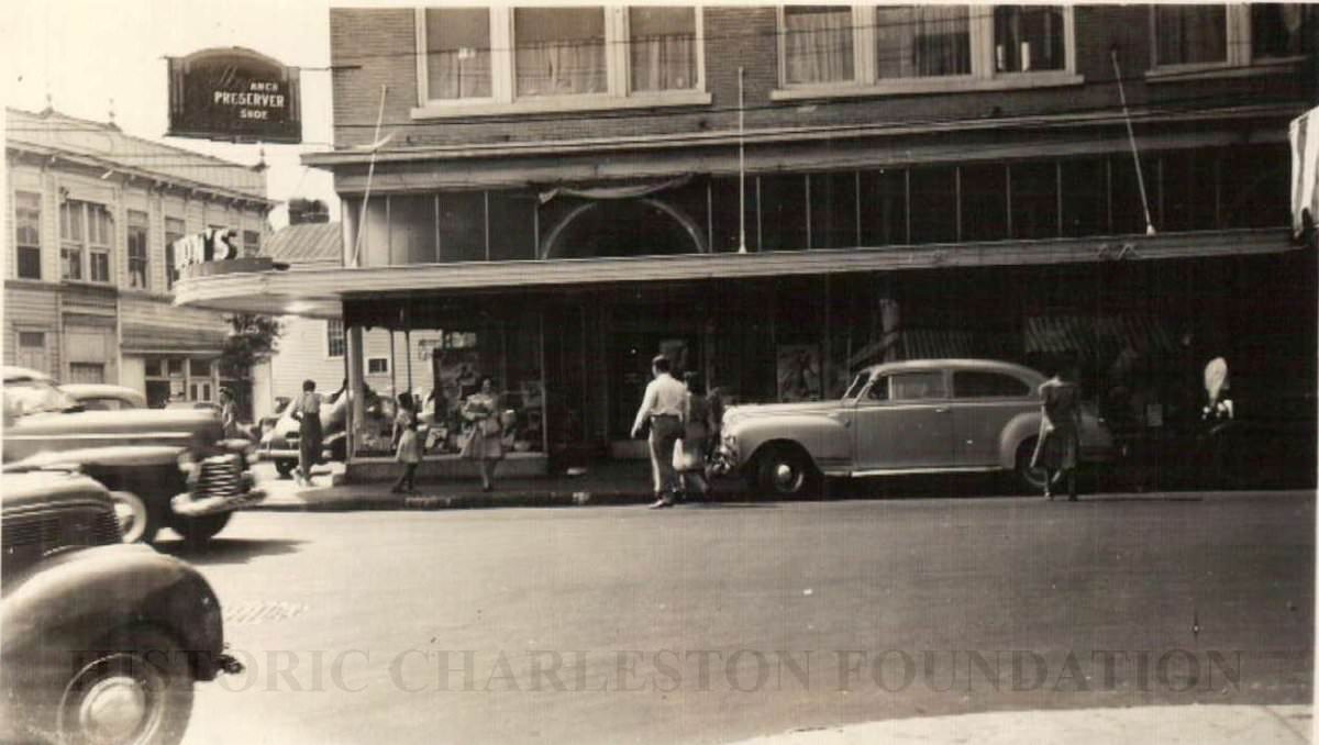
Condon's Department Store (431 King) located at the northwest corner of King and Warren Streets, featuring the lower portion of the bulding. Also in view is a portion of the building across the street (427 King Street); this building was demolished 1947 for the construction of a new building, the South Store
#62 Corner of King Street and Spring Street After Hurricane Hugo, 1989
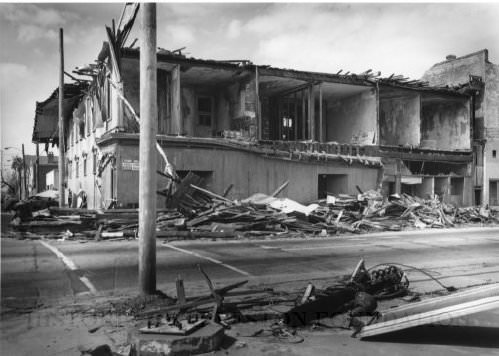
#63 Corner of King Street and Spring Street After Hurricane Hugo, 1989
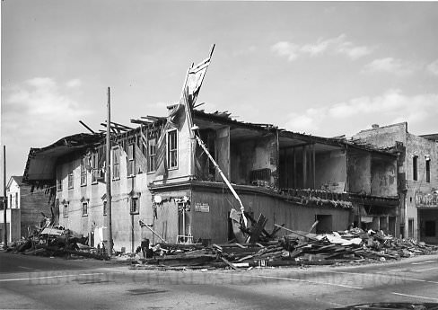
#64 Gabriel Manigault House (290 Meeting Street), 1930
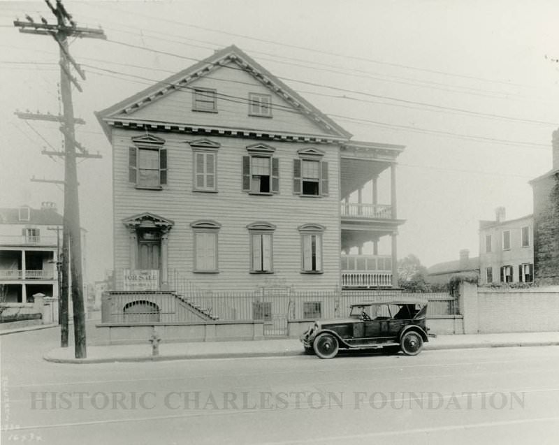
#65 Fishburne Street House After the 1938 Tornado, 1938
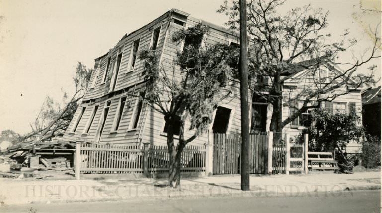
#66 Heart of Charleston Motor Hotel (200 Meeting Street), 1970s
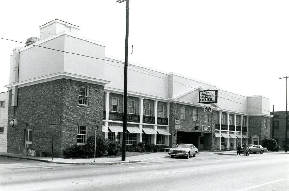
The Heart of Charleston Motor Hotel at 200 Meeting Street, between Hayne Street and Pinckney Street. Corner view of building (northeast elevation) and view of the southeast corner of Meeting and Pinckney. Previously the site of The Charleston Hotel (1838-1960) and currently the site of the Bank of America Building.
#67 Henry Laurens House (320 East Bay Street), 1900s
#68 Isle of Palms Bath House and Pavilion, 1930
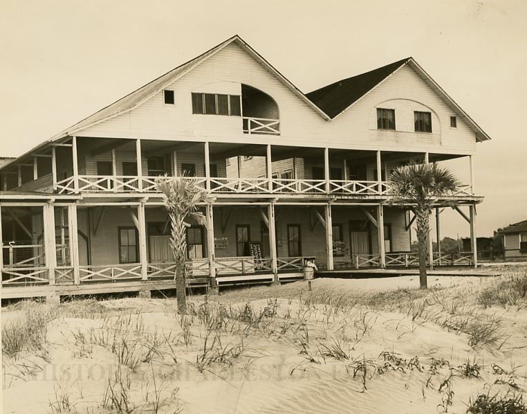
The Isle of Palms Bath House and the Pavilion. Many include crowds at the Pavilion socializing and enjoying a band. A view of the grounds of the Isle of Palms Bath House, including a hotel next door, a parking lot filled with cars, and a ferris wheel. The Bath House and Pavilion were destroyed by fire on January 29,1 938.
#69 John Street Fire Station (44-48 John Street), 1930s
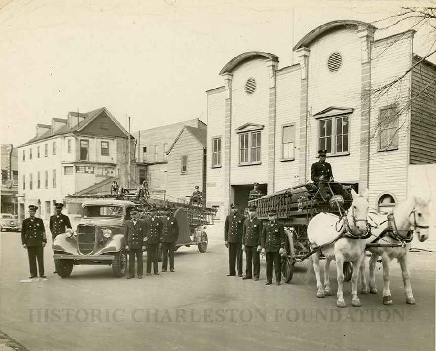
The John Street Fire Station (44-48 John Street). A fire truck and horse-drawn fire wagon are in front, as well as white and black firemen. At left are also neighboring buildings, including the rear of 428 King Street (left) and a small portion of 431 King Street (far left) across King Street. The John Street Fire Station was also known as Hook and Ladder No. 1. There is no history of this building in the HCF Archives. The building is believed to have been on the north side of John near the corner of King and John Streets. This building appears on the 1902 Sanborn Map. In the 1940s, the City budget included funds for a new fire station to replace the John Street Fire Station, and a new station was built on Coming Street near Calhoun Street. The fire station housed the first all-Black company and was the last fire station to use horses. In the 1940s and 1950s, the John Street building was used as a building materials warehouse and then as a liquor store. Sometime between the publication of the 1951 and 1955 Sanborn Maps, the building was demolished and the site became a parking lot.
#70 Looking North Across Parking Lot at Corner of King and Market, 1970s
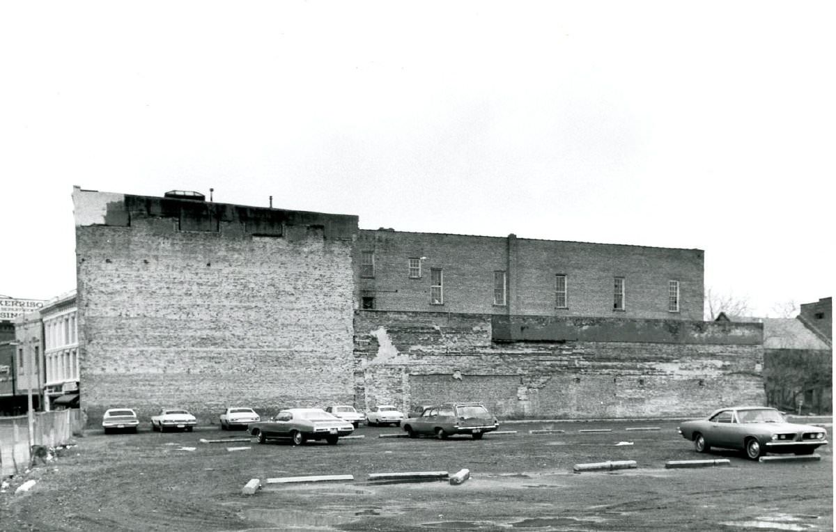
The view looking north across what was a parking lot for Belk Department Store (232 King Street), now the site of Charleston Place (f/k/a Charleston Center). Shows the southeast elevation of 238-242 King Street. Portion of Kerrison's (department store) in background at far left.
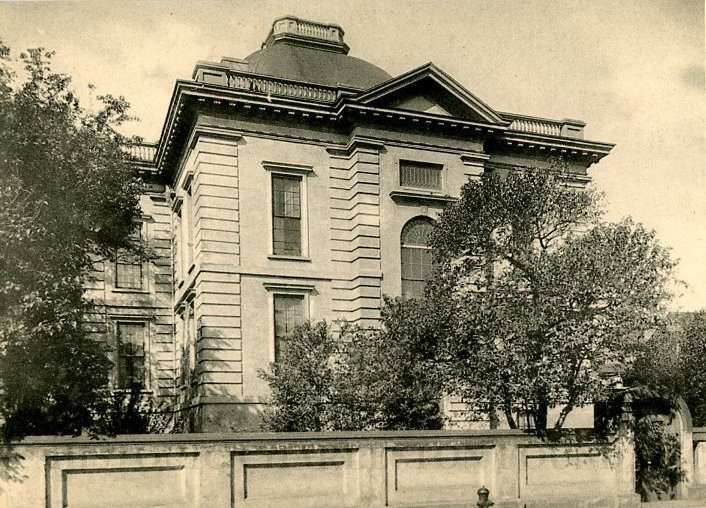
#71 Memminger Normal School, 1920
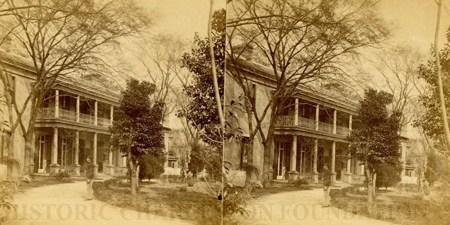
#72 Officer’s Quarters, Porter Military Academy,1882
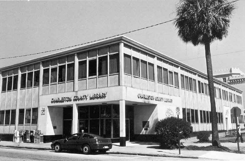
#73 Old Charleston County Public Library (404 King Street). 1996
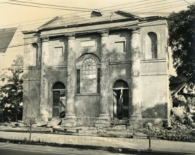
#74 Orphan House Chapel Demolition, 1953
#75 Orvin Inn of Charleston, 194 Calhoun Street, 1965
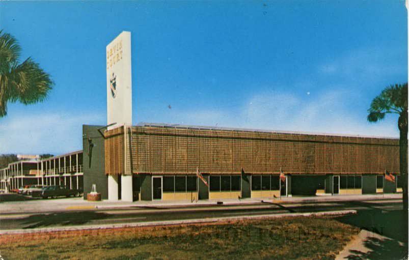
View of the Orvin Inn / Orvin Court that was located at 194 Calhoun Street, probably the Calhoun Street elevation showing the southwest corner of the building and viewed from across the street.
The Orvin Inn, also known as the Orvin Motor Court and the John C. Calhoun Motor Court, was located at 194 Calhoun Street. The building was later named The College Inn when the College of Charleston purchased the motel and used it to house students until the 1990s. At some point thereafter, the building was demolished and used as a parking lot, and in the mid-2000s, construction began on a new science building and the Mace Brown Museum of Natural History, which occupy the site today.
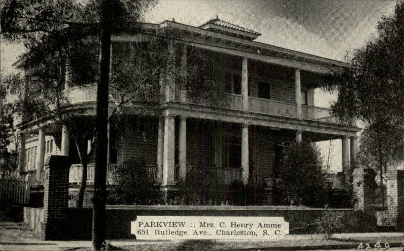
#76 Parkview: Mrs. C. Henry Ammes, 651 Rutledge Avenue, 1930s
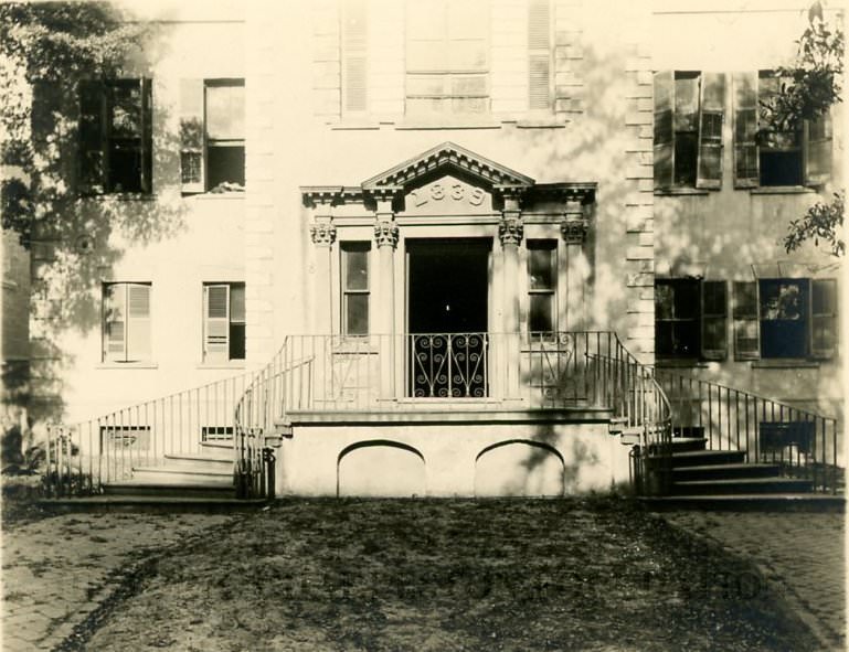
#77 Radcliffe-King Mansion (~22-24 George Street), 1920
#78 Rodenberg’s Grocery Store, 1955
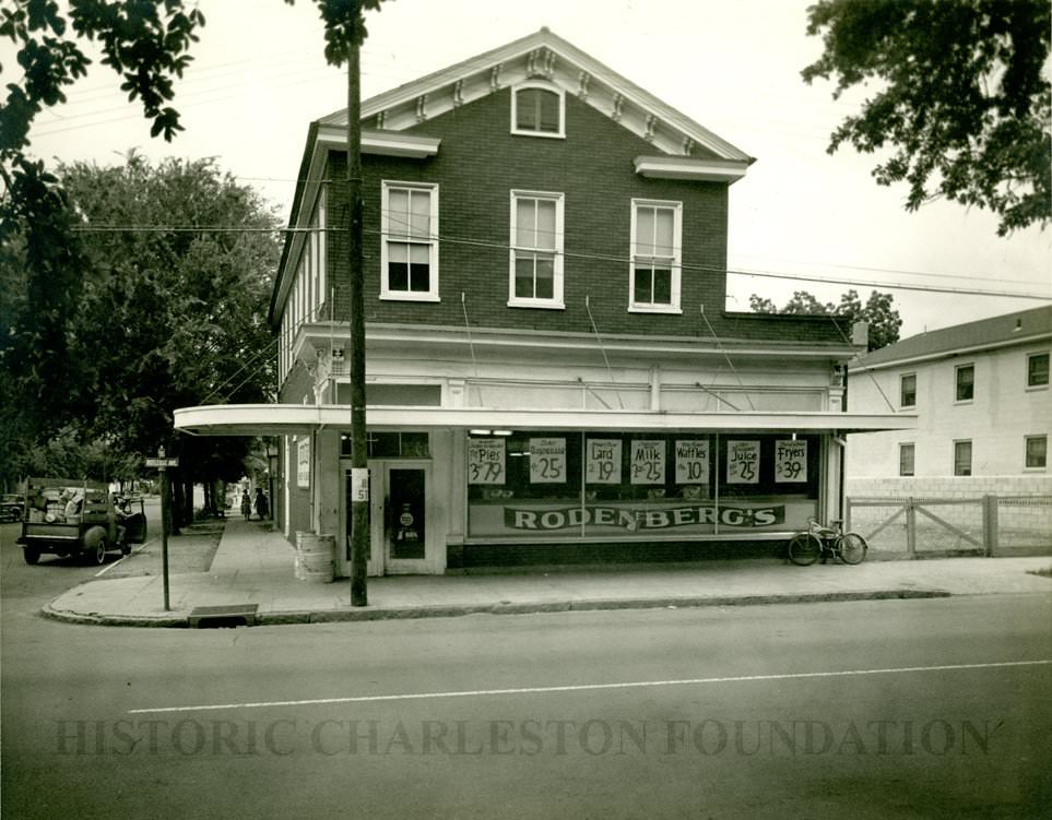
Rodenberg's grocery store, street (front) elevation, located at 569 Rutledge Avenue. This building was later bulldozed and replaced with a Food Lion when Food Lion was still a series of tiny grocery stores, and that building itself later was redone." (Currently the site of the Nehemiah Lodge fraternal organization.)
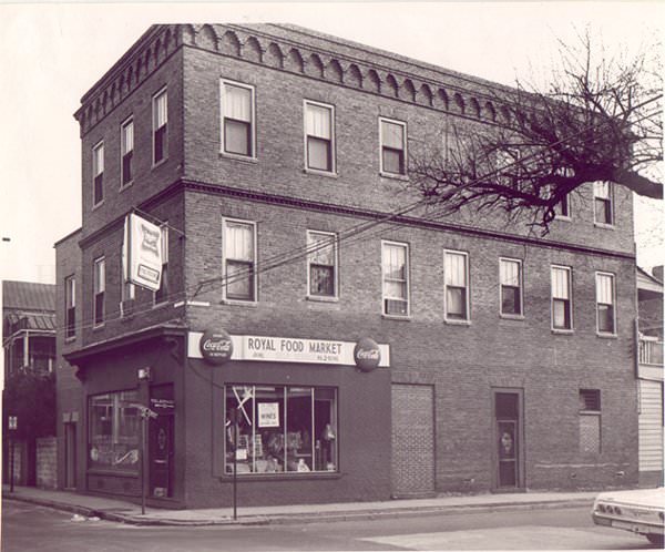
#79 Royal Food Market (78 Anson Street), 1960s
#80 Ruins of the Pinckney Mansion [235 East Bay Street], late-19th century
![Ruins of the Pinckney Mansion [235 East Bay Street], late-19th century](https://www.bygonely.com/wp-content/uploads/2021/11/Charleston_demolished_landmarks_82.jpg)
#81 Runnymede Plantation, 1991
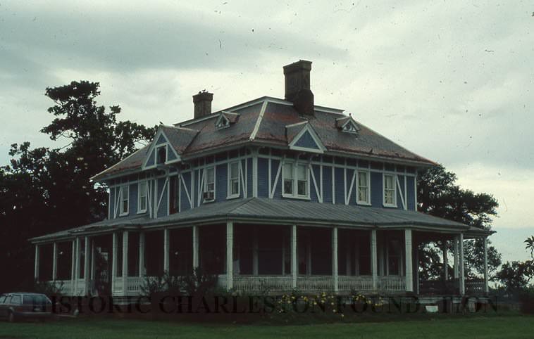
Located on the Ashley River between Magnolia and Middleton Plantations, it is believed to have been named because of the property's great oak and location along a river similar to the Runnymede in England. Two other houses on the property were destroyed (the first by fire and the second by the Union Army) but the house featured here was constructed sometime after the Civil War by Charles C. Pinckney. The house remained in the Pinckney family for over a century. The house burned down in 2002.
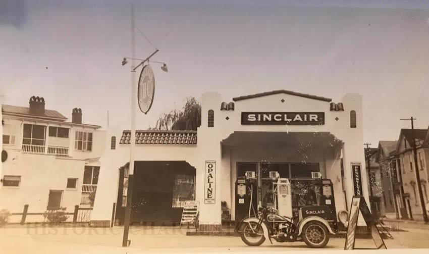
#82 Sinclair Filling Station, 1940
#83 St. John Hotel (115 Meeting Street), 1930s
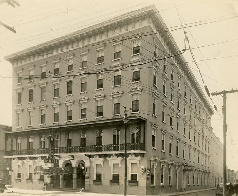
#84 St. John Hotel (115 Meeting Street), 1960s
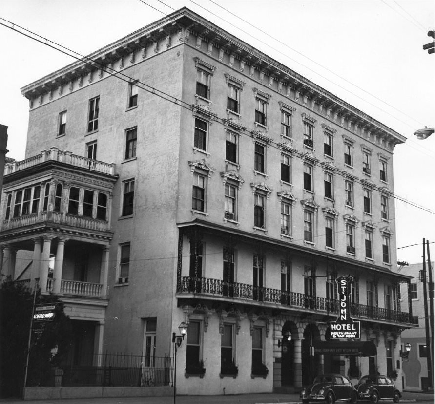
#85 St. John Hotel (115 Meeting Street, a/k/a Mills House Hotel), 1960s
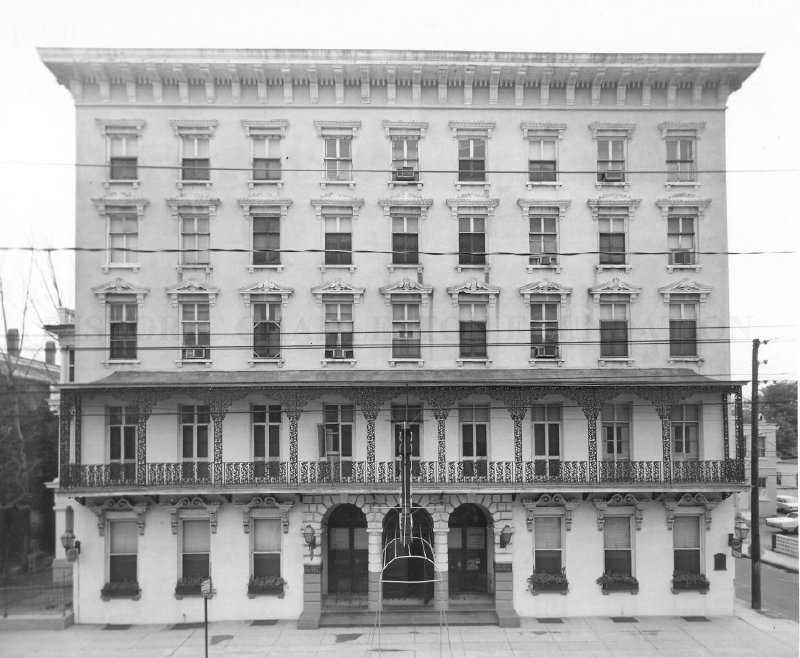
#86 St. John’s Lutheran Church Parish House, 1954
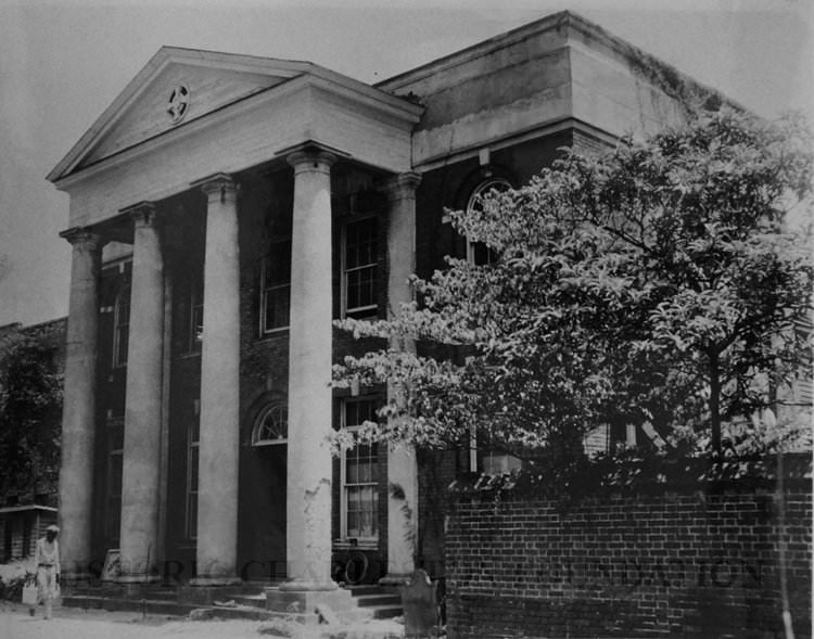
The St. John's Lutheran Church Parish House before it was demolished for the construction of a new building. Address: 5 Clifford Street.
The building was constructed ca. 1854 and was razed by September 1954 when ground was broken for the construction of a new building designed by Halsey and Cummings Architects and would be built by General Contracting Company for $85,764. ("America's News-Historical and Current," "Fire Insurance Maps Online" [a/k/a Sanborn Maps], each accessed via the Charleston County Public Library website.)
#87 State and Cumberland Street Structures, early 20th century
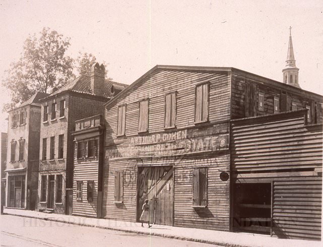
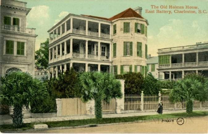
#88 The Old Holmes House, East Battery, Charleston, 1900s
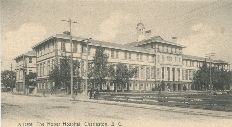
#89 The Roper Hospital, Charleston, Early 1900s
#90 The Three Sisters and the Intersection of Calhoun and East Bay Streets, 1963
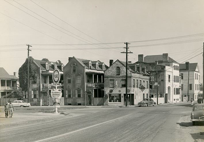
The view south on East Bay Street from Calhoun Street showing the corner of Calhoun and East Bay Streets. Features 37 Calhoun, 39 Calhoun, and 41 Calhoun (left to right), locally known as "The Three Sisters"; the Pure gas station across the street at 474 East Bay; and the two houses at 344 East Bay and 342 East Bay.
#91 Thomson Autditorium, Confederate Veterans Reunion, 1902
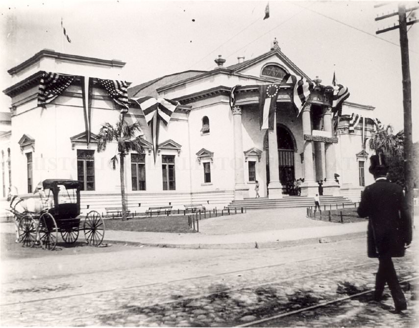
Thomson Auditorium (121 Rutledge Avenue) decorated for a Confederate's Veteran's Reunion, per sign on columns. Trolley tracks are visible on Rutledge Avenue, then a cobblestone street. Man in a top hat crosses the street walking toward the building; horse-drawn carriage parked by sidewalk; people standing on steps outside front door.
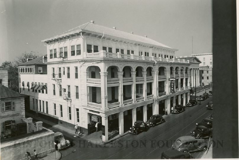
#92 Timrod Hotel, 1930s
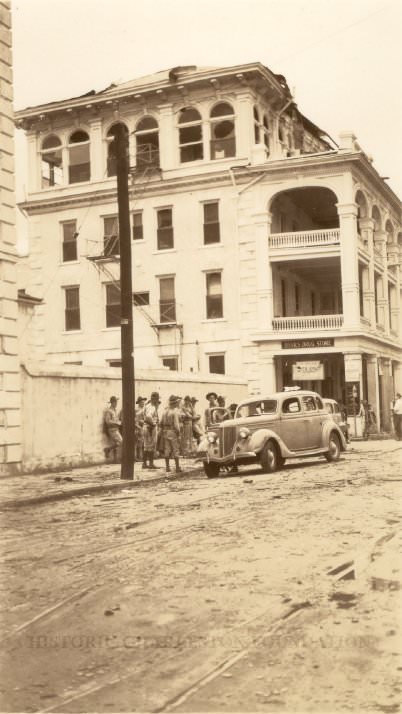
#93 Timrod Hotel After the 1938 Tornadoes, 1938
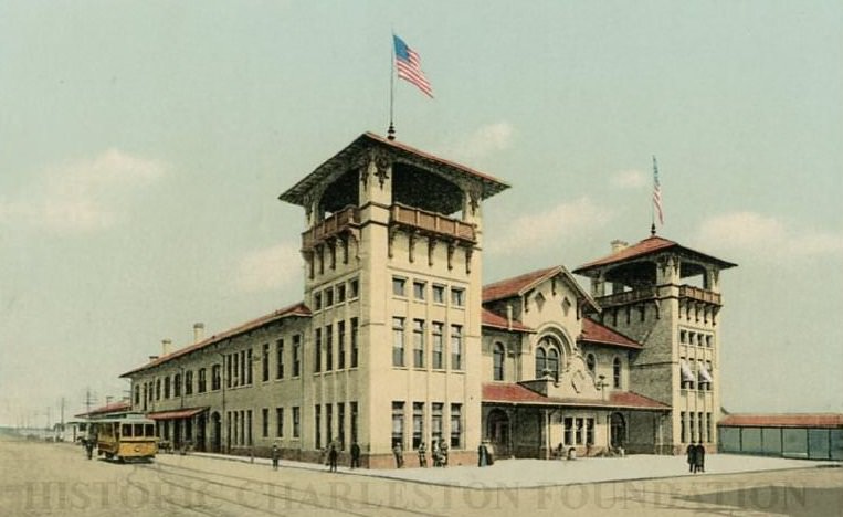
#94 Union Station, 1900s
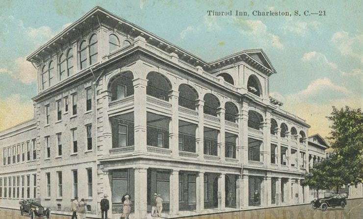
#95 Timrod Inn, Charleston, S.C, early 20th Century
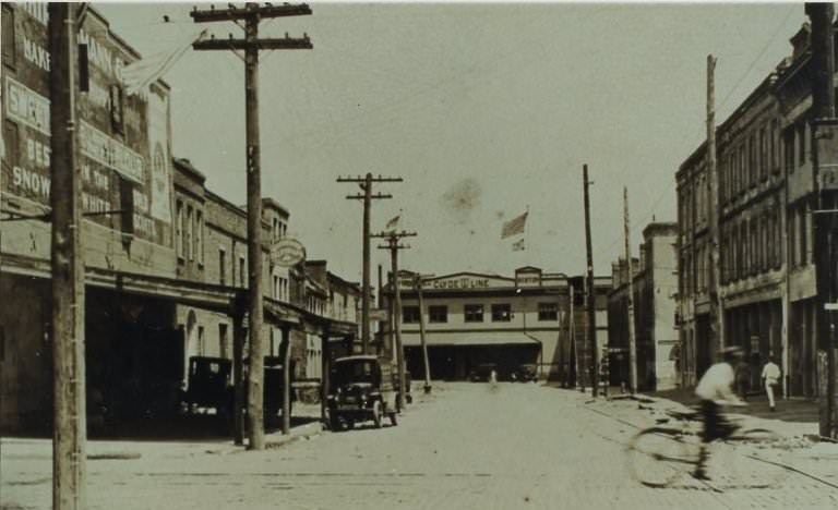
#96 View of Vendue Range Looking East, Early 20th Century
#97 West Side of King Street Below Market Street (221 King Street), 1970s
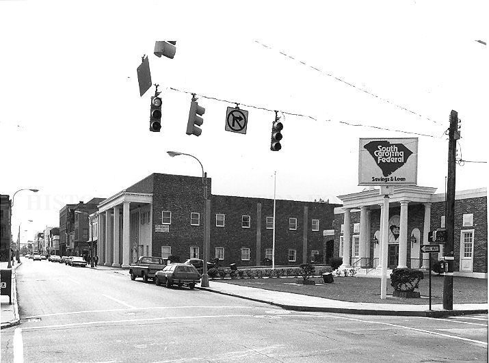
The west side of King Street below Market Street (where Majestic Square is now), at the corner of King Street and Market Street. South Carolina Federal Savings & Loan (221 King Street) in foreground. Also shown are 219 King Street, 217 King Street, 215 King Street, and 213 King Street.
#98 West Side of Meeting Street Below Market Street (177 Meeting Street, Madren Paint Company), 1970s
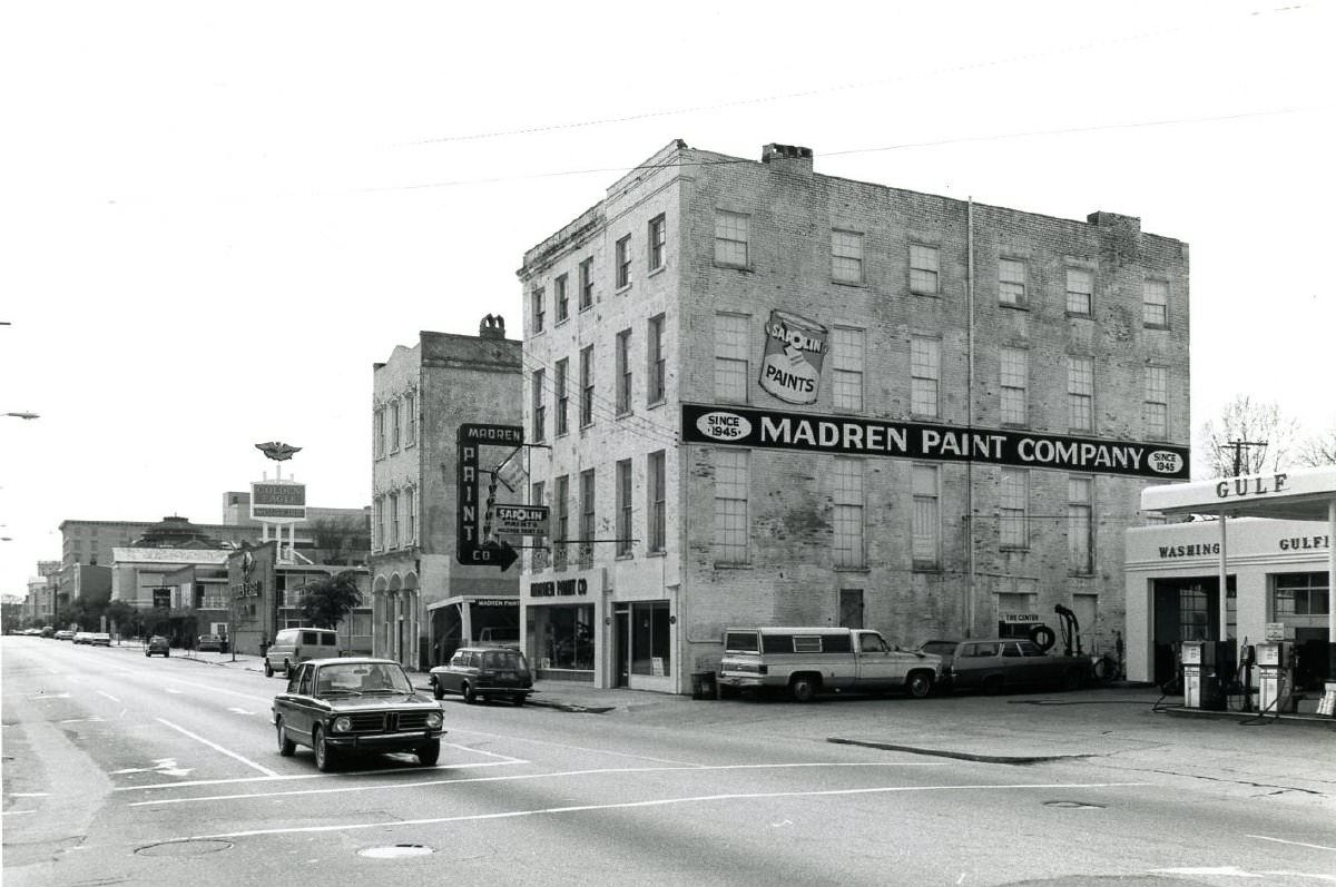
The west side of the 170 block of Meeting Street, looking south from the corner of Market Street. Shows Parson's Gulf Station (181-183 Meeting), Madren Paint Company (177 Meeting Street, 173 Meeting Street, and the Golden Eagle Motor Inn. Currently the site of the Wells Fargo Banking Center.
#99 Weyman’s House (340 Meeting Street).
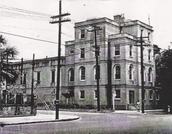
#100 Weyman’s House (340 Meeting Street), 1948
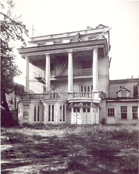
#101 White Swan Laundry During Demolition [723 King Street], 1995
![White Swan Laundry During Demolition [723 King Street], 1995](https://www.bygonely.com/wp-content/uploads/2021/11/Charleston_demolished_landmarks_103.jpg)
#102 Y.W.C.A., Charleston, S.C. [26 George Street], 1920
![Y.W.C.A., Charleston, S.C. [26 George Street], 1920](https://www.bygonely.com/wp-content/uploads/2021/11/Charleston_demolished_landmarks_105.jpg)
The Y.W.C.A. building, located at 26 George Street. Three women stand in front of building. Also shows portions of the neighboring buildings at left and at right. The Y.W.C.A. was first established in 1903 in Charleston in two rooms on King Street, 1903. They moved several times before settling in this building at 26 George Street, which was completed on March 4, 1920.
#103 Mickey Funeral Home (50 Cannon Street), 1923
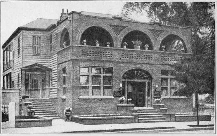
The Mickey Funeral Home was established in Charleston in 1894 by Edward Mickey. At his death, Edwin G. Harleston, brother of Edward Mickey's wife, Hannah Harleston Mickey, took over the firm until the two Mickey sons, Richard Harleston Mickey and Edward Crum Mickey became of age. In 1901, Edward Crum Mickey learned the trade and worked with Edwin G. Harleston at the funeral home. The company split in 1913; the Mickey Funeral Home re-established itself as an individual entity, run by the two brothers and their mother Hannah, while Edwin G. Harleston founded the Harleston Funeral Home. In the early 1930s, E.C. Mickey decided to build an expensive funeral parlor at 50 Cannon Street. The business failed and the firm shut down in 1933.
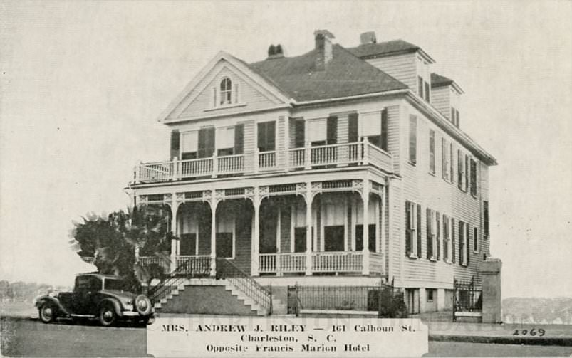
#104 Mr. and Mrs. Andrew J. Riley – 161 Calhoun Street, 1920
#105 Nathaniel Heyward House (East Bay Street), early 20th Century
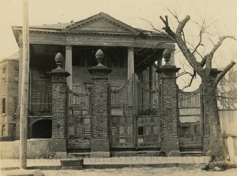
#106 Nathaniel Heyward House, 1915
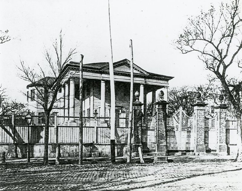
#107 Nathaniel Heyward House, East Bay Street at Society Street, 1898
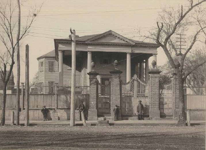
#108 Northeast corner of Hasell and Anson Streets [46 Hasell Street], 1960
![Northeast corner of Hasell and Anson Streets [46 Hasell Street], 1960](https://www.bygonely.com/wp-content/uploads/2021/11/Charleston_demolished_landmarks_111.jpg)
#109 191 Rutledge Avenue,1948
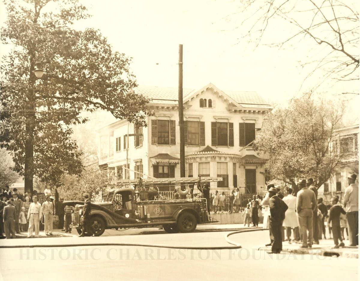
Photograph (scan) of 191 Rutledge Avenue from the corner of Morris Street taken after a fire that occurred in a storage room at the rear of the house. A fire truck is in front of the house where a crowd has gathered.
191 Rutledge was a two-story frame Victorian house that was the home of J.N. (John N.) Peecksen, a successful Charleston grocer, in the early 20th century. The house was demolished in 1968 for the construction of the headquarters of the Charleston Baptist Association and Baptist Student Center. It is now the location of the offices of Charleston Cardiology.

Thanks for sharing this. It’s sad to see such elegant buildings getting demolished without much regard. Maybe now we need to focus on resources we will learn to love and preserve these beautiful examples of our species’ creativity. When I walk through the town where I live, I think about the number of people who have also walked through these buildings throughout history.
I just finished watching Black Sails; Charles Town is featured in season 2. Interesting to learn about the history of Charles Town.
How were Black Sails? I heard about it when that girl was on The Flash, and I heard she was also in Black Sails, but I never actually took the time to watch it. Nevertheless, it sounded intriguing.
It’s worth a look, I’d say. There were only four seasons, but that was enough.
Last month, I visited those historic battery homes for the first time and saw massive cracks in the foundations that made me anxious about both the residents and the buildings.
That’s such a shame! The rate Charleston is going now, one day it will lose its character and look like any other city in the country.
At the rate it’s going now, Charleston will lose its character and become like any other city in the country.
Downtown is one of the best preserved parts of the country. It’s hard to trim your hedges without BAR permission. The situation is really a double-edged sword. It is one of the most expensive places in the region because of all those beautiful homes that have been preserved.
So much beauty, thanks for sharing