

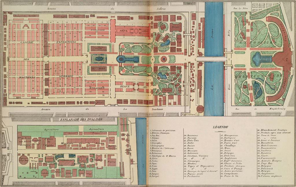
The top image represents the Champ-de-Mars, from the Trocadéro Palace to the Galerie des machines (next to the École Militaire, which still exists today). The bottom print represents the Esplanade des Invalides, about half a mile from the Champ-de-Mars. This second site of the World Fair housed the Exposition coloniale as well as an agricultural fair.