Getting humans ready to walk on the Moon required more than flight simulators and classroom lessons. NASA needed land that looked and felt like the lunar surface — rough, barren, and full of craters. They found it in Arizona. The state’s volcanic cinder cones, ancient lava fields, exposed canyon walls, and natural impact craters made it one of the most geologically rich training grounds on Earth. Nearby landmarks like Meteor Crater and the Grand Canyon served as open-air geology classrooms unlike anything else in the country.
The hub of this training was Flagstaff, a small city tucked into a forest of ponderosa pines at the base of the San Francisco Peaks — Arizona’s tallest mountain range. Between January 1963 and November 1972, scientists based in Flagstaff led 200 separate geological field exercises for NASA’s astronauts. These weren’t casual field trips. They were structured, technical sessions designed to teach astronauts how to read rock formations, identify geological features, and collect useful samples — all while wearing bulky equipment that mimicked what they’d carry on the Moon.
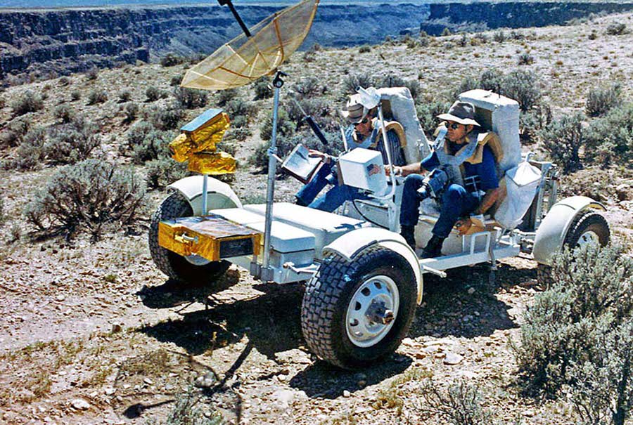
Both Duke and Young went on to walk on the surface of the moon in 1972, during Apollo 16.
The Apollo program officially ran from 1961 to 1972. Its first crewed flight launched in 1968. Apollo 8 became the first crewed spacecraft to orbit another celestial body. Then, in 1969, Apollo 11 landed the first humans on the Moon. Each mission that followed built on the geological knowledge that astronauts had gathered during their years of training in the Arizona desert.
One of the most ambitious parts of the training program was the construction of a completely artificial lunar surface. Workers detonated hundreds of explosives across a stretch of Arizona terrain to carve out craters that matched the size, shape, and spacing of those photographed on the Moon by early robotic probes. The result was the Cinder Lake Crater Field — a remarkable feat of engineering built solely to prepare men for another world.
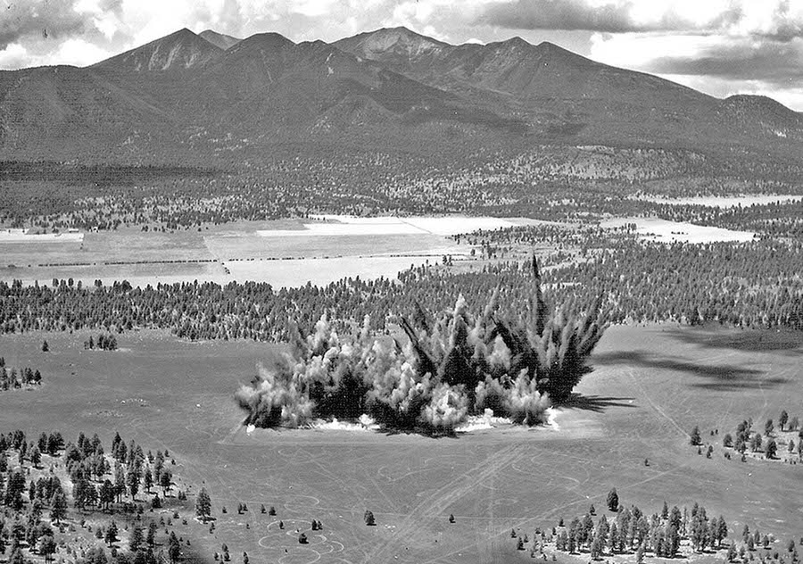
A total of 354 craters were carved out of the Arizona landscape in this field to create a simulated lunar surface.
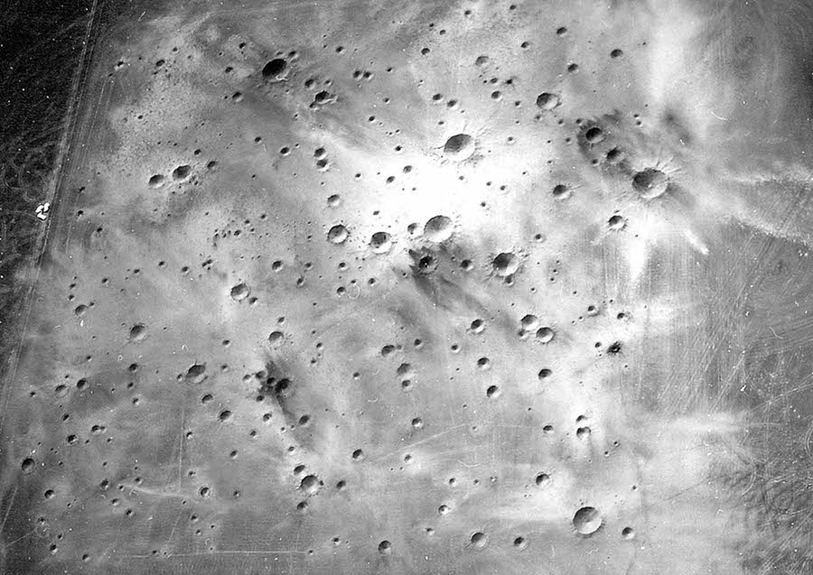
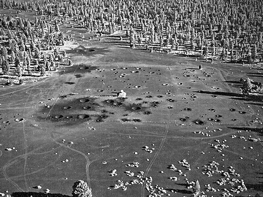
The finished crater field stretched across the landscape north of Flagstaff and closely matched orbital photographs of the Moon’s surface. A total of 354 craters were blasted into the ground across multiple phases of construction. The first phase produced 258 craters. A second round of explosions in October 1967 added 96 more. The scale and detail of the finished site were striking — from above, it was nearly indistinguishable from actual lunar terrain.
Apollo 17 astronauts Harrison Schmitt and Gene Cernan were among those who trained at Cinder Lake. Both men walked on the Moon in December 1972 during the final Apollo landing mission. Their time at Cinder Lake gave them direct, hands-on experience navigating the exact kind of broken, crater-riddled terrain they would face on the lunar surface.
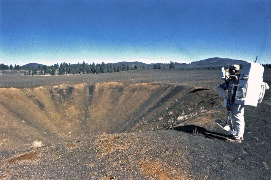
Both men went on to walk on the surface of the moon in 1972, during Apollo 17.
Navigating the crater field wasn’t just done on foot. Engineers and astronauts tested a range of prototype lunar vehicles to find out what kind of rover could handle the punishing terrain. Grumman Aircraft Engineering Corporation developed one early concept vehicle and drove it through fields of boulders to gauge its performance.
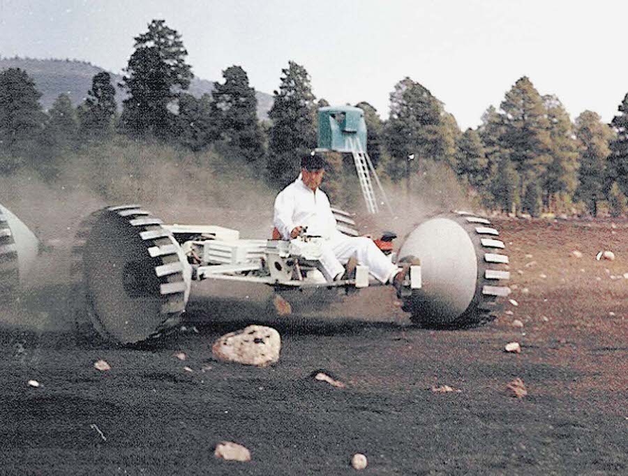
Spacesuit testing was another critical piece of the training program. Before astronauts could wear suits on the Moon, engineers and geologists had to test early versions in real field conditions. The volcanic landscape of Hopi Buttes, Arizona, served as one of the primary test sites. A feature known as “Apollo dike” — a long, narrow ridge of volcanic rock — became a key location for these early suit evaluations.
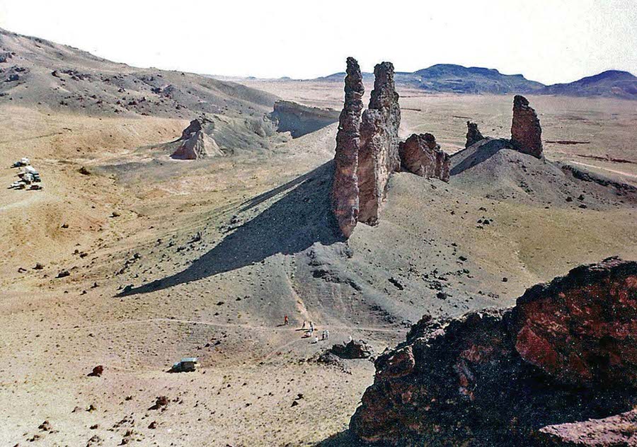
USGS geologist Joe O’Connor was one of the people who wore the earliest versions of the Apollo spacesuit during these field tests. In the fall of 1965, he suited up at the Apollo mesa dike in the Hopi Buttes volcanic field to assess how the suit performed in rugged, rocky terrain. These tests directly shaped the design refinements that would eventually keep astronauts safe on the Moon.
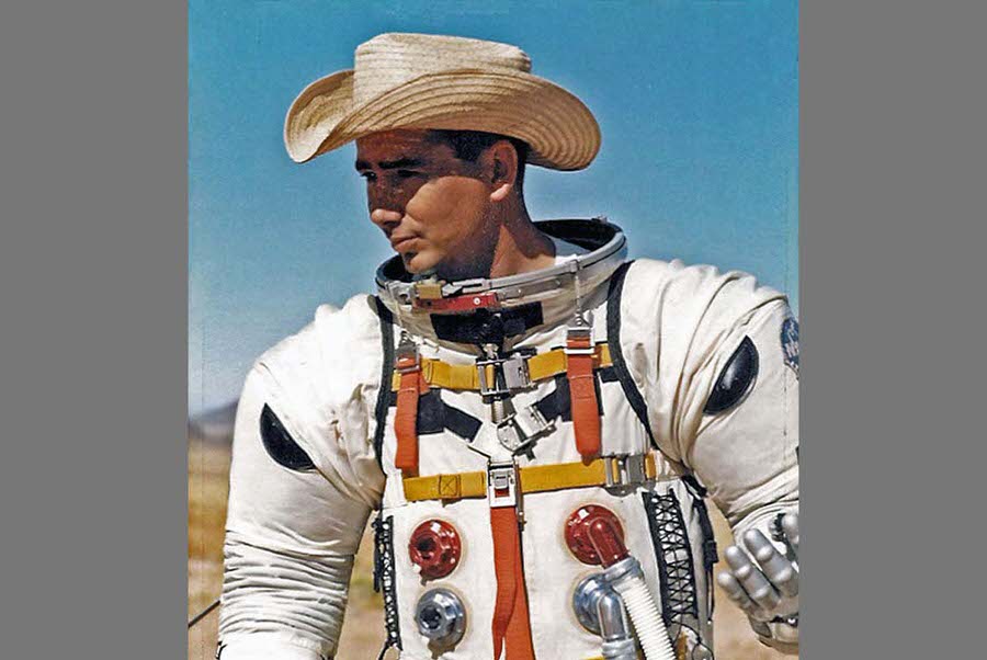
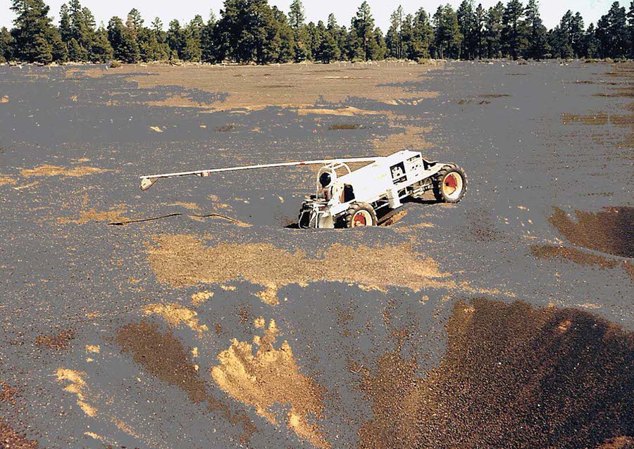
Alongside suit testing, vehicle engineers ran prototype lunar rovers through increasingly difficult obstacles. The Explorer vehicle was one such machine, tested directly inside the craters at Cinder Lake to evaluate how well it could enter and exit uneven depressions in the terrain.
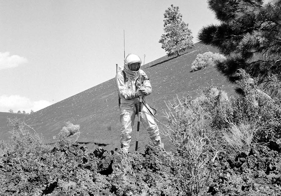
Arizona’s Sunset Crater volcano provided yet another training backdrop. The Bonito Lava Flow near the volcano offered a hardened, textured surface ideal for testing navigation tools and equipment. Testers experimented with early concept tools like the “lunar staff” — a pole topped with a sun compass designed to help astronauts orient themselves on the Moon’s surface without GPS or magnetic north.
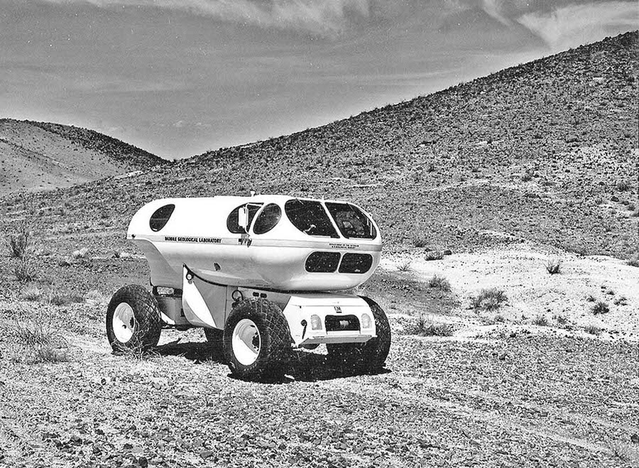
Not all early vehicle concepts were small or lightweight. The Mobile Geological Laboratory — known as MOLAB — was a pressurized, enclosed vehicle large enough for astronauts to work inside without wearing spacesuits during extended lunar traverses. In 1966, MOLAB was tested at Merriam Crater, northeast of Flagstaff, to determine whether such a vehicle was practical for lunar exploration.
For Apollo 15, the final geology exercise before the mission took place at Coconino Point, Arizona, on June 25, 1971. Astronauts Jim Irwin and Dave Scott — the prime crew — examined rock outcrops in the field as part of their last preparation before flight. Both men landed on the Moon just weeks later in July 1971, becoming the first humans to use a lunar roving vehicle on the surface.
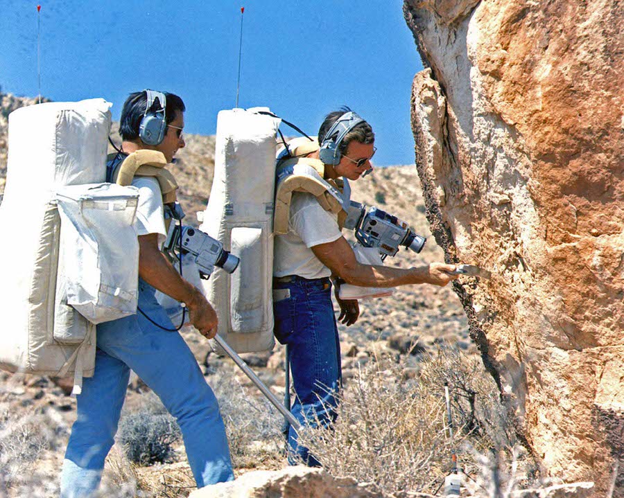
Both men went on to walk on the surface of the moon in 1971, during Apollo 15.
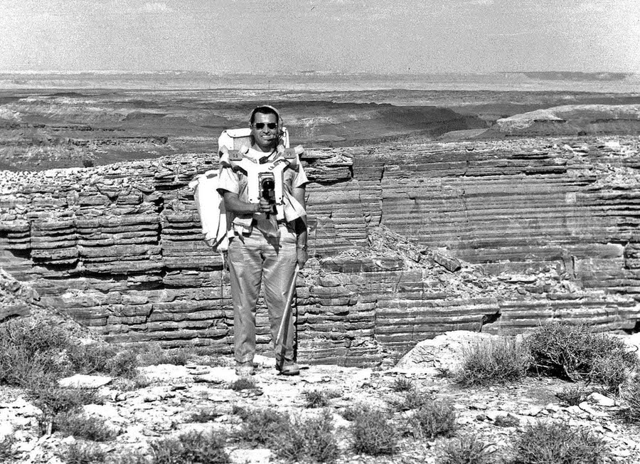
Harrison Schmitt played a unique role in the Apollo program. Originally on the Apollo 15 backup crew, he had been slated to fly on Apollo 18. When that mission was canceled, Schmitt was moved up to Apollo 17 — largely because of his background as a professional geologist, which made him irreplaceable as a scientist-astronaut. During training, he used Arizona’s erosional canyons to simulate the Hadley Rille, a large valley near the Apollo 15 landing site.
Schmitt was originally part of the Apollo 15 backup crew and later slated to fly in Apollo 18. When that mission was canceled, Schmitt was moved up to Apollo 17 due to his previous work and studies as a professional geologist.
The expansion of Cinder Lake Crater Field happened in phases. This October 1967 photograph captured the site after the second round of crater-blasting was complete, showing how much of the Arizona terrain had been transformed into a functional analog of the Moon’s surface.
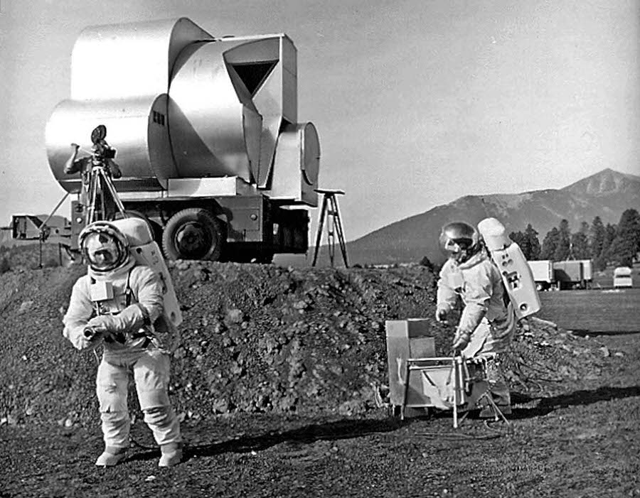
USGS geologists Tim Hait and David Schleicher conducted early Apollo field tests at Cinder Lake while wearing spacesuits — a direct test of how scientists would operate in the suits during real lunar traverses. A simulated lunar module ascent stage mock-up was parked on an earthen ramp in the background, giving the site the full appearance of a staged Moon landing scenario.
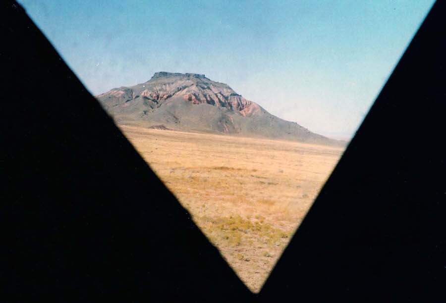
Lunar module mock-ups weren’t just used outside. Interior simulations allowed astronauts and engineers to rehearse what the view from the spacecraft would actually look like during landing. This 1965 photograph, taken through one of the two triangular windows of a mock-up, shows the view of Chezhin Chotah Butte — a real-world feature standing in for lunar terrain.
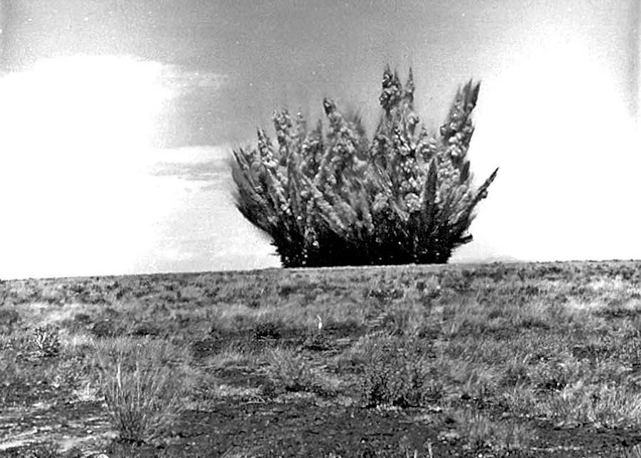
In addition to the manufactured craters at Cinder Lake, engineers also blasted test craters into other natural lava formations around northern Arizona. On August 1, 1968, a large explosion tore into the Black Point lava flow along the Little Colorado River, north of Flagstaff. These additional impact tests helped researchers understand how crater ejecta — the material thrown out by an explosion or impact — behaved in different soil and rock types.
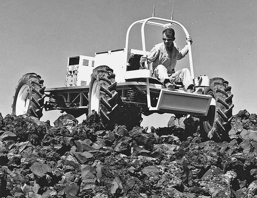
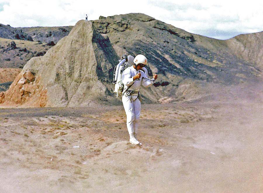
Personal mobility equipment was also tested during the Apollo training program. Bell Aerosystems developed a rocket belt — a wearable device that used jets of gas to lift a person off the ground for short bursts of flight. The device was demonstrated during Apollo training to explore whether such technology might be useful for moving across the lunar surface.
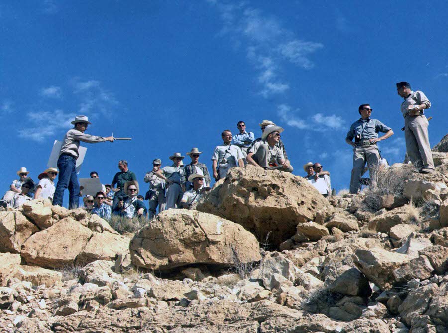
Geology education was at the heart of the entire training program. Astrogeologist Gene Shoemaker — one of the founders of the field of planetary science — regularly led astronauts on field trips to major geological sites. In May 1967, he brought a large group of astronauts to the rim of Arizona’s Meteor Crater to explain how the ejecta blanket surrounding the impact site was formed. Understanding these features was critical, because similar formations existed all across the Moon.
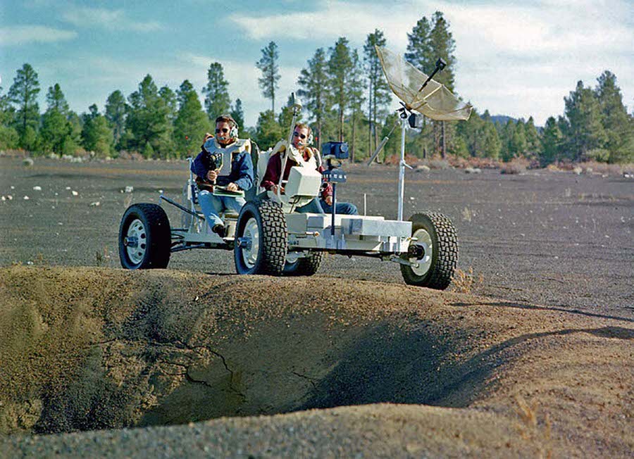
The Grover — short for Geological Rover — was a six-wheeled electric vehicle built to simulate the handling and dimensions of the actual lunar roving vehicle used on the Moon. Astronauts Jim Irwin and Dave Scott trained extensively with Grover at Cinder Lake, driving it along crater rims and across broken terrain to build the navigation skills they’d need on the lunar surface.
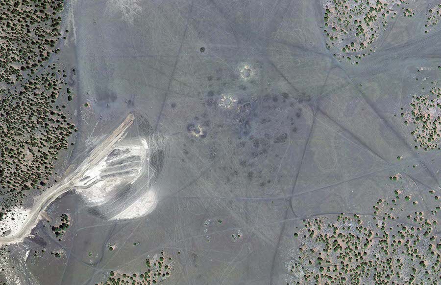
Decades after astronauts last trained there, Cinder Lake Crater Field remains visible from space. A 2011 satellite image of the site north of Flagstaff still shows the rows of craters carved into the Arizona landscape — a permanent mark left by one of the most extraordinary preparation efforts in the history of human exploration.