
Amsterdam’s story begins not with grand ambition, but with practical necessity. In the 12th century, fishermen living along the banks of the River Amstel needed to cross the water and protect their homes from flooding. They built dikes on both sides of the river, and around 1270, they constructed a dam between those dikes. That dam gave the city its name — Amsterdam. From those modest origins, the city grew into one of Europe’s most remarkable urban centers.
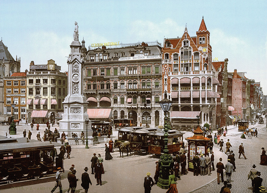
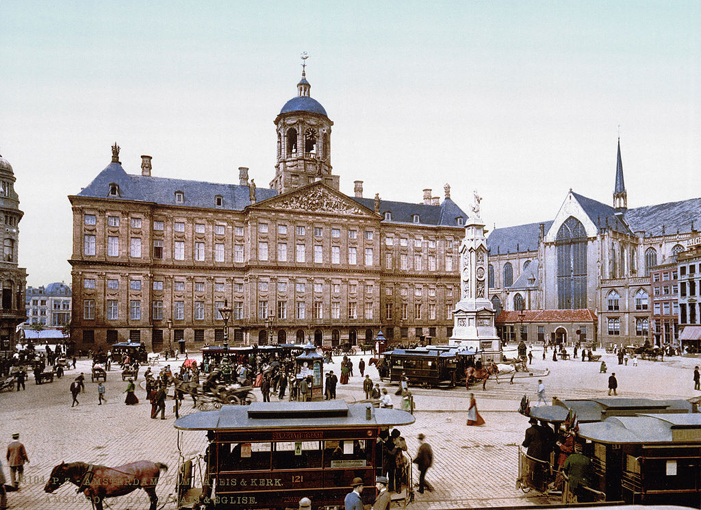
The heart of Amsterdam has always been Dam Square. By the late 19th century, it was a busy public space surrounded by some of the city’s most important buildings, including the Royal Palace, which was originally built as a city hall in the 17th century. The square served as a meeting point for residents and a hub for trade and civic life.
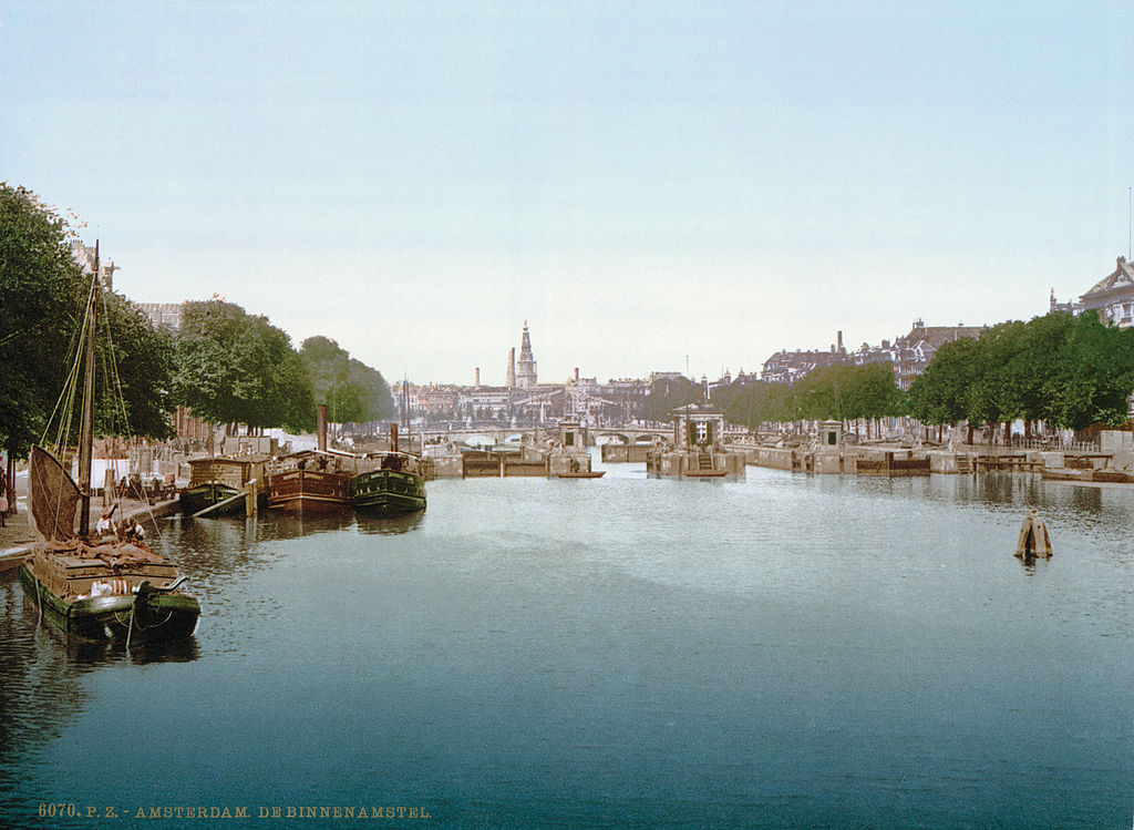
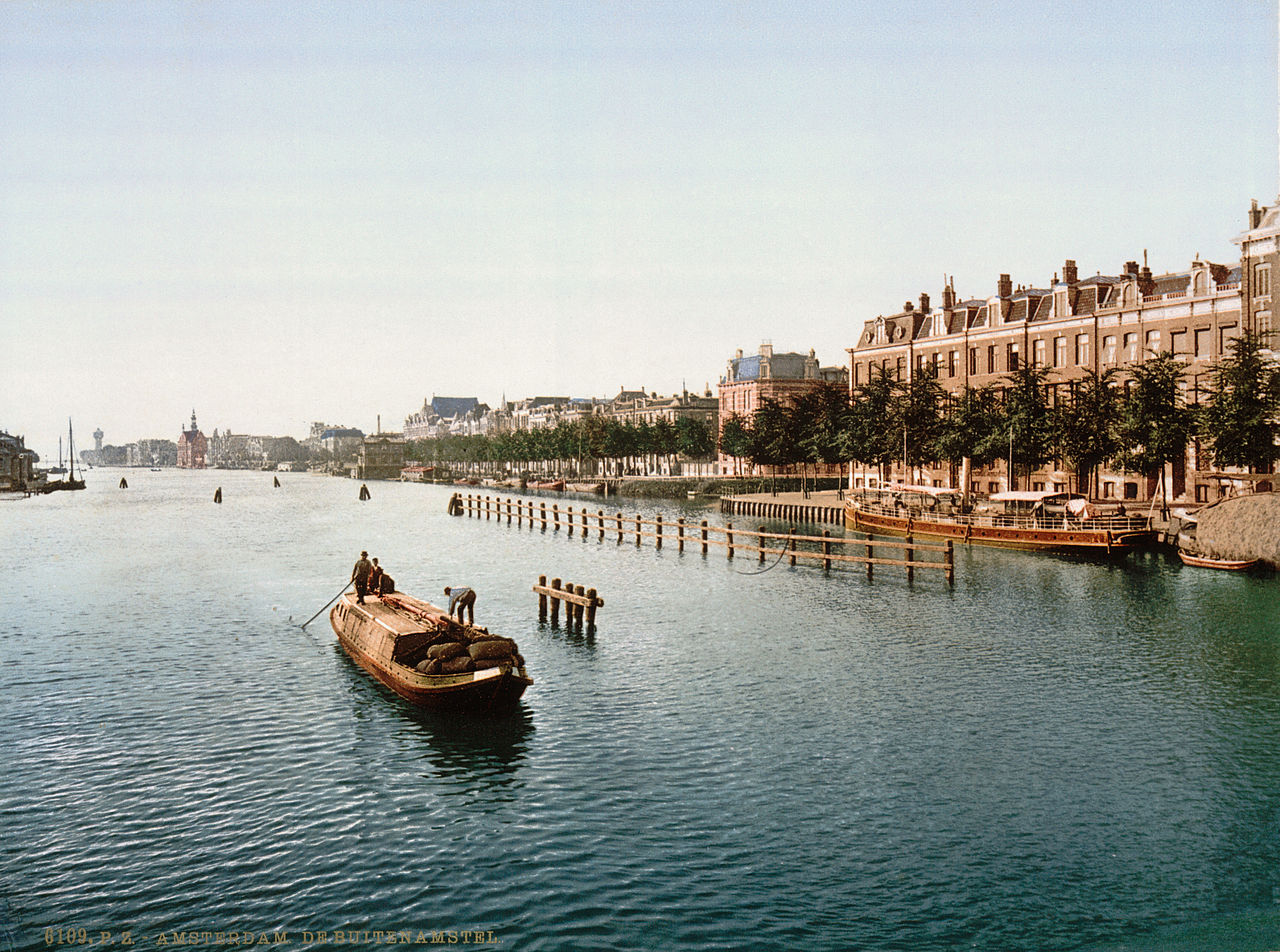
Amsterdam’s canal system was — and still is — the backbone of the city. The network of inner and outer waterways shaped how the city was built, how goods moved, and where people lived. During the 17th and 18th centuries, Amsterdam became a city of immigrants. Lutheran Protestant Germans, French Huguenots, and Spanish Jews all settled here, each group bringing its own trades, languages, and religious practices. That mix of cultures left a lasting mark on the city’s neighborhoods and architecture.
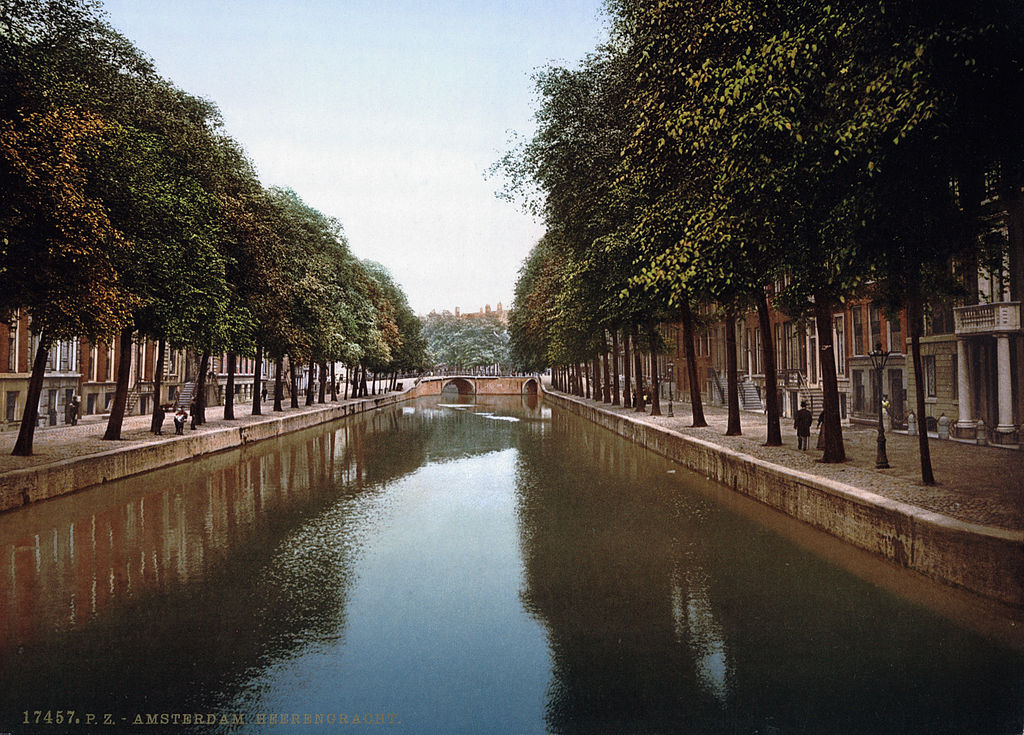
The Heerengracht — meaning “Gentlemen’s Canal” — was the most prestigious address in Amsterdam. Wealthy merchants built their tall, narrow townhouses along its banks, many of which still stand today. The canal was dug in the early 17th century as part of a major expansion of the city, and it became a symbol of Amsterdam’s golden age of commerce and prosperity.
By the end of the 19th century, the Industrial Revolution had arrived in Amsterdam. The city was no longer just a trading port — it was becoming an industrial center. This brought a massive wave of worker migrants from the Dutch countryside into the city, straining housing and infrastructure. To handle the increased demand for trade and transport, the Amsterdam-Rijn Kanaal was built to connect the city directly to the Rhine, and the Noordzee Kanaal provided a direct route to the North Sea. Amsterdam’s old canal network was now part of a much larger system.
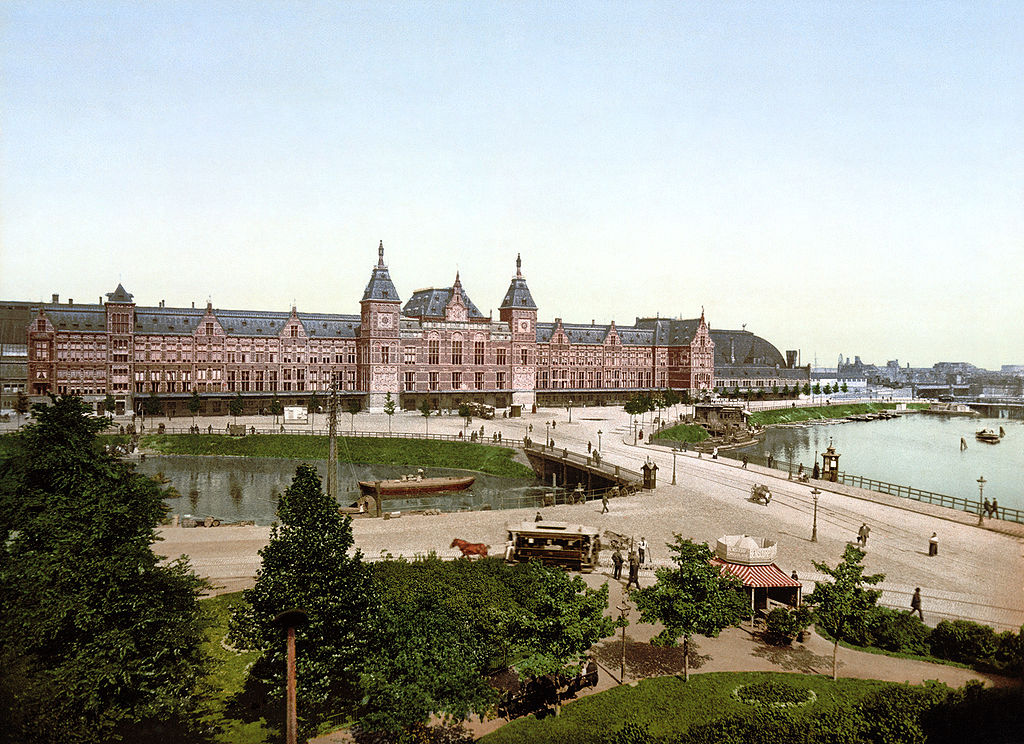
Amsterdam Centraal Station, completed in 1889, was one of the most dramatic symbols of the city’s modernization. Designed by Pierre Cuypers and A.L. van Gendt, the station was built on three artificial islands in the IJ harbor, supported by thousands of wooden piles driven into the riverbed. Its grand neo-Gothic and neo-Renaissance facade made it one of the most impressive railway stations in Europe at the time.
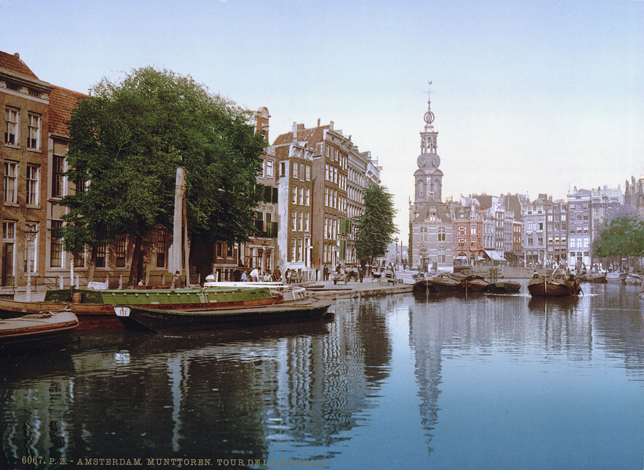
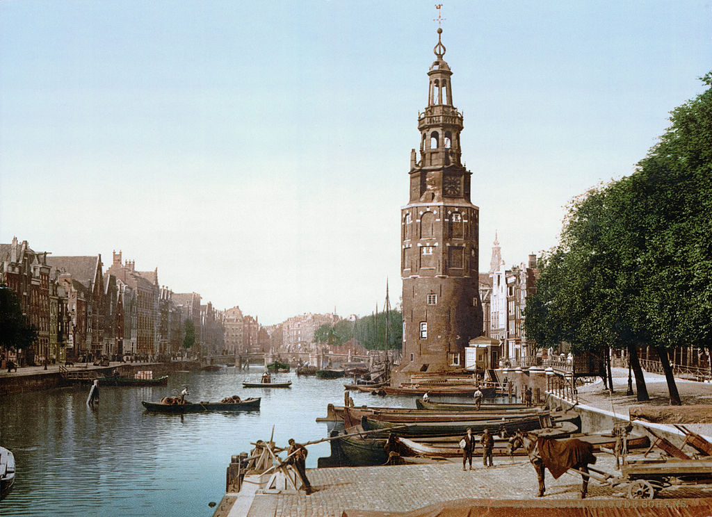
The Singel was originally the outer moat of Amsterdam’s medieval city wall. By the late 19th century, it had long since been transformed into a canal lined with houses and small businesses. Looking down the Singel toward the Muntplein, you could see the Munttoren — the Mint Tower — a 17th-century clock tower that became one of the city’s most recognizable landmarks.
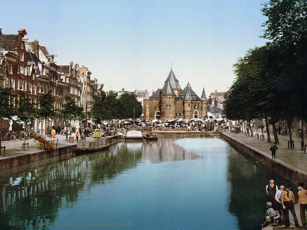
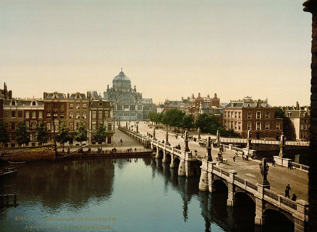
Trade defined Amsterdam’s identity for centuries, and the city’s markets and exchanges reflected that. The bourse — Amsterdam’s stock exchange — was one of the oldest in the world, established in 1602 alongside the Dutch East India Company. By the late 1800s, a new market and exchange building was part of the city’s effort to modernize its commercial infrastructure to meet the demands of an industrial economy.
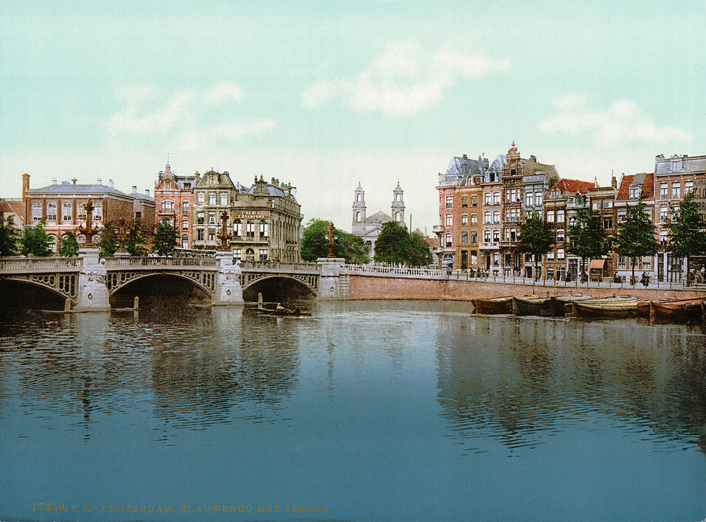
The Blauwbrug, or “Blue Bridge,” spans the Amstel River and connects the Waterlooplein to the Rembrandtplein. The current stone bridge was completed in 1884 and was inspired by the Pont Alexandre III in Paris. It replaced an older wooden bridge that was reportedly painted blue, giving it the name that stuck even after the blue paint was gone.
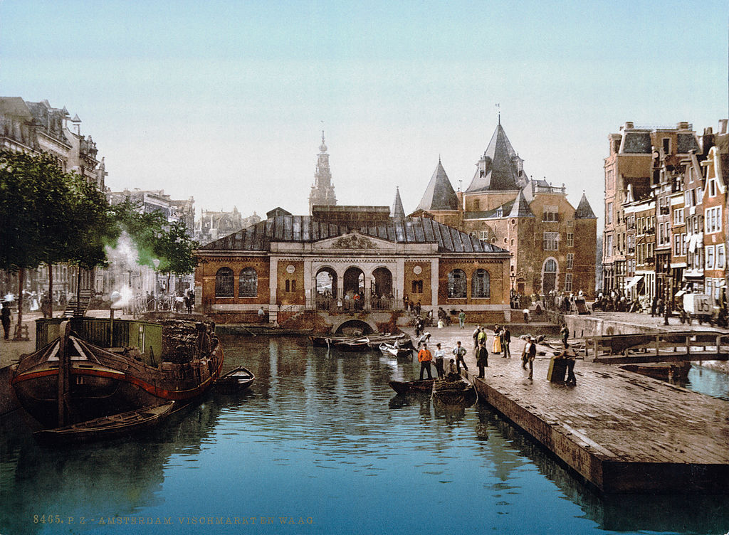
Fish had been central to Amsterdam’s economy since those first fishermen settled on the Amstel in the 12th century. The fish market remained a vital part of city life well into the 19th century, sitting close to the bourse, where buyers and sellers met to conduct business. The two institutions side by side — one ancient, one modern — captured the tension between old Amsterdam and the rapidly changing city it was becoming.
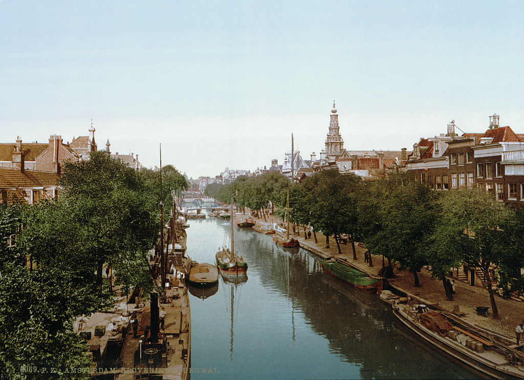
The Kloveniersburgwal is one of Amsterdam’s oldest canals, dating back to the 15th century when it formed part of the city’s outer defense system. By the late 19th century, it was a quiet residential waterway lined with historic buildings, including the Trippenhuis — a grand 17th-century mansion that served as home to the Rijksmuseum’s collection before the new museum building opened.
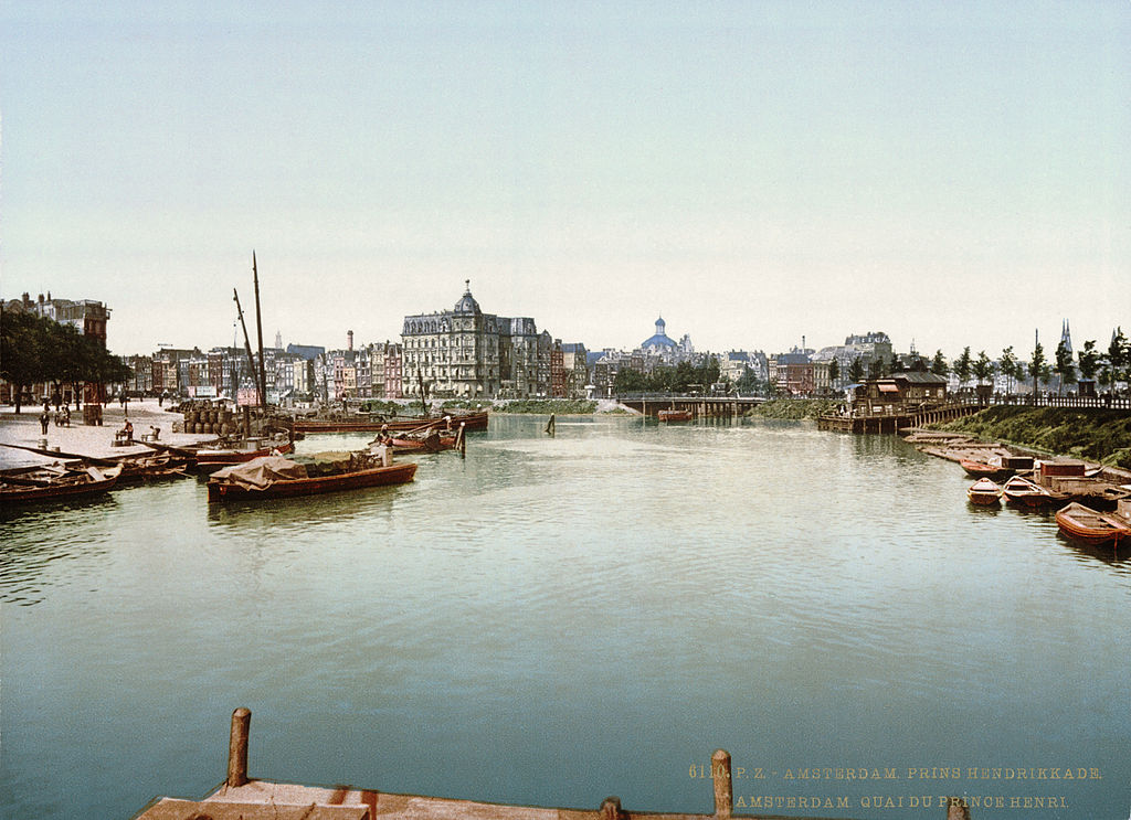
Prince Henry’s quay ran along the waterfront of the IJ, the body of water that had served as Amsterdam’s gateway to the sea for centuries. In the late 19th century, this stretch of the harbor was active with shipping traffic. The construction of Centraal Station nearby transformed the waterfront, but the quay remained a working part of the city’s port activity.
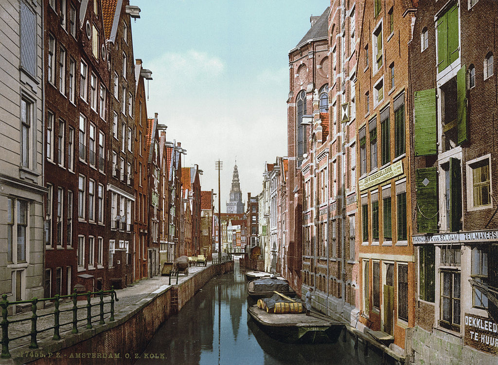
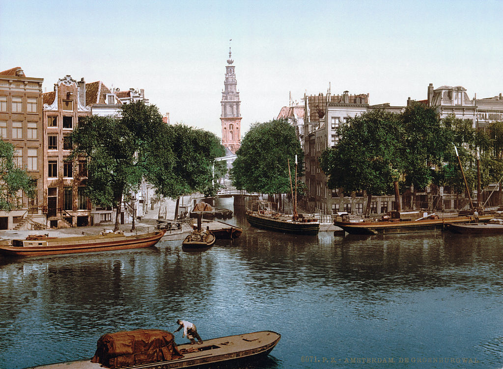
The Oudezijds Kolk — part of Amsterdam’s oldest district — is one of the city’s most ancient waterways. The area around it, known as the Oude Zijde or “Old Side,” was where Amsterdam first grew as a settlement. By the 19th century, the neighborhood was densely packed, its narrow streets and canals largely unchanged from centuries earlier, even as the rest of the city modernized around it.
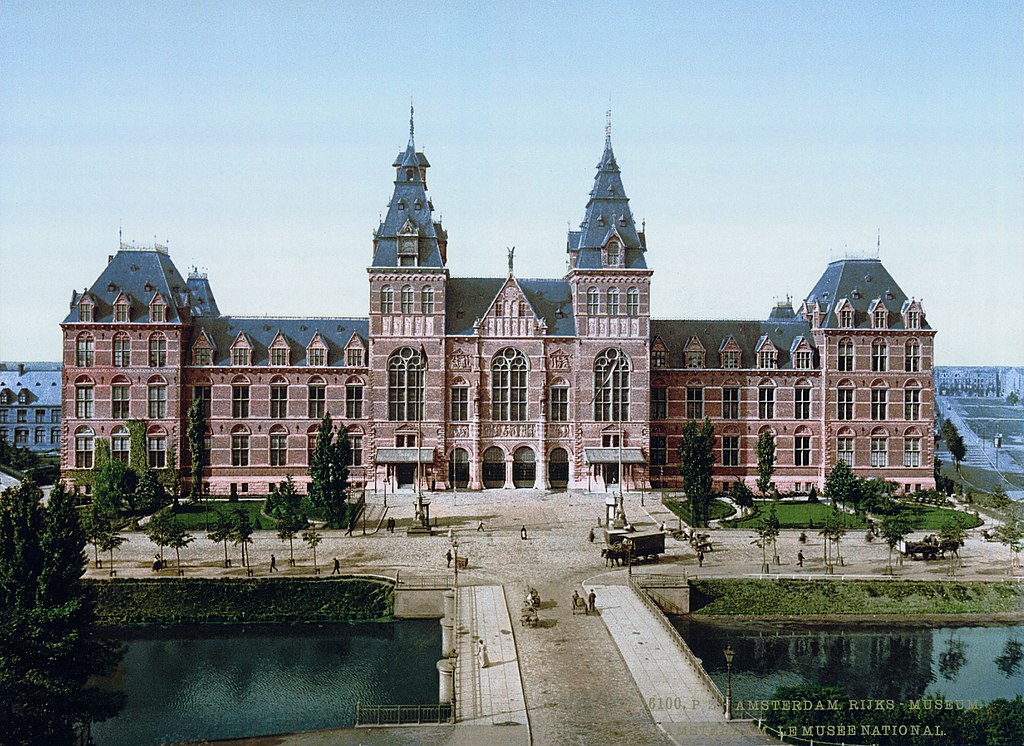
The Rijksmuseum opened its current building in 1885, designed by Pierre Cuypers — the same architect behind Centraal Station. The museum was built to house the Netherlands’ national art collection, including works by Rembrandt, Vermeer, and other Dutch masters. Its grand brick facade and ornate towers made it one of the most striking new buildings in Amsterdam at the time.
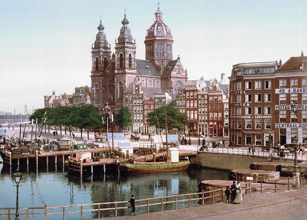
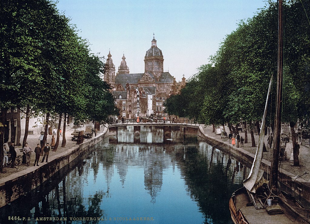
St. Nicholas Church was completed in 1887, making it one of the newest major buildings in Amsterdam during this period. Built just steps from Centraal Station, the Catholic church was designed by A.C. Bleijs in a neo-baroque style. Its twin towers and copper dome made it a powerful architectural statement in a city that had long been dominated by Protestant churches. These photographs, taken in vibrant color, offer a rare and direct look at Amsterdam just as it was crossing the threshold from its historic past into a modern industrial city.




