

The late 19th century was a turbulent and transformative period for Ireland. The memory of the Great Famine of 1845–51 still cut deep across the country, having killed over one million people and driven another million to emigrate. In its wake, the push for Irish autonomy grew louder and more urgent. The Irish Nationalist Party worked to shift the balance of power in the House of Commons, while British politicians increasingly acknowledged that the situation in Ireland demanded a serious response. It was a time of political tension, social change, and deep national feeling — and it was all unfolding against a backdrop of remarkable landscapes, ancient towns, and a people carrying on with daily life.
Into this world stepped Robert John Welch, an Irish photographer whose camera captured Northern Ireland with extraordinary skill and patience. Welch specialized in outdoor photography and spent decades traveling the towns, coastlines, and countryside of Ireland, building an archive of thousands of images. His work from the late 19th and early 20th centuries is now considered among the most important visual records of Irish life ever made. The Ulster Museum holds a permanent exhibition featuring twenty enlarged prints from his collection, focusing on travel and transport. Beyond photography, Welch was a member of the Royal Irish Academy and served as president of both the Belfast Naturalists’ Field Club and the Conchological Society of Great Britain and Ireland.
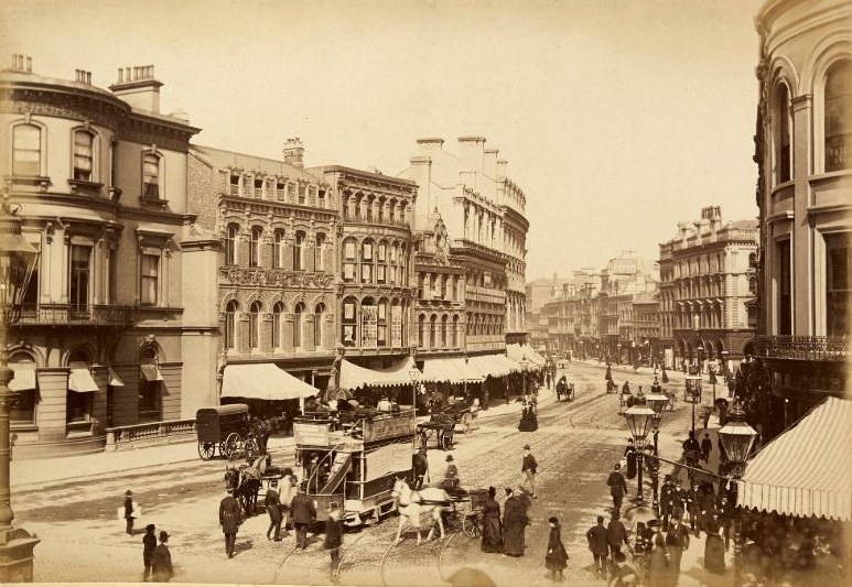
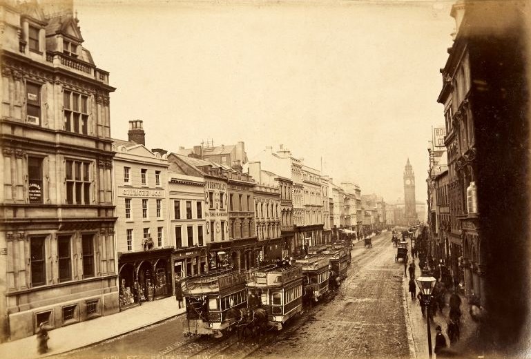
Belfast was the beating heart of Northern Ireland’s urban life during this era, and Welch documented it thoroughly. High Street was one of the city’s main commercial arteries, lined with shops, foot traffic, and the bustle of a growing industrial city.
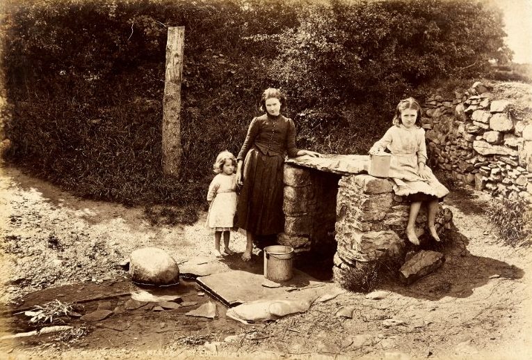
Religion and folklore were woven deeply into everyday Irish life. Holy wells were scattered across the countryside and held great spiritual significance for local communities, many of whom visited them for prayer, healing, and ritual — traditions that stretched back centuries before Christianity arrived and were simply absorbed into Catholic practice.
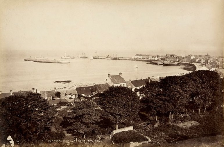
The coastal town of Donaghadee sits on the eastern shore of County Down, offering a clear view across the North Channel toward Scotland. From its fortified position, the surrounding harbor and sea were easy to survey — a strategic feature that had made the town an important landing point for centuries.
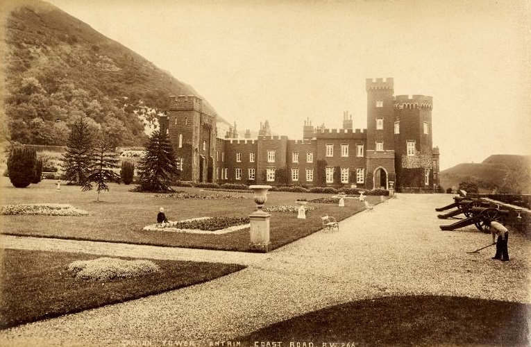
The Antrim Coast Road, built in the 1830s, was one of the great engineering achievements of 19th-century Ireland. It opened up the glens and coastal communities of County Antrim to the wider world. Garron Tower, a Victorian folly built by Frances Anne Vane-Tempest, stood as a distinctive landmark along this dramatic stretch of coastline.
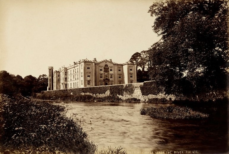
Antrim Castle sat at the edge of the Six Mile Water river, its grounds carefully landscaped in the formal style fashionable among the Anglo-Irish gentry. The castle itself dated back to the early 17th century and remained a seat of the Massereene family for generations.
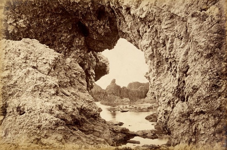
The north Antrim coast offered some of the most dramatic rock scenery in all of Ireland. Near the small village of Ballintoy, the shoreline breaks into jagged basalt formations and limestone outcrops shaped by millions of years of geological activity.
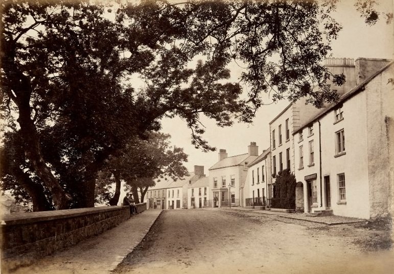
Ballycastle was a market town and small port on the northeast tip of County Antrim. Quay Road connected the town center to its harbor, where boats carried coal, limestone, and other goods along the coast. Welch captured the quiet, workaday character of the street in a way that few images of the era managed.
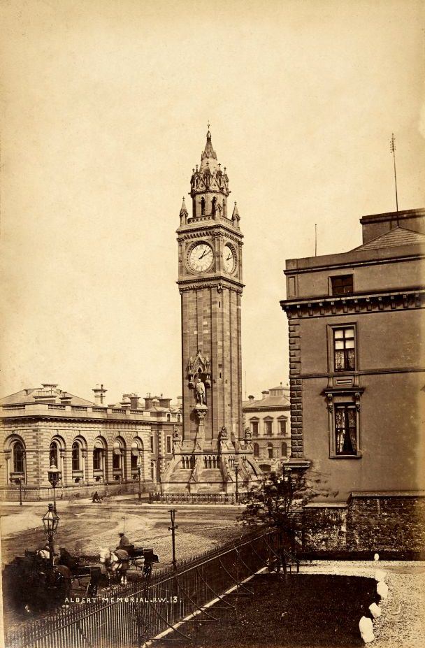
Back in Belfast, the Albert Memorial Clock Tower stood as one of the city’s most recognizable landmarks. Completed in 1869, it was built to honor Prince Albert, Queen Victoria’s late husband. The tower is known for a slight lean it developed due to the soft ground beneath its foundations.
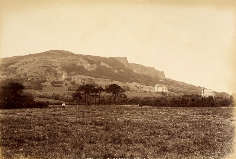
Cave Hill rises sharply to the north of Belfast, its basalt cliffs forming a natural boundary between the city and the countryside beyond. Belfast Castle, rebuilt in the Scottish Baronial style and completed in 1870, sat on its lower slopes — a grand residence with a commanding view over the city and Belfast Lough.
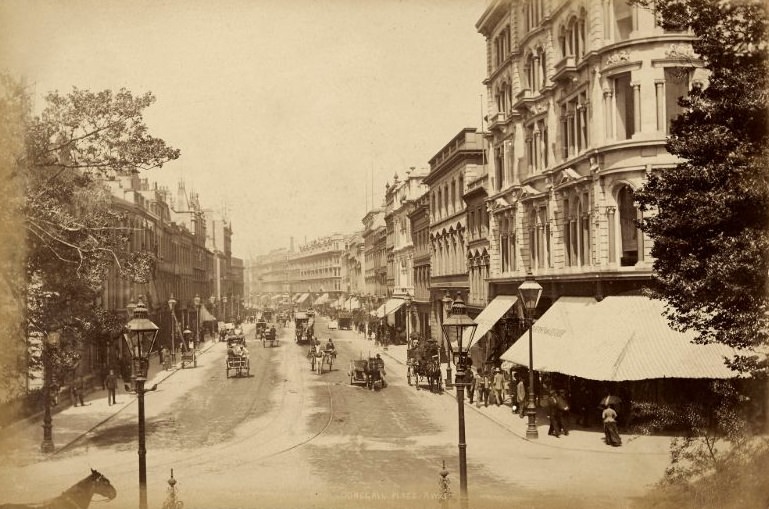
Donegall Place was Belfast’s premier shopping street in the Victorian era. Wide, well-maintained, and lined with substantial commercial buildings, it reflected the confidence of a city that had grown rapidly on the back of linen manufacturing and, later, shipbuilding.
Welch returned to High Street more than once, capturing it from different angles and at different times. Each image tells a slightly different story about the rhythm of commerce and movement in the city’s core.
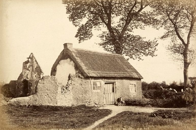
Not far from the grand facades of the city center, Irish mud cabins still stood in certain areas of Belfast. These simple single-room structures, built from mud, straw, and stone, were the standard rural dwelling for poor families across Ireland for centuries. Their presence at Bladon Park, within sight of an expanding industrial city, illustrated the sharp divide between wealth and poverty in Victorian Belfast.
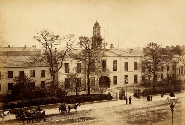
The Linen Hall Library was founded in 1788 and remains one of Belfast’s oldest institutions. In the 19th century, it served as a hub for intellectual life in the city — a place where merchants, lawyers, and educated citizens gathered to read, debate, and exchange ideas.
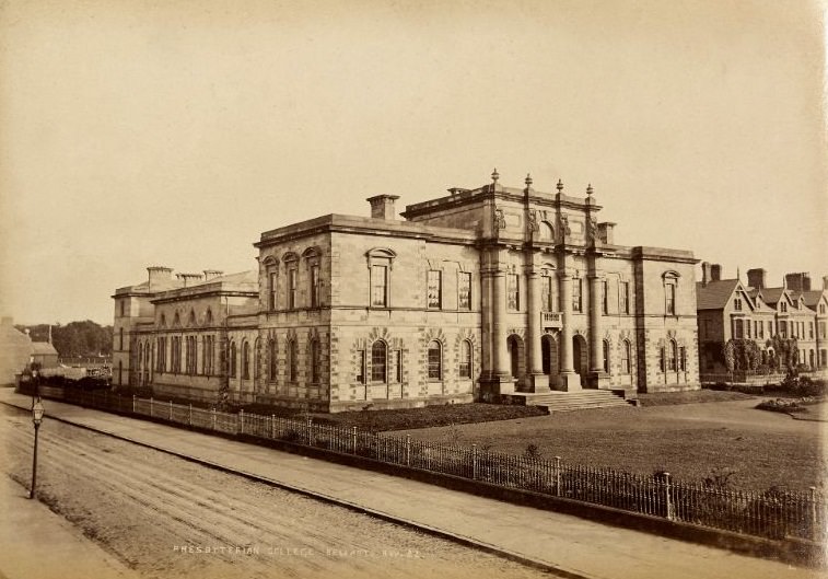
Presbyterian College Belfast, also known as Assembly’s College, was established in 1853 to train ministers for the Presbyterian Church in Ireland. Its imposing stone building on Botanic Avenue stood as a symbol of the strong Presbyterian tradition that shaped much of northern Irish society and culture.
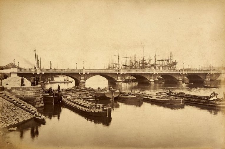
Queen’s Bridge crossed the River Lagan and was a critical link between Belfast’s city center and the east of the city. First opened in 1843, the bridge carried a steady flow of workers, carts, and goods between the docks and the commercial heart of the city.
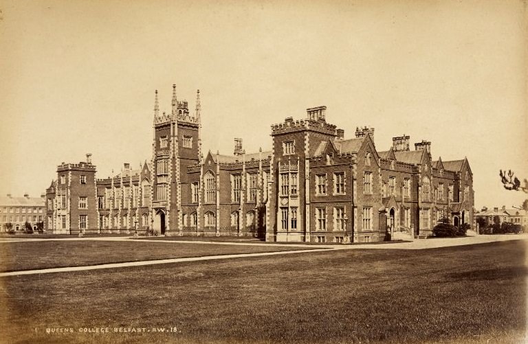
Queen’s University Belfast was founded in 1845 as one of three Queen’s Colleges established across Ireland by the British government. Its Tudor Revival architecture, designed by Charles Lanyon, gave the institution a sense of permanence and prestige from the moment it opened.
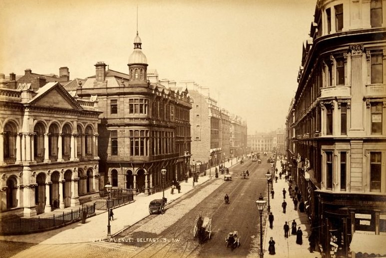
Royal Avenue was a relatively new street in the Belfast that Welch photographed. It was cut through the older parts of the city in the 1880s as part of a major urban improvement scheme, and quickly became one of the city’s busiest thoroughfares.
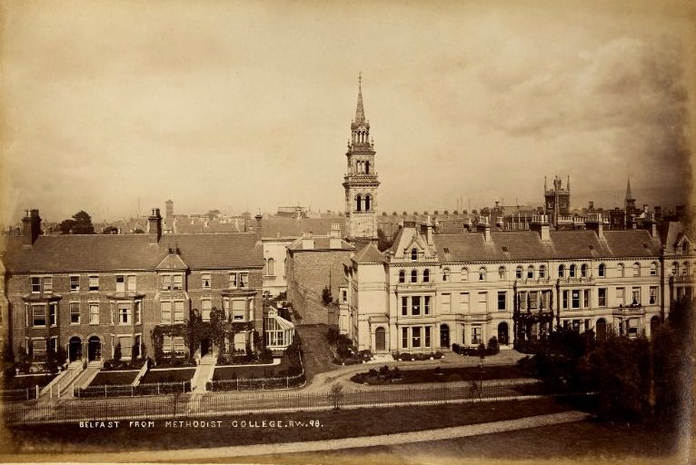
Methodist College Belfast, founded in 1868, sat on a slight elevation that offered a clear view across the city’s rooftops. Welch used this vantage point to capture a wide panorama of Belfast — the dense urban fabric of a city in the middle of its industrial peak.
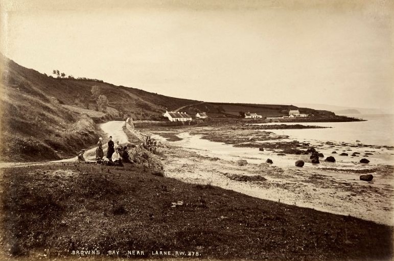
Leaving the city behind, the coastline north of Larne offered a quieter kind of beauty. Browns Bay was a sheltered cove set against the rolling hills of Islandmagee, its calm waters a contrast to the rougher seas of the open North Channel just beyond.
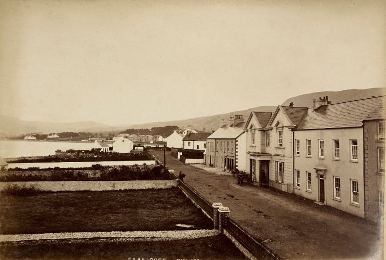
The village of Carnlough sits at the foot of Glencloy, one of the nine Glens of Antrim. In the 19th century, it was an active limestone quarrying community, with a small harbor built specifically to ship stone to other parts of Ireland and Britain.
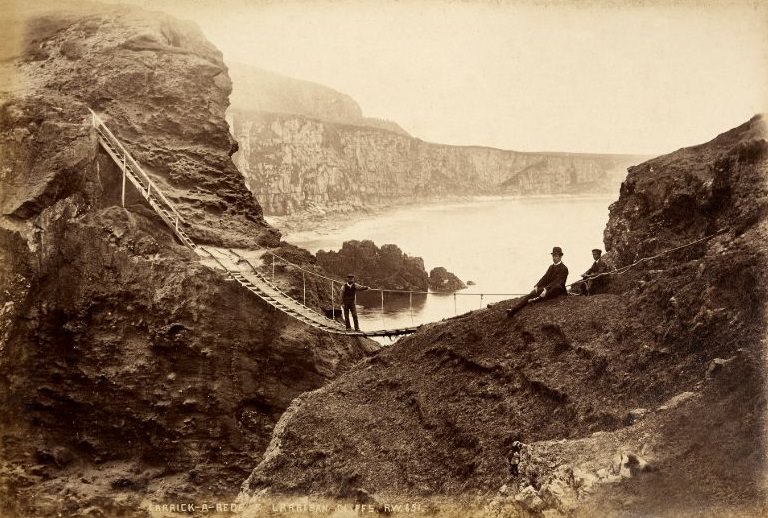
The Carrick-a-Rede rope bridge drew visitors even in the Victorian era, connecting the mainland to a small rocky island used by salmon fishermen. The cliffs at Larriban nearby drop sharply into the sea, forming one of the most visually striking sections of the entire Antrim coastline.
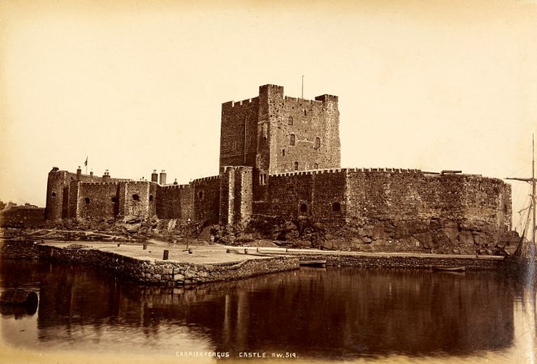
Carrickfergus Castle is one of the best-preserved Norman castles in Ireland. Built by John de Courcy following his invasion of Ulster in 1177, it guarded the entrance to Belfast Lough for centuries and served at various times as a military garrison, a prison, and an arms depot.
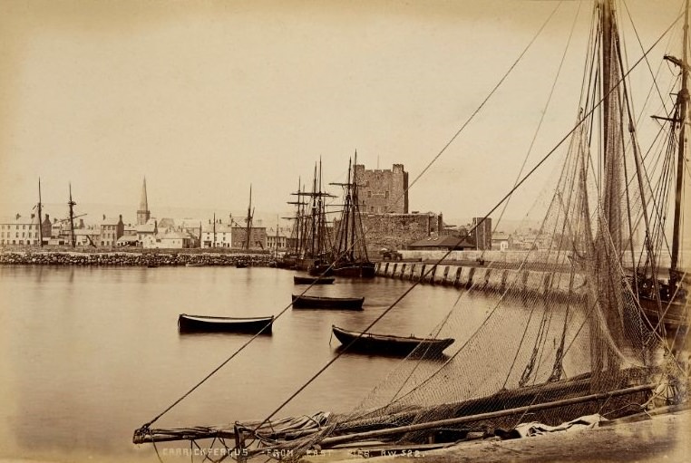
Viewed from East Pier, Carrickfergus spread along its waterfront in a way that made clear its long history as a port town. The castle dominated the shoreline, while the town behind it showed the modest scale of a community that had grown slowly over many centuries.
Welch’s lens also turned to the social rituals of Irish life. A wedding party arriving in Carrickfergus was the kind of everyday moment that most photographers of the era overlooked in favor of landscapes and monuments. Welch understood that these human scenes were just as historically valuable.
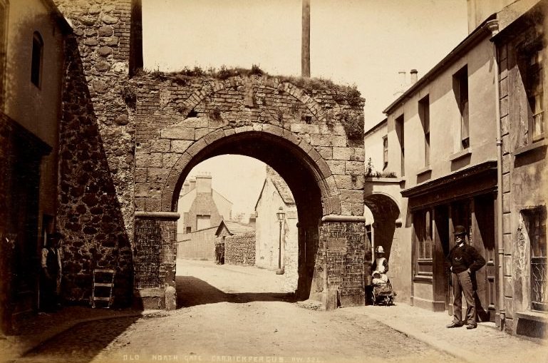
The Old North Gate of Carrickfergus was one of the surviving pieces of the town’s medieval walls. By the late 19th century, much of the original fortification had been demolished to make way for modern streets, but the North Gate still stood as a physical link to the town’s walled past.
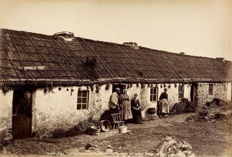
At the Giant’s Causeway, a woman known as Widow Laverty made her living telling stories to tourists at the Causeway Cottages. She recounted the legend of Finn McCool — the Irish giant said to have built the Causeway as a path to Scotland — drawing visitors into the oral tradition that had kept these stories alive for generations.
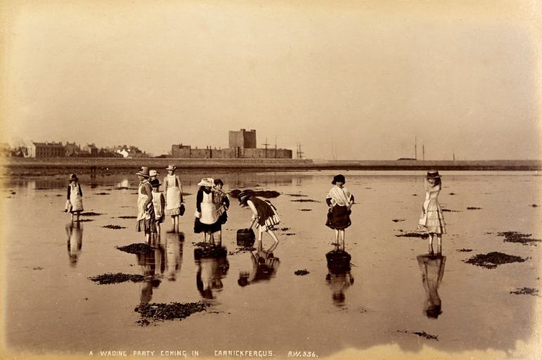
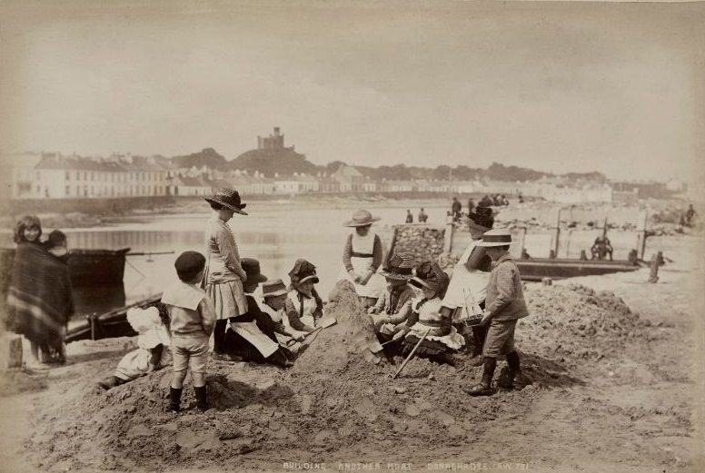
Children playing on the sand were a common sight along the Antrim coast during summer months. Even in the Victorian era, the beaches attracted families from Belfast and other towns, and the children who played there left their own brief marks on the landscape.
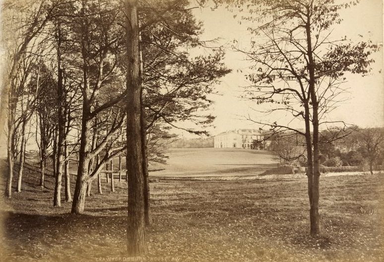
Crawfordsburn, a small village in County Down, was home to one of the oldest hotels in Ireland. Crawfordsburn House stood in a wooded glen, its surroundings popular with walkers and day-trippers from Belfast who could reach it by train on the newly built railway line along the southern shore of Belfast Lough.
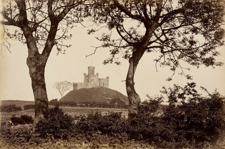
The Donaghadee Mound was a large earthwork that dominated the harbor area of the town. Its origins were debated even in Welch’s time, with some attributing it to Viking activity and others to earlier Norman fortifications. Whatever its origin, it remained a defining feature of the Donaghadee skyline.
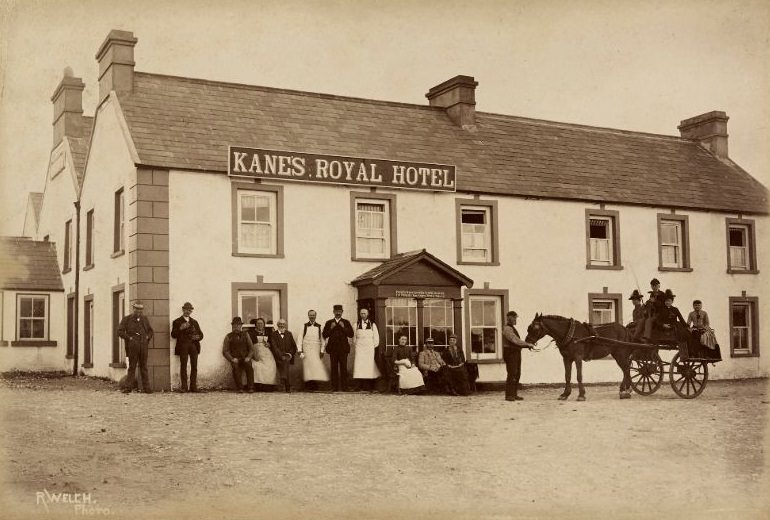
Tourism at the Giant’s Causeway was already well established by the time Welch arrived with his camera. Kane’s Royal Hotel catered to the growing number of visitors drawn to the basalt columns, offering accommodation within walking distance of one of the most remarkable geological formations in Europe.
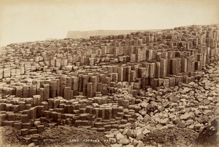
Lord Antrim’s Parlour was one of the named formations within the Giant’s Causeway — a sheltered cluster of basalt columns that guide books and tour operators had given colorful names to attract visitors. These labels helped tourists navigate and appreciate a landscape that could otherwise feel overwhelming in its scale.
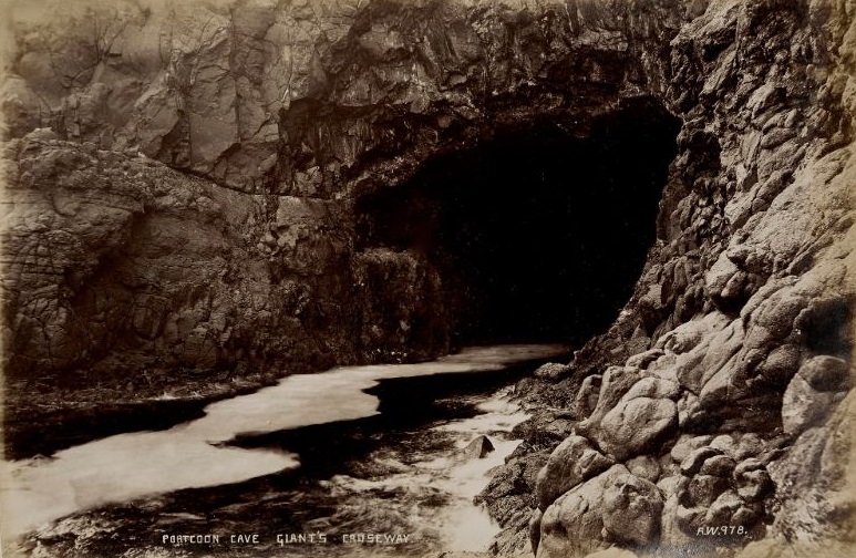
Portcoon Cave cut into the basalt cliffs at the edge of the Causeway, accessible only at low tide or by boat. Its dark interior and the sound of the sea echoing within it made it one of the more memorable natural features along this already spectacular stretch of coastline.
The Giant’s Fan was another named section of the Causeway, where the basalt columns spread outward in a shape that Victorian visitors found particularly photogenic. Welch photographed these formations with a level of technical precision that reflected both his skill and his understanding of light in an outdoor setting.
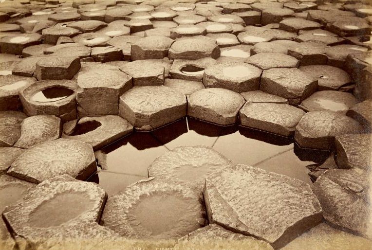
The Giant’s Honeycomb was among the most frequently photographed sections of the Causeway. The tightly packed hexagonal columns, formed by the slow cooling of ancient lava flows, created a surface that looked almost too geometric to be natural.
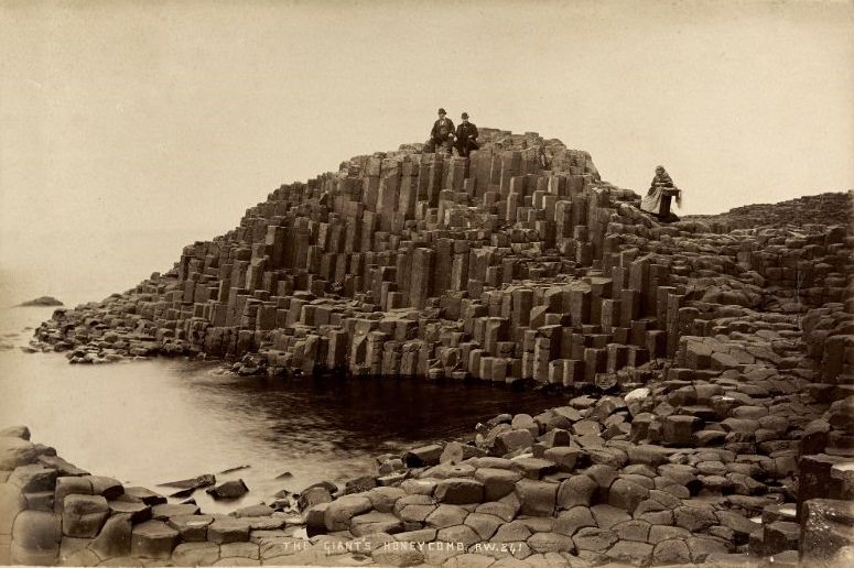
The Giant’s Well was a small natural spring among the basalt rocks, another feature that had been woven into the mythology surrounding Finn McCool. Tour guides of the era used every such feature as an opportunity to reinforce the legend and enrich the visitor experience.
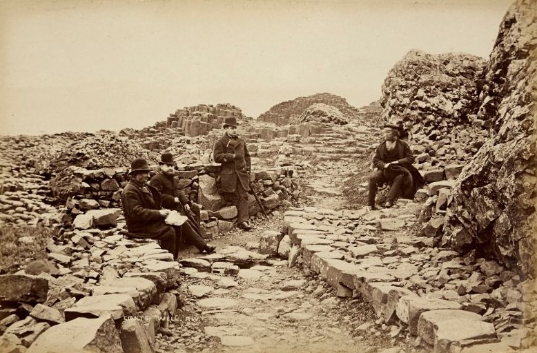
Glenariffe is considered the most scenic of the nine Glens of Antrim. From above Ess-Na-Crub — one of its most celebrated waterfalls — the glen spread out in a wide, forested valley that dropped steeply toward the sea. Welch photographed it from the high ground, giving full scope to the landscape below.
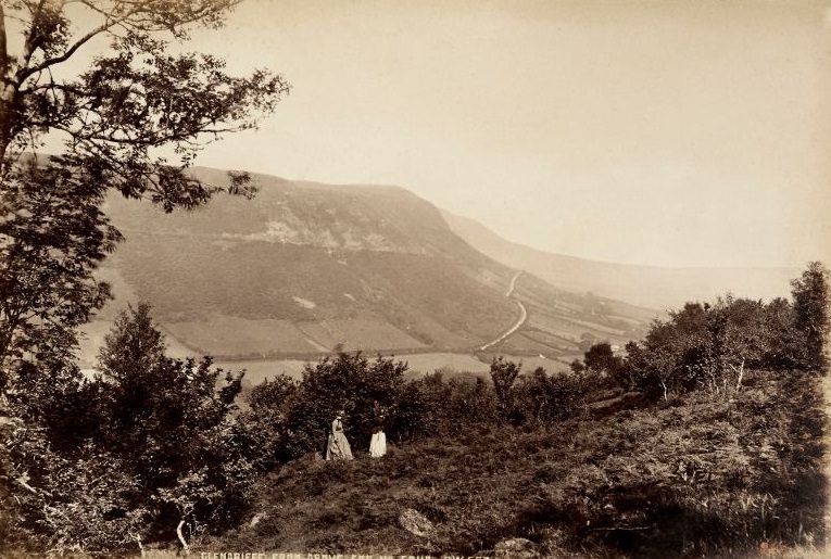
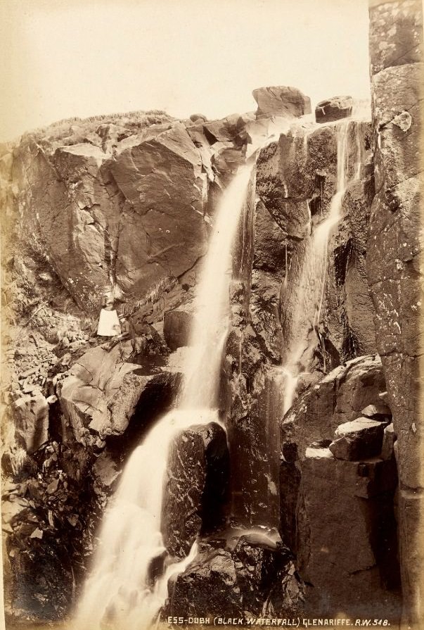
Within Glenariffe, the Black Waterfall plunged through dark basalt rock, its waters stained by peat from the upland bogs above. The contrast between the dark rock and the white rushing water made it one of the glen’s most striking natural features.
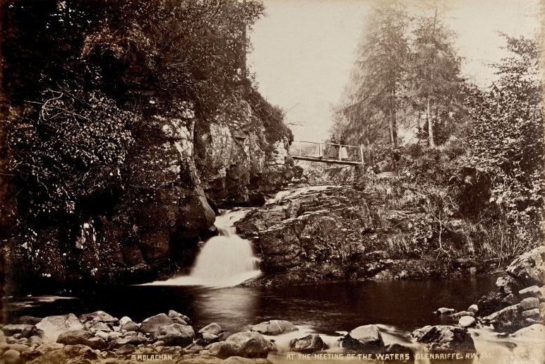
Two streams met at the floor of Glenariffe, creating the spot known as the Meeting of the Waters. It was a place where the glen’s character — dense, green, and constantly moving with the sound of water — was fully on display.
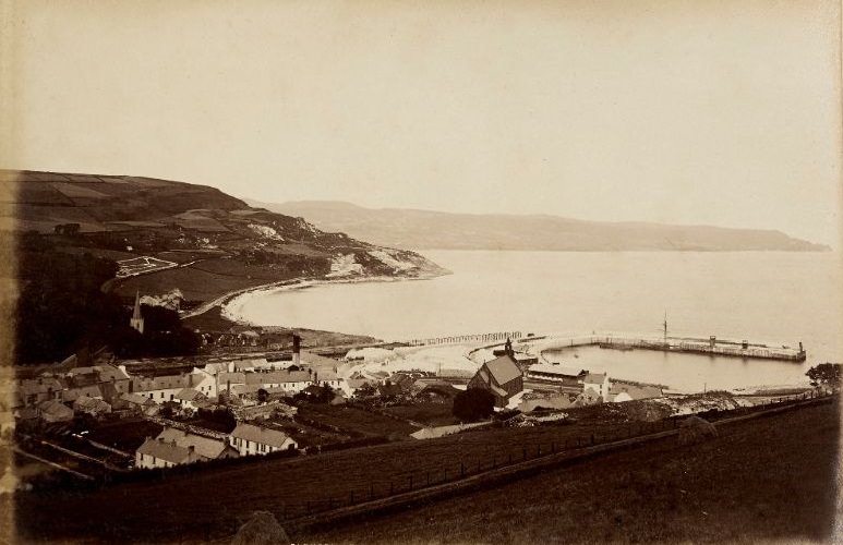
Glenarm Bay offered a natural harbor sheltered by the headland at Garron Point. The small harbor at Glenarm had served the local community for generations, handling fishing boats and small cargo vessels carrying limestone quarried from the surrounding hills.
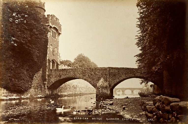
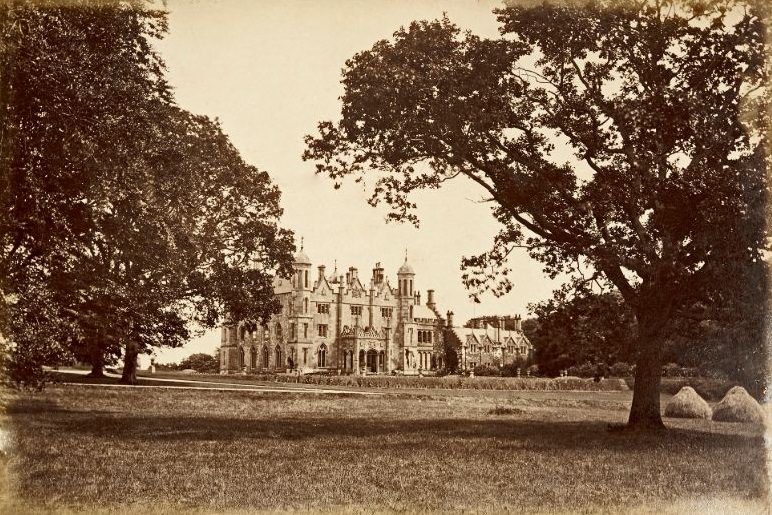
Glenarm Castle was the seat of the McDonnell family, Earls of Antrim, one of the most powerful aristocratic families in Ulster. The Barbican Bridge at the castle entrance was a gothic-style gatehouse that added a theatrical quality to an already imposing residence.
The castle itself, when viewed directly, showed the scale of the McDonnell estate. Rebuilt and extended multiple times over the centuries, by the late 19th century it presented a largely Victorian Gothic facade, set against the wooded hills of the glen behind it.
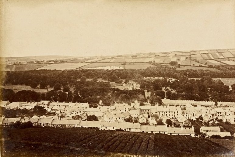
The village of Glenarm sat at the mouth of the glen, its stone buildings tight along the river. It was one of the oldest towns in County Antrim, its history tied closely to the castle and the fishing and quarrying industries that sustained the local economy.
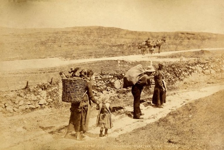
Rural life across Ireland in this period meant physical labor from morning to night. Cutting and carrying turf — blocks of dried peat used as fuel — was a seasonal task that every rural family undertook. Donkeys loaded with creels of turf were a standard sight on country roads throughout the year.
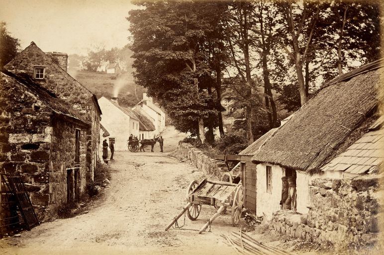
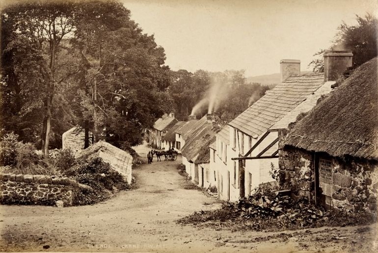
The village of Glenoe near Larne sits at the head of a small glen with a waterfall at its center. Welch photographed it more than once, drawn back by a landscape that rewarded careful observation.
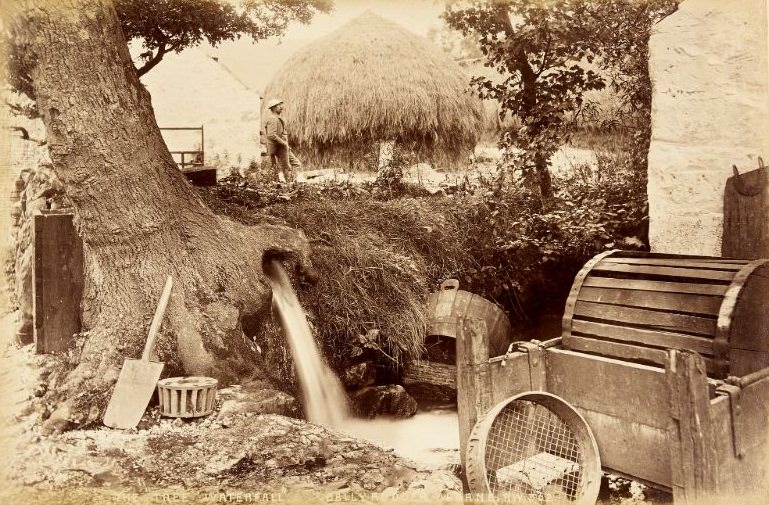
At Ballyrudder near Larne, a waterfall known as the Tree Waterfall dropped through a dense canopy of overhanging branches, creating an enclosed, almost tunnel-like effect around the falling water. It was a quiet, intimate scene — far removed from the exposed drama of the Antrim coastline.
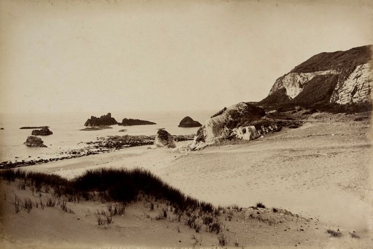
Whitepark Bay on the north Antrim coast was a wide, sweeping stretch of white sand backed by chalk cliffs. At its eastern end, the bay narrowed and the cliffs rose more steeply, offering views along the full length of the beach and out toward the open sea.
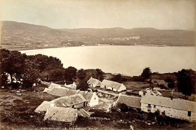
Straidkilly overlooked the village of Carnlough and the bay below, offering an elevated perspective on a stretch of coastline that Welch returned to repeatedly throughout his career. The combination of farmland, cliffs, and sea made it one of the most compositionally rich locations on the entire Antrim coast.
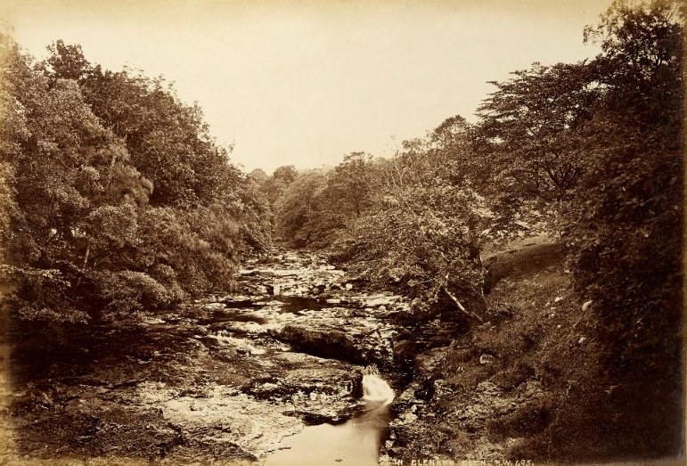
Glenarm Glen was threaded through with streams that fed down from the hills above the castle. Walking along these waterways meant moving through a landscape that shifted constantly — from open meadow to dense woodland, from smooth water to broken rapids. Welch followed this stream with his camera, leaving behind a record of a place that most people of his era would never have had the chance to see.

In the 19th century, wasn’t Ireland just regular?
Belfast had some beautiful buildings. Bombs destroyed many, but the majority were killed by poor city planning and replaced with ugly, bland slabs that now dominate the main shopping areas in Belfast.
What happened to Antrim Castle?
Fire in the 1920s, demolished in the 1970s
These are pictures of Ireland, not Northern Ireland
Northern Ireland didn’t even exist; we were happily unified at this time, before those from a foreign land divided us.
We were only unified for a brief period. Britain passed the act of union act directly after the 1798 rebellion, but it didn’t last long as Northern Ireland was created in 1921 to bring an end to the Anglo/Irish conflict. I truly believe after everything that’s came and past, we should be in a position to have proper dialogue about one island one Ireland, where everyone realises we aren’t so different to each after all.
Catholics/Protestants/non Conformists all need to realise that we are stronger together..
You were not unified for a short period – that is absurd. Ireland was one country (albeit under colonialist oppressive rule of the United Kingdom for quite some time).
The architecture in Belfast was so beautiful, shocking how much of it is gone or lying dereliction, i wish they would fix it up and bring back all the historical architecture that’s gone, would probably improve the tourism in the city too.