
In January 1952, heavy rainfall hit Los Angeles with a force the city was poorly prepared to handle. Streets turned into rivers, neighborhoods flooded within hours, and residents were stranded on rooftops and upper floors waiting for rescue. The San Fernando Valley — including Van Nuys and surrounding communities — took some of the worst of it. A second round of flooding struck again in November of that same year, proving that January was not an isolated event but part of a brutal, rain-soaked year for Southern California.
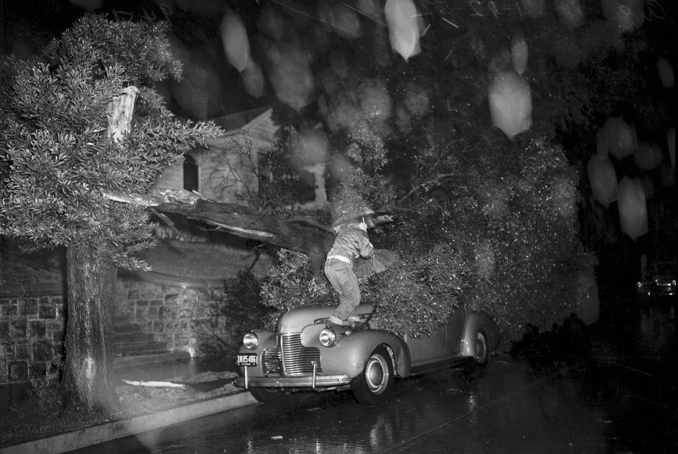
The photographs taken across Los Angeles in 1952 tell the story in stark detail. Cars swallowed by mudslides, bridges sinking into eroded foundations, and residents wading through chest-deep water became common sights. Emergency workers, lifeguards, and volunteers scrambled to keep pace with the scale of the disaster. Some residents didn’t make it out in time.
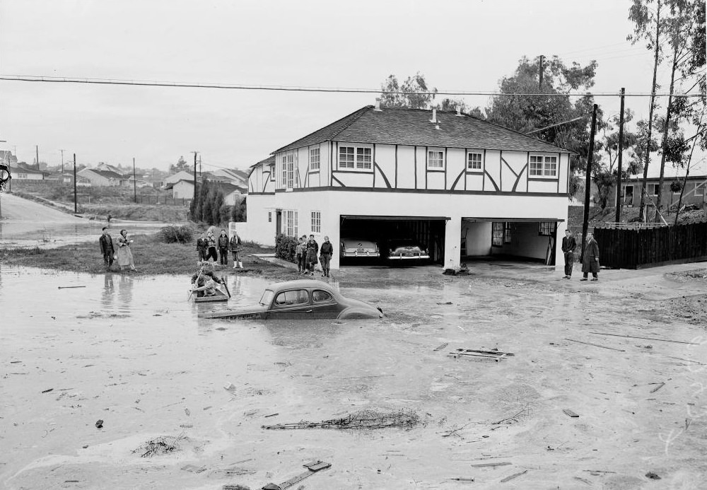
The Cahuenga Pass, one of the main routes connecting the San Fernando Valley to Hollywood, was overwhelmed by January floodwaters. The pass, cut through the Santa Monica Mountains, was particularly vulnerable — water rushing down its slopes had nowhere to go but into the roadway below.
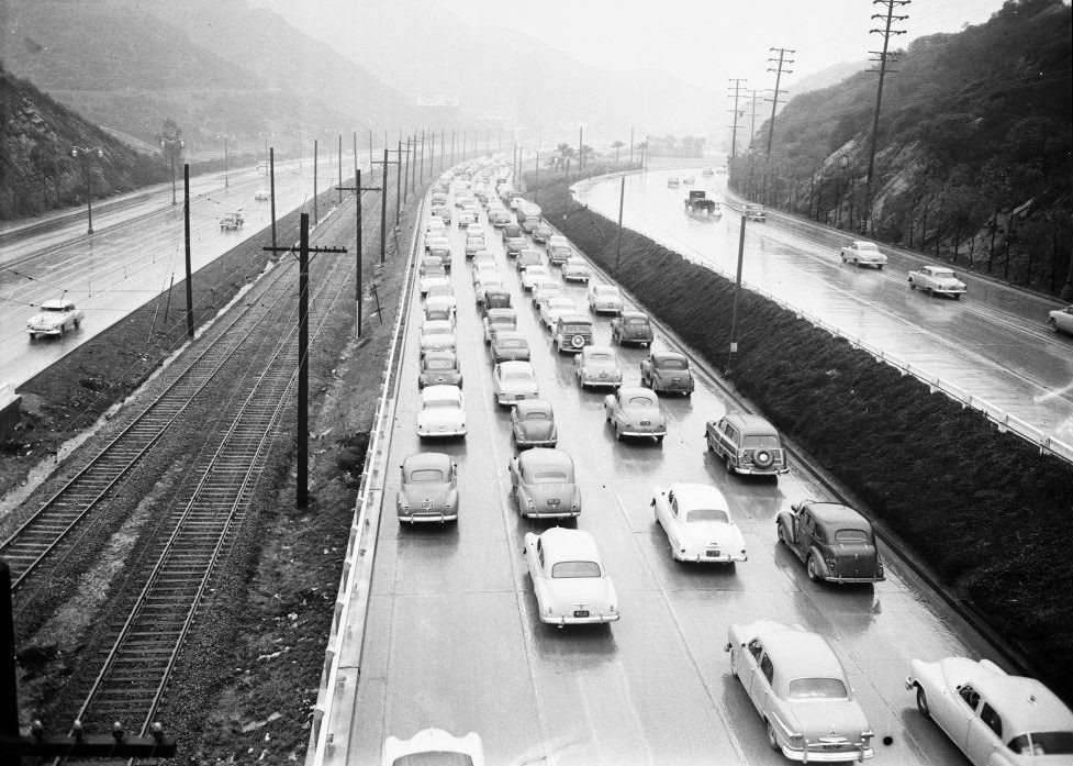
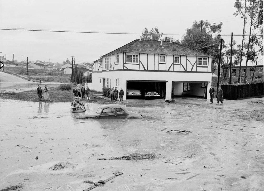
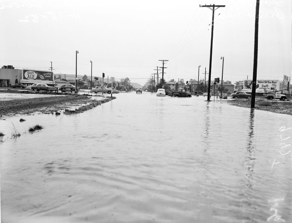
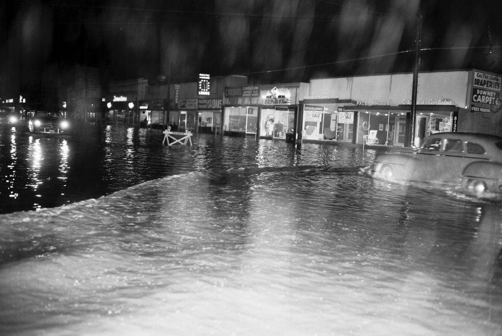
Residential streets fared no better. Tyrone Avenue in Los Angeles was submerged, trapping residents and their vehicles. Entire blocks looked more like shallow lakes than suburban neighborhoods. On January 16 alone, multiple locations across the city recorded dramatic damage.
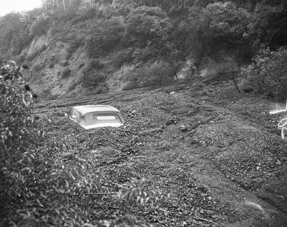
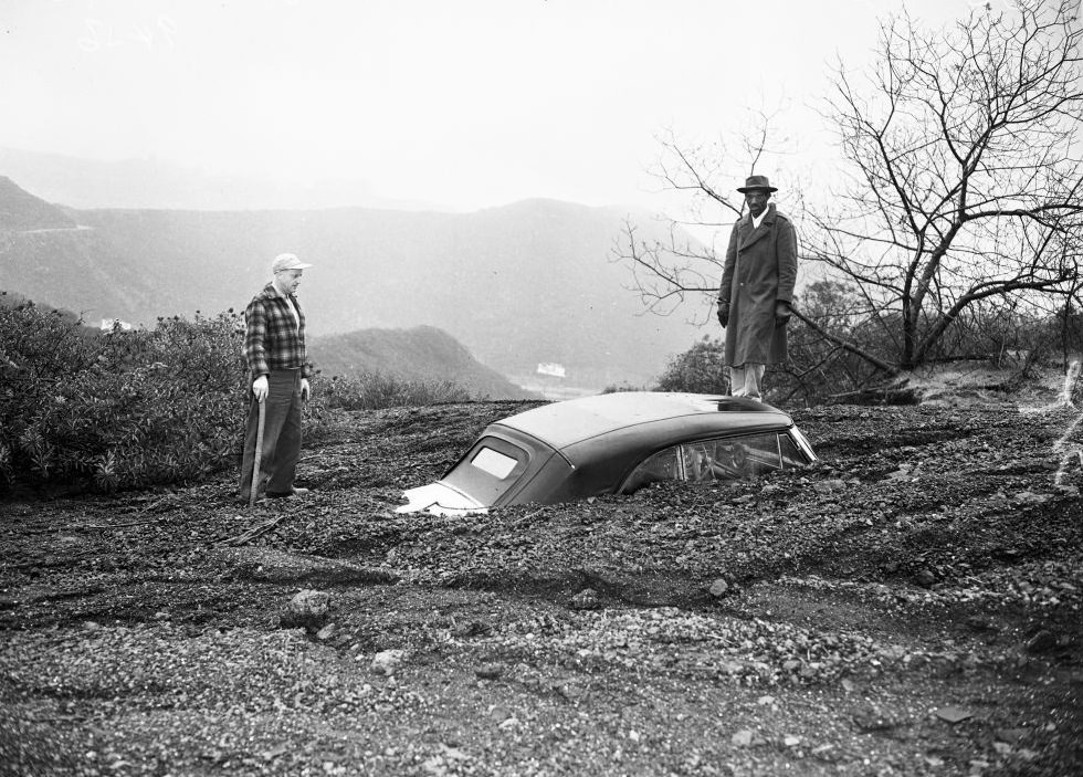
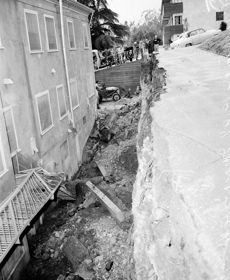
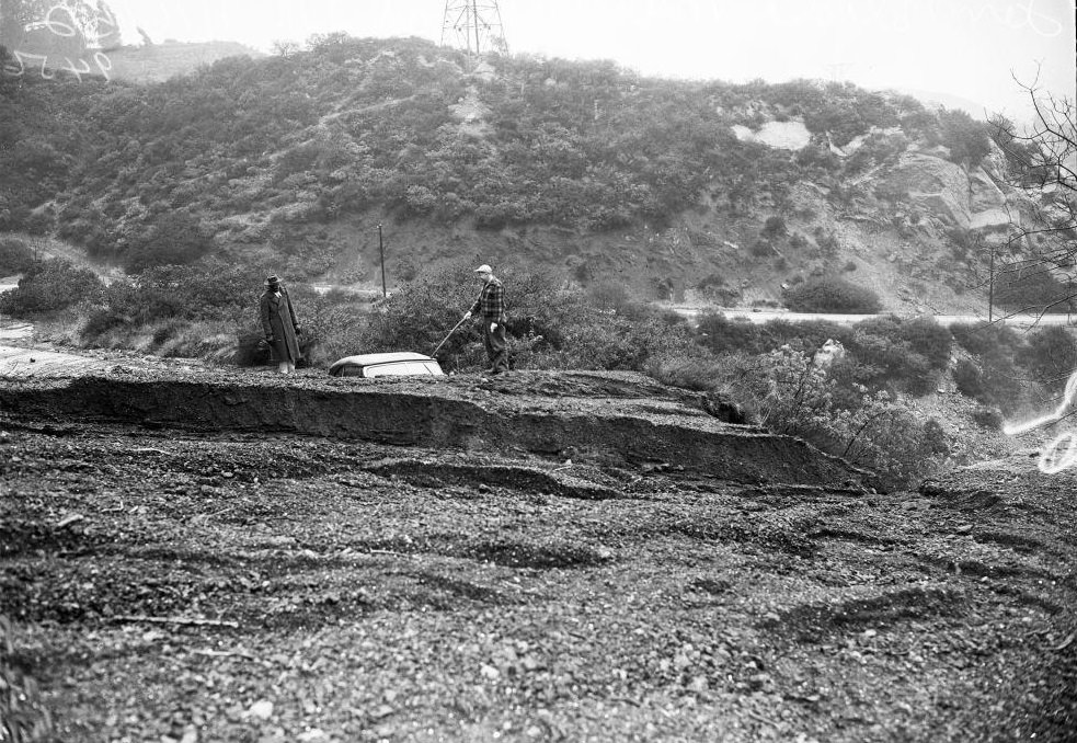
Mulholland Drive, the winding road that runs along the crest of the Santa Monica Mountains, was hit by landslides on January 16. The unstable hillsides, saturated with days of rain, gave way and buried vehicles where they sat. In one case, only the roof of a car was visible above the mud.
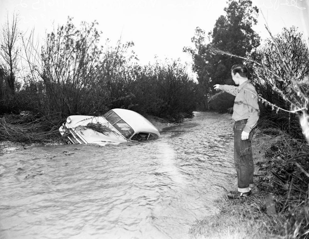
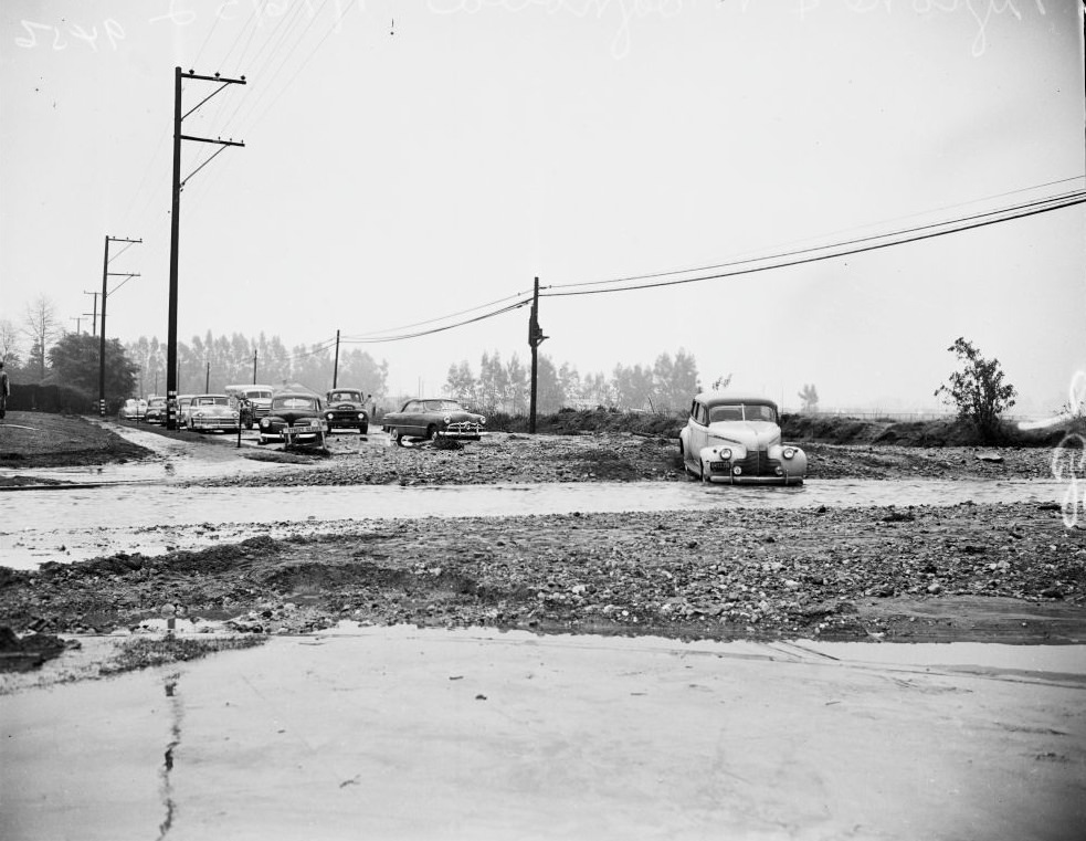
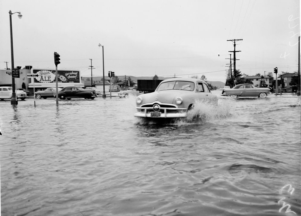
Road closures spread across the city as conditions deteriorated. On Magnolia Boulevard, signs went up warning drivers to turn back. Flooded intersections made navigation by car not just difficult but deadly. Police set up blockades at key points, including Beverly Glen Boulevard, to stop motorists from driving into dangerous water levels.
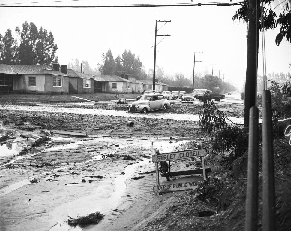
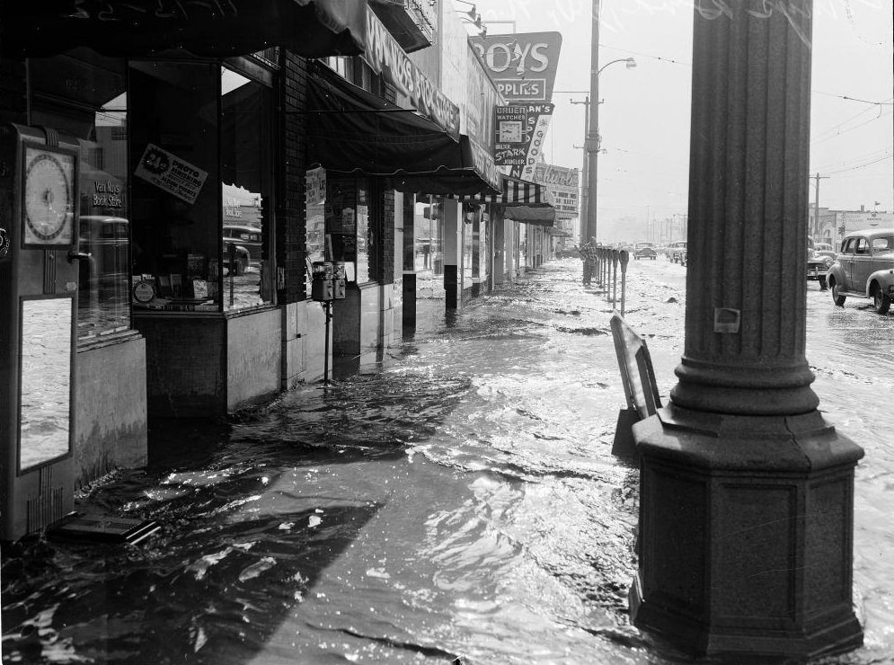
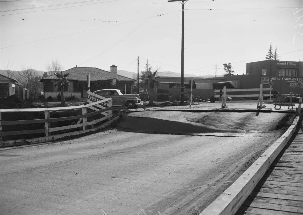
By January 18, Van Nuys was deeply flooded. Sylvan Street in front of City Hall sat under water, and the surrounding area looked unrecognizable. The Van Nuys Boulevard bridge had sunk three feet at its south end after the earth beneath its foundation washed away — a sign of just how thoroughly the soil had been saturated.
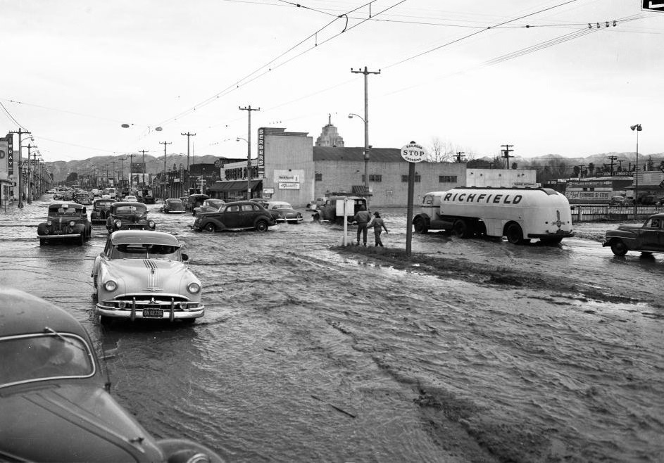
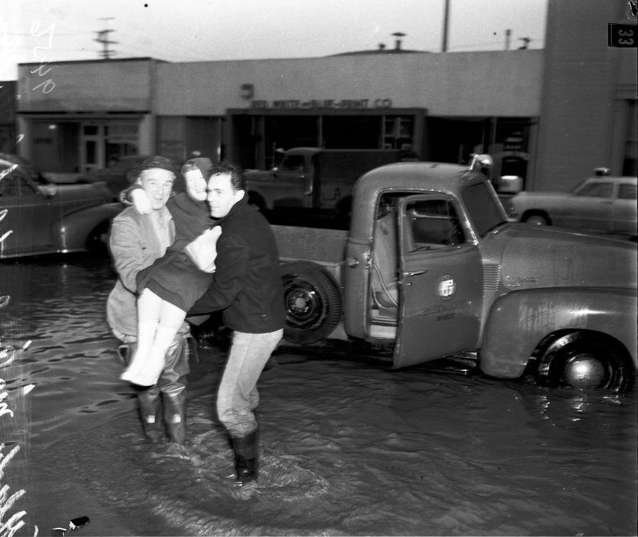
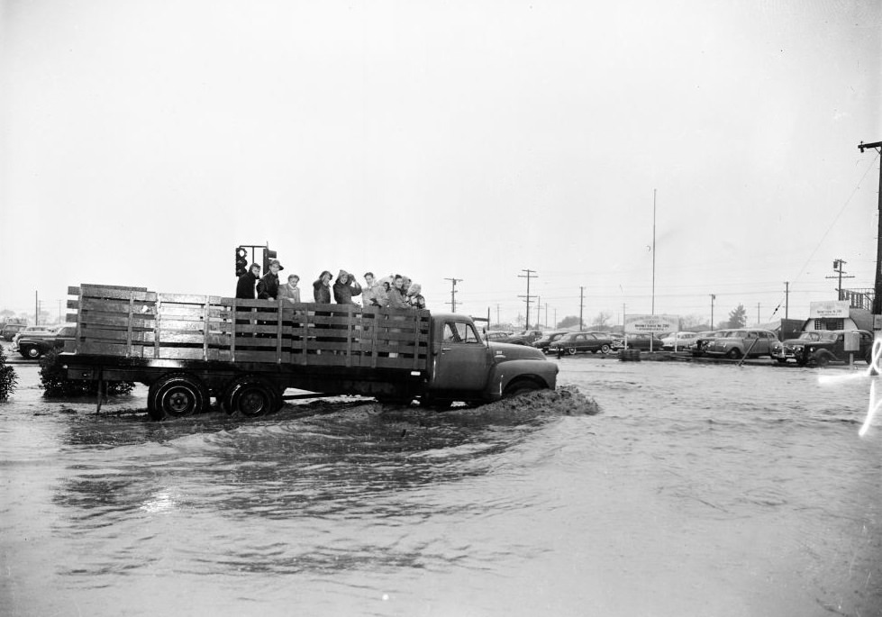
Rescue operations in Van Nuys required boats and trucks working together. Lifeguard service vehicles were deployed alongside small watercraft to reach people trapped in their homes. Flood victims were pulled from upper windows and carried through the water to waiting trucks.
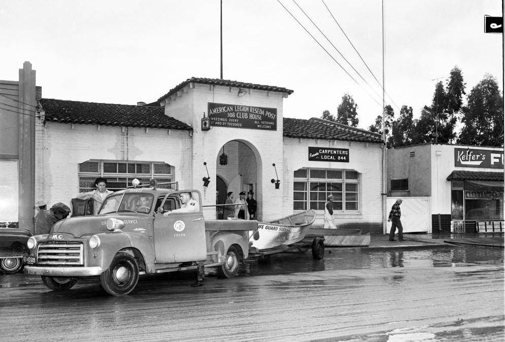
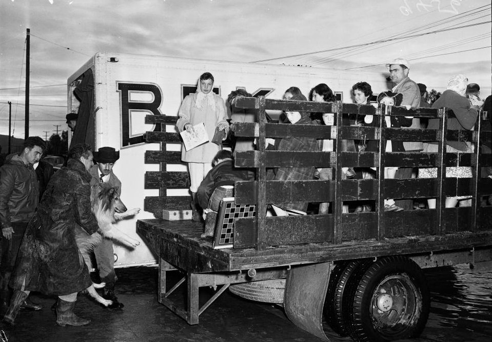
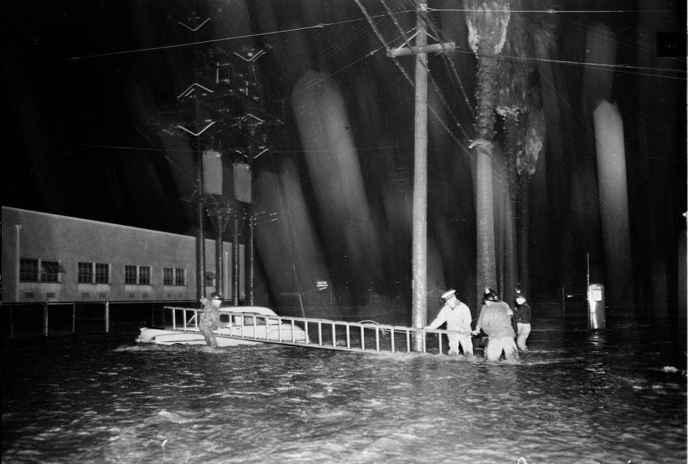
The intersection of Van Nuys and Aetna was a scene of gridlock and chaos, with vehicles stalled in rising water and emergency workers trying to manage the flow of stranded residents. Traffic at the intersection became completely overwhelmed as the floodwater peaked.
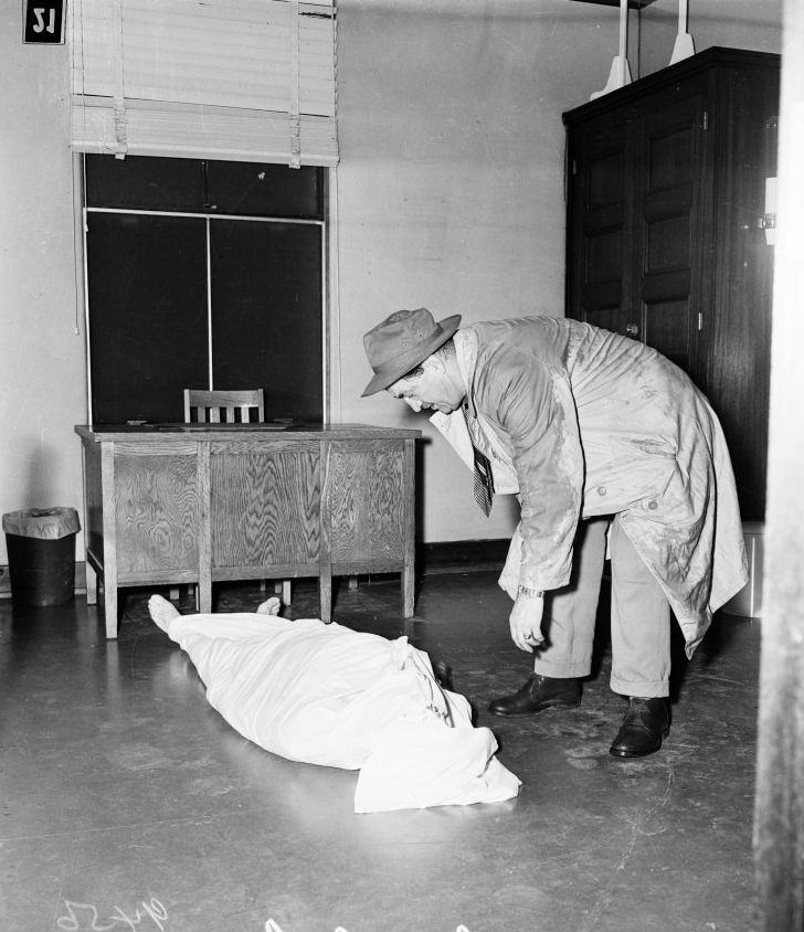
Not everyone survived the 1952 floods. On January 18, Detective Danny Shea was photographed at Van Nuys Receiving Hospital examining a body recovered from the floodwaters. Drowning was a real and documented cause of death during the disaster, and the loss of life added urgency to the already strained rescue operations.
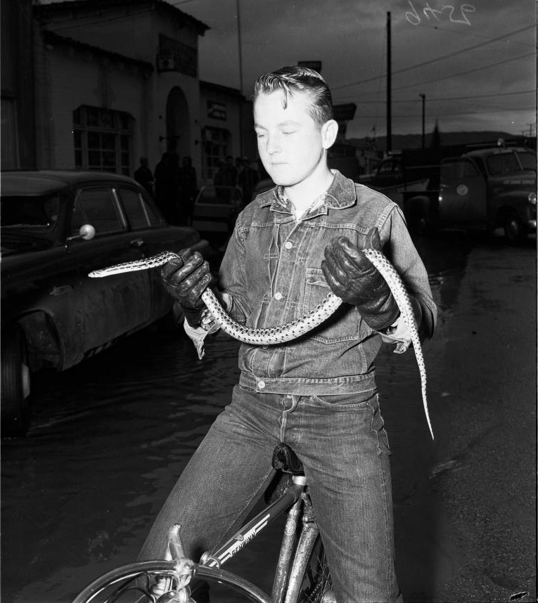
The flooding displaced more than just people and vehicles. Floodwaters forced snakes and other wildlife out of their natural habitats and into the streets. One photograph from 1952 shows a boy holding a snake he caught from the floodwater — a reminder that the disaster disrupted the natural environment as much as the built one.
Culver Boulevard was another major area hit hard. Cars sat stranded in deep water along the road, and a motel on the boulevard had water lapping at its entrance. Photographs from both January and November show that Culver Boulevard flooded repeatedly throughout the year.
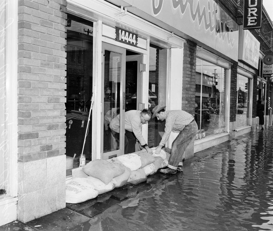
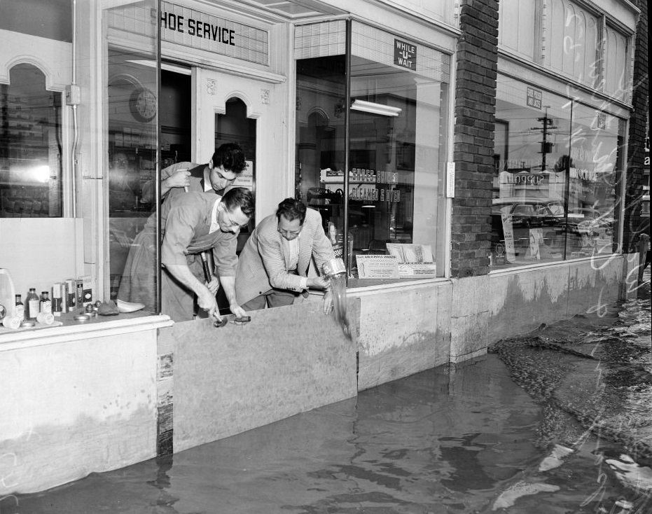
Business owners along flooded streets took whatever protective measures they could. Sandbags were stacked in doorways and sheets of material were stretched across storefronts in an effort to keep water out. These efforts were often outpaced by the sheer volume of water moving through the streets.
Community organizations stepped in to assist with evacuations. On January 18, members of the American Legion helped an elderly woman to a waiting truck, assisting those who couldn’t move quickly through the water on their own. Shelters were set up to house displaced residents, with blankets and hot coffee provided to those who arrived wet and exhausted.
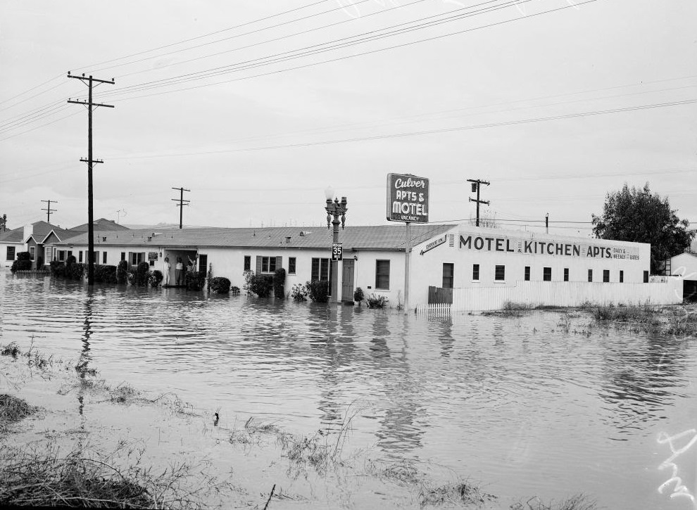
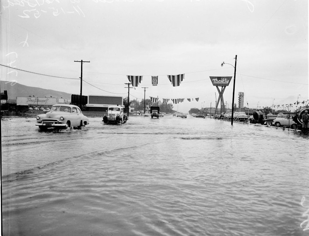
The November rains brought a second wave of flooding to many of the same areas. Sunland Boulevard and the surrounding San Fernando Valley communities were once again submerged. Streets that had barely dried from January were flooded again, and residents faced the same scenes of stranded cars and impassable roads.
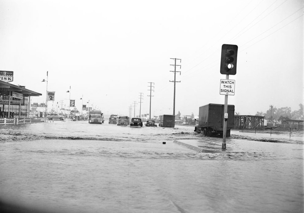
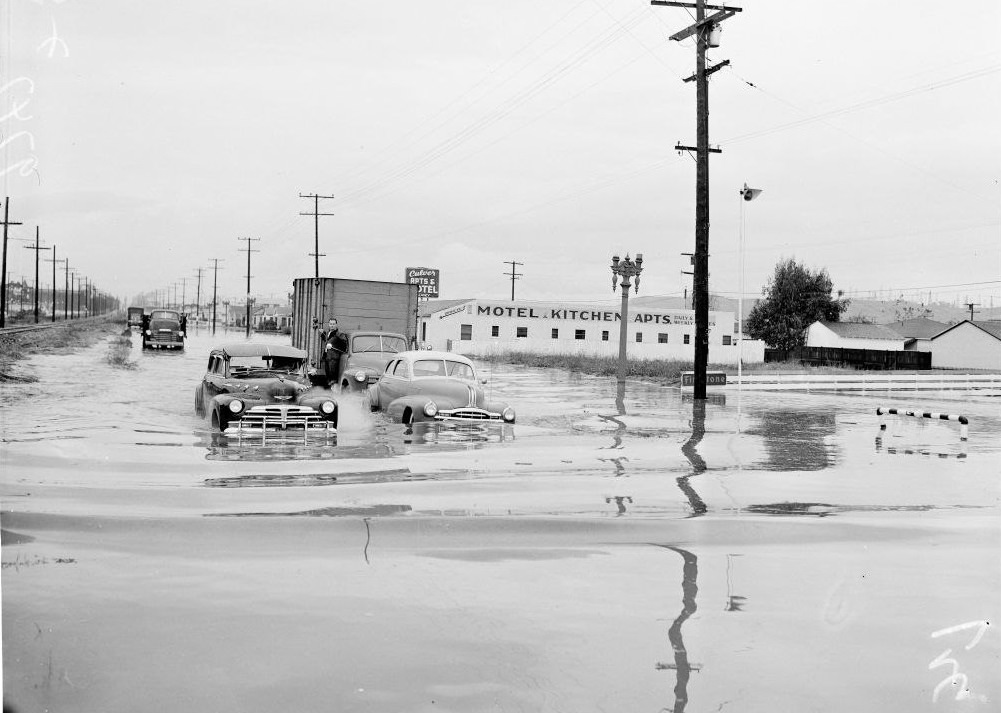
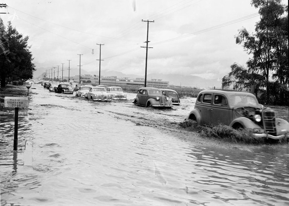
Grace Avenue in Los Angeles and Van Nuys alike showed the same pattern of neighborhood flooding. Residential areas with no drainage capacity simply filled with water. On Van Nuys Boulevard in November, people in boats were photographed navigating past submerged cars — the same kinds of scenes that had played out in January.
Small business owners were repeatedly caught in the path of floodwaters. In one November photograph, the owners of a shoe service store stretched a protective sheet across their storefront, trying to keep the water from destroying their inventory and equipment. For many small shops, the flooding caused financial damage that took months to recover from.
Infrastructure damage was severe and visible. The Van Nuys Boulevard bridge, which had sunk three feet at its south end after its earth foundation eroded away, illustrated how the floods didn’t just flood surfaces — they physically undermined the structures built on top of the soil. Meanwhile, on Mulholland Drive, landslides stripped away entire hillside sections, burying roads and anything parked alongside them.
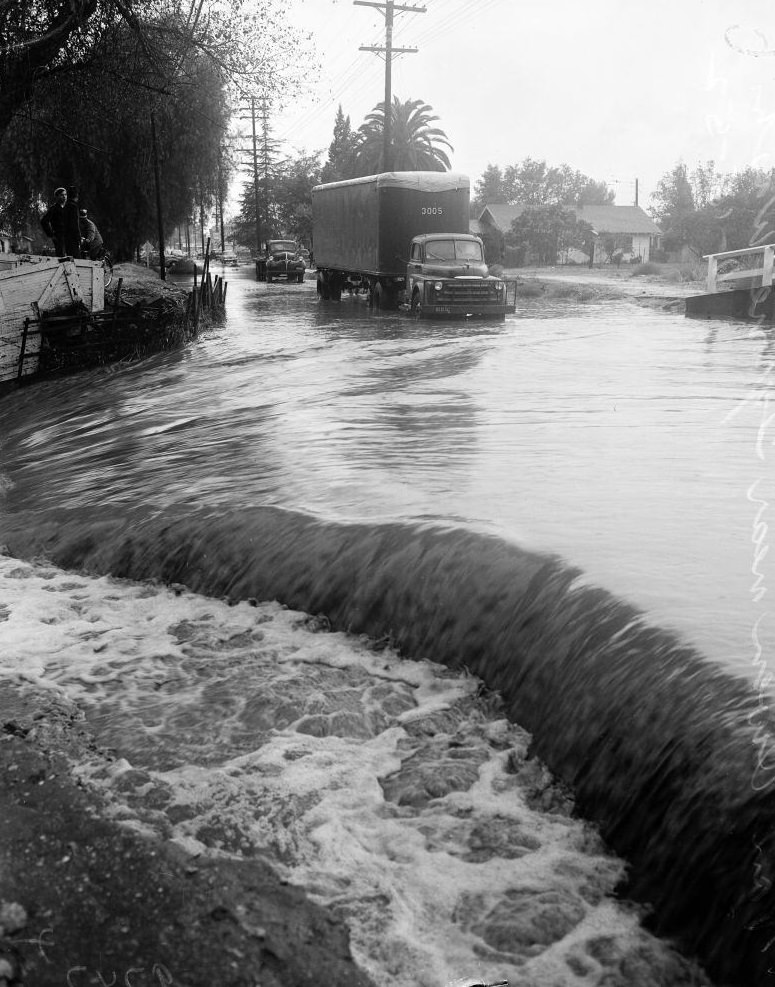
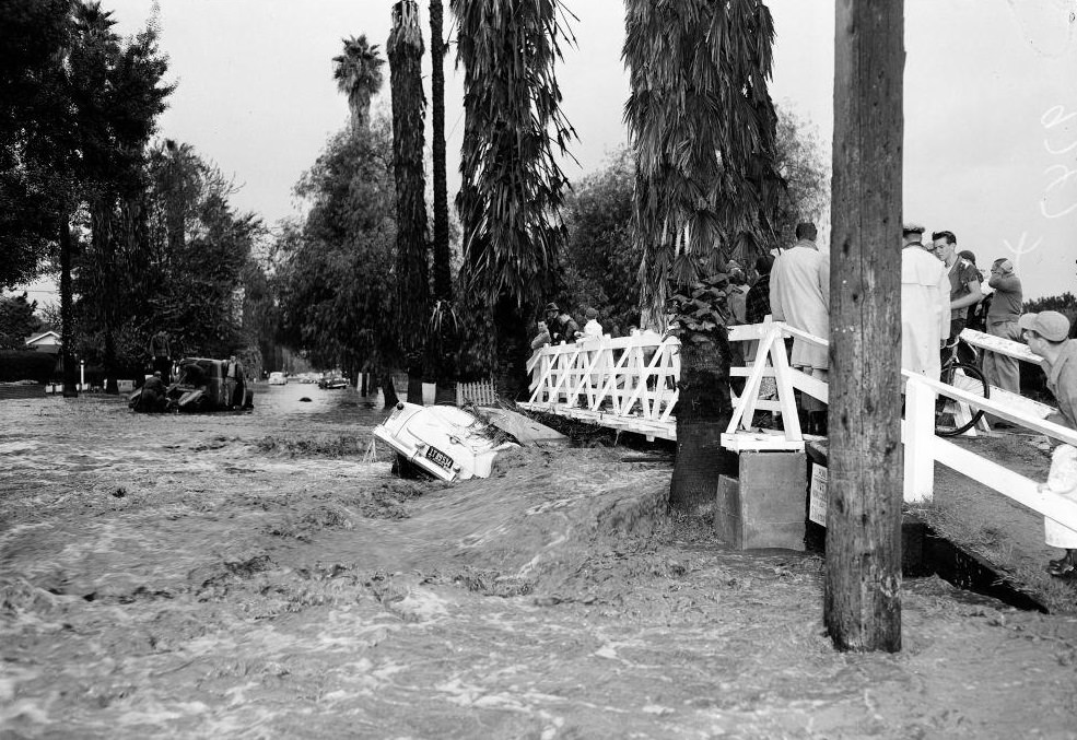
Crowds gathered on bridges across the city to watch floodwaters rush beneath them. On November 15, a large number of people stood on one such bridge as water flowed fast below. It was a scene repeated at many crossings throughout Los Angeles, as residents tried to make sense of the scale of what was happening to their city.
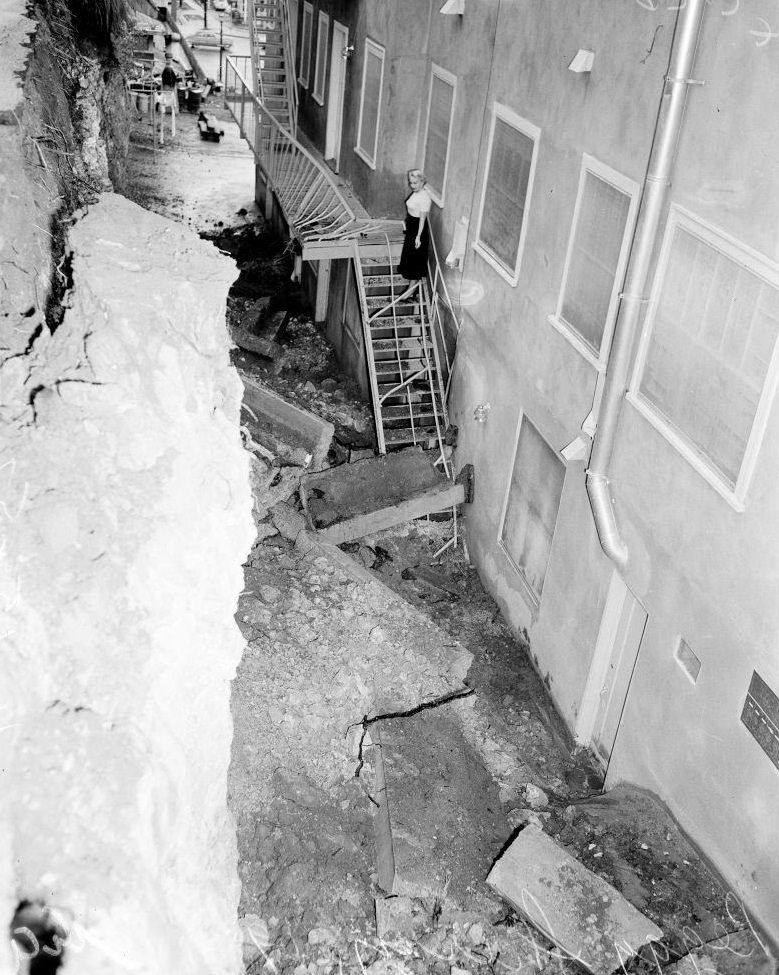
For homeowners along hillsides, the threat wasn’t just water — it was the earth moving. One photograph from November shows a woman standing outside her home, looking toward a fresh landslide that had occurred nearby. The combination of saturated hillsides and unstable soil turned hillside properties into dangerous ground throughout the rainy season.
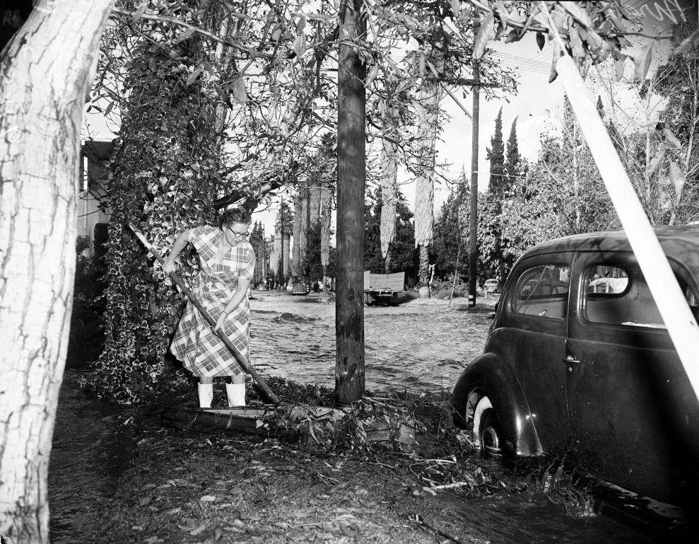
On Tyrone Avenue in November, resident Agnes Snyder was photographed removing debris from her car on the flooded street. It was the kind of exhausting, hands-on work that thousands of Los Angeles residents faced after each wave of rain — clearing mud, pulling belongings out of waterlogged vehicles, and trying to salvage whatever could be saved.
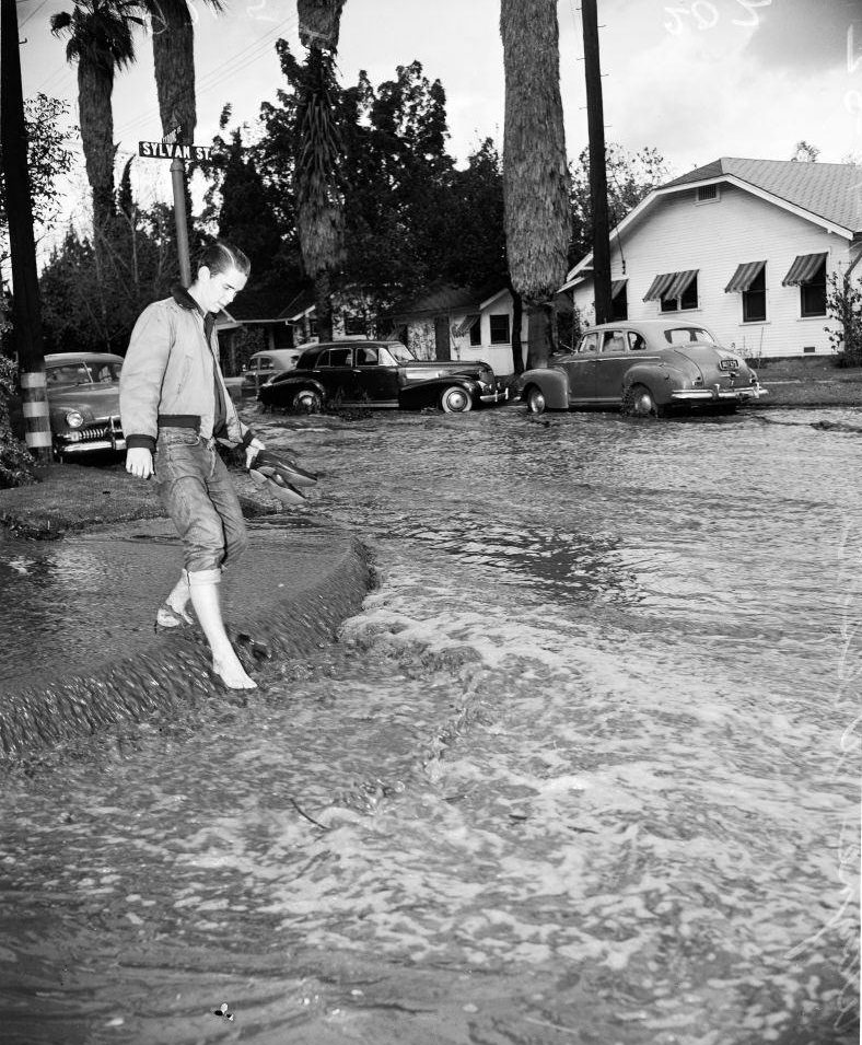
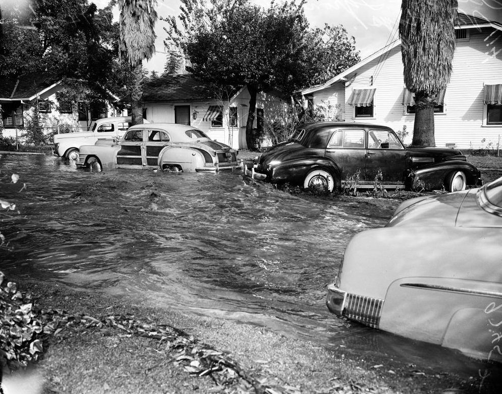
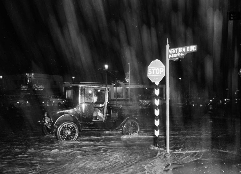
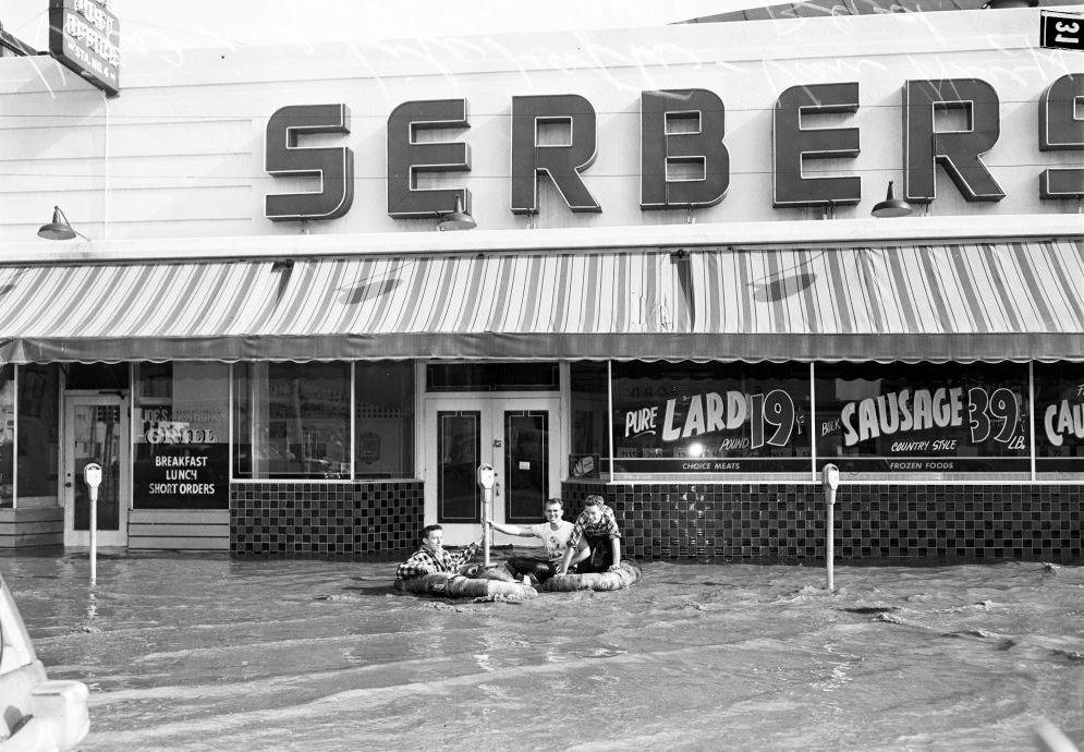
Children were present throughout the disaster, and the photographs capture them in the middle of it. Kids sat in a stalled car on Sylvan Street. On January 18, children floated along Van Nuys Boulevard in life rafts — using the flooded road as an improvised waterway. At the intersection of Van Nuys and Ventura Boulevard in January, a vintage Model T Ford sat surrounded by floodwater, an image that underscored how completely the streets had ceased to function as roads.
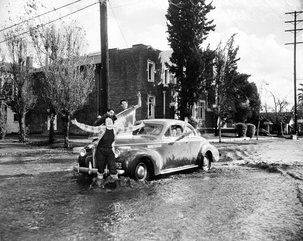
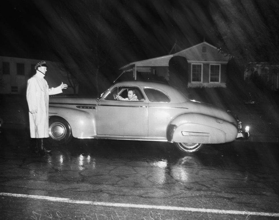
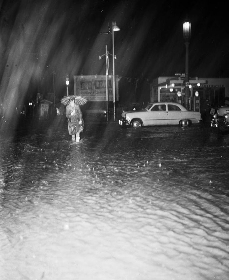
By January 20, Hamlin Street in Van Nuys remained flooded, showing how long the water lingered after the worst of the rains had passed. Drainage systems were simply not equipped to move that volume of water. Slauson Avenue and Sepulveda Boulevard, the Ramona Freeway west of Atlantic Boulevard, and North Solano Avenue all appeared in flood photographs from throughout the year — a cross-section of the city’s most affected corridors.
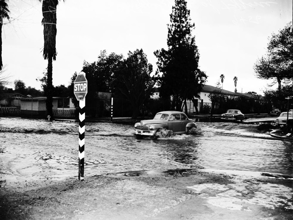
The 1952 floods exposed the limits of Los Angeles’s infrastructure at a time when the city was rapidly expanding. The San Fernando Valley had been growing fast through the late 1940s and early 1950s, with new housing developments filling in land that had little to no flood control built into it. When the rains came, the water followed the contours of a landscape that had been paved and built on without adequate drainage. The photographs from that year document not just a weather event, but the real cost of a city that had grown faster than its infrastructure.





Climate change?
I’m guessing this is before they built the famous concrete channel storm drains.