
San Francisco in the 1890s was a city pulling in two directions at once. Grand buildings rose along its busy streets while workers struggled to make ends meet. New immigrants shaped entire neighborhoods. Cable cars clanged up steep hills. And all of it unfolded against the backdrop of one of the most dramatic waterfronts in the world. These photographs capture that decade in sharp detail — a city that was young, restless, and building itself in real time.
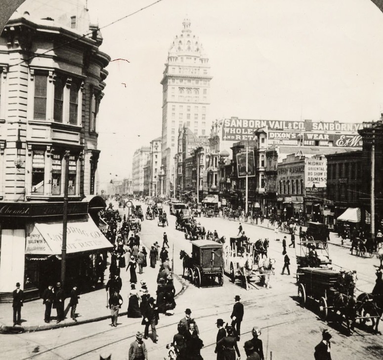
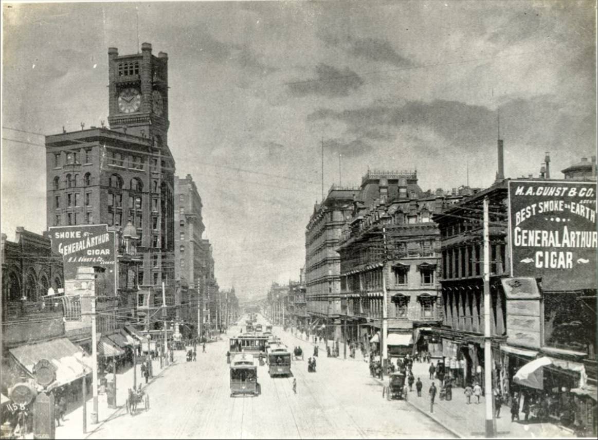
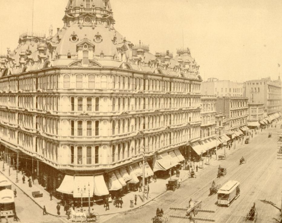
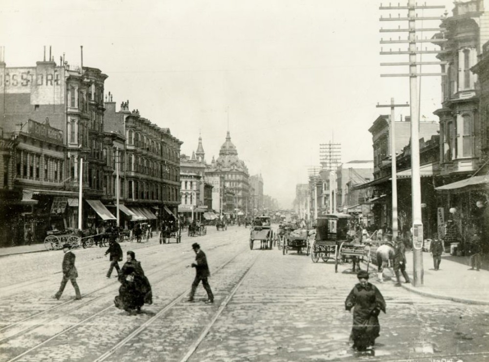
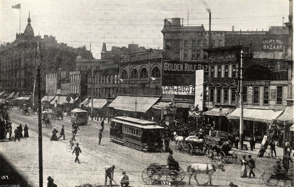
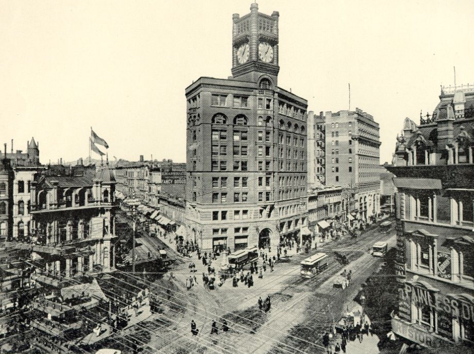
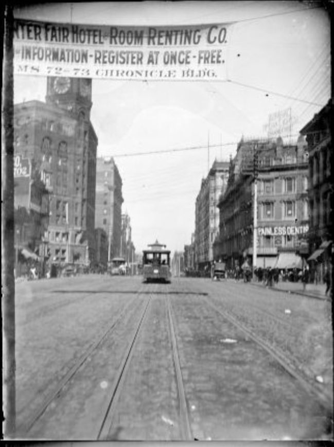
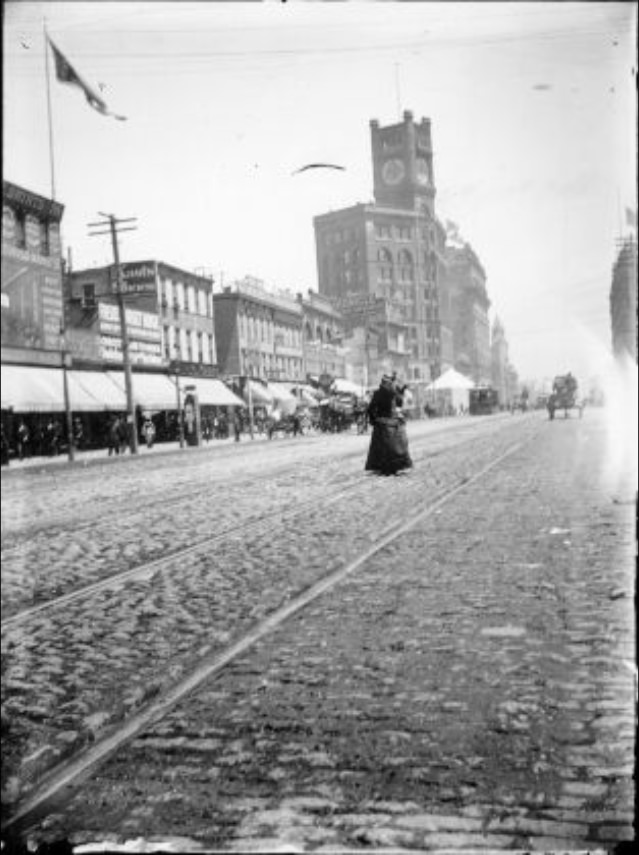
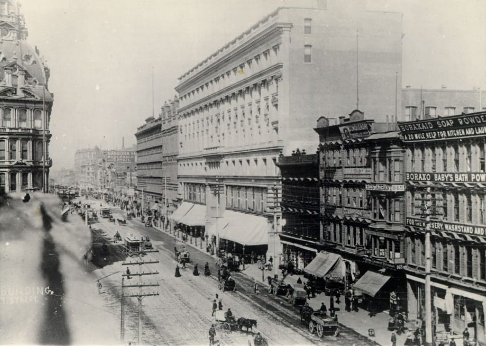
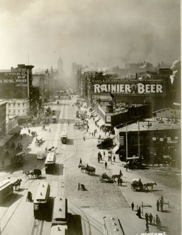
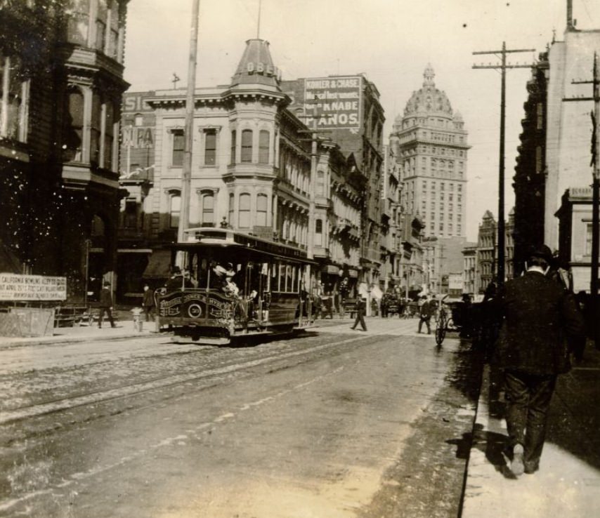
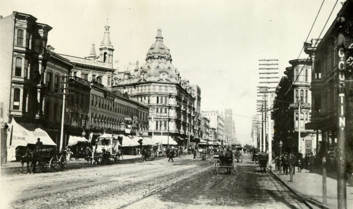
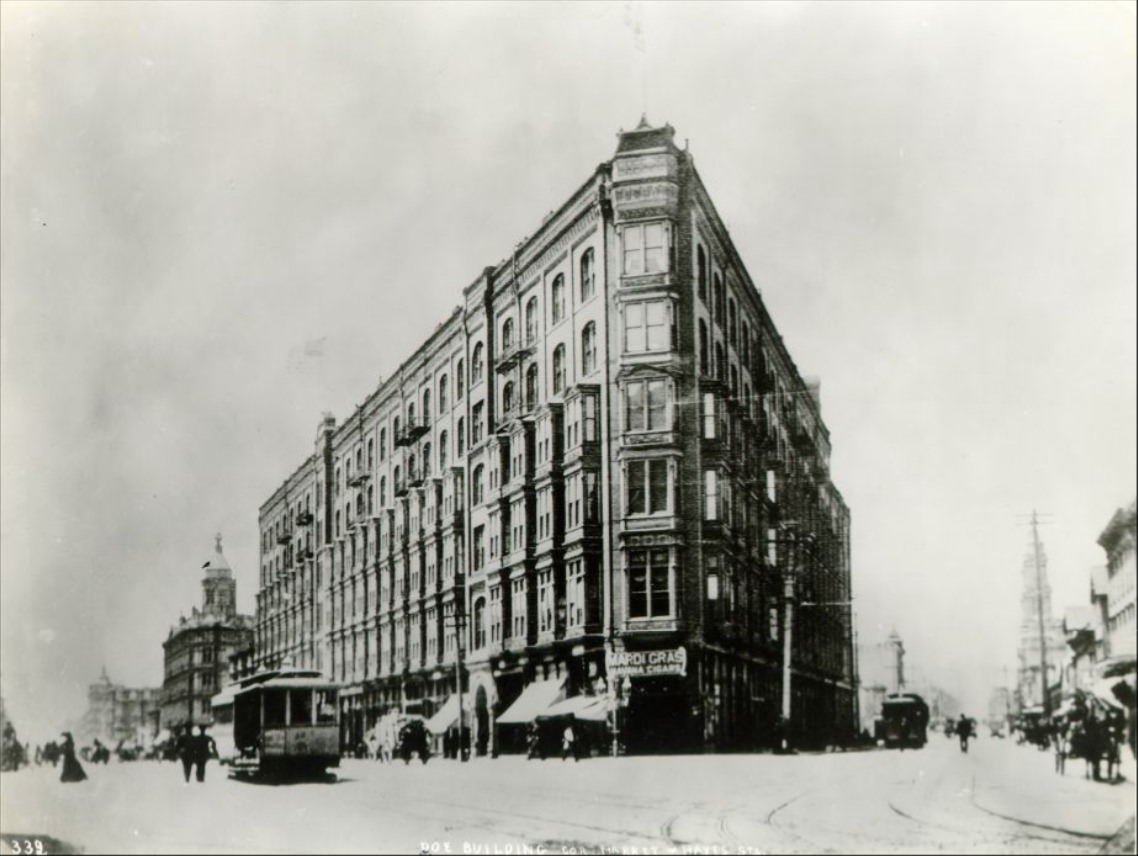
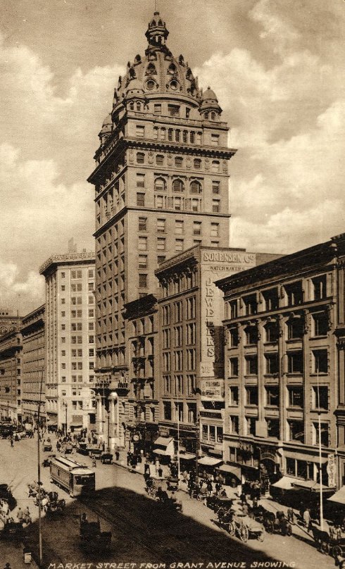
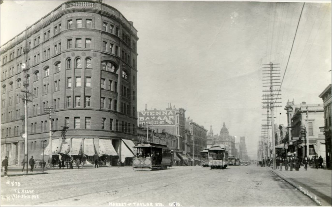
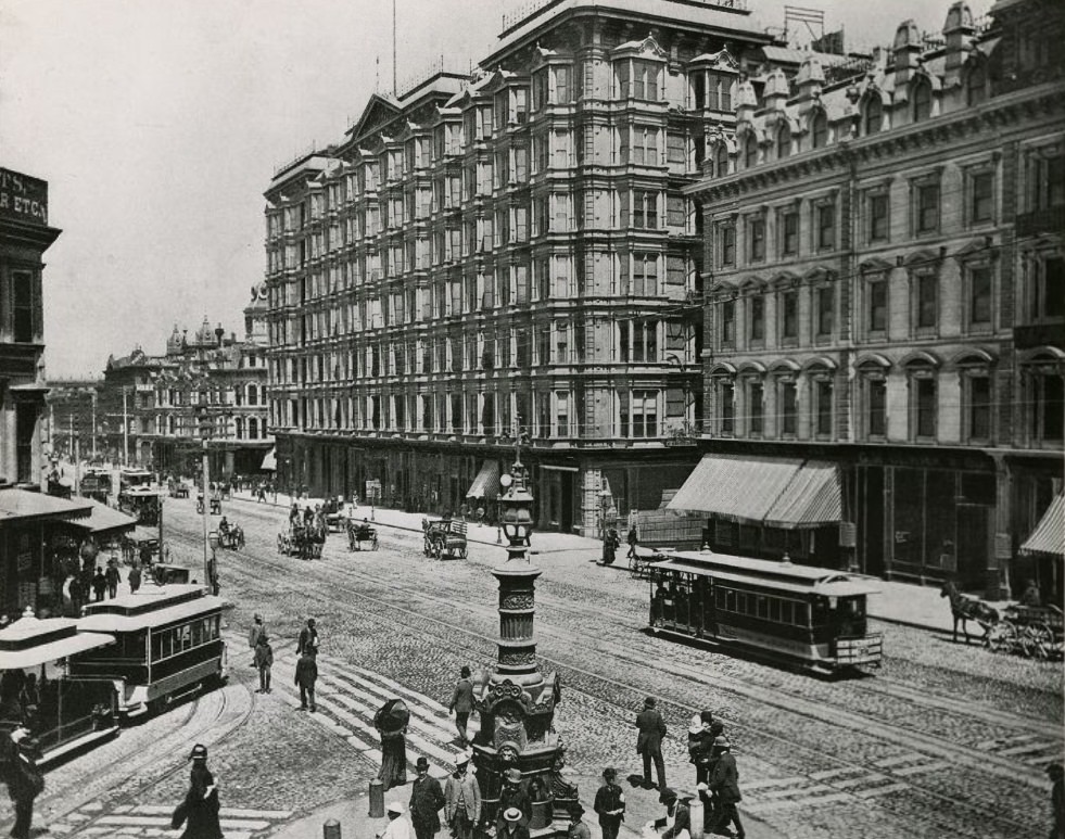
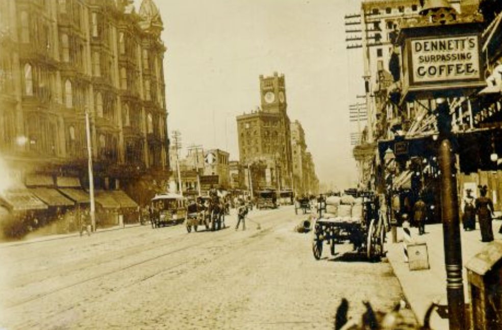
Market Street was the spine of the city. Wide, busy, and lined with commercial buildings, it served as the main artery connecting the Ferry Building at the waterfront to the neighborhoods spreading west. Streetcars and horse-drawn wagons shared the road, and foot traffic was constant. The street reflected the city’s ambitions — always expanding, always adding another story to the skyline.
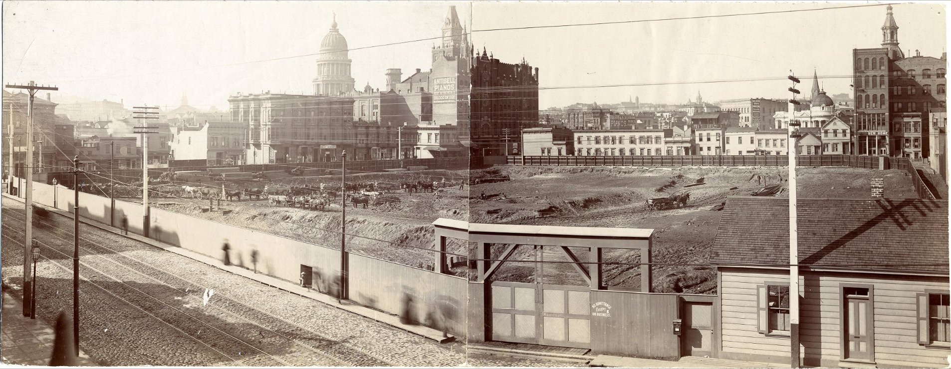
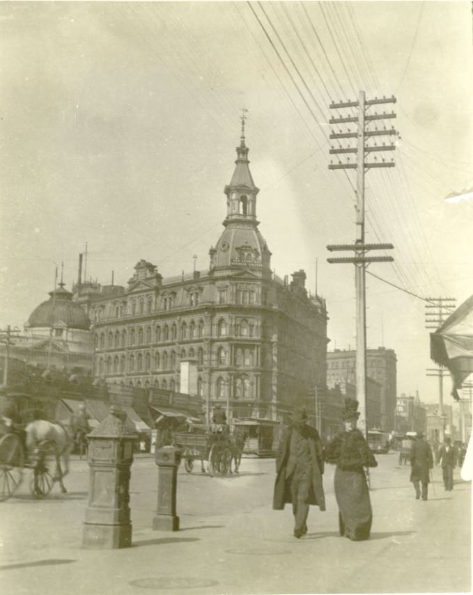
The decade opened with serious economic trouble. The Panic of 1893 triggered a nationwide financial collapse that hit San Francisco hard. Banks failed. Unemployment spiked. The city’s rapid growth came to a sudden halt. Workers who had flooded into San Francisco looking for opportunity found themselves scrambling for basic wages instead.
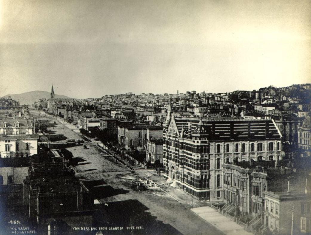
Despite the financial crisis, construction never fully stopped. San Francisco kept building its Victorian neighborhoods — rows of ornate wooden houses with decorative trim, bay windows, and steep staircases. These homes defined the residential character of the city and filled block after block across the Western Addition, the Mission, and beyond.
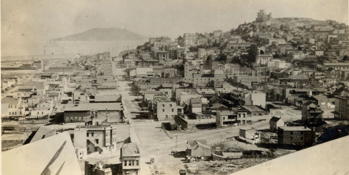
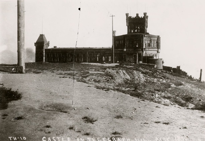
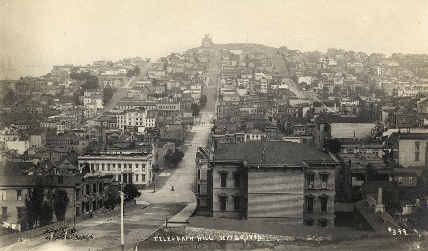
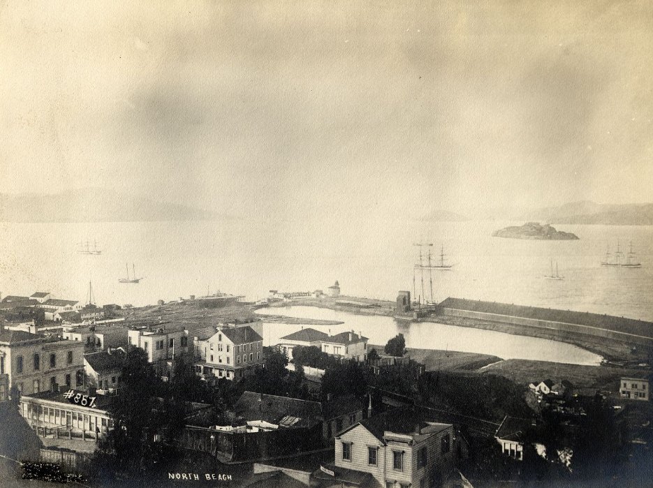
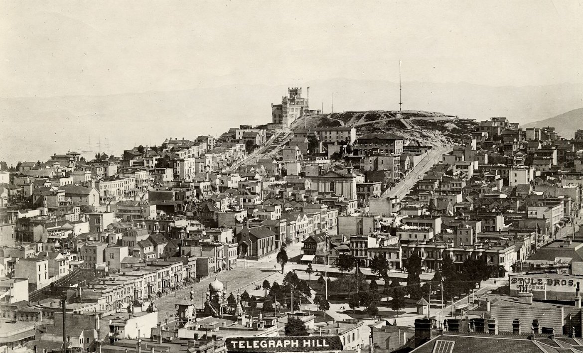
Telegraph Hill loomed over the northeastern edge of the city, offering sweeping views of the bay. It was a working-class neighborhood in the 1890s, home largely to Italian and Irish immigrants who had arrived in waves through the decades prior. Rocky, steep, and densely settled, it stood in contrast to the flat commercial grid of downtown just below.
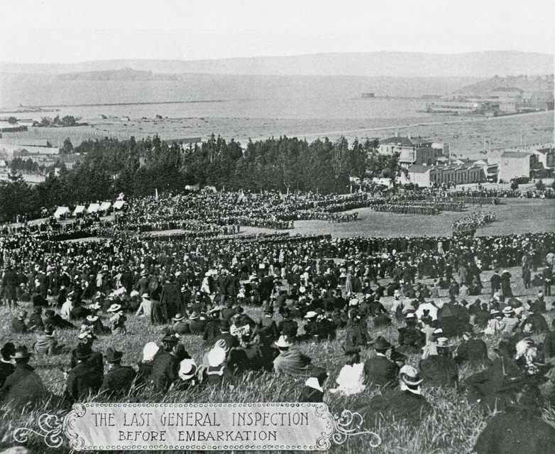
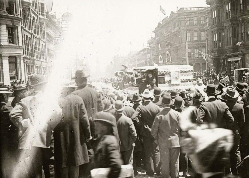
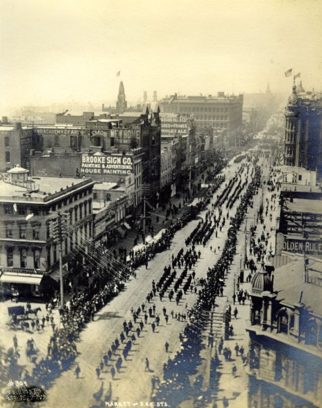
By the end of the decade, the Spanish-American War of 1898 had placed San Francisco at the center of U.S. military operations in the Pacific. The Presidio, the Army base at the northern tip of the peninsula, became a staging ground for troops bound for the Philippines. Thousands of soldiers moved through the city, and San Franciscans turned out in large numbers to watch them depart and return.
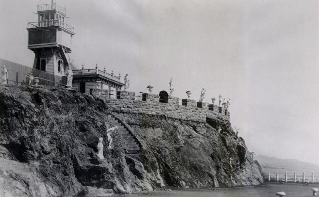
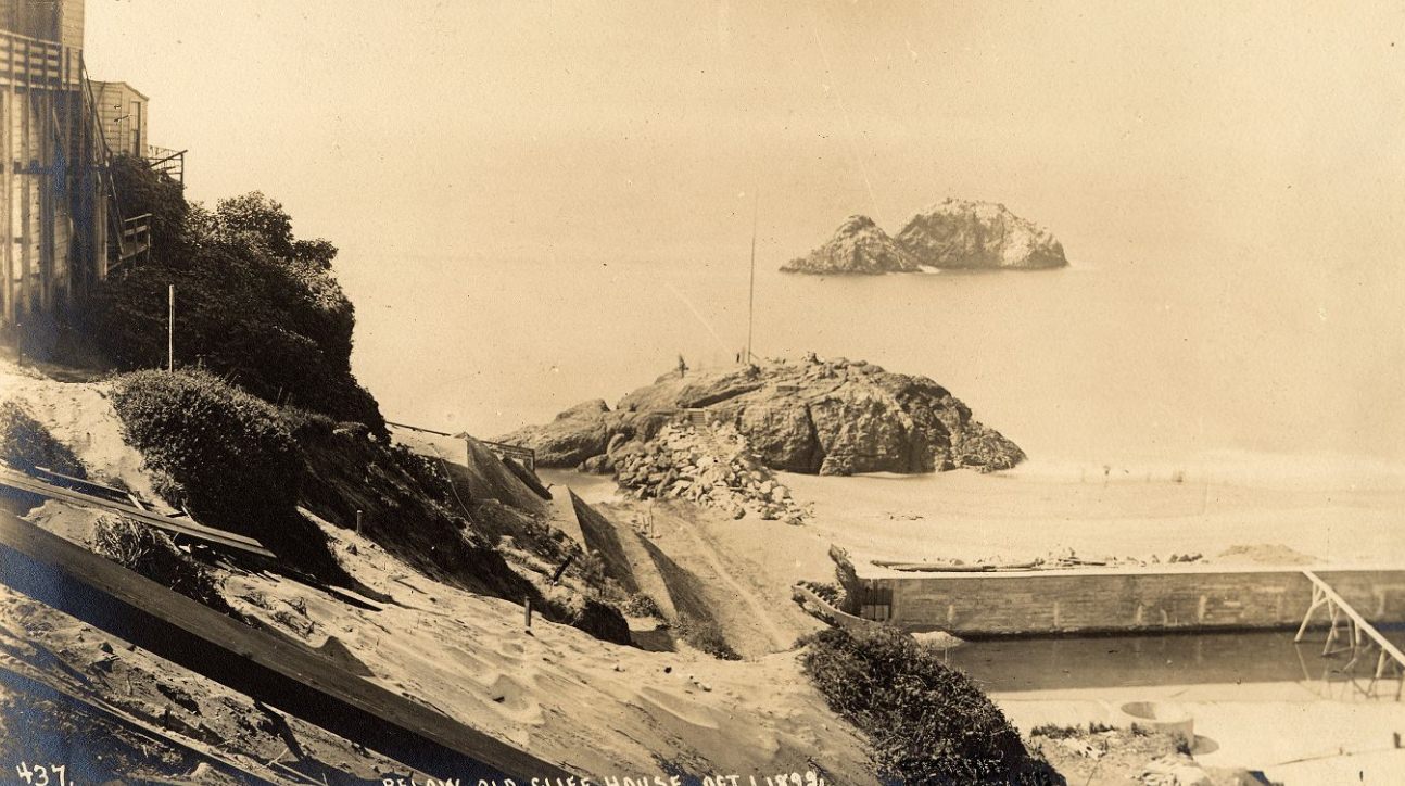
Adolph Sutro, who served as San Francisco’s mayor from 1894 to 1896, left a visible mark on the city’s western edge. Sutro Heights — his estate overlooking the Pacific — featured gardens, statues, and an observatory open to the public. Nearby, the old Cliff House drew visitors who came to watch sea lions on the rocks below and take in the cold, wild stretch of Ocean Beach.
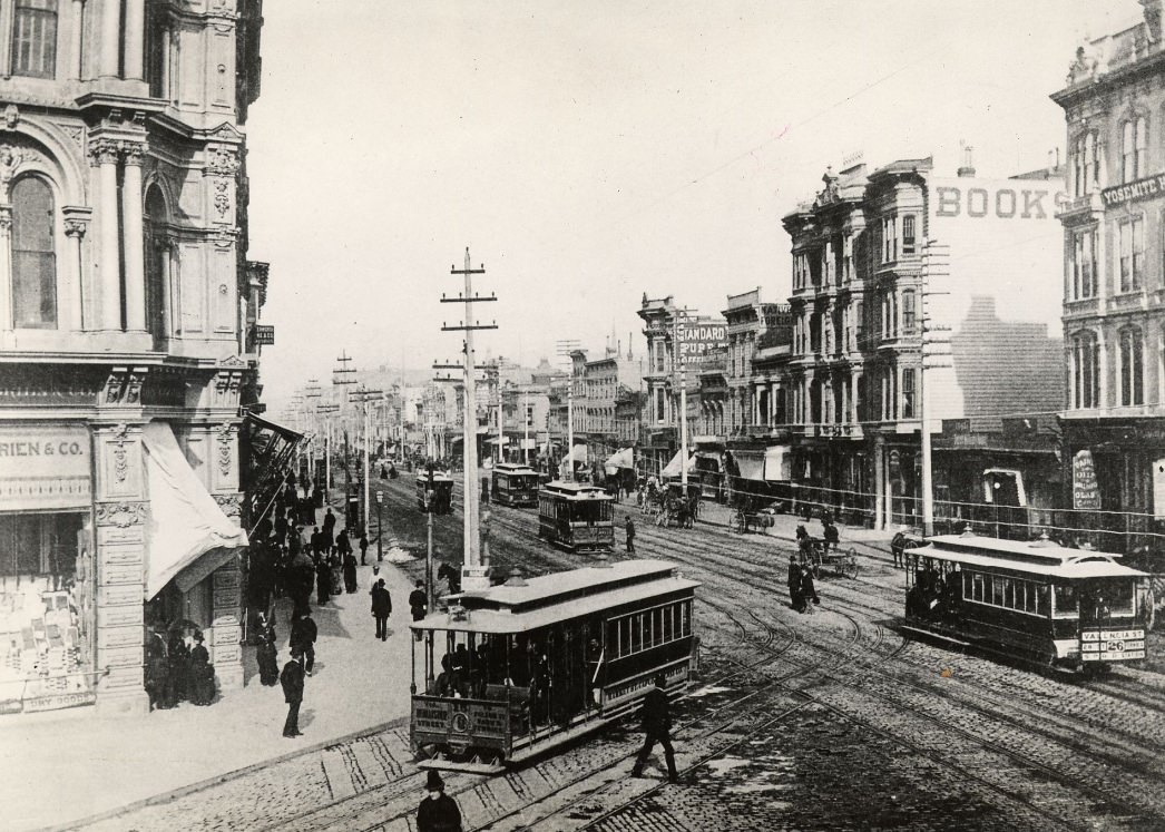
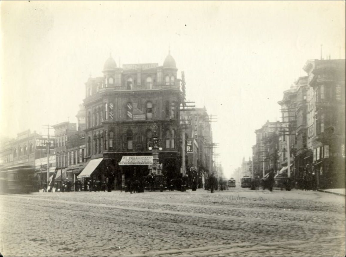
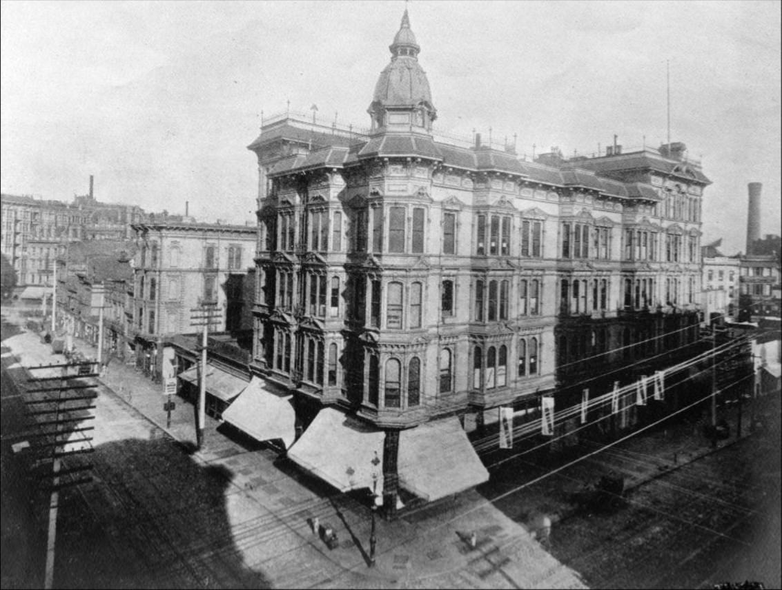
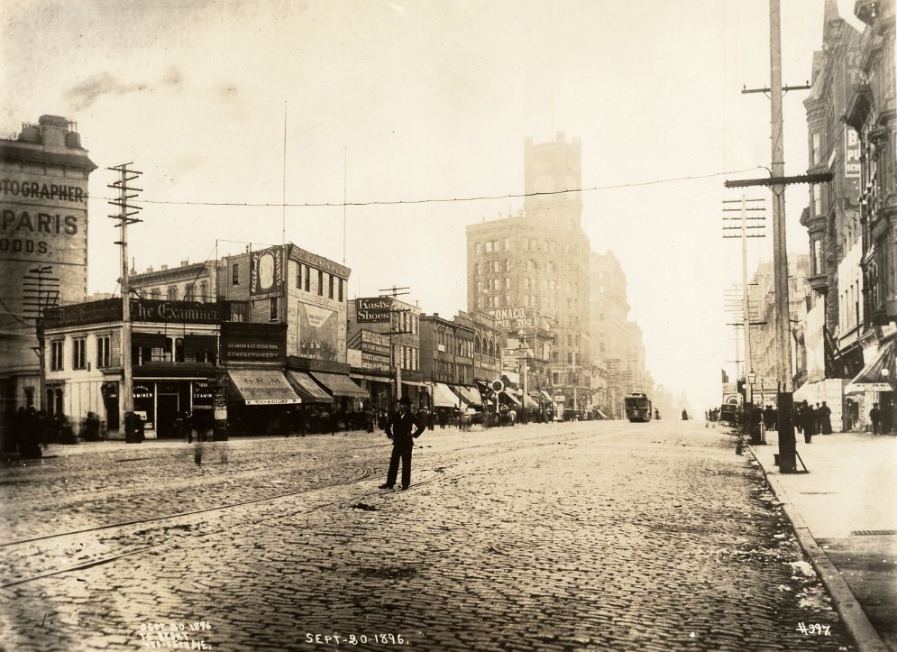
The city’s commercial core buzzed with newspaper offices, banks, department stores, and hotels. The Palace Hotel on Market Street was among the grandest in the country. Nearby, the offices of the San Francisco Examiner and the San Francisco Call competed for readers. Claus Spreckels, the sugar magnate, funded the Call Building — the tallest structure in the city by the end of the decade.
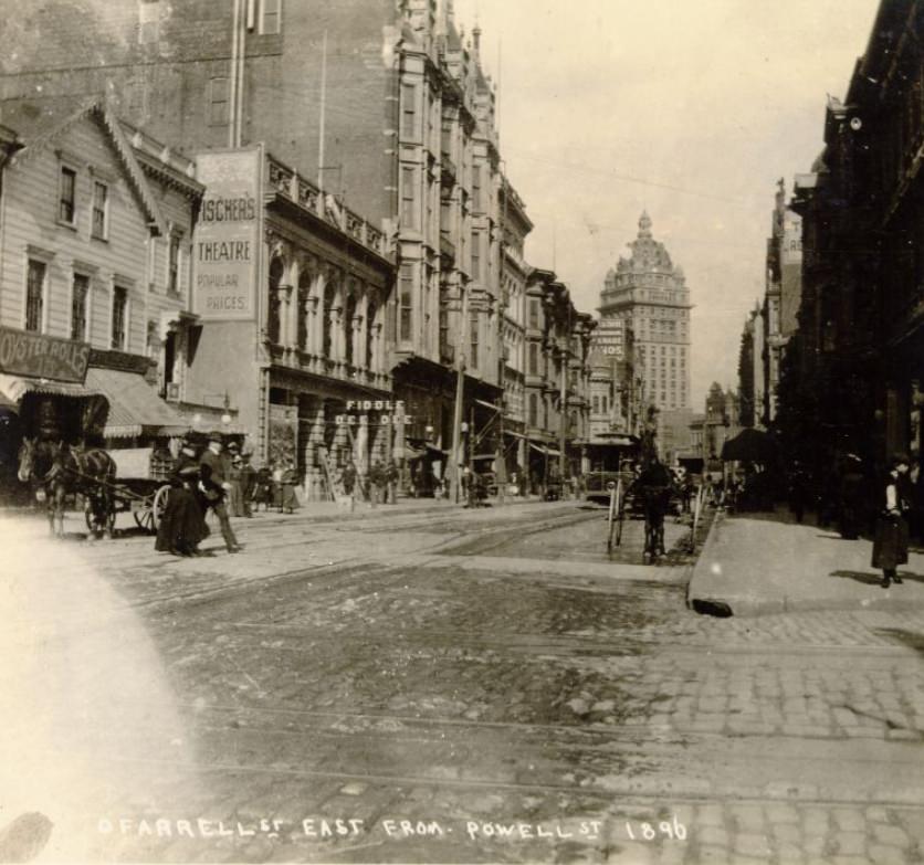
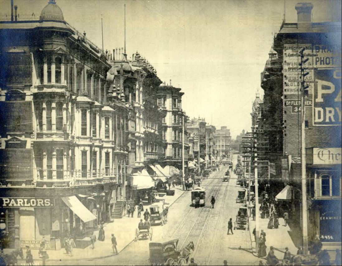
Grant Avenue cut through the heart of Chinatown, one of the most densely populated urban neighborhoods in the United States at the time. Chinese immigrants who had built the transcontinental railroad and worked in California’s mines and farms had settled here, forming a self-contained community with its own businesses, temples, newspapers, and social organizations. Despite constant legal discrimination, Chinatown remained a vibrant and resilient part of the city.
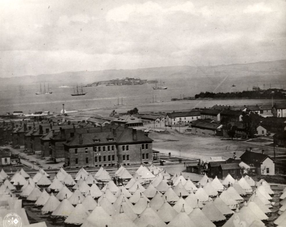
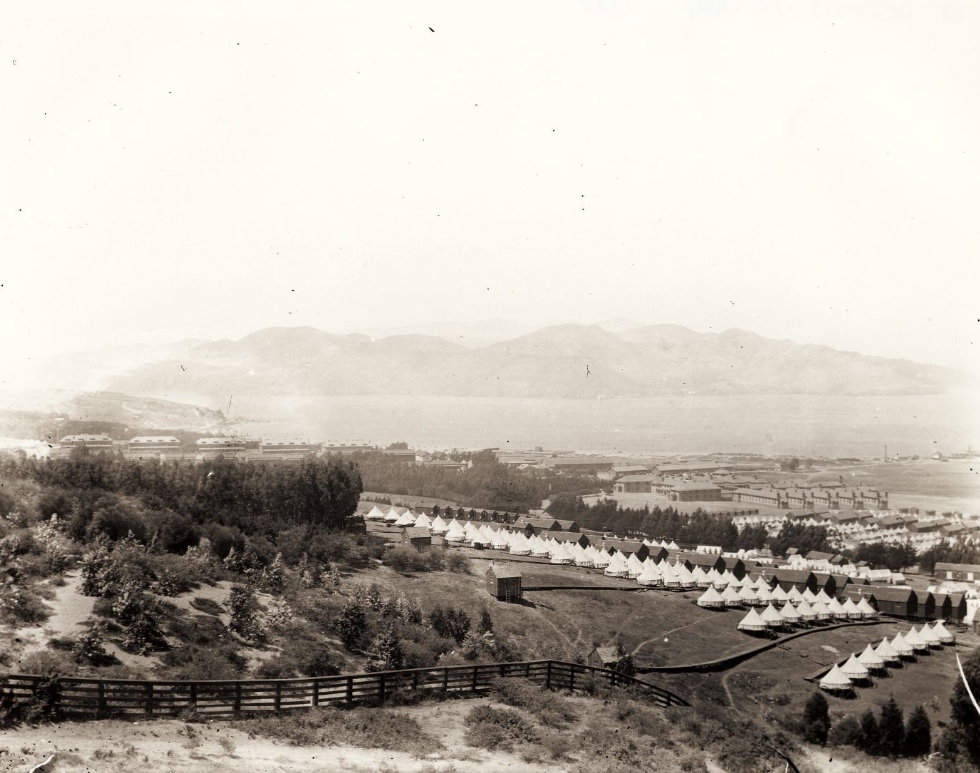
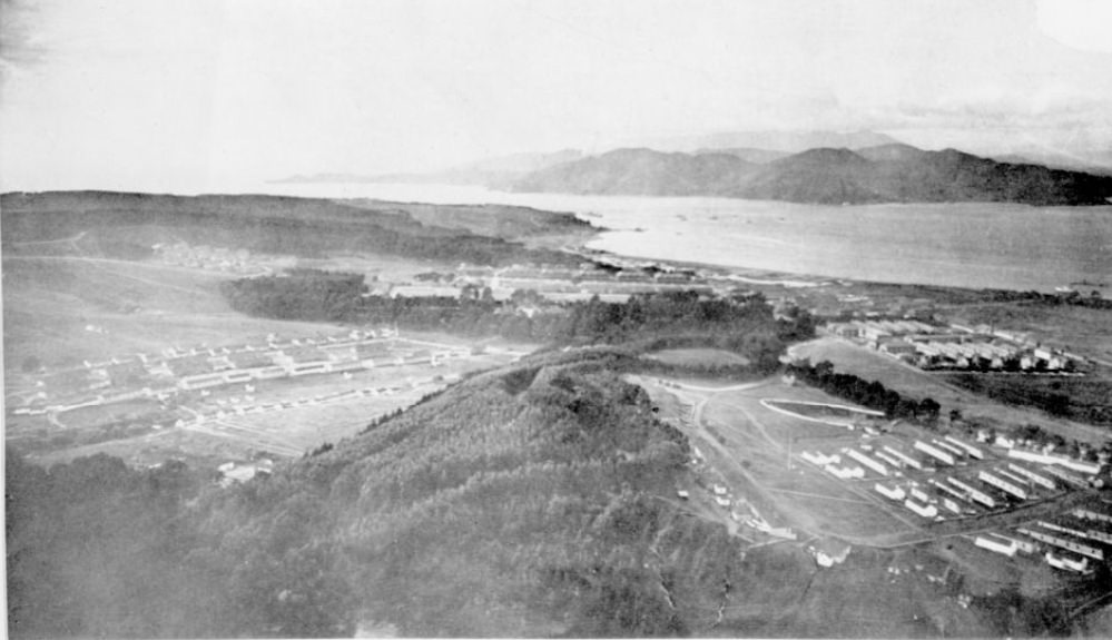
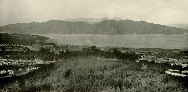
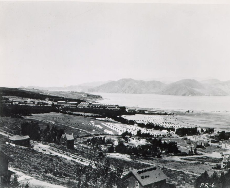
The Presidio in 1898 looked dramatically different from its peacetime appearance. Army tents spread across the grounds alongside permanent barracks as the base swelled with troops preparing for deployment. The San Francisco Bay stretched out behind them — the same waters that had carried gold rush ships into port half a century earlier and now carried transport ships toward the Philippines.
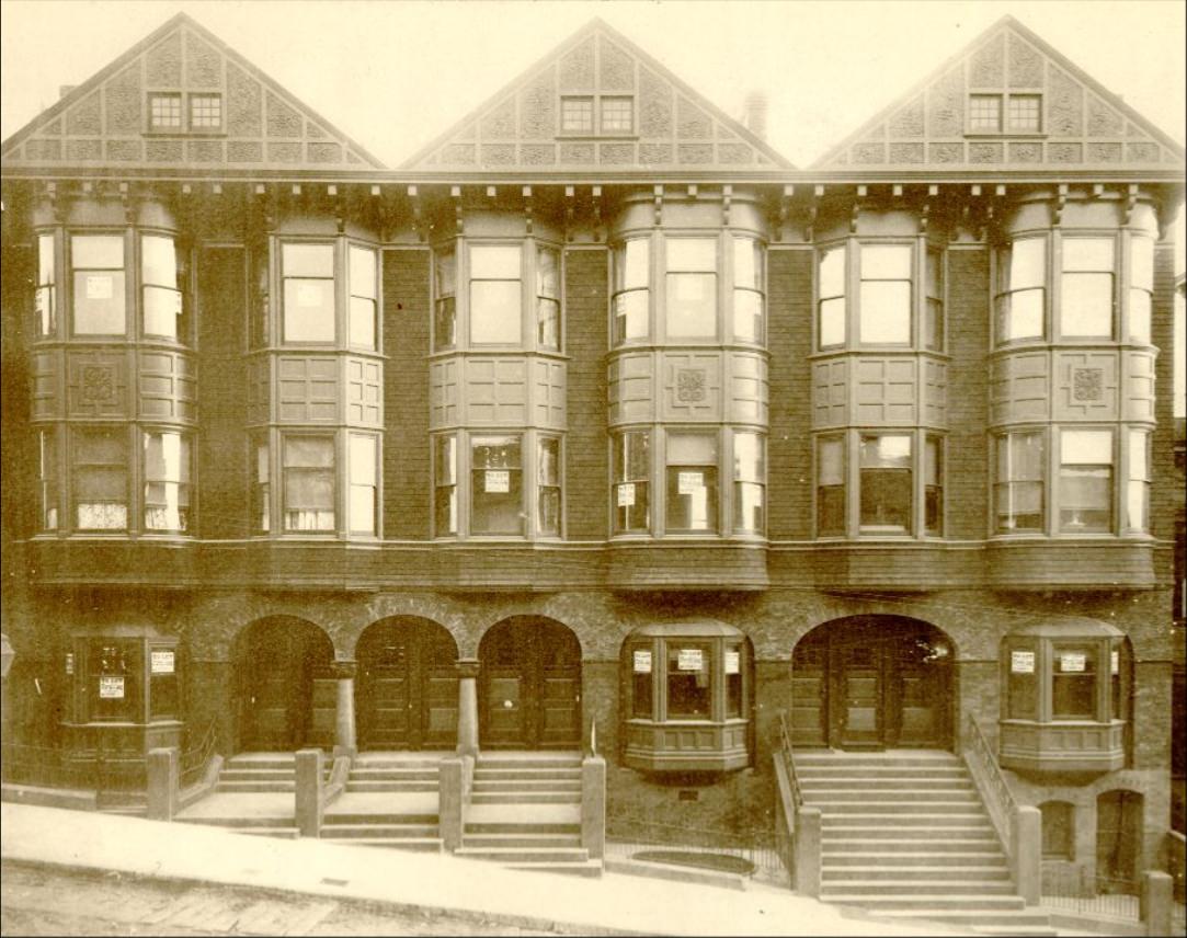
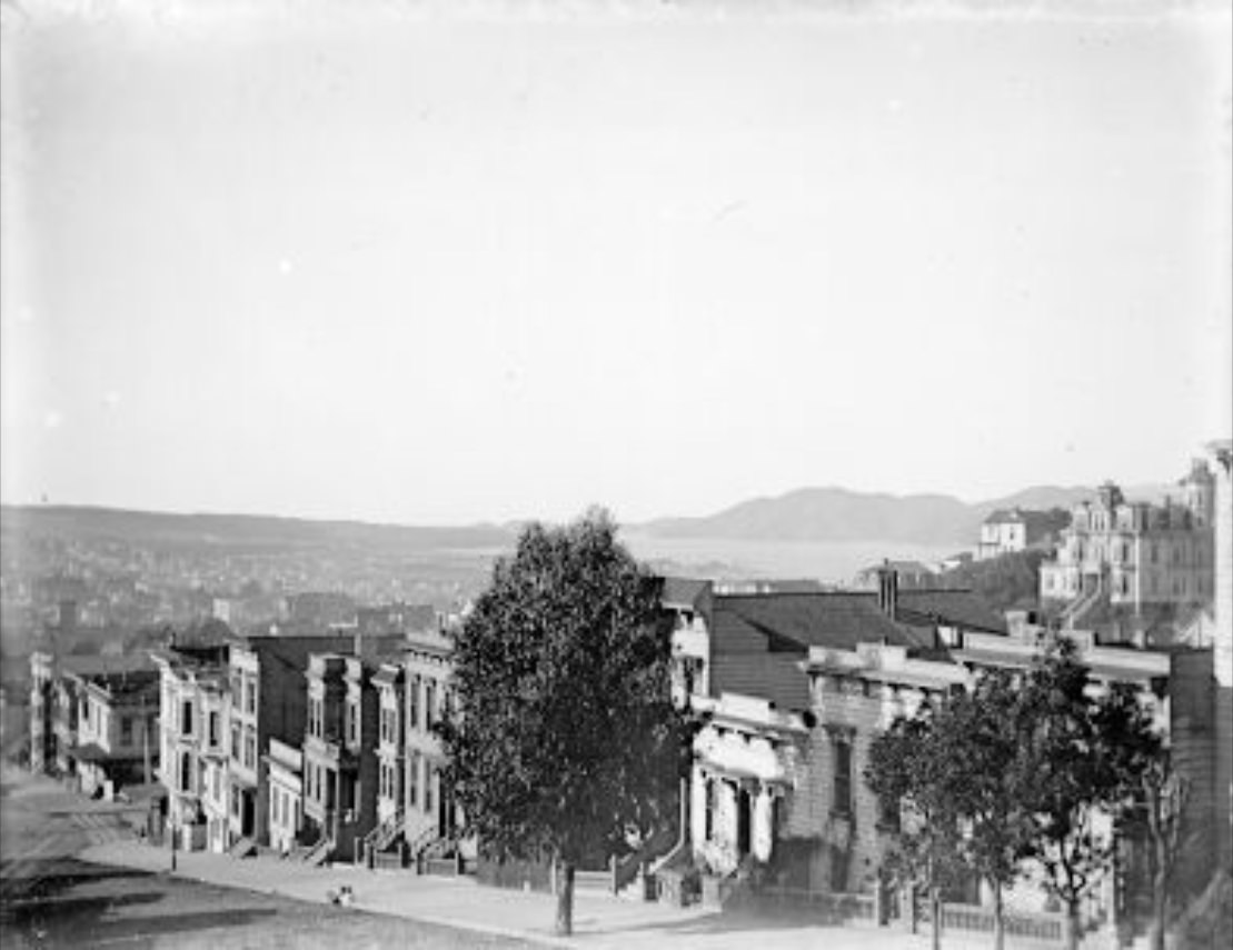
Residential construction pushed up the hills and into new neighborhoods throughout the 1890s. Flat-fronted Italianate homes and more ornate Queen Anne-style buildings went up side by side. The city’s housing stock expanded quickly to meet demand from a growing population that included workers, merchants, immigrants, and a rising middle class.
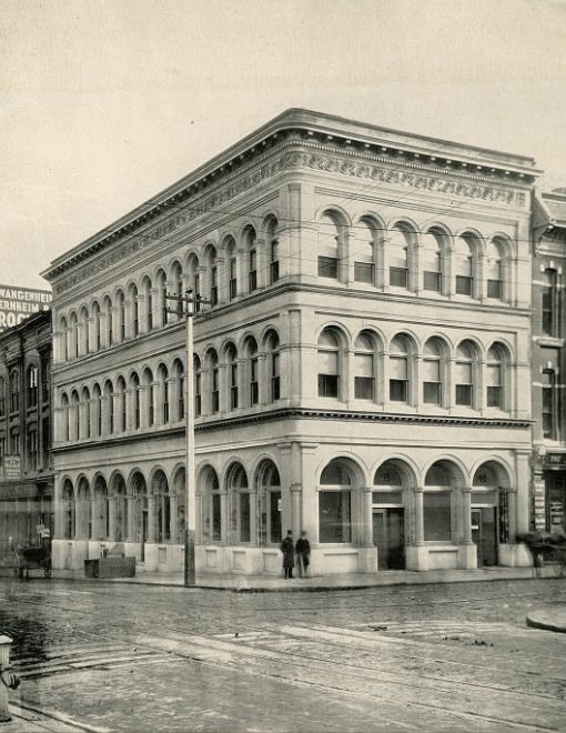
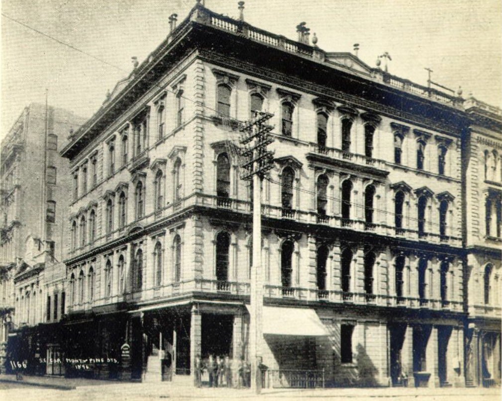
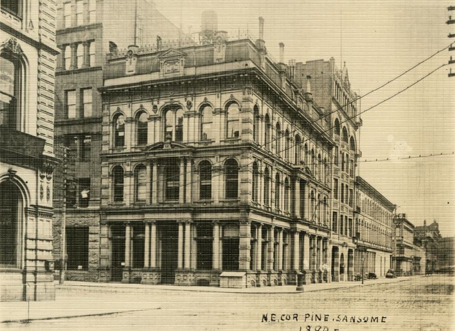
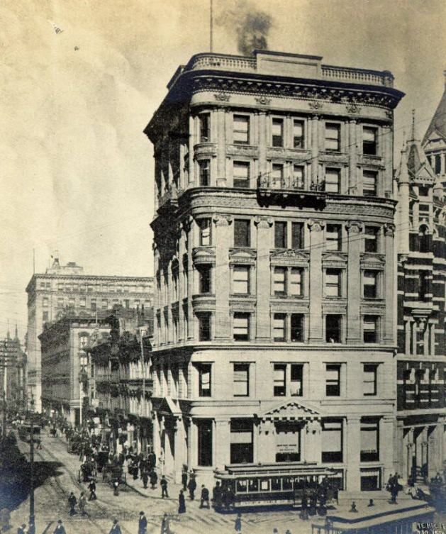
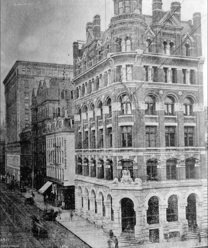
Montgomery Street was San Francisco’s financial district. Banks, insurance companies, and law offices filled its lower blocks. The Mills Building, completed in 1891, stood as one of the finest commercial structures on the West Coast — a ten-story Romanesque Revival building that signaled San Francisco’s place among the country’s major financial centers.
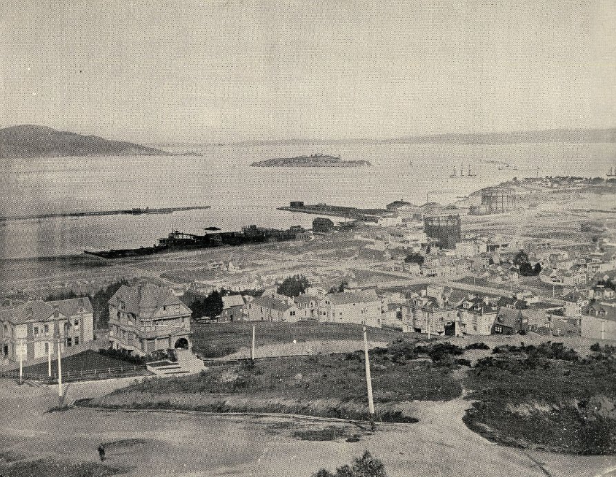
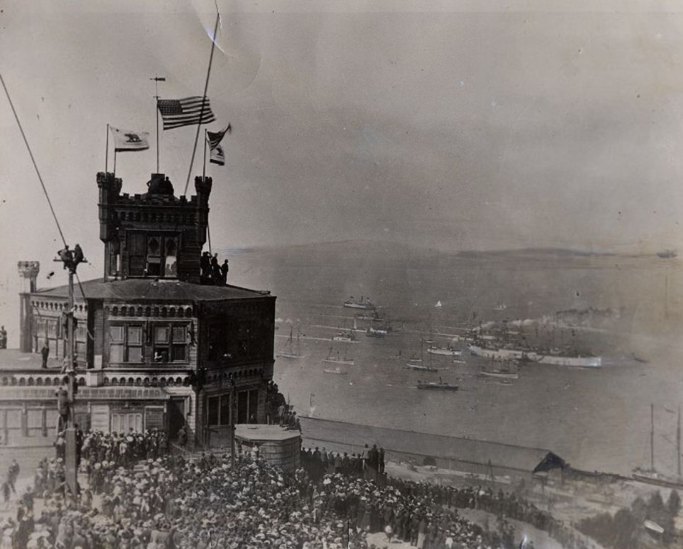
On August 25, 1899, crowds packed Telegraph Hill to watch the transport ship Sherman sail into the bay, carrying California Volunteers returning from the Philippines. The Spanish-American War had lasted only a few months in 1898, but its aftermath — the U.S. occupation of the Philippines — was just beginning. San Francisco served as the main port of entry and departure for all of it.
The labor movement grew stronger through the decade, driven partly by the desperation of the early 1890s depression. Workers in shipping, manufacturing, and domestic service organized strikes and formed unions. San Francisco became one of the most labor-active cities in the country. By the end of the decade, organized labor had gained real power in local politics and in the workplace.
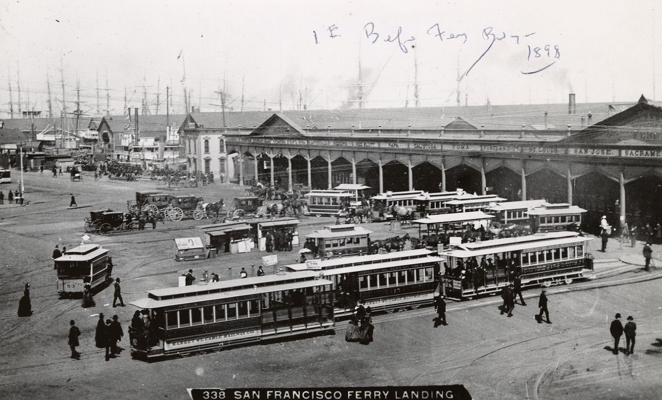
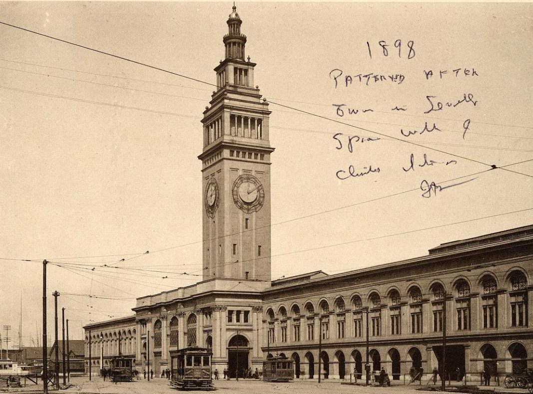
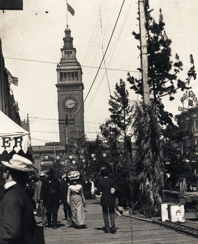
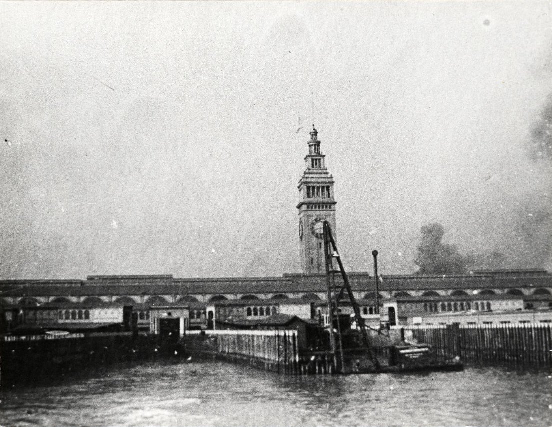
The Ferry Building was completed in 1898 at the foot of Market Street, replacing an earlier wooden structure. Its 245-foot clock tower became the city’s most recognizable landmark. Ferries crossing the bay docked here, carrying commuters, goods, and travelers between San Francisco and the East Bay communities. On busy days, tens of thousands of people passed through its arcaded hall.
San Francisco’s cultural life thrived even during hard economic years. Theaters and opera houses drew large audiences. The city supported a lively literary scene that helped define a distinctly Californian voice in American writing. Art galleries opened in the commercial districts, and music halls offered entertainment across all income levels — from grand concert halls to the rough saloons of the Barbary Coast.
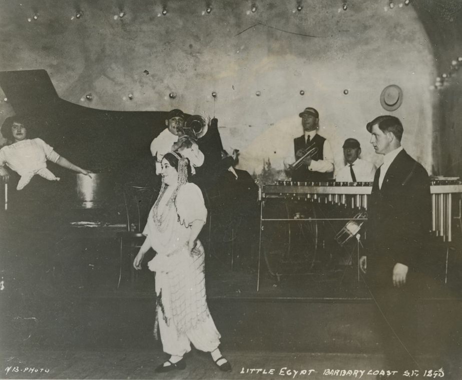
The Barbary Coast — the waterfront district north of downtown — was San Francisco’s most notorious neighborhood. Dance halls, gambling dens, and saloons operated openly. It drew sailors, dockworkers, and newcomers to the city, and it earned a reputation that spread far beyond California. Performers like Little Egypt brought a brand of entertainment that was considered scandalous by the standards of the time.
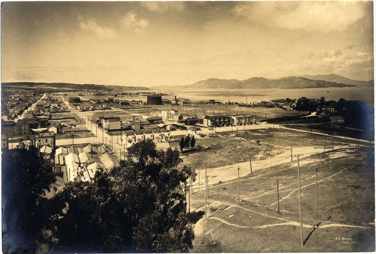
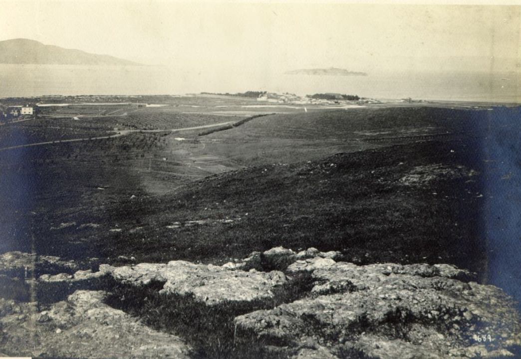
The northern waterfront and the Marina District in the 1890s looked nothing like the built-up neighborhood they would become. The land was still largely undeveloped, offering wide views of the Golden Gate and the Marin headlands across the water. The Presidio’s tree-lined grounds bordered these areas, and the military presence kept large sections of the northern peninsula off-limits to commercial development.
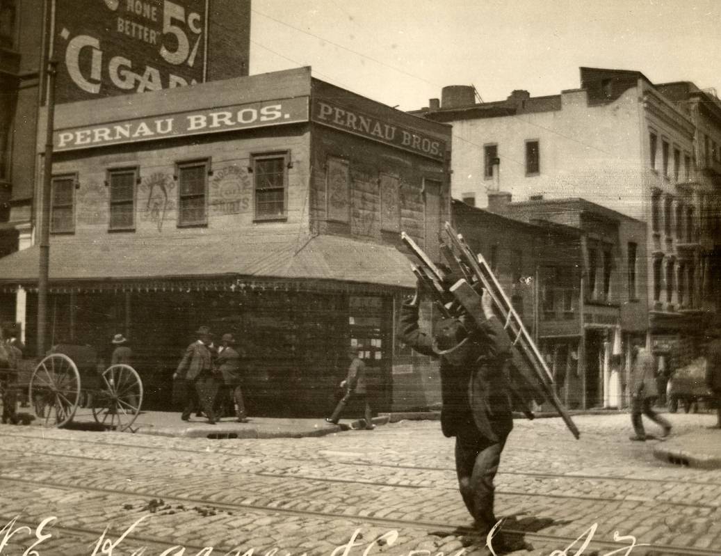
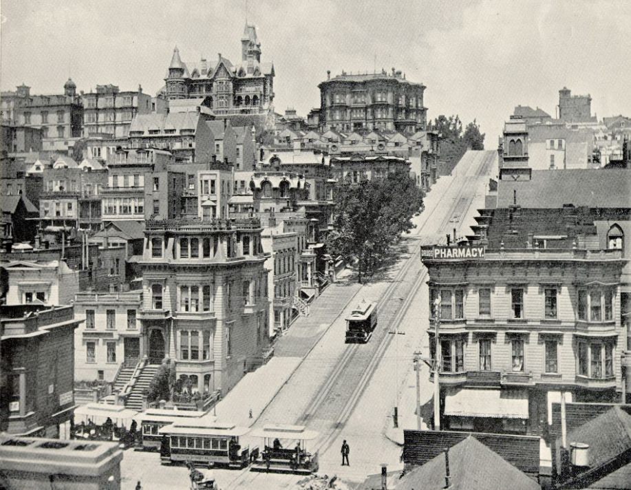
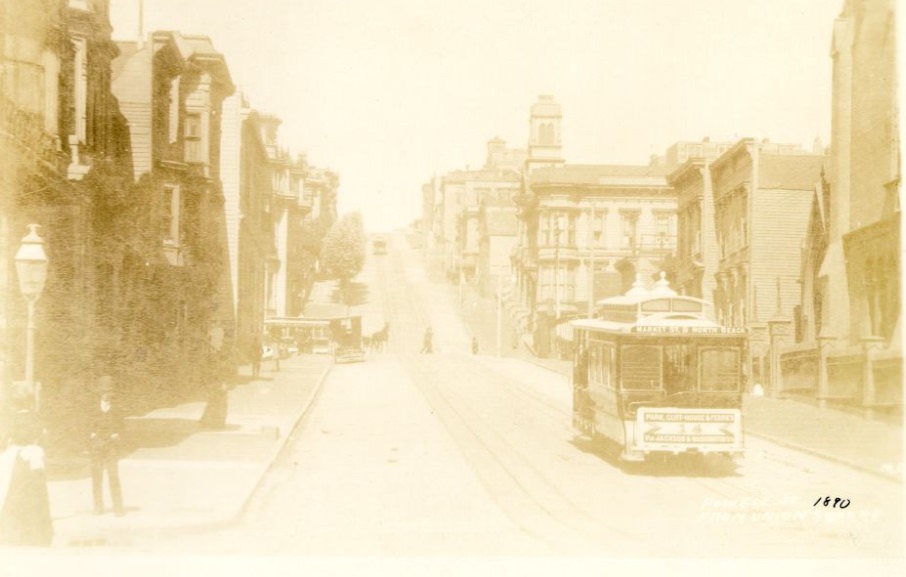
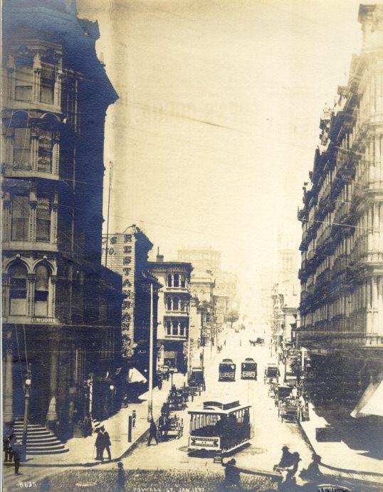
Powell Street ran north from Market through Union Square, one of the city’s main public spaces. Cable cars climbed its steep grade, connecting downtown with Nob Hill and the neighborhoods further north. By the mid-1890s, San Francisco’s cable car network was one of the most extensive in any American city, a practical solution to streets that conventional horses and early streetcars couldn’t manage.
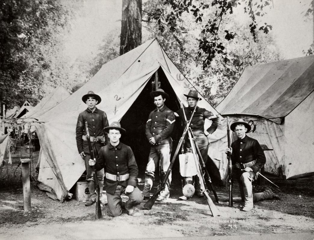
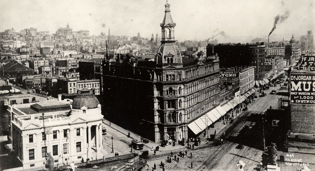
Nob Hill, visible from Market Street, was home to the city’s wealthiest residents. The railroad barons — Leland Stanford, Mark Hopkins, Collis Huntington, and Charles Crocker — had built their mansions here in the 1870s and 1880s. By the 1890s, the hill remained a symbol of concentrated wealth, sitting in obvious contrast to the working-class neighborhoods crowding the waterfront and the eastern slopes.
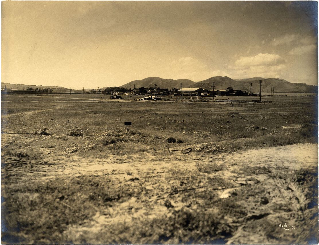
North Beach, just east of Telegraph Hill, was the center of San Francisco’s Italian immigrant community. Restaurants, bakeries, and small shops lined the streets. Families who had come from Liguria and Sicily settled here in close-knit clusters, building a neighborhood that retained strong ties to Italian language and culture. Fishing boats operated out of the nearby wharves, supplying the city’s markets and restaurants.
By the late 1890s, San Francisco had clearly turned a corner from the depression earlier in the decade. Its port handled increasing volumes of Pacific trade. New businesses opened along Market Street and its side streets. The population continued to grow, and the city’s tax base supported expanded public services, parks, and infrastructure. The recovery was real, and these photographs show a city that looked the part.
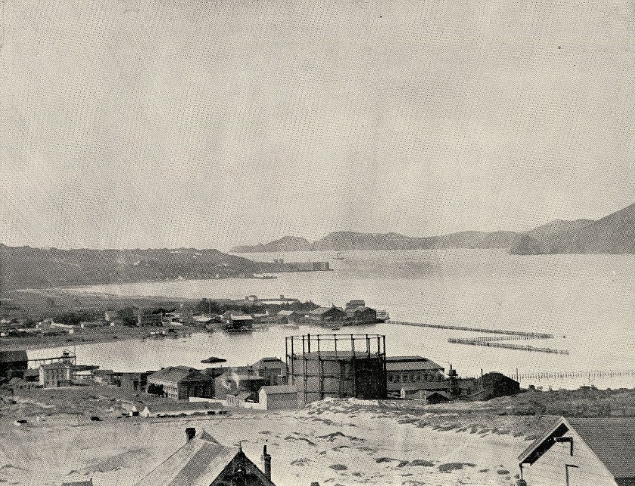
Fort Point sat at the base of the Golden Gate headland, guarding the narrow entrance to the bay. Built during the Civil War era, it was already considered outdated by the 1890s, but the military maintained it as part of the broader Presidio complex. Views from this part of the city — looking out through the Golden Gate toward the open Pacific — made clear why San Francisco had been coveted as a port since the days of the Spanish missions.
In 1898, San Francisco celebrated the 50th anniversary of the discovery of gold at Sutter’s Mill. The city lit up Market Street with decorations and held large public events marking the moment that had transformed California — and San Francisco in particular — from a small settlement into a boomtown almost overnight. The gold rush had defined the city’s origins, and the anniversary was a chance to reflect on how far it had come in five decades.
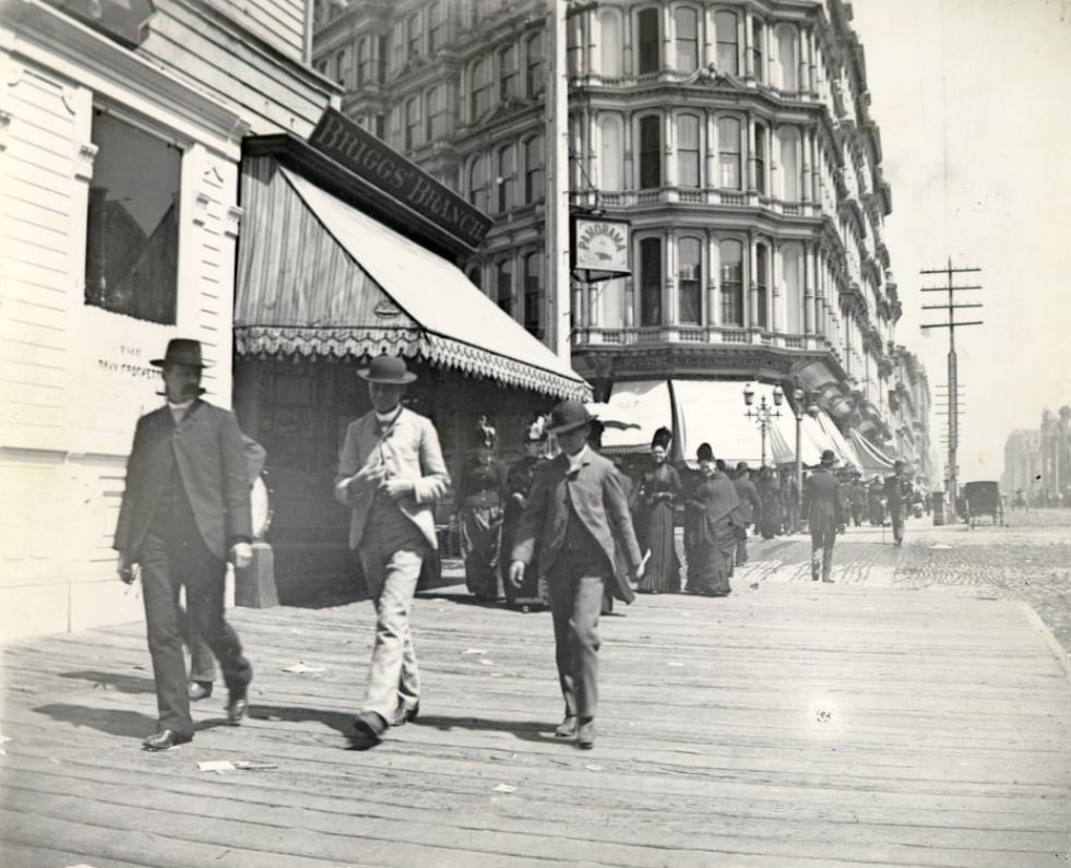
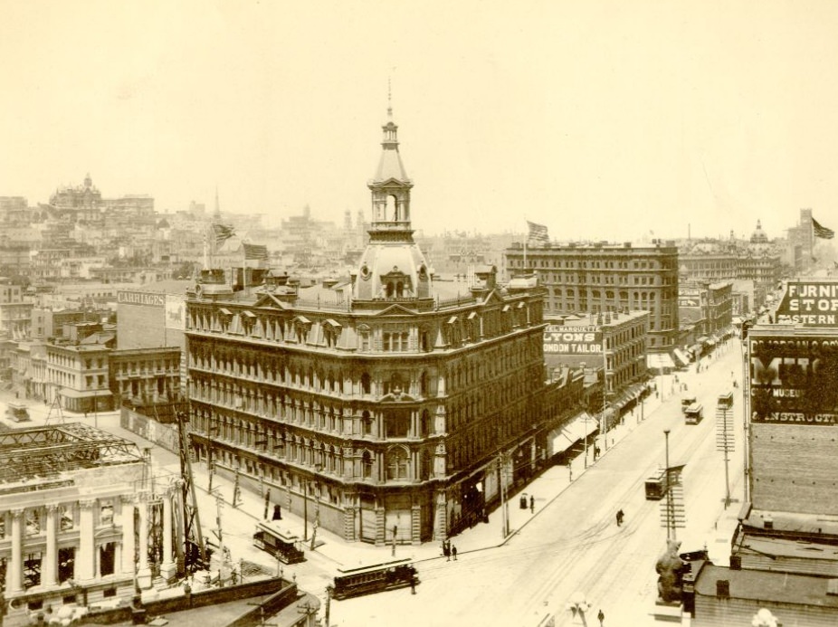
Lotta’s Fountain, standing at the intersection of Market, Kearny, and Geary streets, was one of the city’s most recognizable public monuments. The cast-iron fountain had been donated to the city in 1875 by entertainer Lotta Crabtree. By the 1890s it served as a gathering point and a landmark that appeared in photograph after photograph of the busy Market Street corridor.
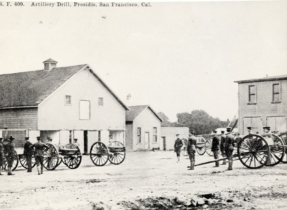
Artillery drills at the Presidio were a regular part of the Army’s presence in San Francisco. The base trained soldiers in the use of coastal defense weapons, maintaining readiness for threats that might come through the Golden Gate. When the Spanish-American War broke out in 1898, that training proved immediately relevant as the Presidio shifted from peacetime garrison to active staging area.
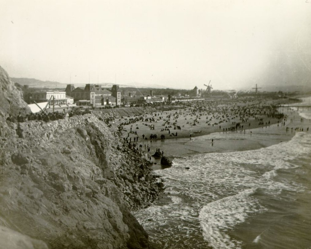
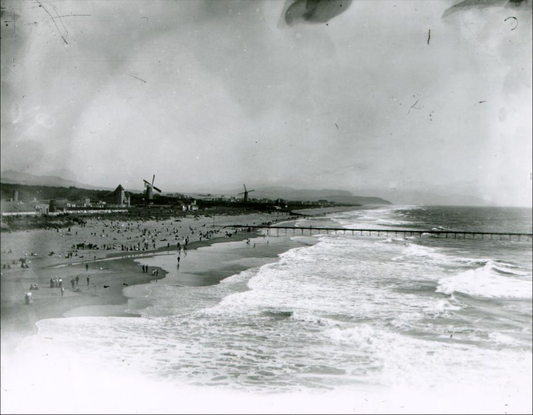
Ocean Beach stretched for miles along the western edge of the city, facing the cold waters of the Pacific. It was a popular destination despite the foggy weather and the powerful surf. The streetcar lines extended out this way, making it accessible to working-class families who could spend a Sunday afternoon at the shore without the cost of a lengthy carriage ride.
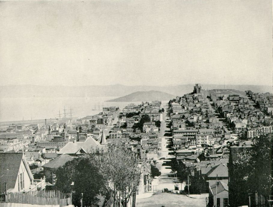
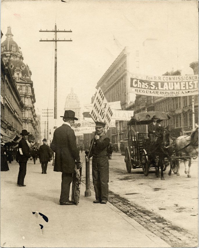
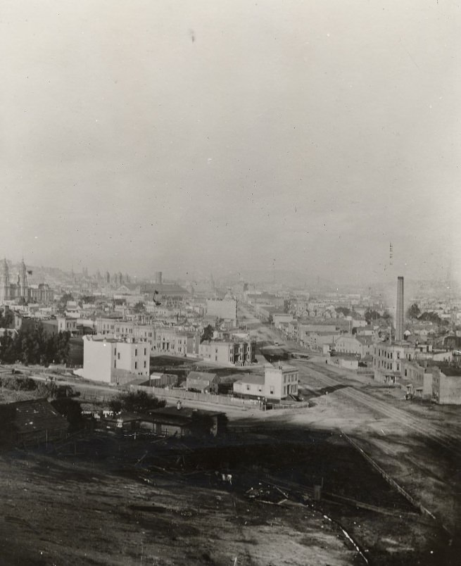
The bird’s-eye views captured in photographs of the 1890s reveal how dense the city had already become. From the heights of Russian Hill or Telegraph Hill, the rooftops spread in every direction — a grid of streets, wooden houses, commercial blocks, and church spires covering the peninsula’s hills and valleys. And the bay, always the bay, glittering at the edges of the frame.
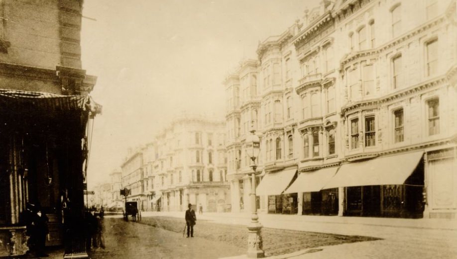
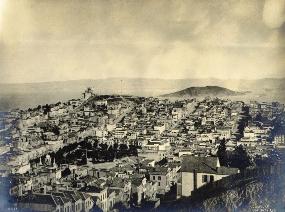
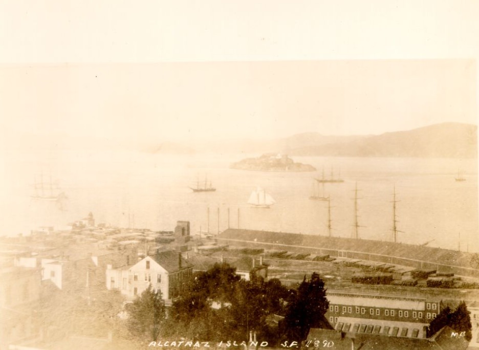
Alcatraz Island in the 1890s served as a military prison and fortification. The Army had used it since the Civil War era to house military prisoners and to mount guns covering the bay’s entrance. It sat just over a mile from the San Francisco waterfront, visible from Telegraph Hill and the northern neighborhoods, a constant presence in the city’s daily backdrop.
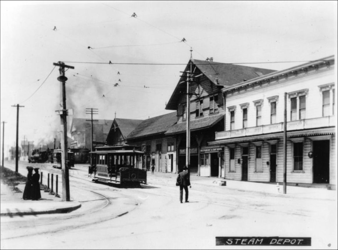
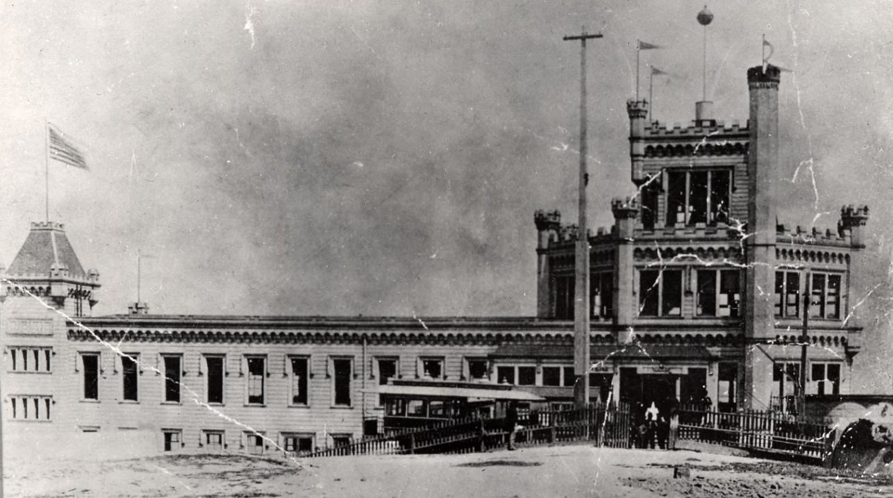
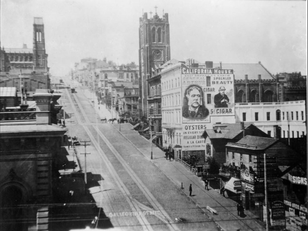
The California Street cable car line ran from the downtown waterfront all the way up and over Nob Hill, connecting the financial district to the wealthy residential neighborhoods above. The cable terminal at the end of the line was a busy hub. Cable cars had become so essential to the city’s daily functioning that by the late 1890s, life on San Francisco’s steeper streets was barely conceivable without them.
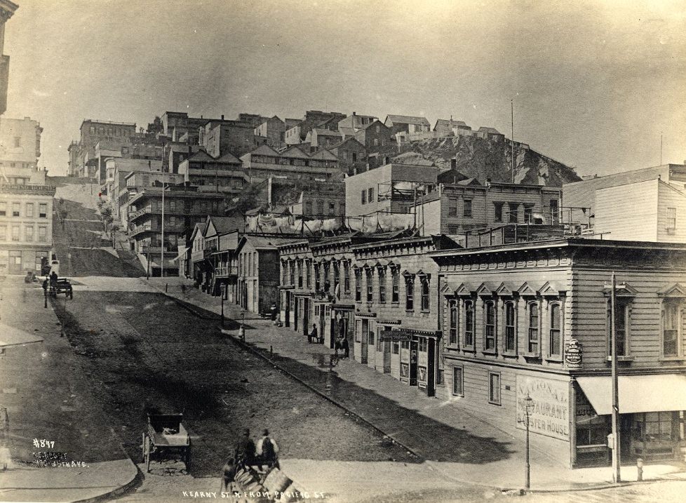
Kearny Street north of Pacific Avenue was where the commercial district began to give way to denser residential blocks and the edges of Chinatown. The street-level photographs from this stretch in the early 1890s show a city in transition — storefronts giving way to boarding houses, horse traffic thinning out as the streets narrowed and climbed.
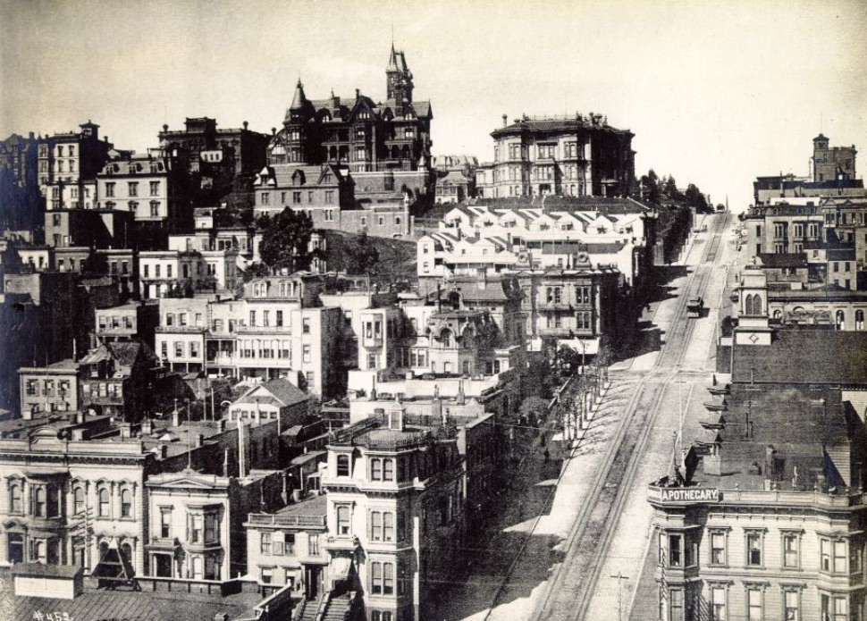
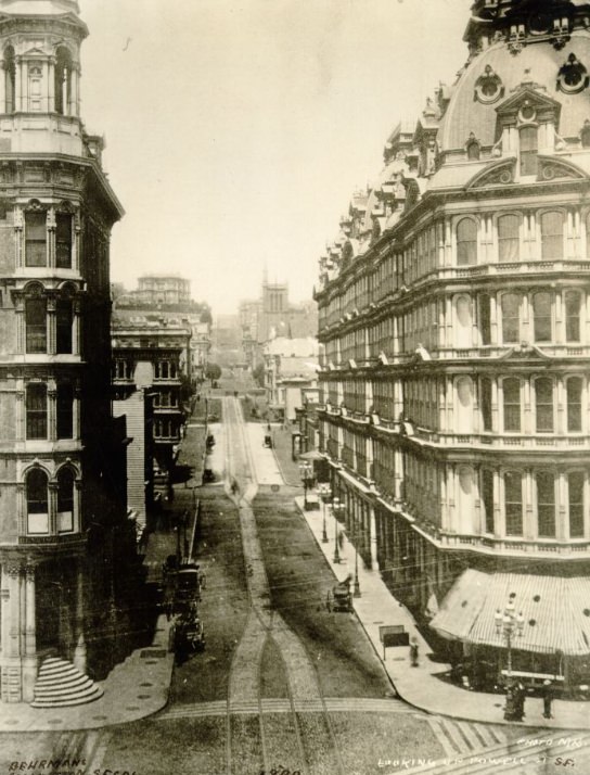
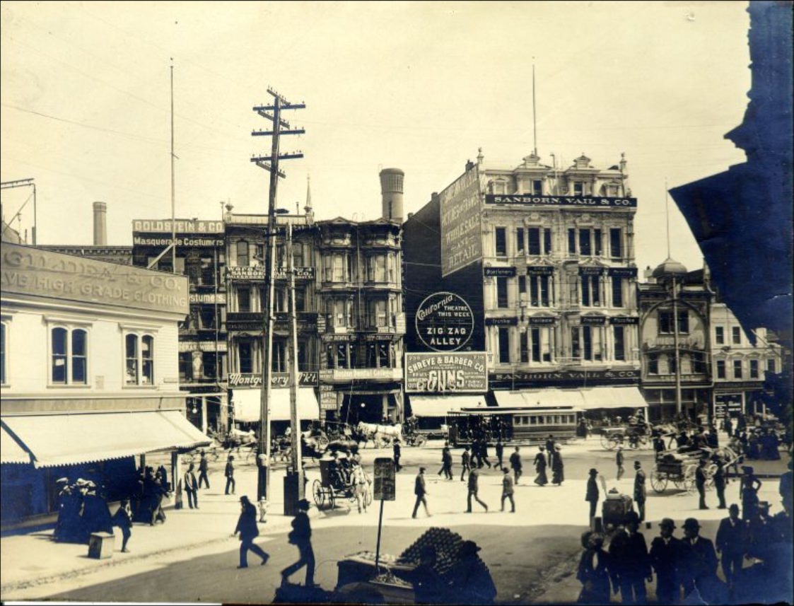
Powell Street, seen here at the very start of the decade, already had the character it would carry for the next century. The intersection with Market was one of the busiest corners in the city, and the cable car turnaround at Union Square made it a constant focal point of activity. Shops, hotels, and offices crowded both sides of the street, and the sidewalks filled early and stayed full late into the evening.
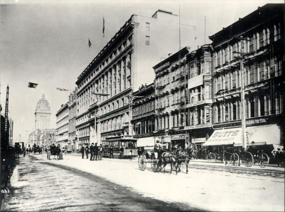
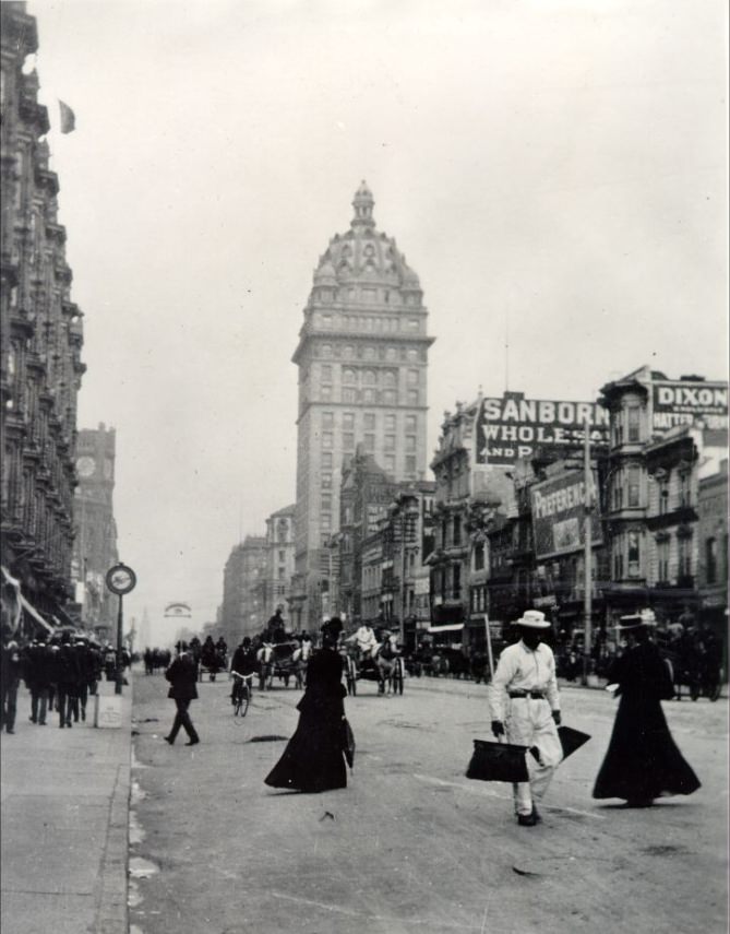
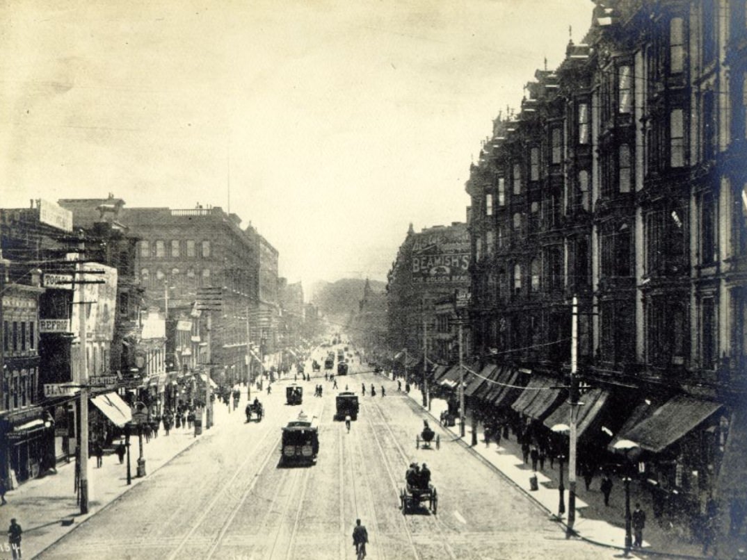
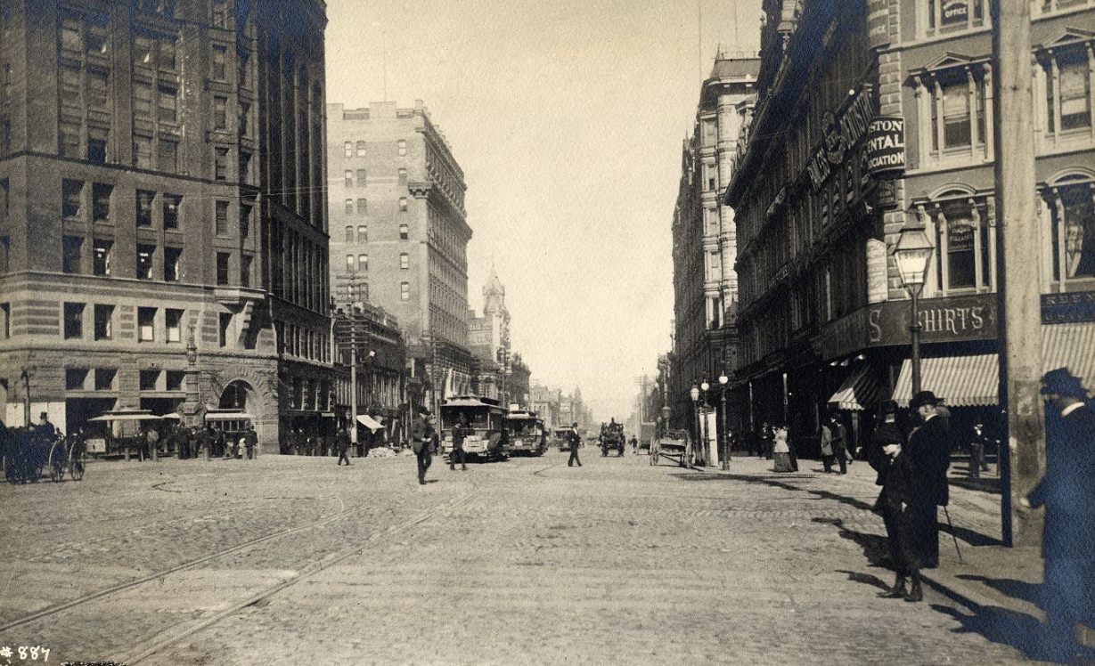
Market Street appeared in more photographs than any other location in 1890s San Francisco, and for good reason. It was the city’s main commercial and civic artery — 120 feet wide, running diagonally across the street grid, connecting the bay to the residential interior. Every major building, parade, and public demonstration eventually made its way to Market Street.
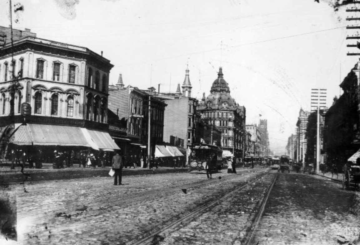
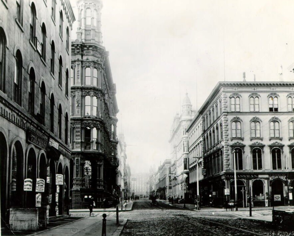
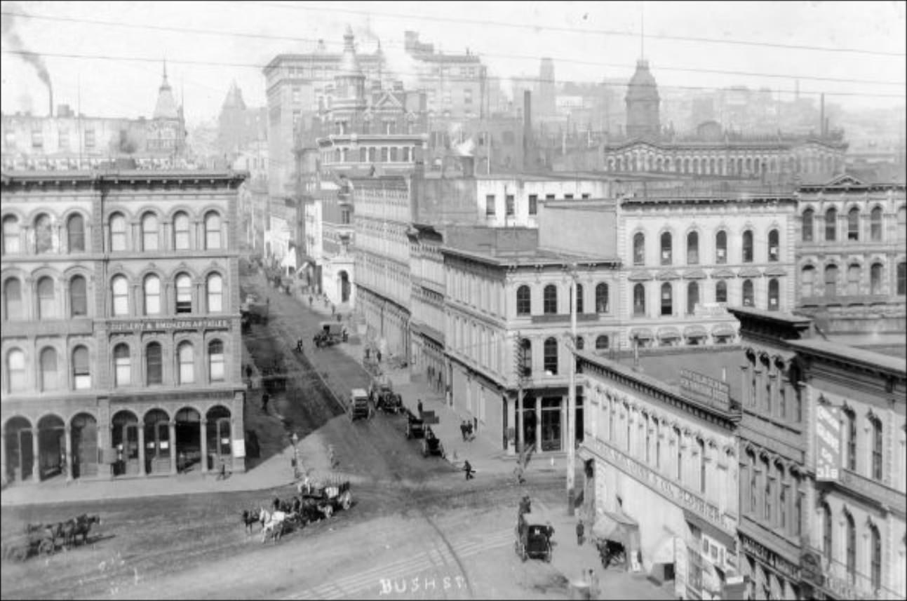
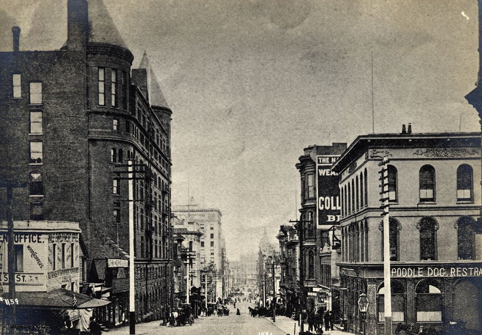
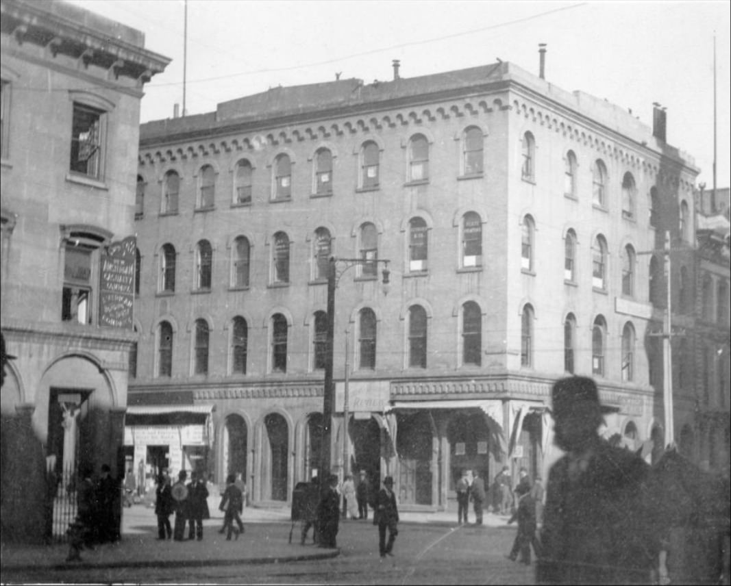
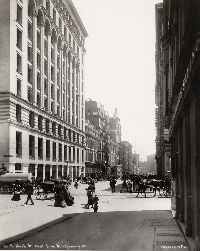
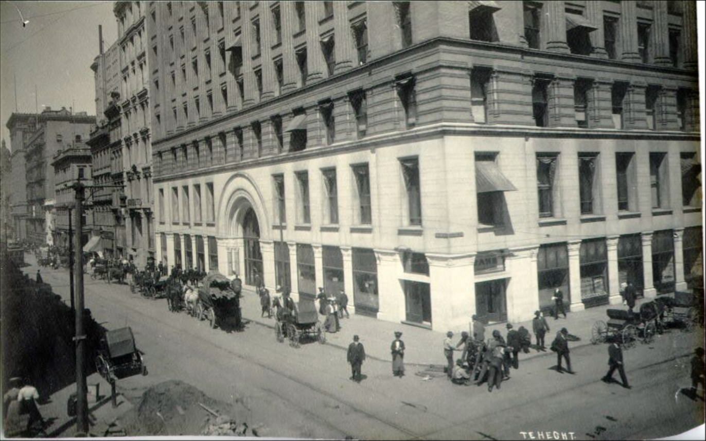
Bush Street heading east from Market Street ran through the heart of the commercial district, passing banks, office buildings, and small specialty shops. By the late 1890s, the city’s financial recovery was visible in the condition of these blocks — freshly built facades, electric streetlamps beginning to replace gas lights, and the constant movement of people doing business.
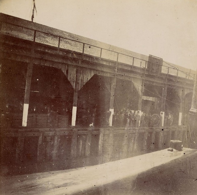
The Pacific Mail Steamship Company operated its docks along the waterfront, running regular service to Asia and Central America. The Pacific Mail Dock was one of the most active points on the entire bay. Ships arriving from China, Japan, and the Pacific islands tied up here, unloading cargo and passengers and loading exports bound for Asian markets. San Francisco’s economy ran on this Pacific trade.

Looking east from the Broadway and Webster Street corner in the late 1890s, the bay and its islands were visible on clear days. Alcatraz and Angel Island rose from the water. The dense middle neighborhoods — Pacific Heights, Russian Hill — filled the foreground. Views like this reminded residents that they lived in a city defined by water on three sides.
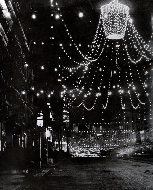
The night photograph of Market Street decorated for the gold rush anniversary celebration in 1898 is striking. Electric lights outlined the buildings and strung across the road. The street was still mostly a daytime place in this era, but events like this anniversary brought crowds out after dark. The electric illumination was itself part of the spectacle — a technology that was still new enough to impress.
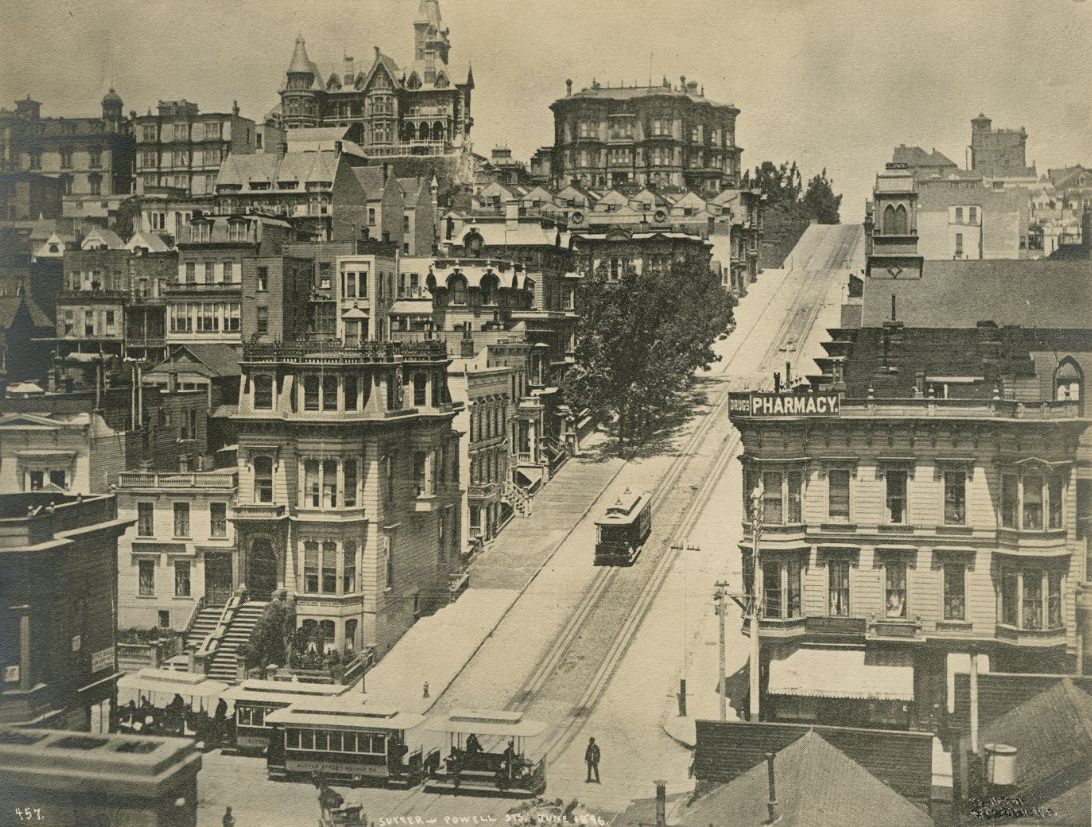
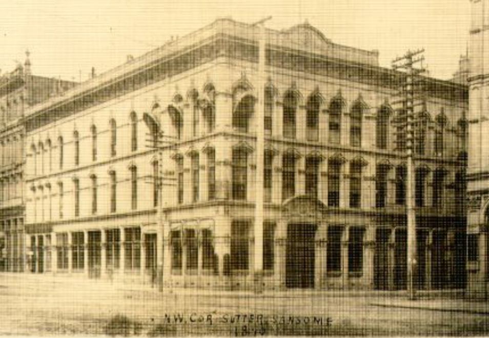
The intersection of Powell and Sutter streets placed visitors squarely in the busy retail and hotel district that surrounded Union Square. Department stores, tailors, jewelers, and restaurants occupied the blocks in every direction. In June 1896, when this photograph was taken, San Francisco had been pulling out of the early-decade recession for several years and the commercial vitality on these streets showed it.
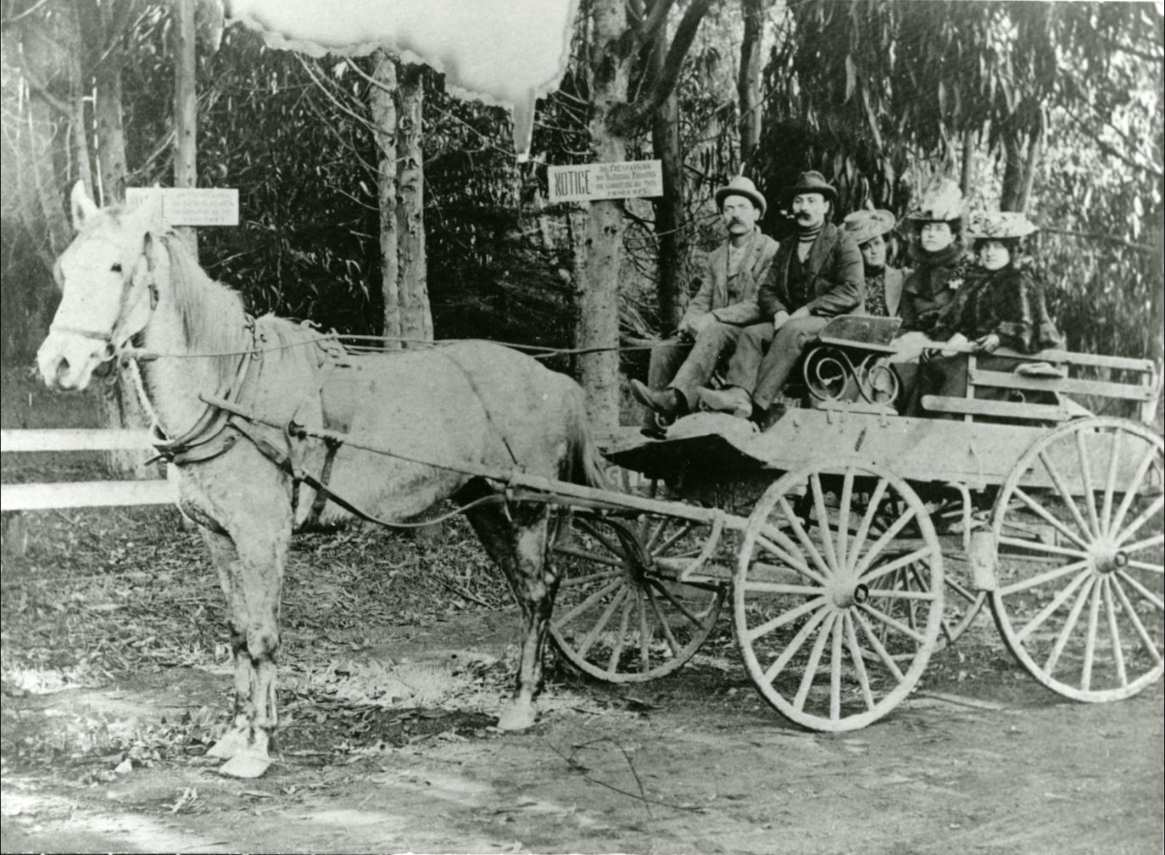
Horse-drawn carriages remained the primary form of private transportation throughout the 1890s. Families used them for daily errands, social calls, and leisure trips out to parks and beaches. The streets of San Francisco were shared by horses, cable cars, pedestrians, and the occasional early bicycle — a chaotic mix that the city’s wide commercial streets just barely managed.
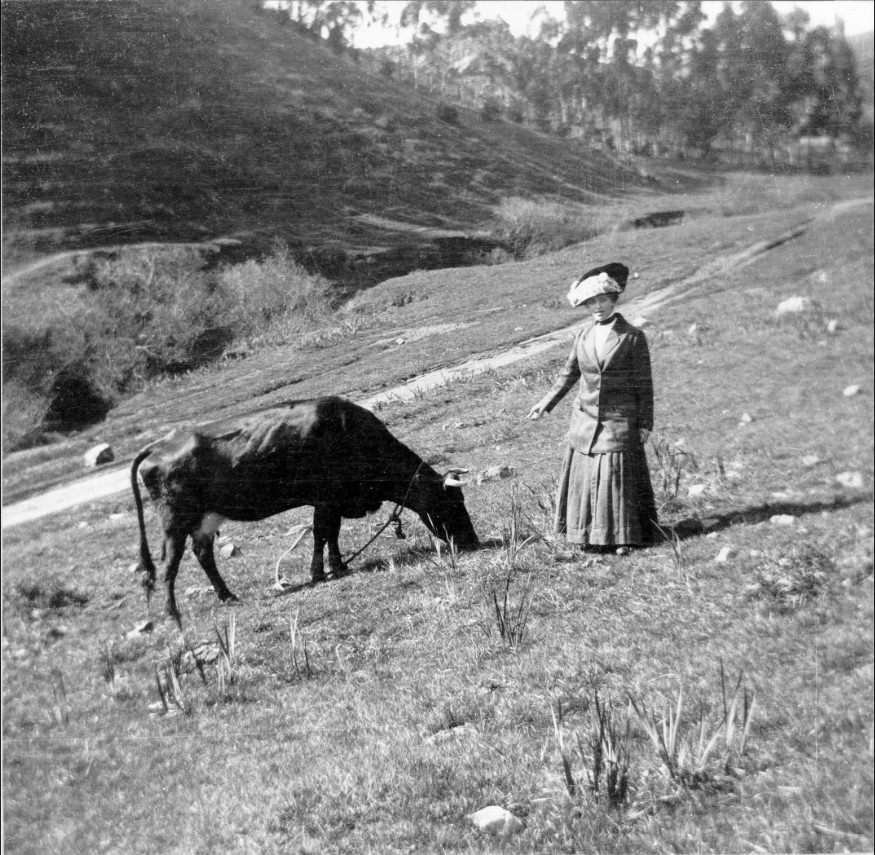
Glen Canyon, on the southwestern edge of the city, was rural enough in 1899 that residents still kept livestock there. The city’s western and southern edges had not yet been fully absorbed into the urban grid, and pockets of farmland and open space persisted well into the decade. It was a reminder that for all its urban ambition, San Francisco in the 1890s still had one foot in its agricultural past.





These are amazing! So many I’ve never seen before. It’s so cool to see things or views I recognize from living in this time period and how it used to be. So wish I could visit their time as a tourist.