
San Francisco in the 1960s was a city in motion. Its streets carried cable cars up steep hills, its neighborhoods held everything from produce markets to beat poetry readings, and its skyline was steadily climbing higher. The city was home to roughly 740,000 people, and nearly every corner of it was changing — physically, politically, and culturally. These vintage photographs capture that transformation in concrete detail, block by block and year by year.
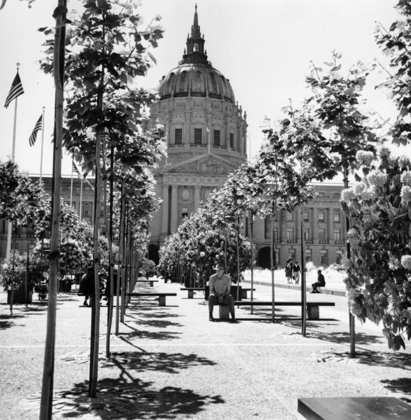
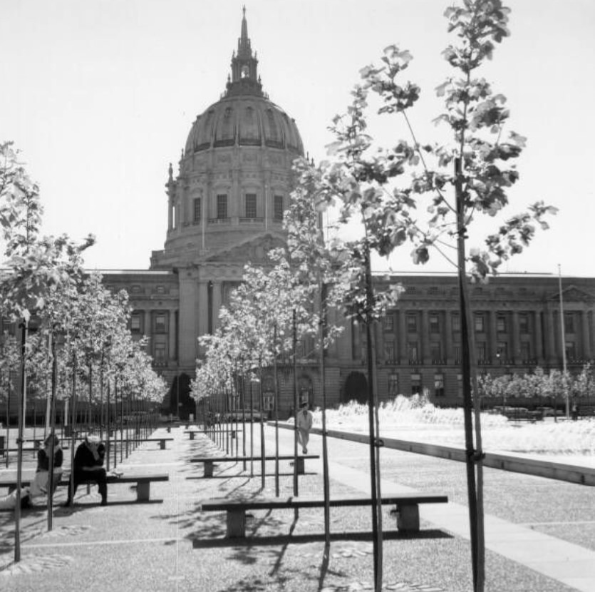
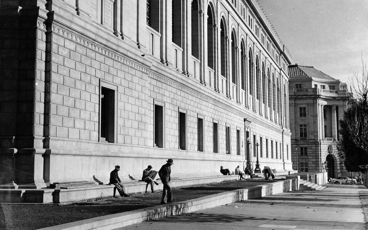
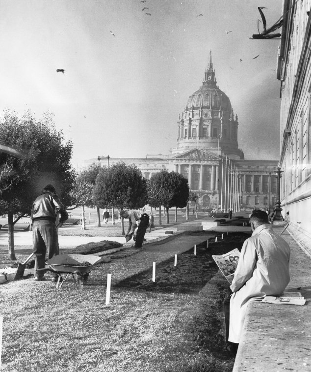
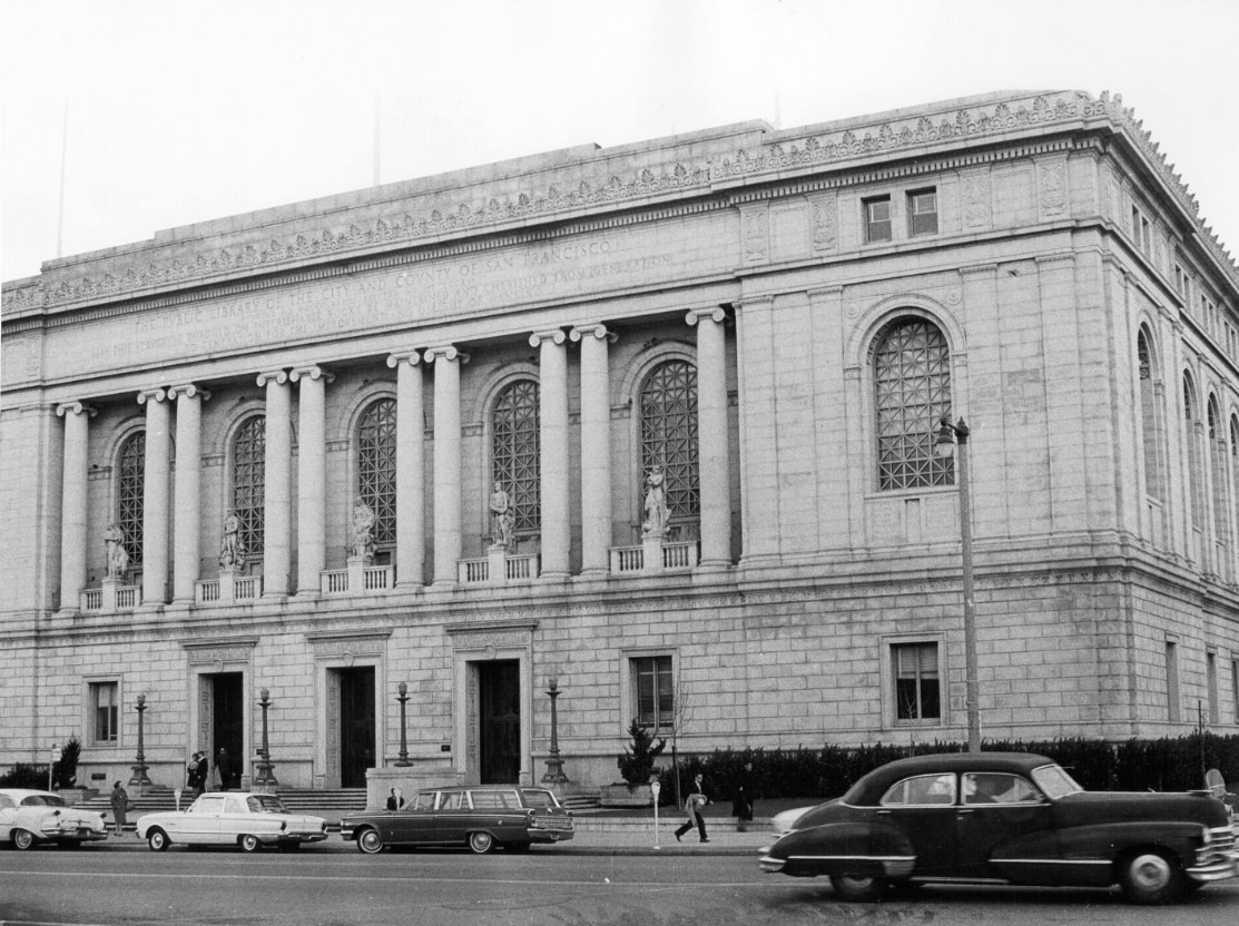
The Civic Center was one of San Francisco’s most recognizable stretches of public space. City Hall, completed in 1915, anchored the plaza with its massive dome — taller than the one on the U.S. Capitol. The Main Library sat nearby, and the area was regularly used for public gatherings, protests, and civic events throughout the decade.
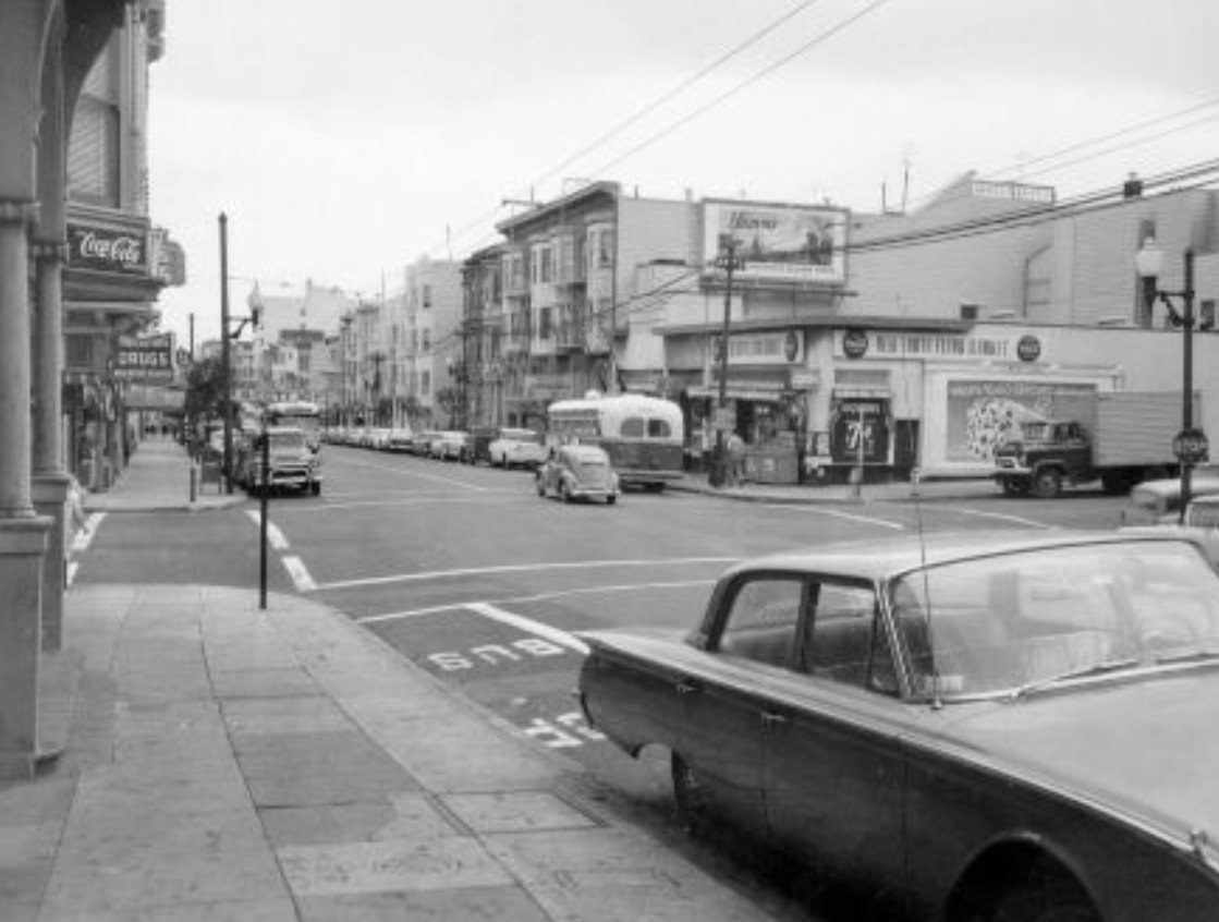
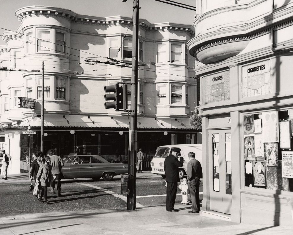
In 1960, Haight Street looked like many other commercial strips in the city — storefronts, parked cars, and foot traffic moving at an ordinary pace. Within a few years, this neighborhood would become internationally known. By 1967, Haight-Ashbury was the center of the counterculture movement, drawing tens of thousands of young people during the Summer of Love. That summer alone saw an estimated 100,000 people flood into the neighborhood seeking communal living, music, and a break from mainstream society.
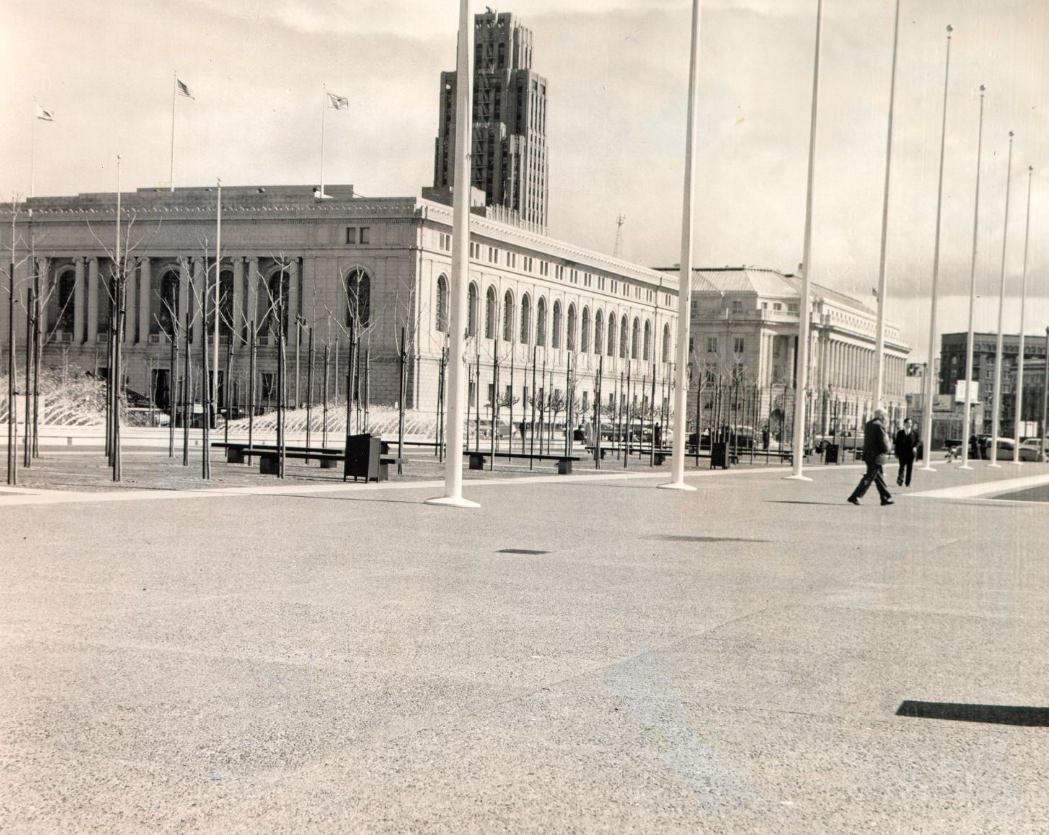
The Main Library on Larkin Street was a regular gathering spot for students, intellectuals, and activists. San Francisco’s universities — including San Francisco State College and the University of San Francisco — were fueling a generation of politically engaged young people. Students organized teach-ins, marched against the Vietnam War, and pushed for free speech on campuses across the Bay Area.
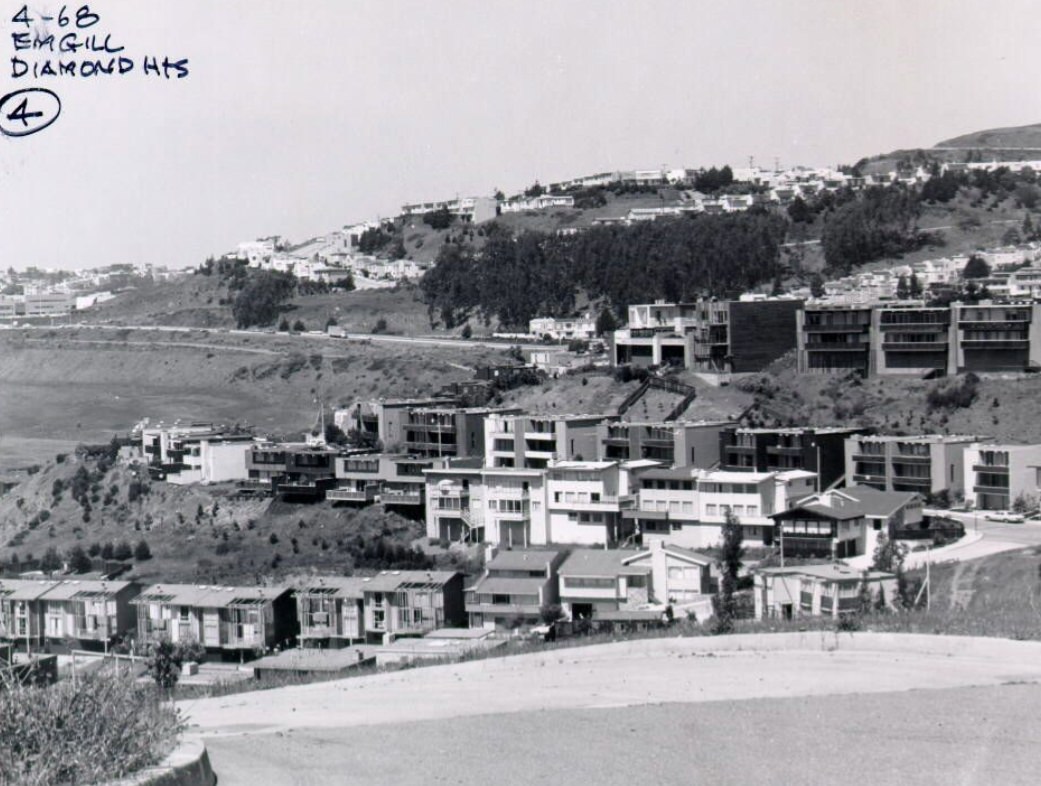
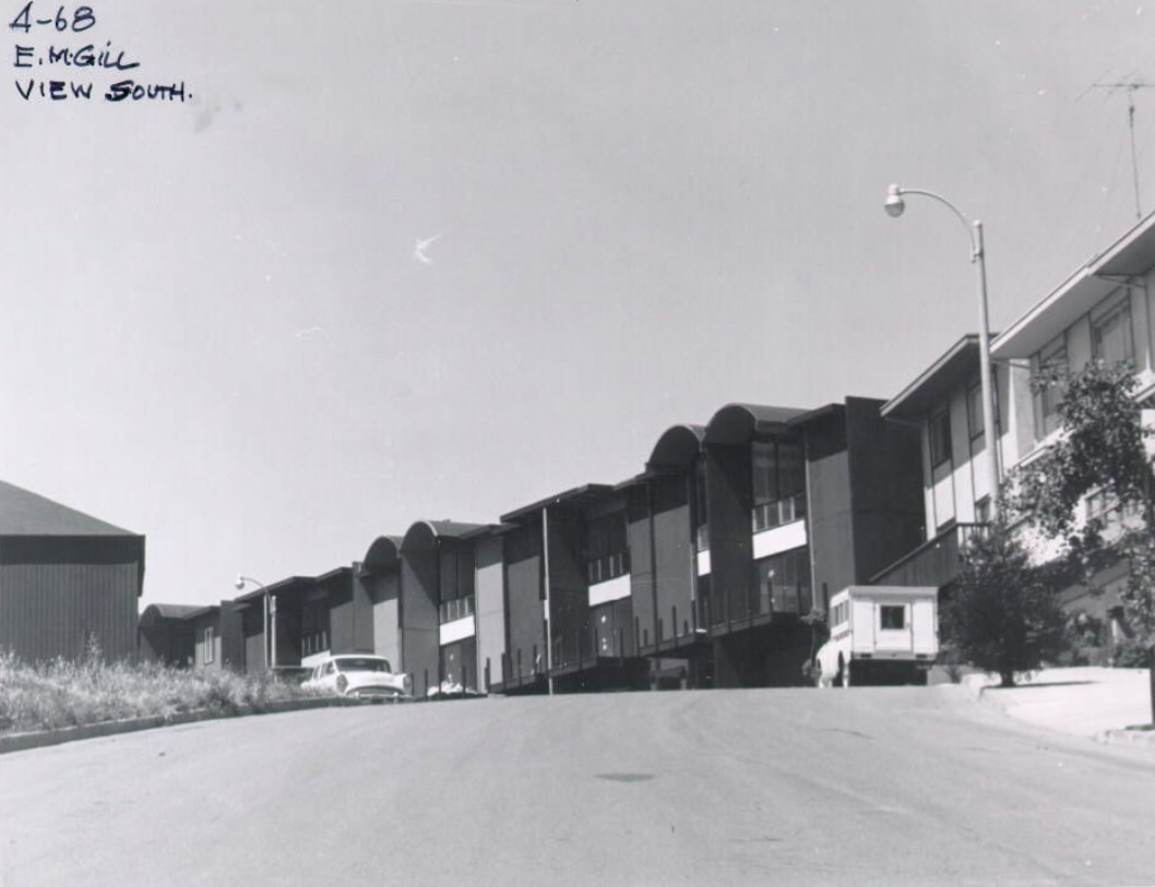
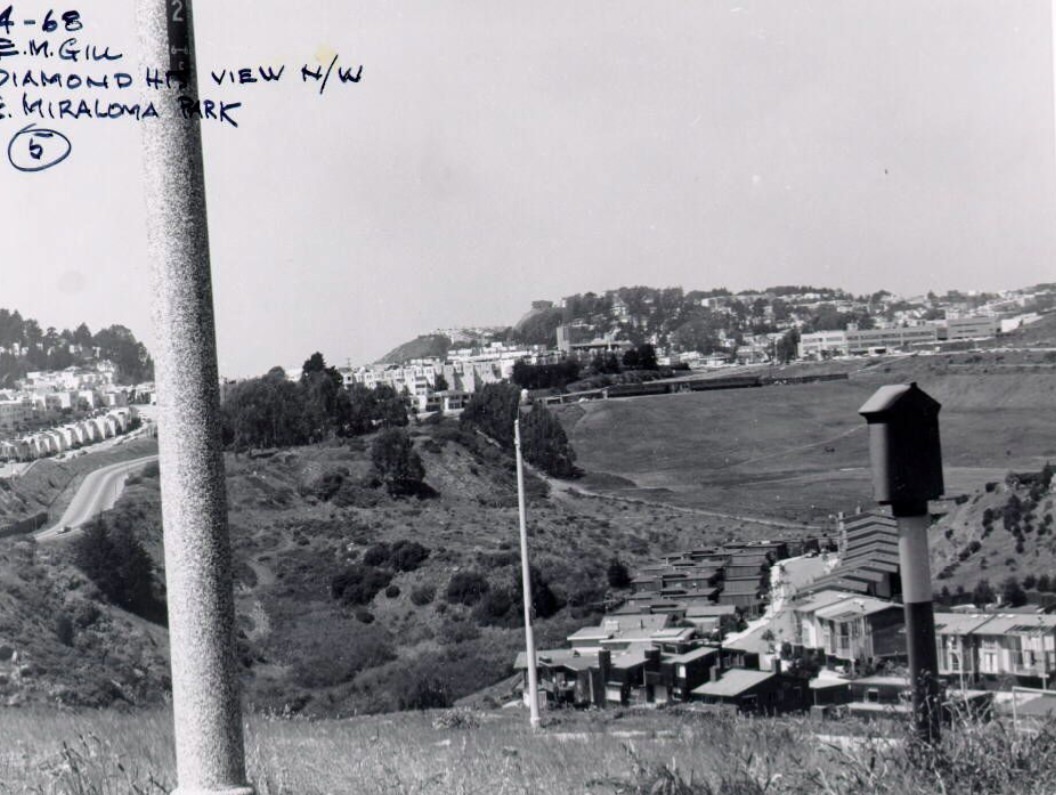
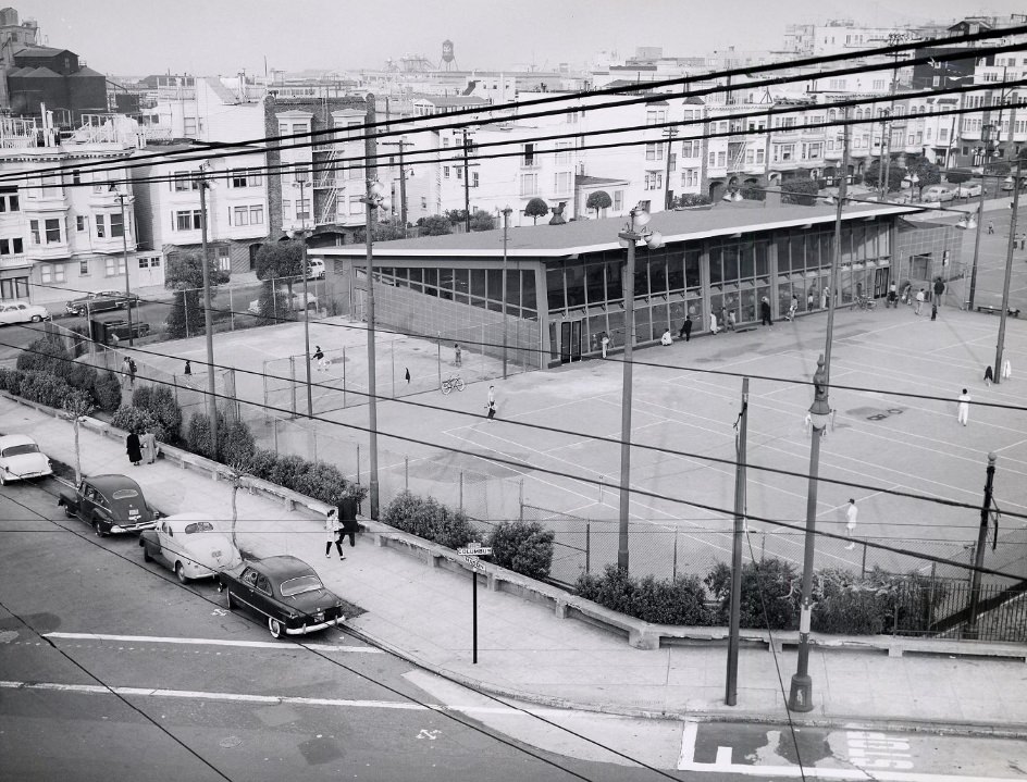
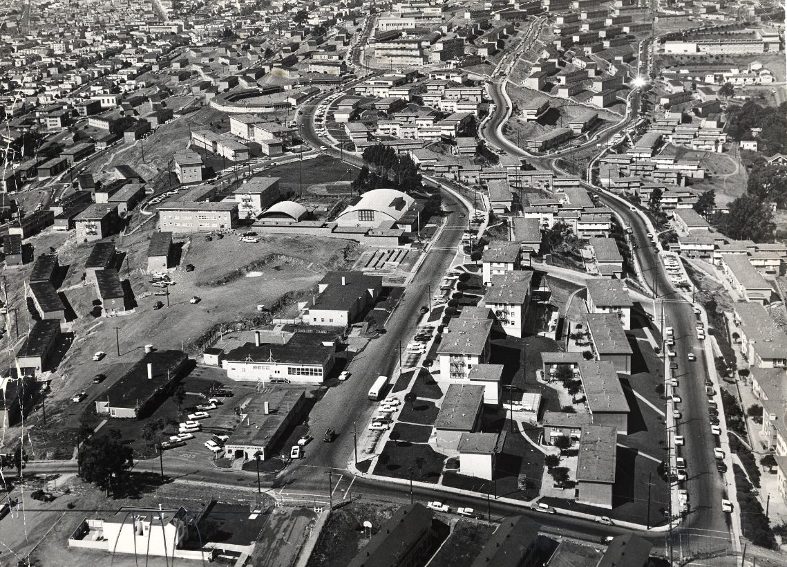
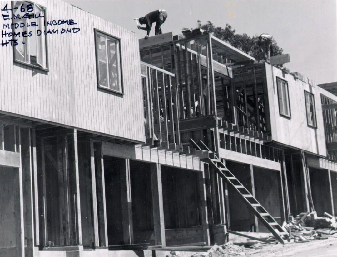
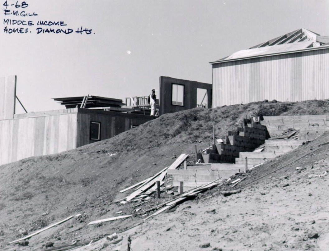
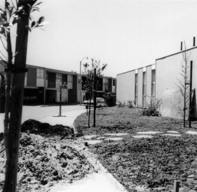
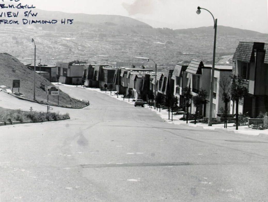
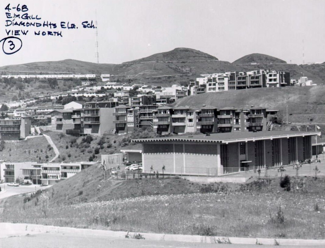
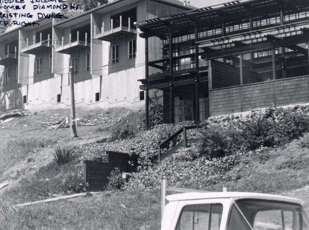
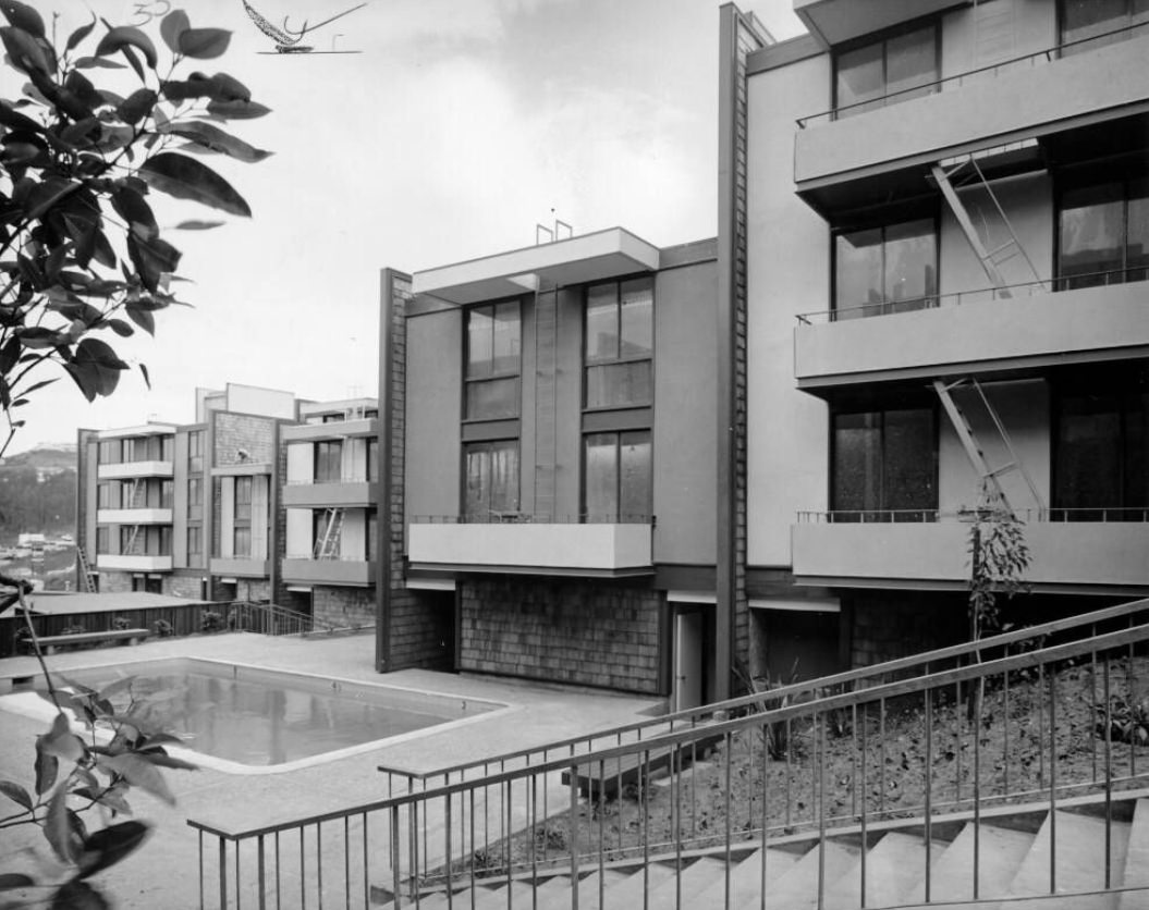
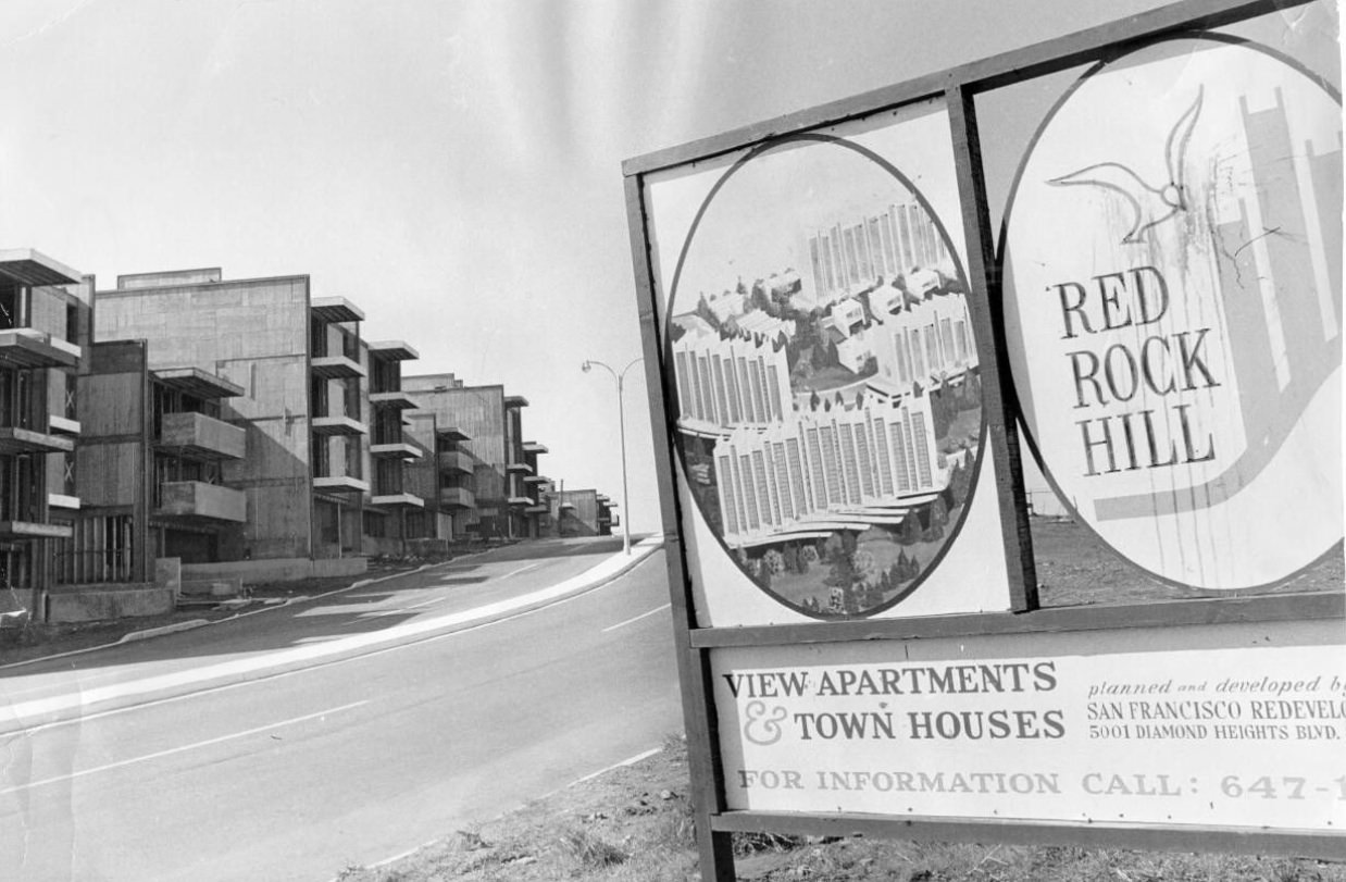
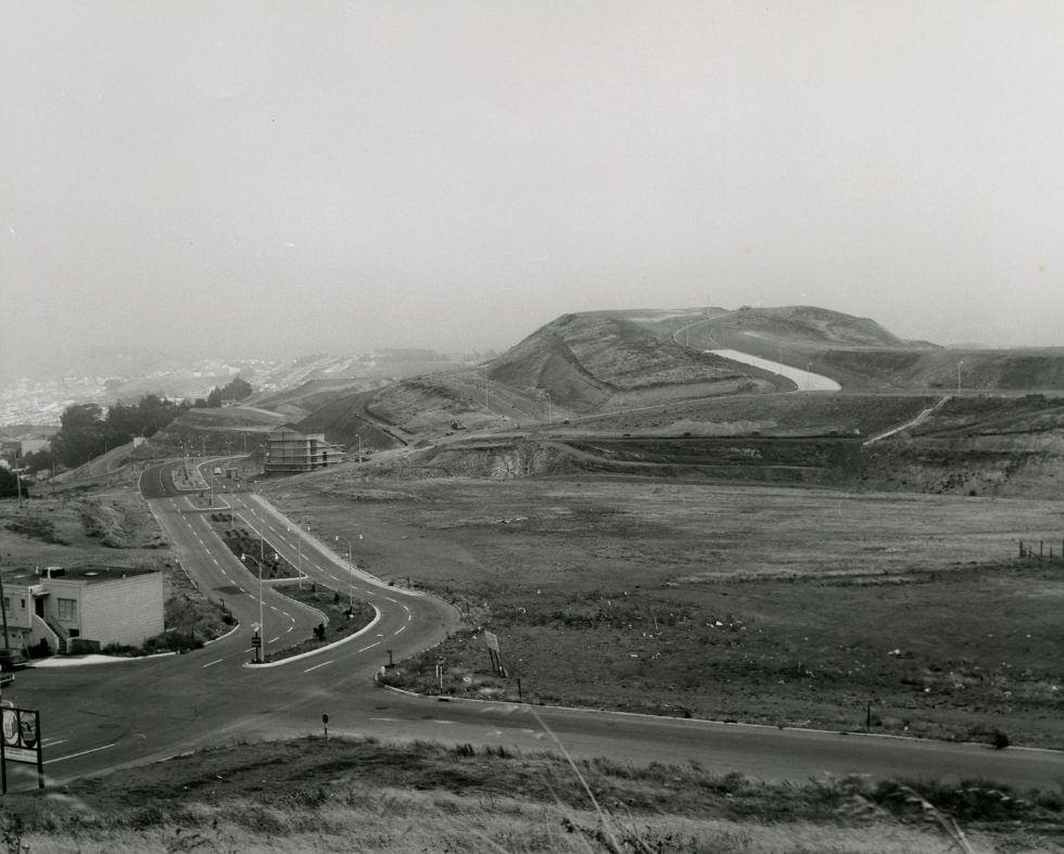
Diamond Heights was one of the decade’s most visible urban development projects. The neighborhood, perched in the hills south of Twin Peaks, was largely undeveloped at the start of the 1960s. The city began a major redevelopment effort there, building new middle-income homes, schools, and apartment complexes throughout the decade. By 1968, the area had taken on a distinctly modern look compared to the older Victorian streets found elsewhere in the city.
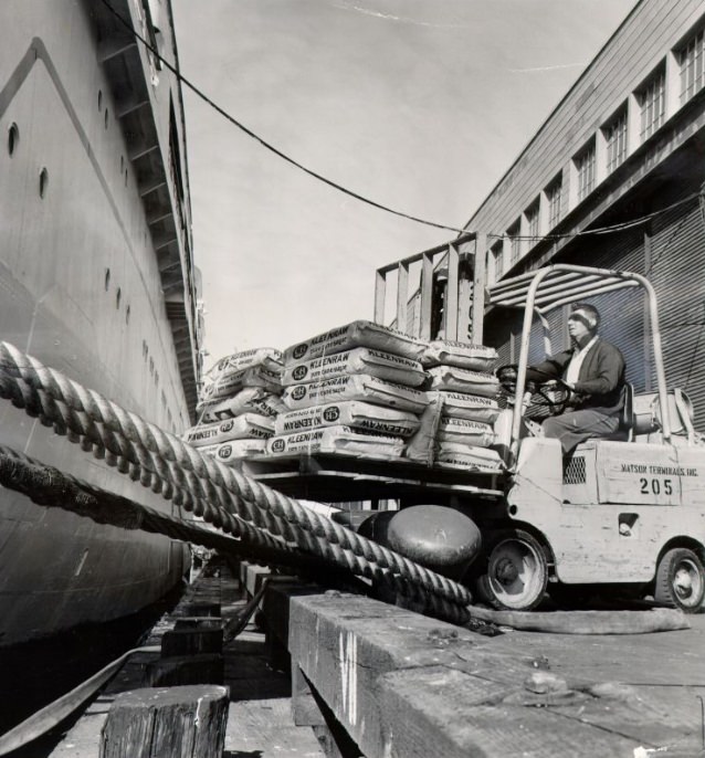
The San Francisco waterfront was still a working industrial zone in the early 1960s. Longshoremen loaded and unloaded cargo ships, and the docks hummed with commercial activity. The International Longshoremen’s and Warehousemen’s Union, led by Harry Bridges, had a strong presence at the port and played a significant role in the city’s labor politics throughout the decade.
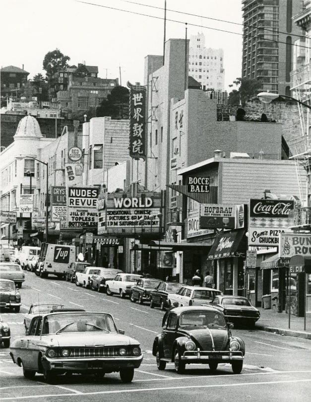
Broadway and the surrounding North Beach area had a dual identity in the 1960s. On one hand, it was home to nightclubs, strip joints, and venues like The Condor — which made headlines in 1964 as one of the first clubs to feature topless entertainment. On the other hand, North Beach was still the spiritual home of the Beat Generation. City Lights Bookstore on Columbus Avenue, founded by poet Lawrence Ferlinghetti, remained a hub for writers, poets, and readers. Allen Ginsberg was a regular presence, and the bookstore stocked titles that mainstream shops refused to carry.
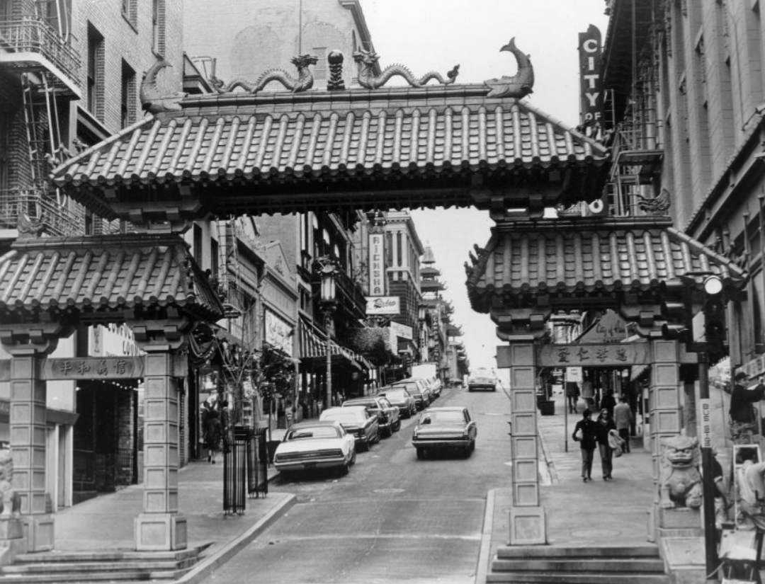
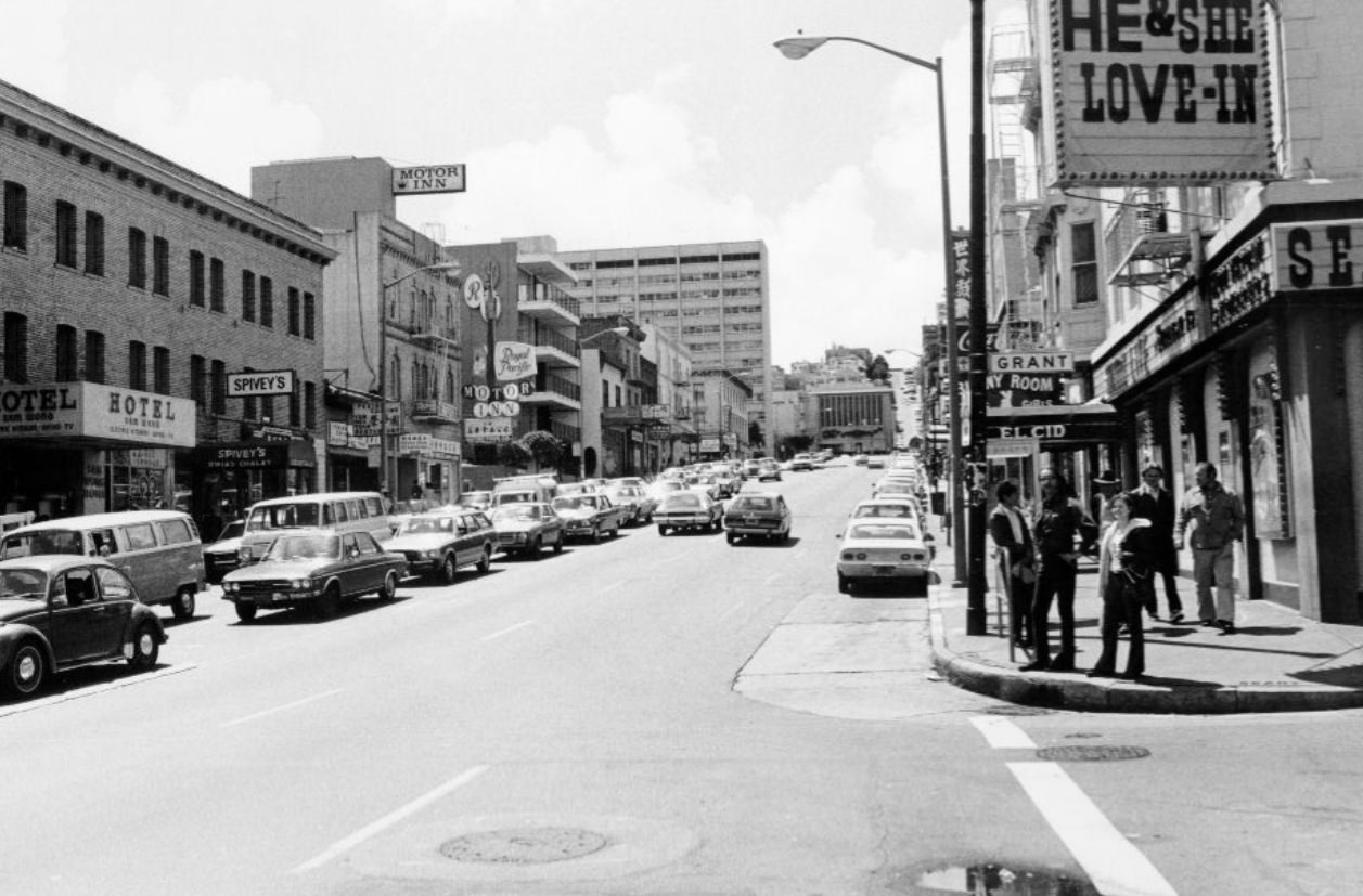
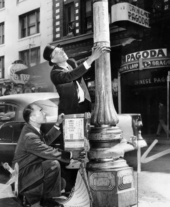
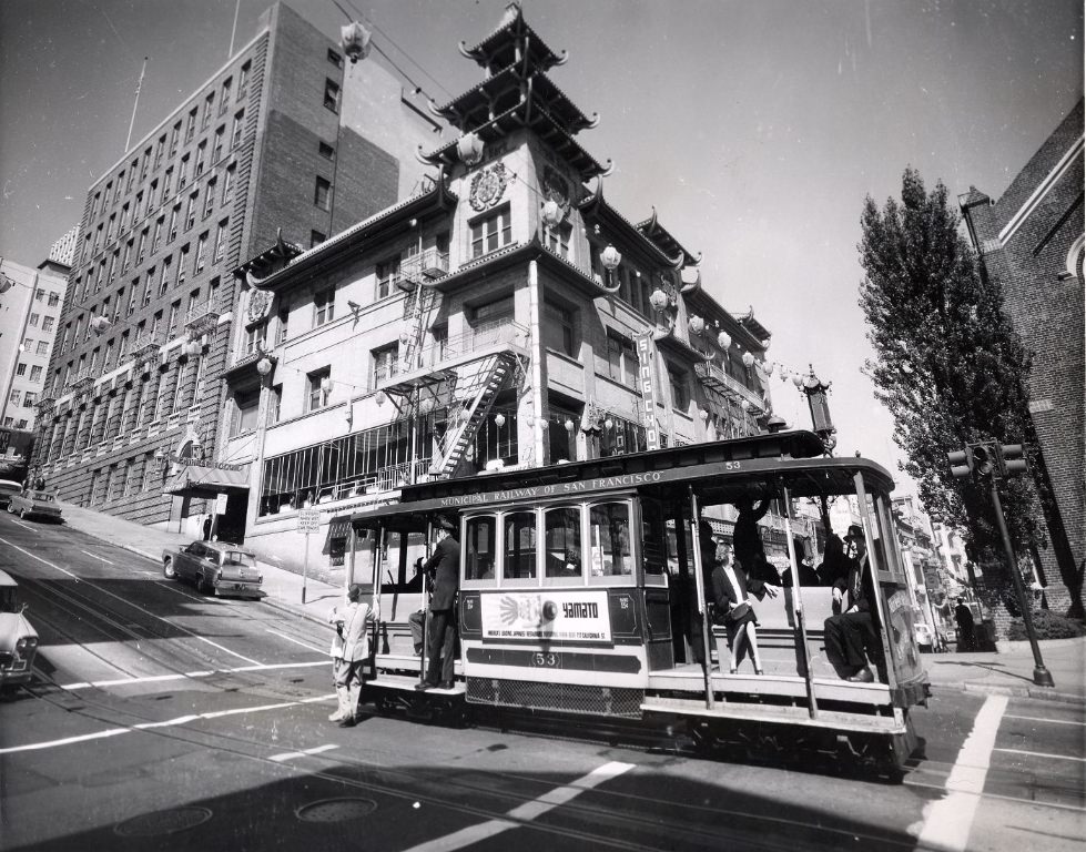
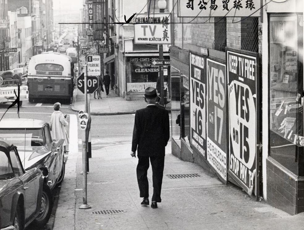
Chinatown, centered along Grant Avenue, was one of the most densely populated neighborhoods in the United States. By the early 1960s, San Francisco’s Chinese-American community had lived there for over a century, and the neighborhood retained a strong cultural identity with its own newspapers, temples, shops, and civic organizations. The ornate Chinatown Gate at Grant and Bush streets served as the neighborhood’s most recognizable landmark.
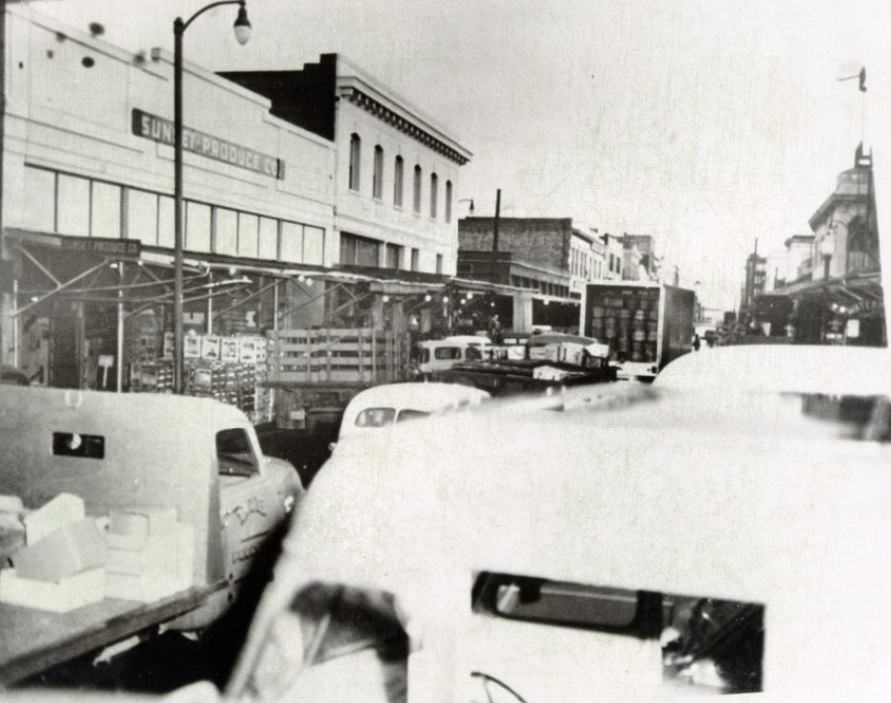
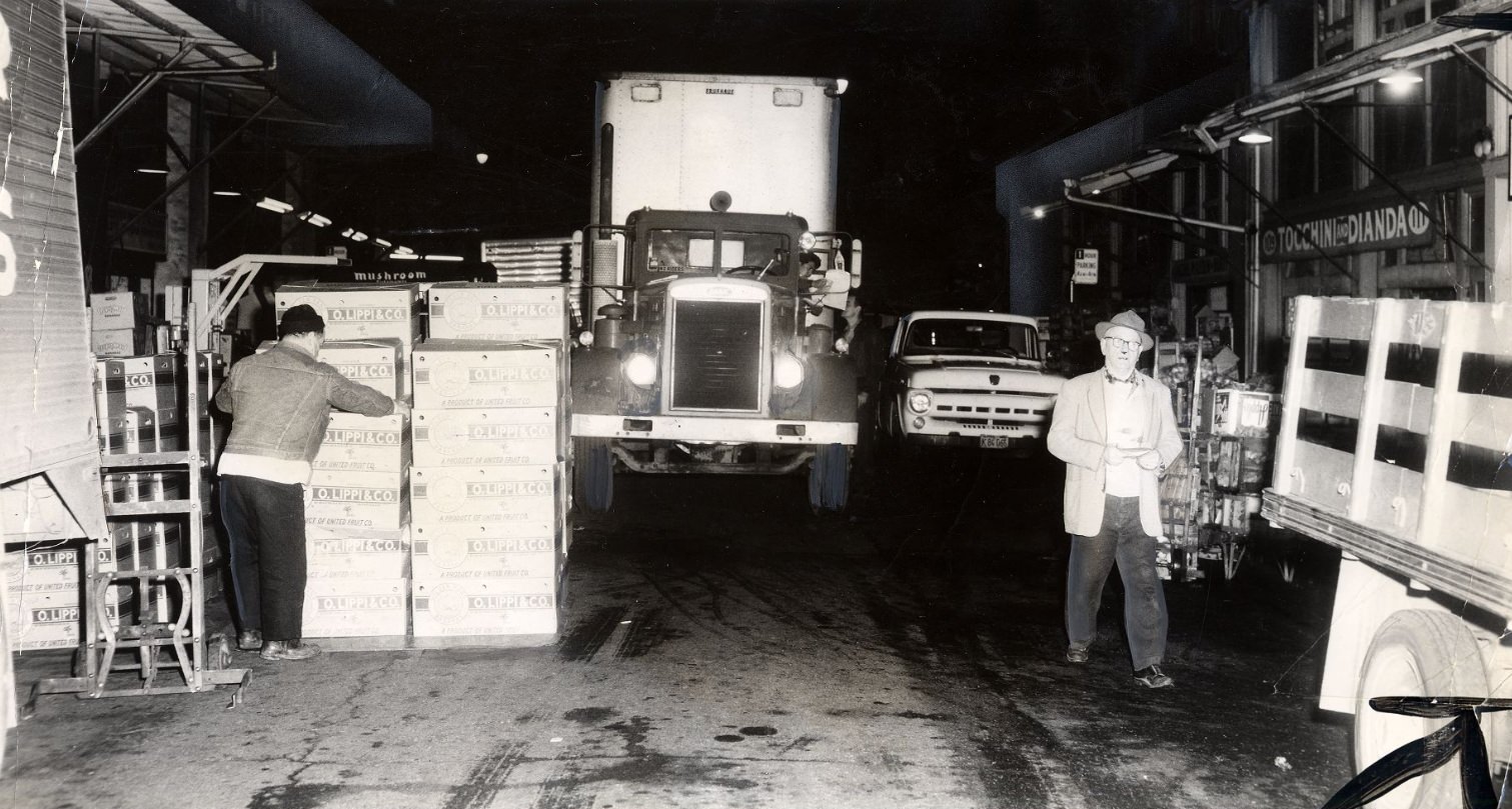
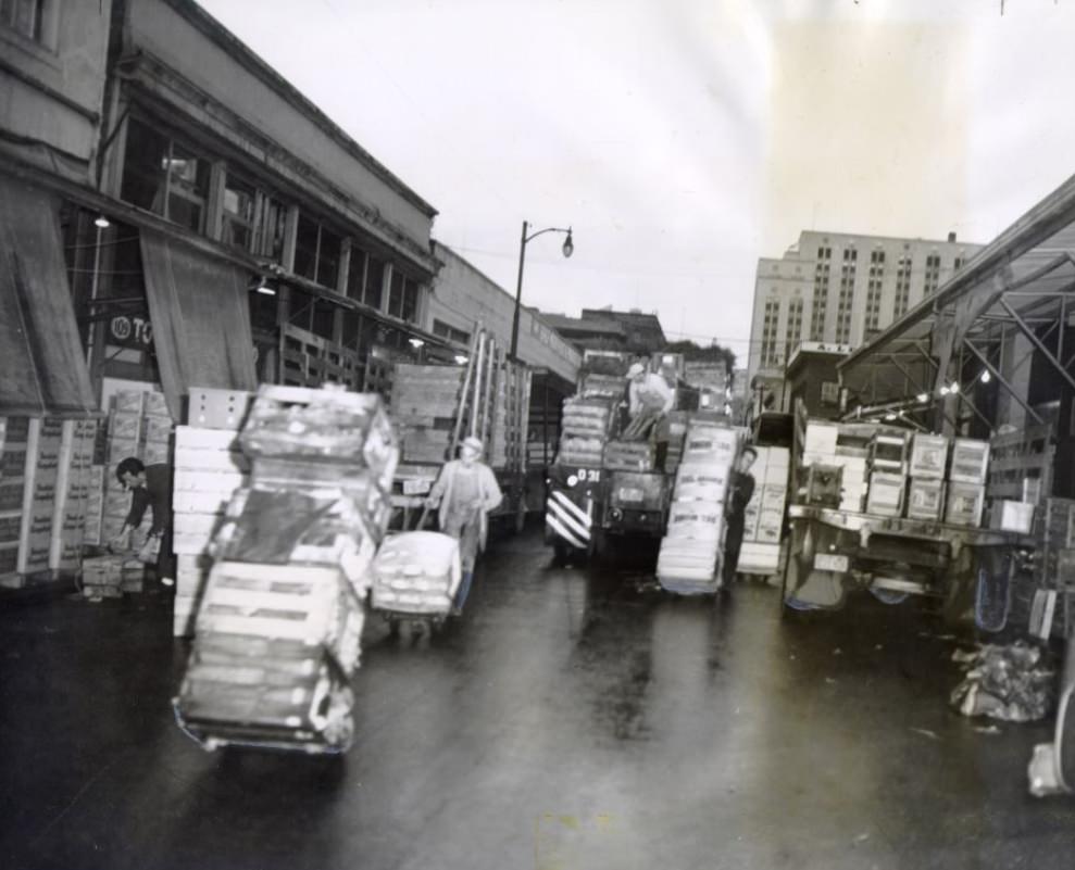
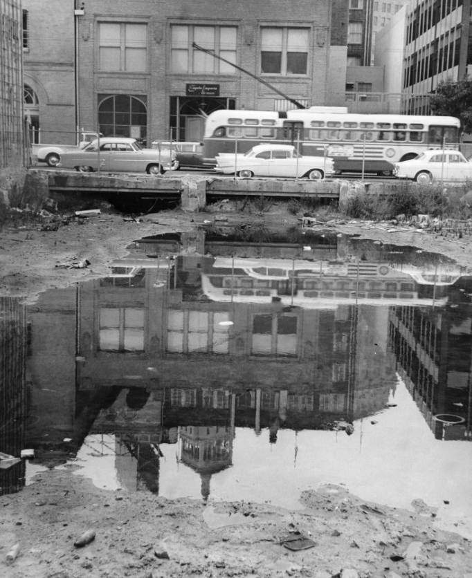
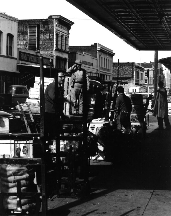
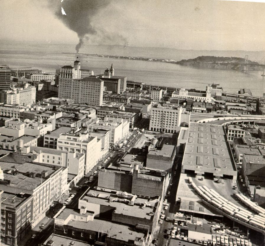
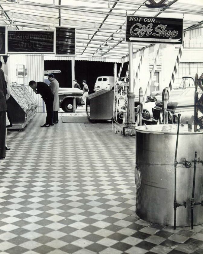
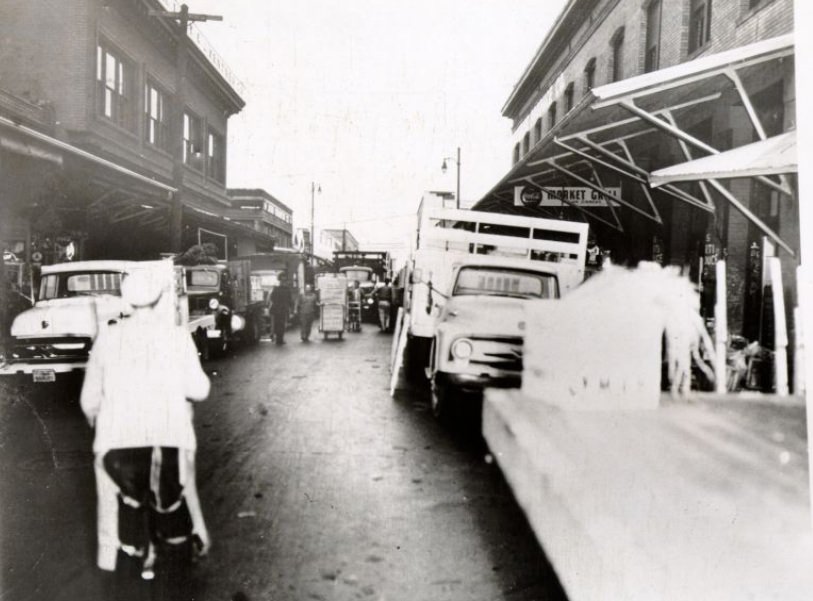
San Francisco’s downtown produce district was a chaotic, pre-dawn operation. Trucks jammed the streets around Washington and Davis, delivering fruits and vegetables to wholesale buyers before most of the city was awake. The area was loud, crowded, and essential to the regional food supply. The city eventually relocated the produce market as part of broader urban redevelopment efforts during the decade.
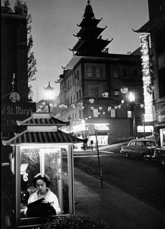
Small details like the pagoda-style phone booth on Grant Avenue reflected how thoroughly Chinatown maintained its distinct visual character. Even practical street furniture was designed to match the neighborhood’s aesthetic. These kinds of details made San Francisco’s neighborhoods feel like distinct worlds within a single city.
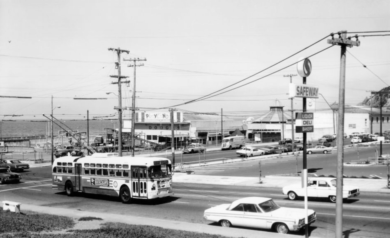
San Francisco’s public transit system — Muni — ran buses and streetcars across the city, connecting neighborhoods from the foggy western edge near Ocean Beach all the way to the downtown core. The city was also in the early planning stages of a much larger project: the Bay Area Rapid Transit system, or BART. Ground was broken on BART in 1964, and construction reshaped streets and neighborhoods throughout the rest of the decade.
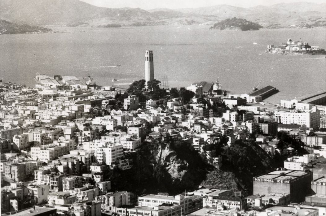
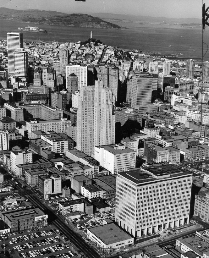
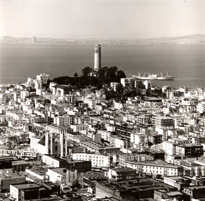
Telegraph Hill, rising steeply above the northeastern waterfront, offered sweeping views of the bay and the city below. Coit Tower sat at its peak — a 210-foot fluted concrete column built in 1933 that remained one of the city’s most beloved landmarks. The hill’s eastern face was lined with wooden staircases and narrow lanes, some accessible only on foot.
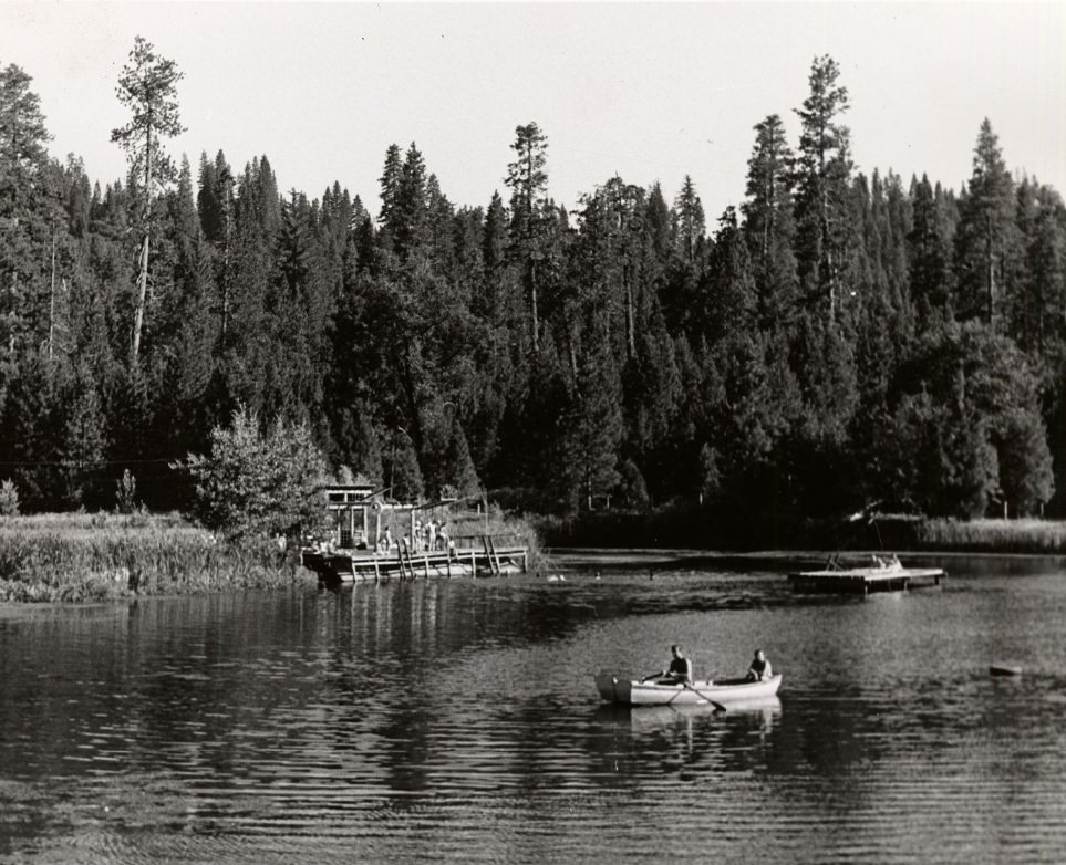
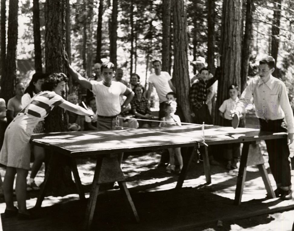
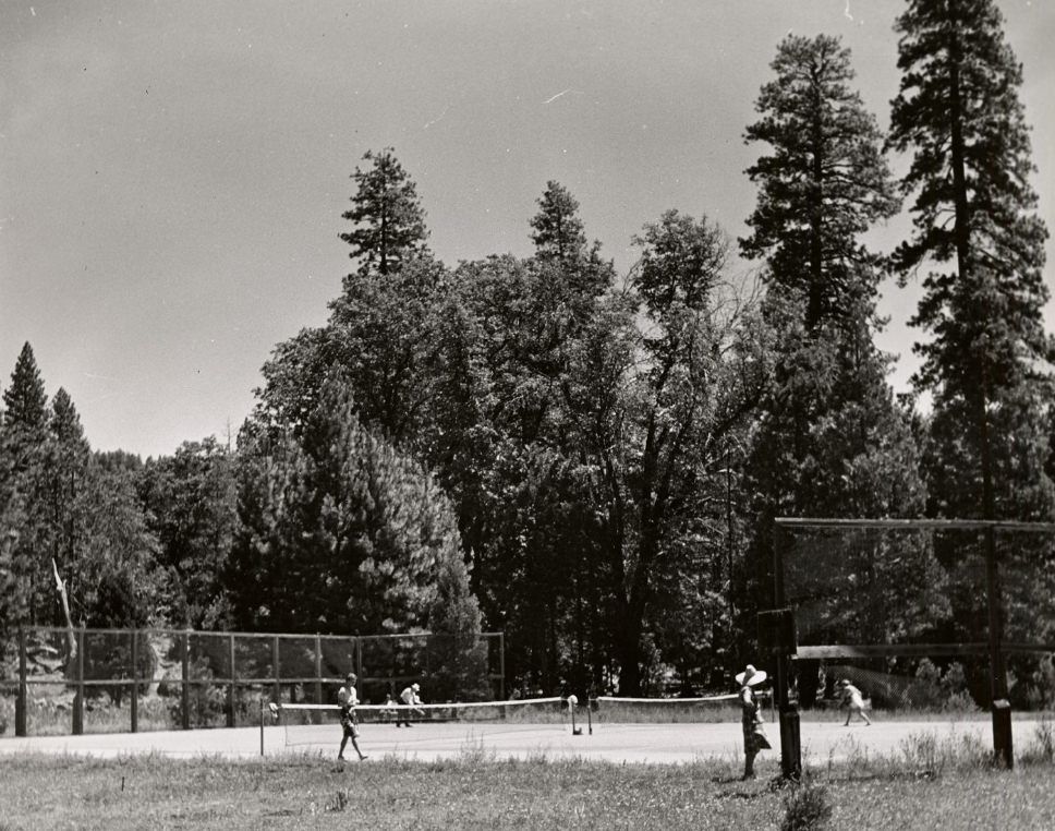
San Francisco operated Camp Mather, a city-run family camp located near Yosemite in the Sierra Nevada. Families reserved spots months in advance, and the camp offered swimming, tennis, rowboating, and communal meals. It was one of the more unusual municipal programs in any American city — a full outdoor recreation camp funded and run by the city for its residents.
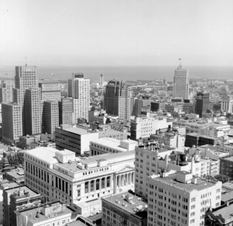
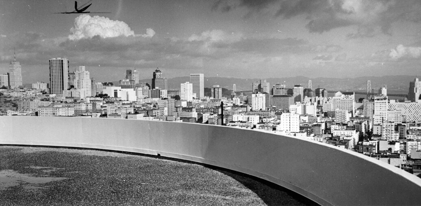
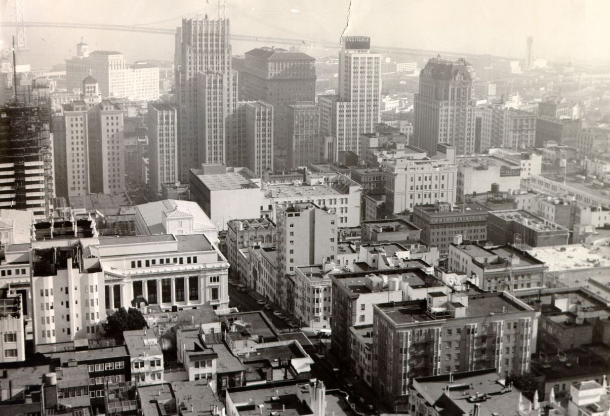
From the top of Nob Hill, the view of downtown San Francisco in 1961 showed a city that was already dense but not yet dominated by glass towers. The Bank of America Building — which would become the city’s tallest structure at 779 feet — was still years away from completion, finished in 1969. The skyline was in the process of reinventing itself, and new construction cranes were a regular sight across downtown.
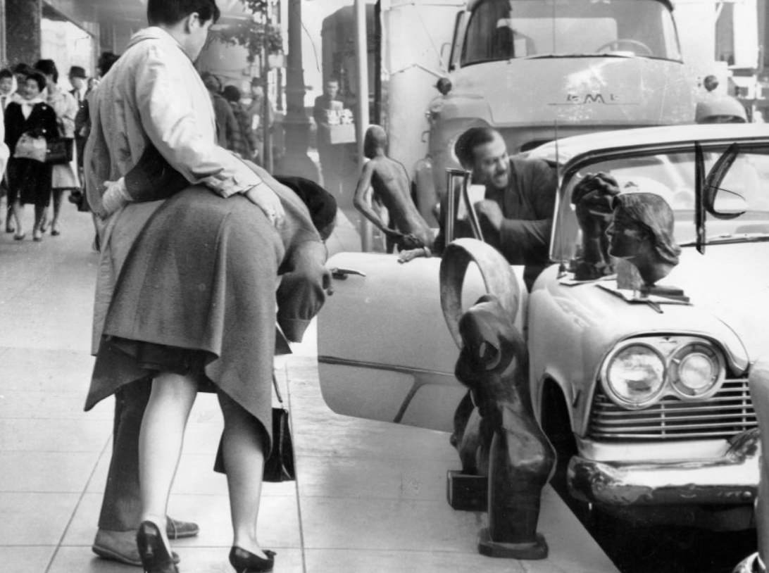
San Francisco’s art scene was visible on the streets as well as in galleries. Artists set up displays on sidewalks and in plazas, turning public space into exhibition space. The San Francisco Museum of Modern Art was an anchor for the more established art world, but plenty of artists worked outside institutional settings entirely. Performance art, street art, and poetry readings were all part of the city’s cultural fabric throughout the decade.
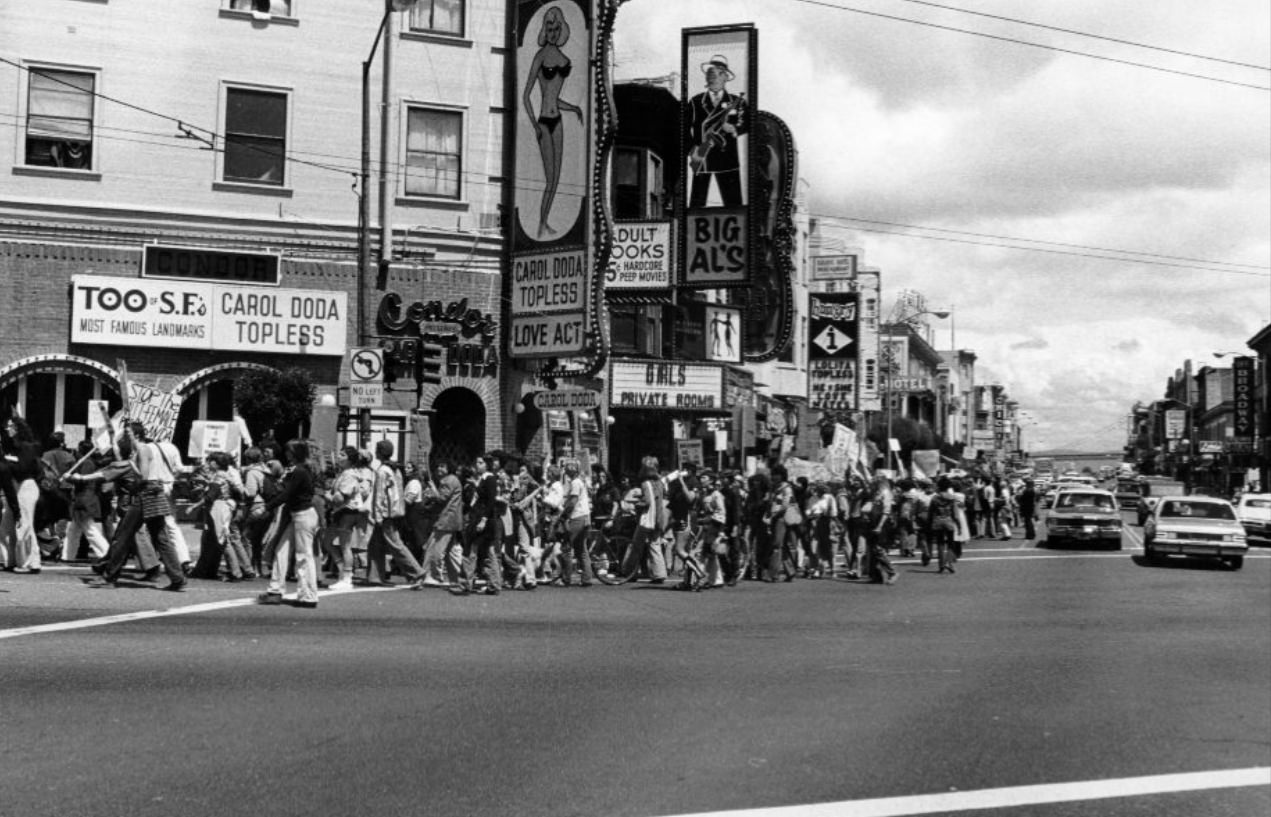
Political demonstrations were a defining feature of 1960s San Francisco. Anti-Vietnam War protests gathered thousands in Golden Gate Park and at the Civic Center. The city also saw marches focused on a wide range of social issues, from civil rights to local disputes over development and public morality. The Broadway and Columbus area — home to adult entertainment venues — was the site of organized protests against the industry.
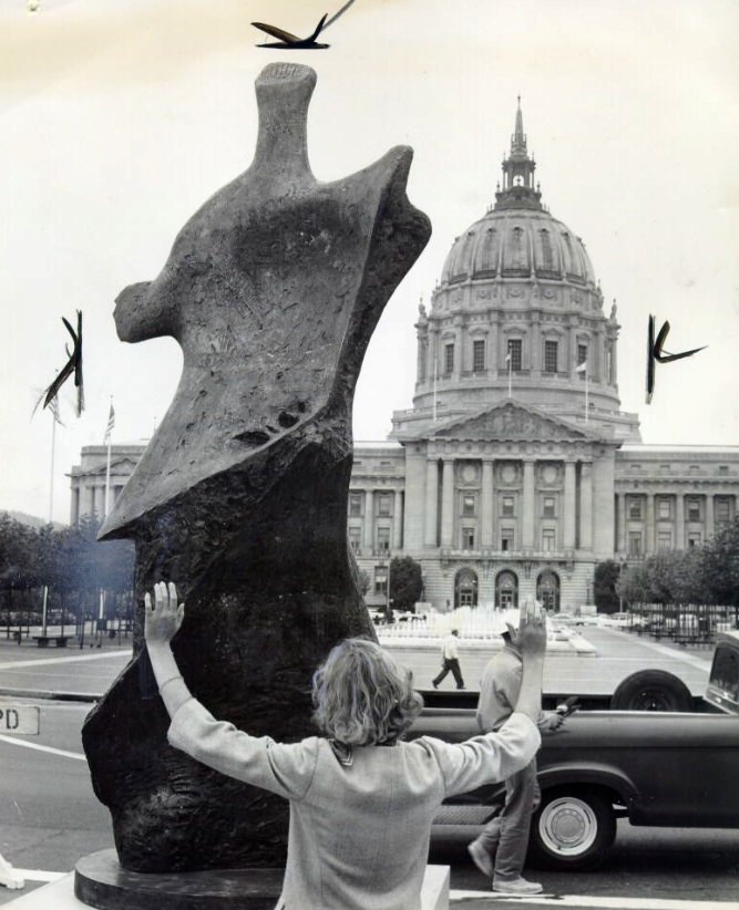
Public art was a deliberate part of Civic Center life. Henry Moore’s ‘Winged Figure’ was among the sculptures installed in the plaza, giving the space a cultural dimension beyond its administrative function. The Civic Center was both a seat of government and a public stage — used for rallies, exhibits, performances, and everyday leisure.
Hamm’s Brewing Company operated a large facility in the Bayview neighborhood, and its neon sign — featuring a rotating beer barrel — was one of the city’s most recognizable commercial landmarks. The brewery employed hundreds of workers and was part of a broader industrial economy that San Francisco still maintained in the early 1960s, before manufacturing began its long decline in the region.
Hunters Point Naval Shipyard was one of the largest employers in the southeastern part of the city. The shipyard had grown enormously during World War II and continued operating through the 1960s, repairing and modernizing naval vessels. The surrounding Hunters Point neighborhood was home to a large African-American community, many of whom had come to San Francisco during the war to work in the defense industry and stayed on afterward.
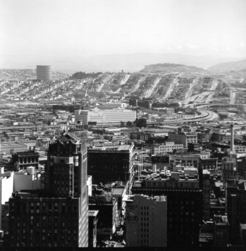
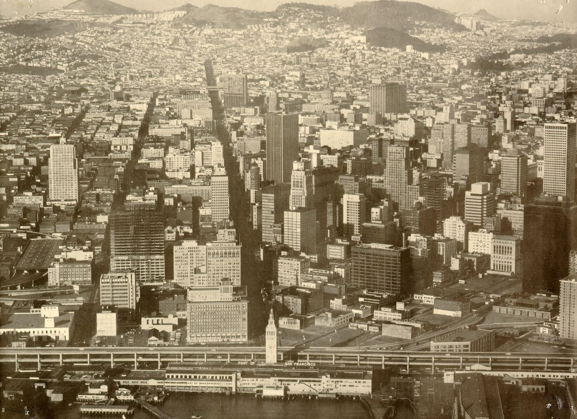
Market Street was San Francisco’s central spine — a broad diagonal boulevard that cut from the Ferry Building at the waterfront all the way to the Castro and Twin Peaks beyond. It carried cable cars, buses, streetcars, automobiles, and pedestrians in a continuous, noisy flow. The street was lined with department stores, movie theaters, hotels, and office buildings, making it the commercial heart of the city.
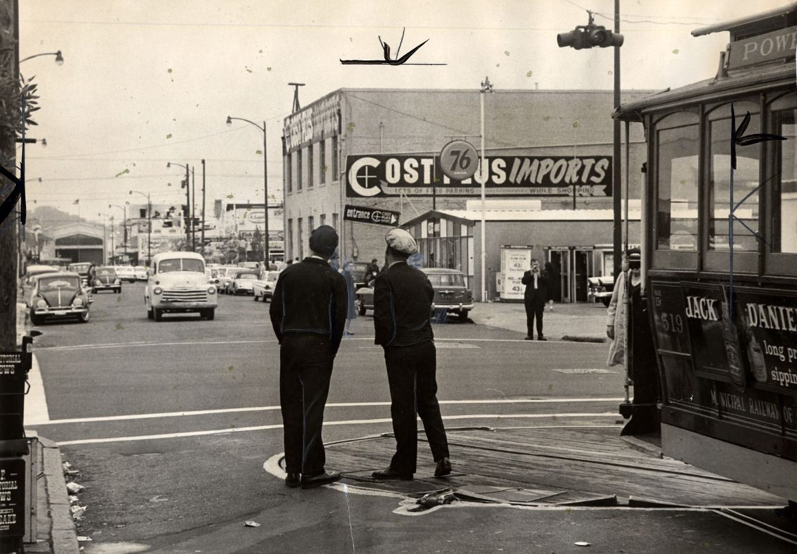
The cable car turntable at Fisherman’s Wharf was one of the city’s most-watched pieces of street machinery. Workers manually rotated the cars using the turntable before sending them back up the hill on their return run. San Francisco’s cable car system, which dated back to 1873, operated three lines by the 1960s and remained both a practical transit option and a major tourist attraction.
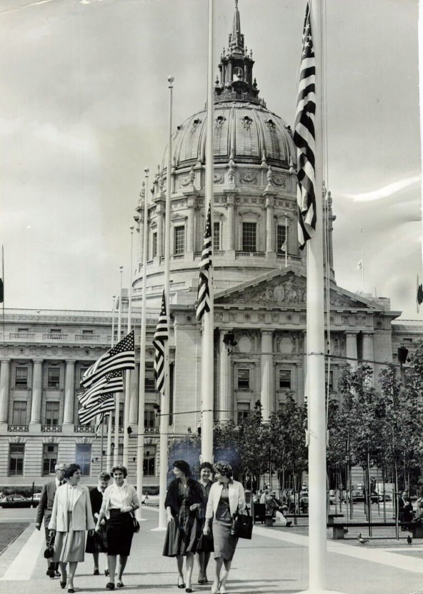
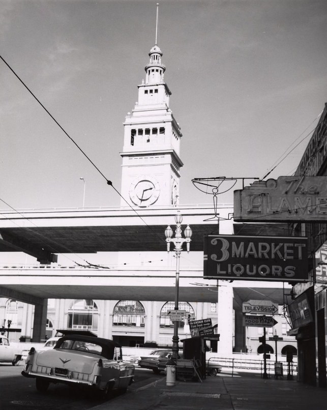
The Embarcadero Freeway was one of the most controversial infrastructure projects in San Francisco’s history. Built in the late 1950s and extended into the 1960s, the elevated double-decker roadway cut directly in front of the Ferry Building and blocked the city’s waterfront from view. Critics called it an eyesore from the moment it opened, and efforts to tear it down would continue for decades — it was ultimately demolished after the 1989 Loma Prieta earthquake.
Alcatraz Island, visible from many hilltops and waterfront points throughout the city, was still operating as a federal penitentiary until 1963, when it was closed due to high operating costs. The island would later become a flashpoint for Native American activism in 1969, when members of the Indians of All Tribes organization occupied it for 19 months to protest federal Indian policies.
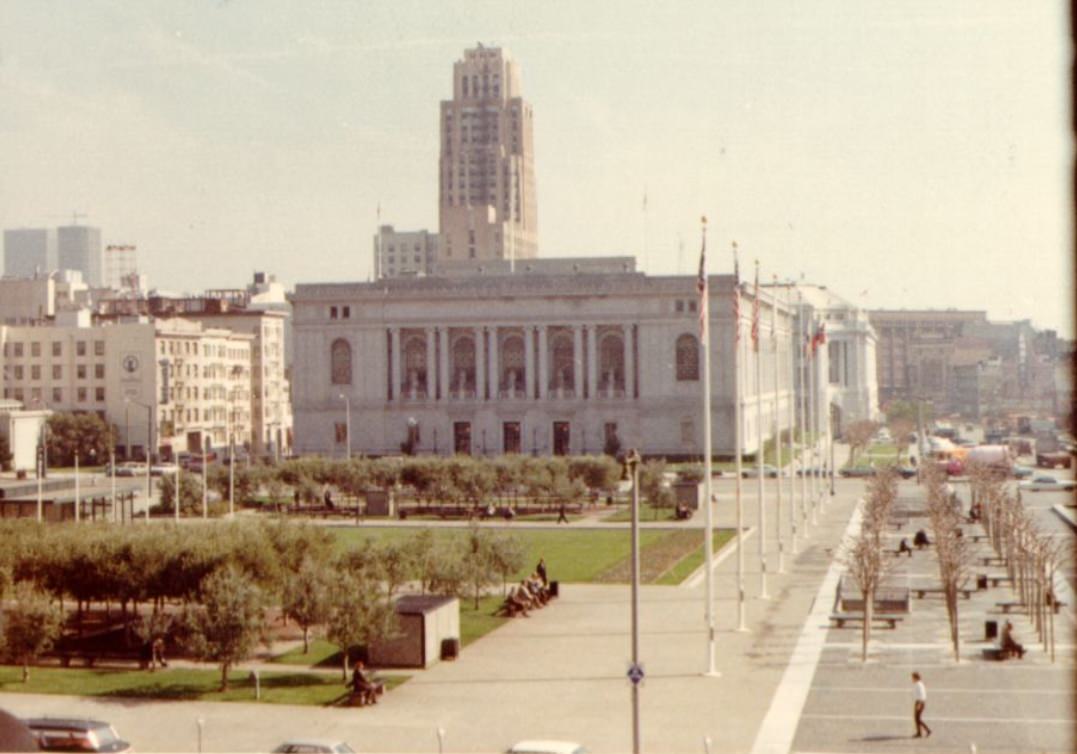
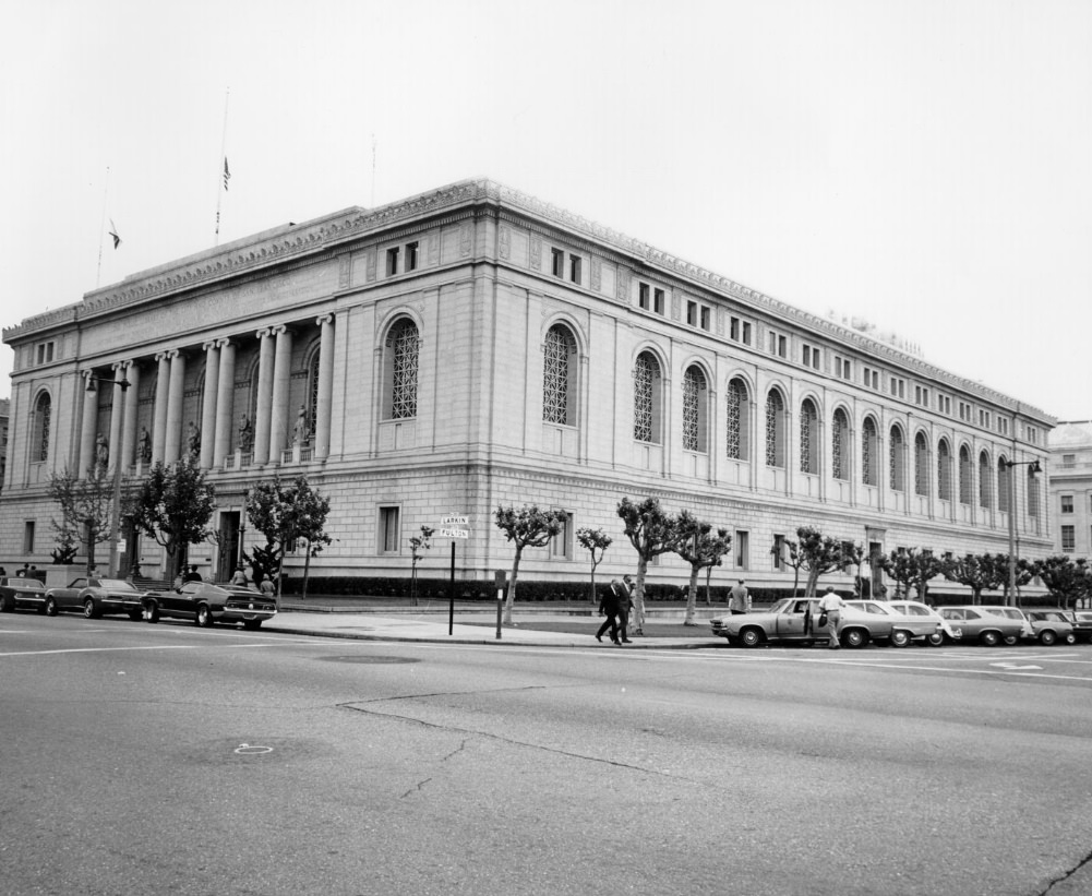
By 1969, the view from City Hall to the Main Library had changed little physically, but the city around it had transformed dramatically. That same year, San Francisco State College was the site of the longest student strike in U.S. history, lasting five months and resulting in the creation of the first School of Ethnic Studies at any American university.
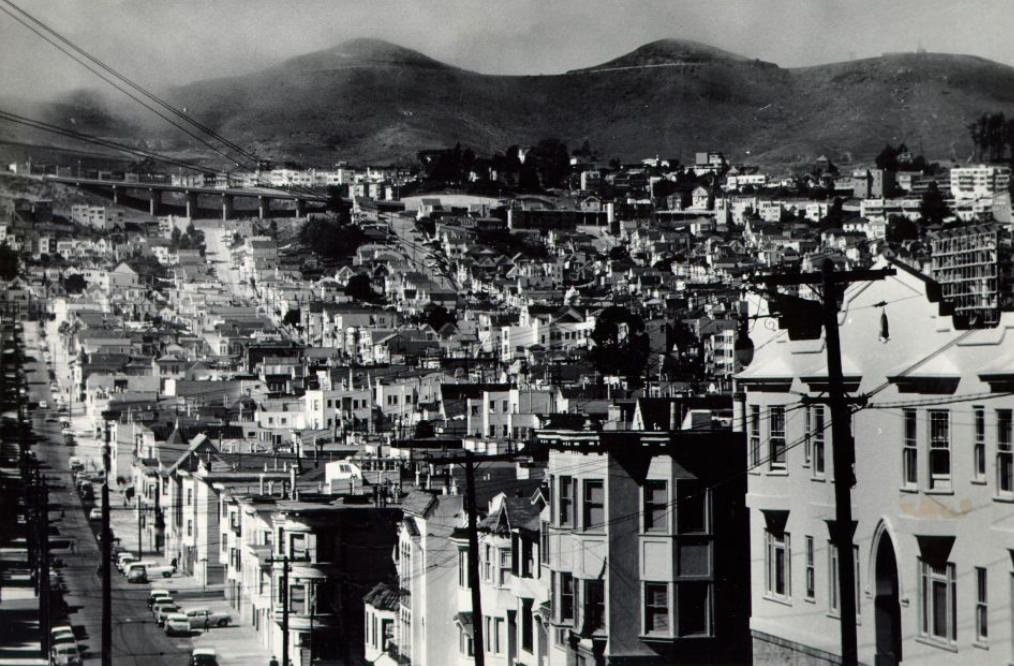
Twin Peaks, the pair of hills near the geographic center of San Francisco, offered some of the best panoramic views in the city. The neighborhood around its base was largely residential, with a mix of older homes and newer construction. Twin Peaks Boulevard, which wound around the summits, became a popular spot for both locals and tourists looking out over the bay, the bridges, and the dense patchwork of neighborhoods below.
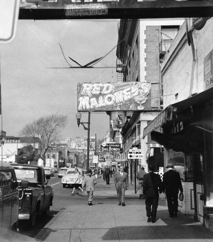
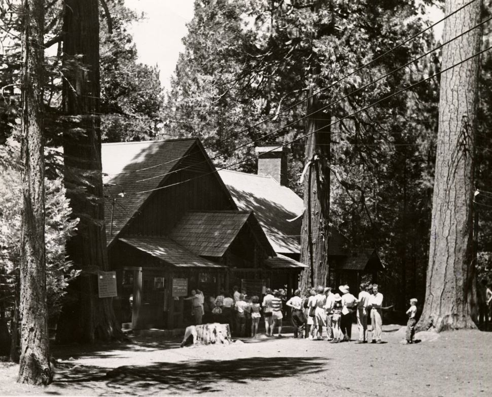
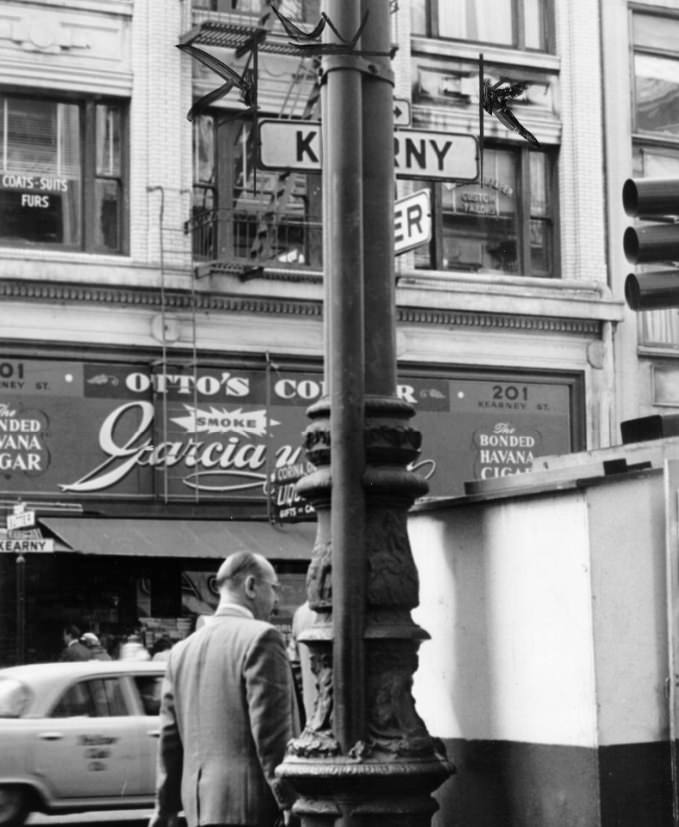
Downtown San Francisco in 1960 still looked in many ways like the postwar city it had been throughout the 1950s. Kearny Street and its surrounding financial district blocks were lined with mid-rise office buildings, bank branches, and small storefronts. The massive construction wave that would reshape downtown was just beginning.
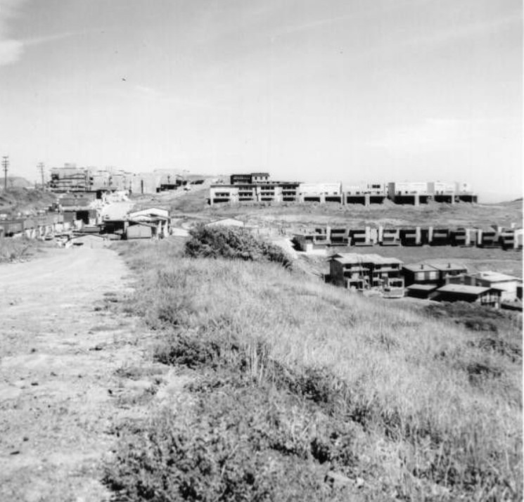
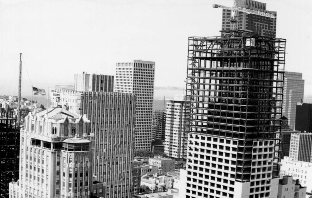
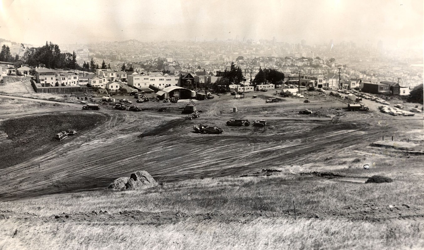
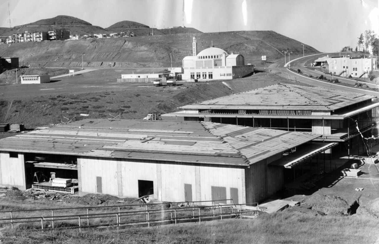
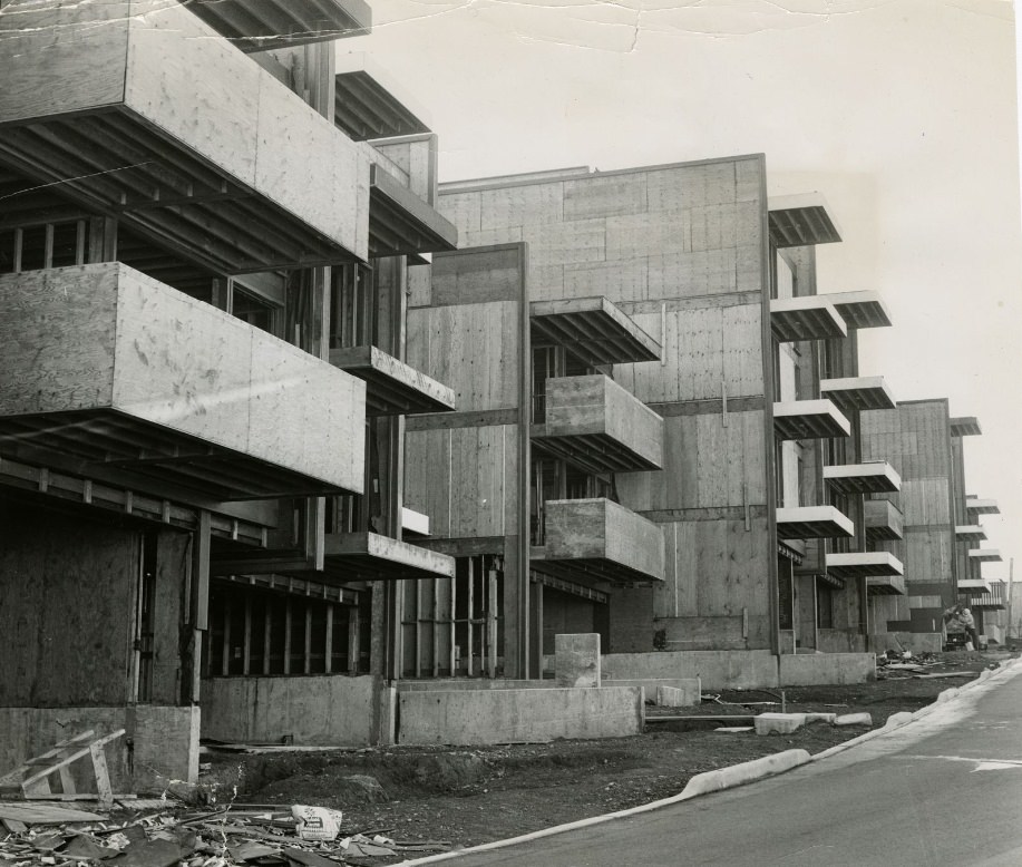
The Diamond Heights redevelopment project was a product of the city’s urban renewal ambitions. The San Francisco Redevelopment Agency targeted the hilly, sparsely built terrain for new housing aimed at middle-income families. The project leveled rocky hillsides, graded roads, and laid water and sewer lines before construction began in earnest. By the mid-1960s, new townhouses, apartments, and a small shopping center had taken shape.
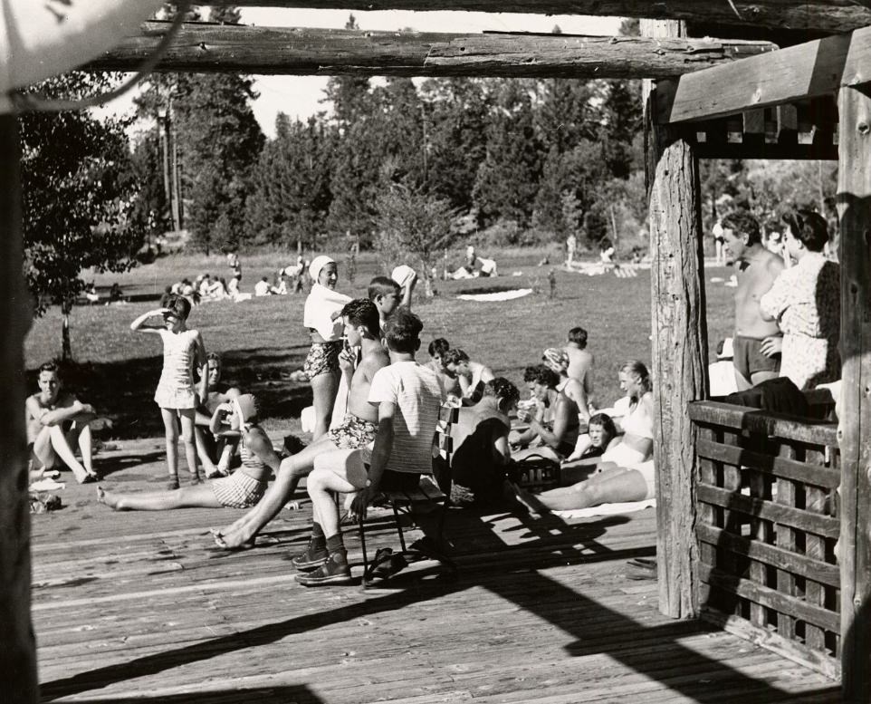
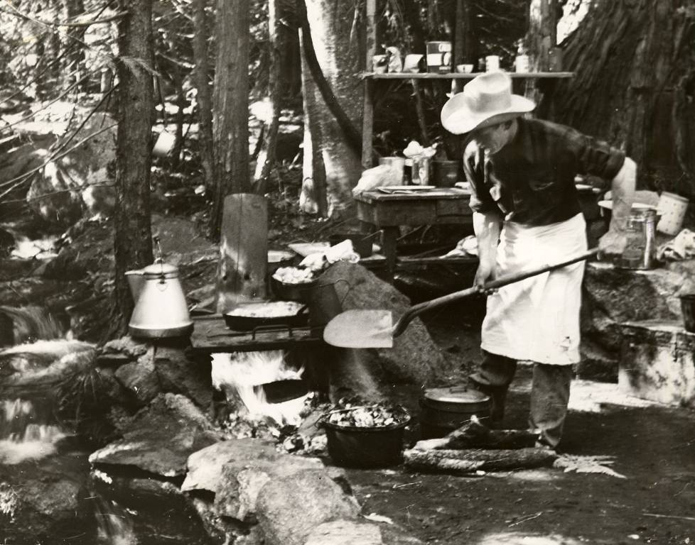
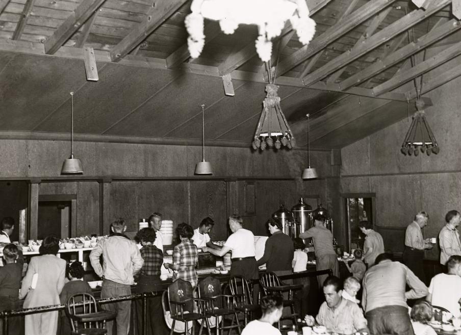
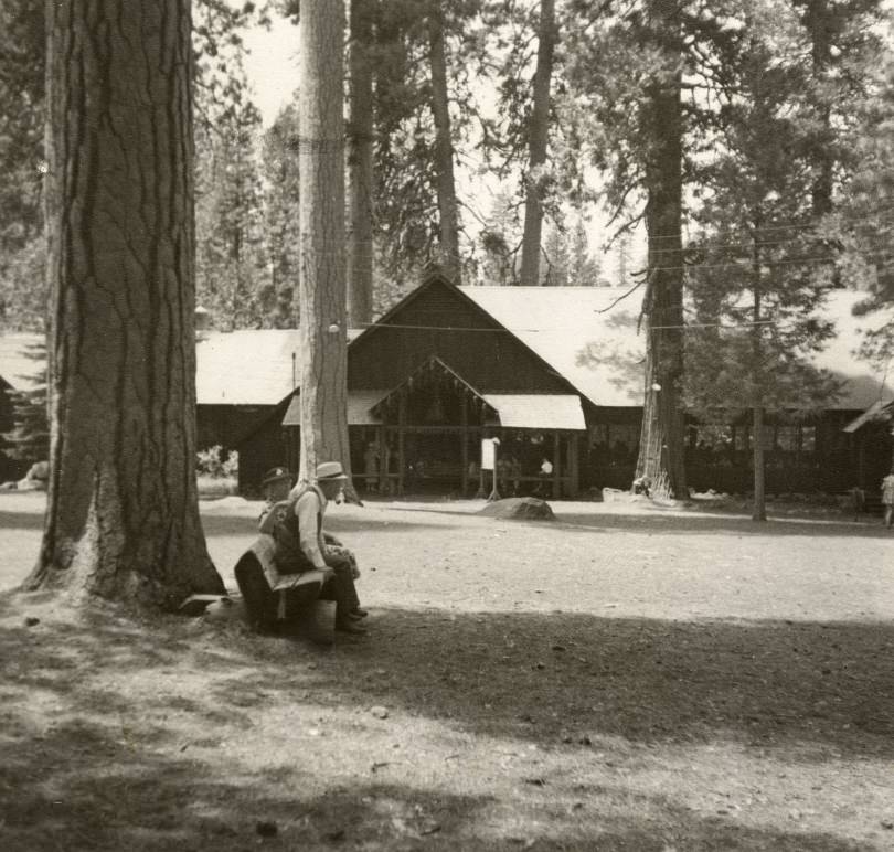
Camp Mather, located near Hetch Hetchy Reservoir in the Stanislaus National Forest, had operated as a city-run recreation camp since the 1920s. The city of San Francisco owned the land as part of its water supply watershed. Families could stay in cabins, eat meals in the communal lodge, and spend days hiking, fishing, and swimming — all at subsidized city rates.
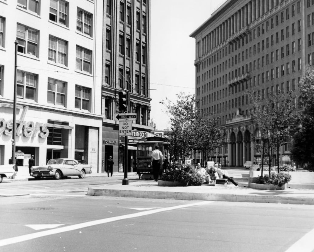
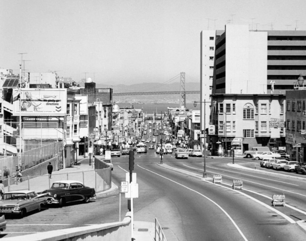
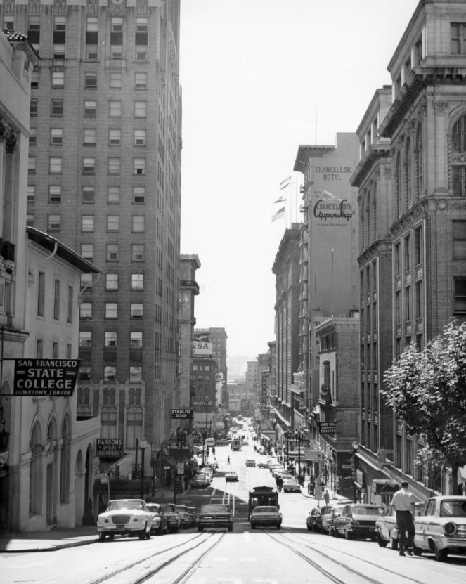
California Street was one of the city’s great cross-town corridors, running from the Financial District up through Nob Hill and continuing west through the Richmond District to the ocean. The California Street cable car line carried passengers up the steep Nob Hill grade past the Fairmont, Mark Hopkins, and Huntington hotels, which had defined that hilltop neighborhood since the early 20th century.
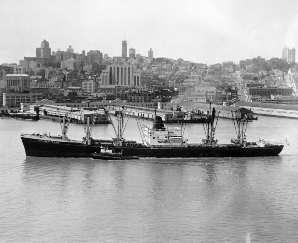
The bay remained central to San Francisco’s identity and economy throughout the 1960s. Commercial shipping, naval operations, ferry service to Sausalito and other bay communities, and recreational boating all shared the same waters. The Golden Gate Bridge and Bay Bridge, both completed in the 1930s, were by this point thoroughly integrated into daily life — carrying millions of vehicles each year.
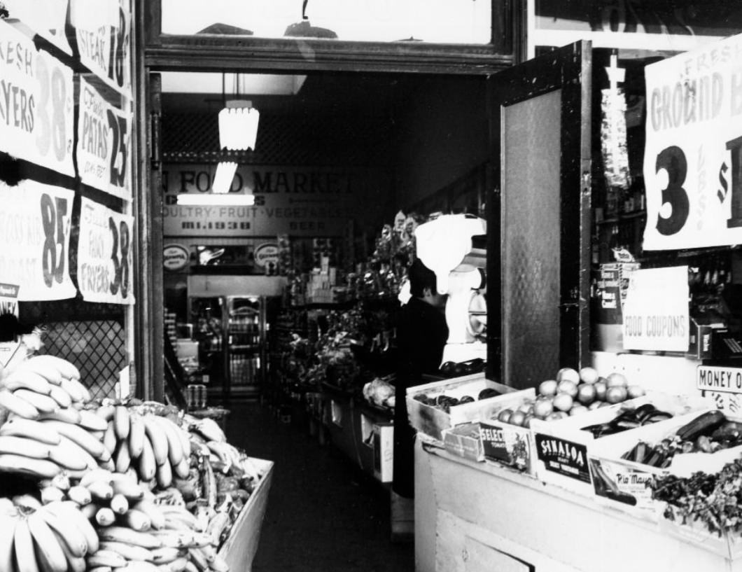
The Mission District in the late 1960s was undergoing a major demographic shift. The neighborhood, historically home to Irish and Italian immigrant families, saw rapid growth in its Latino population during the decade. By 1969, Mission Street was lined with businesses serving a predominantly Spanish-speaking community that had established deep roots in the neighborhood and would go on to shape its identity for generations.
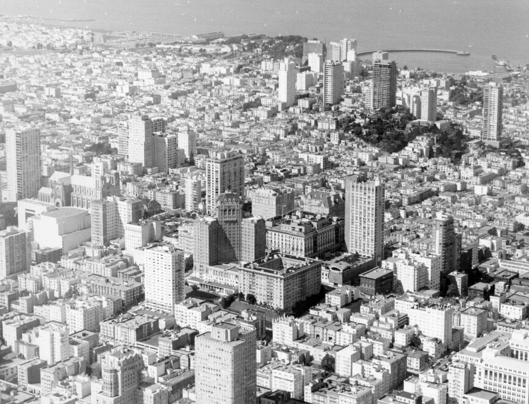
From the air, San Francisco’s tight residential grid was striking. Nob Hill, Russian Hill, and the Marina District each had their own distinct character despite sitting within a mile of each other. The Marina, built on landfill from the 1915 Panama-Pacific International Exposition, was lined with Mediterranean-style apartments. Russian Hill was known for its steep lanes and the famously crooked stretch of Lombard Street.
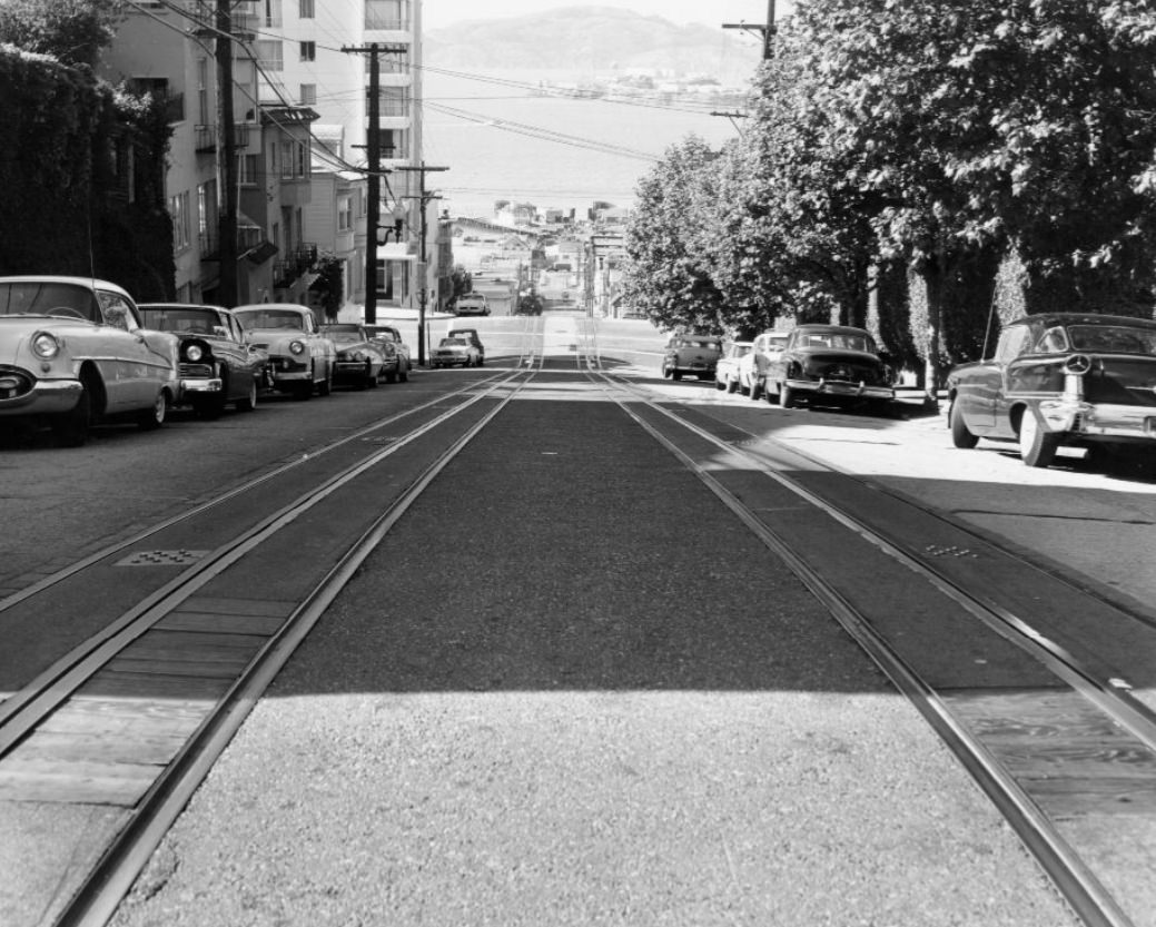
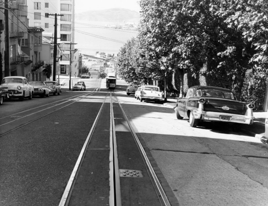
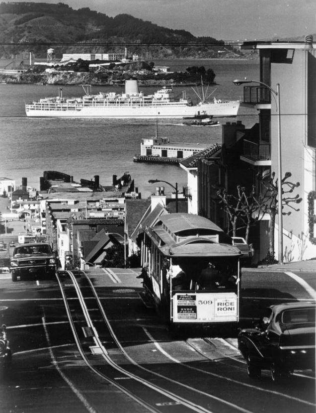
Hyde Street hill offered one of the most dramatic urban views in the country. At the top, a rider on a cable car could look straight down the steep grade toward Aquatic Park and the bay, with Alcatraz and the Marin Headlands visible in the distance. The descent was steep enough that passengers gripped the wooden benches, and gripmen operated the cable mechanism with practiced precision.
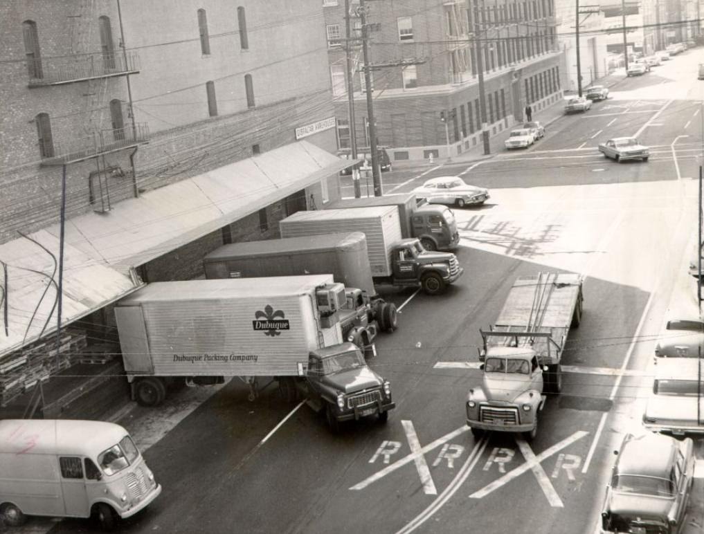
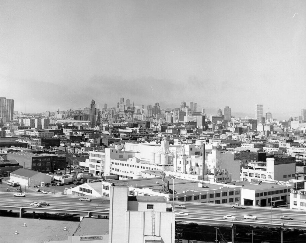
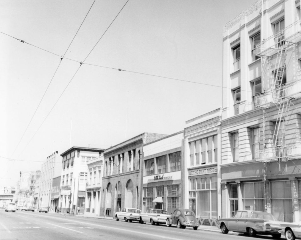
South of Market Street, the SoMa neighborhood was still primarily industrial in the early 1960s. Warehouses, truck docks, light manufacturing, and small workshops lined streets like Brannan, Howard, and Folsom. This was working-class San Francisco — far removed from the tourist circuits of Fisherman’s Wharf or the intellectual energy of North Beach, but essential to the city’s commercial functioning.
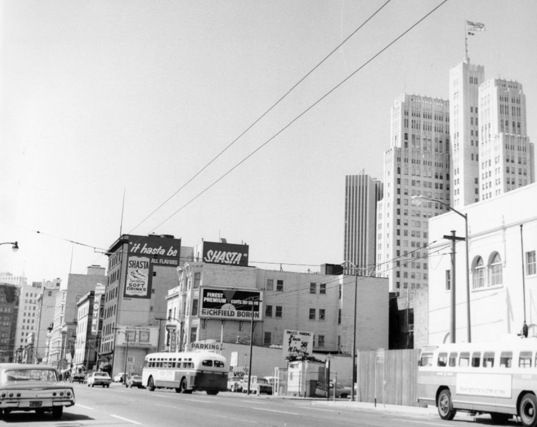
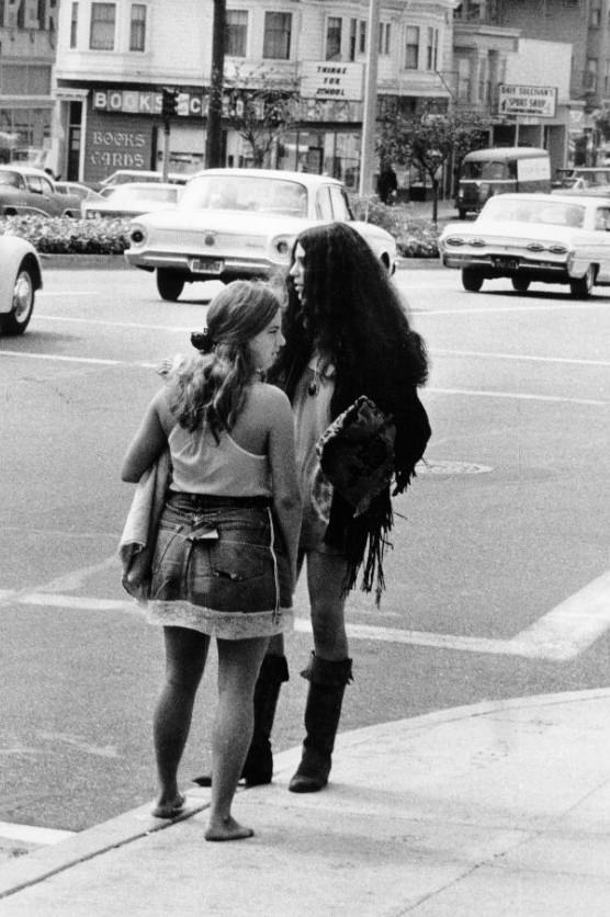
The Richmond District stretched from the eastern edge of Golden Gate Park to the ocean, and Geary Boulevard was its commercial main street. The neighborhood had a strong Russian immigrant community — particularly around the Russian Orthodox Cathedral of the Holy Virgin — as well as growing Chinese and Japanese-American populations. By 1969, the Richmond was one of the city’s most ethnically diverse neighborhoods.

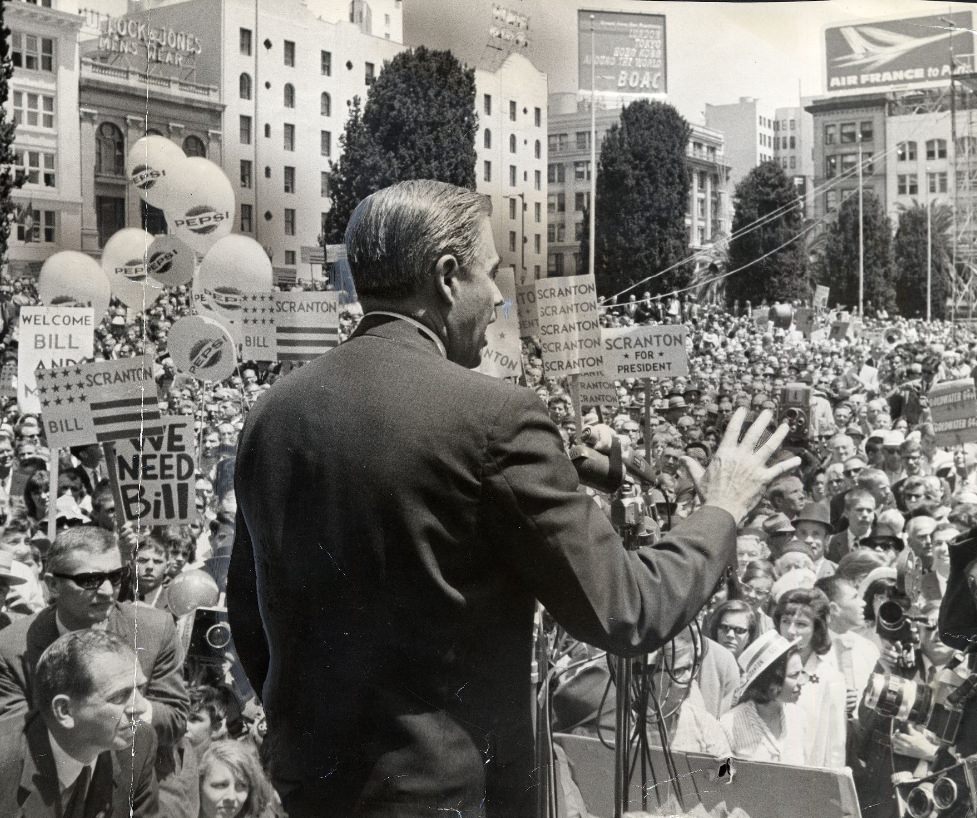
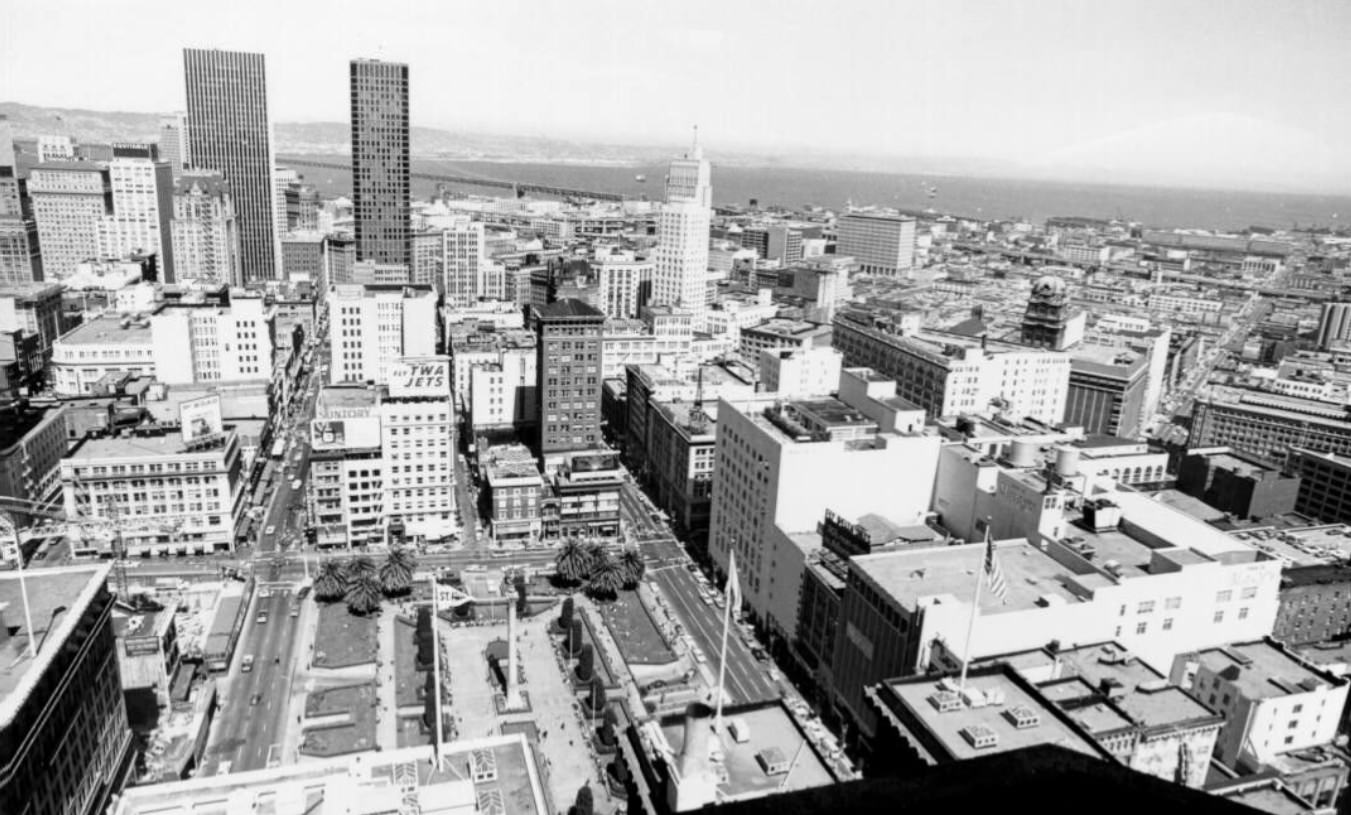
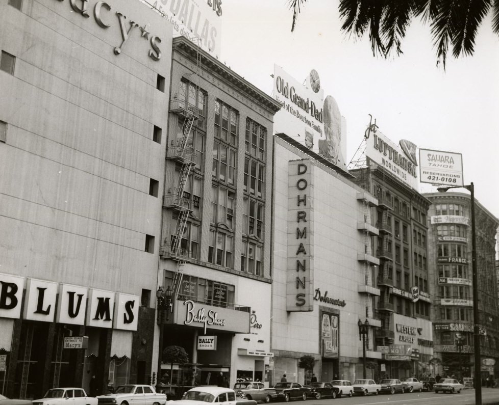
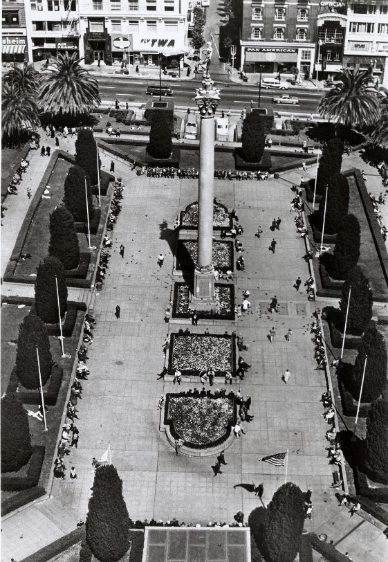
Union Square was San Francisco’s premier shopping district. Macy’s, Neiman Marcus, Saks Fifth Avenue, and dozens of other retailers surrounded the central plaza, which was anchored by a 97-foot granite column topped with a bronze figure of Victory. The square hosted everything from fashion shows to political rallies. In 1964, Republican presidential hopeful William Scranton addressed a crowd there during the party’s national convention, which was held that year in San Francisco at the Cow Palace.
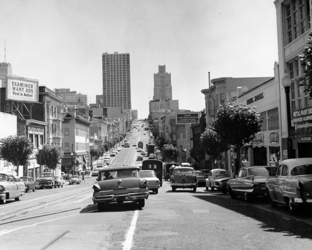
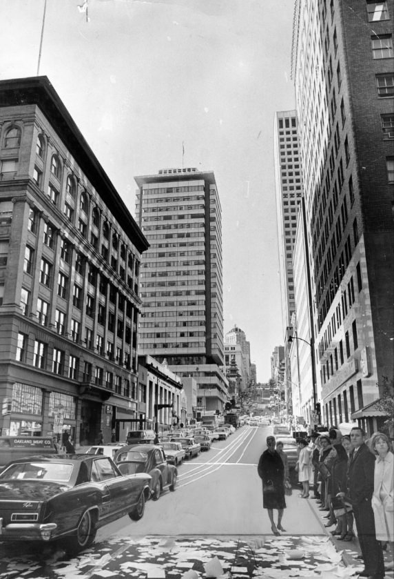
Looking east down California Street from Van Ness Avenue, the visual rhythm of the city’s cable car tracks, overhead wires, and densely packed buildings came into clear focus. Van Ness itself was a major north-south artery lined with auto dealerships, restaurants, and apartment buildings. The intersection of these two major streets was one of the city’s busiest crossings.
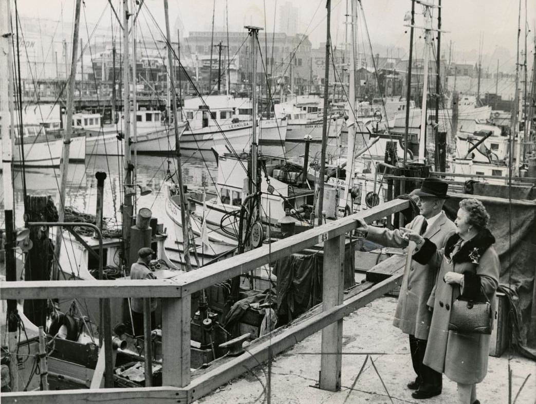
Fisherman’s Wharf drew visitors and locals alike throughout the 1960s. The wharf was both a genuine working fishing operation and an increasingly popular tourist destination. Dungeness crab was a signature product — vendors sold freshly cooked crab from outdoor stands along Jefferson Street. The smell of seafood, diesel fuel, and salt air was constant, and the docks were active from early morning with the return of fishing boats.
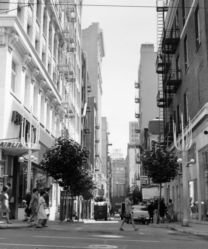
Maiden Lane, a pedestrian-friendly alley just off Union Square, was home to upscale shops and galleries. The street was closed to vehicle traffic on certain days, giving it a different feel from the busy commercial blocks around it. It also held an architectural gem: a building designed by Frank Lloyd Wright in 1948, which served as a prototype for his later Guggenheim Museum design in New York.
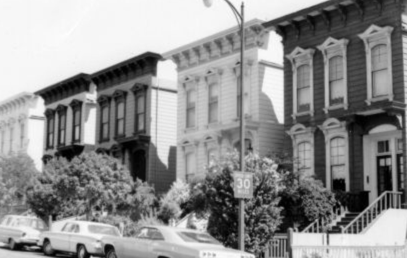
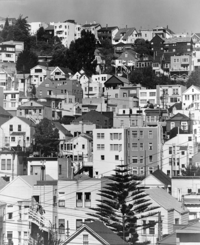
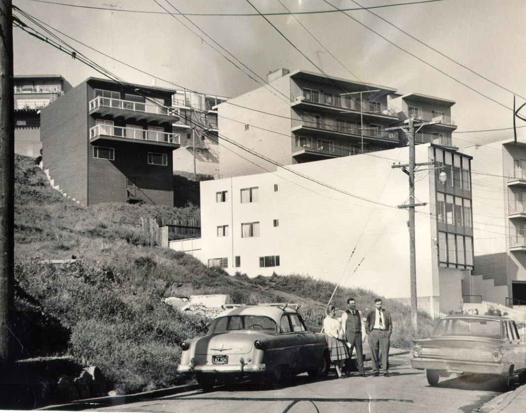
San Francisco’s Victorian and Edwardian housing stock was vast and varied. Rows of painted wooden homes lined streets throughout the Western Addition, the Castro, Noe Valley, and many other neighborhoods. Some of these houses dated to the 1880s and 1890s. During the 1960s, urban renewal projects demolished significant numbers of these older homes — particularly in the Western Addition, where thousands of residents, many of them African-American, were displaced.
The sports scene in 1960s San Francisco had two major anchors. The Giants baseball team played at Candlestick Park, a stadium that opened in 1960 on a wind-blasted point of land along the bay. The park was known for brutal afternoon winds that could rip programs from fans’ hands mid-game. Despite the conditions, the Giants drew large crowds, especially during the 1962 season when they lost the World Series to the New York Yankees in seven games.
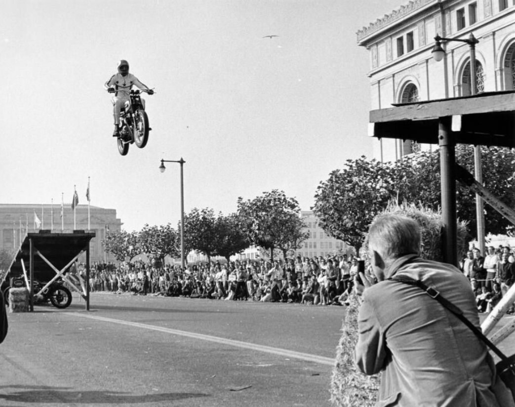
Civic Center Plaza was the setting for one of the more unexpected spectacles of the decade. In 1967, stuntman Evel Knievel performed a motorcycle jump there — part of his early touring career before he became a national phenomenon. The plaza’s broad open space made it a natural stage for events ranging from political demonstrations to public entertainment.
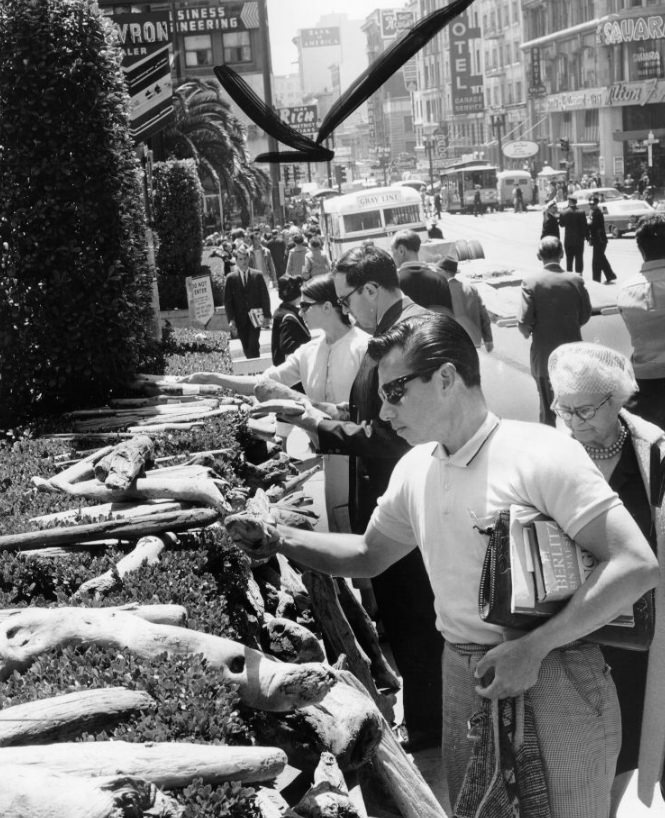
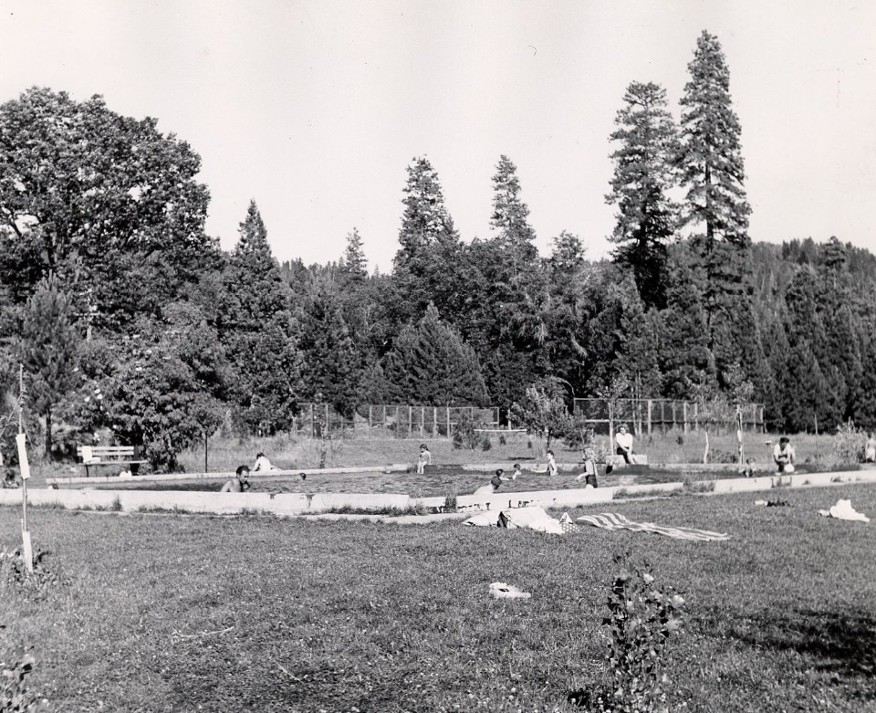
In March 1964, a tsunami triggered by the Good Friday earthquake in Alaska struck Crescent City, California, killing 11 people and destroying much of the downtown. Debris from the disaster washed down the coast and eventually made its way to San Francisco, where curious residents examined pieces of driftwood and wreckage that turned up on city streets and along the waterfront.
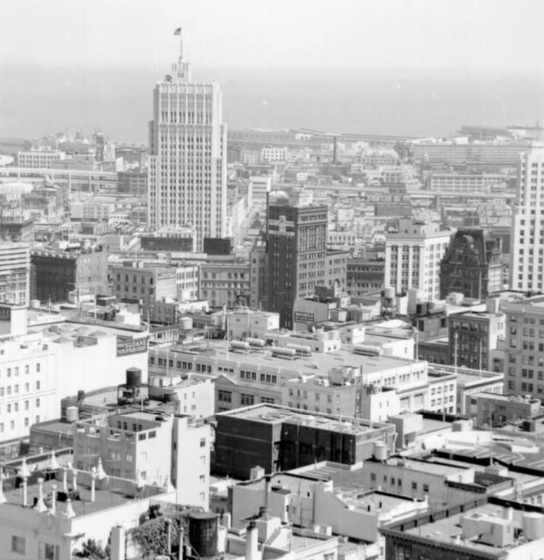
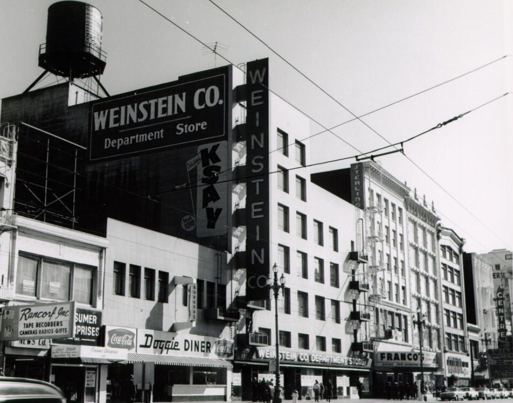
The Fairmont Hotel, perched at the top of Nob Hill at California and Mason streets, offered one of the best elevated views of downtown San Francisco. The hotel itself was a landmark — it had survived the 1906 earthquake and fire and had hosted presidents, diplomats, and celebrities. In 1945, the United Nations Charter was signed in San Francisco, and many of the delegates stayed at the Fairmont during the conference.
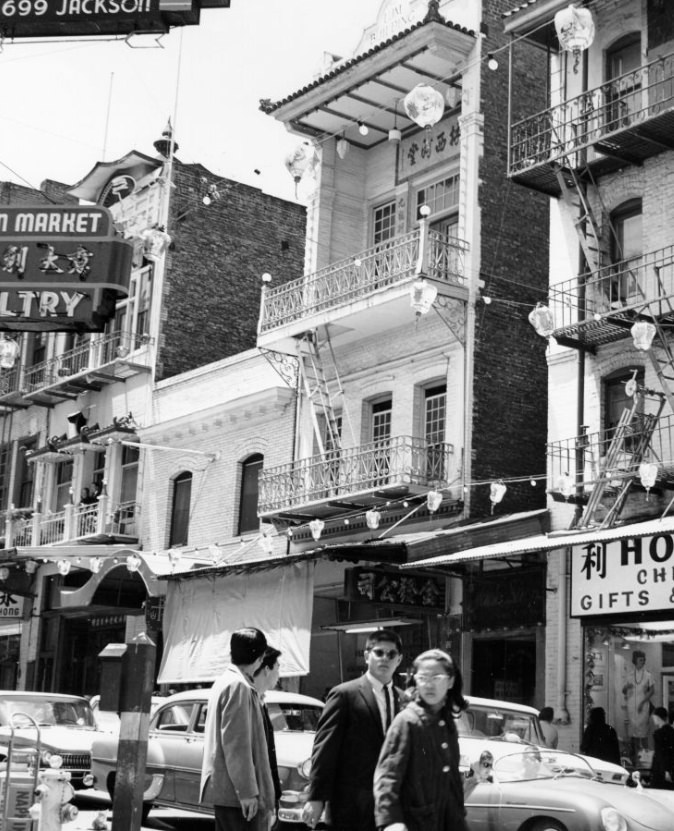
Grant Avenue was the commercial and cultural backbone of Chinatown, running from the ornate gate at Bush Street north through the neighborhood’s densest blocks. Buildings like the Lum Building mixed traditional Chinese architectural ornament with early 20th-century commercial construction. The street was busy throughout the day with shoppers, tourists, restaurant-goers, and residents going about daily life.
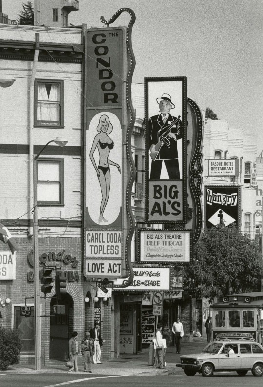
The Condor Club on Broadway opened in 1964 and became famous when Carol Doda performed the first topless act in San Francisco that same year. The club’s sign — featuring a neon silhouette of Doda — became one of the most recognized images associated with the Broadway entertainment strip. The area around Broadway and Columbus was a mix of jazz clubs, coffeehouses, bookstores, and adult entertainment venues.
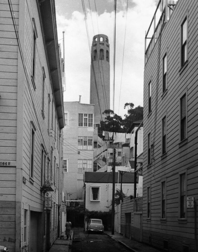
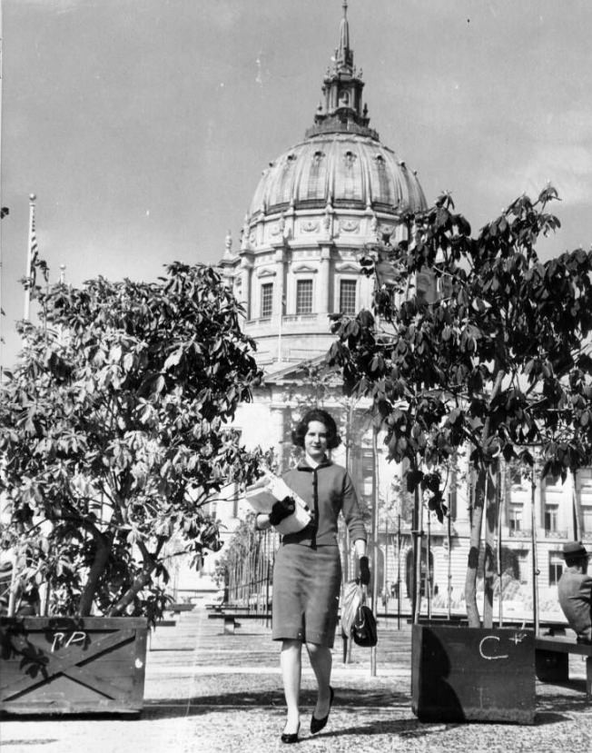
Telegraph Hill’s eastern face, known as the Filbert Steps, descended sharply from the base of Coit Tower through terraced gardens to the waterfront below. The staircase was lined with wild parrots — descendants of escaped pets — and dense plantings maintained by neighborhood volunteers. The hill’s residents were fiercely protective of their neighborhood and fought off several development proposals throughout the decade.
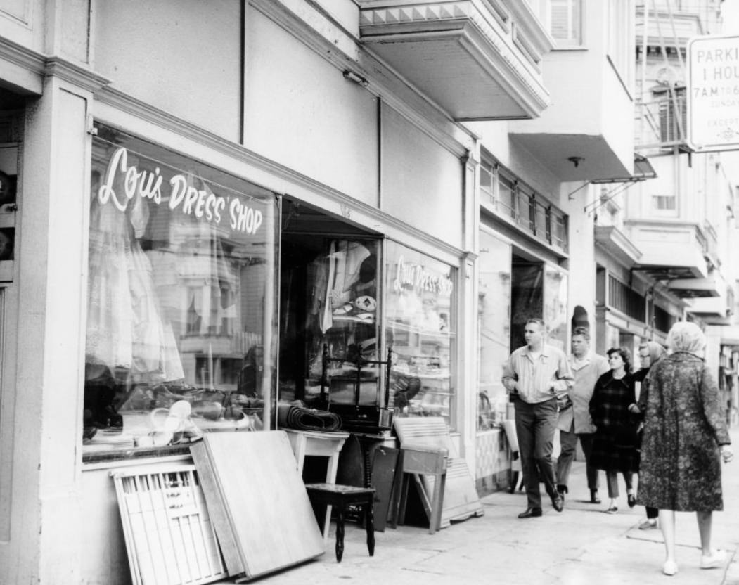
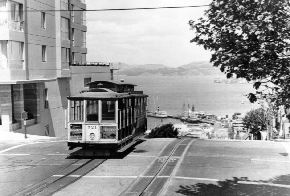
McAllister Street ran along the southern edge of the Civic Center, and its storefronts served the surrounding Tenderloin and Western Addition neighborhoods. Small dress shops, hardware stores, and diners lined the street. The Western Addition to the west was undergoing dramatic redevelopment during the 1960s — the Redevelopment Agency demolished large swaths of Victorian housing there to build new projects, drawing fierce community opposition.
Treasure Island sat in the middle of the bay, connected to Yerba Buena Island by a causeway. The man-made island had been built for the 1939 Golden Gate International Exposition and was subsequently taken over by the U.S. Navy. Throughout the 1960s it served as a naval station, and its flat terrain and bay views made it a distinctive presence in the middle of San Francisco Bay.
Powell Street was one of San Francisco’s busiest pedestrian corridors, running from Market Street north to Fisherman’s Wharf. Two cable car lines — the Powell-Hyde and Powell-Mason — ran up its steep grade. The corner of Powell and Sutter placed riders squarely in the middle of the Union Square shopping district, just steps from the city’s major department stores and hotels.
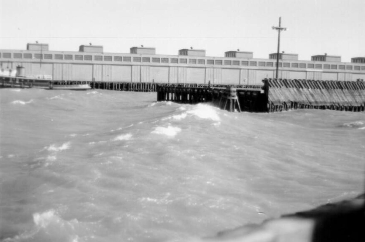
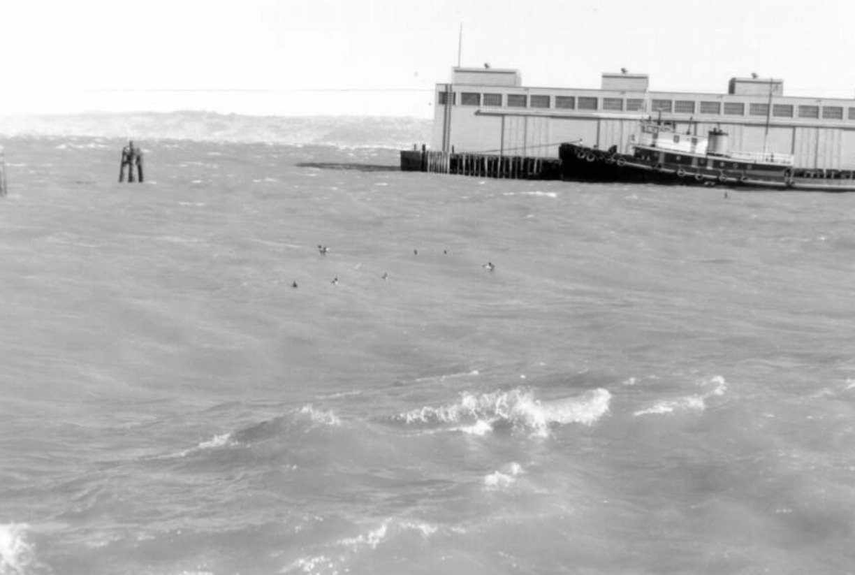
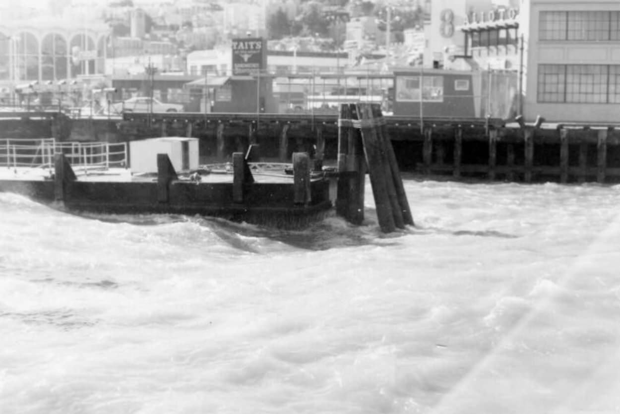
The waters around Fisherman’s Wharf were subject to the strong currents and winds that swept through the Golden Gate. On rough days, waves churned against the pilings and spray reached the dock. The fishing fleet that operated out of the wharf — many boats owned by Italian-American families whose roots in the neighborhood went back generations — was one of the last working fishing communities in any major American city.
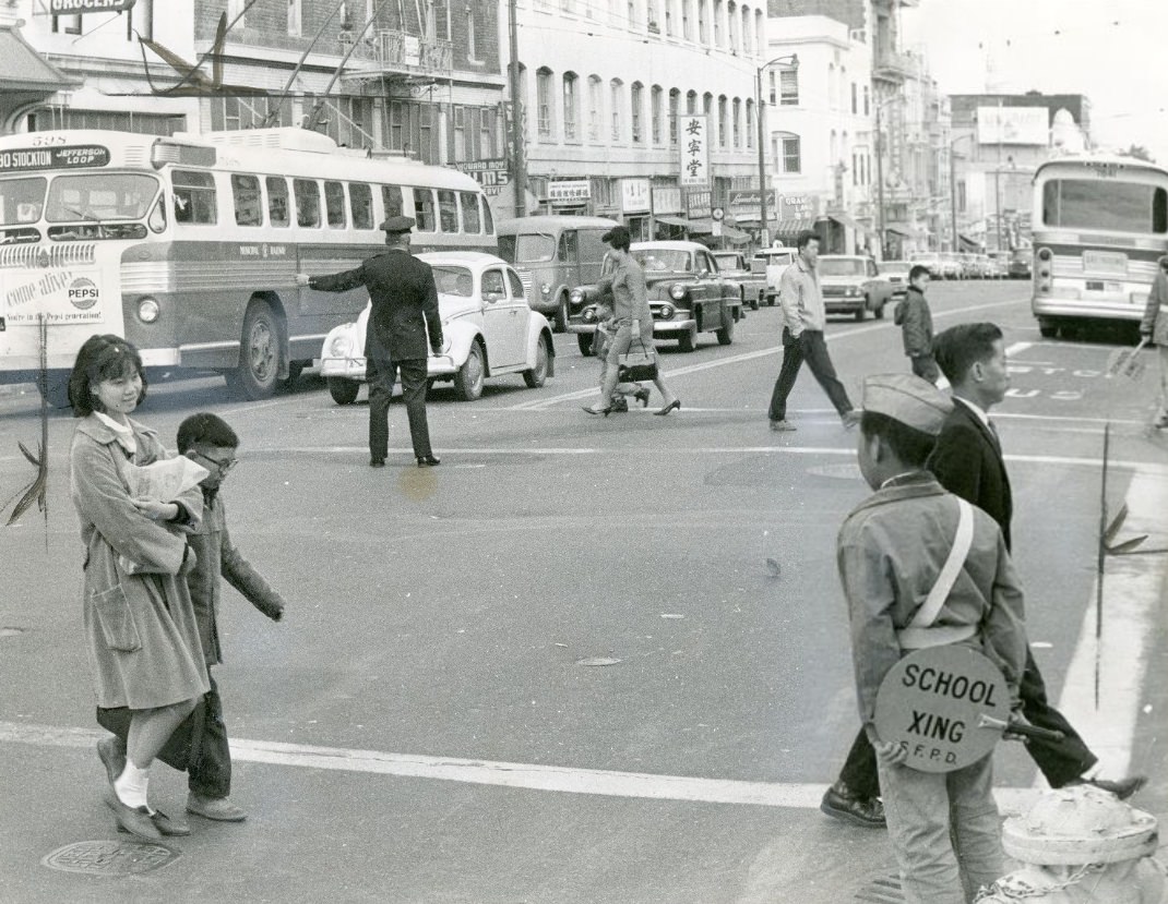
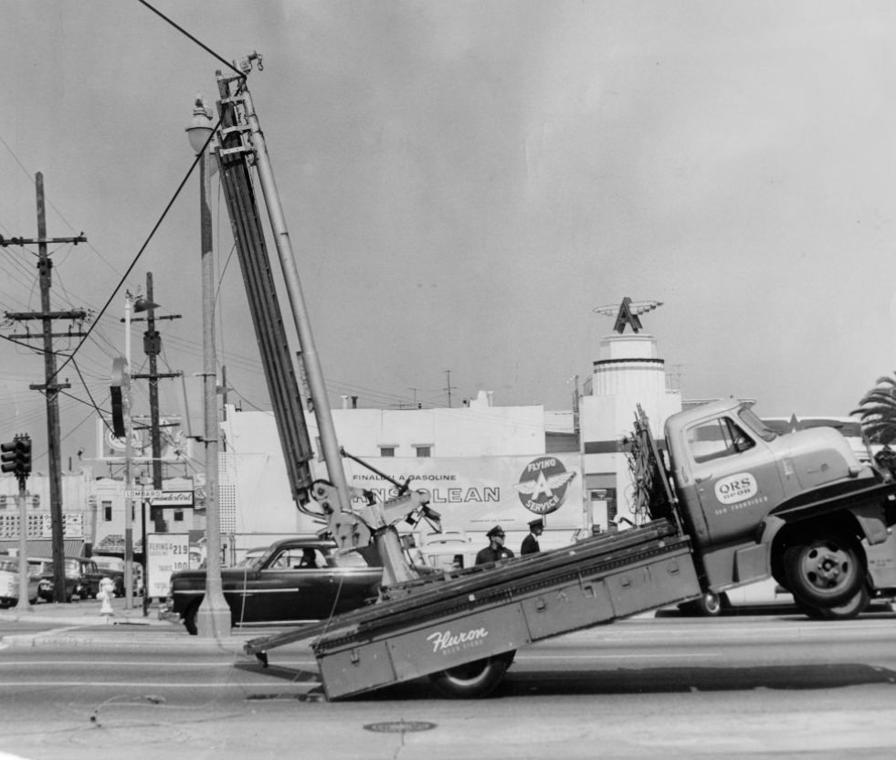
Traffic management in 1960s San Francisco was an ongoing challenge. The city’s street grid, designed for a much earlier era, struggled to accommodate the volume of automobiles that had exploded in the postwar years. Traffic officers directed vehicles at busy intersections, and the city experimented with one-way street conversions and new traffic signals throughout the decade. The debate over freeways versus transit was one of the defining urban planning arguments of the era.
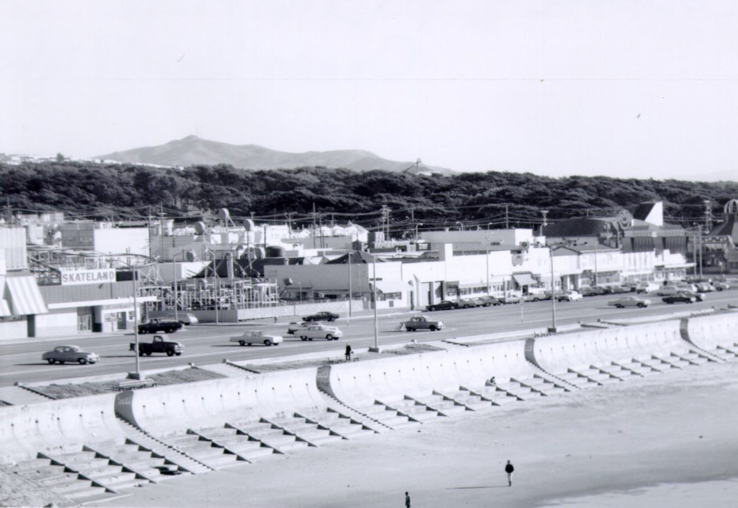
Ocean Beach stretched along the western edge of San Francisco for miles, facing the open Pacific. Behind it, Playland at the Beach — an amusement park that had operated since the 1920s — offered rides, games, and concessions to generations of San Franciscans. The park closed in 1972, but in the 1960s it was still drawing families on weekends, with the giant wooden roller coaster and the laughing Sal mechanical figure at its entrance among the most recognizable features.
The technology industry was beginning to take root in the communities south of San Francisco during the 1960s. Fairchild Semiconductor in Mountain View and Hewlett-Packard in Palo Alto were among the companies developing transistors, integrated circuits, and early computing hardware in what would later be named Silicon Valley. The region’s universities — Stanford in particular — were feeding a steady stream of engineers and entrepreneurs into these new companies.
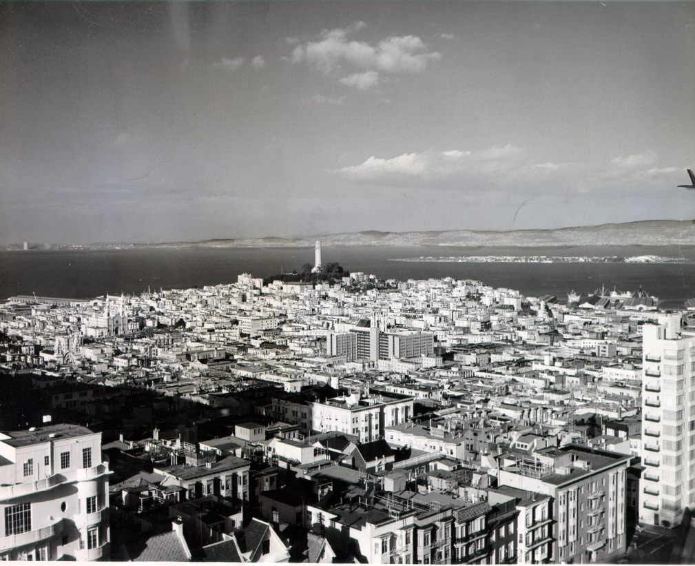
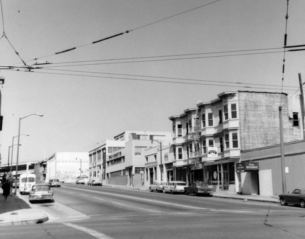
From the upper floors of apartment buildings on California Street, the full depth of San Francisco’s layers was visible — rooftops, church steeples, Coit Tower rising from Telegraph Hill, the bay bridge, and Treasure Island all stacked together in the middle distance. The city’s famous fog often rolled in from the ocean in the afternoon, softening the view and blanketing neighborhoods in cool gray.
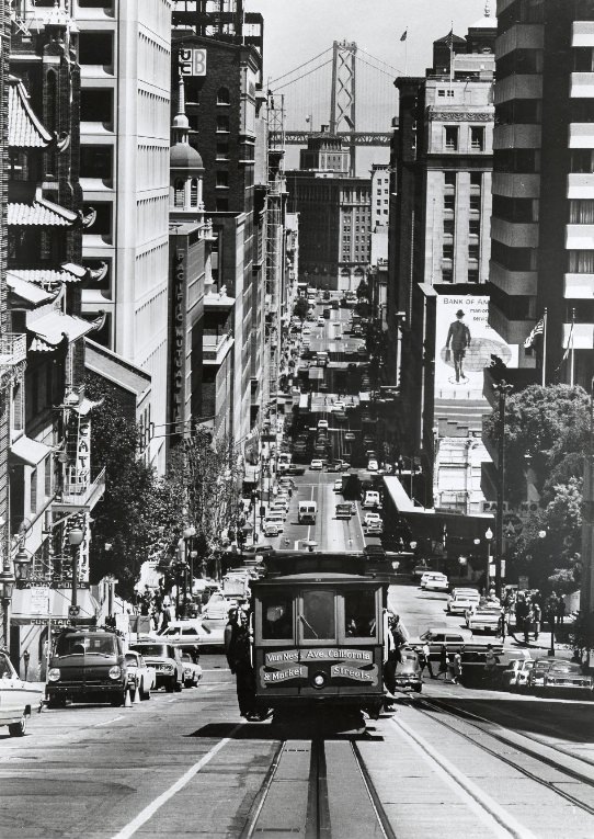
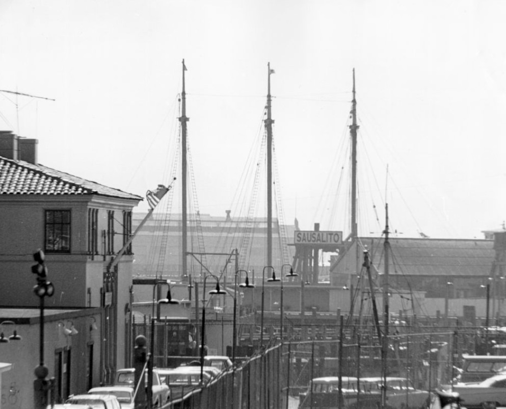
The California Street cable car line was the only one of the original twelve lines that had survived a city effort to eliminate the system entirely in the early 1950s. Citizen opposition, led largely by Friedel Klussmann and the Citizens’ Committee to Save the Cable Cars, had forced a ballot measure that preserved the system. By the 1960s, the cars were both a functioning transit option and one of the city’s most beloved icons.
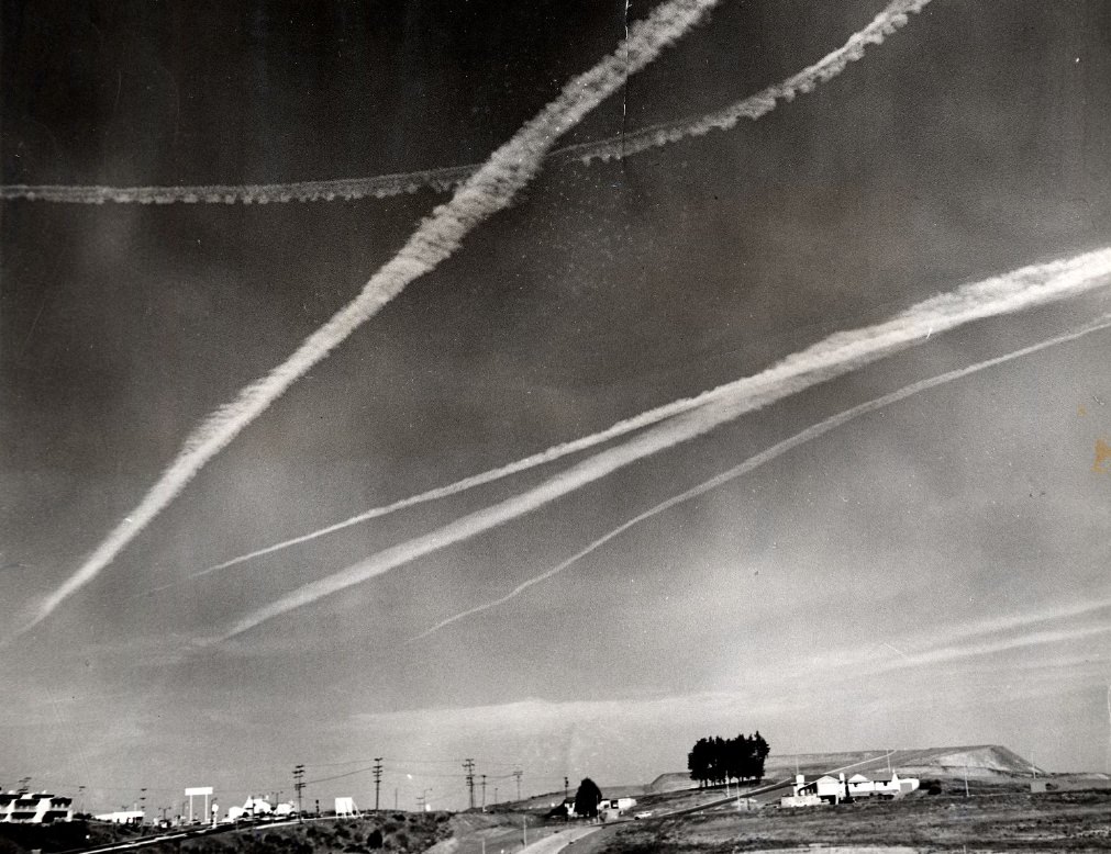
In 1961, Diamond Heights was still largely raw hillside — rocky terrain that had resisted development for decades. The city’s redevelopment authority had taken over the area and was beginning the process of grading roads and installing infrastructure. Over the following years, the district would be completely transformed, with several hundred new homes built to serve working- and middle-income families who were being priced out of other San Francisco neighborhoods.
Geary Street was a major east-west corridor, running from downtown through the Tenderloin and the Western Addition all the way to the Richmond District and Ocean Beach. Near Union Square, it was lined with theaters — the Geary Theater, home to the American Conservatory Theater, was among the city’s most important performing arts venues. Farther west, Geary became Geary Boulevard and took on a more commercial, neighborhood character.
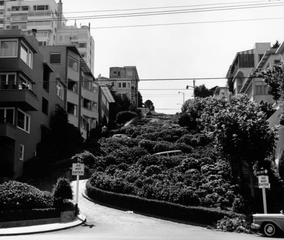
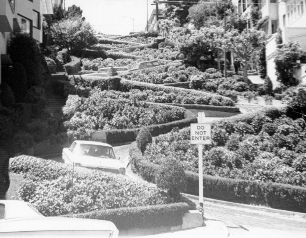
The famous crooked block of Lombard Street between Hyde and Leavenworth was already a well-established tourist attraction by the 1960s. The one-block stretch had been converted to its current switchback design in 1922 to reduce the grade for vehicles. Cars descended slowly through the brick-paved curves while pedestrians used the straight stairways on either side. The surrounding garden plantings — mostly hydrangeas — were maintained by the city.
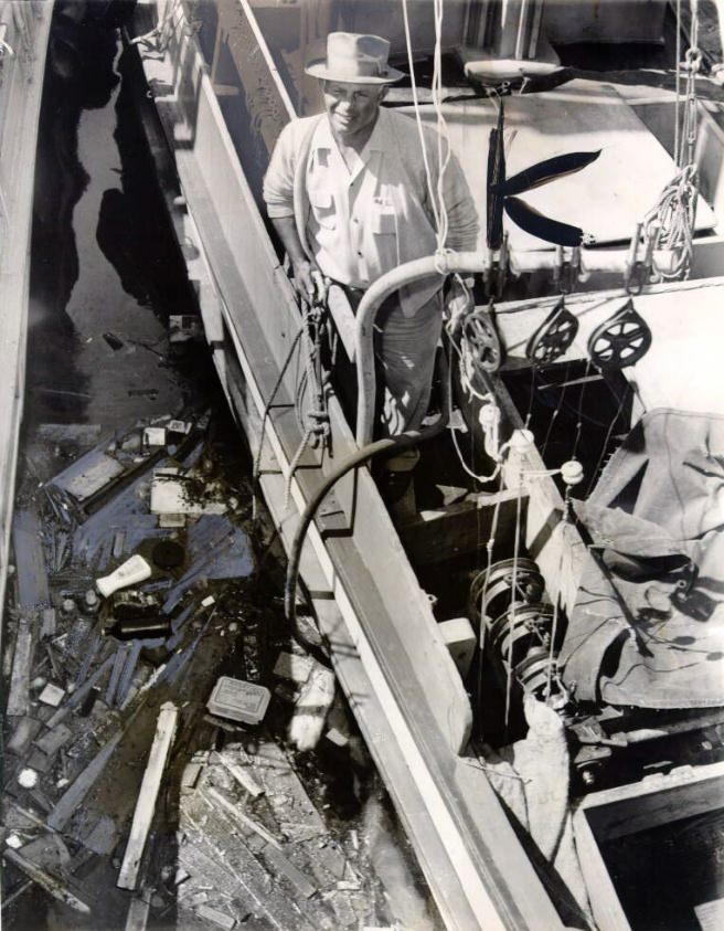
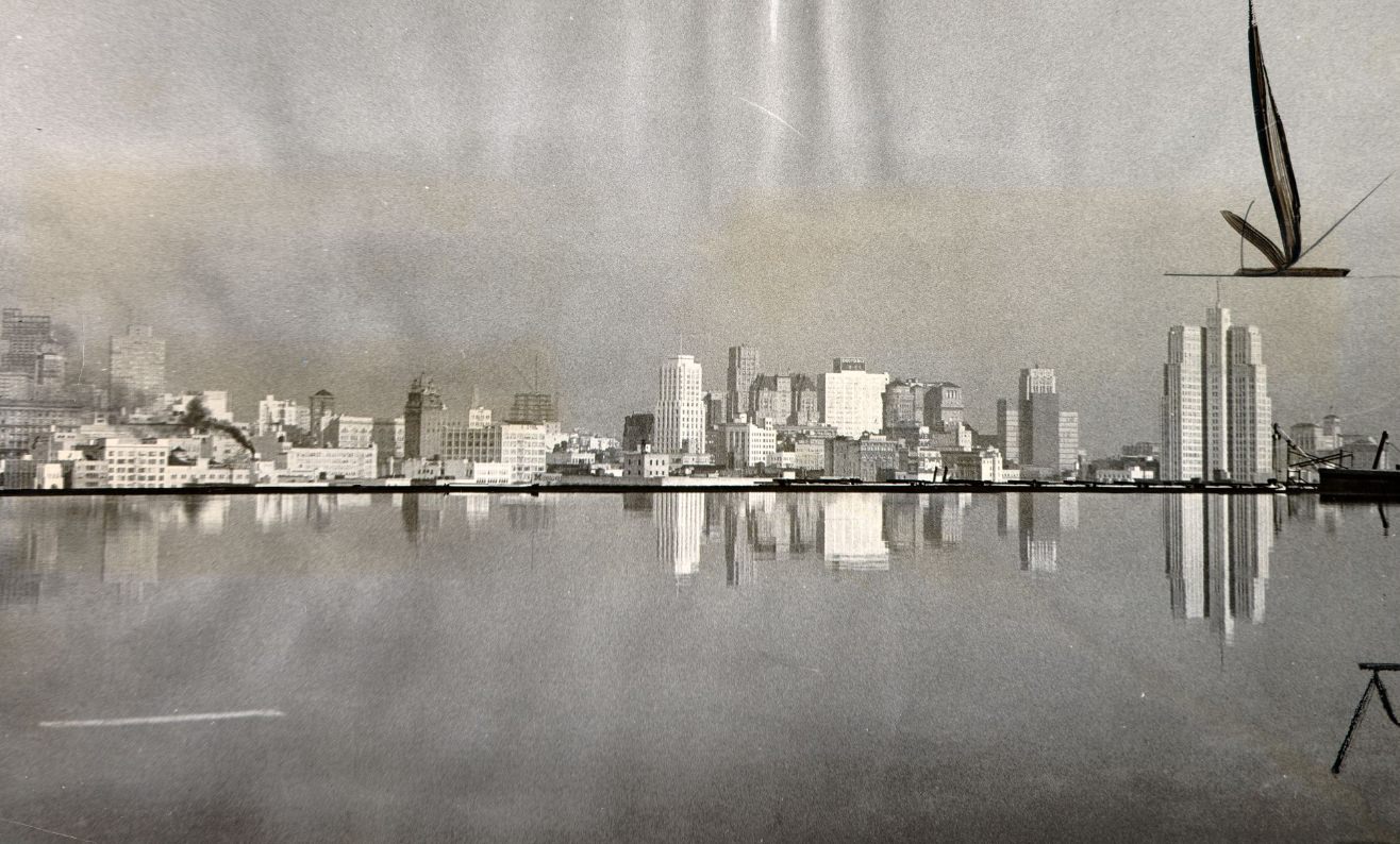
San Francisco Bay was not just a scenic backdrop — it was a working body of water with strong tidal currents that regularly carried debris, timber, and flotsam in visible swirling patterns near the shore. The bay was also significantly larger in the 1960s than it is today. Decades of bay fill had already reduced its surface area by roughly 40 percent since the Gold Rush era, and environmental groups were beginning to organize against further filling.
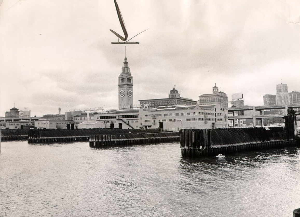
The Ferry Building, with its 245-foot clock tower, had been the gateway to San Francisco for generations of commuters and travelers arriving by boat from across the bay. By the 1960s, the Bay Bridge and Golden Gate Bridge had dramatically reduced ferry traffic, and the building’s grand interior was now used mostly for offices and light commerce. The Embarcadero Freeway running in front of it further diminished the building’s waterfront presence.
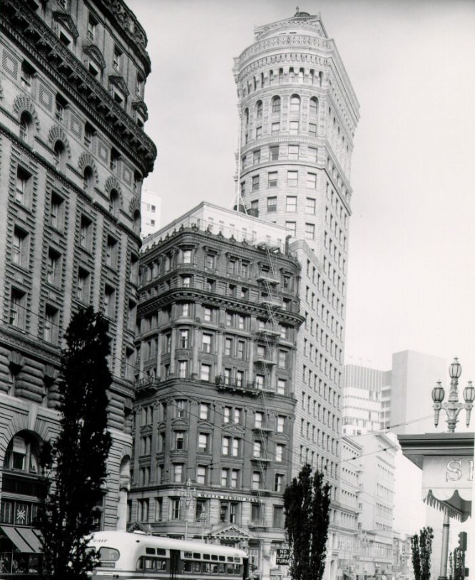
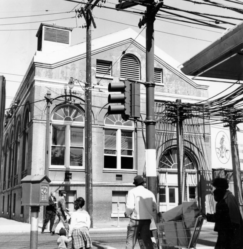
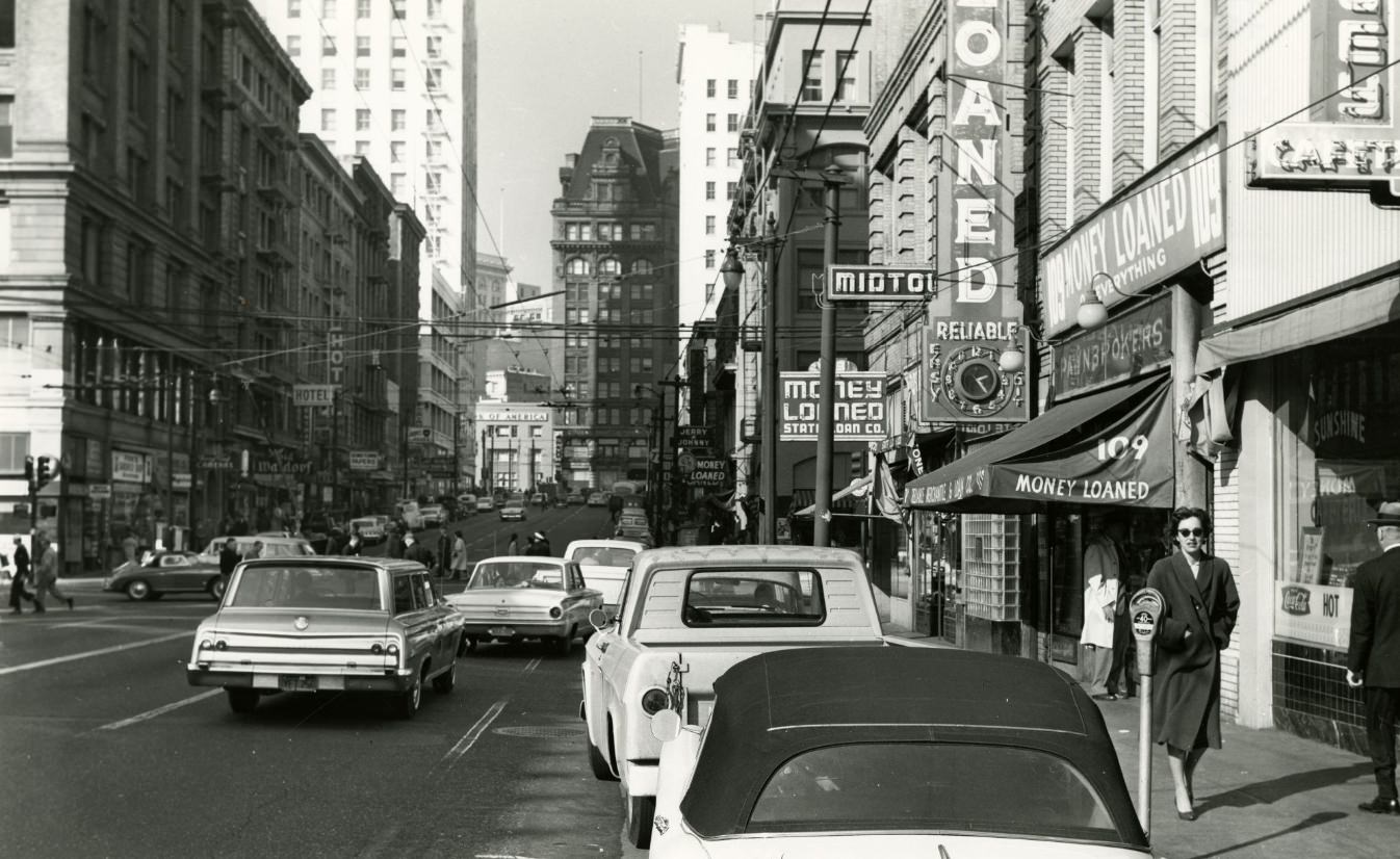
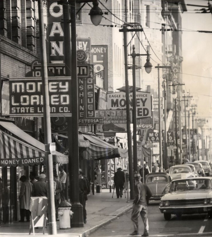
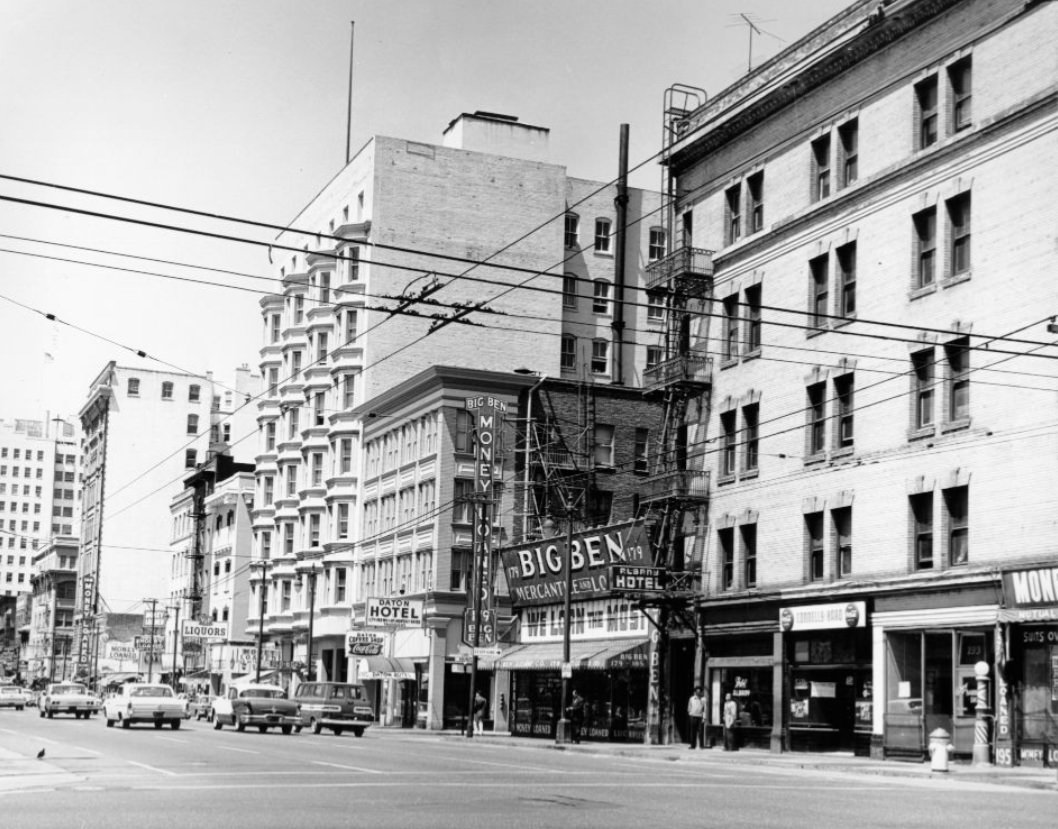
Market Street in the 1960s was a street of contradictions — upscale department stores at one end, run-down hotels and cinemas at the other. The stretch between Fifth Street and the Civic Center was particularly mixed, with pawn shops, cheap eateries, and struggling businesses sitting alongside larger commercial establishments. The city made multiple attempts throughout the decade to revitalize the street with new lighting, street furniture, and public improvements.
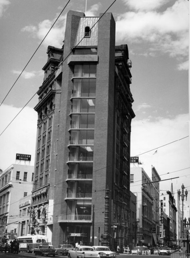
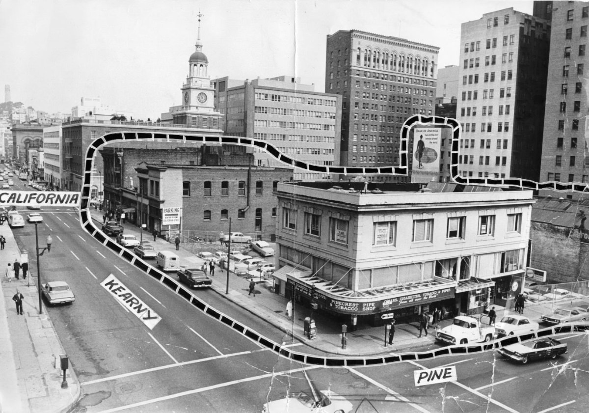
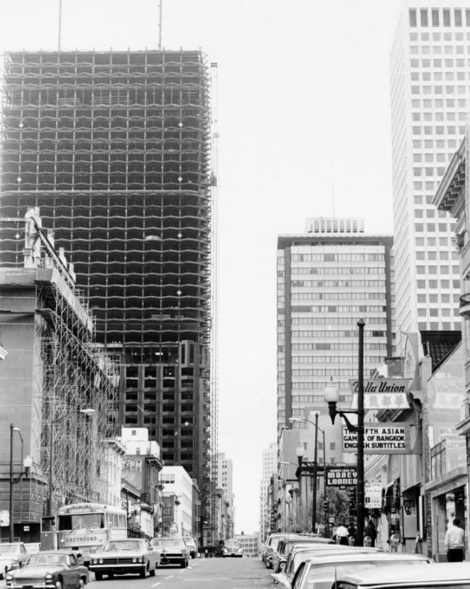
The Financial District along Kearny, Montgomery, and California streets was the center of San Francisco’s banking and insurance industries. Major institutions including Bank of America — headquartered in San Francisco — and Wells Fargo operated from this compact cluster of office buildings. The area saw some of its most dramatic physical changes during the 1960s as older low-rise buildings were demolished to make way for glass and steel towers.
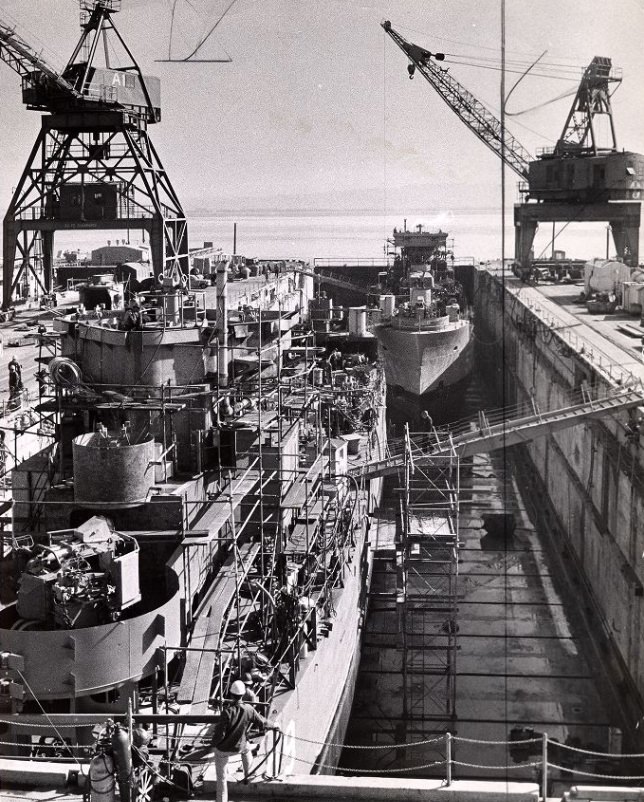
Hunters Point Naval Shipyard was one of the most active industrial facilities on the West Coast throughout the 1960s. The shipyard repaired and overhauled naval vessels, including aircraft carriers, and employed thousands of civilian and military workers. The facility stretched along the southeastern waterfront and was largely off-limits to the general public, though its cranes and dry docks were visible from the surrounding hills.
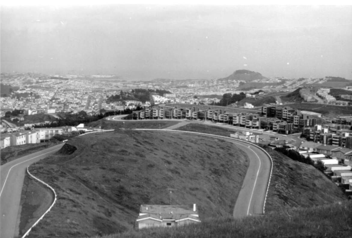
By 1967, Twin Peaks had become a gathering place with new significance. The neighborhood below it — particularly the Castro Street corridor — was quietly becoming a destination for gay men who were beginning to settle there in growing numbers. The social and political organizing that would define the Castro in the 1970s had its roots in the late 1960s, as bars and businesses catering to the gay community began to cluster around 18th and Castro streets.
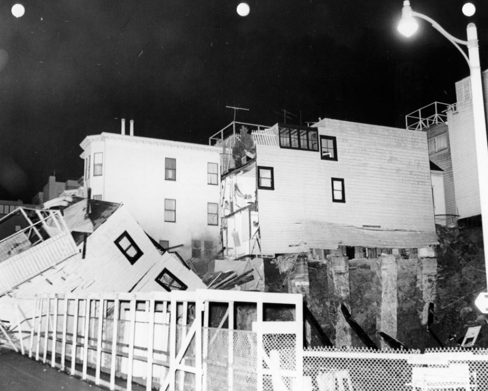
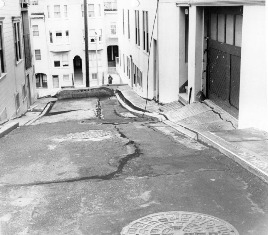
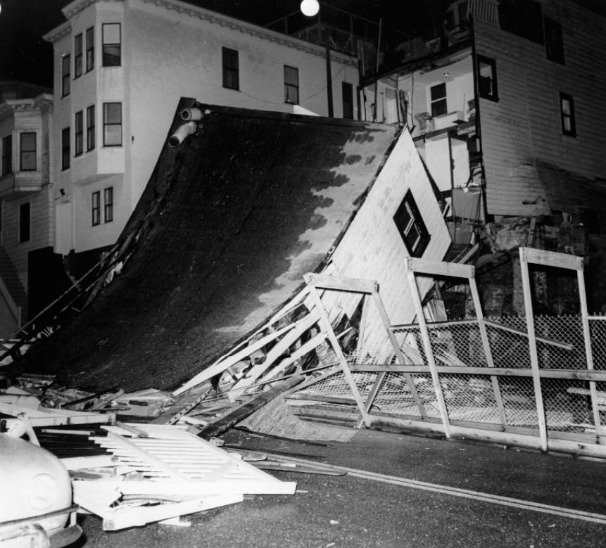
Telegraph Hill was not immune to the physical hazards of San Francisco’s steep terrain. The hill’s eastern face was a rocky cliff — the result of quarrying operations in the late 19th century — and buildings at its edge occasionally succumbed to erosion and structural failure. A collapse at Grant and Lombard in 1964 illustrated how precarious some of the older construction on the hill’s edges had become.
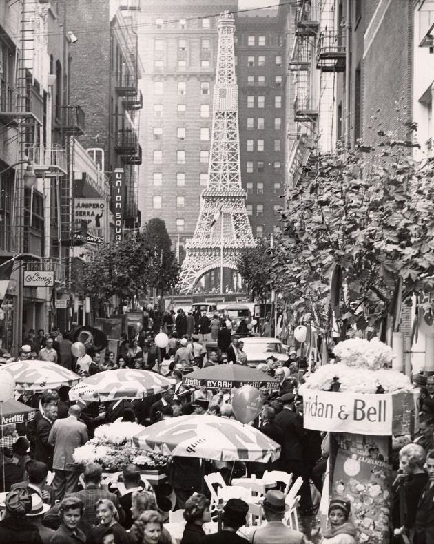
Maiden Lane hosted cultural events throughout the decade that drew crowds to the Union Square area. A Festival of France in 1963 brought French goods, food, and entertainment to the pedestrian alley, part of a broader pattern of street festivals and outdoor events that made San Francisco’s public spaces feel alive. The city’s mild climate made outdoor events feasible year-round, even if the fog kept temperatures cool.
As Diamond Heights Elementary School opened in 1968, the neighborhood had completed its transformation from barren hilltop to functioning residential district. The school served the children of the families who had moved into the new housing developments over the previous several years. Its modern, flat-roofed design matched the architectural style of the homes and apartments that surrounded it.
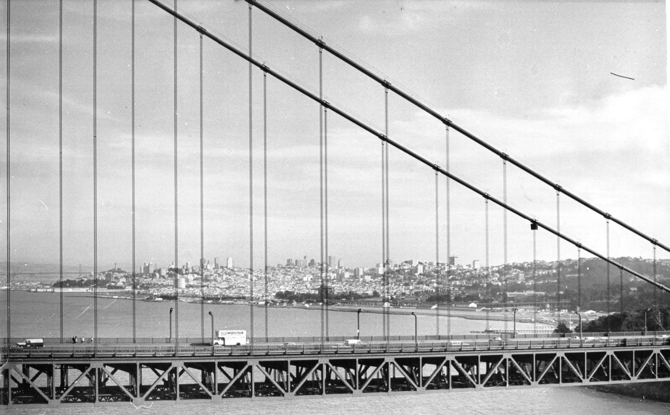
The Golden Gate Bridge, opened in 1937, remained the defining symbol of San Francisco throughout the 1960s. Its distinctive International Orange paint was touched up continuously by a full-time crew of painters who worked the 1.7-mile span year-round. From the air, the bridge’s relationship to the narrow strait connecting the bay to the ocean was immediately apparent — a thread of steel connecting two headlands across one of the world’s great natural harbors.
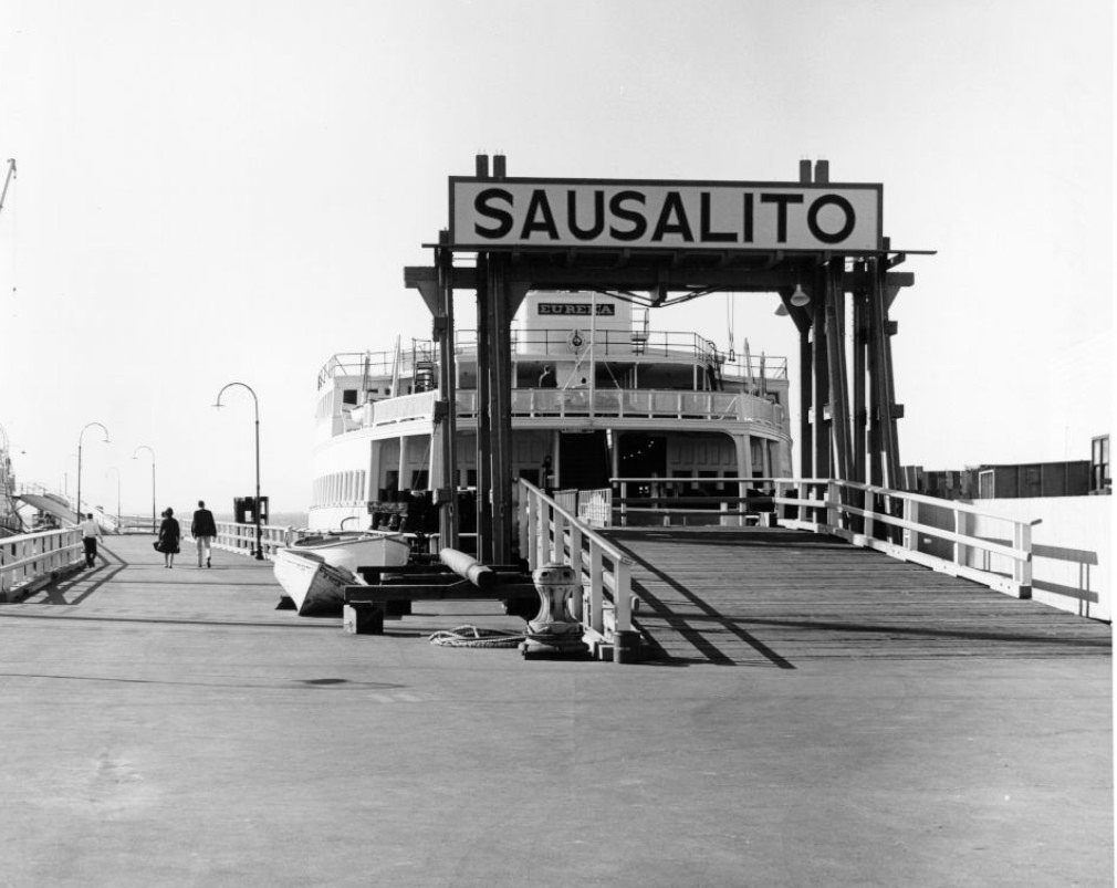
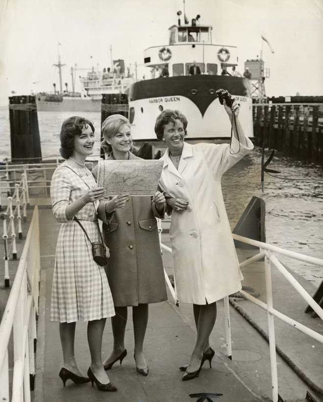
Ferry service between San Francisco and Sausalito continued through the 1960s, even as the Golden Gate Bridge carried the overwhelming majority of bay crossings. The ferry offered a slower, more scenic alternative and was used by commuters who worked in Marin County and preferred not to drive. The boats departed from a terminal near the Ferry Building and made the crossing in about 30 minutes.
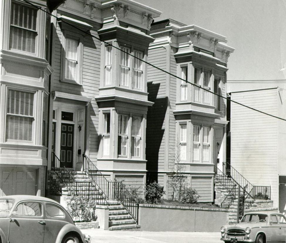
Sacramento Street in Pacific Heights was lined with some of the city’s most substantial residential architecture. Georgian-style homes with formal facades and well-kept gardens stood on blocks that had avoided the wholesale demolition happening in other parts of the city. Pacific Heights was one of San Francisco’s wealthiest neighborhoods, and its housing stock reflected that — well-maintained, architecturally varied, and largely spared from the redevelopment pressures facing poorer districts.
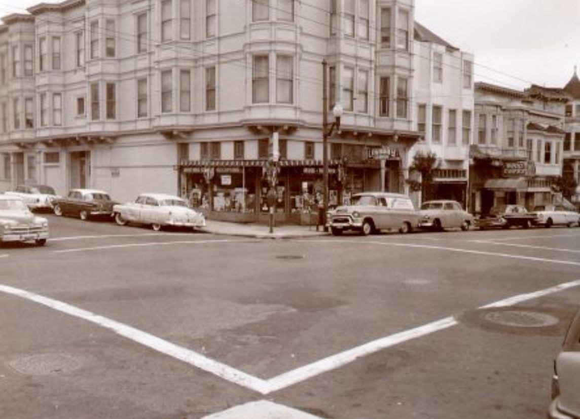
By 1967, Haight Street had become unrecognizable compared to its 1960 appearance. Head shops, poster stores, and crash pads had replaced conventional businesses. The Grateful Dead lived communally at 710 Ashbury Street, just a block from Haight, and Jefferson Airplane occupied a mansion on Fulton Street. The Fillmore Auditorium, under promoter Bill Graham’s management starting in 1966, hosted weekend concerts that became the soundtrack of the movement.
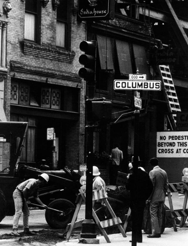
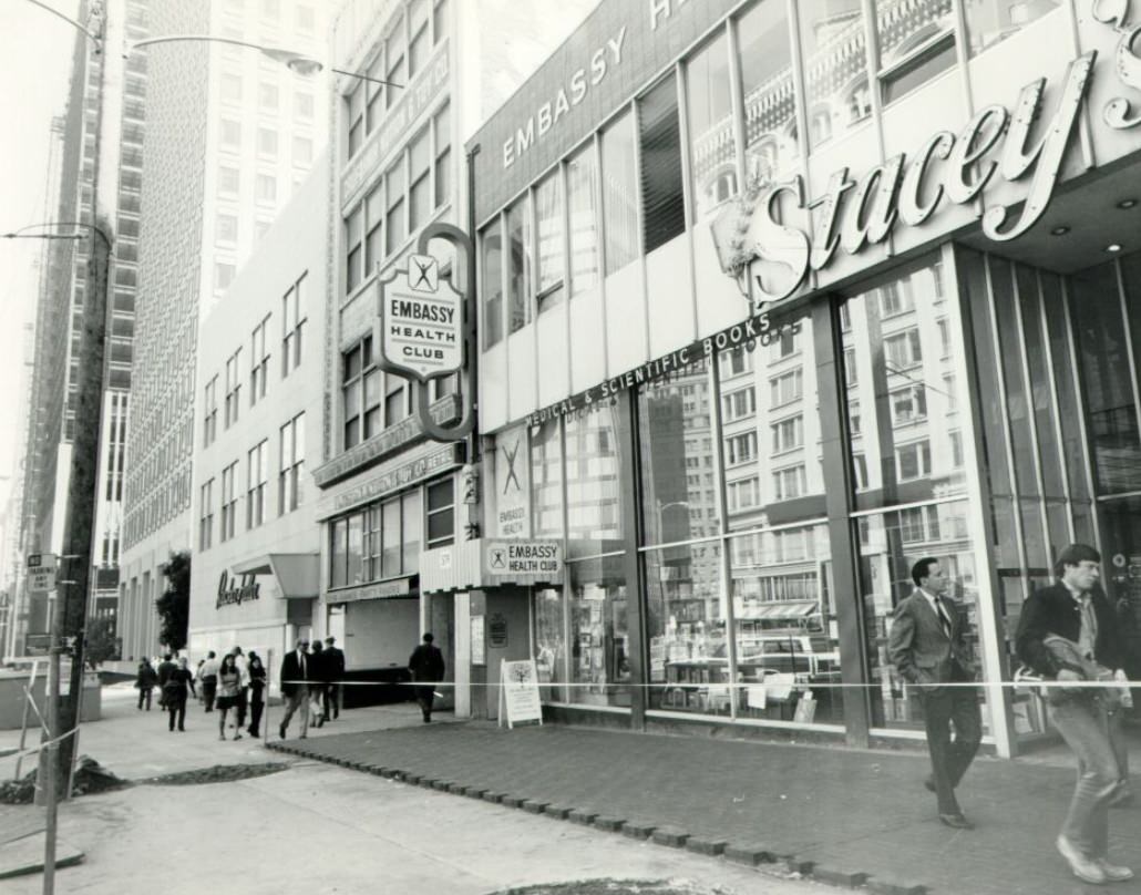
Columbus Avenue was the main artery of North Beach, running diagonally from the Financial District northwest to Fisherman’s Wharf. Street-level work — paving, utility installation, storefront construction — was a constant along its length throughout the decade as the neighborhood evolved. By 1969, Columbus Avenue was still the same basic street it had been at the start of the decade, but the culture around it had shifted substantially.
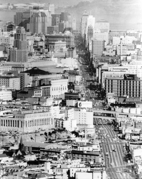
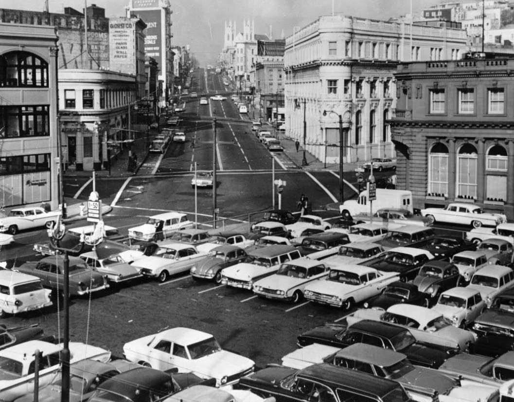
Looking east down Market Street in 1964, the Ferry Building’s clock tower was visible at the far end, rising above the canyon of commercial buildings that lined both sides of the boulevard. Streetcar tracks still ran down Market’s center lanes, and the mix of buses, cable cars, automobiles, and pedestrians made the street one of the noisiest in the city. The entire corridor was scheduled to be rebuilt as part of the BART construction project, which would tear up Market Street’s surface for years.
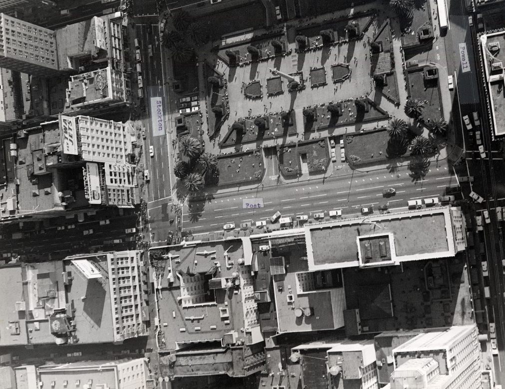
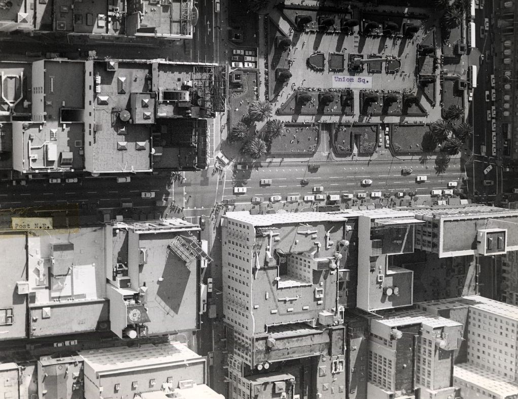
From the air, Union Square’s layout was clear — a rectangular park surrounded on all four sides by major commercial streets, with the Dewey Monument column rising from its center. The underground parking garage beneath the square, opened in 1942, was one of the first in the United States. The rooftop of the garage served as the park’s surface, where workers and shoppers gathered during lunch hours and on weekends.
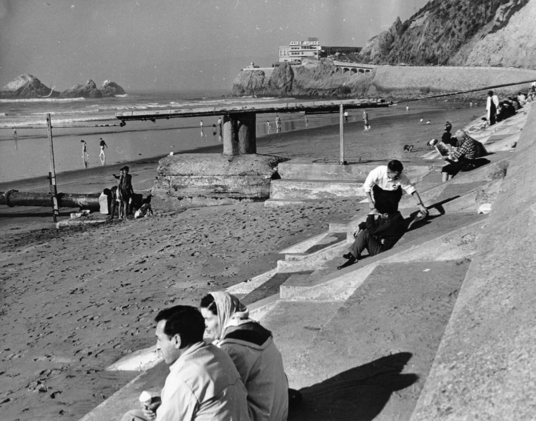
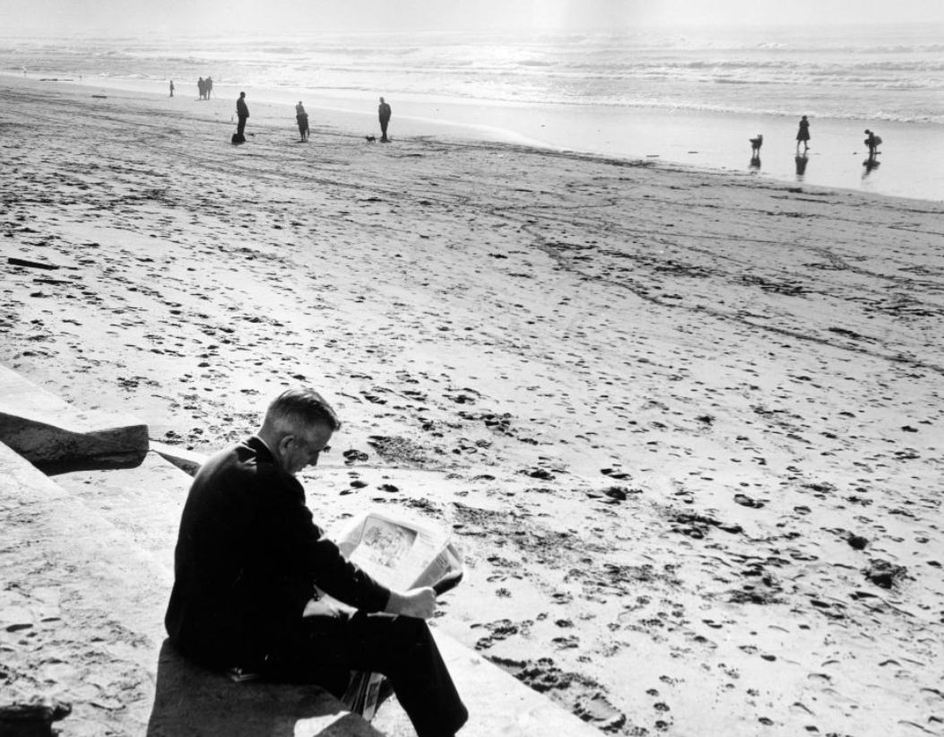
Ocean Beach in 1960 was a wide, cold, wind-swept expanse of sand. The water temperature rarely climbed above 60 degrees Fahrenheit, and rip currents made swimming dangerous. Still, the beach attracted walkers, joggers, and people who simply wanted to sit facing the open Pacific. The Great Highway ran parallel to the beach, and on clear days the Farallon Islands were visible on the horizon, 27 miles offshore.
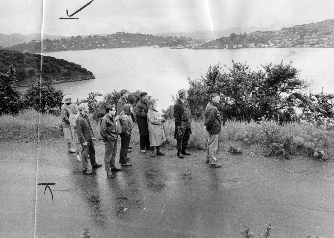
Angel Island sat in the middle of San Francisco Bay and had served as a military base and immigration processing station for decades. By 1963, when the Army closed its installation there, the island was described as badly rundown. California took ownership of the island and began converting it into a state park, though the process was slow. During the 1960s, explorers and hikers began visiting the abandoned buildings, which still showed their history as a gateway for hundreds of thousands of immigrants from Asia.
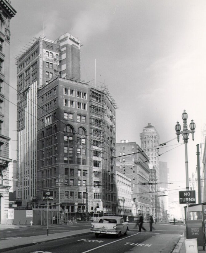
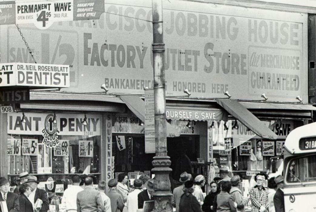
Market Street storefronts in the 1960s ranged from flagship department stores near Fifth Street to discount shops and pawn brokers further from Union Square. The street’s commercial character shifted noticeably depending on which block you were standing on. Theaters — the Orpheum, the Warfield, the Fox — drew large audiences for movies and live performances, particularly along the stretch between Fifth and Tenth streets.
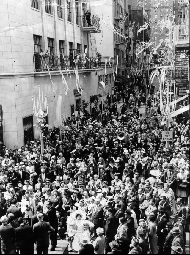
The annual Spring Festival on Maiden Lane drew crowds into the Union Square area each year, filling the short pedestrian alley with vendors, performers, and shoppers. These kinds of neighborhood festivals were common across San Francisco in the 1960s. North Beach held its own Italian street fair, Chinatown celebrated the Lunar New Year with a parade along Grant Avenue that drew tens of thousands of spectators, and the Fillmore District had its own community events.
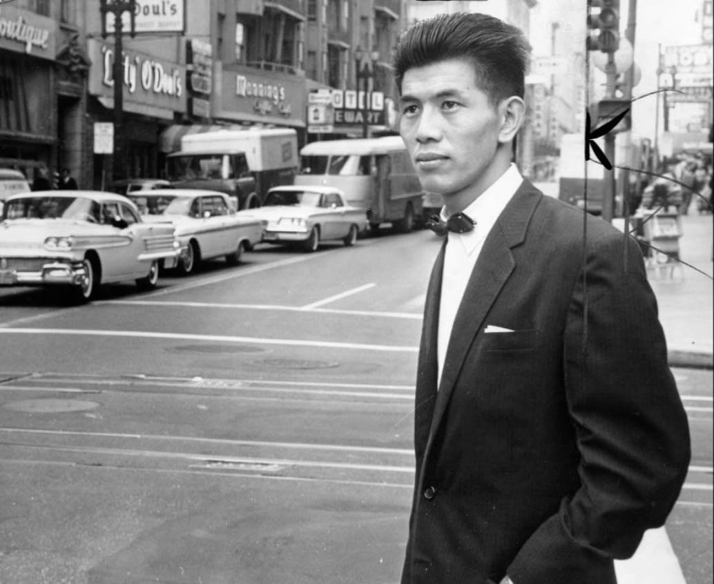
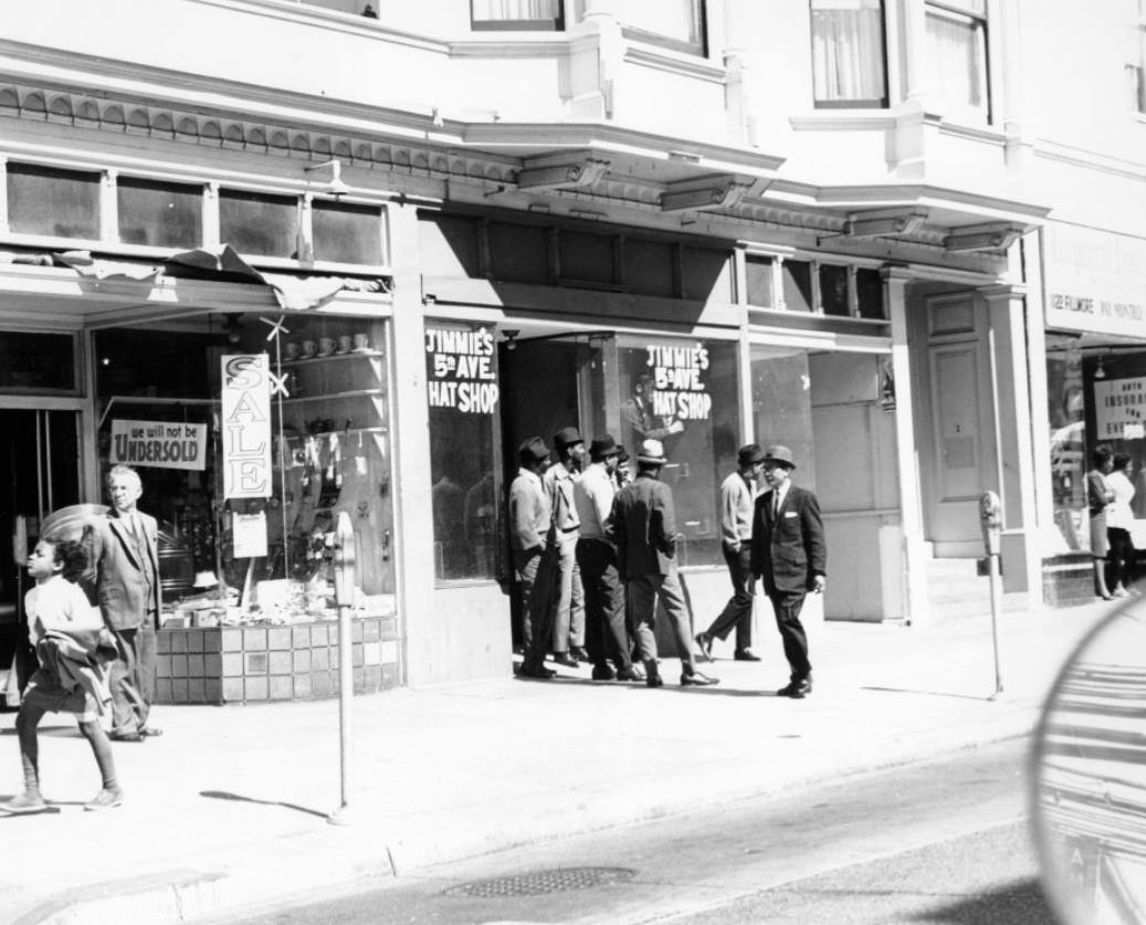
Fillmore Street in the Western Addition was known as the ‘Harlem of the West’ — a title it had earned during and after World War II when San Francisco’s African-American population grew rapidly. Jazz clubs, blues venues, barbershops, and restaurants lined the street. Artists like John Coltrane, Billie Holiday, and Charlie Parker had performed in Fillmore clubs. By the mid-1960s, however, urban renewal was systematically demolishing buildings throughout the neighborhood, displacing thousands of residents and businesses.
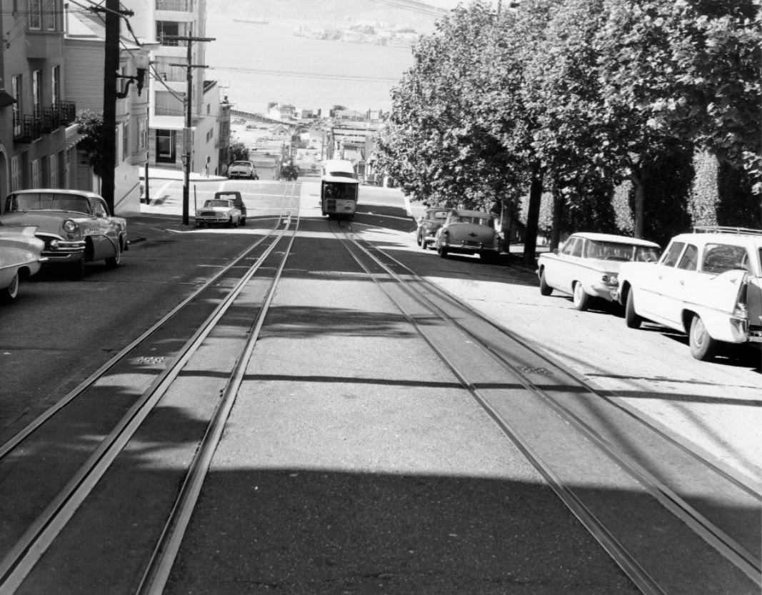
The Hyde Street cable car descended toward Aquatic Park and the bay with views that stretched across the water to Marin County. The Powell-Hyde line was the most scenic of the three remaining cable car routes, carrying passengers through Russian Hill and down to the waterfront. Gripmen operated the cars using a lever-controlled grip that clamped onto a continuously moving underground cable — a system unchanged since the line’s original operation in the 19th century.
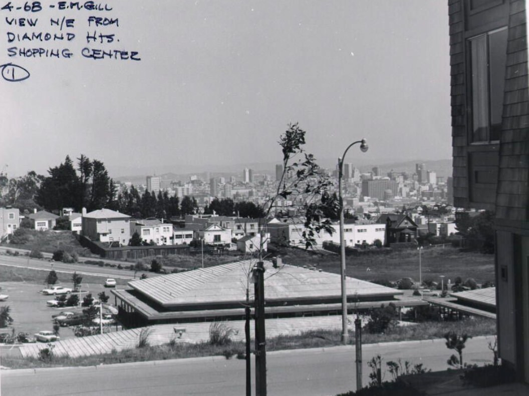
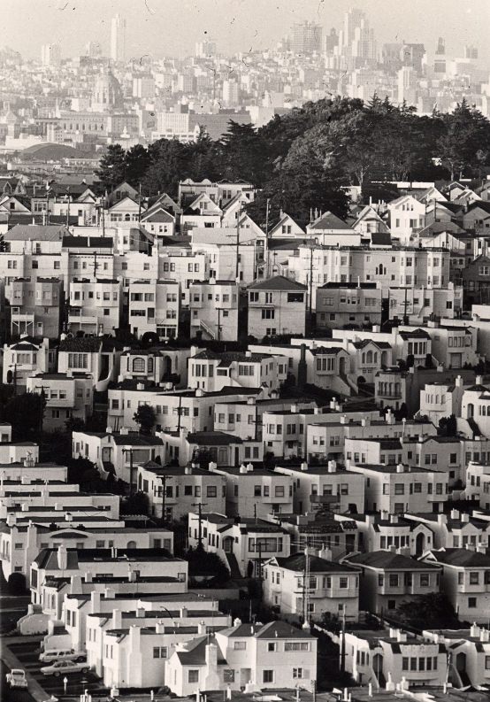
Diamond Heights shopping center, a small commercial cluster built as part of the redevelopment project, served the new residents who had moved into the surrounding housing. Looking northeast from its vicinity in 1968, the density of San Francisco’s older neighborhoods was visible in contrast to the newer, more spacious development of Diamond Heights — a clear illustration of the generational divide in the city’s built environment.
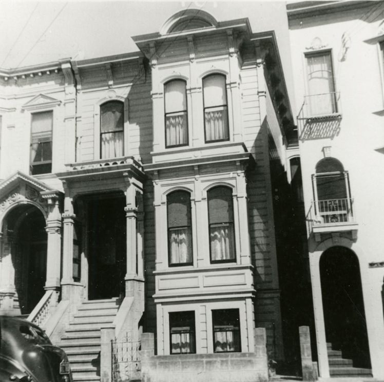
The loss of historic buildings was one of the defining tensions of 1960s San Francisco. A house on Steiner Street that had survived the catastrophic 1906 earthquake and fire — a structure that had outlasted one of the worst urban disasters in American history — was demolished during the decade as part of ongoing redevelopment. Preservationists had not yet developed the legal and political tools that would later give them the ability to protect such buildings.
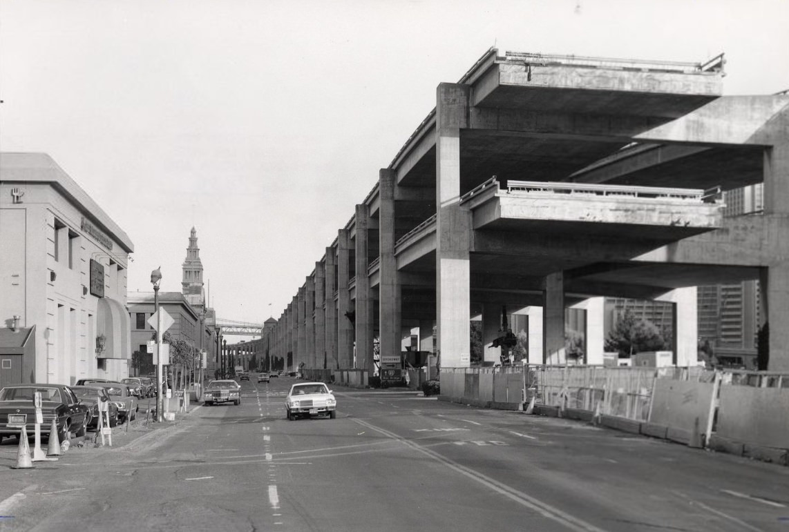
The Embarcadero Freeway’s construction extended through the early 1960s, and its visual impact on the waterfront was immediate and dramatic. The double-deck elevated structure cut the city off from its bayfront in a way that residents found deeply objectionable. The freeway revolt of 1959 — in which the Board of Supervisors cancelled seven planned freeways — had already stopped several similar projects, but the Embarcadero section was too far along to halt.
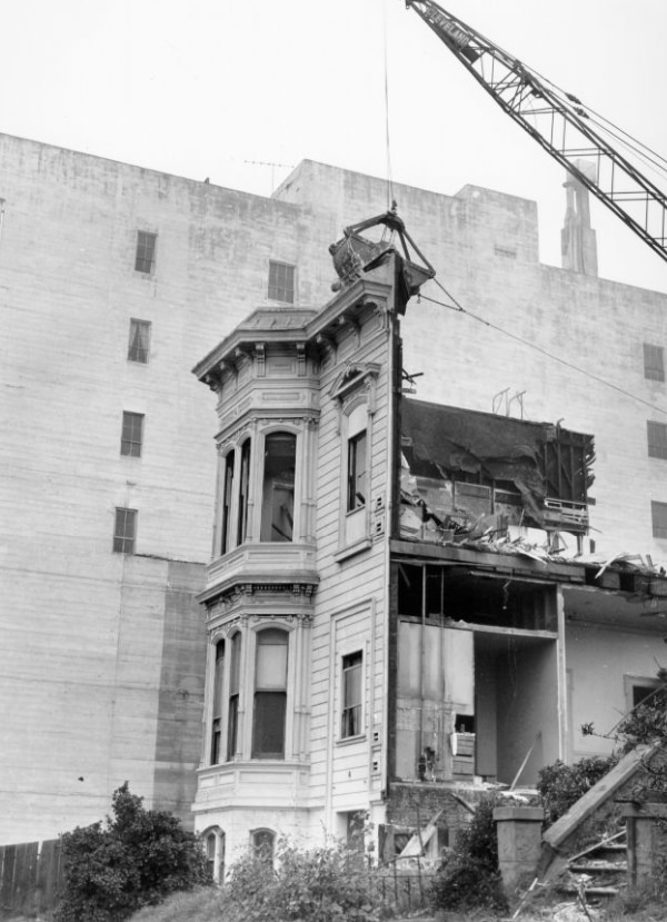
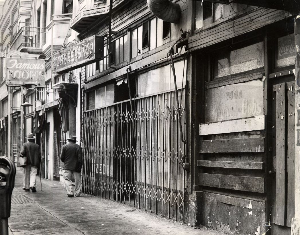
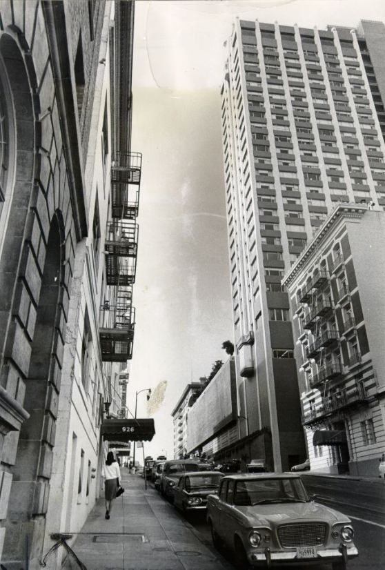
Demolition was as much a part of 1960s San Francisco as construction. On Bush Street and across many other blocks, older housing came down to make way for new apartment buildings, parking structures, and commercial developments. The pace of demolition alarmed residents who valued the city’s architectural heritage, and the decade saw the first organized efforts to create historic preservation policies in San Francisco.
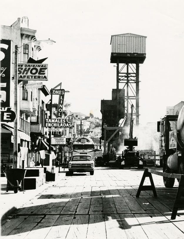
Mission Street in 1969 showed a neighborhood in transition. Storefronts with Spanish-language signs stood alongside older establishments catering to the neighborhood’s previous residents. The Mission District’s transformation into a predominantly Latino community had been underway for a full decade, driven by migration from Mexico and Central America as well as internal migration from other parts of California. The neighborhood’s energy was visible in its murals, markets, and community organizations.
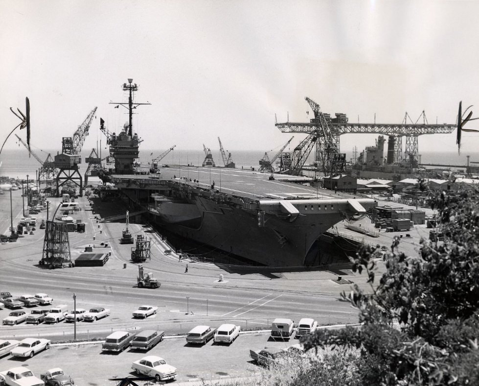
Aircraft carriers undergoing repair at Hunters Point Naval Shipyard were among the largest man-made structures visible in 1960s San Francisco. The massive ships dwarfed the surrounding dry docks and cranes. Hunters Point was one of the few facilities on the West Coast capable of handling ships of that size, making it a strategically important installation as the United States deepened its military involvement in Vietnam throughout the decade.
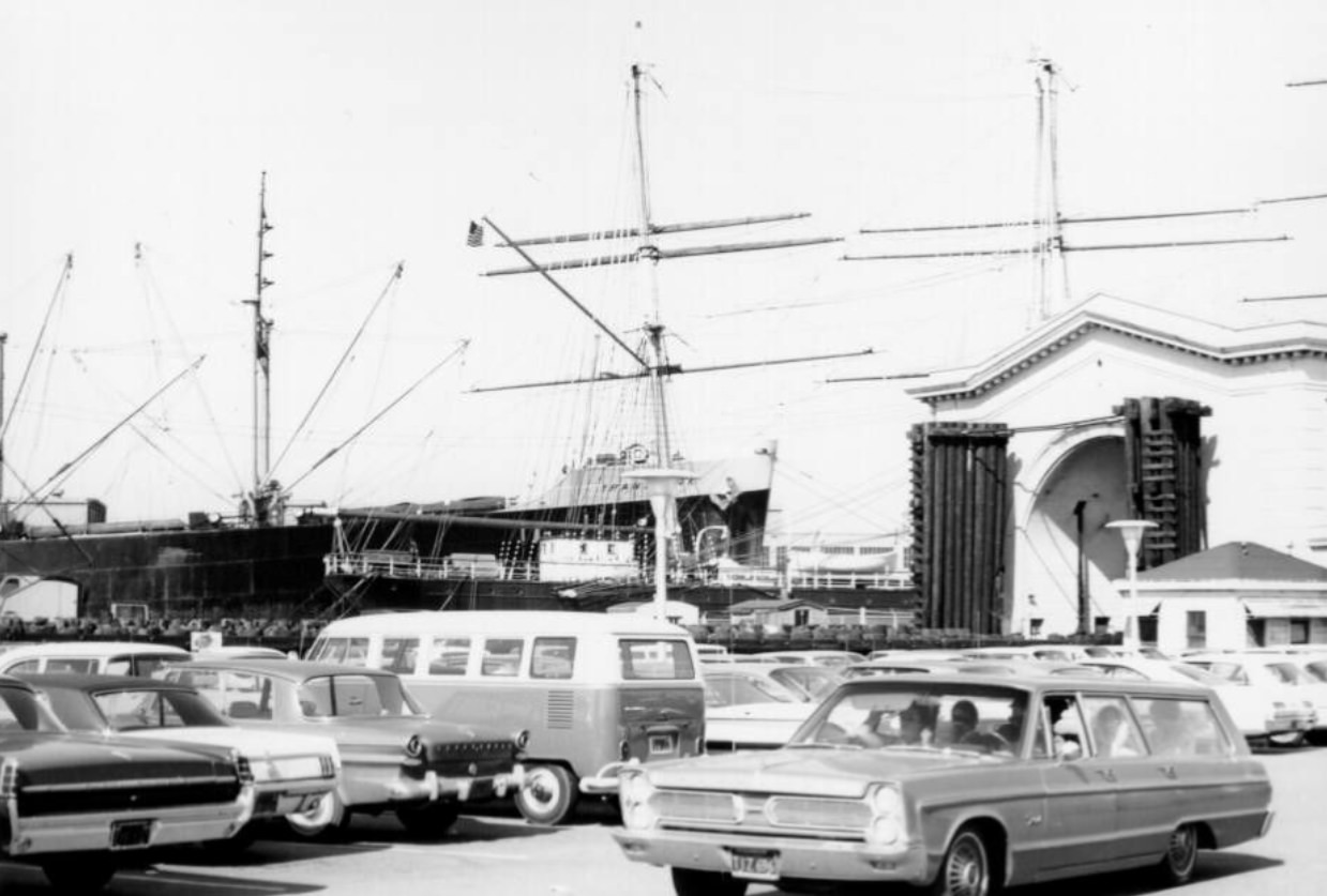
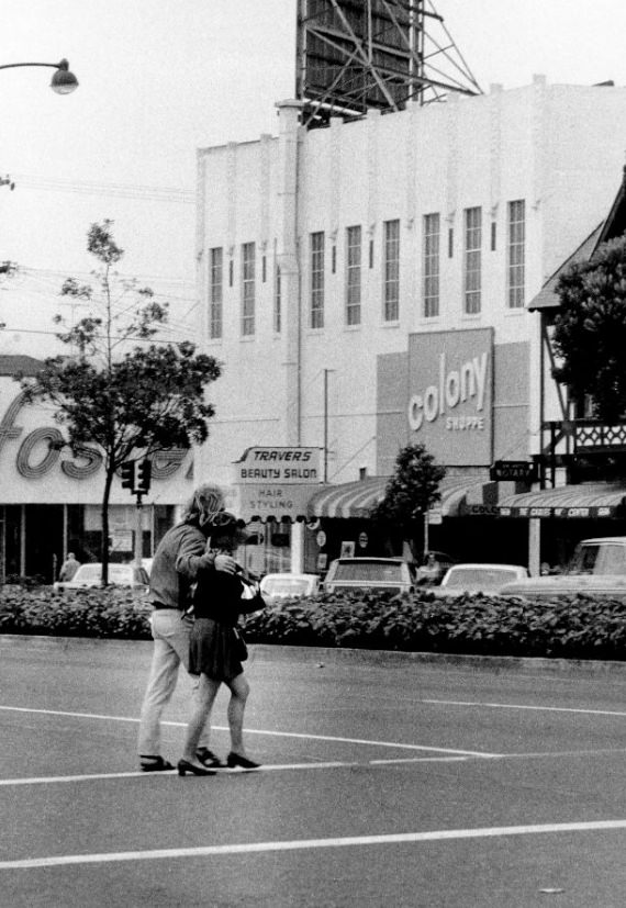
Fisherman’s Wharf in 1967 was increasingly a tourist destination as much as a working waterfront. Souvenir shops, seafood restaurants, and attractions were drawing visitors who had little connection to the fishing industry itself. The number of commercial fishing boats operating out of the wharf had been declining for years as the industry consolidated and costs rose. The tourist economy filling that gap was changing the character of the wharf faster than many longtime residents wanted.
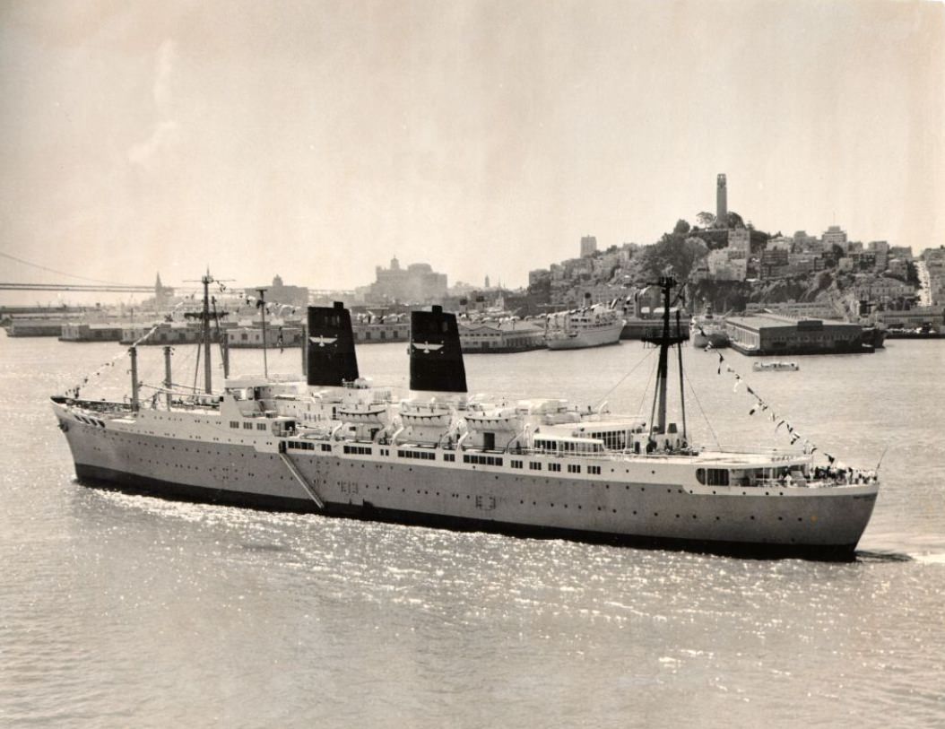
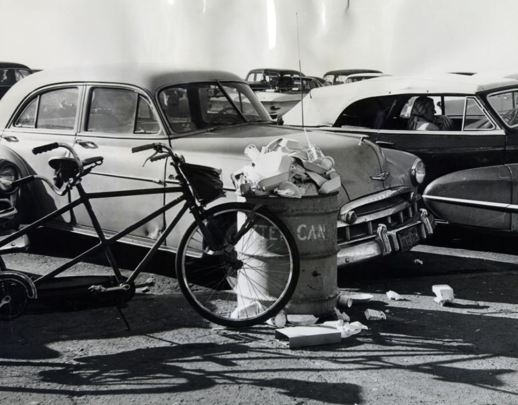
Passenger ships still called at San Francisco throughout the early 1960s, arriving at the port’s passenger terminals along the Embarcadero. The S.S. Roosevelt’s arrival in 1962 was part of a tradition of oceanic travel that was rapidly fading as commercial aviation took over long-distance passenger routes. By the end of the decade, most travelers crossing the Pacific were doing so by jet aircraft, and the era of major passenger ship traffic to San Francisco was nearly over.
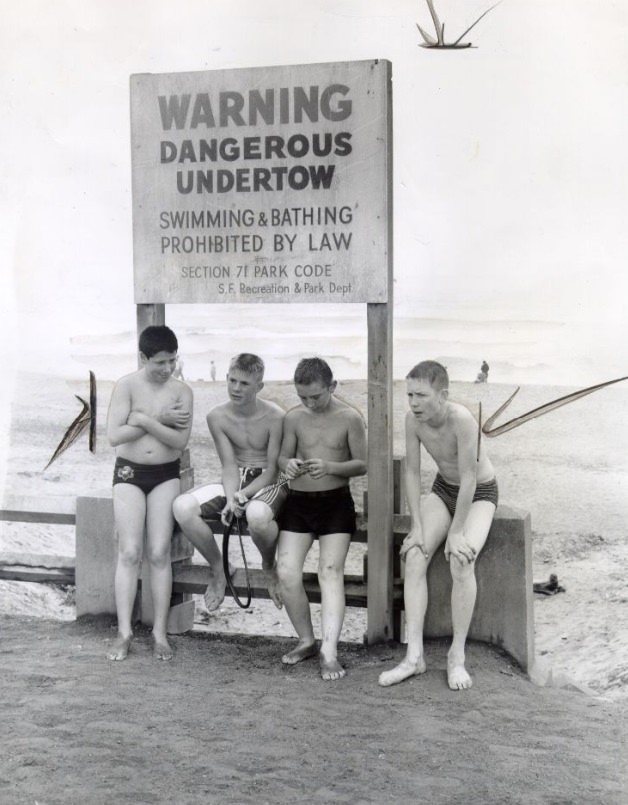
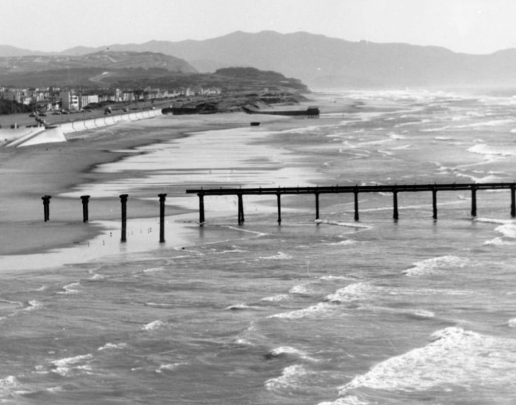
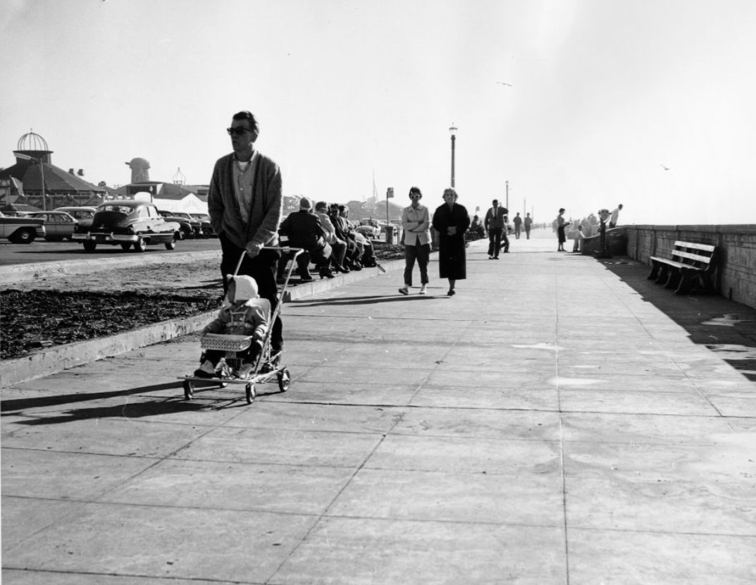
Ocean Beach was a place for everyday San Franciscans rather than the tourist crowds that gathered at Fisherman’s Wharf or Union Square. Families came for weekend walks, teenagers gathered in groups, and older residents read newspapers on benches along the Great Highway. The beach ran for nearly three miles along the western edge of the city, backed by the dunes and windmills of Golden Gate Park at its northern end.
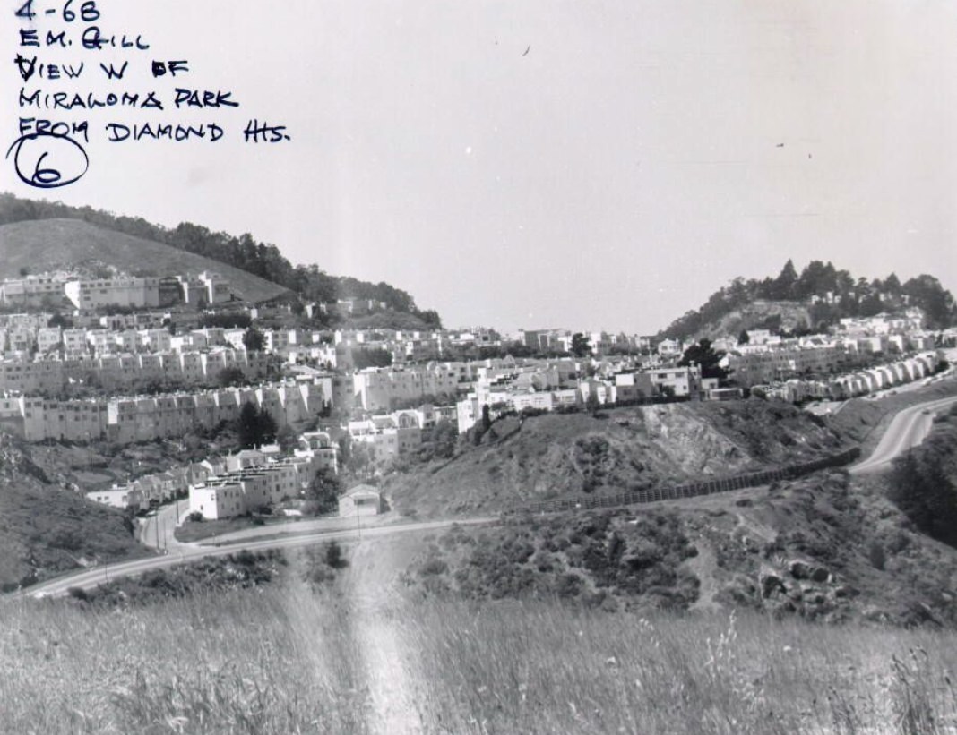
Miraloma Park, visible to the west from Diamond Heights, was a quieter residential neighborhood of single-family homes built mostly in the 1920s and 1930s. The contrast between Miraloma’s established streetscapes and Diamond Heights’ brand-new construction was striking from certain vantage points — the old city and the new city sitting side by side on adjacent hilltops.
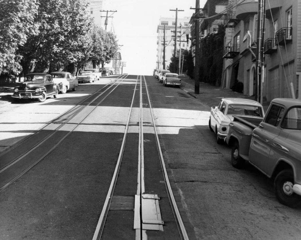
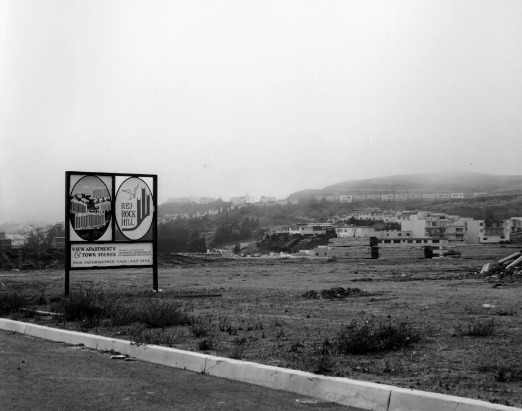
Hyde Street near Lombard sat at the intersection of two of San Francisco’s most recognizable streets. The cable car line ran down Hyde, and just a block away, Lombard’s famous switchbacks attracted a steady stream of curious visitors. The surrounding Russian Hill neighborhood was one of the denser residential areas in the city, filled with apartment buildings, small parks, and the kind of steep staircase streets found nowhere else in the country.
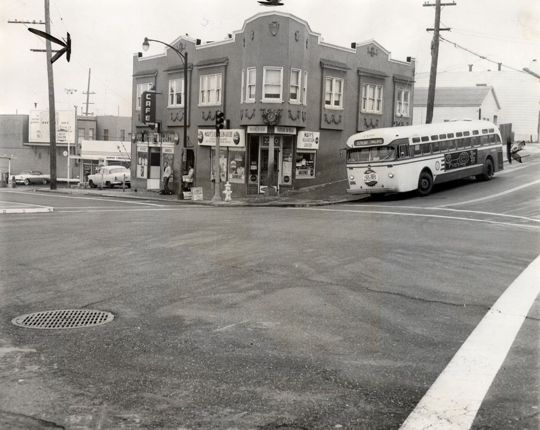
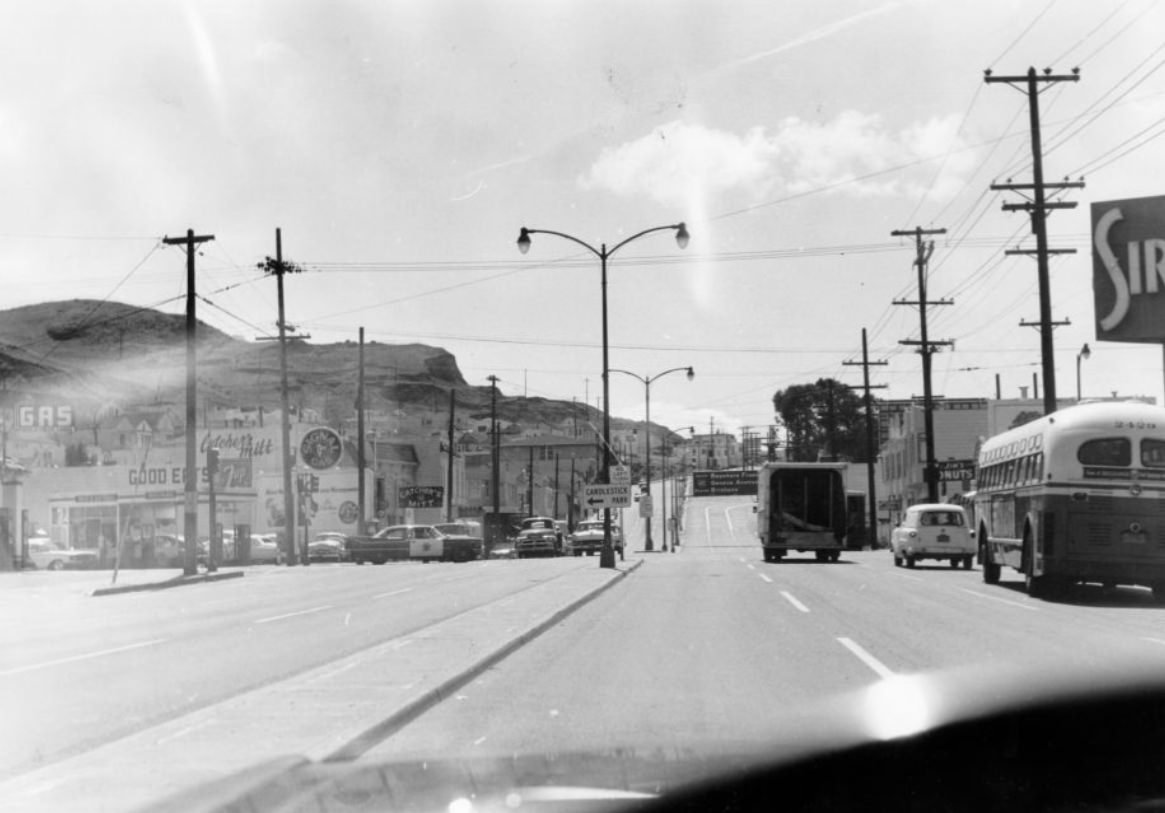
The southeastern neighborhoods along Bayshore Boulevard and Third Street were among the most working-class parts of San Francisco. The area included the Visitacion Valley, Excelsior, and Portola neighborhoods — home to families working in manufacturing, transportation, and the trades. These districts rarely appeared in tourist literature but formed a large part of the city’s residential fabric and population.
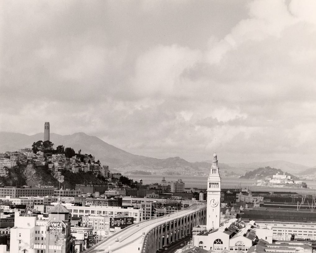
The relationship between the Ferry Building and the Embarcadero Freeway was visually jarring throughout the 1960s. The graceful Beaux-Arts terminal, designed in 1898 and rebuilt after the 1906 earthquake, sat directly behind the massive concrete freeway structure. The freeway blocked the building from view from the street and cut off what had once been an open, grand approach from Market Street to the waterfront.
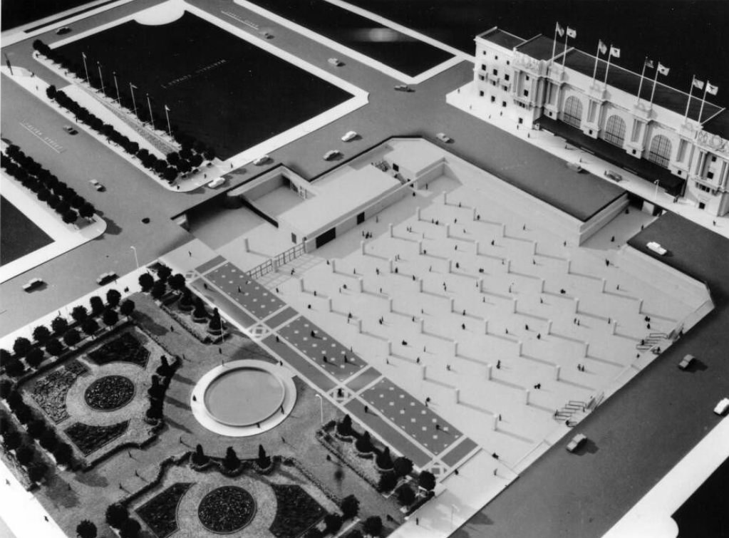
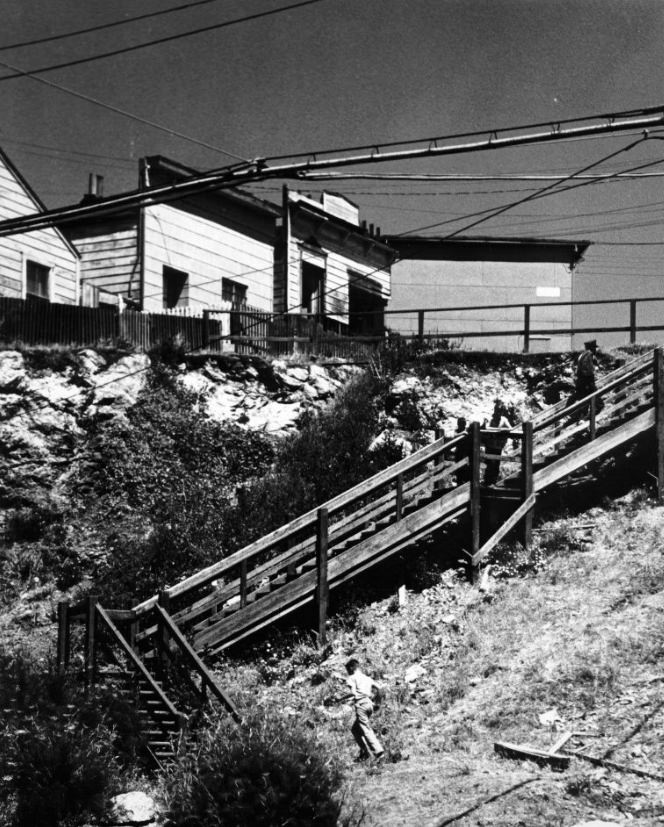
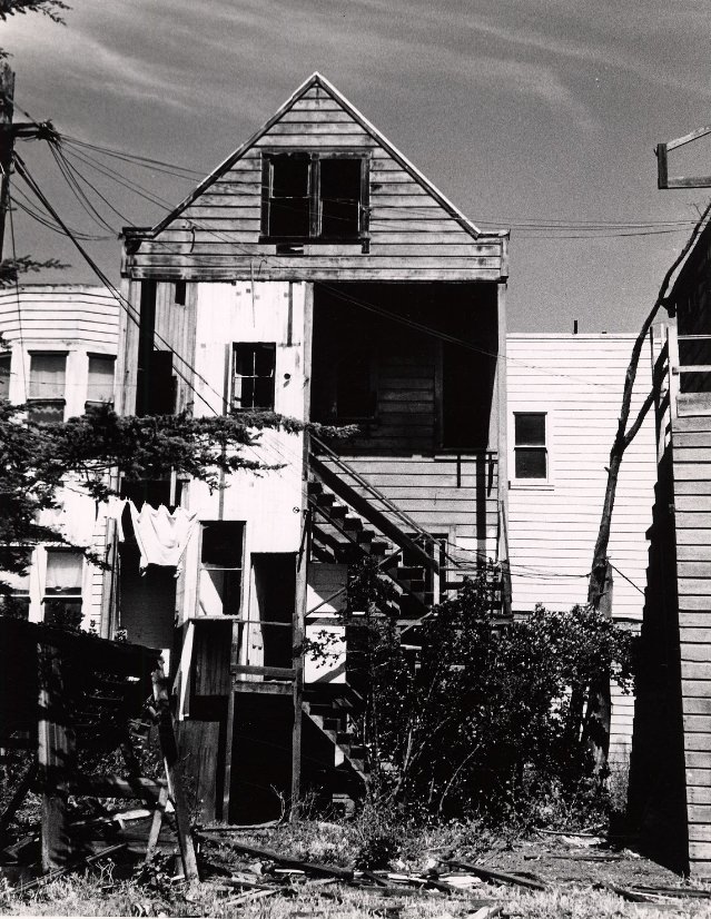
The back sides of Telegraph Hill residences told a different story than their street-facing fronts. Many homes on the hill’s steep slopes were accessed by wooden staircases rather than roads, and their rear elevations often showed improvised additions, garden terraces cut into the hillside, and structural adaptations to the dramatic terrain. The neighborhood’s inaccessibility was part of what made it distinctive — and what had allowed it to resist wholesale redevelopment.
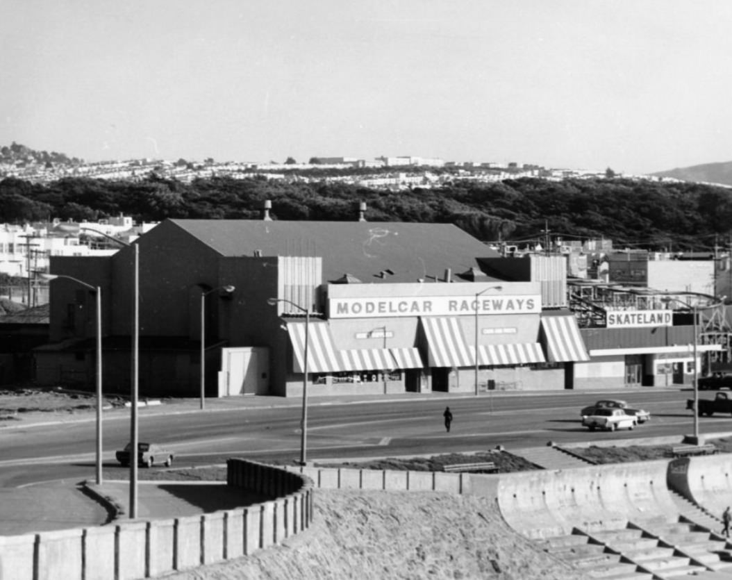
Model car racing at Ocean Beach in 1967 was one of the many small-scale recreational activities that filled the city’s parks and open spaces. Golden Gate Park, with its 1,017 acres, offered even more options — fly-casting pools, lawn bowling, a buffalo paddock, botanical gardens, a carousel, and the de Young Museum were all within its boundaries. The park was used intensively throughout the 1960s, including as a gathering place for anti-war demonstrations and counterculture events.
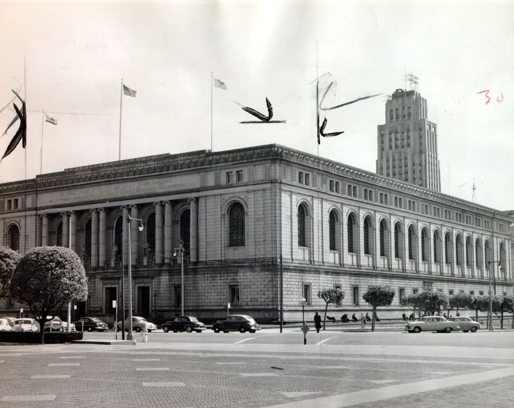
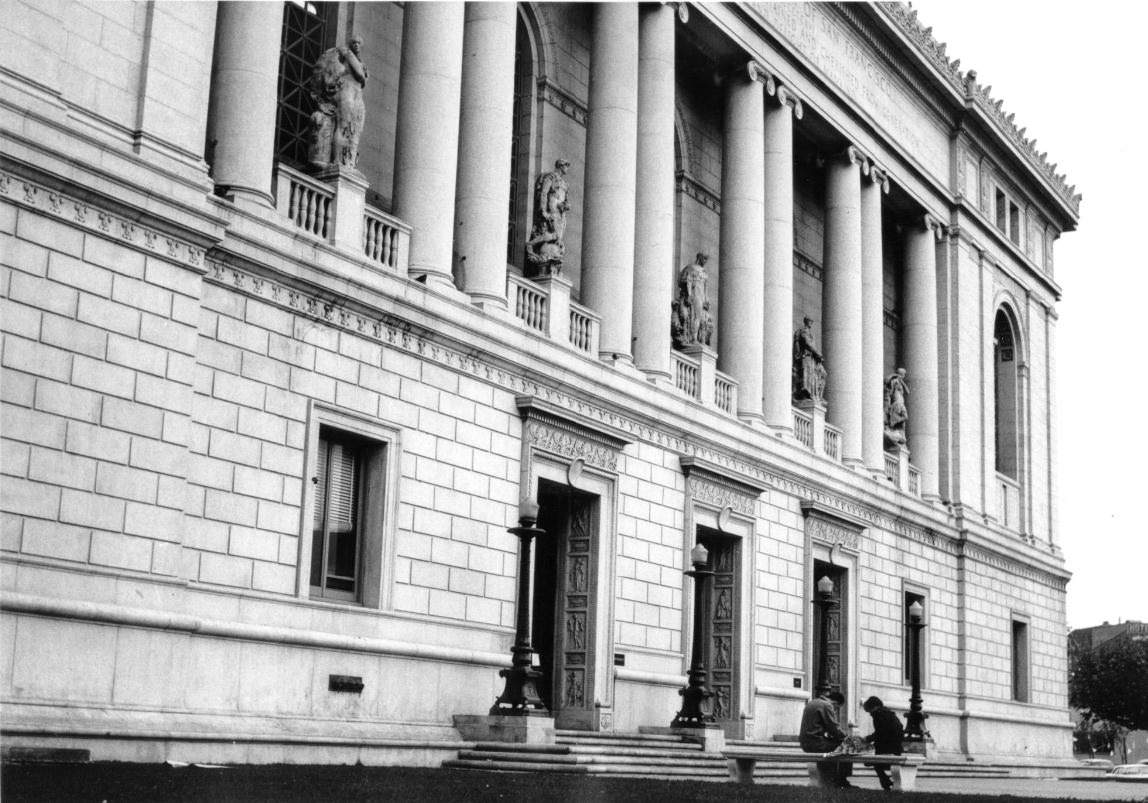
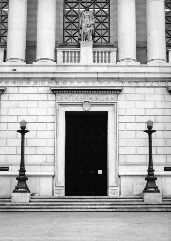
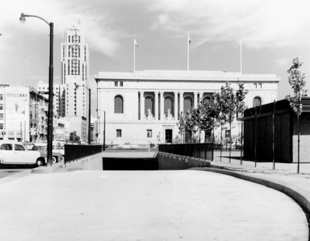
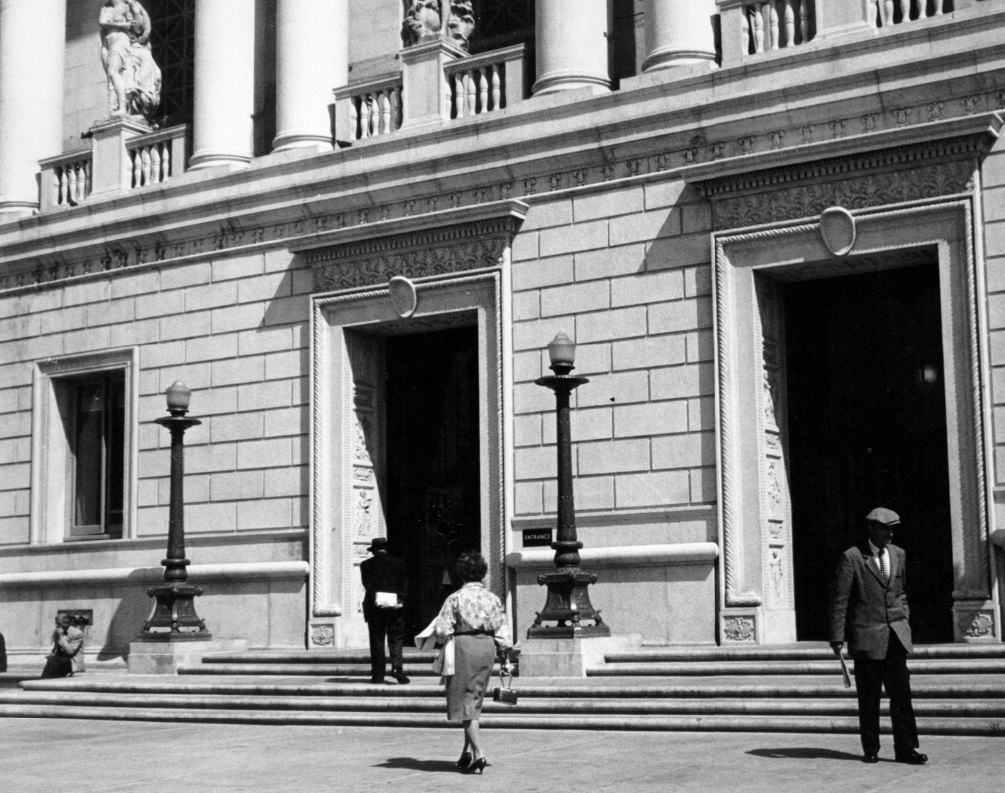
The Main Library at Larkin and Fulton streets was a Beaux-Arts building that opened in 1917 and anchored the Civic Center’s eastern edge. Its reading rooms were busy throughout the 1960s with students, researchers, and the general public. The library’s collection grew significantly during the decade, and its role as a free public resource made it a democratic counterpart to the private university libraries across the bay in Berkeley.
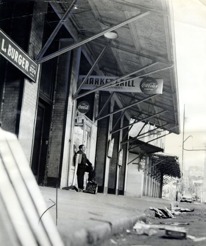
After the produce market was relocated from its downtown site, the cleared land represented one of the larger vacant parcels in the central city. The old market district around Washington and Davis streets had been a chaotic but vital part of the city’s commercial life for decades. Its removal was part of a broader pattern of relocating industrial and wholesale functions to peripheral areas as downtown real estate values climbed.
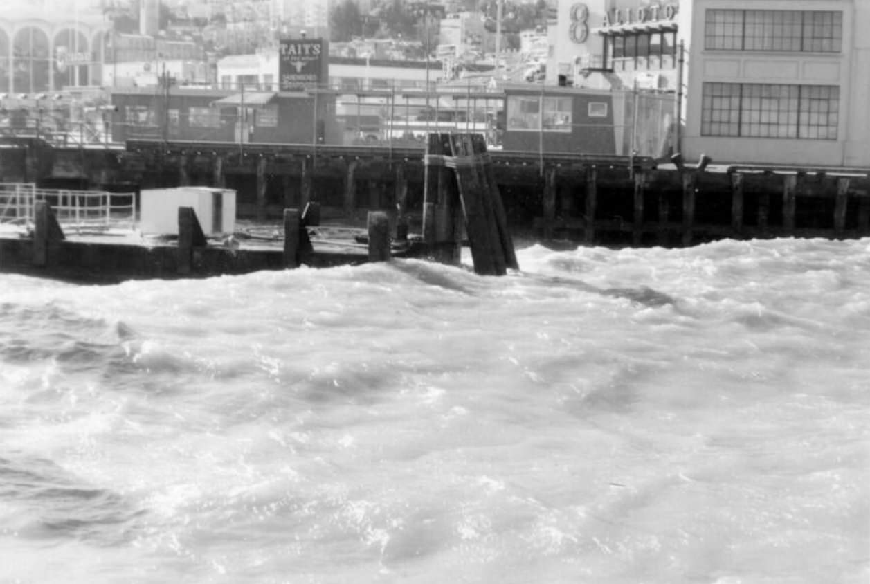
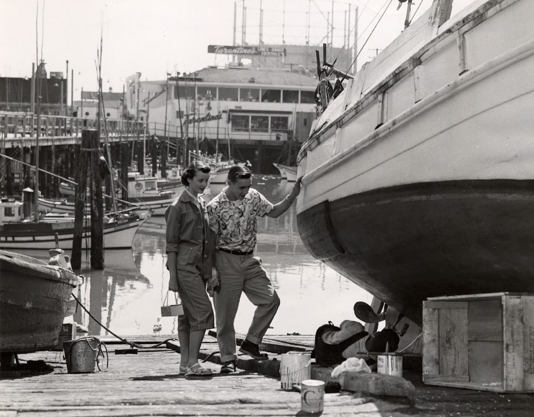
The waters around Fisherman’s Wharf reflected the bay’s moods throughout the year — calm and glittering on clear summer mornings, dark and choppy when the afternoon winds picked up or fog rolled in. The wharf’s pilings and boats absorbed years of salt and weather, giving the docks a worn, authentic quality that the growing tourist industry actually found appealing. The smell of crab pots, diesel exhaust, and salt air was inseparable from the experience of being there.
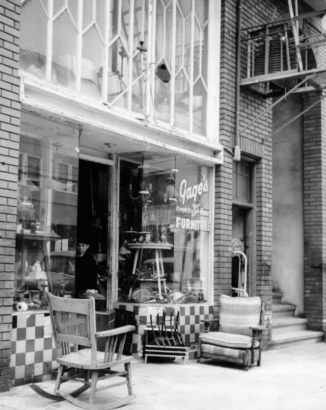
Furniture stores, appliance shops, and home goods retailers were scattered throughout San Francisco’s commercial corridors in the 1960s. A store like Gage’s, offering both new and used furniture, served working- and middle-class households that couldn’t afford the department store prices at Macy’s or the Emporium. These kinds of neighborhood businesses filled storefronts that have since become restaurants, tech offices, or simply vacant space.
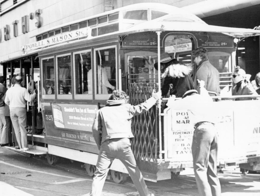
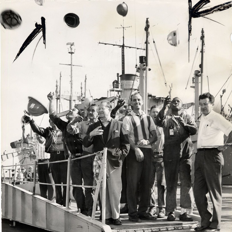
The Powell Street cable cars were among the most photographed objects in San Francisco throughout the 1960s. Riders hung off the sides of the open cars as they climbed toward Nob Hill, with the bay visible between buildings to the east. At Hunters Point in 1964, shipyard workers’ reactions to news — whether a launch, an accident, a labor dispute, or the Kennedy assassination’s lingering aftermath — captured something of the intensity that defined the decade across every part of the city, from its working docks to its counterculture stages.




