

Honolulu experienced boom times after Hawaiian statehood in 1959 and the viability of commercial air travel to the island. Tourism started to dominate the city’s economy, followed by defense expenditures and agricultural exports. Today, Honolulu is known for its world-famous Waikiki Beach, luxury shopping, and proximity to Pearl Harbor. The airplane age made Honolulu a popular tourist destination. Most visitors to Oahu arrive at Honolulu International Airport nowadays. The airport was named after Commander John Rodgers in 1932. In 1925, he became the first person to fly from the mainland to Hawaii. Getting to Hawaii and traveling to the other islands by cruise ship is possible, but most inter-island travel is handled by airlines.
Historically, the 1960s were a significant decade for Honolulu and Hawaii. The decade was shaped by volcanic eruptions, tsunamis, political change, and environmental activism. Here are some fascinating vintage photos of Honolulu in the 1960s.
Also, check what Honolulu looked like in the 1940s and 1950s.
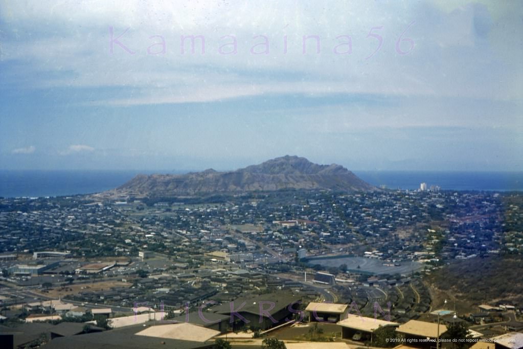
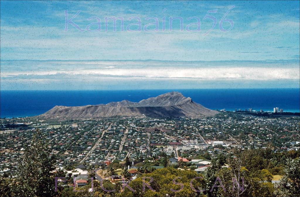
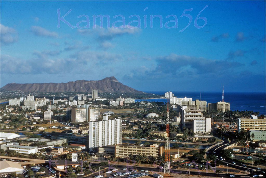
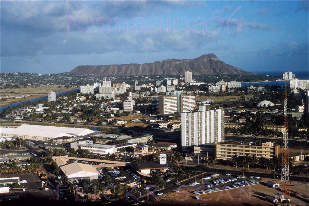
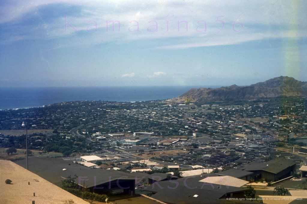
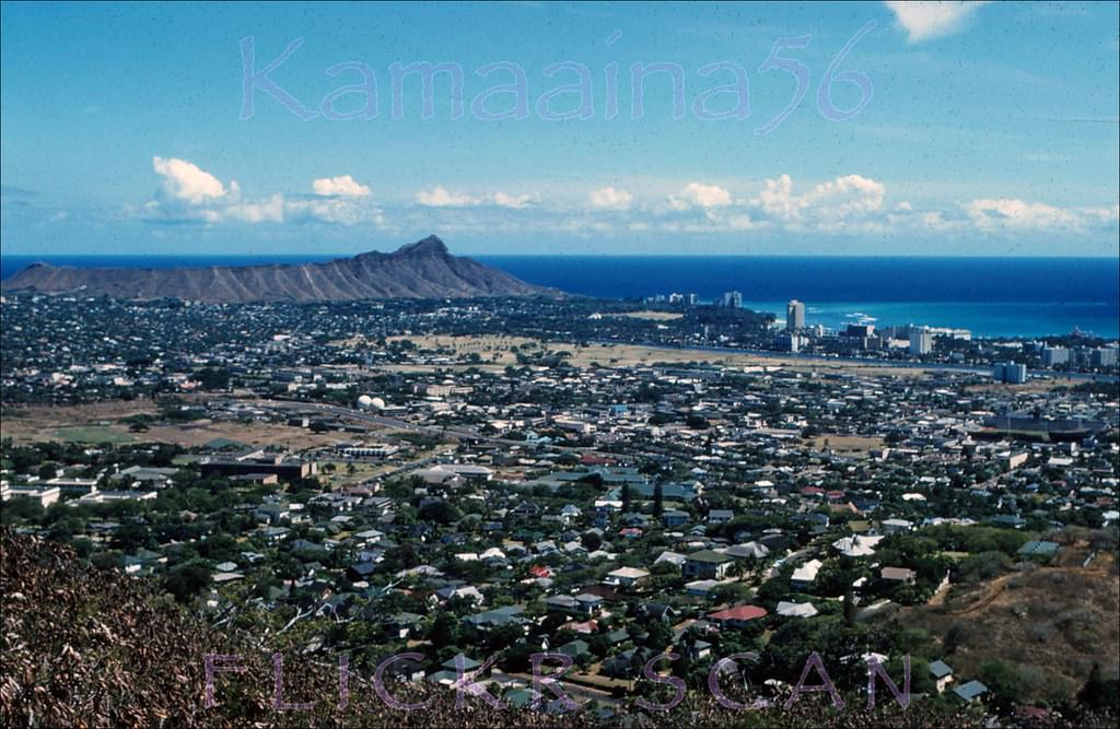
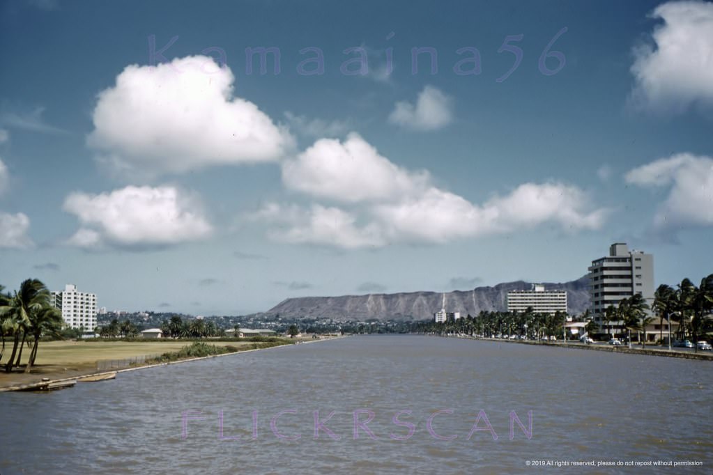
#1 Looking east to Diamond Head over Honolulu. Vintage slide marked, 1961
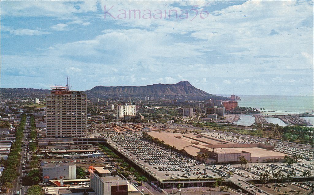
#2 Honolulu’s 1959 Ala Moana Shopping Center seen from above the intersection of Kapiolani Blvd and Piikoi Street, 1960
#3 Ala Moana Center Piikoi, 1962
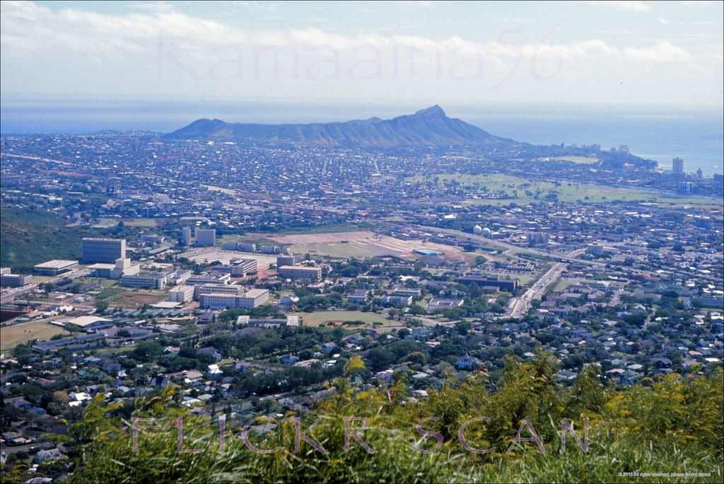
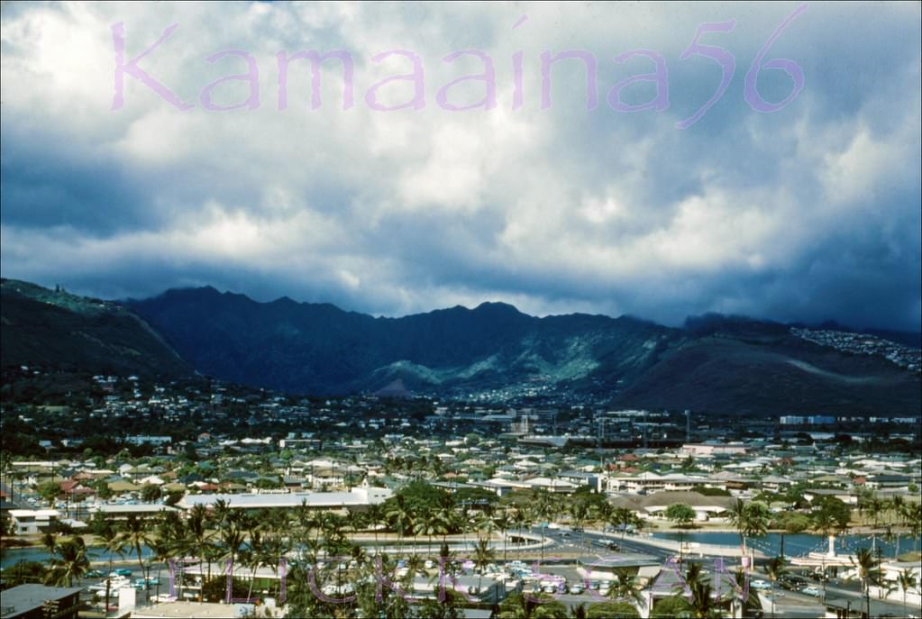
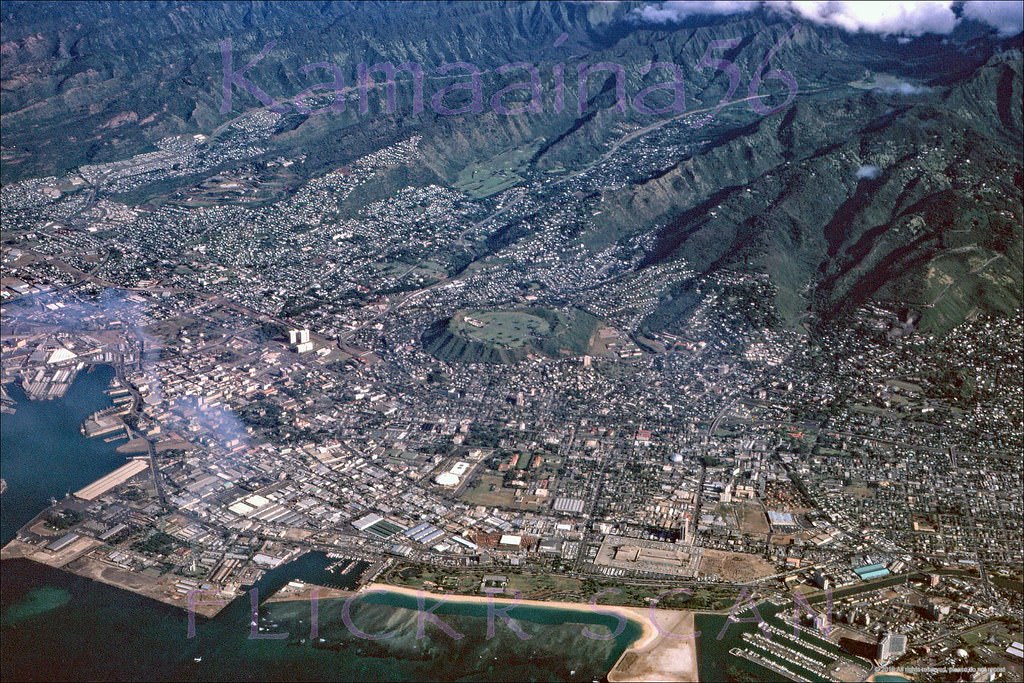
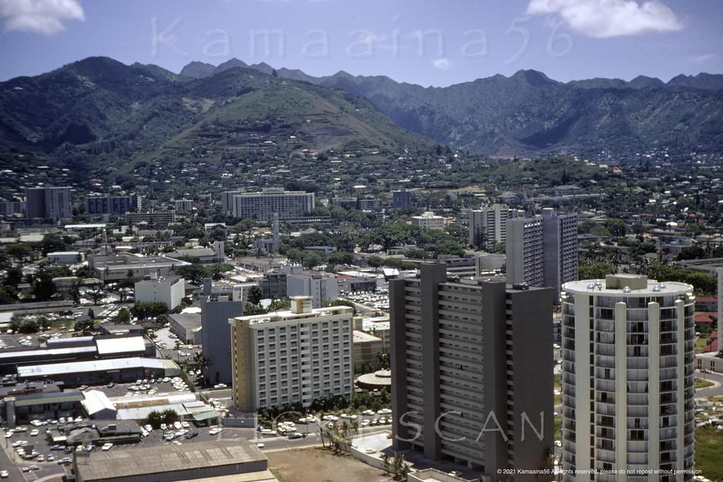
#4 UH Manoa Birdseye Honolulu, 1960s
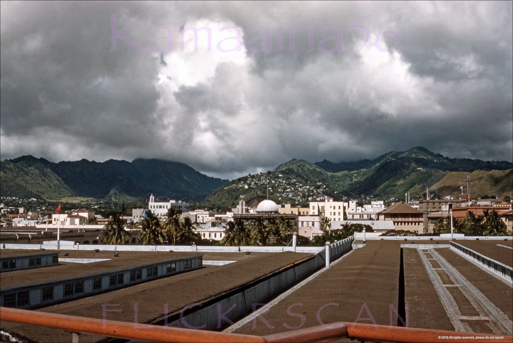
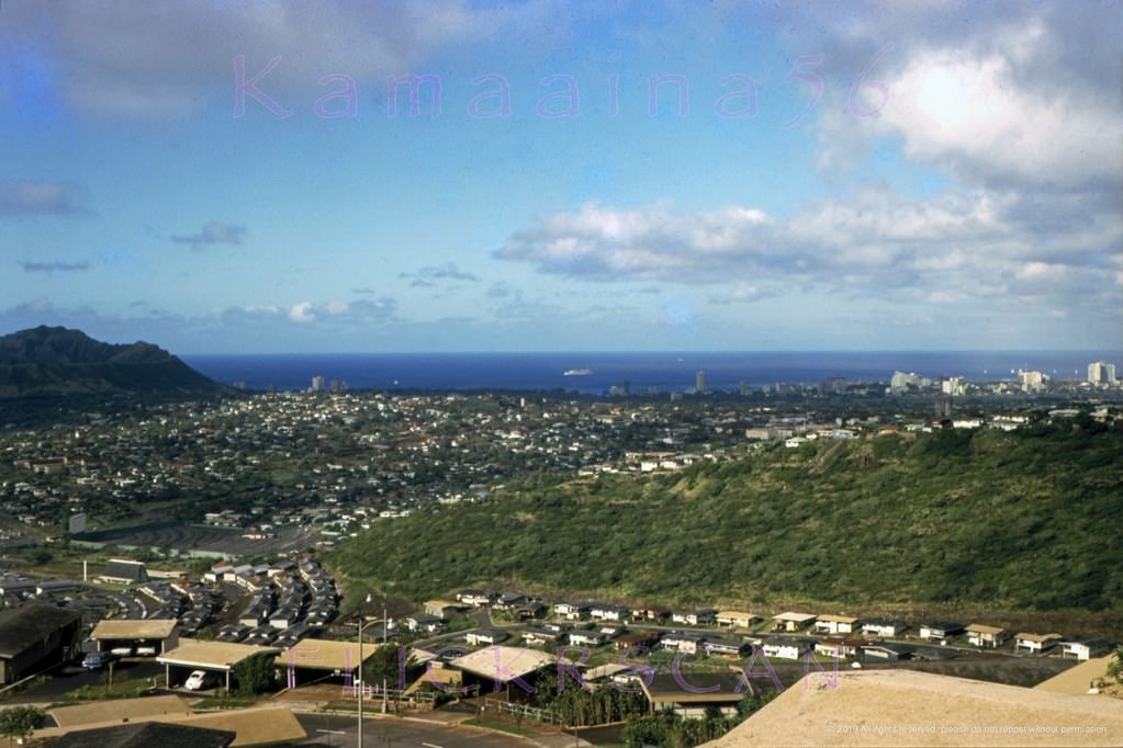
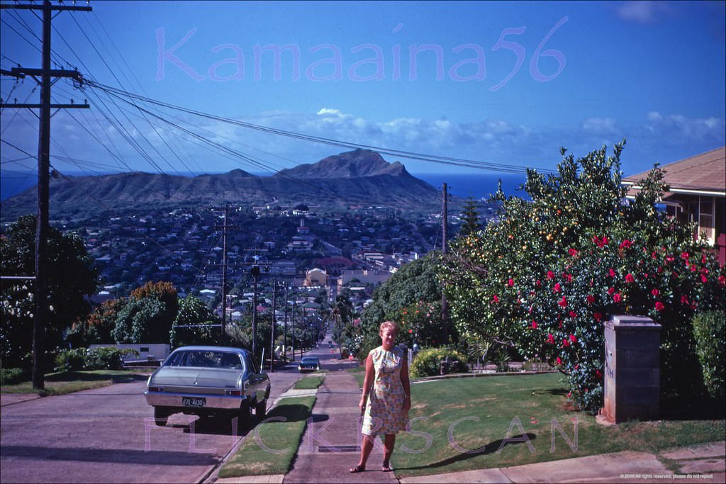
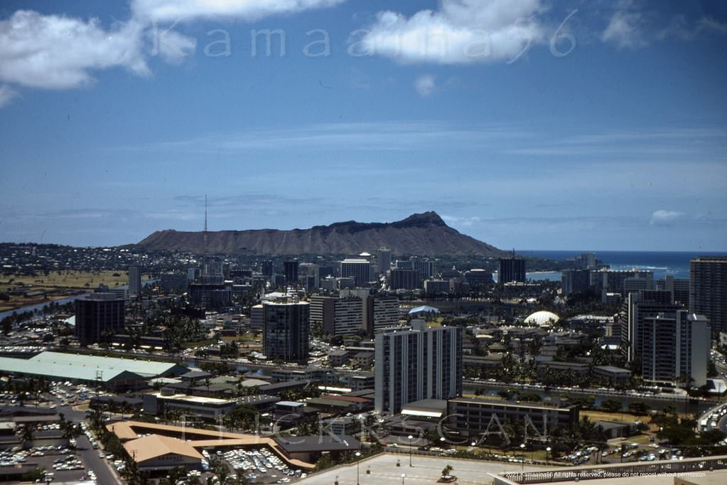
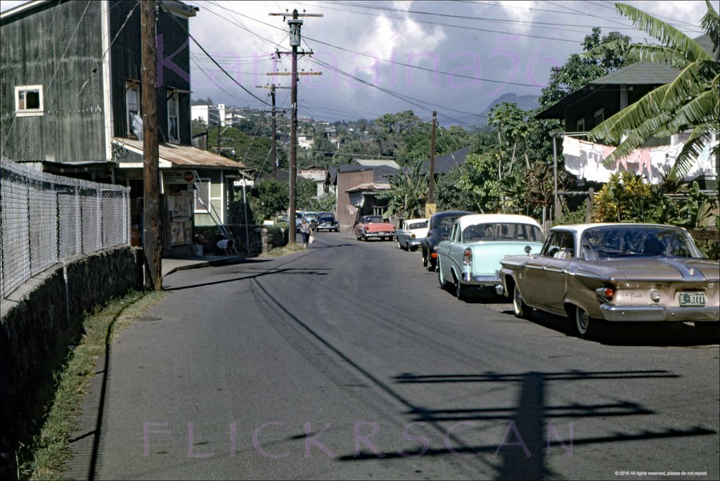
#5 View is from Halekoa Drive on Waialaie Nui Ridge (then known as Waialae Uplands) looking Diamond Head, 1965
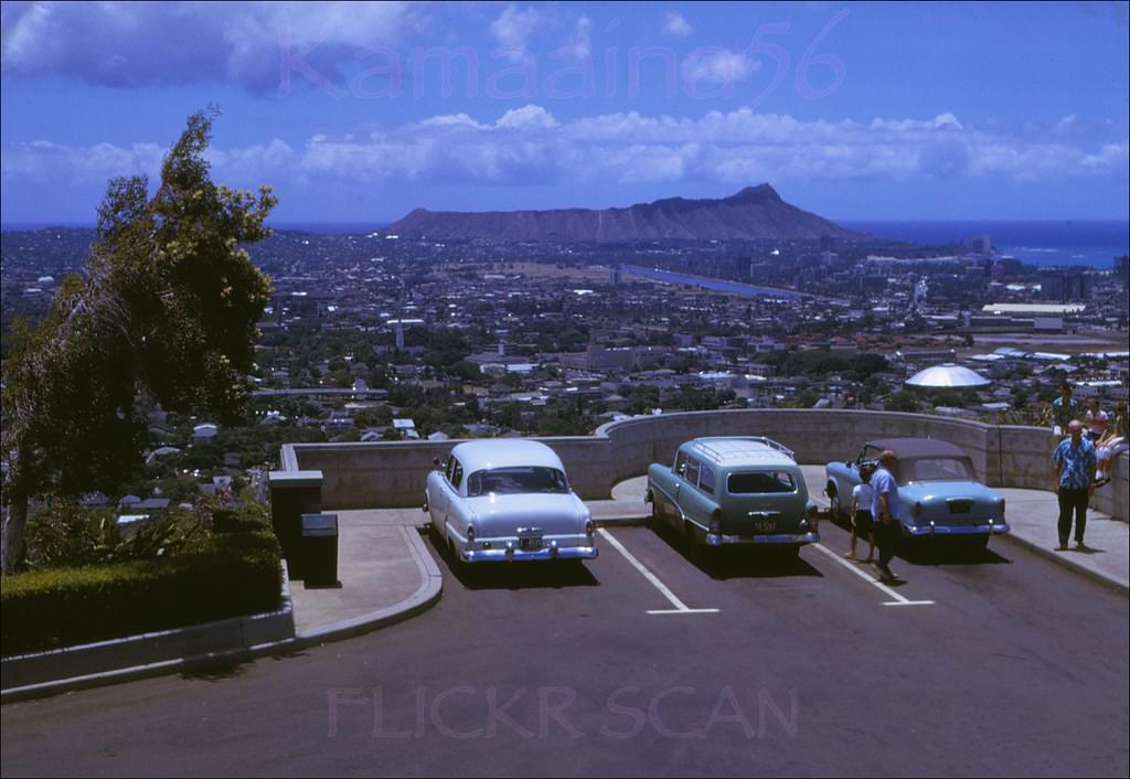
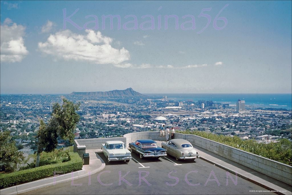
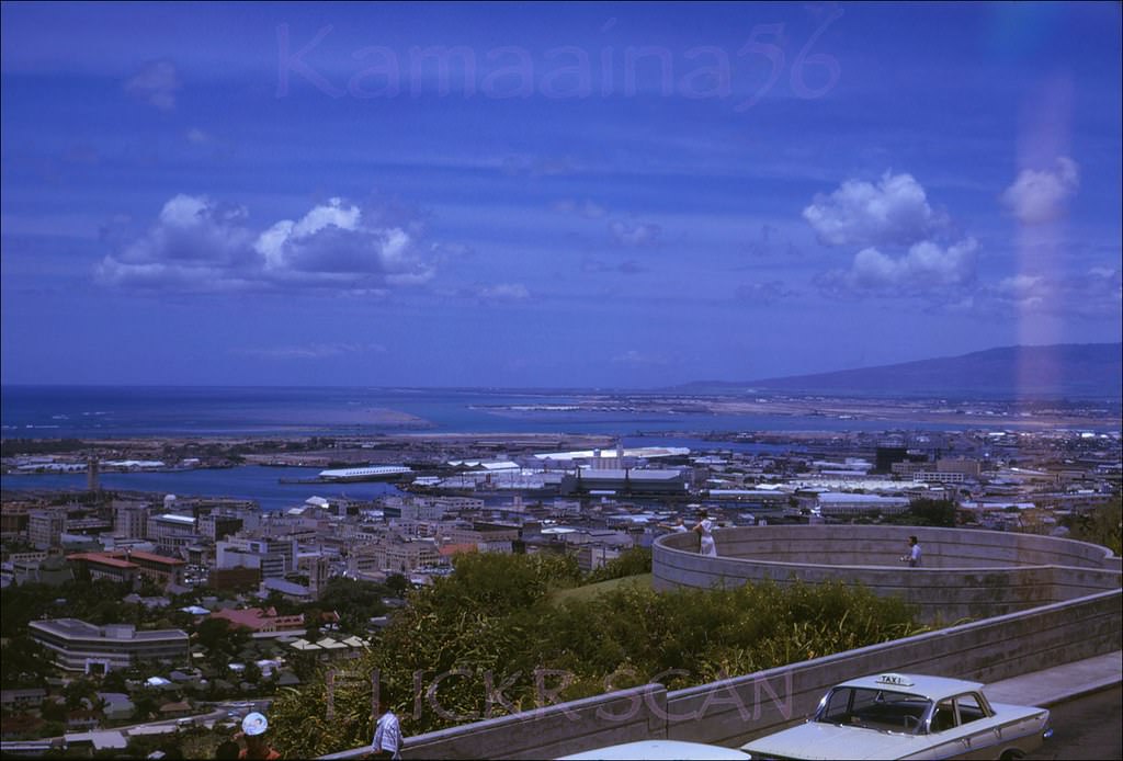
#6 Looking Diamond Head over Honolulu from the old lookout at Punchbowl Crater, 1961.
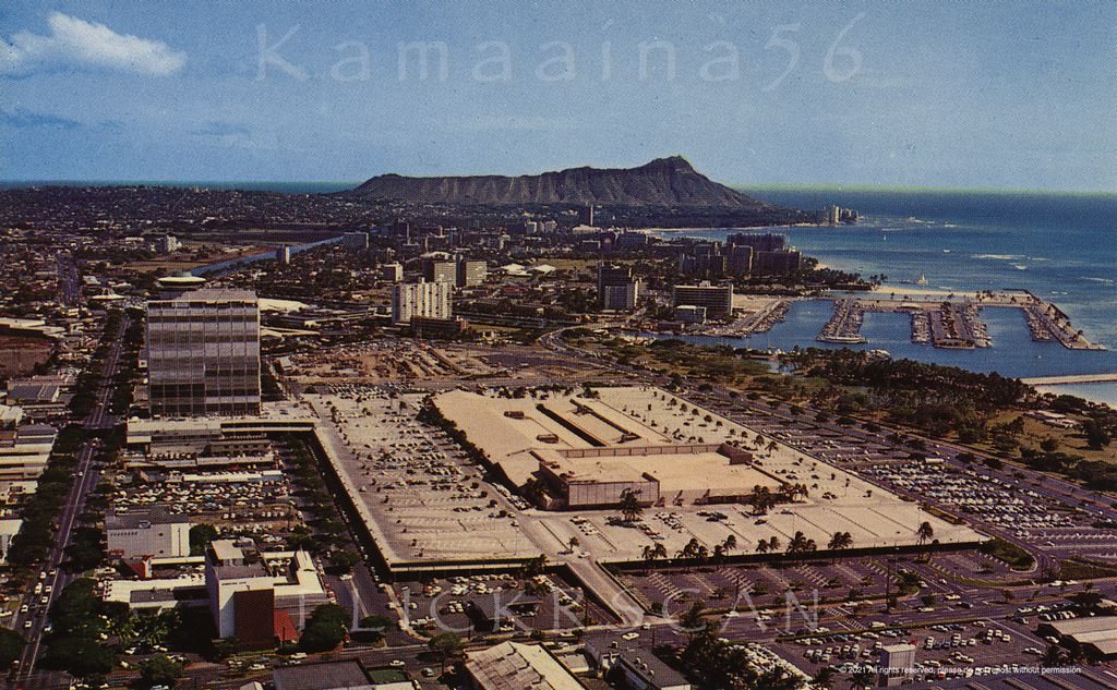
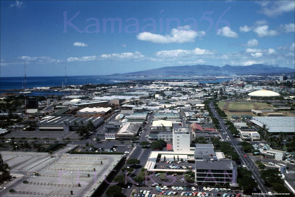
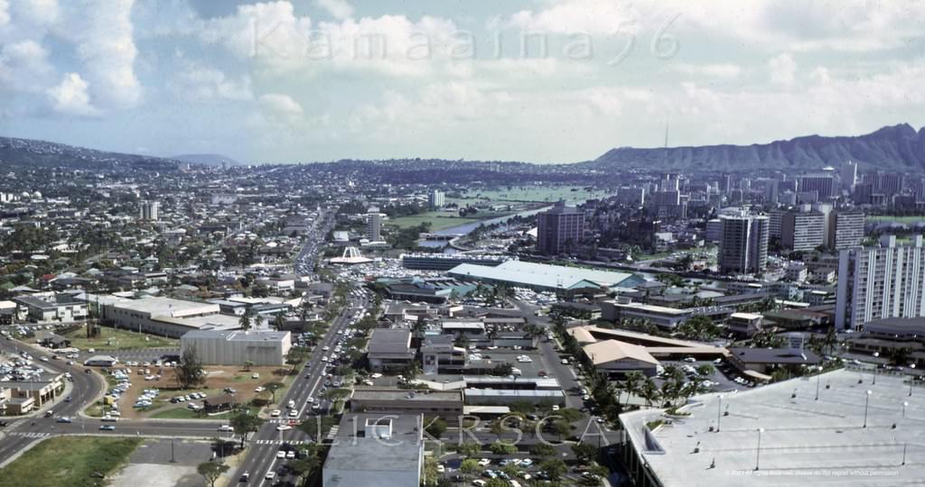
#7 Ala Moana Birdseye, 1966
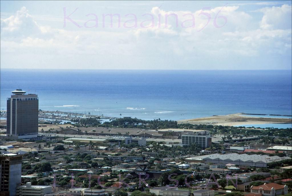
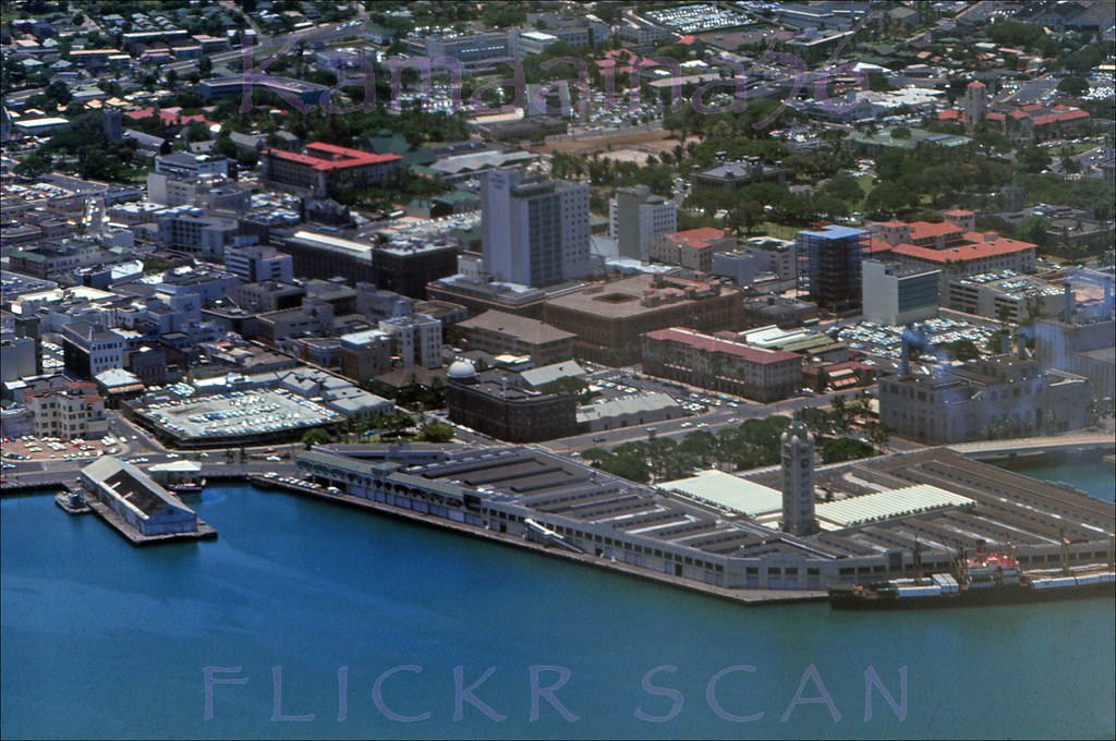
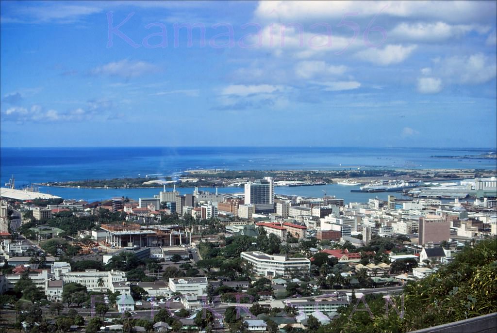
#8 Downtown Honolulu and the harbor area viewed from Punchbowl Crater, 1967
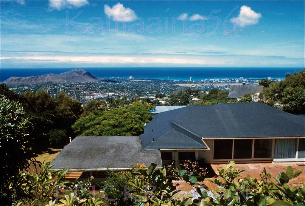
#9 Diamond Head Wilhelmina, 1962
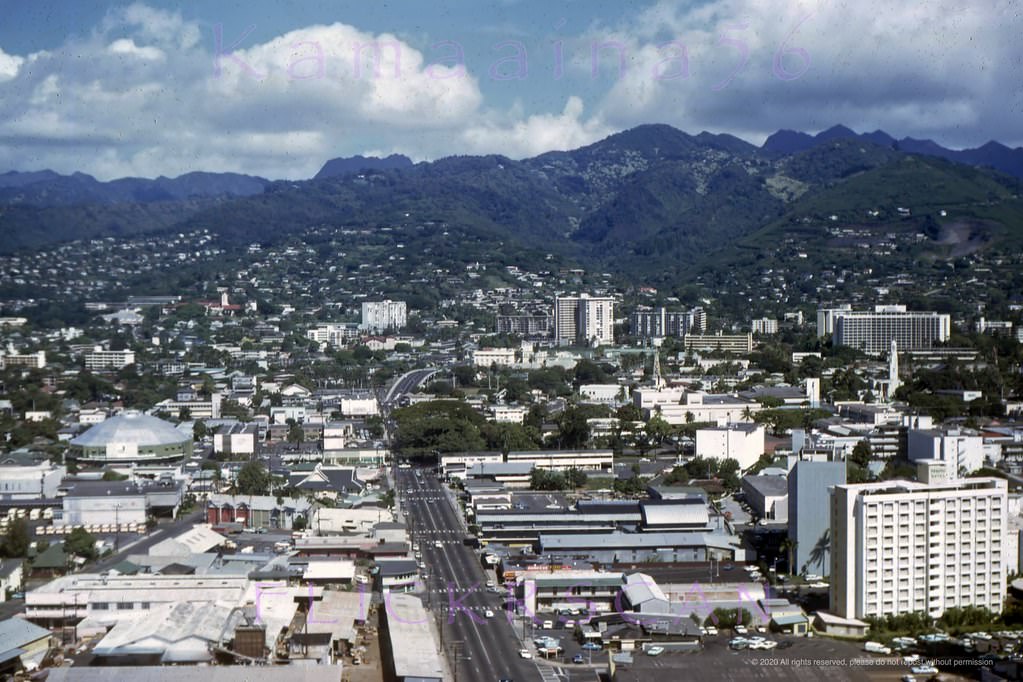
#10 Birdseye view looking mauka towards Manoa Valley from the McCully Street bridge over the Ala Wai Canal that connects Waikiki with the rest of Honolulu, 1960
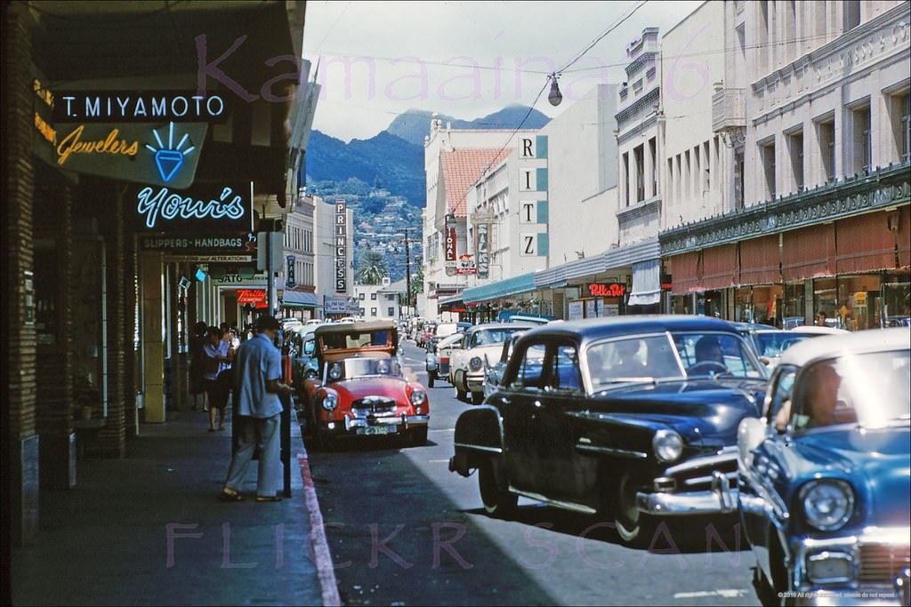
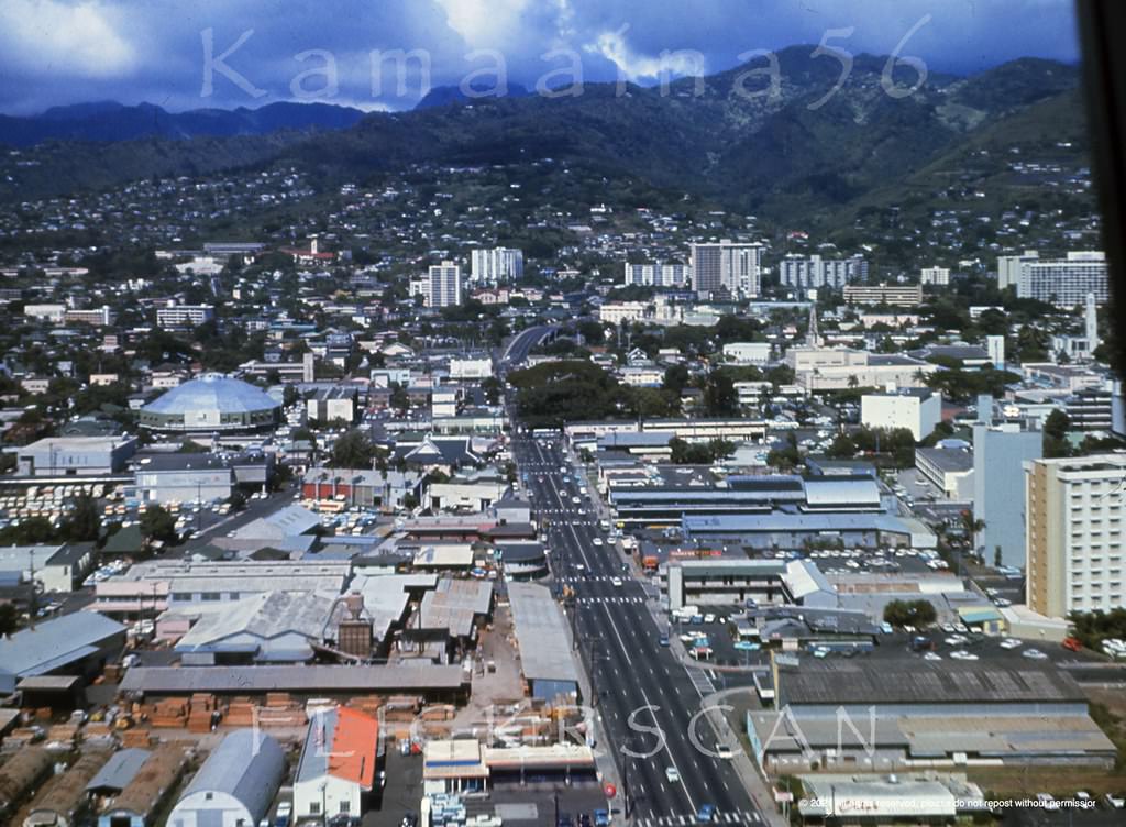
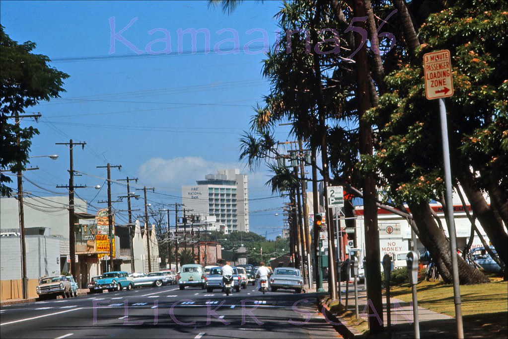
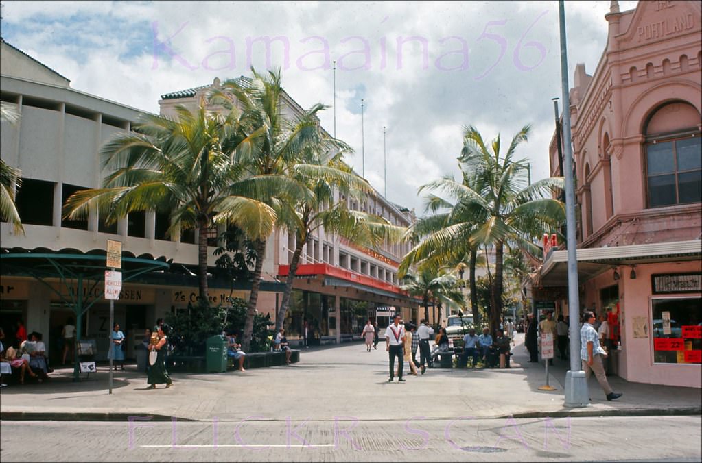
#11 Honolulu’s University Avenue near the intersection with South King Street in Moiliili, 1968
#12 On Pali Highway at Vineyard, built 1963 and still there today looking much the same, 1960s
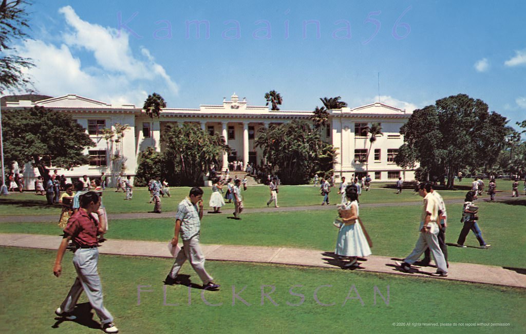
#13 Hawaii Hall UH Manoa, 1961
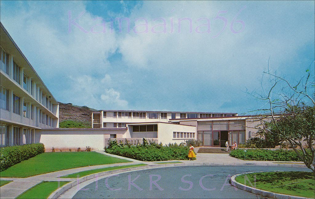
#14 Exterior view of Mary Dillingham Frear Hall, the oldest women’s dormitory at the University of Hawaii’s Manoa Valley campus, 1961
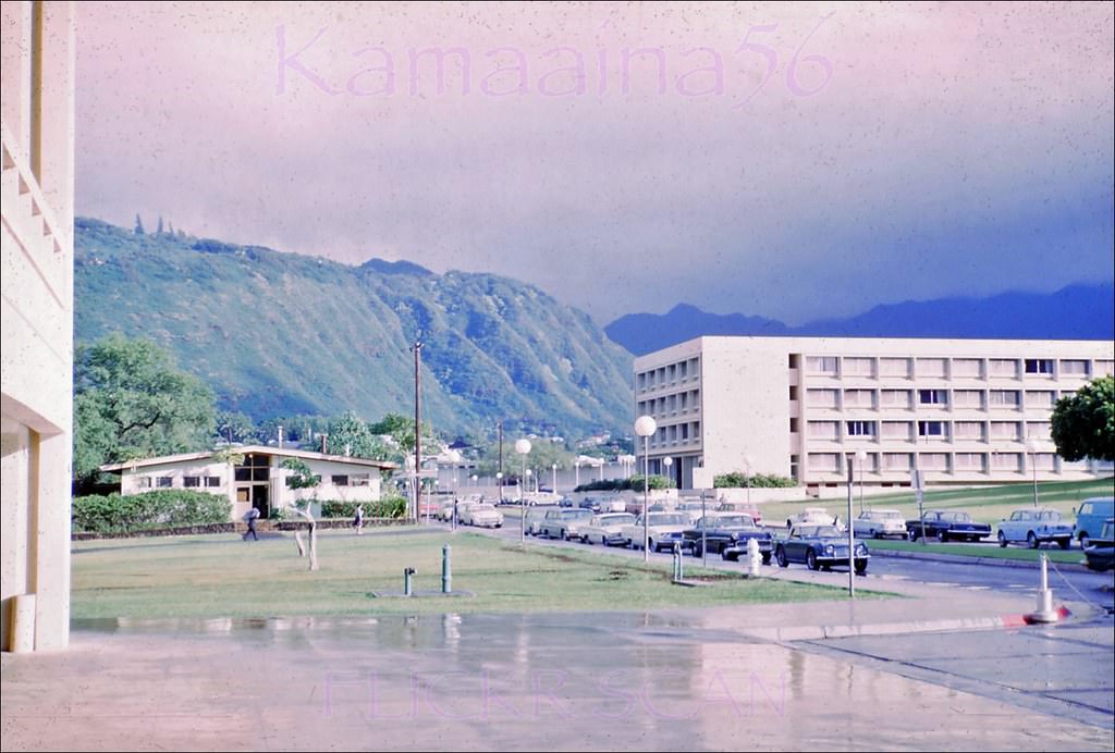
#15 Looking mauka along East-West Road at the University of Hawaii’s Manoa Campus in Honolulu, 1967
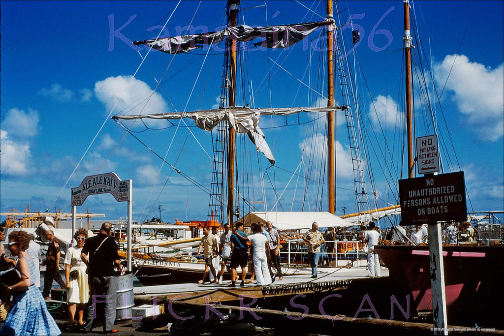
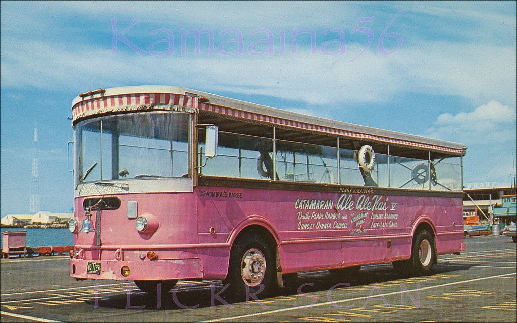
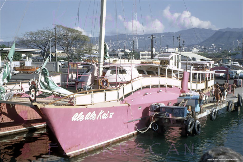
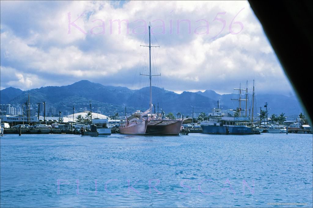
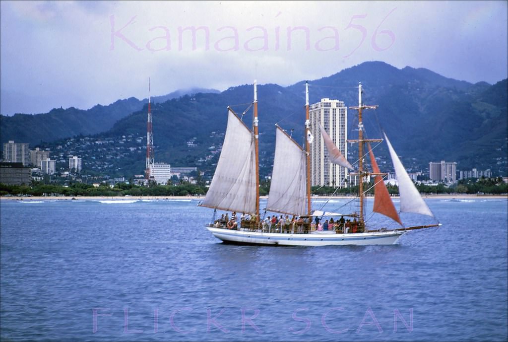
#16 Industrialist Henry J. Kaiser’s big pink catamaran Ale Ale Kai V moored in Kewalo Basin on south shore Oahu, 1968
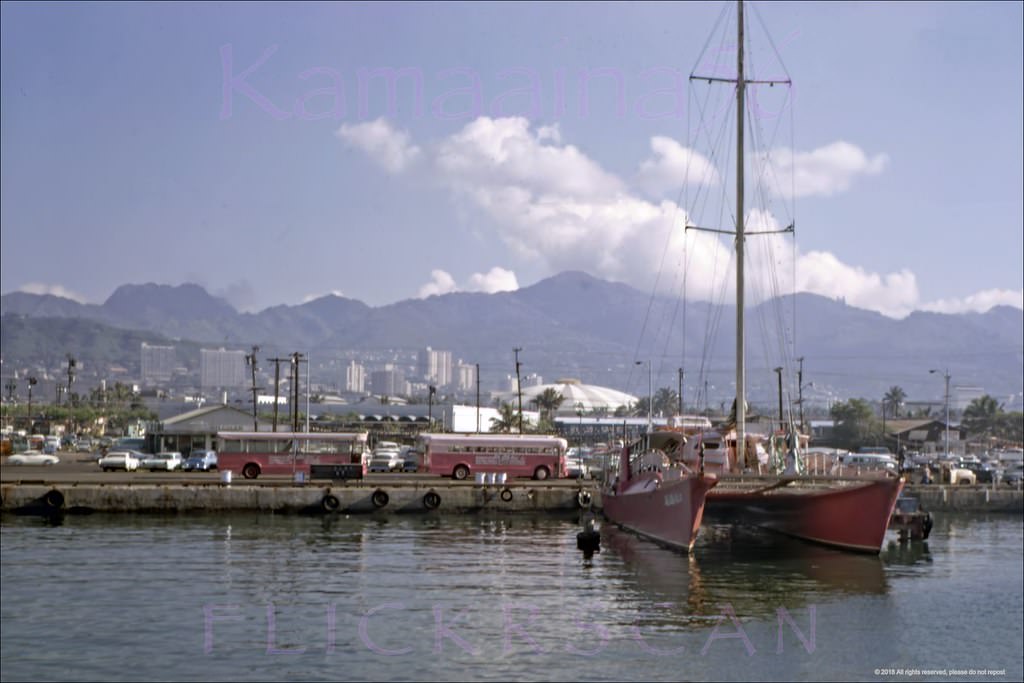
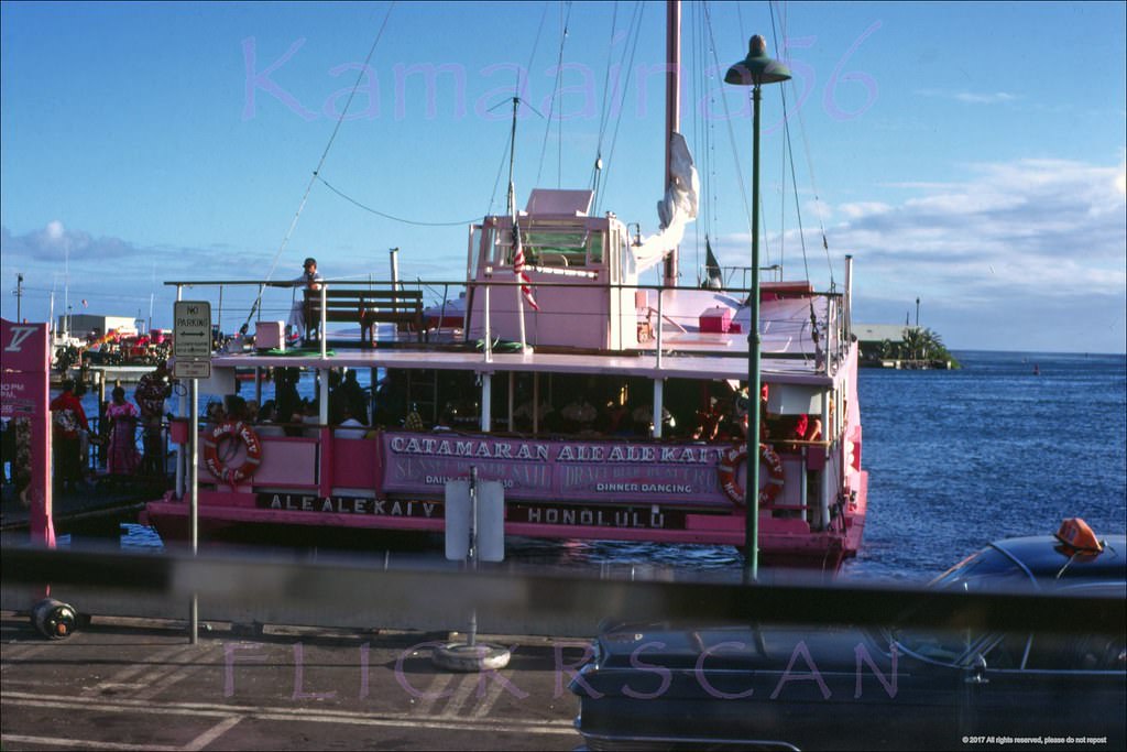
#17 Ale Ale Kai Kewalo Honolulu, 1962
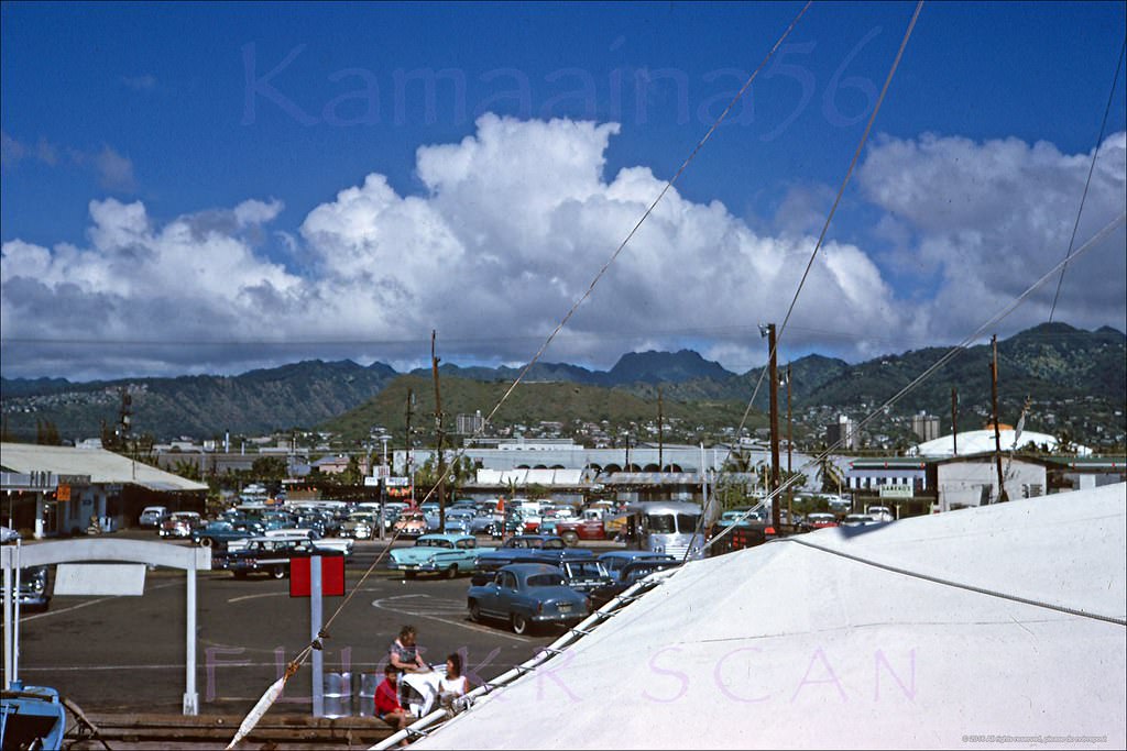
#18 Kewalo Basin, Honolulu, in front of the old Fisherman’s Wharf Restaurant out of the frame to the left, 1968
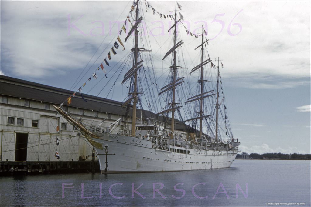
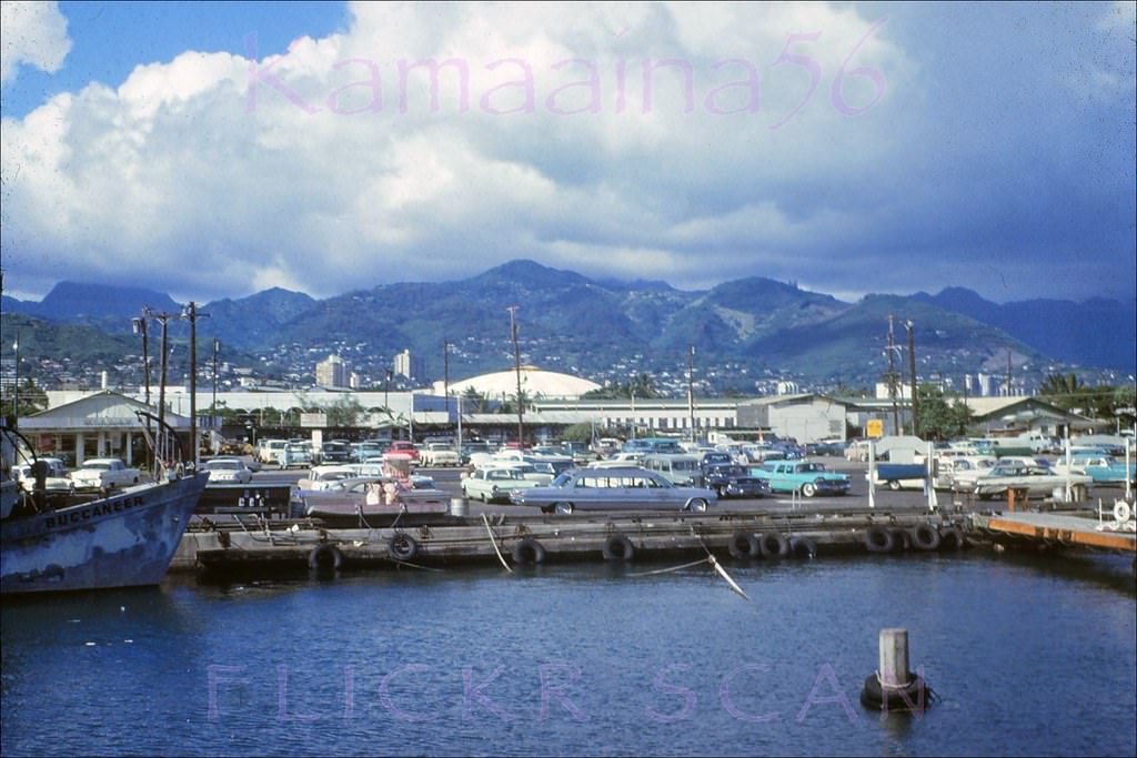
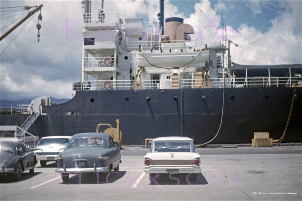
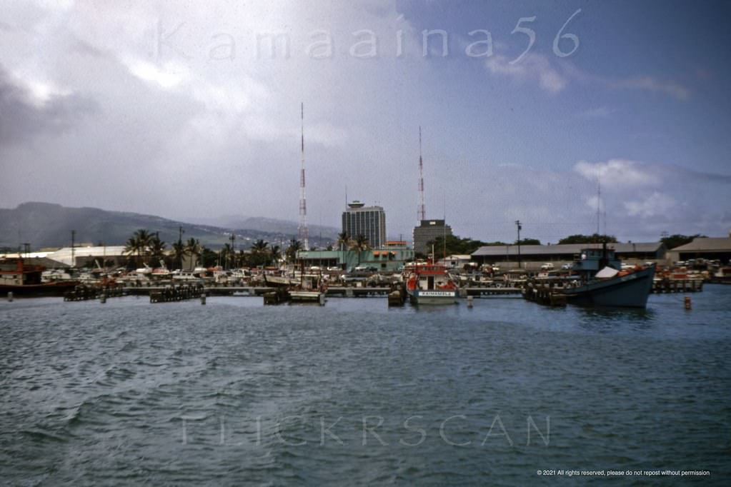
#19 Kaiwo Maru Pier 6 Honolulu, 1960
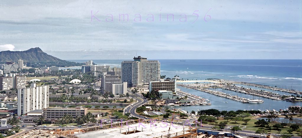
#20 Slightly shifted birdseye view of Waikiki and Diamond Head apparently from the 23-story 1961 Ala Moana Towe, 1962
#21 Birdseye view of the Ala Moana area of Honolulu and Waikiki looking Diamond Head from the LaRonde revolving restaurant atop the 23-story 1961 Ala Moana Tower, 1962
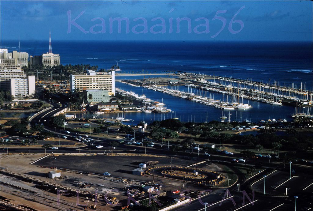
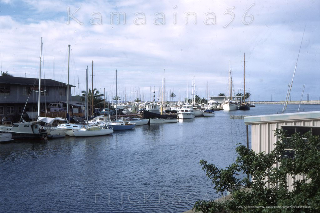
#22 Ala Wai Harbor Panorama, 1962
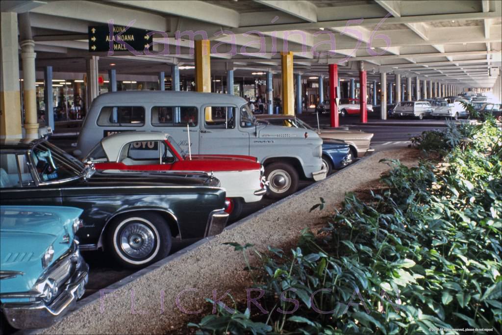
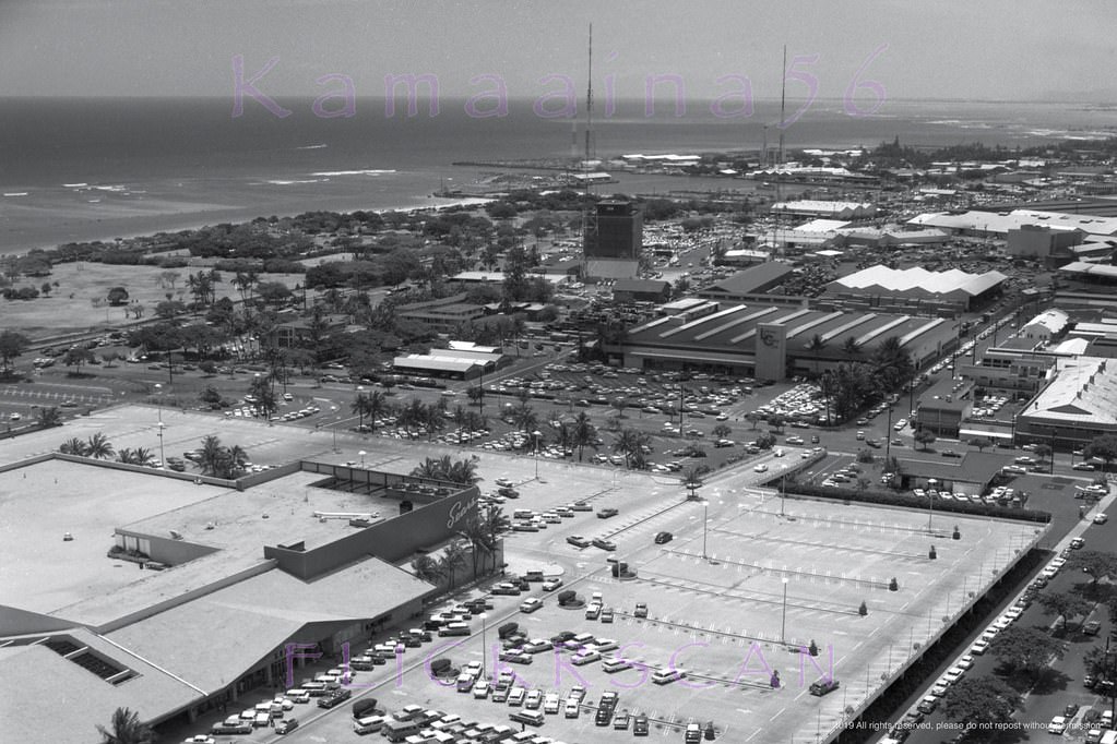
#23 Kind of unusual to see a photo of the parking garage at Ala Moana Center, 1966
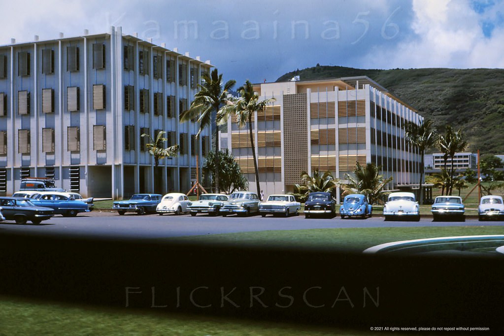
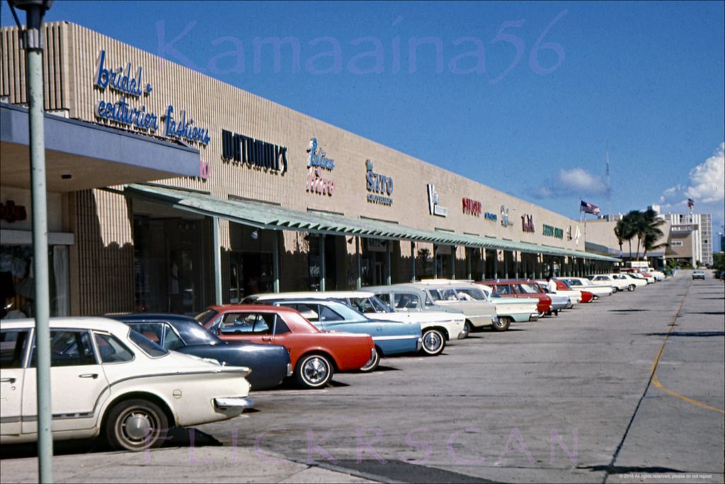
#24 Ala Moana Center Drive-by, 1960
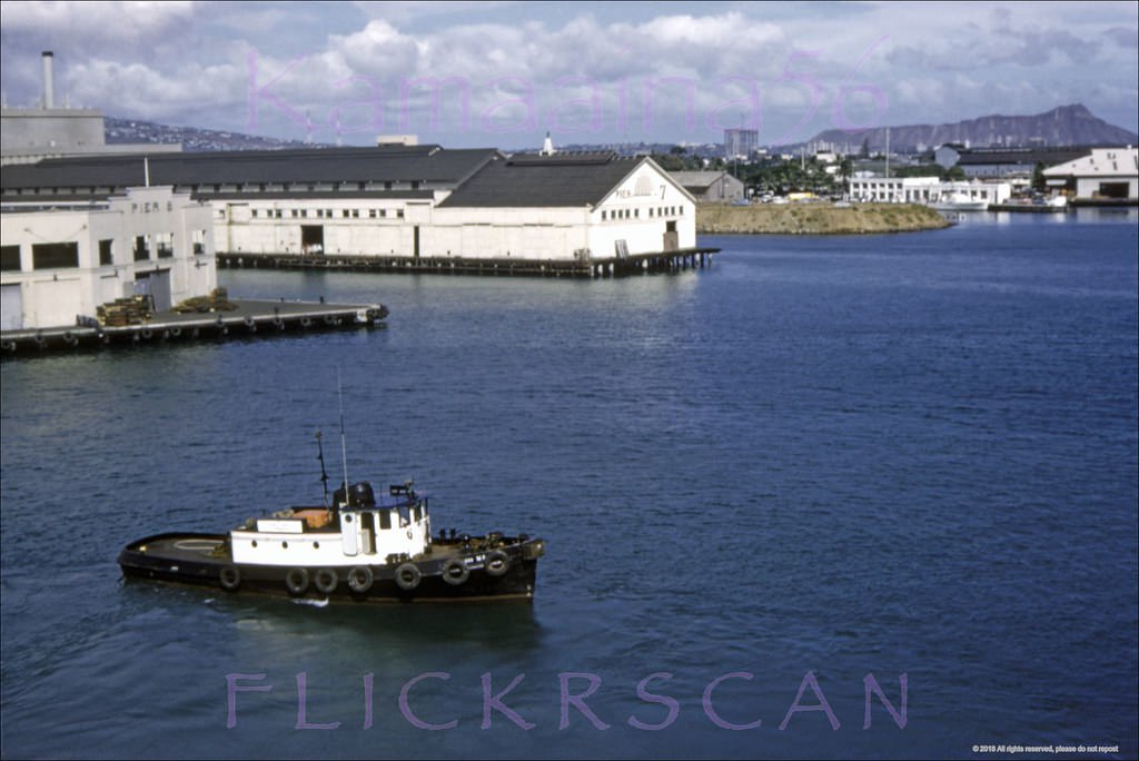
#25 Honolulu Harbor Mauka, 1961.
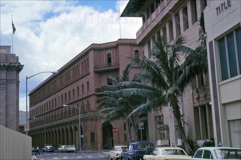
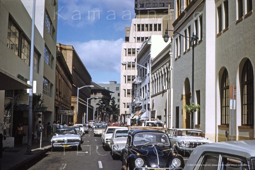
#26 Looking mauka along Fort Street in downtwon Honolulu from just above the Hotel Street intersection, 1961
#27 Ala Moana Honolulu Birdseye, 1964
#28 Overlooking Honolulu south to the harbor and west out to the Ewa plain, 1961
#29 Birdseye view from Halekoa Drive on Waialaie Nui Ridge (then known as Waialae Uplands), 1965
#30 Birdseye view from Halekoa Drive on Waialaie Nui Ridge (then known as Waialae Uplands) looking Waikiki, 1965
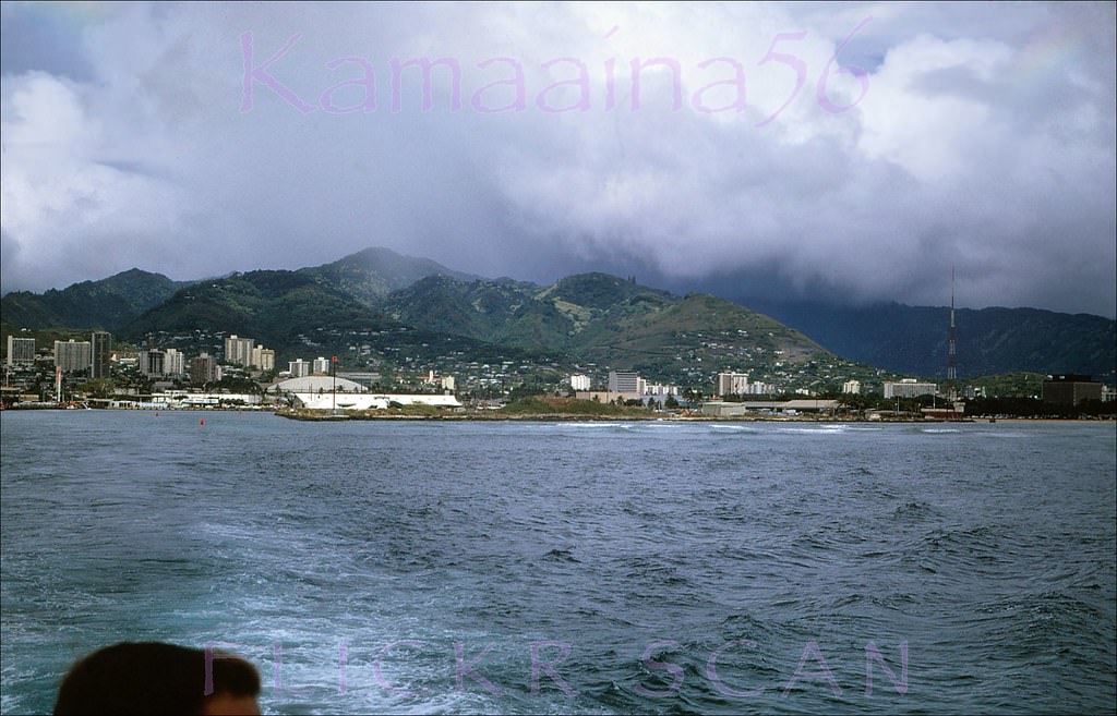
#31 Waikiki from Wilhelmina Rise, 1962
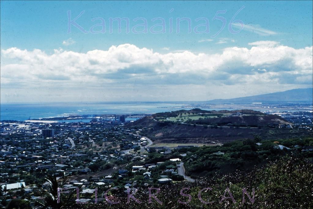
#32 Looking towards Punchbowl Crater and Honolulu Harbor, 1962
#33 Looking makai along Wilhelmina Rise above the Honolulu neighborhood of Kaimuki, 1968
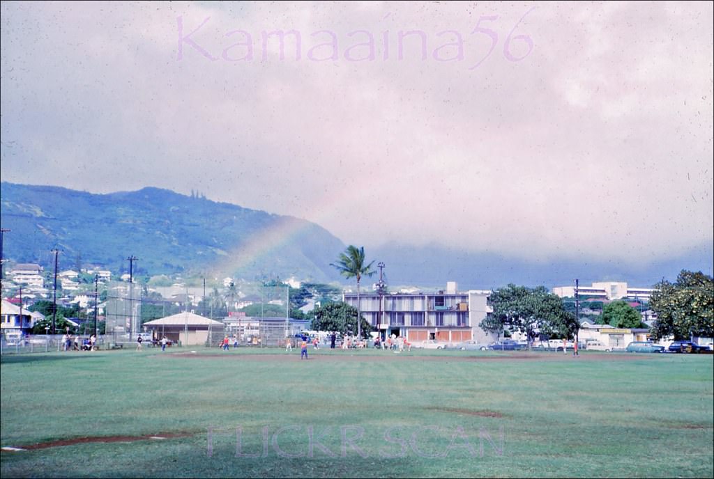
#34 Moilili Rainbow Honolulu, 1967
#35 The University of Hawaii’s 1949 administration building viewed from Dole Street near University Avenue, 1961
#36 UH Hawaii Hall McCarthy Road, 1961
#37 Webster and Snyder Halls (built 1962) at the University of Hawaii’s Manoa Campus in Honolulu, 1963
#38 Looking more or less south over the University of Hawaii’s Manoa Valley Campus towards Honolulu and Waikiki with Diamond Head Crater in the distance, 1960s
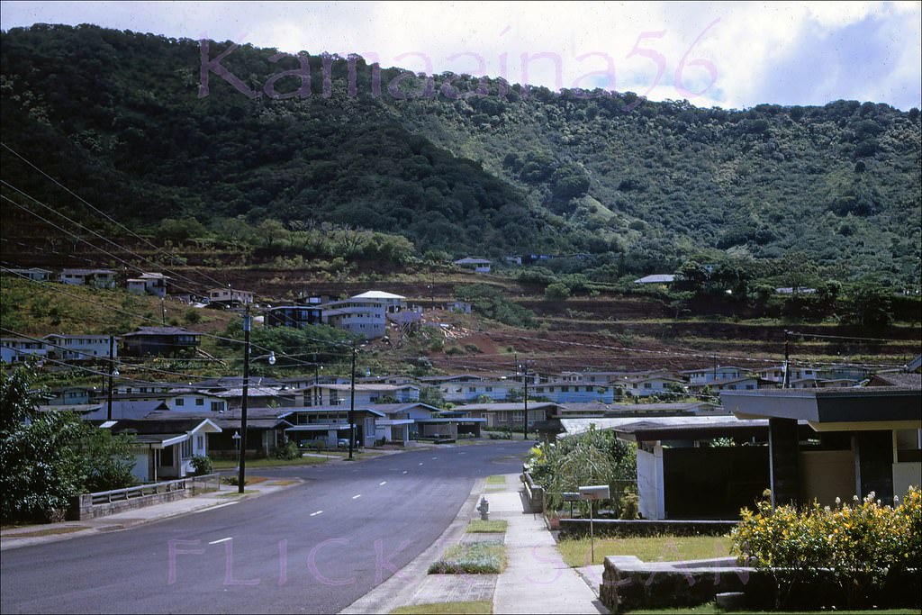
#39 Pawaina Street in upper Manoa Valley, Honolulu, with Pinao Street on the left, 1968
#40 Oahu Avenue in upper Manoa Valley, Honolulu, 1968
#41 Kapiolani Palms Honolulu, 1960
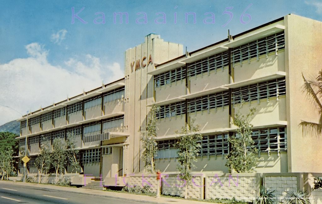
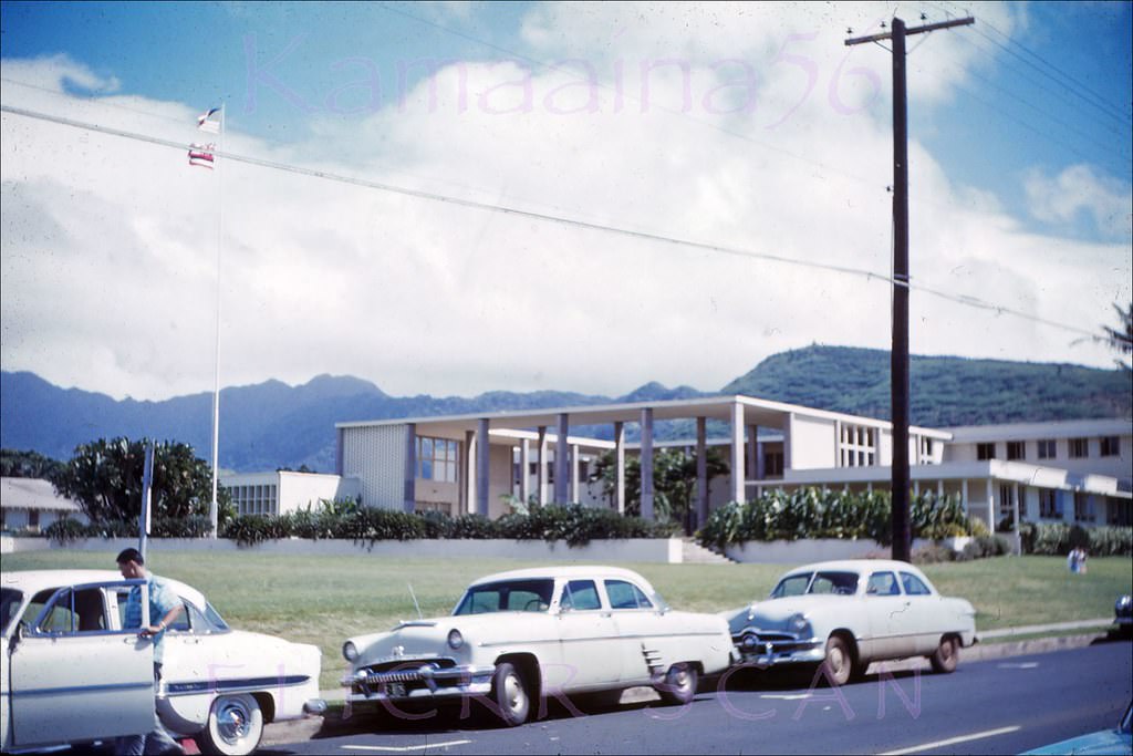
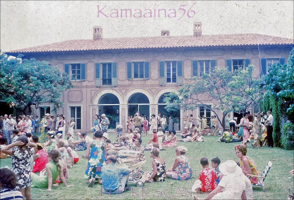
#42 La Pietra School Hawaii, 1968
#43 McCully at Ala Wai Honolulu, 1961
#44 Looking ewa along the Ala Wai Canal between Waikiki on the left and the Kapahulu neighborhood in Honolulu, 1960
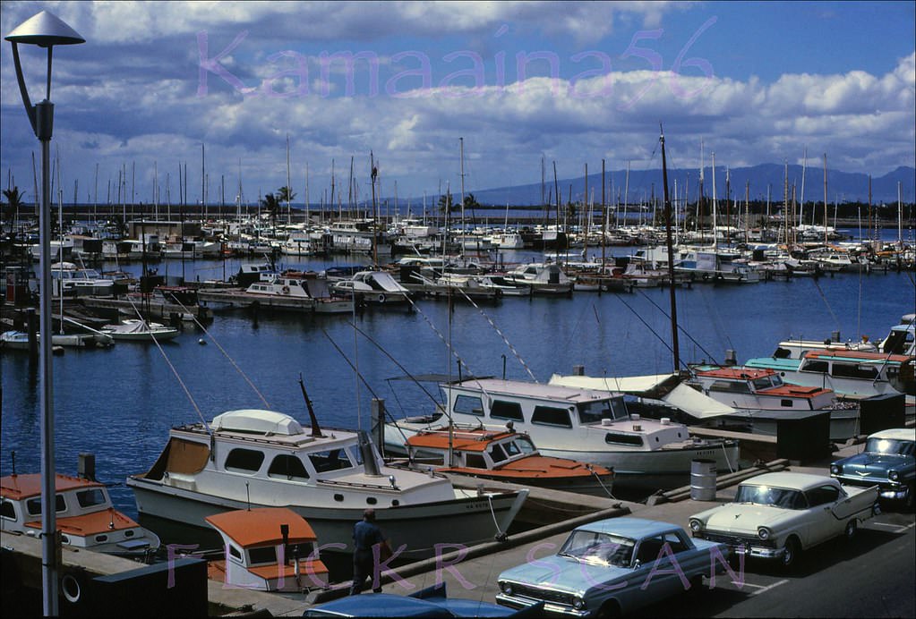
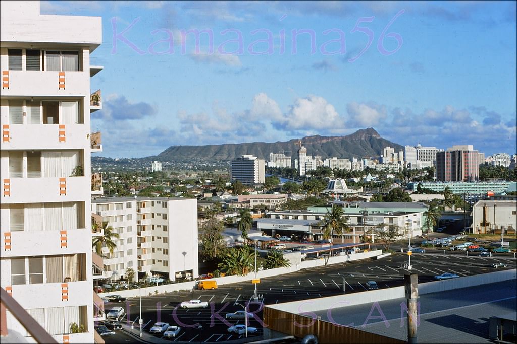
#45 Ala Wai Yacht Harbor on south shore Oahu viewed from the Ilikai Hotel deck, 1965
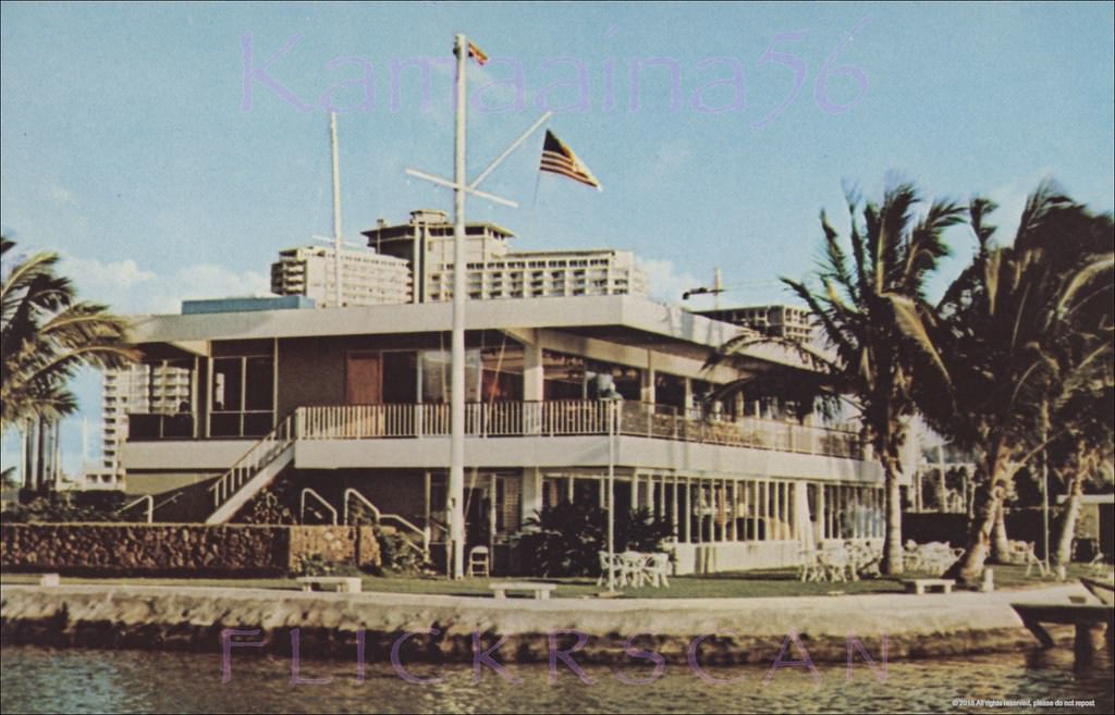
#46 Hawaii Yacht Club Ala Wai, 1965
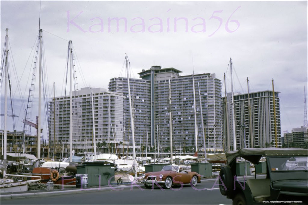
#47 likai HHV Towers Ala Wai, 1968
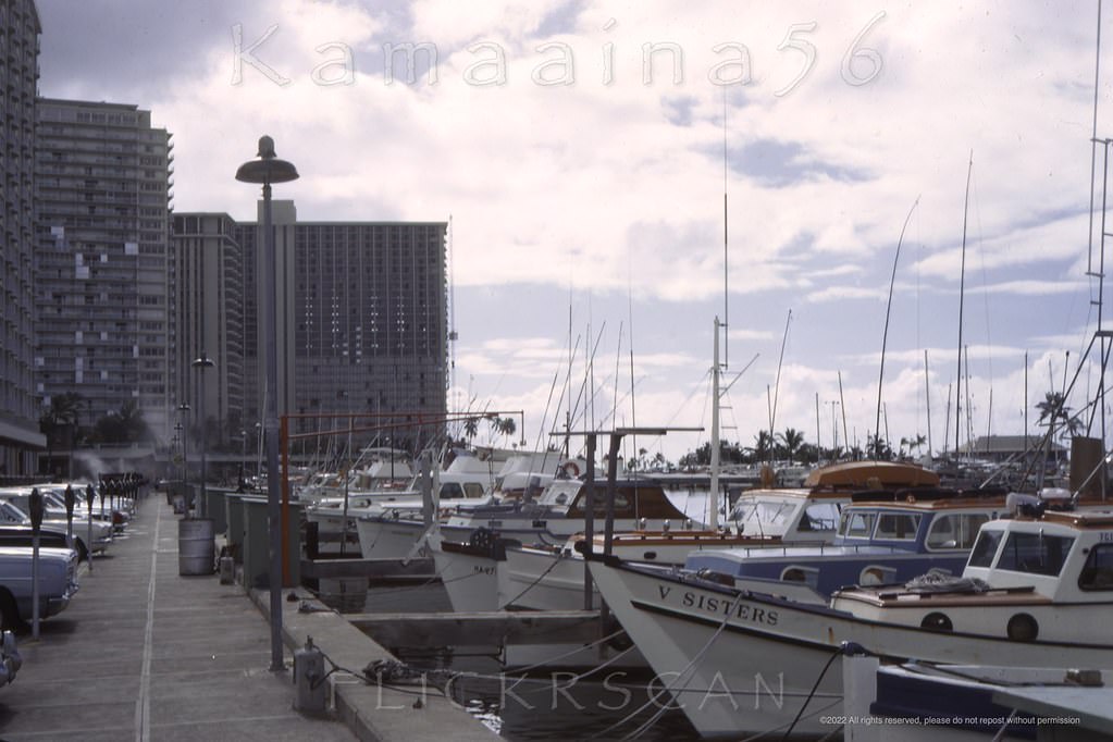
#48 The waterfront at Ala Wai Yacht Harbor on Oahu’s south shore, 1967
#49 Makai (seaward) view of Ala Wai Yacht Harbor at the mouth of the Ala Wai Canal which divides Waikiki from the rest of Honolulu, 1968
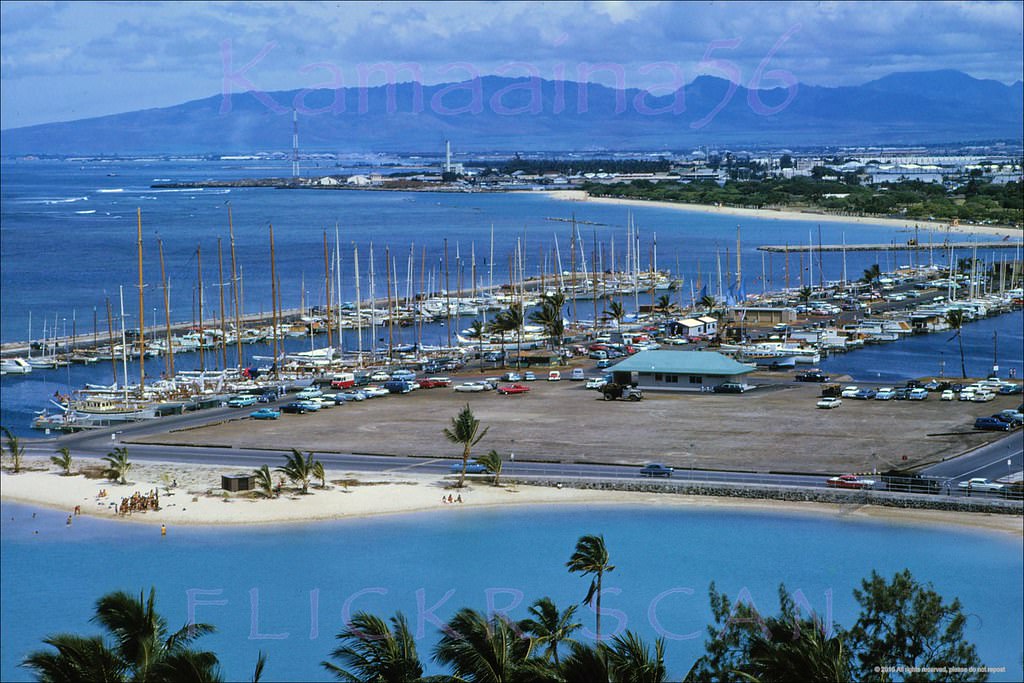
#50 Ala Wai Harbor Birdseye, 1961
#51 Ala Wai Harbor Ewa View, 1961
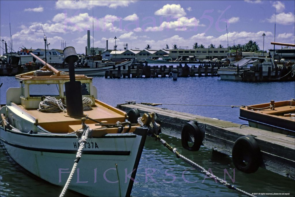
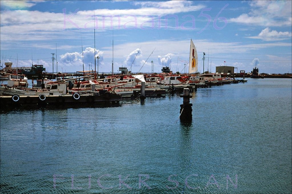
#52 Wooden “sampan” tuna boats docked at Fisherman’s Wharf on Kewalo Basin in Honolulu, 1960
#53 Aku Boats Kewalo Basin, 1967
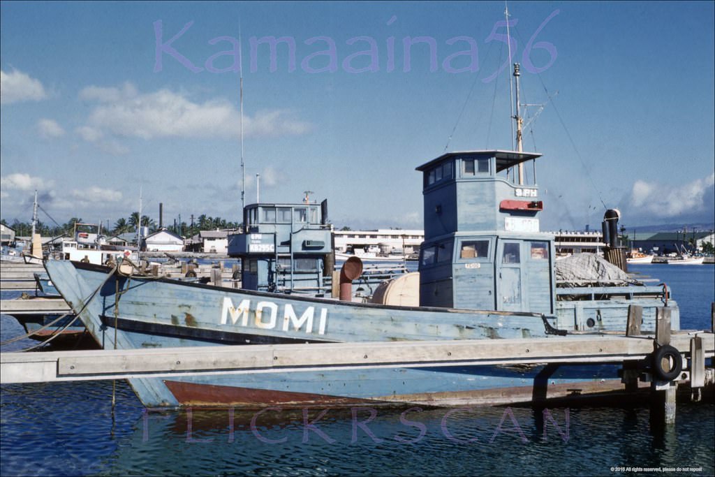
#54 Kewalo Aku Boats Honolulu, 1960
#55 Still Life Kewalo, 1960
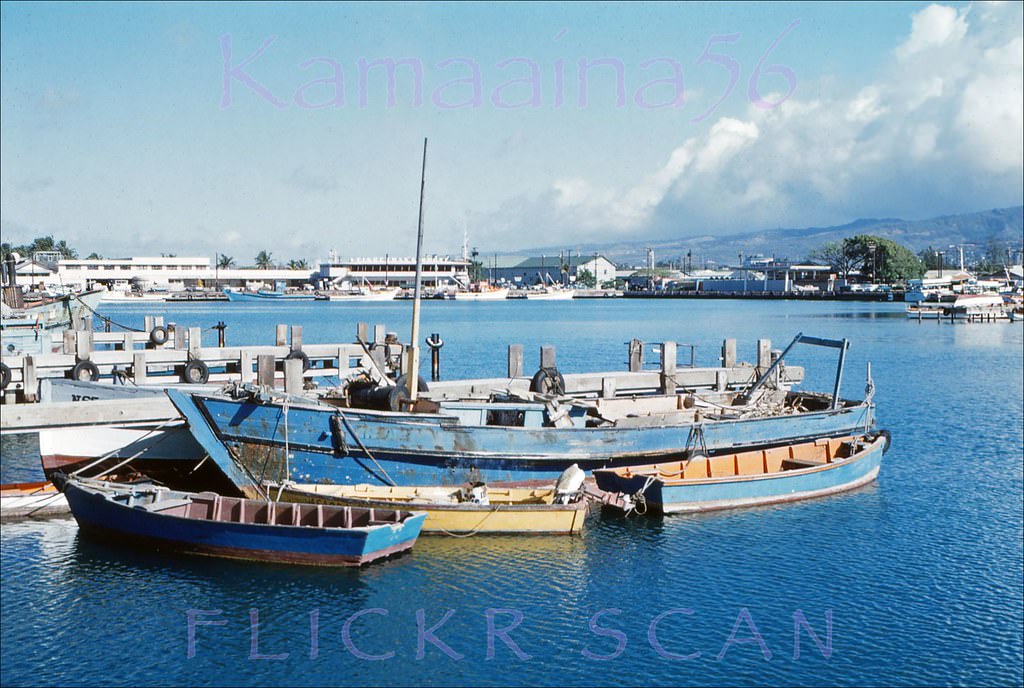
#56 Kewalo Sampans Honolulu, 1967
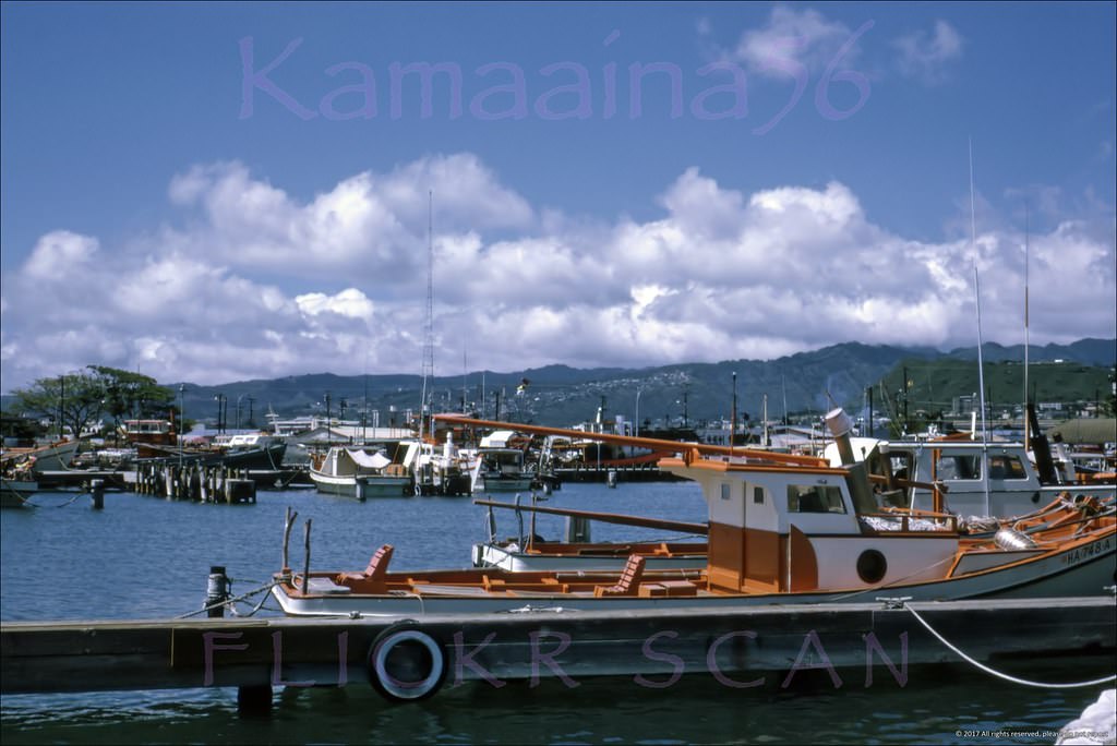
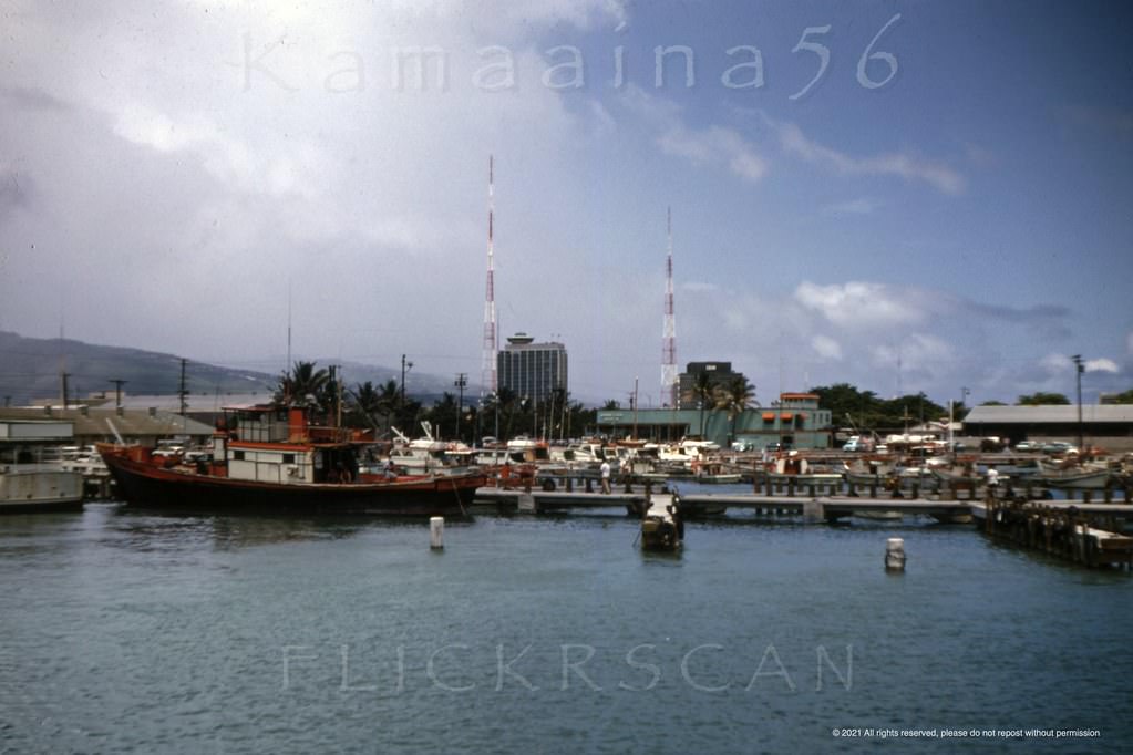
#57 Fisherman’s Wharf Kewalo, 1967
#58 McWayne Marine Honolulu, 1963
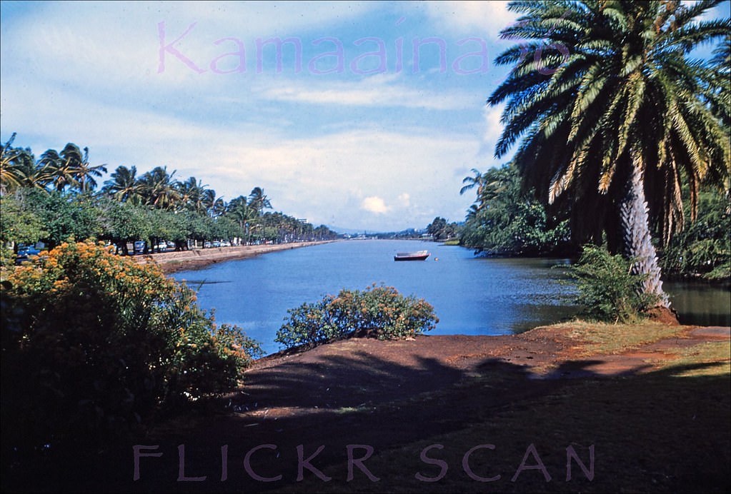
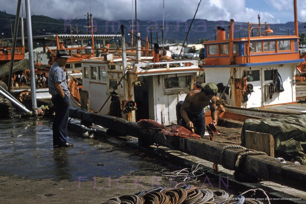
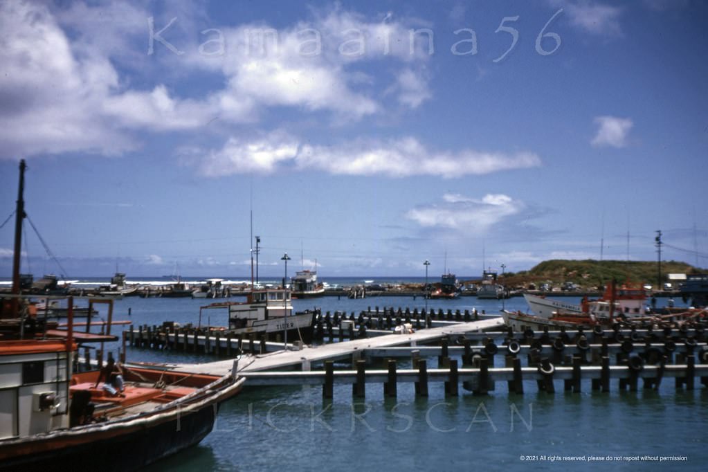
#59 Kewalo Basin Peninsula, 1963
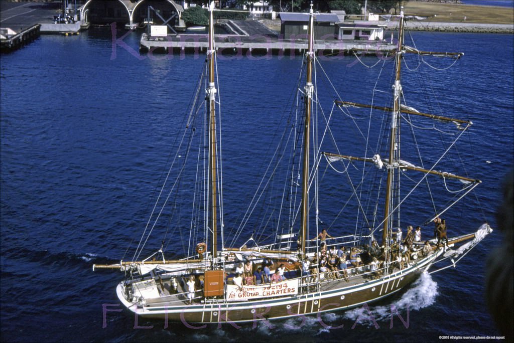
#60 Admiral’s Barge Kewalo, 1960s
#61 Ale Ale Kai Cat Kewalo, 1968
#62 Sunset Dinner Sail Kewalo, 1962
#63 Looking mauka (inland) from a tourist boat docked at Kewalo Basin on Oahu’s south shore, 1964
#64 Kewalo Waterfront Mauka, 1965
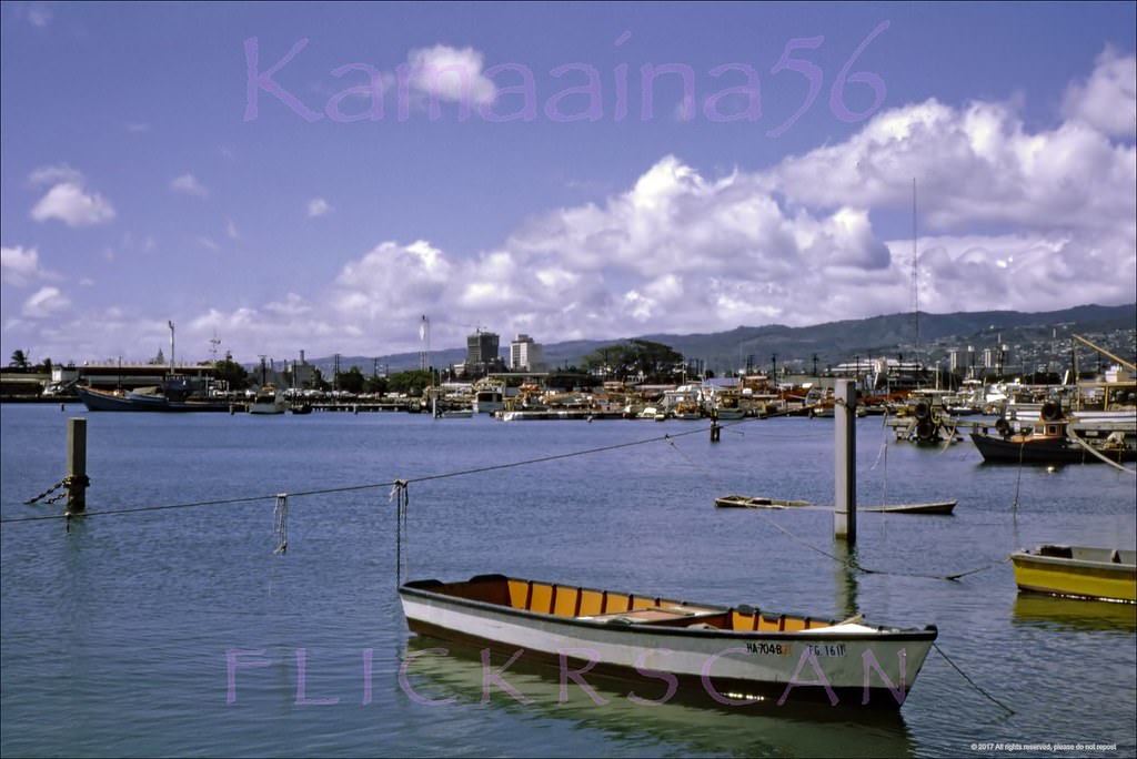
#65 Catamaran Ale Ale Kai Kewalo, 1969
#66 Sampans moored at Kewalo Basin in Honolulu, 1968
#67 Looking inland from a boat leaving Kewalo Basin on Oahu’s south shore, 1960
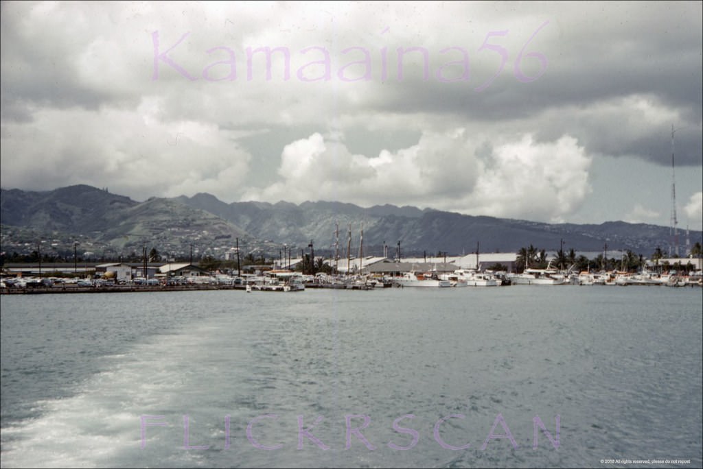
#68 Mauka (inland) view from a cruise boat leaving Kewalo Basin on Oahu’s south shore probably headed for Pearl Harbor or possibly Waikiki, 1968
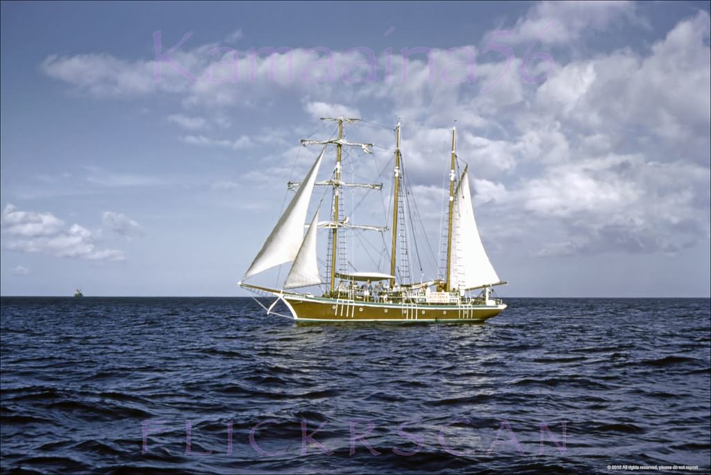
#69 Barkentine California Offshore, 1968
#70 Barkentine California Harbor, 1960
#71 Barkentine California Sails Up, 1960
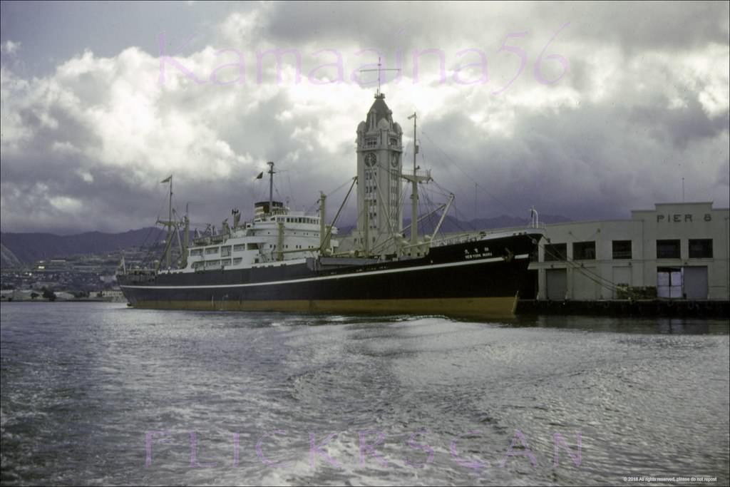
#72 New York Maru Honolulu, 1960
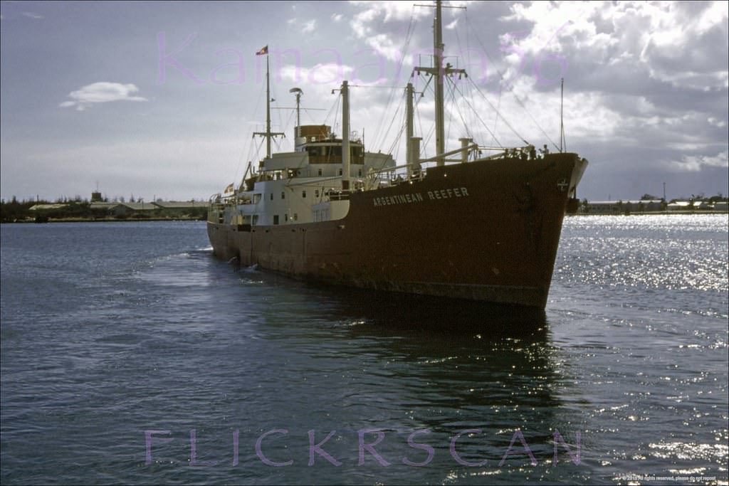
#73 Freighter at Honolulu Harbor, 1963
#74 Detailed panoramic view of Honolulu and Waikiki looking Diamond Head from La Ronde revolving restaurant atop the 23-floor Ala Moana Building at Ala Moana Shopping Center, 1965
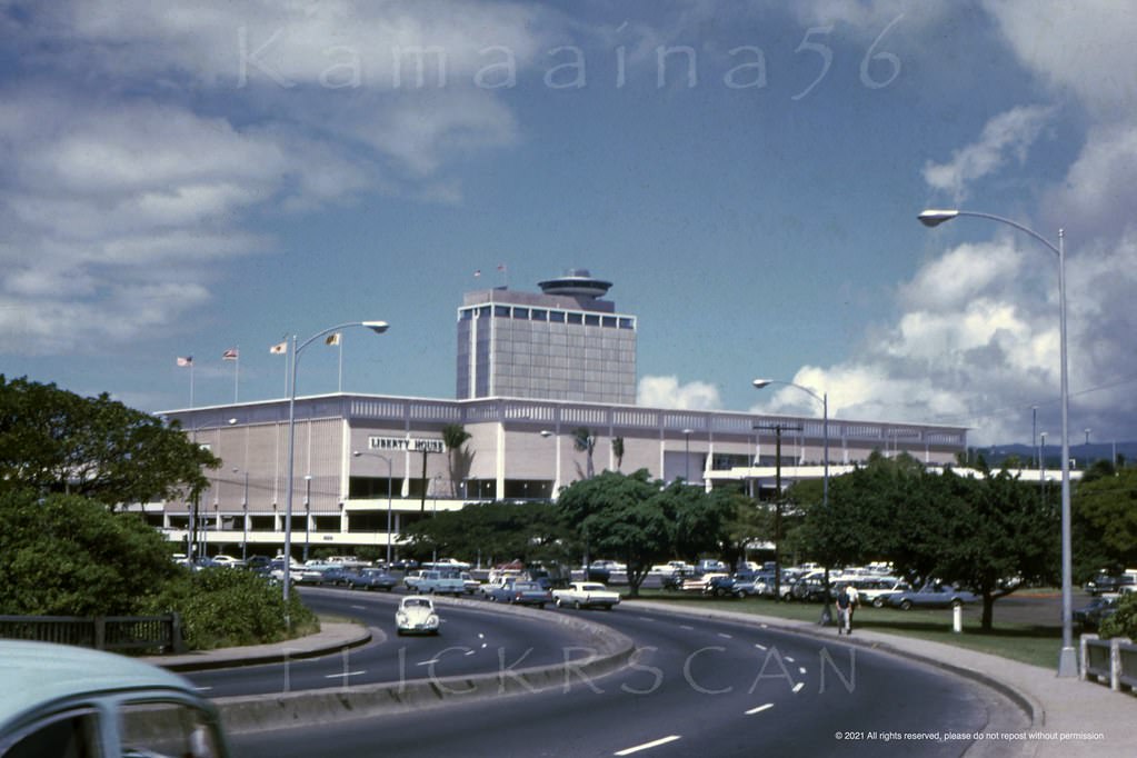
#75 Liberty House Ala Moana BEV, 1965
#76 La Ronde Ala Moana Birdseye, 1967
#77 Honolulu from La Ronde, 1967
#78 Ala Moana Birdseye, 1962
#79 La Ronde Ewa Birdseye, 1964
#80 Coco’s Honolulu BEV, 1960s
#81 Rainbow Rollerland Birdseye, 1967
#82 Keeaumoku Aerial La Ronde, 1967
#83 La Ronde Mauka Honolulu, 1962
#84 La Ronde Panorama Honolulu, 1967
#85 La Ronde Honolulu Birdseye, 1967
#86 Ala Moana Shopping Center seen from Ala Moana Blvd just Ewa (west) of the Ala Wai Bridge, 1967
#87 Ala Moana Mall Level Stores, 1960
#88 Early days at Honolulu’s 1959 Ala Moana Shopping Center, 1960
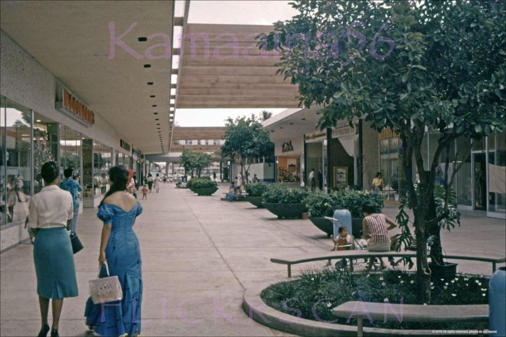
#89 Ala Moana Mall Level Stores, 1960
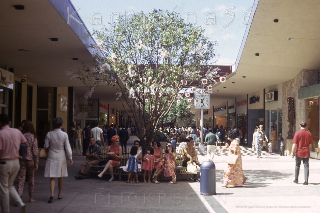
#90 Ala Moana Upper Level, 1961
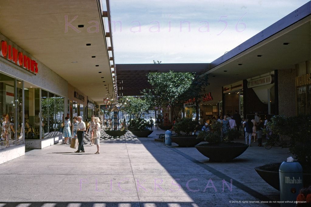
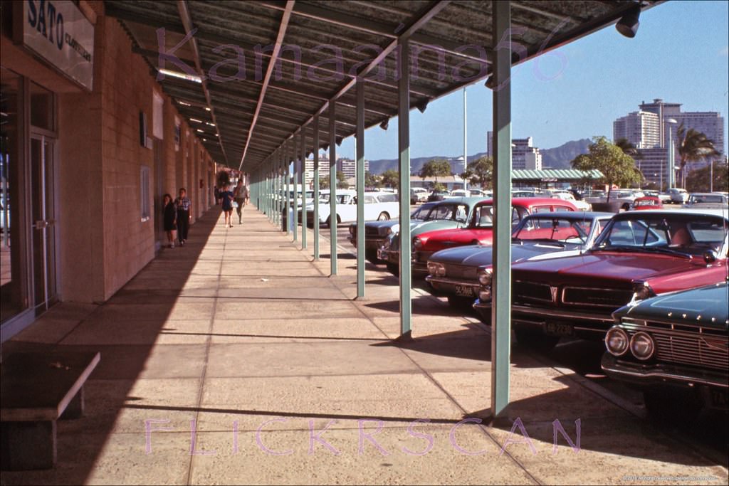
#91 Honolulu’s 1959 Ala Moana Shopping Center looking Diamond Head (more or less east) along the interior of the upper level, 1963
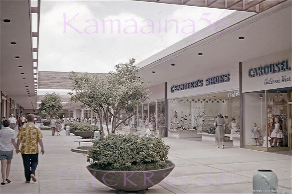
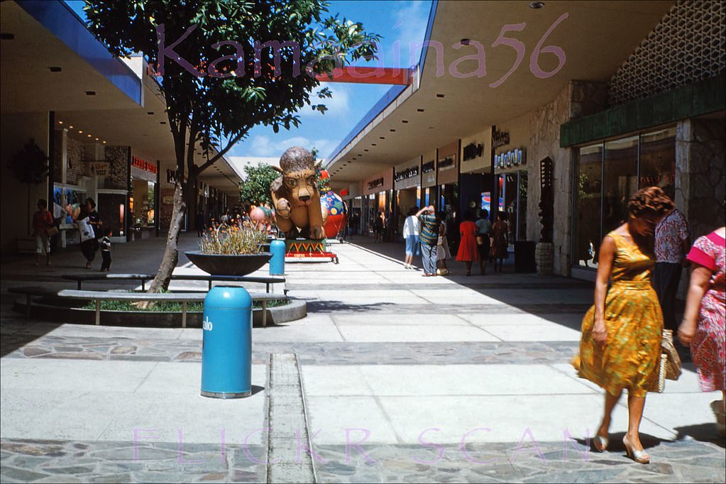
#92 Mall Level Shops Ala Moana, 1967
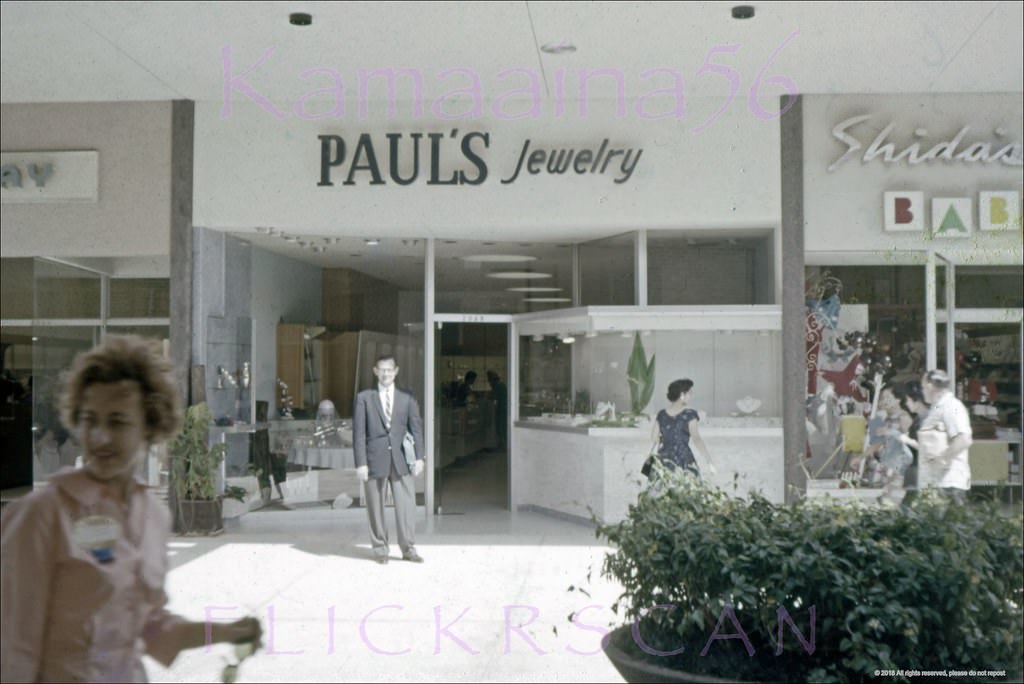
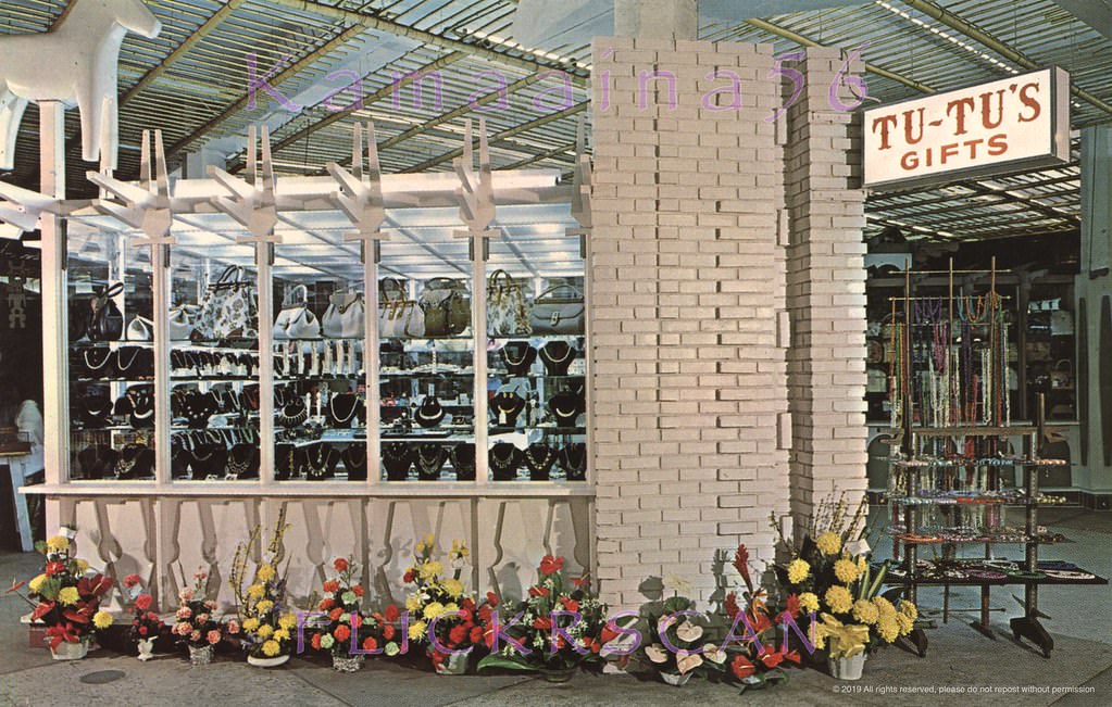
#93 Tutu’s Gifts on the street level of the 1959 Ala Moana Shopping Center, 1963.
#94 Ala Moana Fountain of Gods, 1960s
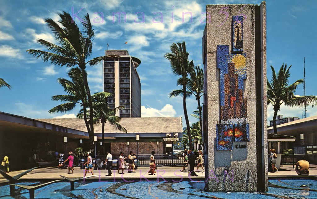
Mall Level (second floor) next to the escalators at Honolulu's 1959 Ala Moana Shopping Center. The view here is looking mauka (inland) at the “Fountain of the Gods” (1959) by noted Hawaii sculptor Bumpei Akaji (1921-2002). This fountain was apparently demolished during construction of the third level expansion 1990.
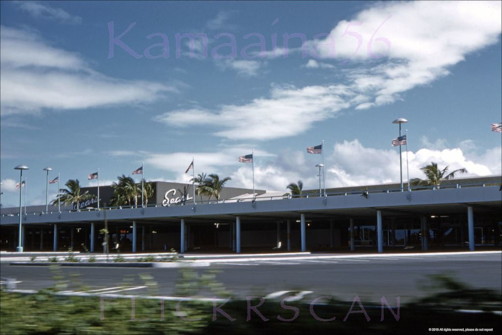
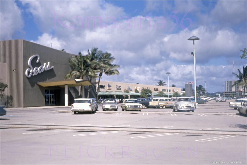
#95 Sears Ala Moana Honolulu, 1963
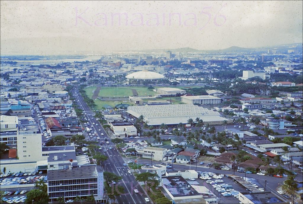
#96 Ala Moana Upper Deck Makai, 1960
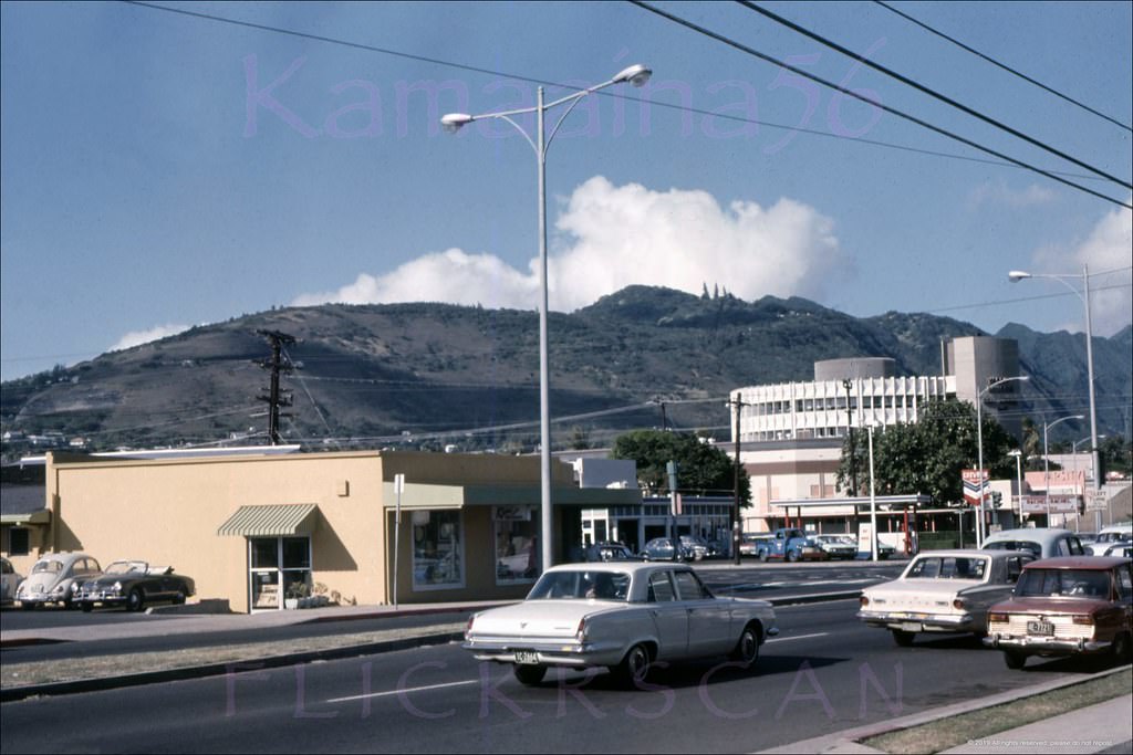
#97 The ocean-facing storefronts along the upper level at Ala Moana Center, 1967
#98 Upper level makai side at Ala Mona Center looking Diamond Head, 1966
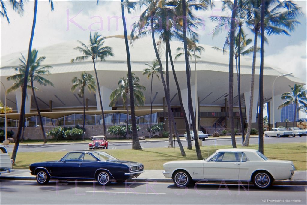
#99 Honolulu International Center, 1965
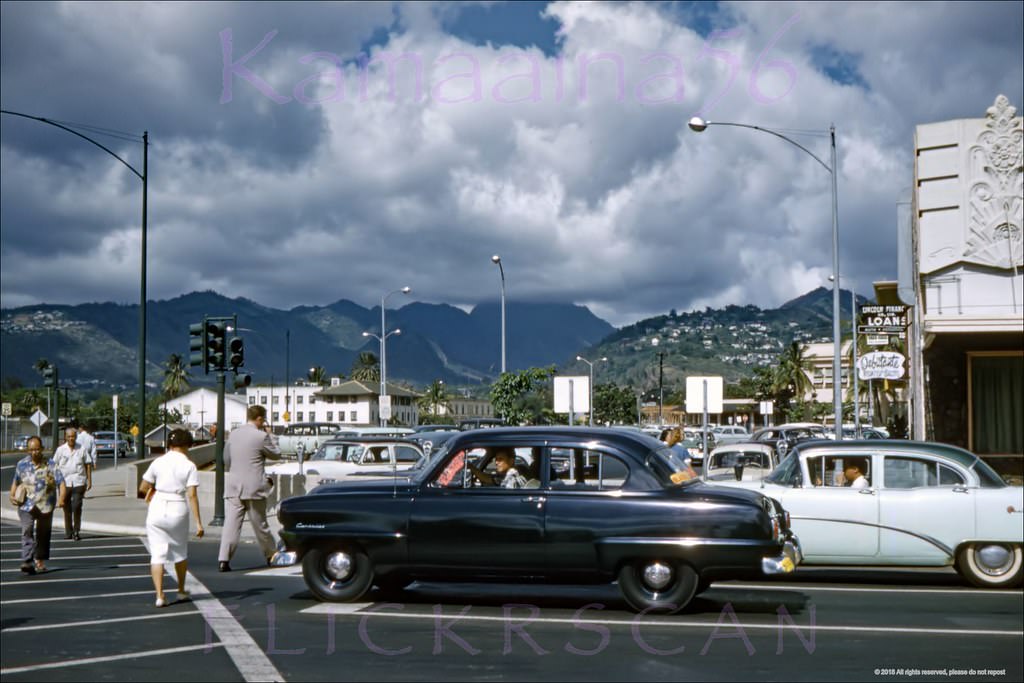
#100 Beretania Street at Ward Ewa, 1966
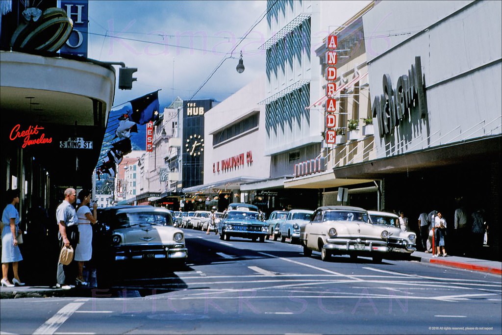
#101 Honolulu Harbor Downtown, 1965.
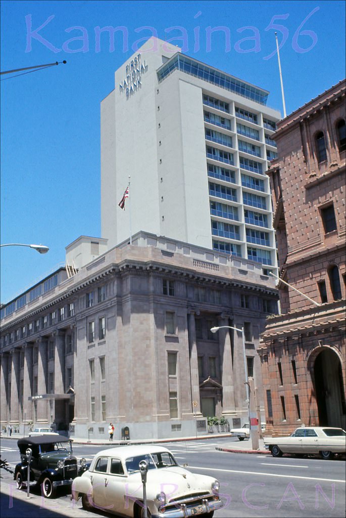
#102 Merchant Street at Bishop, 1966.
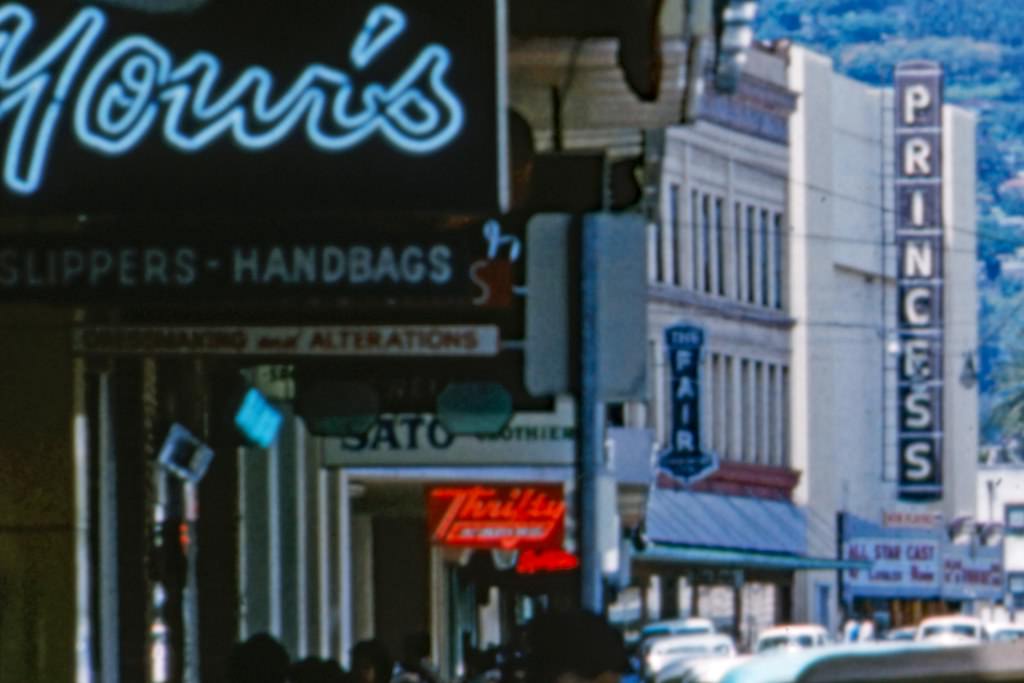
#103 Hob Nob Bishop St Makai, 1966.
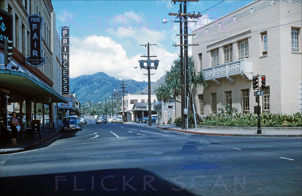
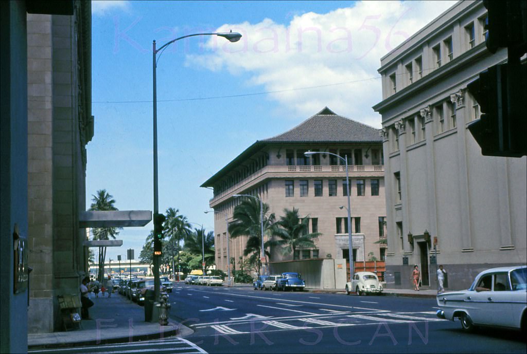
#104 Fort Street at King Makai, 1960.
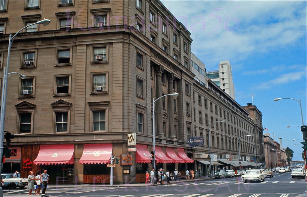
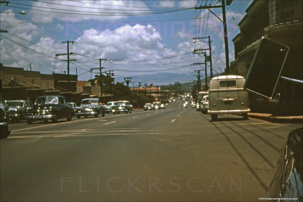
#105 Busy Fort St at King Honolulu, 1961.
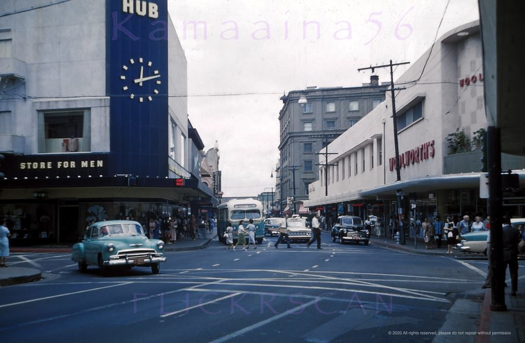
#106 Princess Theater Honolulu, 1961
#107 Looking mauka (inland) along Fort Street from Beretania Street towards the 1922 Princess Theater in downtown Honolulu, 1960
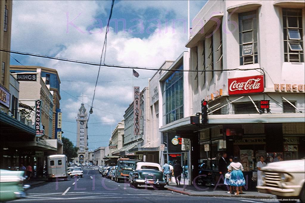
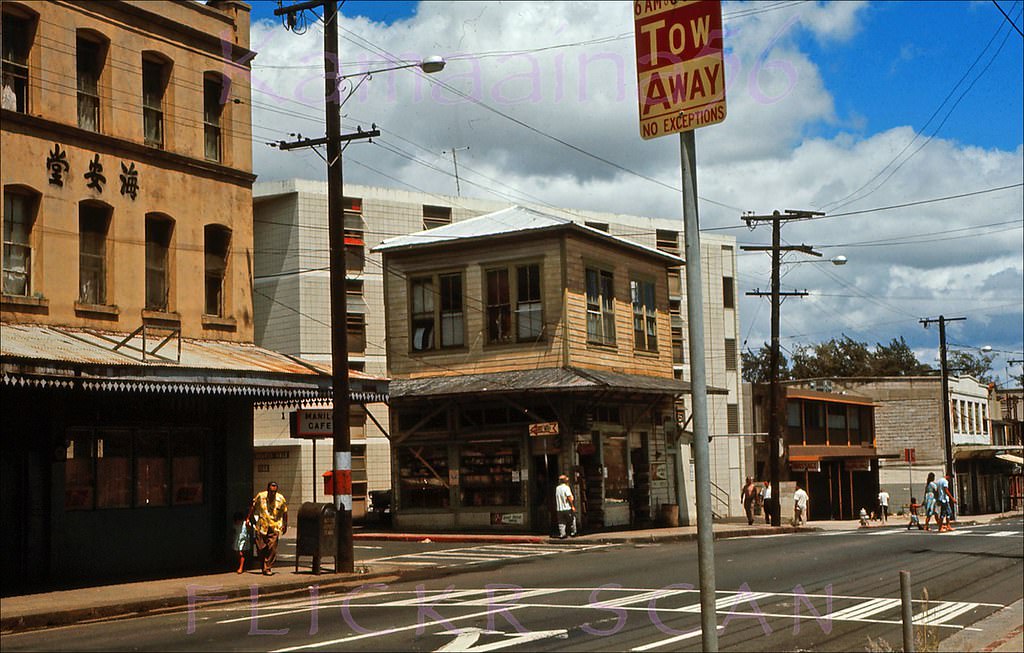
#108 Hotel Street at Fort Honolulu, 1960.
#109 Union Mall Kress Honolulu, 1966.
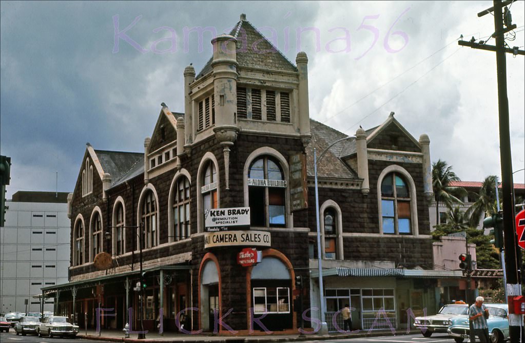
#110 Masonic Temple on Alakea, 1966.
#111 Manila Cafe Chinatown, 1966
#112 Queen Emma Street Honolulu, 1960.
#113 Auld Lane Kapalama Mauka 1961.
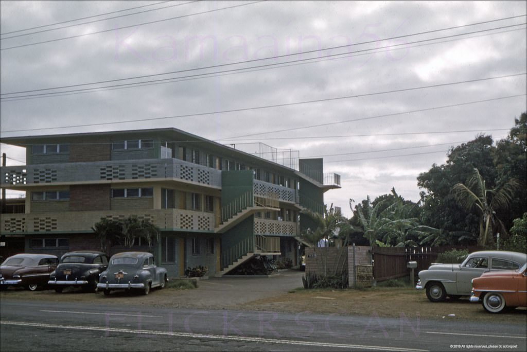
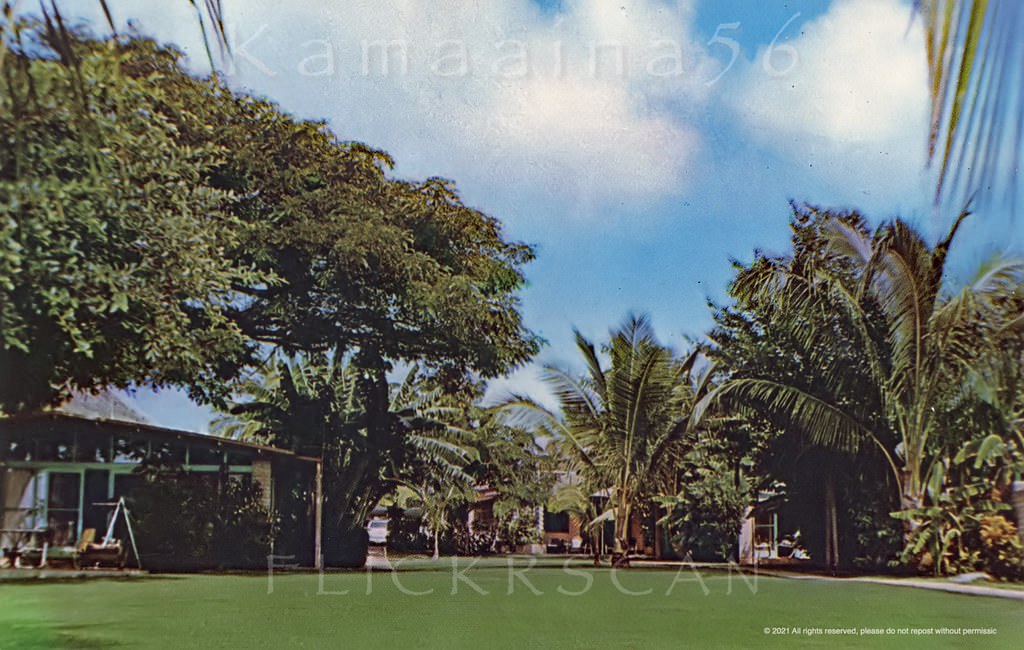
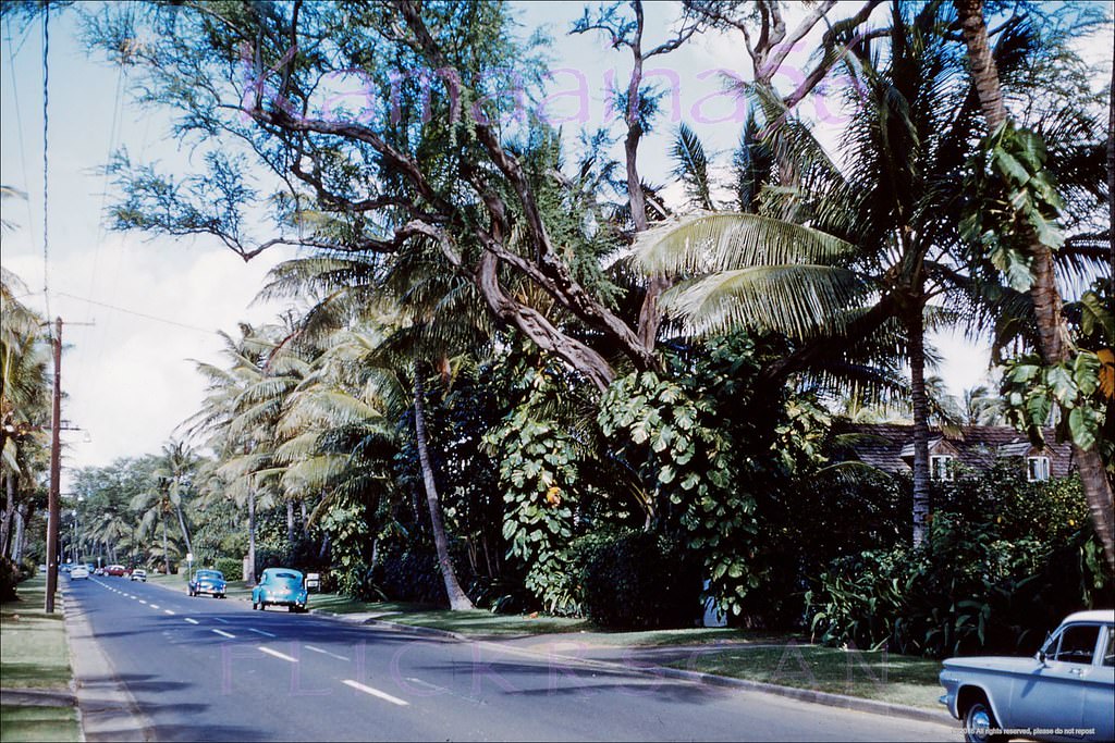
#114 Courthouse Kamehameha, 1963.
#115 Merchant Street Honolulu, 1960.
#116 King St at Richards Honolulu, 1969.
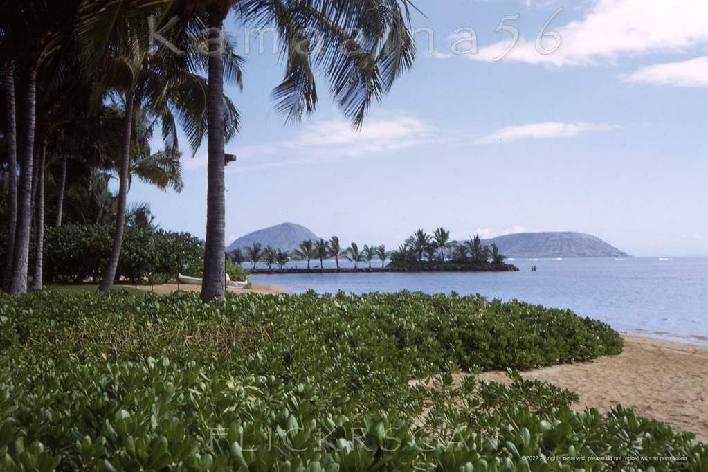
#117 Paterson Cottages Black Point 1960s.
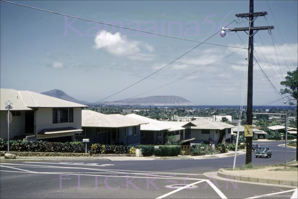
#118 Kahala Hilton Beachfront, 1968.
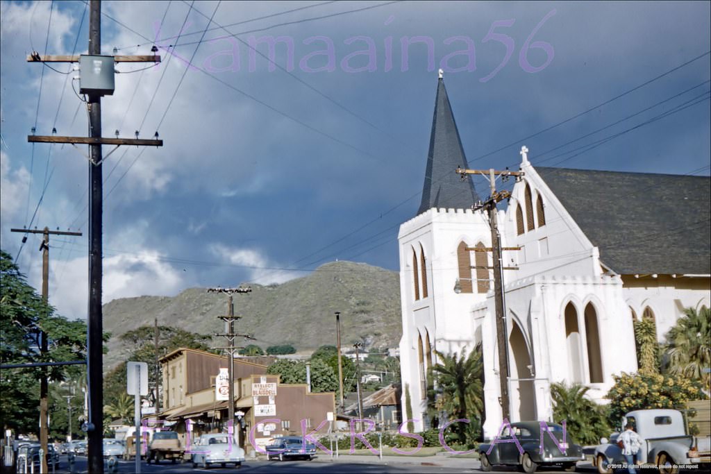
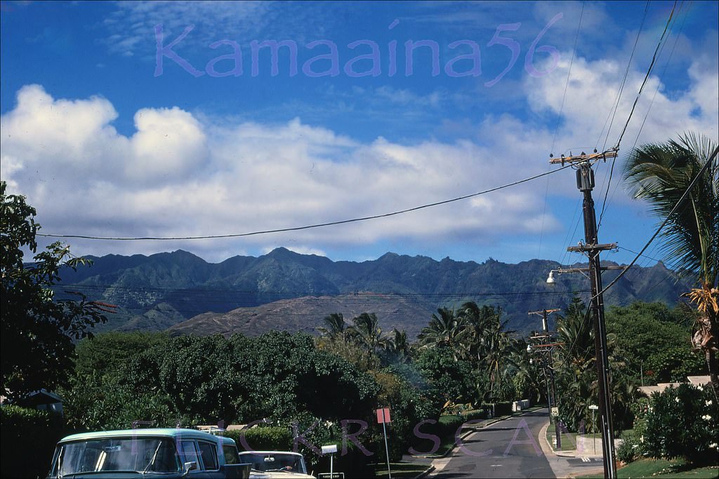
#119 Kahala Ave at Royal Mauka, 1960.
#120 Waialae Avenue Kaimuki Ewa, 1963.
#121 Harding Ave at 21st Kaimuki, 1960.
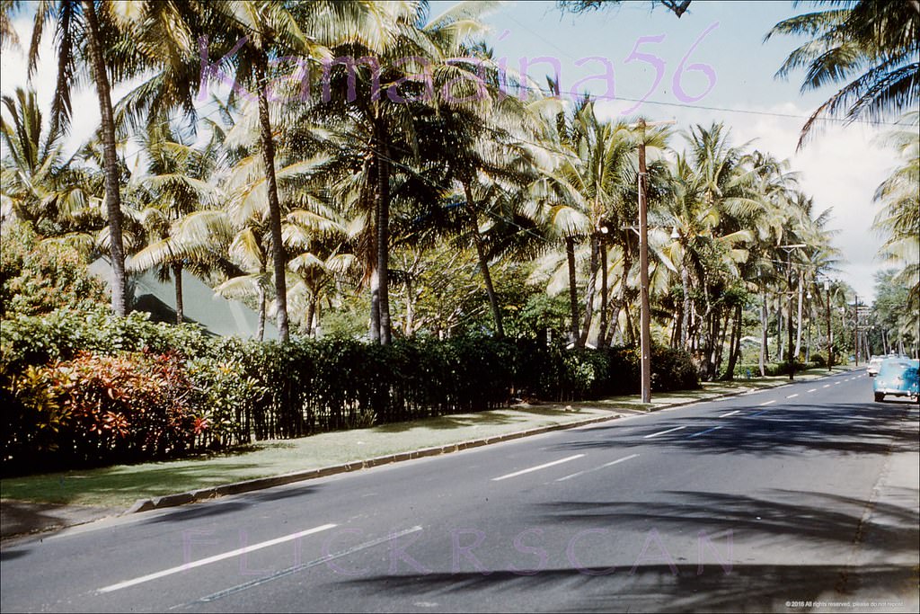
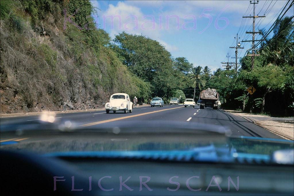
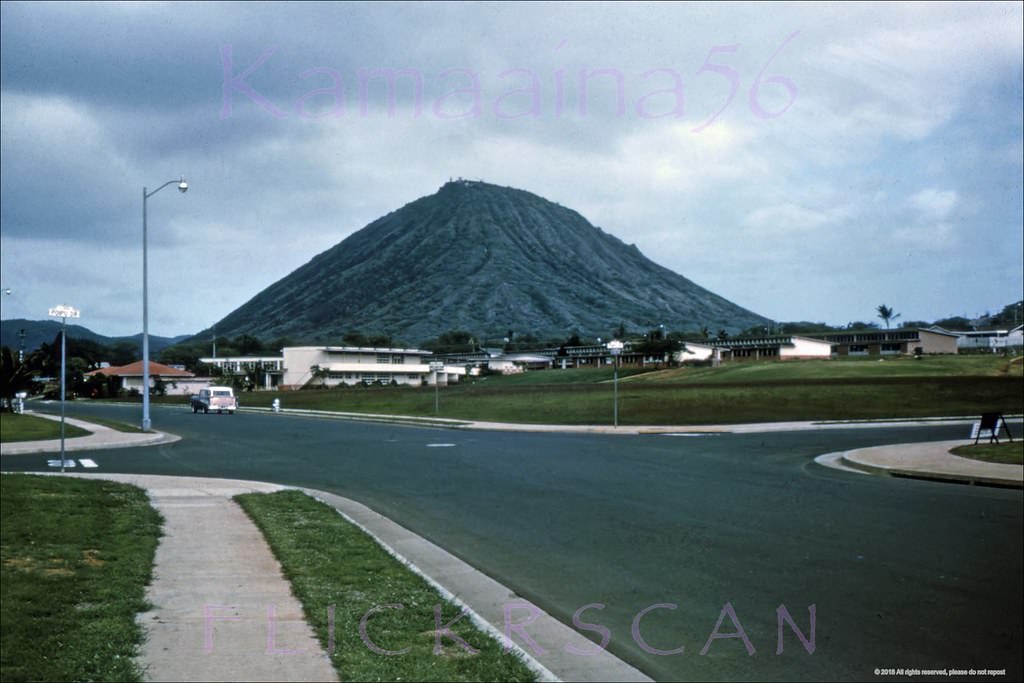
#122 Kalanianalole Hwy Waialae Iki, 1968
#123 Kalanianaole Hwy East Oahu, 1968.
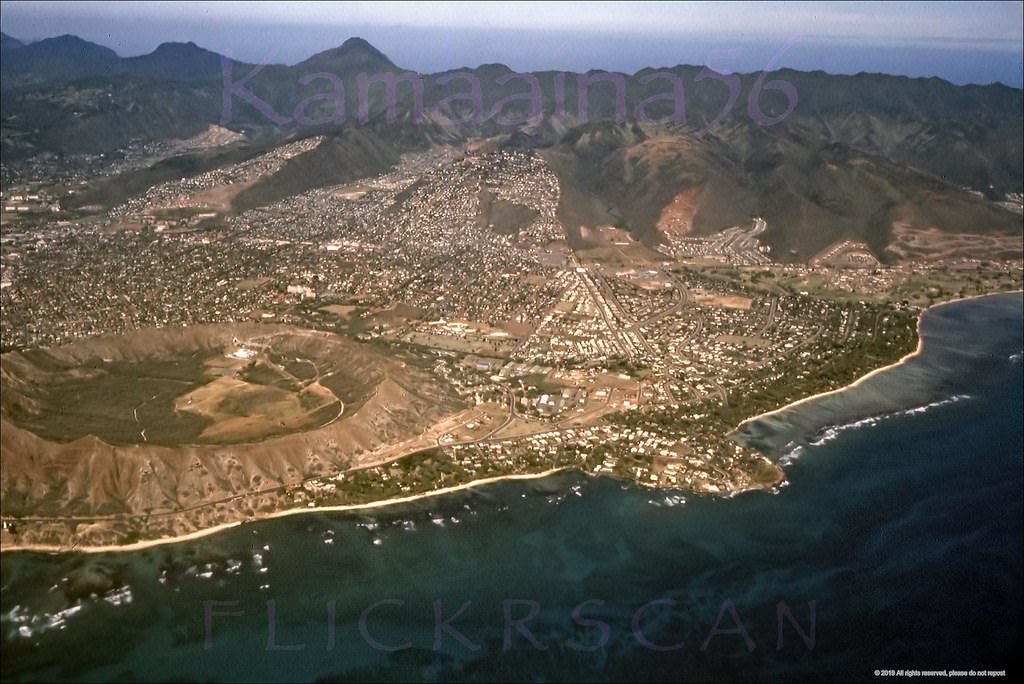
#124 Portlock Road at Lawai, 1968.
#125 Koko Crater from Portlock, 1960s.
#126 Koko Crater from Portlock, 1960s.
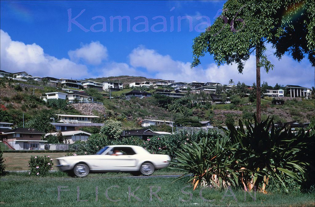
#127 Slightly shaky airplane view over south shore Oahu looking inland at the east Honolulu neighborhoods of Waialae, Kahala, and Kaimuki, 1961
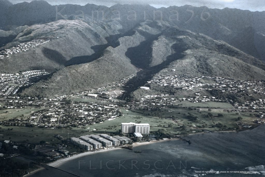
#128 Nice detailed airplane view of the east Honolulu neighborhood of Waialae Kahala, 1967.
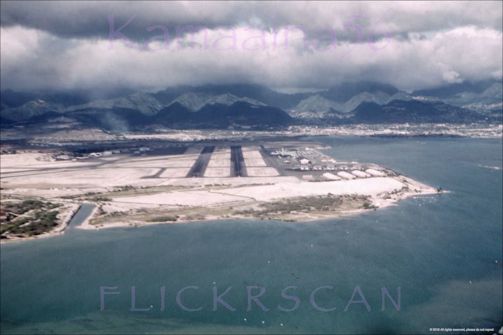
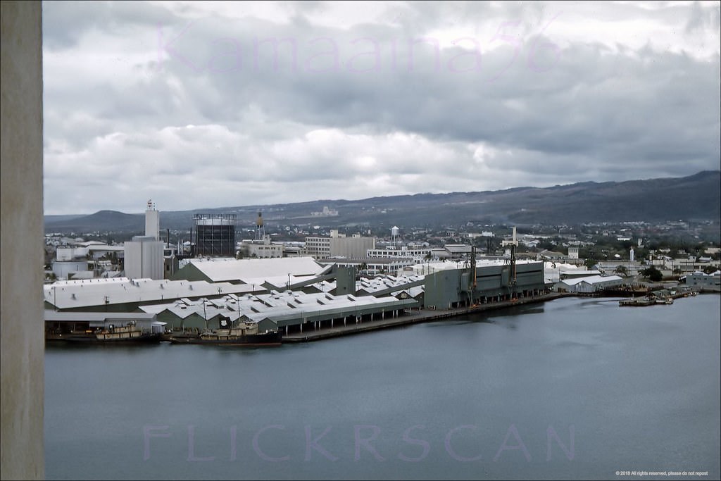
#129 Ahua Approach, Honolulu, 1960..
#130 Looking across lower Manoa towards Waikiki and Diamond Head, 1962.
#131 New Capitol Bldg Honolulu 1966
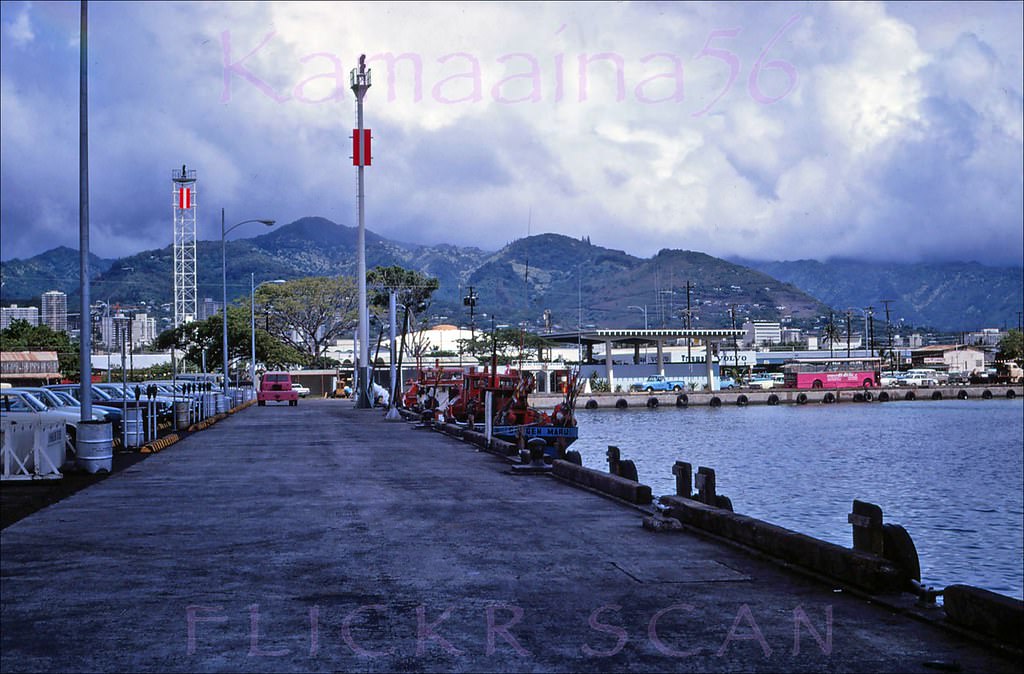
#132 Kewalo Basin Old Piers, 1966
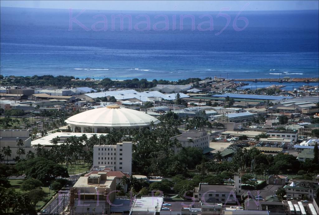
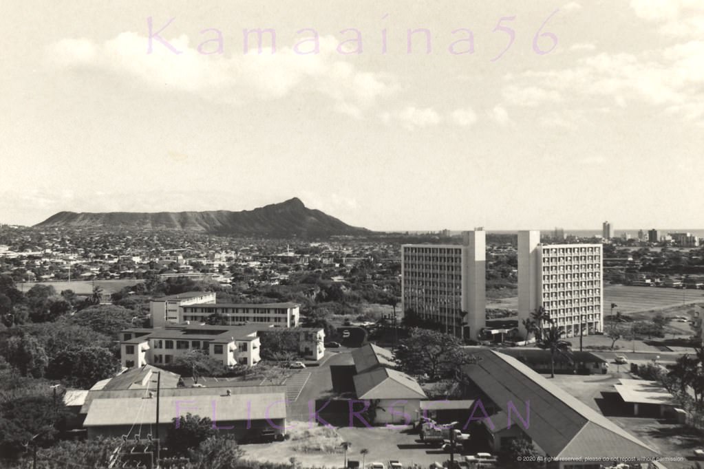
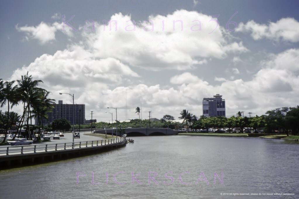
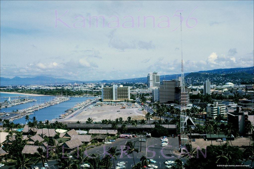
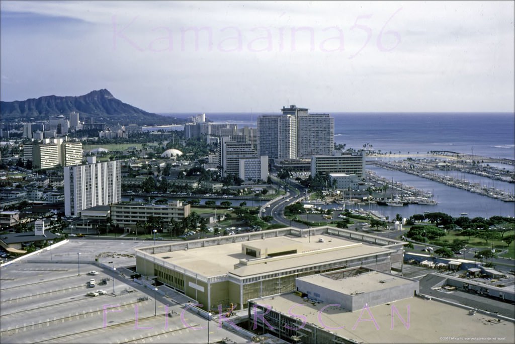
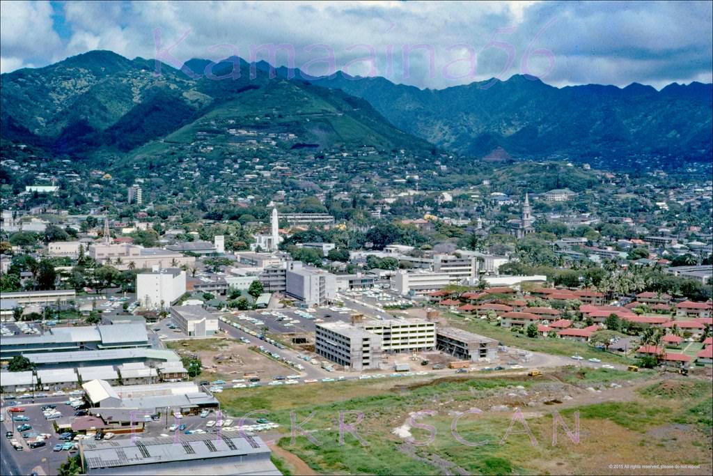
Punchbowl view of the 1964 Honolulu International Center on Ward Avenue Between King and Kapiolani in the mauka section of the Kakaako District. Renamed the Blaisdell Center 1984 in honor of 1955-1969 Honolulu Mayor Neal S. Blaisdell. Kewalo Basin can be seen in the distance on the right.
Thank you! Great photos I was there at Radford Hi Scool 1963-1965. Feel lucky!
Thank you for sharing your great photos of Honolulu, similar to my memory in the later 60s. Wow it was like just yesterday and now these photos bring back those memories so wonderfully. Much Aloha, from the Kakaako Kid.
It was cool to see the photos of what it looked like in the 60’s. Considering, I love looking at old photos of generations past.
Where’s Steve McGarret and the 5-O building where the others worked.
How can you forget that? Just joking.
Never been there but still interesting.
Boy there are so many photos.
Thanks for sharing! I showed my mom (born in the 50s) and she got all teary-eyed and nostalgic.
I lived there in the 60s … could smell that photo of cars parked at Ala Moana. Leaded gas fumes, the nut counter from Sears, hot dogs from Orange Julius, and sweat because none of those cars have AC.