Edinburgh has one of the longest urban histories in Scotland. People settled there as far back as the early Middle Ages, drawn by the natural defense of the volcanic rock that would eventually hold the castle. By the first half of the 18th century, Edinburgh had grown into one of the most densely packed cities in all of Europe, with tens of thousands of people crowded into a tight web of closes and tenements along the Old Town ridge. That density came with serious problems — disease, poverty, and crumbling housing — but it also produced a city with an incredibly layered physical character that few places in Britain could match.
By 1821, Glasgow had overtaken Edinburgh as Scotland’s largest city, driven by industrial growth along the River Clyde. Edinburgh shifted its focus. In the mid-19th century, the arrival of the railways transformed the city center. Princes Street and George Street became major commercial corridors, attracting department stores, hotels, and businesses that would define the look of central Edinburgh for the next hundred years. The railways also brought Waverley Station, sitting in the valley between the Old and New Towns — one of the most dramatically located railway terminals in the world.

By the 1960s, Edinburgh was in the middle of significant change. Large-scale slum clearance projects were underway, demolishing overcrowded Victorian-era housing across the city. Entire streets that had stood for generations were torn down to make way for new housing schemes on the outskirts of the city. It was a decade of transition — the old and the new existed side by side on the same block, sometimes on the same street corner. The color photographs from this era capture that moment with remarkable clarity.

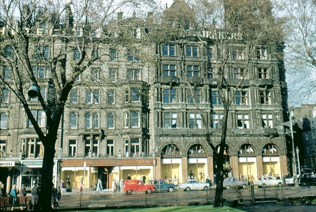
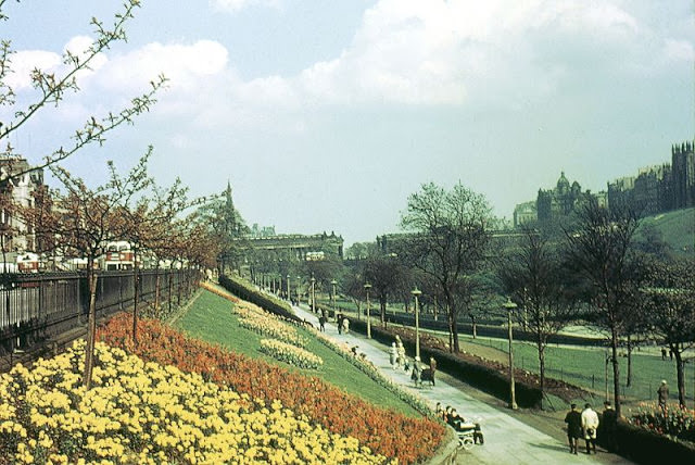
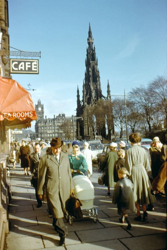
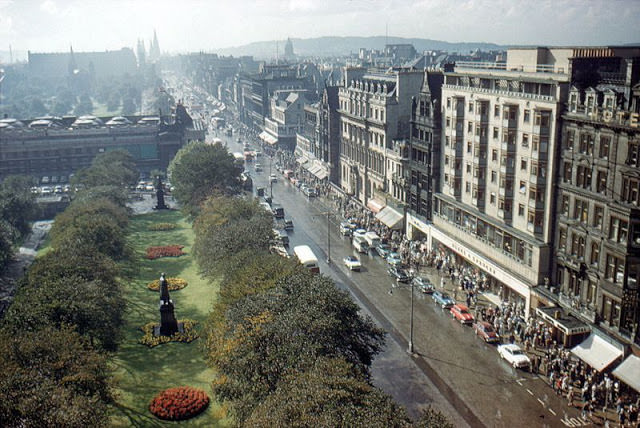
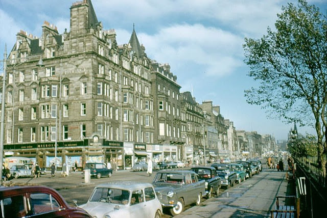
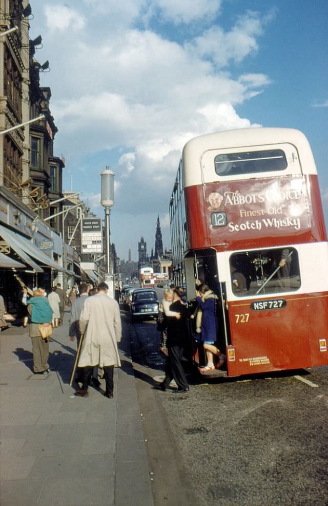
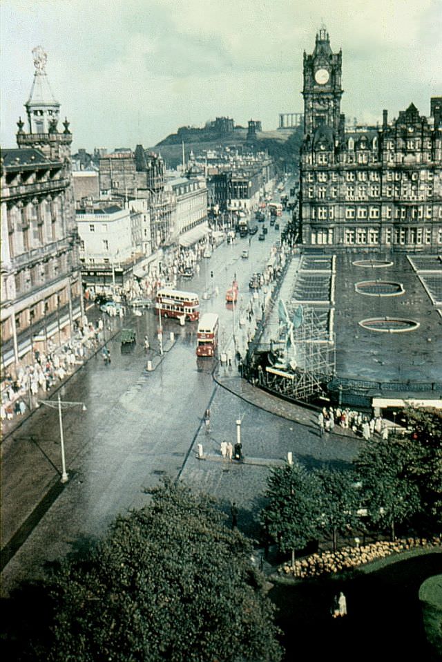
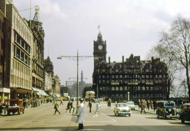
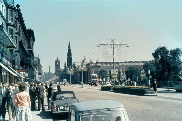
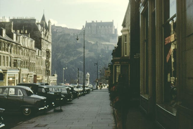
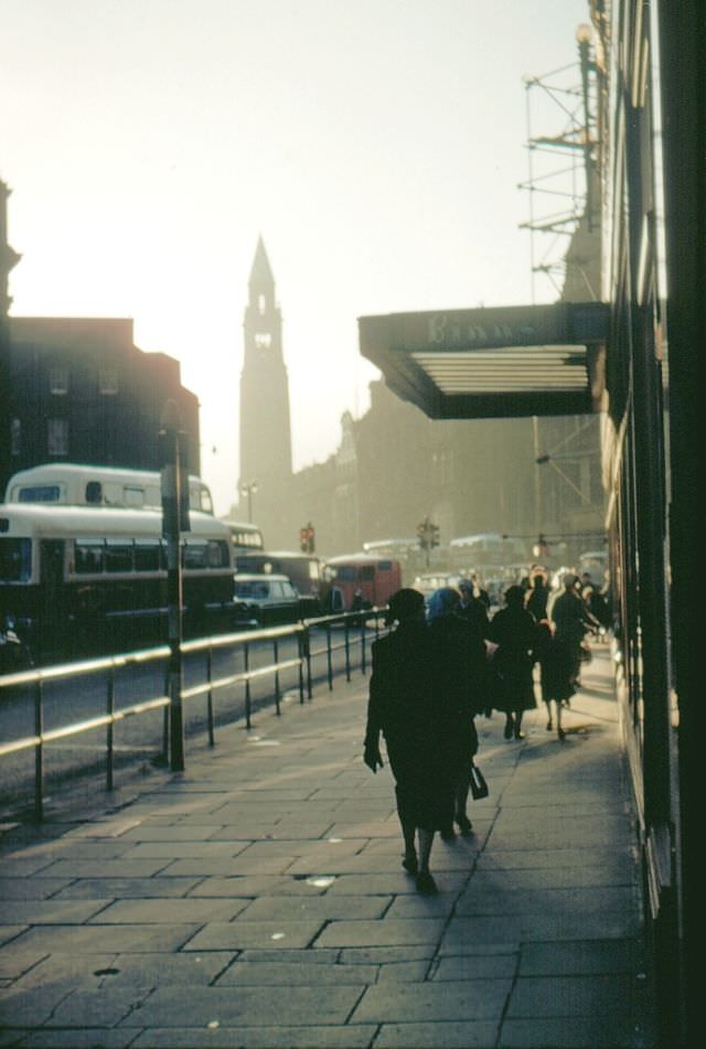
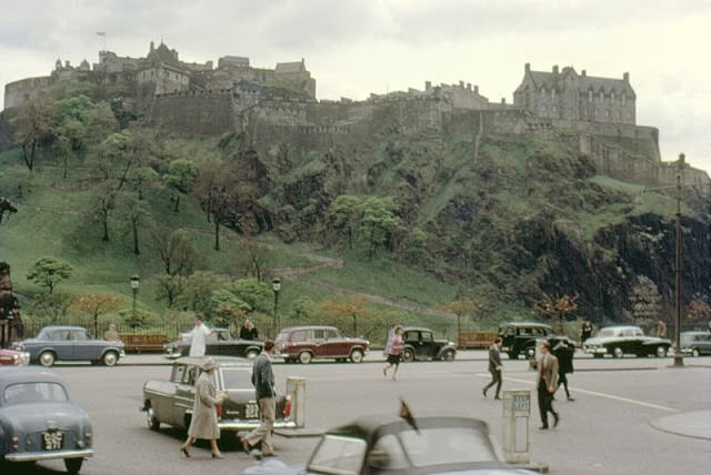
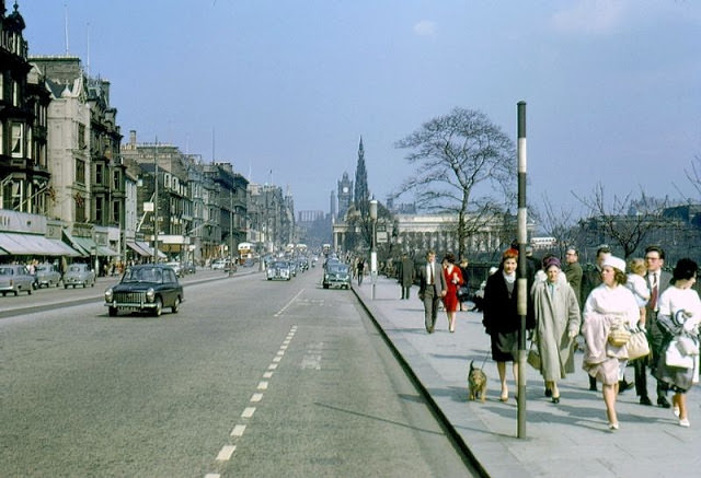
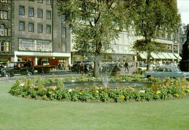
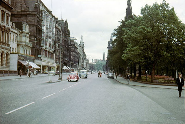
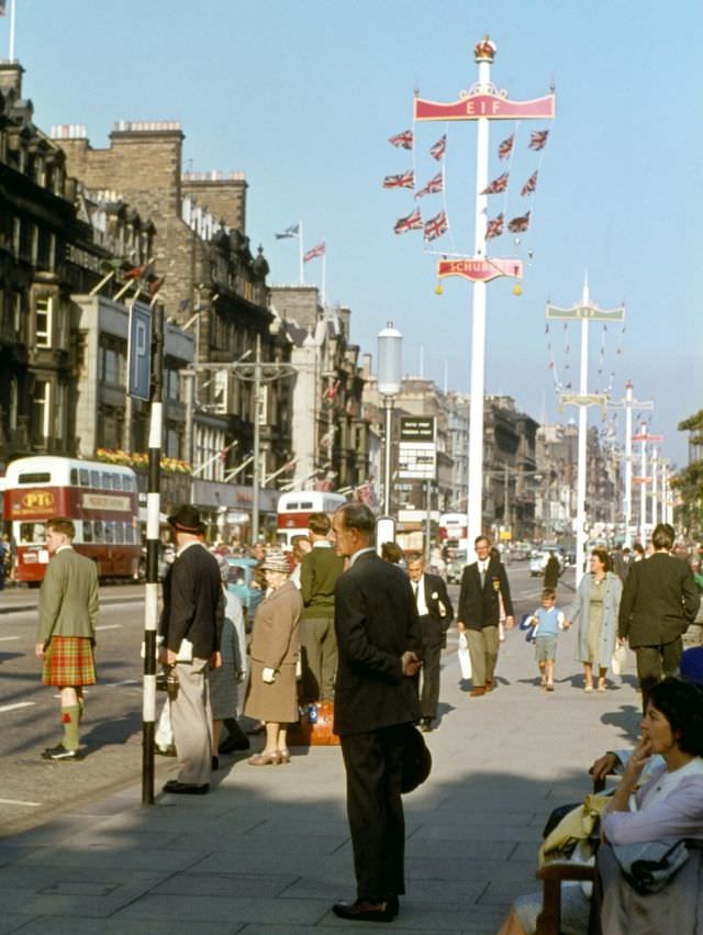
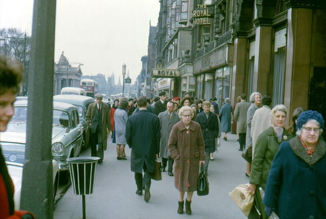
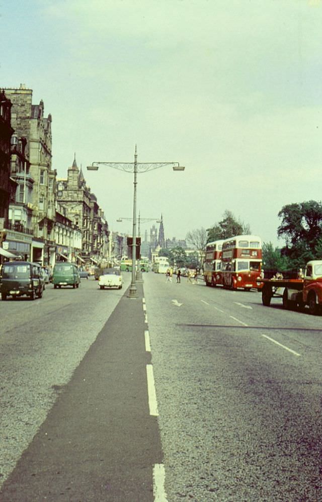
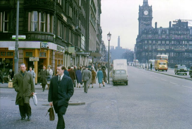
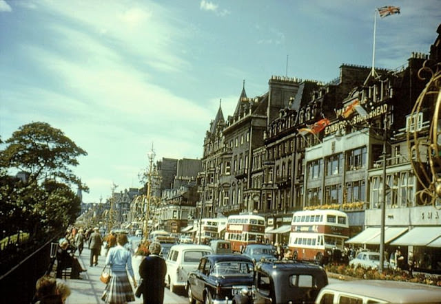
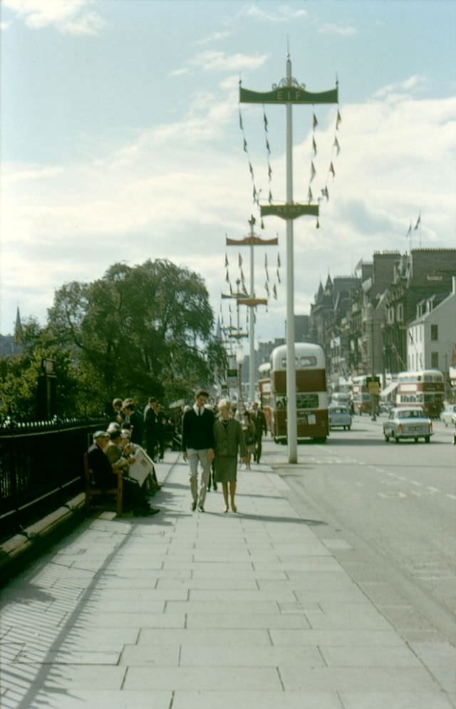
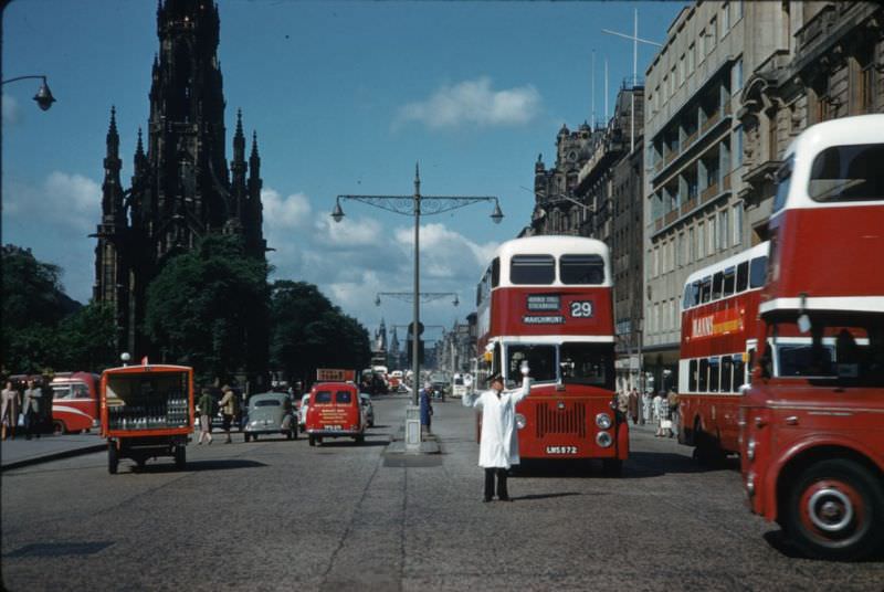
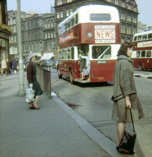
Princes Street was the undisputed commercial heart of Edinburgh, and these photos show it at its busiest. Double-decker buses, period automobiles, and pedestrians in coats and hats fill the pavements. On the south side of the street, there are no buildings — only the open drop into Princes Street Gardens, with the castle rock rising dramatically behind. That unbroken view of the castle from a busy shopping street is one of the things that makes Edinburgh unlike any other city in the world.


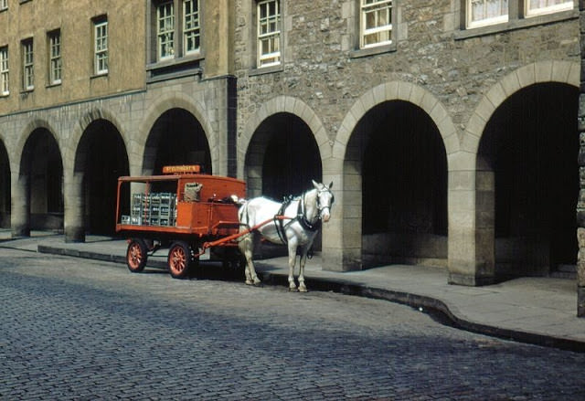
Not everything in 1960s Edinburgh moved at the pace of the motor car. On Canongate in 1960, St. Cuthbert’s Co-operative still made milk deliveries by horse-drawn cart. The St. Cuthbert’s Co-operative Association had been serving Edinburgh households since the 19th century, and horse-drawn carts remained a practical and common sight on the city’s older streets well into the early 1960s. The cobbled surfaces of the Old Town’s closes and wynds were actually better suited to horses than to motor vehicles.

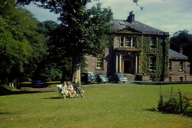
Away from the city center, Edinburgh in the 1960s was also a city of neighborhoods — each with its own pubs, shops, and local identity. The Pentland Hills Hotel on Camus Avenue sat in the southern suburb of Fairmilehead, far from the tourist trails of the Royal Mile. These neighborhood pubs and hotels were fixtures of working-class and middle-class Edinburgh life, places where locals gathered after work and on weekends.

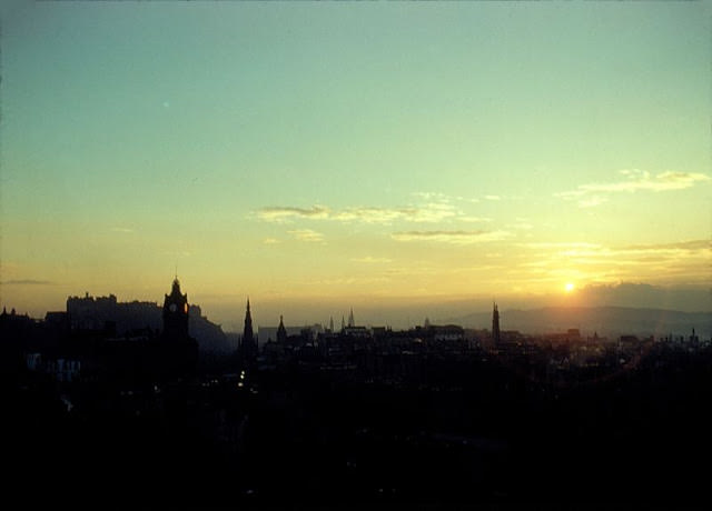
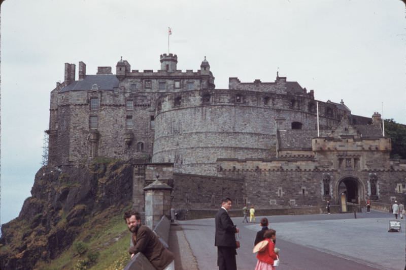
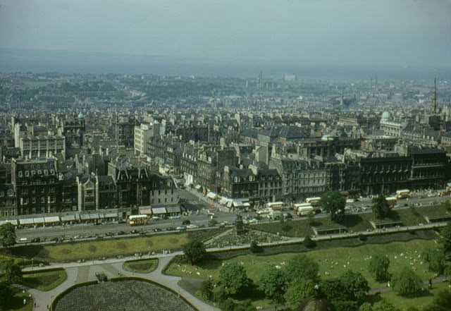
Edinburgh Castle dominates the city from every angle, but looking north from the castle’s battlements reveals just how far the New Town stretches. The Georgian grid of streets, laid out from the 1760s onward, spreads out toward the Firth of Forth in the distance. The New Town was one of Europe’s great planned urban developments, designed to relieve the overcrowding of the medieval Old Town and attract wealthy residents who preferred wide streets and ordered architecture.

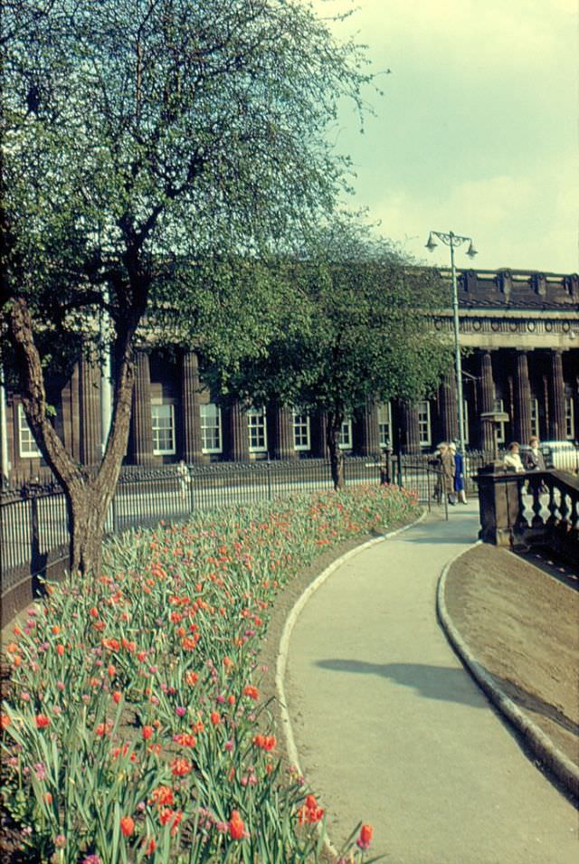
The Floral Clock in Princes Street Gardens is one of Edinburgh’s most recognized features. Installed in 1903, it was the first floral clock in the world. By 1961, it had already been a city landmark for nearly sixty years. Each year its design changes, planted with thousands of small bedding plants arranged to form patterns and images. The clock’s hands actually move, driven by a mechanism beneath the display.


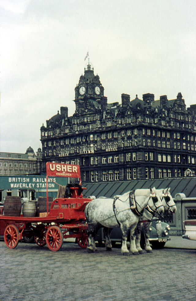
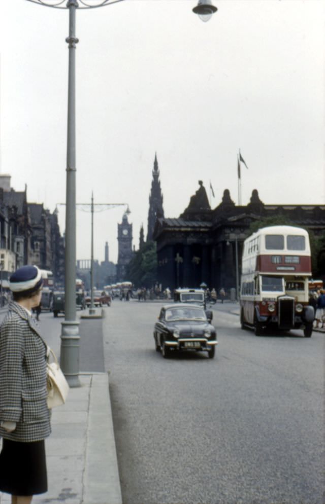
The east end of Princes Street in the early 1960s was anchored by major landmarks. The Register House, designed by Robert Adam and completed in the 1780s, sat at the top of the street. The North British Hotel — later renamed the Balmoral — rose above Waverley Station with its famous clock tower. The tower’s clock is kept two minutes fast to help passengers catch their trains, a tradition that continues to this day.

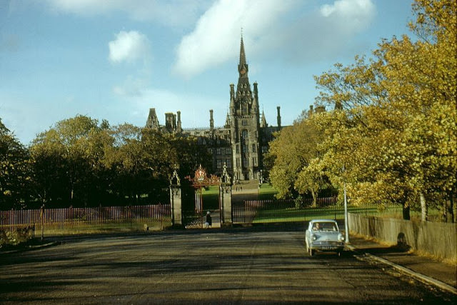
Fettes College, set in the Inverleith area of north Edinburgh, is one of Scotland’s most architecturally striking private schools. The building was completed in 1870 and designed in a French Gothic style by architect David Bryce. It sits within extensive grounds and has educated some well-known figures in British public life. In the early 1960s, the school looked much as it does today — a vast turreted structure that looks more like a French château than a Scottish school.

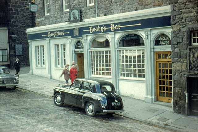
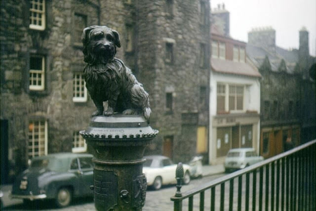
Candlemaker Row leads down from George IV Bridge toward the Grassmarket, and at its foot stands the small bronze statue of Greyfriars Bobby — a Skye Terrier said to have guarded the grave of his owner John Gray in Greyfriars Kirkyard for 14 years after Gray’s death in 1858. The nearby pub, Greyfriars’ Bobby’s Bar, took the dog’s name and became one of the most visited spots in the Old Town. The statue and the bar drew tourists even in the early 1960s, long before Edinburgh’s tourism industry reached its modern scale.


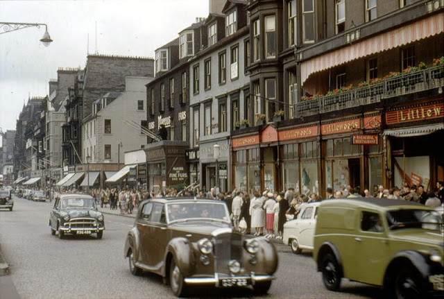
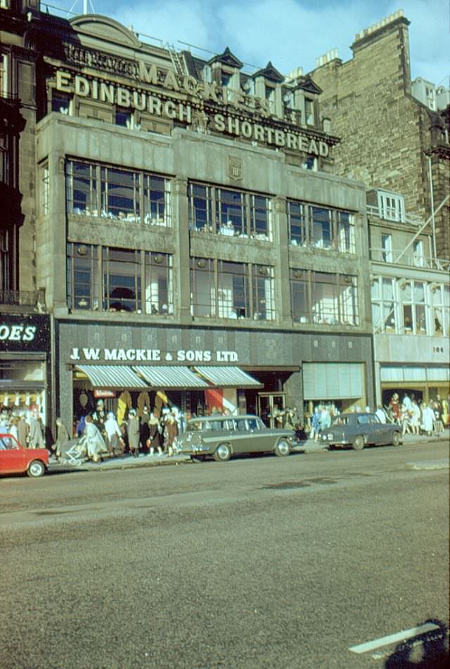
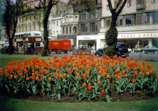
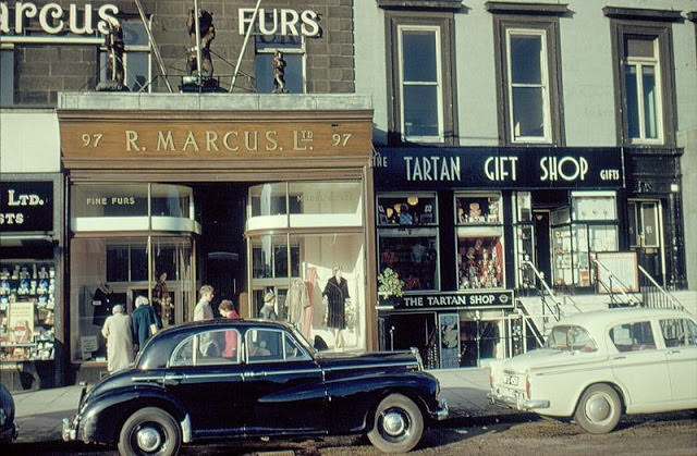
Princes Street in 1961 was lined with well-known shops and tea rooms. J. W. Mackie’s, a confectioner and tea room, was a popular stop for shoppers. Jenners, the large department store that had traded on Princes Street since 1838, remained a dominant presence on the street. The current Jenners building dated from 1895, designed by William Hamilton Beattie in a Venetian Renaissance style. Marcus’ Fur Shop at number 97 reflected the shopping tastes of the period — fur coats were considered high fashion throughout the 1950s and into the 1960s.


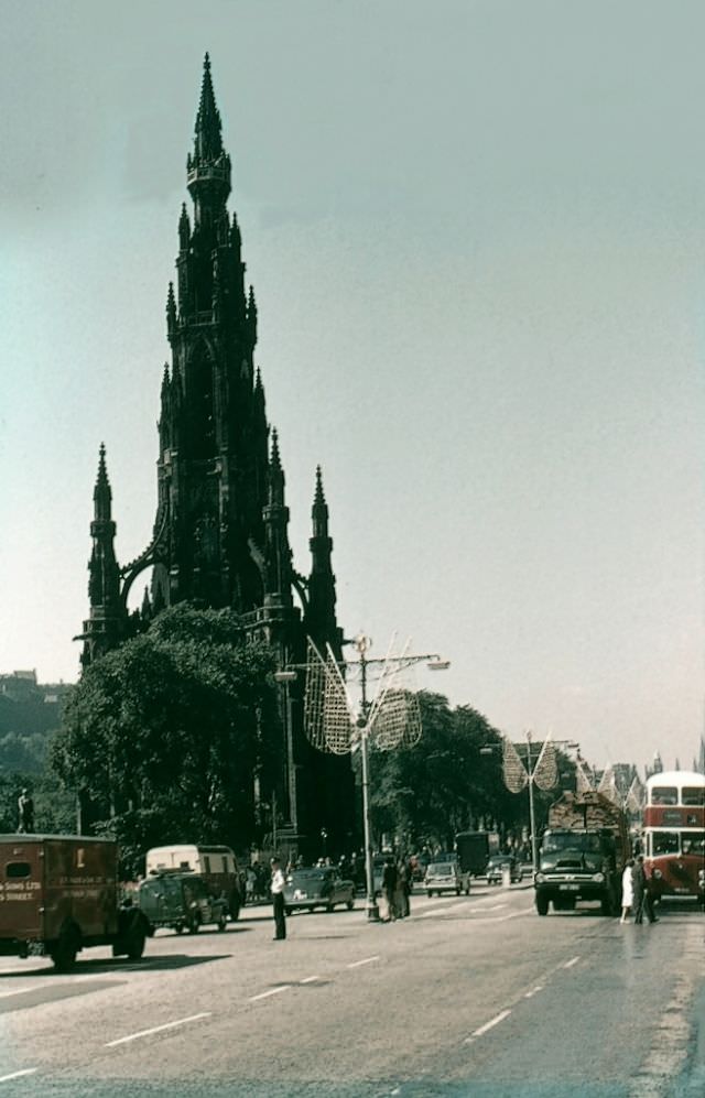
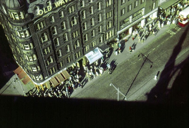
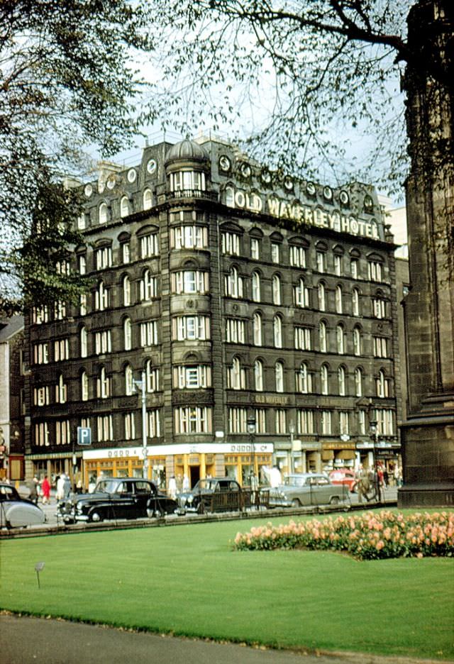
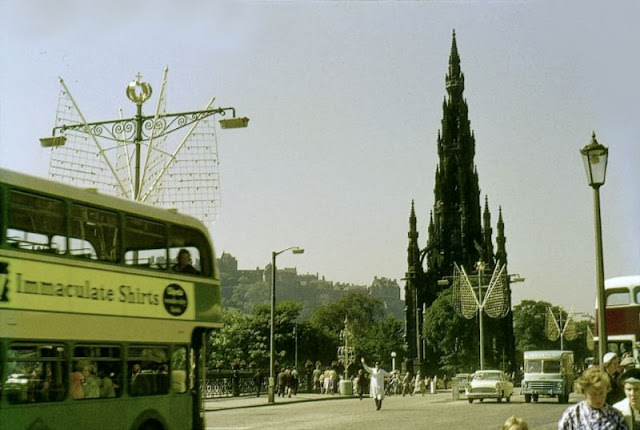
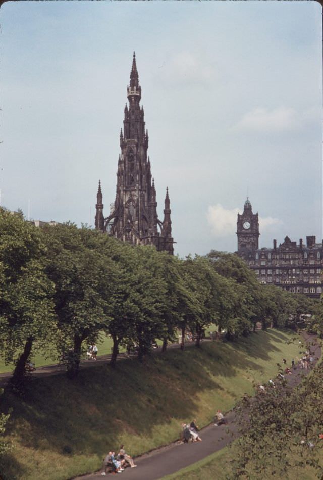
The Scott Monument on Princes Street is one of the largest monuments to a writer anywhere in the world. Built between 1840 and 1846 in honor of Sir Walter Scott, the Gothic tower stands 61 meters tall. Visitors can climb the narrow internal staircase to platforms at several levels for views over the city. The Old Waverley Hotel sits directly opposite, its name — like the railway station — a reference to Scott’s Waverley novels. From the upper levels of the monument, the full length of Princes Street stretches out in both directions.


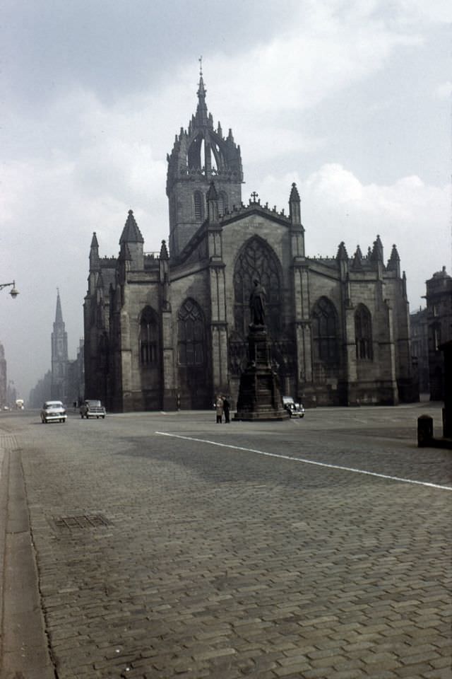
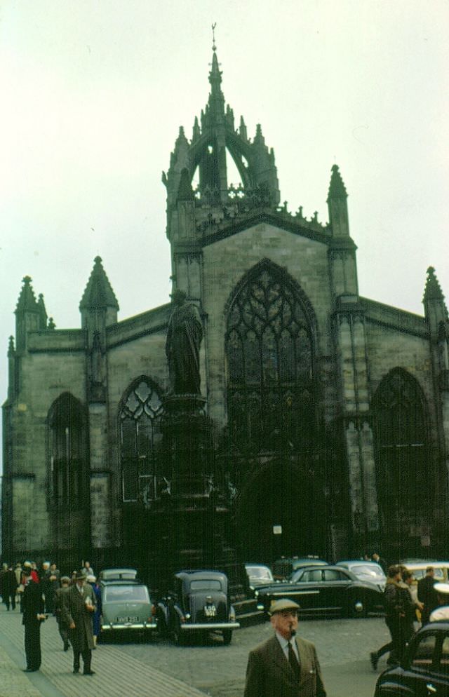
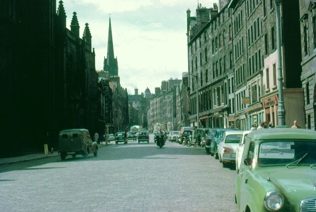
St. Giles’ Cathedral stands at the center of the Royal Mile on the High Street and has been the principal place of worship in Edinburgh since the 12th century. Its distinctive crown spire, completed around 1495, is one of the most recognizable rooflines in the city. Inside, the Thistle Chapel — added in 1911 — contains the stalls of the Knights of the Thistle, Scotland’s highest order of chivalry. The cathedral served as the setting for major events in Scotland’s Reformation and remains one of the most historically significant buildings in the country.


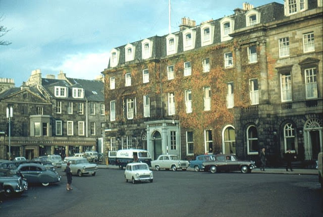
Charlotte Square, at the western end of the New Town, was designed by Robert Adam in 1791 as a set-piece of Georgian urban planning. The Roxburghe Hotel occupied one of the grand terraced townhouses on the square. The square’s north side is considered one of the finest examples of Georgian architecture in Europe. In the 1960s, Charlotte Square still functioned largely as a residential and hotel address, before it became more associated with financial and government offices in later decades.
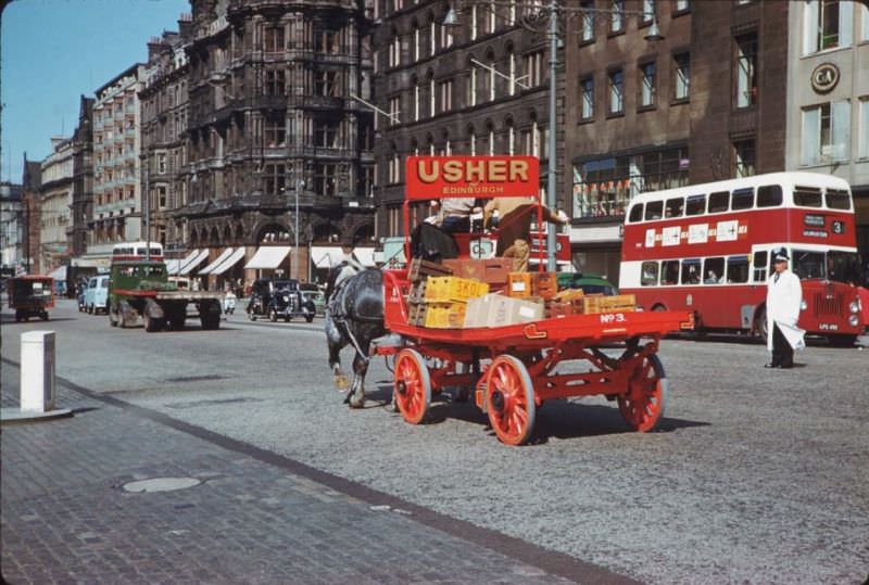
The Usher Brewery was one of Edinburgh’s major brewing operations, and its delivery carts were a familiar sight on the city’s streets. In 1961, a horse-drawn Usher Brewery cart was still crossing Waverley Bridge — another example of traditional working methods surviving alongside motor vehicles. Edinburgh had a strong brewing tradition, and several large breweries operated within the city. The trade name Usher’s dated back to Andrew Usher, the Edinburgh brewer also credited with pioneering blended Scotch whisky in the 1860s.


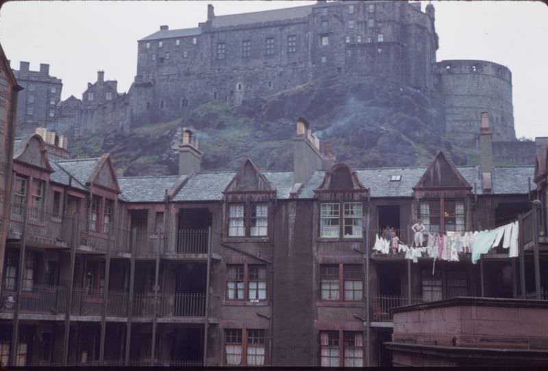
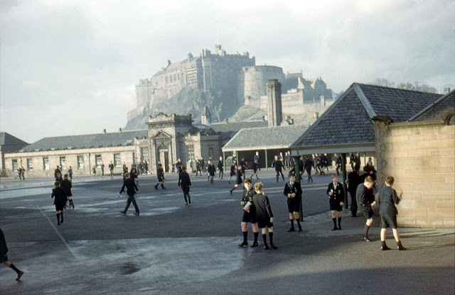
George Heriot’s School, just south of the castle, was founded in the early 17th century using a bequest from royal goldsmith George Heriot. The school’s main building was begun in 1628 and is one of the finest Renaissance buildings in Scotland. From its grounds, the view up to Edinburgh Castle is particularly dramatic — the castle rock looms over the school’s turrets and courtyard in a way that makes the relationship between Edinburgh’s history and its architecture feel very immediate.


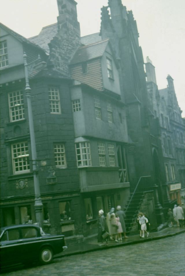
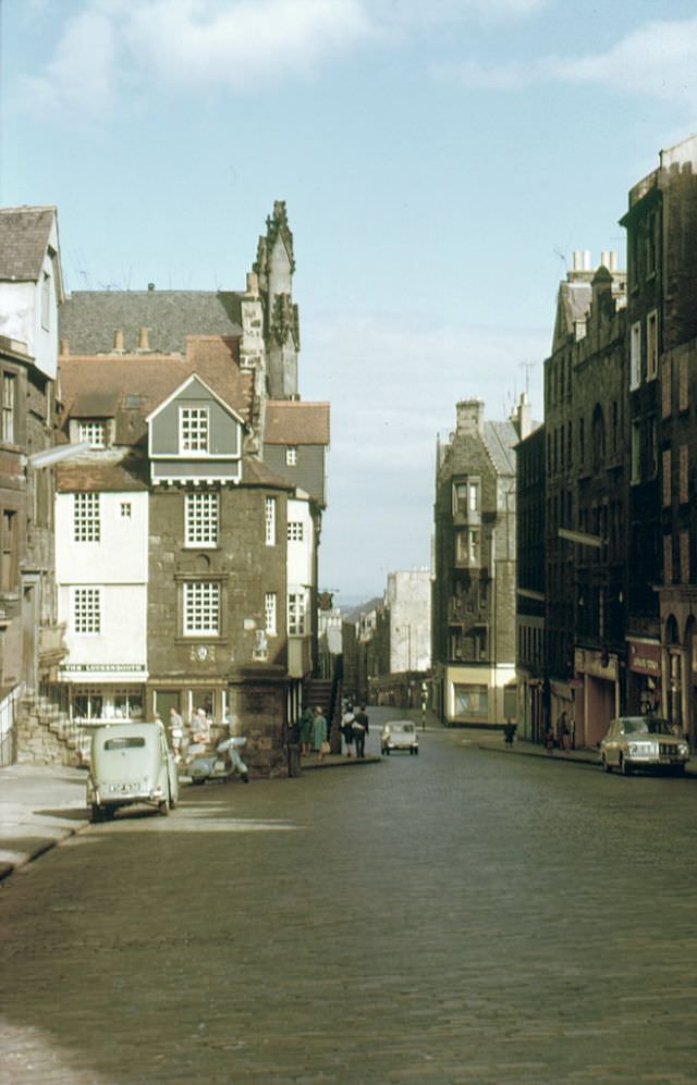
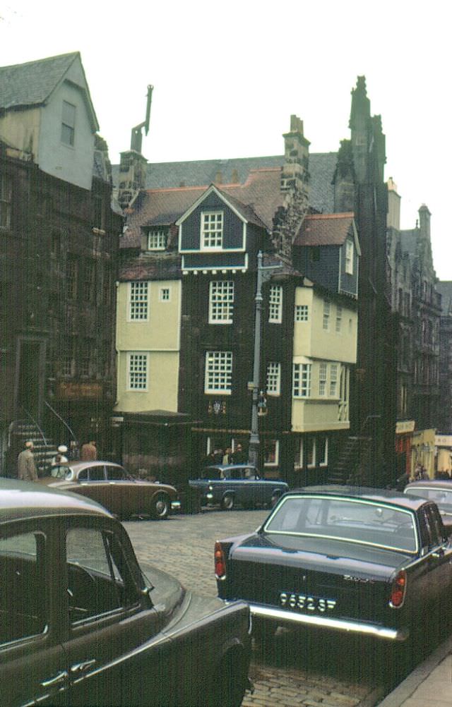
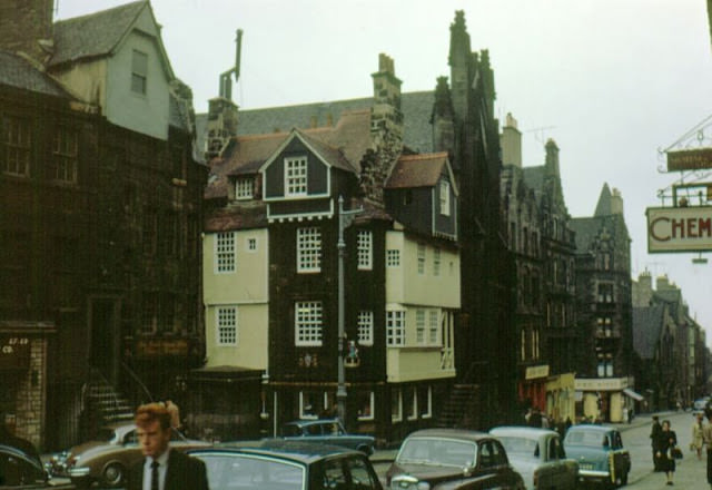
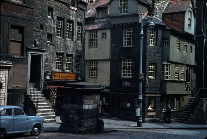
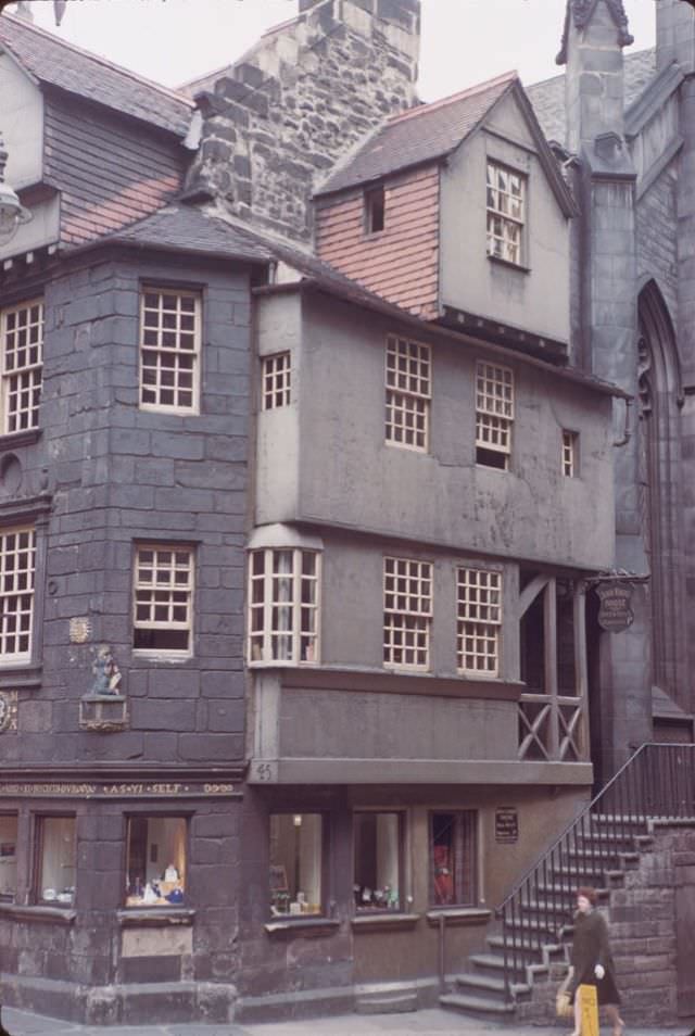
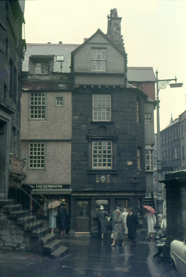
The High Street — the central section of the Royal Mile — runs from the castle down to Holyrood. John Knox’s House, which juts out slightly into the street at the lower end, is one of the oldest surviving domestic buildings in Edinburgh. Dating from the late 15th century, it was associated with the Protestant reformer John Knox, who is believed to have lived there in the 1560s. The timber-fronted upper stories overhang the street in a way that was once common but is now extremely rare in Edinburgh.


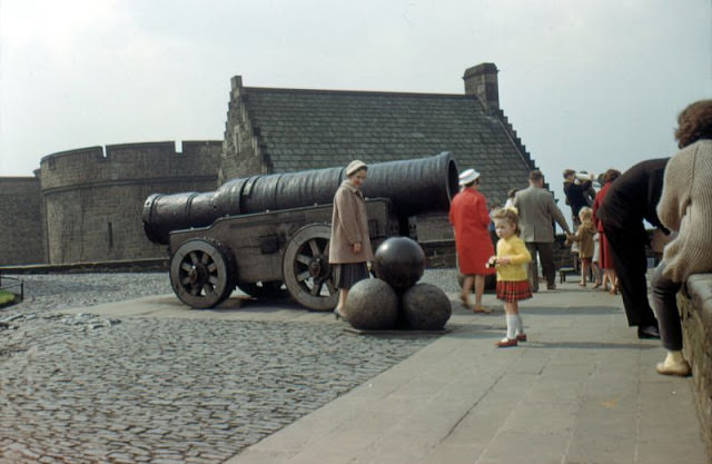
Mons Meg is a massive medieval siege cannon that sits on the castle ramparts. Forged in Belgium in 1449, it was a gift to King James II of Scotland and saw action at several sieges during the 15th and 16th centuries. The cannon’s barrel is 4 meters long and could fire a stone cannonball weighing over 150 kilograms. Mons Meg cracked in 1681 while firing a salute for the Duke of Albany and has not been fired since. In 1829, Sir Walter Scott campaigned for its return to Edinburgh after it had been taken to the Tower of London.


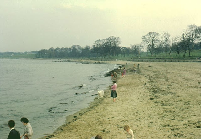
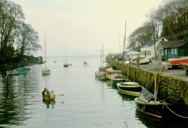
The village of Cramond sits at the mouth of the River Almond on the western edge of Edinburgh, where it meets the Firth of Forth. The Romans built a fort at Cramond in the 2nd century AD, and it remained an occupied site through several periods of history. By the 1960s, Cramond was a peaceful riverside and coastal spot within the city boundary. The beach and the tidal estuary of the Almond made it a popular destination for Edinburgh families on weekends.

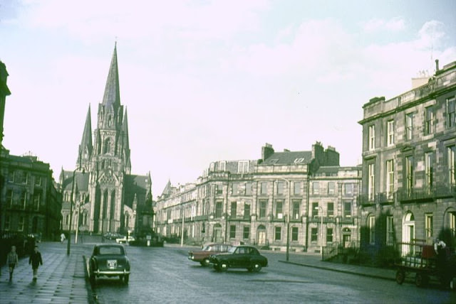
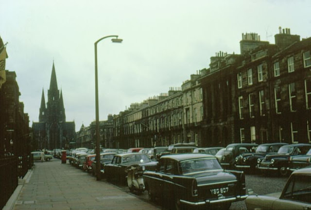
St. Mary’s Episcopal Cathedral on Palmerston Place is the largest church built in Scotland since the Reformation. Its construction began in 1874 to a design by Sir George Gilbert Scott, the same architect responsible for the Albert Memorial and St. Pancras Station in London. The cathedral’s three spires — the central one completed in 1917 and the two western spires added in 1917 as well — are visible from many parts of the western New Town. Melville Street leads directly to the cathedral’s west front, framing the view of the building from several blocks away.


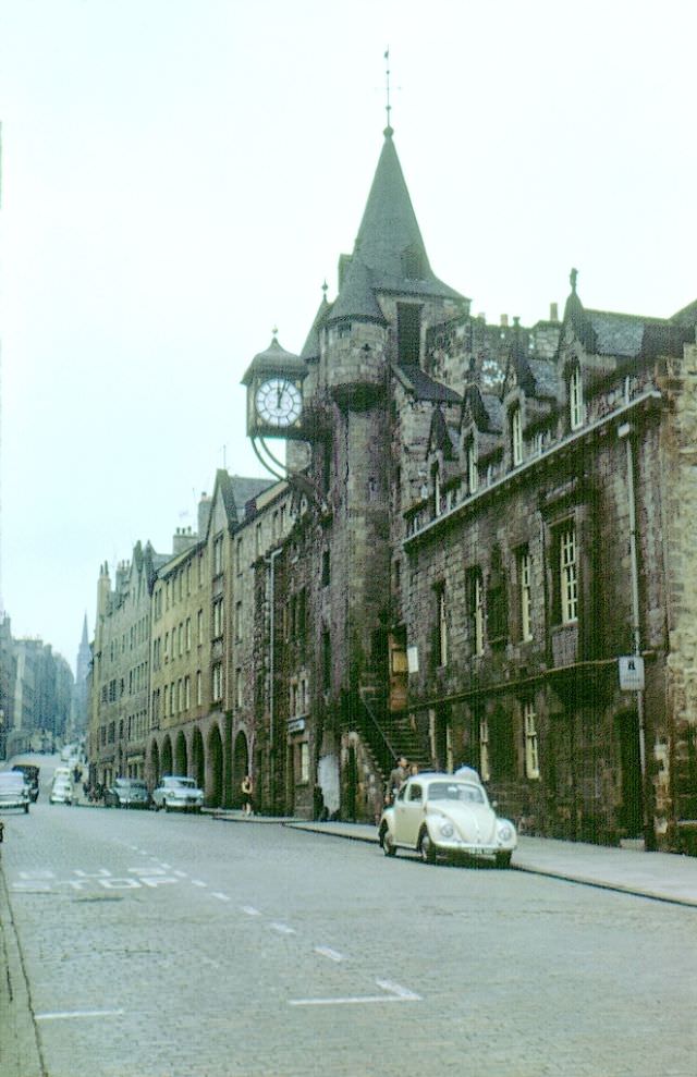
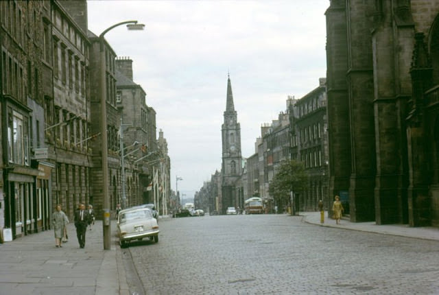
The Canongate Tolbooth, built in 1591, served as the courthouse and prison for the burgh of Canongate — which was a separate town from Edinburgh until the two merged in 1856. The building’s distinctive clock tower projects over the pavement of the High Street. By 1963, it had long since ceased to function as a prison and was being used as a museum. It now houses the People’s Story, a museum of Edinburgh social history.


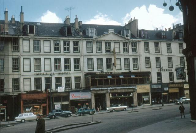
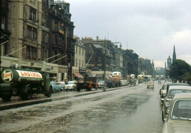
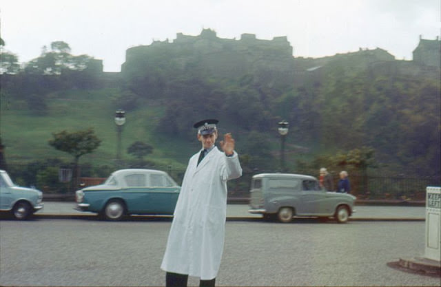
By 1963, Princes Street remained the busiest shopping street in Scotland. The photographs from this year show the street dense with foot traffic, period vehicles, and the ornate facades of department stores and hotels. A traffic policeman was still stationed at the junction of Frederick Street and Princes Street in 1963, directing vehicles by hand — traffic lights alone were not yet considered sufficient for the volume of cars and buses that converged there each day.


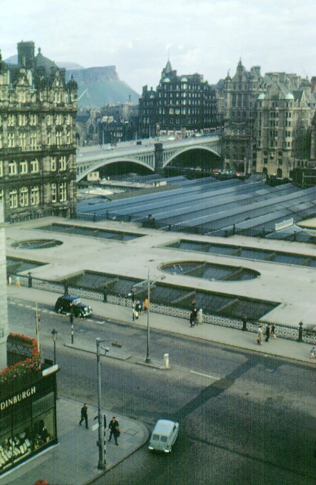
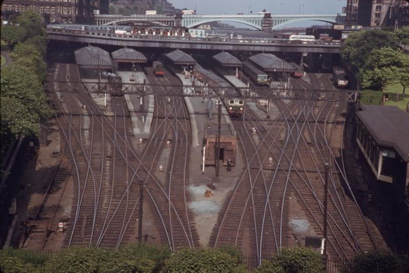
Waverley Station, Edinburgh’s main railway terminal, sits in the valley between the Old and New Towns. The station is named after Sir Walter Scott’s Waverley novels, making it one of the only railway stations in the world named after a work of fiction. The view from South St. Andrew Street in 1963 shows the station roof spread across the valley floor, with the city rising steeply on both sides. The station handled long-distance services to London as well as regional trains throughout Scotland.


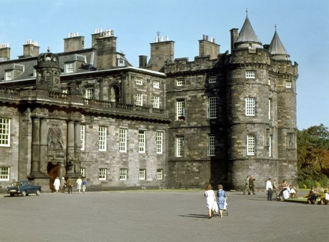
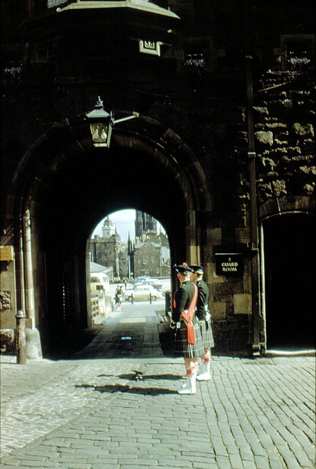
Holyroodhouse at the foot of the Royal Mile has been the official Scottish residence of the British monarch since the 16th century. The palace grew around an Augustinian abbey founded in 1128, and the oldest surviving tower dates from the early 16th century. Mary Queen of Scots lived at Holyrood from 1561 to 1567, and it was there that her secretary David Rizzio was murdered in 1566. In 1964, the palace and its forecourt appear relatively unguarded compared to modern royal residences.


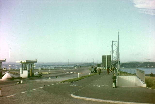
The Forth Road Bridge opened in September 1964, connecting Edinburgh’s western outskirts at South Queensferry with Fife on the north bank. At the time of its opening, it was the longest suspension bridge in Europe, with a main span of 1,006 meters. Before the bridge, the only crossing of the Firth of Forth was by ferry — a service that had operated for centuries. The bridge cut journey times between Edinburgh and the north dramatically and transformed road travel across central Scotland.

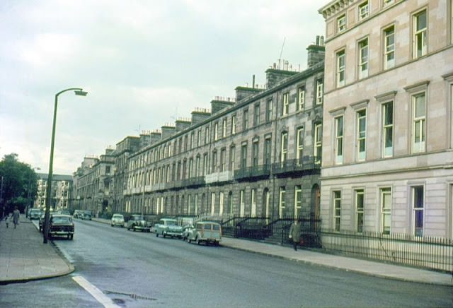
Melville Street in the western New Town is a wide, tree-lined Georgian street of handsome terraced houses. By 1965, many of the street’s original residential townhouses had been converted into offices and professional practices. The street runs east to west, leading directly toward St. Mary’s Cathedral, whose spires are visible from its eastern end. The Georgian architecture of streets like Melville Street represented a completely different Edinburgh from the medieval closes and tenements of the Old Town just a mile away.


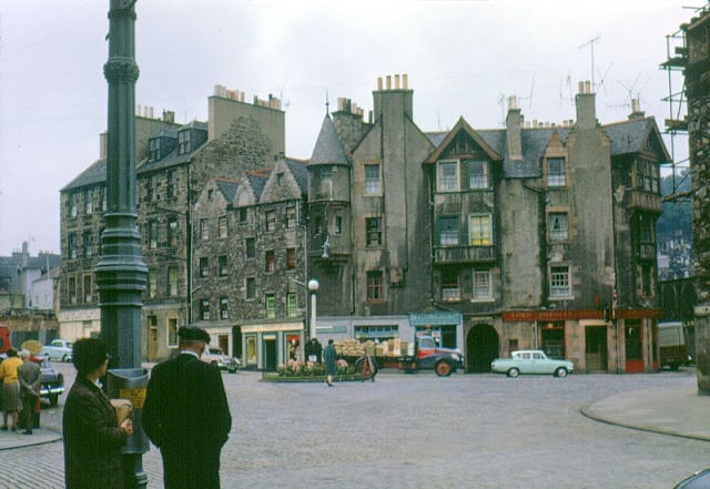
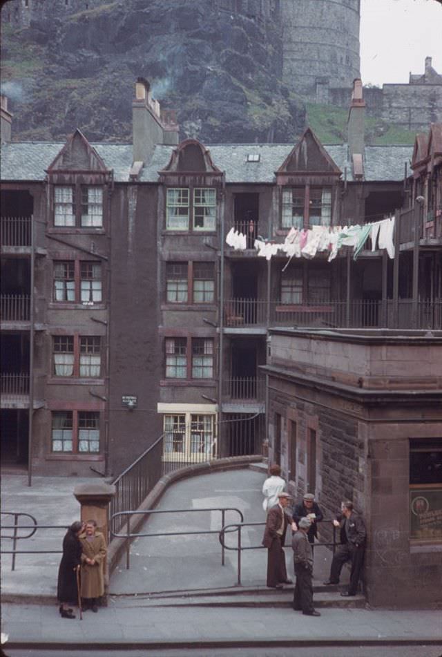
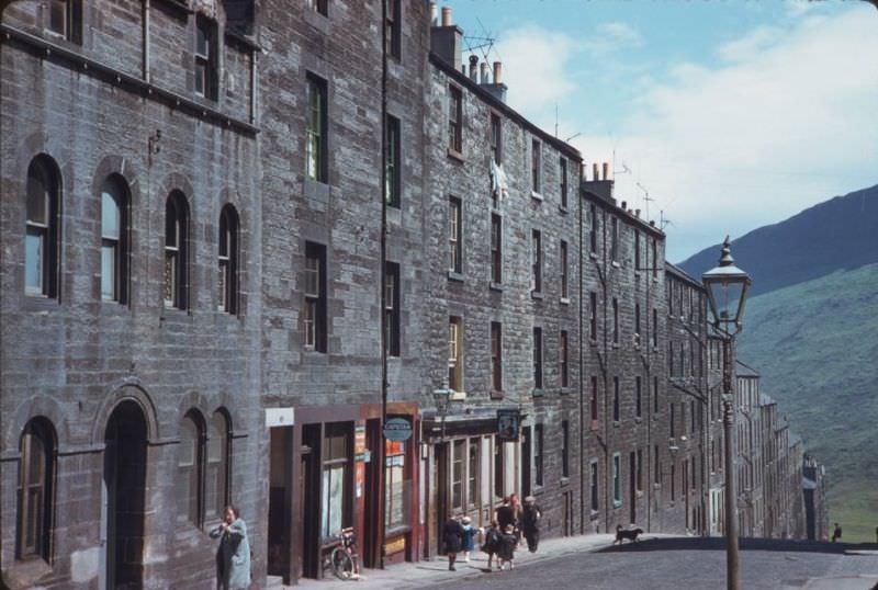
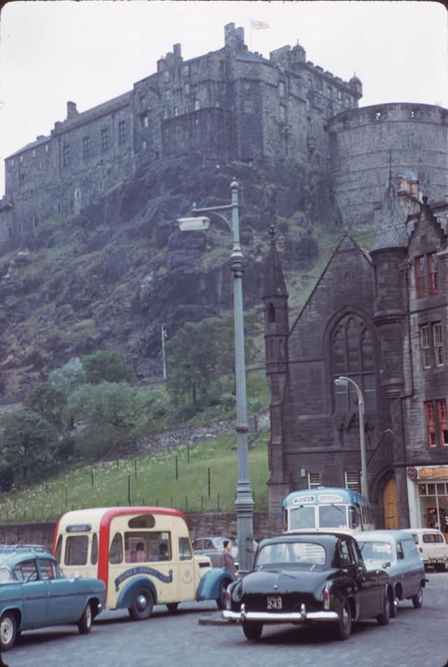
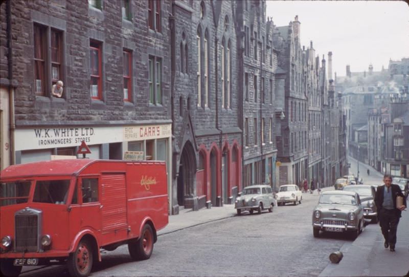
The streets surrounding Edinburgh Castle — the Grassmarket below and Portsburgh Square to the southwest — were among the areas marked for clearance during the 1960s. The Grassmarket had been one of Edinburgh’s main public execution sites in earlier centuries, and the surrounding streets were densely built with Victorian working-class housing by the time the clearances began. Photographs from this era show a mix of still-occupied tenements and empty lots where buildings had already been demolished.


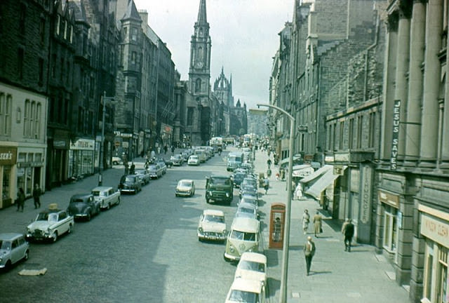
Blackfriars Street runs off the High Street and was one of the many narrow lanes that connected the Royal Mile to the lower streets of the Old Town. Streets like these — steep, confined, and often sunless — were typical of the medieval and post-medieval city. The High Street itself, photographed during the 1960s, shows the mix of old stone buildings, street-level shops, and pedestrians that characterized the Royal Mile before large-scale conservation efforts reshaped it in later years.


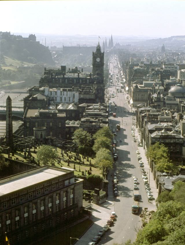
Waverley Station’s approach tracks cut through the heart of Edinburgh in a deep cutting, surrounded by the city on all sides. The view of the tracks entering the station from above shows the scale of the railway infrastructure hidden within the city’s center. The North British Hotel — renamed the Balmoral in 1991 — towers above the station at the east end, its clock visible for miles. The Scott Monument stands nearby on Princes Street, and together the two Victorian landmarks frame Edinburgh’s busiest urban valley.


A bit like Edinburgh in 2021, except more hats and older cars.
The horses in these are what caught my eye. The horse is so rare these days – the power comes from petrol and diesel (but not for much longer).
The space for pedestrians is smaller now compared to the 60s in comparison with most European cities. I would like to see wider sidewalks, fewer streets, and more pedestrian-only streets.
Corr blimey! Just look at those smooth roads.
Check out how dirty the Balmoral was. I would love to see more of the Grassmarket, since that’s where my wife was born and raised.
You forget that cars used to park and drive down Princess Street.
At one time, you could park outside the shops on Princes Street. (And you’d expect to find a space!)
Is it just my imagination or are they very narrow by modern standards as well?
My earliest memories of this place are when I was a toddler. I felt at home here. Now the city center is a cod disney filled with Gold Brothers shite.
This is a great point
I loved the buses without doors that you could jump on and off at traffic lights and I don’t remember any of us getting killed!
Oh, and the hats. I remember my mother wearing a hat all the time.
Fashion has changed most dramatically!
The temporary barrier construction industry hasn’t emerged in 60 years.
For note the one captioned Archer Street, I’m pretty sure is actually Arthur Street (now New Arthur Place) in Dumbiedykes. Must have been taken very close to the time of the slum clearances and therefore a real rarity.
Happy to be corrected if I’m wrong
Wow, a great collection. I don’t remember Archer Street. Has it been renamed? Or is it gone? It looks like it should be off The Pleasance, or perhaps round Dumbiedykes area?
I think it’s part of the slums that were cleared to make Dumbiedykes, or at least the bit on the royal mile side of Holyrood Road.
Archer Street (and many others) were cleared to make way for the redevelopment of Dumbiedykes. City of Edinburgh libraries has an image collection that includes some of the old Dumbiedykes buildings and streets before they were demolished
Great collection. The roads and footpaths are all so well maintained. Smooth tarmac and no sunken cobbles.
Great pics. The amount of parking space for cars is incredible.
In 1960 roughly 80% of households didn’t have a car. They were also about half the size they are now.
Wow. They had cars back then?
Where’s the sand dog?
The thing I noticed is how high quality the road surface is, basically everywhere. Not a single pothole, all the granite setts completely flush.
Could only dream of that now.
The average car has doubled in weight, and there are now twice as many on the roads. Add in even heavier trucks, buses, vans and the strain on the roads is even higher. There are also more roadworks/ patch jobs. If you want pristine roads we need vehicle numbers like the 1960s too.
wow! nice one thanks for sharing. It’s nice to see how much we’ve regressed in all those years haha